
Hike Schedule
Join us for a hike! Registration required.
All hikes available to BTC members. Some hikes are open to non-members.
See Refund Policy for Paid Hikes >
TIP: The calendar view displays up to 7 hikes on a day, but often there are more. Click “View more events” to see them all.
Categories
- 10February 10, 2025

Hike 4 of 5 - Toronto Winter E2E
https://hikesstaging.brucetrail.org/event/hike-4-of-5-toronto-winter-e2e/Sorry, the registration cut-off time for this hike has been reached.Not a member? Click here to join today!Hike open to BTC Members only.
Hosting Club: Caledon Hills
Category: End-to-End
Location (Google Maps): Meet at 9:15 at 10th Line, 2.2 km southeast of 32 SideroadShuttle to start at Creditview Rd., park at Boston Mills Rd.
Hike Leader(s): Jennie Greenfield Click here to contact Hike Leader(s)
Pace: Medium – 3 to 4 km/hour
Terrain: Moderate – some hills and/or some poor footing, Strenuous – hilly with steep climbs and some poor footing
Distance: 11.6 kmDescription
Hike 4 of 5 – south from the Toronto Boundary Sign at the east side Cheltenham Badlands; 3 km on the road before entering the forest, along the escarpment brow, then heading through Terra Cotta Conservation area and emerging onto 10th Line.50.4 to 38.8 = 11.6 km
Headwaters Trail
https://hikesstaging.brucetrail.org/event/headwaters-trail/Sorry, the registration cut-off time for this hike has been reached.Not a member? Click here to join today!Hosting Club: Iroquoia
Category: General Hike
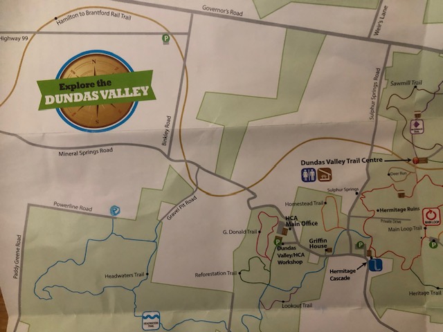
Location (Google Maps): Park at the end of Powerline Road
Take Powerline Road East from Hwy 52 until it endsHike Leader(s): Cathie Green Click here to contact Hike Leader(s)
Pace: Medium – 3 to 4 km/hr
Terrain: Moderate – Some hills and/or some poor footing
Distance: Approximately 8 kmsDescription
Meet where Powerline Road East dead ends at edge of Dundas Valley Conservation Area -Travel east on Powerline Rd from Hwy 52 -there is free parking at the cul de sac-look for the Hydro Tower!We will hike Headwaters Trail to Martin Road and follow the old road now a path to Mineral Springs and loop back on the
rail trail and Gravel Pit Road to the Headwaters Trail and our vehicles at the end of Power Line Road E
Hilly sections, bring Icers/ snack/ water/poles /appropriate clothing for the weather conditions
- 11February 11, 2025
9:00 Long Hike Wiley Road Short Hills
https://hikesstaging.brucetrail.org/event/900-long-hike-wiley-road-short-hills-45/Sorry, the registration cut-off time for this hike has been reached.Not a member? Click here to join today!Hosting Club: Niagara
Location (Google Maps):
Short Hills Wiley Road Entrance
Pace: Medium
Terrain: Moderate
: 10kmDescription
Explore Short Hills and the majestic side trails of Scarlett Tanager, Hemlock. Swayze Falls and Terrace. Register for each hikeBring Poles, Icers, snack, and dress for the weather
Urban Walk: Valley View Park Thornhill
https://hikesstaging.brucetrail.org/event/urban-walk-valley-view-park-thornhill-54/Sorry, the registration cut-off time for this hike has been reached.Not a member? Click here to join today!Hosting Club: Toronto
Location (Google Maps): Parking lot is inside Sycamore Drive East of Bayview , north of Bayview Reservoir Park Playground
Hike Leader(s): Mohammad Aghamiri Click here to contact Hike Leader(s)
Pace: Moderate (3-4 km/hr)
Terrain: Level 2 (Intermediate – some hills and uneven surfaces, rocks and roots underfoot)
Distance: 7-8 kmDescription
We will explore Valleyview and Maple View parks, and walk along German Mill Creak,In return we stop in Huntington park and have snack under beautiful shed ,Even it is considered Urban walk, but it is urban hike as we have some up and down hills and tree roots, please bring your Ice cleats and hiking poles
9:15 Short Hike - Short Hills Park, Pelham Rd
https://hikesstaging.brucetrail.org/event/915-short-hike-short-hills-park-pelham-rd-18/Sorry, the registration cut-off time for this hike has been reached.Not a member? Click here to join today!Hosting Club: Niagara
Category: Hike
Location (Google Maps): Short Hills Provincial Park, Pelham Rd entranceHike Leader(s): Debbie Demizio Click here to contact Hike Leader(s)
Pace: Medium
Terrain: Moderate
Distance: ~ 6kmsDescription
Hike the main and side trails in Short Hills Provincial Park, Bring hiking boots and water. Icers are highly recommended in case trail conditions are icy.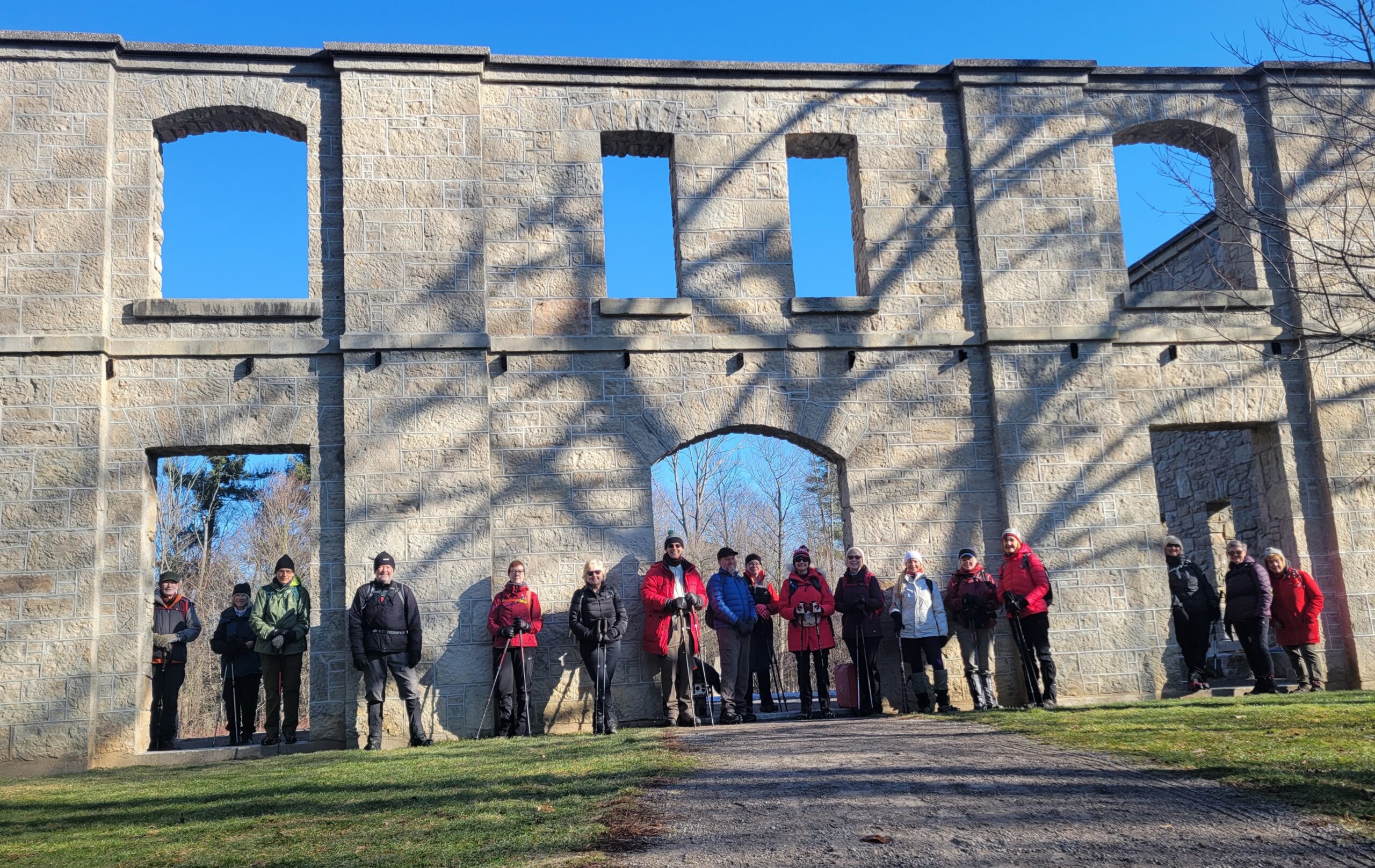
Celebrating February - Black History Month, Valentines Day - Exploring the Trails and History in Dundas Valley Conservation Area
https://hikesstaging.brucetrail.org/event/celebrating-february-black-history-month-valentines-day-exploring-the-trails-and-history-in-dundas-valley-conservation-area/Sorry, the registration cut-off time for this hike has been reached.Not a member? Click here to join today!Hosting Club: Caledon Hills
Category: Tuesday Hikers
Location (Google Maps): Meet in the main parking lot of the Dundas Valley Trail Centre- km 50.7 – enter from Governors Rd. There is a parking fee; carpooling recommended.Hike Leader(s): Doris Harper Click here to contact Hike Leader(s)
Pace: Medium – 3 to 4 km/hour
Terrain: Moderate – some hills and/or some poor footing
Distance: approximately 10 kmDescription
From the main parking lot we will follow the trail north to Governors Rd. and return by main trail and follow the Artaban Side Trail, visit Griffin House and Canterbury Falls and return to the trail centre.Poles, icers recommended as there are hilly and p0ssibly icy sections. Bring water and snacks of choice, lunch can be eaten in the trail centre .
Mono Cliffs/South Outlier
https://hikesstaging.brucetrail.org/event/mono-cliffs-south-outlier/Sorry, the registration cut-off time for this hike has been reached.Not a member? Click here to join today!Hosting Club: Dufferin Hi-Land
Category: Tuesday Hike
Location (Google Maps):Dufferin Hi-Land Section, Map 19. Meet at Mono Community Centre hiker parking area off of 2nd Line Mono at south end of Mono Centre village.
Hike Leader(s): Inge Eckerich, Les Babbage, Julie Daley, Tony Evangelista Click here to contact Hike Leader(s)
Pace: Leisurely
Terrain: Moderate
Distance: Long hike: 5.9 km,short hike 3.8 kmDescription
Both hikes will take the Laidlaw Side Trail and Main Trail, do the South Outlier loop, both will return by way of Main Trail and Laidlaw Side Trail. The longer hike will do Turnbull side trail weather permitting - 12February 12, 2025
CANCELLED DUE TO WEATHER - Moonlit Hike Series - Snow (or Bear) Moon (#5 of a 6 part series): Ski or Snowshoe at Bruce Ski Club's Sawmill Trails
https://hikesstaging.brucetrail.org/event/moonlit-hike-series-snow-or-bear-moon-5-of-a-6-part-series-ski-or-snowshoe-at-bruce-ski-clubs-sawmill-trails/Sorry, the registration cut-off time for this hike has been reached.Not a member? Click here to join today!Hosting Club: Peninsula
Category: Moonlit Hike Series
Location (Google Maps): Bruce Ski Club’s Sawmill Ski Trails, 719533 Hwy 6, Hepworth, ON N0H 2T0Hike Leader(s): Margie Gloade Click here to contact Hike Leader(s)
Pace: Leisurely (2.0 – 3.0 km/h): A relaxed pace with frequent breaks and a focus on enjoyment., Medium (3.0 – 4.5 km/h): A comfortable pace for most hikers with steady progress.
Terrain: Easy: Flat forested sections or lowland trails., Moderate: Rolling hills, mild slopes and rocky paths.
Distance: 3-10Description
At 11am, Feb.12, this event was CANCELLED due to a forecasted Winter Storm Warning. Watch for updates for a rescheduled date.Join us for a fun, winter evening snowshoeing or classic nordic skiing at the Bruce Ski Club’s Sawmill Nordic Centre trails in Hepworth!
Time: 6:00-8:30pm
Moonrise: 6:01pm
Sunset: 5:59pm
Hike length: 3-5 kms on snowshoe or ski trails. Note: Lots of trail options available depending on weather and group’s interest. Note: walking is not permitted on ski or snowshoe trails.
Duration: 2.5 hours
Join Hike Leaders Margie and Natalie, and their partners Curtis and Dawson, in February for the PBTC’s fifth Moonlit Series, celebrating the “Snow” Moon snowshoeing or classic cross-country skiing on the trails at the Bruce Ski Club (BSC) Sawmill Nordic Centre. The trails are cut through rolling land, sheltered by hardwood and evergreen stands. All ski trails are packed, groomed, and trackset on a regular basis. Under the moonlight, we’ll stick to the easy, gentle loops for beginners.
The trailhead for the Sawmill Nordic Centre is located on Highway 6 between Shallow Lake and Hepworth, Ontario.
If you are new to skiing and interested in trying it out, Curtis and Dawson are coaches with the BSC’s Jackrabbit’s program, and will be there to help guide you and get you safety started.
Don’t have equipment? Skis and snowshoes can be rented at the Suntrail Source for Adventure store, at 100 Spencer Street in Hepworth (located 1 kilometre west of the Sawmill trailhead). Suntrail is kindly offering a special flat rate of $10 for classic ski or snowshoe rentals for this event. Please call ahead to reserve and mention you are part of the PBTC’s Moonlit Series for this special rate. Store hours on weekdays are 10am-5:30pm. Suntrail has asked any rentals to be picked up before 5pm. Rentals must be returned within 24 hours. To contact Suntrail, call 519-935-2478 or see their website https://suntrail.ca.
Not a member of the Bruce Ski Club? That’s OK. You can purchase a $10 day pass at the Sawmill trailhead using cash or eTransfer (etransfer@bruceskiclub.ca). You can also purchase a day pass at Suntrail Source for Adventure. Look for “Day Pass” on the BSC’s website https://bruceskiclub.ca. There is also a BSC waiver you must sign.
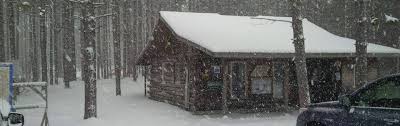
Thanks to the BSC team of volunteers, Gerry’s Place – a heated ski hut – will be open for us that evening. There are small changerooms inside if needed. We’ll have hot chocolate available afterward. Feel free to bring a sharable snack.
There is a portable toilet in the parking lot.
Important Notes:
Weather and trail conditions will be updated closer to the date – probably the Monday or Tuesday before.
What to bring:
- A headlamp.
- Your snowshoe or ski equipment.
- Water.
- Appropriate clothing to ski and snowshoe in, suitable for the weather conditions (layers are great).
- Your BSC pass (annual membership or day pass), and signed waiver (if you are purchasing a day pass).
Don’t miss this opportunity to enjoy a winter activity under the full Snow Moon of February!
Questions? Feel free to reach out to Margie (mcgloade@rogers.com) or Natalie (nataliemech98@gmail.com).

8:30 Niagara Winter End to End #5 Decew House to Woodend Conservation Area
https://hikesstaging.brucetrail.org/event/830-niagara-winter-end-to-end-5-decew-house-to-woodend-conservation-area-2/Sorry, the registration cut-off time for this hike has been reached.Not a member? Click here to join today!Hosting Club: Niagara
Category: Car Pool
Location (Google Maps): Meet at Woodend Conservation Area and Carpool to Decew HouseHike Leader(s): Sam Rutherford Click here to contact Hike Leader(s)
Pace: Medium
Terrain: Moderate
Distance: 14.5 kmsDescription
We will be car pooling, Bring Icers and poles. No dogs. To earn your Niagara Winter End to End badge, it must be completed between December 21, 2024 to March 21, 2025.
Because of the potential for bad winter trail conditions we have broken this e2e into 6 hikes rather than 5
Winter Badge Wednesdays: Glen Haffy
https://hikesstaging.brucetrail.org/event/winter-badge-wednesdays-glen-haffy-2/Sorry, the registration cut-off time for this hike has been reached.Not a member? Click here to join today!Hike open to BTC Members only.
Hosting Club: Caledon Hills
Category: General
Location (Google Maps): Meet at 10 am at the roadside parking on Coolihans Sideroad, km 35.0 Map 17, near where the Trail crosses the road. This is just west of the intersection of Glen Haffy Road and Coolihans Sideroad. It is best to aim for arriving around 9:45, so we can start hiking as close to 10 am as possible. Thanks!Hike Leader(s): Flicia Kehl; Elizabeth Ganong Click here to contact Hike Leader(s)
Pace: Medium – 3 to 4 km/hour
Terrain: Moderate – some hills and/or some poor footing
Distance: Approximately 4 kmDescription
Looking to get outside and enjoy nature in another season? You may wish to join in on one Wednesday hike in this winter series or all five! Complete all five as part of the series or do a combination of hikes within the series and your own winter hikes, and you will be eligible to receive the Caledon Winter Hiking Badge (further details below and on the CHBTC website under Club Badges).This Wednesday’s hike is at Glen Haffy. If the trail conditions are challenging, we’ll hike the main Bruce Trail and Glen Haffy’s red loop, which makes a route under 4 km. If the trail conditions are good, we’ll use conservation trails and the main Bruce Trail to make a 4 or 5 km loop. Be prepared for winter conditions by bringing warm gear, poles, and icers. You are encouraged to bring water and a snack. No dogs please. Once back at the roadside parking on Coolihans, there will be an option to extend the hike south along the main Bruce Trail for those hikers wanting a longer hike.
The hike leader for this hike is Flicia Kehl. Registrants can expect a reminder/update message from Flicia one or two days before the hike.
If desired, this hike may be used towards the Caledon Winter Hiking Badge (5 winter hikes in the Caledon section that are 1 ½ hours or longer in length). Please keep a log of your hikes and follow the directions on the CHBTC website to receive your badge.
Winter Wednesday Walkers - Old Baldy
https://hikesstaging.brucetrail.org/event/winter-wednesday-walkers-old-baldy-2/Sorry, the registration cut-off time for this hike has been reached.Not a member? Click here to join today!Hosting Club: Beaver Valley
Location (Google Maps): Meet in the Grey Sauble CA parking lot, km 43.9, Map 26, Edition 3, at the end of the small section of road off Sideroad 7B. Do not attempt to drive up 7B from Grey Road 13, there is no winter maintenance. Instead access 7B from south of Kimberley – Grey Road 13 to Artemesia-Euphrasia Townline to 3rd Line A, then 7B.
Hike Leader(s): Glenda Collings Click here to contact the hike leader.
Pace: Medium
Length of Hike: Approx. 5 km
Description
This is a in and out hike with tremendous views from the heights of Old Baldy. On winter hikes we may encounter bare ground, light snow, deep snow, or ice. Please bring snowshoes and icers to our Winter Wednesday Walkers outings. Wear appropriate clothing for the weather plus water and a snack.COVID-19 Precautions Before, During and After your Hike
- Each hiker joining a Bruce Trail Club organized hike must perform a self-screening check before hiking.
Find Ontario’s self-assessment tool here: https://covid-19.ontario.ca/self-assessment/ - If you are experiencing COVID-19 symptoms, stay home.
Other Guidelines
- Arrive 15 minutes before the start of the hike.
- Wear sturdy footwear and appropriate attire for the weather and the terrain.
Hiking poles are a good idea in any season, especially if the terrain is rocky or slippery. In winter, snowshoes or icers/crampons are needed when conditions dictate.
Wearing appropriate clothing and footwear prevents injuries and shows consideration for a safe and positive group hiking experience. - Always carry I.D. and your health card.
- Bring sufficient water and snacks (or lunch if indicated). A minimum of 1L of water is recommended on all hikes, and 3L is recommended for long, challenging hikes in the heat of the summer.
- Bring sunscreen and insect repellent (for spring and summer hikes).
- Bring your own first aid kit.
- Please leave dogs at home.
Christie Lake Loop
https://hikesstaging.brucetrail.org/event/christie-lake-loop/Sorry, the registration cut-off time for this hike has been reached.Not a member? Click here to join today!Hosting Club: Iroquoia
Category: Good Companions
Location (Google Maps): Christie Lake Conservation Area – See map below – At the T intersection after the entrance kiosk, turn right and continue until you reach the final parking lot near the Bike Trailhead (Conservation pass or fee on entry)Hike Leader(s): Ted Bossence Click here to contact Hike Leader(s)
Pace: Medium – 3 to 4 km/hr
Terrain: Dependent on Conditions, Moderate – Some hills and/or some poor footing, Slippery Sections Likely
Distance: 7 kmDescription
We will do a loop around Christie Lake following mostly good trails. Bring icers, water and a snack. Please arrive at 9:45 am as I will be leaving at 10:00 am sharp. Hike will be cancelled in case of inclement weather and I will email you so please check your emails the night before the hike. I will provide contact details on the day before the hike in case you need to cancel after 4:00 pm that day.
7:00 pm Moonlight Night Hike in Niagara-on-the-Lake
https://hikesstaging.brucetrail.org/event/700-pm-moonlight-night-hike-in-niagara-on-the-lake-9/Sorry, the registration cut-off time for this hike has been reached.Not a member? Click here to join today!Hosting Club: Niagara
Category: Night
Location (Google Maps):Veteran’s Memorial Park, park just outside the park on King St.
Hike Leader(s): Robin Garrett Click here to contact Hike Leader(s)
Pace: Medium
Terrain: Easy
Distance: 6-7 kmDescription
Moonlight Night Hike – Take in the magic of the rising moon over Lake Ontario and the Niagara River. This hike includes a stop to connect with your senses – sights, sounds, smells and the rhythm of your breath. Counts towards your night hike badge (5 night hikes). - 13February 13, 2025
Frosty Five Blues Series 5/5
https://hikesstaging.brucetrail.org/event/frosty-five-blues-series-5-5/Sorry, the registration cut-off time for this hike has been reached.Not a member? Click here to join today!Hosting Club: Caledon Hills
Category: General
Location (Google Maps): Meet north of the intersection of Cataract Road and Mississauga Road at the Elora Cataract Trailway Trail Head. Google Coordinates: 43.813120, -80.028656 (Map 15, Edition 31)Directions: From ON-10 head west on Charleston Sideroad/Peel Regional Rd 24 for 5.5 km. Turn left onto Mississauga Rd. and drive for 1.0 km. Park on west shoulder.
Hike Leader(s): Sandy Green Click here to contact Hike Leader(s)
Pace: Medium – 3 to 4 km/hour
Terrain: Strenuous – hilly with steep climbs and some poor footing
Distance: 11 kilometresDescription
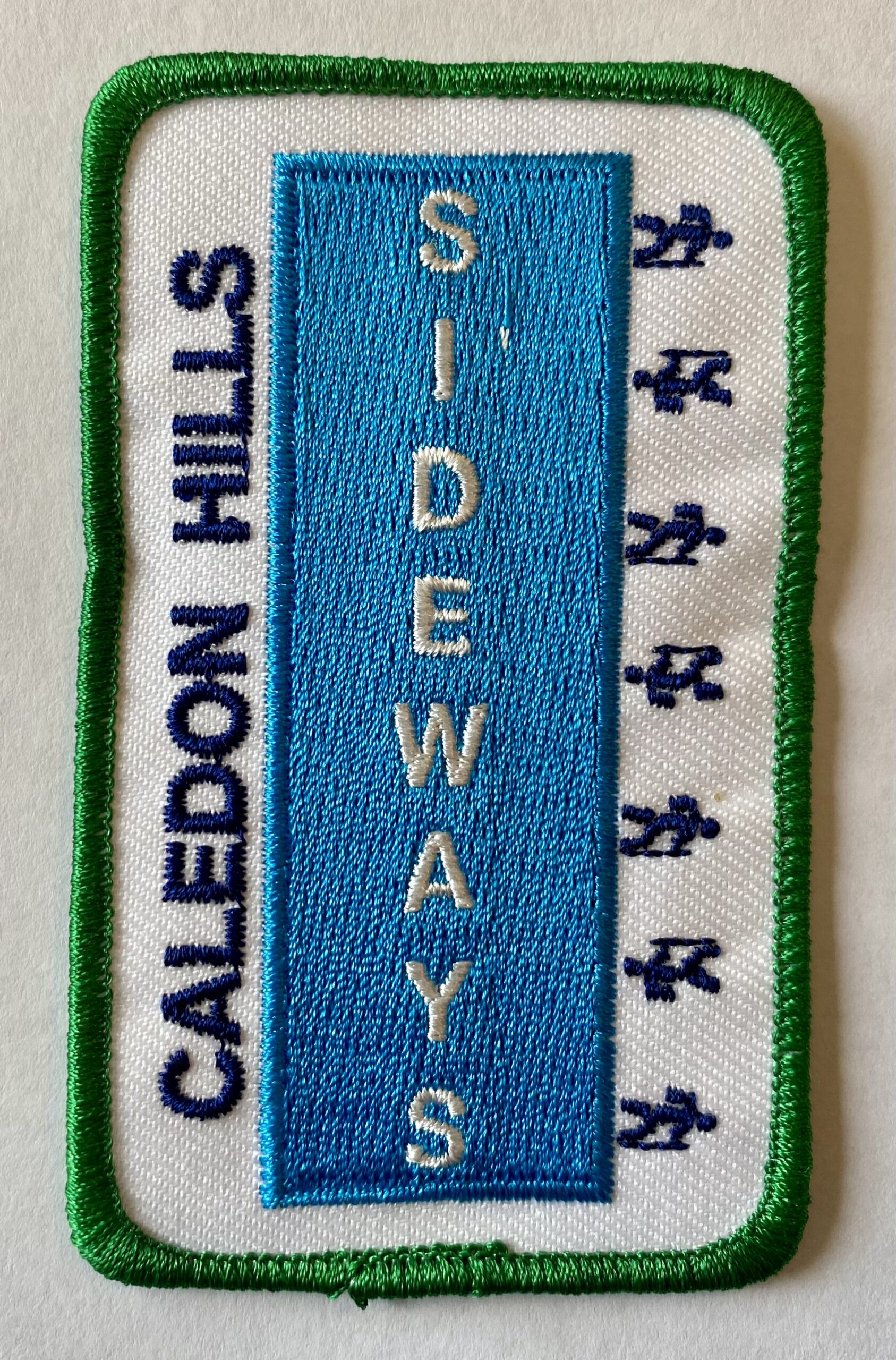
THIS HIKE HAS BEEN POSTPONED TO THURSDAY, FEBRUARY 20TH, DUE TO INCLEMENT WEATHER.Beat the winter blues! Register individually for one, a few, or all of the Frosty Five Blues hikes. Participants who complete all five hikes are eligible to receive a CHBTC Winter badge and new Sideways badge on the final hike. Hike 5 explores main Trail and side trails in Forks of the Credit Provincial Park . Bring your choice of hydration and snacks. Hiking boots and icers/crampons are required. See Jan. 9, 23, 30, & Feb. 6 for details pertaining to the other hikes in the series. (Note: If you wish to purchase badges, the cost of each badge is $10.00 for BTC members and $15.00 for non-members.)
CANCELLED 9:00 am Long Hike Cave Spring
https://hikesstaging.brucetrail.org/event/900-am-long-hike-cave-spring-2/Sorry, the registration cut-off time for this hike has been reached.Not a member? Click here to join today!Hosting Club: Niagara
Location (Google Maps):
Cave Spring Conservation Area
Hike Leader(s): Alan Laver Click here to contact Hike Leader(s)
Pace: Medium
Terrain: Moderate
Distance: 10kDescription
From Cave Spring Conservation Area explore the trail network on the escarpment You must register for each hike. Bring Poles, snack and a drink and dress for the weatherUrban Walk: Valley View Park Thornhill
https://hikesstaging.brucetrail.org/event/urban-walk-valley-view-park-thornhill-55/Sorry, the registration cut-off time for this hike has been reached.Not a member? Click here to join today!Hosting Club: Toronto
Location (Google Maps): Parking lot is inside Sycamore Drive East of Bayview , north of Bayview Reservoir Park Playground
Hike Leader(s): Mohammad Aghamiri Click here to contact Hike Leader(s)
Pace: Moderate (3-4 km/hr)
Terrain: Level 2 (Intermediate – some hills and uneven surfaces, rocks and roots underfoot)
Distance: 7-8 kmDescription
We will explore Valleyview and Maple View parks, and walk along German Mill Creak,In return we stop in Huntington park and have snack under beautiful shed ,Even it is considered Urban walk, but it is urban hike as we have some up and down hills and tree roots, please bring your Ice cleats and hiking poles
CANCELLED
https://hikesstaging.brucetrail.org/event/hiking-around-jordan-22/Sorry, the registration cut-off time for this hike has been reached.Not a member? Click here to join today!Hosting Club: Niagara
Location (Google Maps): Shoarishon Park (formerly known as Jordan Hollow)
Hike Leader(s): Bill Russell Click here to contact Hike Leader(s)
Pace: Medium
Terrain: Moderate
Distance: 7 kmDescription
Hike various trails in Jordan (Balls Falls, Jim Rainforth Trail and Bailey Bridge through the village of Jordan)
Cancelled- RBG Berry Tract
https://hikesstaging.brucetrail.org/event/rbg-berry-tract/Sorry, the registration cut-off time for this hike has been reached.Not a member? Click here to join today!Hosting Club: Iroquoia
Category: Thursday Group
Location (Google Maps): Old Guelph Line near Hwy 6 TunnelHike Leader(s): Colleen Mabalay Click here to contact Hike Leader(s)
Pace: Medium – 3 to 4 km/hr
Terrain: Easy – Mostly flat and usually good footing, Moderate – Some hills and/or some poor footing
Distance: 5-6 kmDescription
There is a couple of sets of stairs on this hike.Bring water, snack and icers.