
Hike Schedule
Join us for a hike! Registration required.
All hikes available to BTC members. Some hikes are open to non-members.
See Refund Policy for Paid Hikes >
TIP: The calendar view displays up to 7 hikes on a day, but often there are more. Click “View more events” to see them all.
Categories
- 10February 10, 2025

Hike 4 of 5 - Toronto Winter E2E
https://hikesstaging.brucetrail.org/event/hike-4-of-5-toronto-winter-e2e/Sorry, the registration cut-off time for this hike has been reached.Not a member? Click here to join today!Hike open to BTC Members only.
Hosting Club: Caledon Hills
Category: End-to-End
Location (Google Maps): Meet at 9:15 at 10th Line, 2.2 km southeast of 32 SideroadShuttle to start at Creditview Rd., park at Boston Mills Rd.
Hike Leader(s): Jennie Greenfield Click here to contact Hike Leader(s)
Pace: Medium – 3 to 4 km/hour
Terrain: Moderate – some hills and/or some poor footing, Strenuous – hilly with steep climbs and some poor footing
Distance: 11.6 kmDescription
Hike 4 of 5 – south from the Toronto Boundary Sign at the east side Cheltenham Badlands; 3 km on the road before entering the forest, along the escarpment brow, then heading through Terra Cotta Conservation area and emerging onto 10th Line.50.4 to 38.8 = 11.6 km
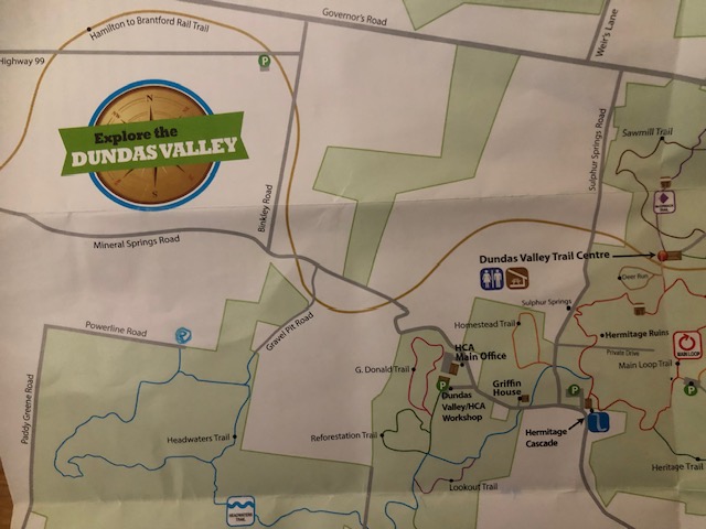
Headwaters Trail
https://hikesstaging.brucetrail.org/event/headwaters-trail/Sorry, the registration cut-off time for this hike has been reached.Not a member? Click here to join today!Hosting Club: Iroquoia
Category: General Hike
Location (Google Maps): Park at the end of Powerline Road
Take Powerline Road East from Hwy 52 until it endsHike Leader(s): Cathie Green Click here to contact Hike Leader(s)
Pace: Medium – 3 to 4 km/hr
Terrain: Moderate – Some hills and/or some poor footing
Distance: Approximately 8 kmsDescription
Meet where Powerline Road East dead ends at edge of Dundas Valley Conservation Area -Travel east on Powerline Rd from Hwy 52 -there is free parking at the cul de sac-look for the Hydro Tower!We will hike Headwaters Trail to Martin Road and follow the old road now a path to Mineral Springs and loop back on the
rail trail and Gravel Pit Road to the Headwaters Trail and our vehicles at the end of Power Line Road E
Hilly sections, bring Icers/ snack/ water/poles /appropriate clothing for the weather conditions