
Hike Schedule
Join us for a hike! Registration required.
All hikes available to BTC members. Some hikes are open to non-members.
See Refund Policy for Paid Hikes >
TIP: The calendar view displays up to 7 hikes on a day, but often there are more. Click “View more events” to see them all.
Categories
- 10February 10, 2024
Winter Coach Trip: Awenda Provincial Park
https://hikesstaging.brucetrail.org/event/winter-coach-trip-awenda-provincial-park-2/Sorry, the registration cut-off time for this hike has been reached.Not a member? Click here to join today!Trip Information
Departure Time: 08:00
Return to City Time: 18:00
Departure Point: York Mills Bus PickupTrip Activities
Pick up at Yonge & York Mills ($0.01)
Pick up at Major Mac ($0.01)
Optional ItemsHosting Club: Toronto
Category: Coach Trips
Location (Google Maps): Awenda Provincial ParkHike Leader(s): Martina Furrer, Nijole Mockevicius, Lisa Lifshitz Click here to contact Hike Leader(s)
Description
Bus departs 10 York Mills Rd at 8:00 AM and Major Mackenzie Dr and HWY 400 Park and Ride at 8:20 AM. If you wish to be picked up at the Major Mackenzie Dr and HWY 400 Park and Ride, select that option when you register. Please arrive 15 minutes before departure. The bus waits for no one.Join us for a super fun winter day in beautiful Awenda Provincial Park. Be prepared to pick your activity according to the conditions. If snowshoeing is good – great! If winter hiking is better – enjoy! If skiing is possible – bonus! The trip will run no matter what.
Driving time to Awenda is 1.75 hours. It’s so worth it to spend the day on the shore of Georgian Bay.
Winter hikers: Explore the trails on your own or join Nijole and Lisa for a guided 10 KM hike on Awenda’s beautiful winter trails. The hike will traverse parts of the Bluff, Wendat, and Connector trails, and will also circle around Kettle’s Lake. Mostly flat with a few short hills. Pace will be approximately 3 km/hr. Plenty of time to take pictures and enjoy the scenery. Skiers: If conditions allow, enjoy self-guided tours of Awenda’s beautiful ski trails with majestic views of Georgian Bay. No rentals. No food or drink.
For information about trail conditions visit: https://www.ontarioparks.com/skireport.
Coach fare must be paid online when you register. Masks are mandatory while on the bus.
Hikers: It may not be clear ahead of time whether snowshoes, icers, or just boots will be the most appropriate footwear. Come prepared for anything. If the Club cancels this trip, your coach fare will be refunded.
Winter Version R2R #2 Mad River Rim
https://hikesstaging.brucetrail.org/event/winter-version-r2r-2-mad-river-rim/Sorry, the registration cut-off time for this hike has been reached.Not a member? Click here to join today!Hosting Club: Blue Mountains
Category: Register online ONLY
Location (Google Maps): There will be an alternate meet up point to start hike.Hike Leader(s): Hart Fischer Click here to contact Hike Leader(s)
Pace: Brisk – 4 to 5 km/hr
Terrain: Strenuous – Hilly with steep climbs and some poor footing
Distance: 12 kmDescription
CONTACT HIKE LEADER for info. We will start at Devil’s Glen white blazed trail and hike across to a steep,
slippery slope reaching Sideroad 15/16 meeting up with the Ganaraska Trail. Once
reaching the Ganaraska sign you have completed half the hike and we will then retrace
our steps back. Bring lots of water, lunch and snacks.
CONTACT Hike Leader for directions for meet-up.Car Hike: Hike of 2 lakes King city
https://hikesstaging.brucetrail.org/event/car-hike-hike-of-2-lakes-king-city-11/Sorry, the registration cut-off time for this hike has been reached.Not a member? Click here to join today!Hosting Club: Toronto
Location (Google Maps): Park along Fairfield Dr. or Dufferin Street. Gather at trail head on Dufferin Street.
Hike Leader(s): Mohammad Aghamiri Click here to contact Hike Leader(s)
Pace: Moderate
Terrain: Variable
Distance: 14-17KMDescription
We will hike in trails around Seneca lake and Mary Lake,pass by Eaton and visit Pine farm where you can enjoy coffee,tea,apple pie during our snack time.Some safety procedures during the hike:
1-Hikers must stay between the leader and the sweep.
2-Hikers must advise the leader or the sweep if they wish to leave the group.
3- Hikers must follow the whistle instructions: 1 blast- stay where you are; 2 blasts come to the leader; 3 blasts – come to the leader quickly.
4-Hike leader may request volunteers to stop at trail intersections, they need to help hikers to the direction the group walk and wait till they see the sweep .
5-Hikers have to make sure they can see the persons behind and in front of them.
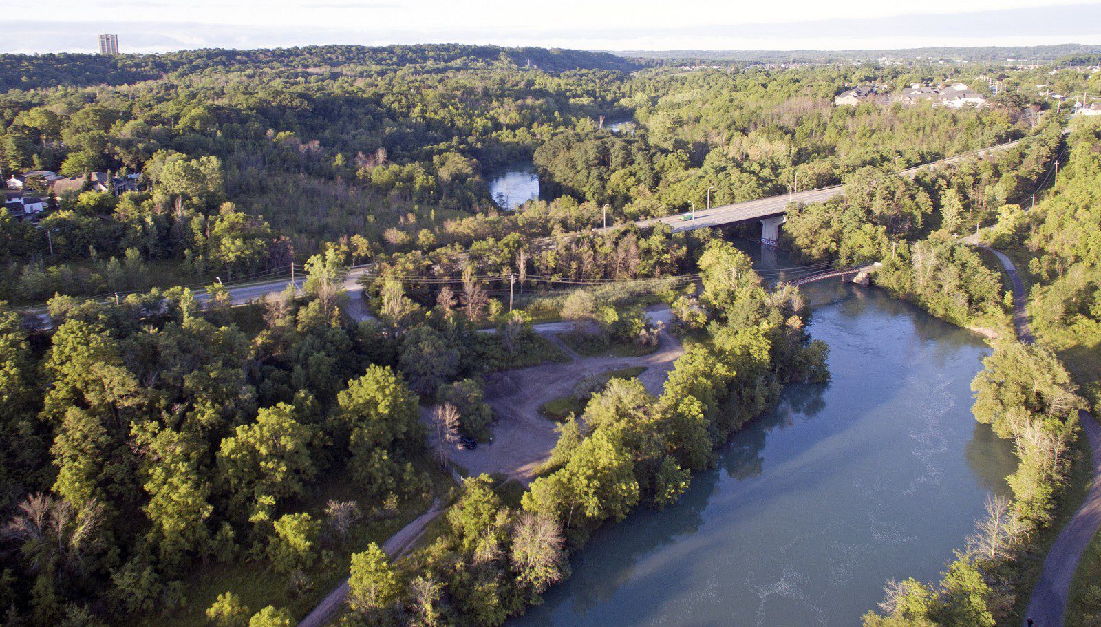
9:00 Twelve Mile Creek Loop
https://hikesstaging.brucetrail.org/event/900-twelve-mile-creek-loop-3/Sorry, the registration cut-off time for this hike has been reached.Not a member? Click here to join today!Hosting Club: Niagara
Category: Loop
Location (Google Maps):Welland Vale Rd. (Pump Station) & Sawmill Rd., St. Catharines
Hike Leader(s): Karen Couch Click here to contact Hike Leader(s)
Pace: Medium
Terrain: Easy
Distance: 15 kmsDescription
Hike along both sides of 12 Mile Creek through St. Catharines. Escape the mud!Pine River Discovery Hike
https://hikesstaging.brucetrail.org/event/pine-river-discovery-hike-2/Sorry, the registration cut-off time for this hike has been reached.Not a member? Click here to join today!Hosting Club: Dufferin Hi-Land
Category: General Hike
Location (Google Maps):Second Line and 15 Sideroad in Mulmur Ontario. From Orangeville, head north on hwy #10 to hwy #89. Turn left and head west to county road #124. Turn right and head north to 15 Sideroad. Turn right and follow to 2nd line. Parking is on the east side of 2nd Line, just north of 15 Sideroad
Hike Leader(s): Tom Thayer Click here to contact Hike Leader(s)
Pace: Medium
Distance: 6 km
Description
We will be exploring the winter wonders that the Pine River Nature Reserve offers during the winter.This is a snowshoe hike so please be sure to bring your snowshoes. Should the weather not behave and snow is not in abundance, we will still do the hike but icer’s would be recommended in this case as there is sure to still be icy patches within the reserve.
Bring snowshoes, icers, mitts, hats, food, and dress according to the weather.
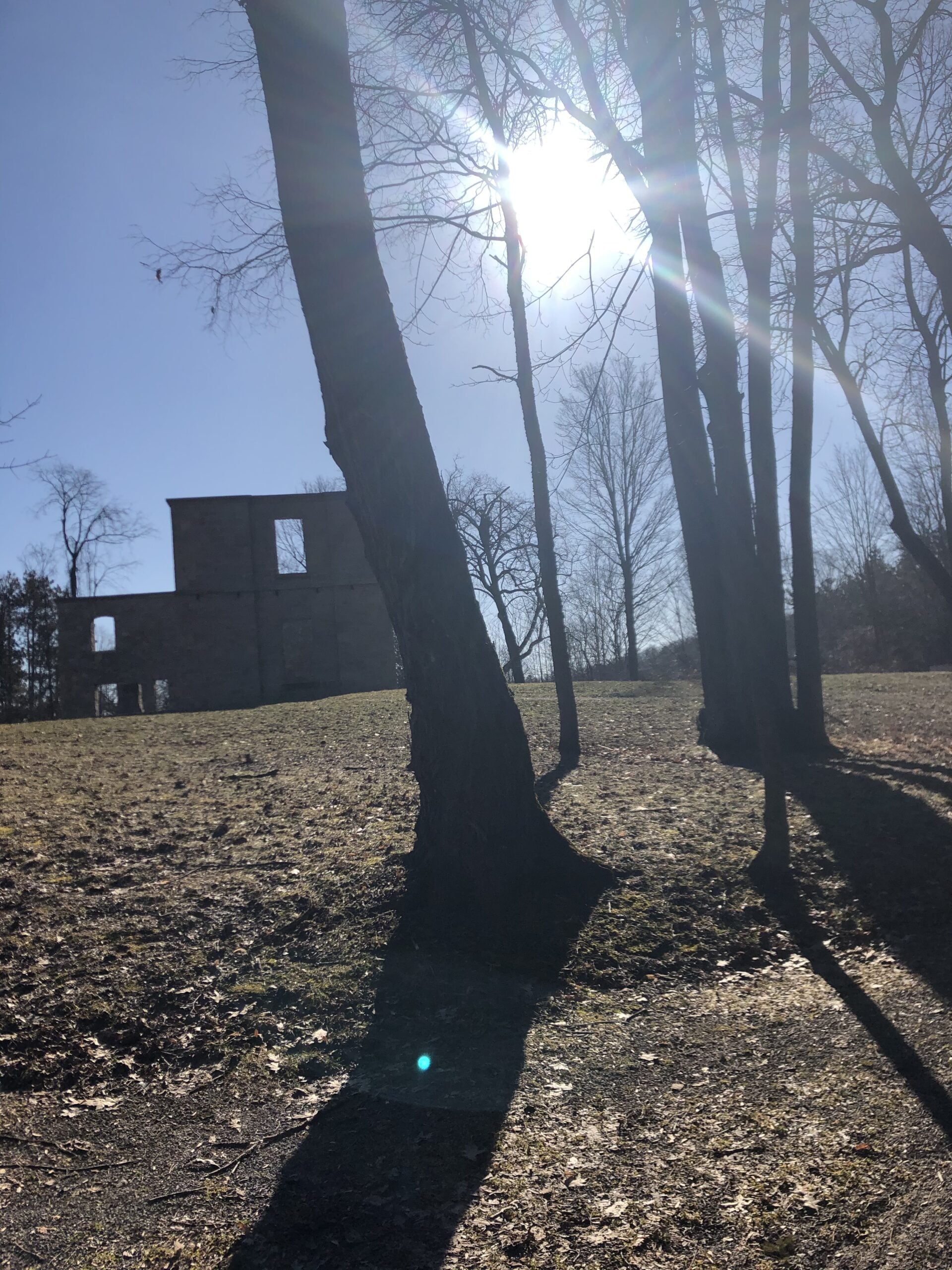
Double Loop in Dundas
https://hikesstaging.brucetrail.org/event/double-loop-in-dundas/Sorry, the registration cut-off time for this hike has been reached.Not a member? Click here to join today!Hosting Club: Iroquoia
Category: Easy Does It Hikes
Location (Google Maps): Dundas Valley Conservation Area, 650 Governor’s Rd., DundasHike Leader(s): Anne Armstrong Click here to contact Hike Leader(s)
Pace: Leisurely – 3km/hr or less
Terrain: Moderate – Some hills and/or some poor footing
Distance: 7 – 10 km.Description
Come enjoy the beauty of Dundas Valley CA with its lovely trails and many hills and valleys. We will complete one or two loops, your choice to do one or both. The terrain is easy but we will encounter some hills. Expect snow and ice, depending on what Mother Nature decides to give us. Bring water, a snack, icers and poles if using. We will stop at the centre between loops for our snack and a bathroom break. If you cannot make the hike the morning of, please text me at 905 617 3937. Parking fee if effect or Conservation Area pass.
Leader: Anne Armstrong 905 617 3937 hikingrandma@gmail.comDaytime, Snowshoe Adventure Badge #1 - Kolapore West
https://hikesstaging.brucetrail.org/event/daytime-snowshoe-adventure-badge-1-kolapore-west/Sorry, the registration cut-off time for this hike has been reached.Not a member? Click here to join today!Hosting Club: Beaver Valley
Location (Google Maps): Meet in the Kolapore parking lot on Grey Road 2, about 650 m south of where the trail crosses at km 23.8, Map 25, Edition 31
Hike Leader(s): Glenda Collings Click here to contact the hike leader.
Pace: Medium
Terrain: Moderate
Length of Hike: Approx. 6km return + 650 m x2 on road to carsDescription
This will be an in and out hike from the Kolapore parking lot. We pass along a field, through cedar and beautiful hardwood forest, encountering signs of old stone borders. On winter hikes we may encounter bare ground, light snow, deep snow, or ice. Please bring snowshoes and icers. Wear appropriate clothing for the weather plus water and a snack. Participants should have some experience with snowshoeing.COVID-19 Precautions Before, During and After your Hike
- Each hiker joining a Bruce Trail Club organized hike must perform a self-screening check before hiking.
Find Ontario’s self-assessment tool here: https://covid-19.ontario.ca/self-assessment/ - If you are experiencing COVID-19 symptoms, stay home.
Other Guidelines
- Arrive 15 minutes before the start of the hike.
- Wear sturdy footwear and appropriate attire for the weather and the terrain.
Hiking poles are a good idea in any season, especially if the terrain is rocky or slippery. In winter, snowshoes or icers/crampons are needed when conditions dictate.
Wearing appropriate clothing and footwear prevents injuries and shows consideration for a safe and positive group hiking experience. - Always carry I.D. and your health card.
- Bring sufficient water and snacks (or lunch if indicated). A minimum of 1L of water is recommended on all hikes, and 3L is recommended for long, challenging hikes in the heat of the summer.
- Bring sunscreen and insect repellent (for spring and summer hikes).
- Bring your own first aid kit.
- Please leave dogs at home.
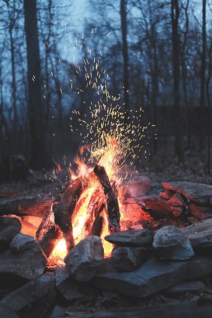
Campfire under the stars - Let's beat the Winter Blues!
https://hikesstaging.brucetrail.org/event/campfire-under-the-stars-lets-beat-the-winter-blues/Sorry, the registration cut-off time for this hike has been reached.Not a member? Click here to join today!Hosting Club: Toronto
Category: Urban Walk
Location (Google Maps): High Park Nature CentreHike Leader(s): Marie-Josée Roy Click here to contact Hike Leader(s)
Pace: Leisurely
Terrain: Variable
Distance: n/aDescription
Please join us for a short hike in High Park, and then gather around a campfire. We’ll have some sausages, buns, condiments, and s’mores, but feel free to bring whatever you would like to roast on the fire. And if you are so inclined, bring a guitar, harmonica, or ukulele, and your best camp songs!The High Park Nature Centre is a 6-minute walk from High Park subway station. Please remember that the park is closed to all vehicle traffic on weekends.
What to bring:
- Proper footwear
- Warm clothing
- Hot drinks (tea, coffee, soup, etc.)
Hike (optional): 4:00-5:00 p.m.
Campfire: 5:00-6:00 p.m.
- Each hiker joining a Bruce Trail Club organized hike must perform a self-screening check before hiking.
- 11February 11, 2024
Iroquoia Odyssey #4 - Dundas Valley to Waterdown
https://hikesstaging.brucetrail.org/event/iroquoia-odyssey-4-dundas-valley-to-waterdown/Sorry, the registration cut-off time for this hike has been reached.Not a member? Click here to join today!Hosting Club: Dufferin Hi-Land
Category: General Hike
Location (Google Maps): Roadside parking where the main trail crosses Snake Road in Waterdown. km 67.8 BTC Map 9.Hike Leader(s): Stuart Law Click here to contact Hike Leader(s)
Pace: Medium
Terrain: Moderate, Slippery and Steep Sections, Slippery Sections Likely
Distance: 17.5 kmsDescription
Join us on the fouth of seven shuttle hikes to complete the Iroquoia Section. We will climb up and out of the Dundas Valley then along the brow with great views of Dundas and Cootes Paradise until we journey below Highway 6 to arrive at Waterdown. Lots of ups and downs and yes, waterfalls. Hiking boots, icers and poles essential. Please dress in layers for the weather. Mitts a good idea. Please bring a smile, warm drink, water, a snack and a lunch. Please meet at 8:45 am to be ready to shuttle at 9 am. Please bring a garbage bag and footwear to change into for the shuttle after the hike (it might be muddy). Please be prepared to contribute to the cost of parking in the Dundas Valley CA.
Urban Walk: Waterfront Trail 4/8 - Parklawn
https://hikesstaging.brucetrail.org/event/urban-walk-waterfront-trail-4-8-parklawn-3/Sorry, the registration cut-off time for this hike has been reached.Not a member? Click here to join today!Hosting Club: Toronto
Category: Urban Walk
Location (Google Maps): Toronto Waterfront TrailHike Leader(s): Brian Rideout Click here to contact Hike Leader(s)
Pace: Moderate
Terrain: Flat
Distance: 9.1 kmDescription
Please join me at Old Mill Station no later than 9:12 am. We will take the 66 bus departing 9:27 am, arriving 9:40 am. If you want to meet us at Parklawn and Lakeshore, please be there by 9:40 am. We start hiking at 9:50 am.We will hike east along the lake to Spadina. The estimated distance is 9.1 km. Here is an online map of our route Parklawn to SpadinaBring a snack, at least 2 liters of water, and icers. Dress for cold weather.Car Hike: Mono Cliffs
https://hikesstaging.brucetrail.org/event/car-hike-mono-cliffs-5/Sorry, the registration cut-off time for this hike has been reached.Not a member? Click here to join today!Hosting Club: Toronto
Category: Car Hike
Location (Google Maps): Mono Cliffs Prov. Park, Map 19Hike Leader(s): Al Brown Click here to contact Hike Leader(s)
Pace: Moderate
Terrain: Variable
Distance: 8 KmDescription
This will be a loop winter hike through the Park starting at the Mono Community Centre. The terrain is variable and mostly flat. The hike will take approximately 3 hours and may be shortened depending on weather. After the hike those interested are invited to stop for refreshments in the area.Bring snow shoes if you have them and icers.
To get to the meeting point drive north on Hwy 10 past Orangeville to County Road 8 (at Camilla). Turn right and take the Road 8 into Mono Centre. The parking area is just before the Community Centre on your right. Parking is free.
11:00 am Gerry Berkhout Trail in Fenwick
https://hikesstaging.brucetrail.org/event/1100-am-gerry-berkhout-trail-in-fenwick/Sorry, the registration cut-off time for this hike has been reached.Not a member? Click here to join today!Hosting Club: Niagara
Category: In and Out
Location (Google Maps): Meet at Centennial Park on Church St in Fenwick. Park in first parking lot. After the hike we can go to the Grill on Canboro for refreshments. This is a flat walk, minimal if any mud. Bring water and dress for the weather.Hike Leader(s): Evelyne Mitchell Click here to contact Hike Leader(s)
Pace: Leisurely
Terrain: Easy
Distance: 7-8kmsDescription
This will be an in/out hike. We’ll walk for an hour and then turn around. The terrain is flat (this was an old railway line) and in most sections will be dry.Kemble Wetlands
https://hikesstaging.brucetrail.org/event/kemble-wetlands-4/Sorry, the registration cut-off time for this hike has been reached.Not a member? Click here to join today!Hosting Club: Sydenham
Category: Snowshoe Hike
Location (Google Maps): The Owen Sound Galaxy Theatre parking lot. Meet at the tall “Galaxy Centre” sign next to the traffic lights.Hike Leader(s): Danuta Valleau Click here to contact Hike Leader(s)
Pace: Leisurely: 3 km/h or less
Terrain: Moderate: Some hills and/or poor footing
Distance: 4 kmDescription
We will carpool to the intersection of Taylor Side Road and Coles Side Road. From there we hike Don Richards Side Trail, Kemble Wetland Side Trail, and Main Trail sections to loop back to our starting point. On this hike there are escarpment features, mixed forest, wetlands and regenerating pastureland. If you are unable to register, please call or text the hike leader at 519-378-5630. - 12February 12, 2024
9:00 am Side Trail Challenge #7 – Rockway, Louth, Staff, Midway, Lower Falls
https://hikesstaging.brucetrail.org/event/900-am-side-trail-challenge-7-rockway-louth-staff-midway-lower-falls-2/Sorry, the registration cut-off time for this hike has been reached.Not a member? Click here to join today!Hosting Club: Niagara
Category: Loop
Location (Google Maps): (Google Maps): Park at Rockway Conservation Area Parking LotHike Leader(s): Heather Howkins Click here to contact Hike Leader(s)
Pace: Brisk
Terrain: Moderate
Distance: 11.5kmsDescription
Take Rockway ST to the end.
Hike back to where it meets the Main Trail @ km 47.9
Take Main Trail until it meets Lower Falls Side trail. Take Lower Falls Side Trail until it meets main trail again then continue up Midway Side Trail until it meets the Main trail again. Take Main trail up the hill until it meets Staff Ave Side Trail. Take Staff Ave Side Trail out and back. Then take Louth Side trail until it meets Main Trail at km 51.2. Turn right and follow Main trail back to Rockway.This is a make up hike for the side trail badge.

Silent Moon Night Hike
https://hikesstaging.brucetrail.org/event/silent-moon-night-hike-2/Sorry, the registration cut-off time for this hike has been reached.Not a member? Click here to join today!Hosting Club: Niagara
Category: Night
Location (Google Maps):Louth Conservation Area
Hike Leader(s): Alan Laver Click here to contact Hike Leader(s)
Terrain: Moderate
Distance: 8 kmDescription
This is a silent hike in the woods . Take in the Magical sights and sounds of Louth Conservation Area. Bring night light and dress for the weather . 5 night hikes to earn your badge
Numbers are limited due to Parking
- 13February 13, 2024
9:00 CHANGE LOCATION Long Hike Rockway
https://hikesstaging.brucetrail.org/event/900-long-hike-wiley-road-short-hills-25/Sorry, the registration cut-off time for this hike has been reached.Not a member? Click here to join today!Hosting Club: Niagara
Location (Google Maps): Rockway
Hike Leader(s): Alan Laver Click here to contact Hike Leader(s)
Pace: Medium
Terrain: Moderate
Distance: 10kmDescription
Explore Short Hills and the majestic side trails of Scarlett Tanager, Hemlock. Swayze Falls and Terrace. Register for each hike
Bring Poles water, snack, Icers and dress for the weather

9:15 Short hike. Short hills Pelham road
https://hikesstaging.brucetrail.org/event/short-hike-short-hills-pelham-road/Sorry, the registration cut-off time for this hike has been reached.Not a member? Click here to join today!Hosting Club: Niagara
Category: Loop
Location (Google Maps): Short Hills Provincial Park. Pelham RdHike Leader(s): Debbie Demizio Click here to contact Hike Leader(s)
Pace: Medium
Terrain: Moderate
Distance: ~ 6kmsDescription
Hike the main and side trails of Short Hills Provincial Park. Bring hiking boots, icers and water. This hike qualifies for the Winter Hiking badge. See website for details. https://niagarabrucetrail.club/badges/Humber Valley Heritage Trail
https://hikesstaging.brucetrail.org/event/humber-valley-heritage-trail-9/Sorry, the registration cut-off time for this hike has been reached.Not a member? Click here to join today!Hosting Club: Dufferin Hi-Land
Category: Tuesday Hike
Location (Google Maps): Meet at roadside parking on the northwest side of Castllederg Rd. at the Humber River bridge, midway between the Gore Rd and Highway 50.
For carpooling meet at Party City (4th Ave. and Hwy10 in Orangeville) at 8:30 am.Hike Leader(s): Tony Evangelista, Les Babbage, Inge Eckerich, Julie Daley Click here to contact Hike Leader(s)
Pace: Leisurely
Terrain: Dependent on Conditions, Slippery and Steep Sections
Distance: Long hike 6 km Short hike 3 kmDescription
We will hike north for about 3 km and return to the parked cars. The short hike will turn back after 1.5 km.Bring snacks, water, and icers. Hiking poles are recommended. If the snow is deep, snowshoes will be required.
Optional refreshment stop in Bolton after the hike.
Dundas Valley Conservation Area - Waterfalls, History and Valentines
https://hikesstaging.brucetrail.org/event/dundas-valley-conservation-area-waterfalls-history-and-valentines/Sorry, the registration cut-off time for this hike has been reached.Not a member? Click here to join today!Hosting Club: Caledon Hills
Category: Tuesday Hikers
Location (Google Maps): Dundas Valley Conservation Area – meet in the parking area north of km 46.6 on Artaban Rd. within Dundas Valley Conservation Area,180 m north of Lions Club Rd. Iroquoia Section , Map 8 of the BTC Guide 30th. editionHike Leader(s): Doris Harper Click here to contact Hike Leader(s)
Pace: Medium – 3 to 4 km/hour
Terrain: Moderate – some hills and/or some poor footing
Distance: 12 kmDescription
February is Black History month. Within the Conservation Area there are historic ruins and buildings to visit and stories to remember.There are waterfalls we can hike to, and Valentine treats to share.
Meet at 9:45 AM in the parking area on Artaban Rd. as described above. There is a per car parking fee, so ride share if you can.
The hike is about 12 km in length and will take about 4 hours. We will walk the trails to the waterfalls, visit the historic sites and have lunch in the wild, or the visitors centre, dependent on the weather.
Dress for the weather, poles and icers recommended as the trails may be slippery. Bring lunch, snacks, beverage of choice.