
Hike Schedule
Join us for a hike! Registration required:
All hikes available to BTC members. Some hikes are open to non-members.
TIP: The calendar view displays up to 7 hikes on a day, but often there are more. Click “More events” to see them all.
Categories
- 18October 18, 2023
Harrison Park and Inglis Falls Loop with an opportunity for lunch at the Inn
https://hikesstaging.brucetrail.org/event/harrison-park-and-inglis-falls-loop-with-an-opportunity-for-lunch-at-the-inn/Sorry, the registration cut-off time for this hike has been reached.Not a member? Click here to join today!Hosting Club: Sydenham
Category: General Hike
Location (Google Maps):Parking lot in Harrison Park by the Harrison Park Inn (north of km 96.7) (Map 32).
Hike Leader(s): Sheri Hatcher Click here to contact Hike Leader(s)
Pace: Brisk: 4 to 5 km/h
Terrain: Moderate: Some hills and/or poor footing
Distance: Approximately 10 kmDescription
On this 10 km hike, we encounter a variety of terrain. We start on the Harrison Park Side Trail which meets both the main trail (upper) and the Palisades Side Trail (lower). The main trail is quite spectacular with rocky and steep sections. Weather permitting, we will do this section but if it appears too slippery we will do the Palisades Side Trail. Both trails will take us back to the main trail. From there we will head to Inglis Falls and return via the Creamery Side Trail to Harrison Park. After the hike, there will be an opportunity to enjoy lunch at the Harrison Park Inn. Please arrive 15 minutes before the start time.Lavender
https://hikesstaging.brucetrail.org/event/lavender-4/Sorry, the registration cut-off time for this hike has been reached.Not a member? Click here to join today!Hosting Club: Blue Mountains
Category: Register in person the morning of hike.
Location (Google Maps): Hike meets in the parking lot behind Tim Hortons on First St. in Collingwood.Hike Leader(s): Anhong MacNeil Click here to contact Hike Leader(s)
Pace: Medium – 3 to 4 km/hr
Terrain: Moderate – Some hills and/or some poor footing, Strenuous – Hilly with steep climbs and some poor footing
Distance: 11.5kmDescription
We will drive to the start of the hike at a roadside parking area near the cemetery located 1 km east of Lavender on Mulmur/Nottawasaga Townline. We will hike along the road until we reach Lavender where km 0.0 is the start of the Blue Mountains section. We will continue hiking until we reach the bridge at the Noisy River Nature Reserve and then retrace our steps. This hike offers a variety of terrain as we proceed along crevices, through forest, fields, and beautiful wetlands before reaching the Noisy River. Bring lunch and water.River and Ruin and loop
https://hikesstaging.brucetrail.org/event/river-and-ruin-and-loop-2/Sorry, the registration cut-off time for this hike has been reached.Not a member? Click here to join today!Hike open to BTC Members only.
Hosting Club: Iroquoia
Category: Good Companions
Location (Google Maps): Park at Kilbride Park behind the public schoolHike Leader(s): Jill Parratt Click here to contact Hike Leader(s)
Pace: Medium – 3 to 4 km/hr
Terrain: Moderate – Some hills and/or some poor footing
Distance: 7.5Description
Arrive at 9:15 for 9:30 start.We will hike Kilbride side trail, River and Ruin and loop.
Please bring water.
If you need to cancel day of hike please text me at 905-399-3601
Jill
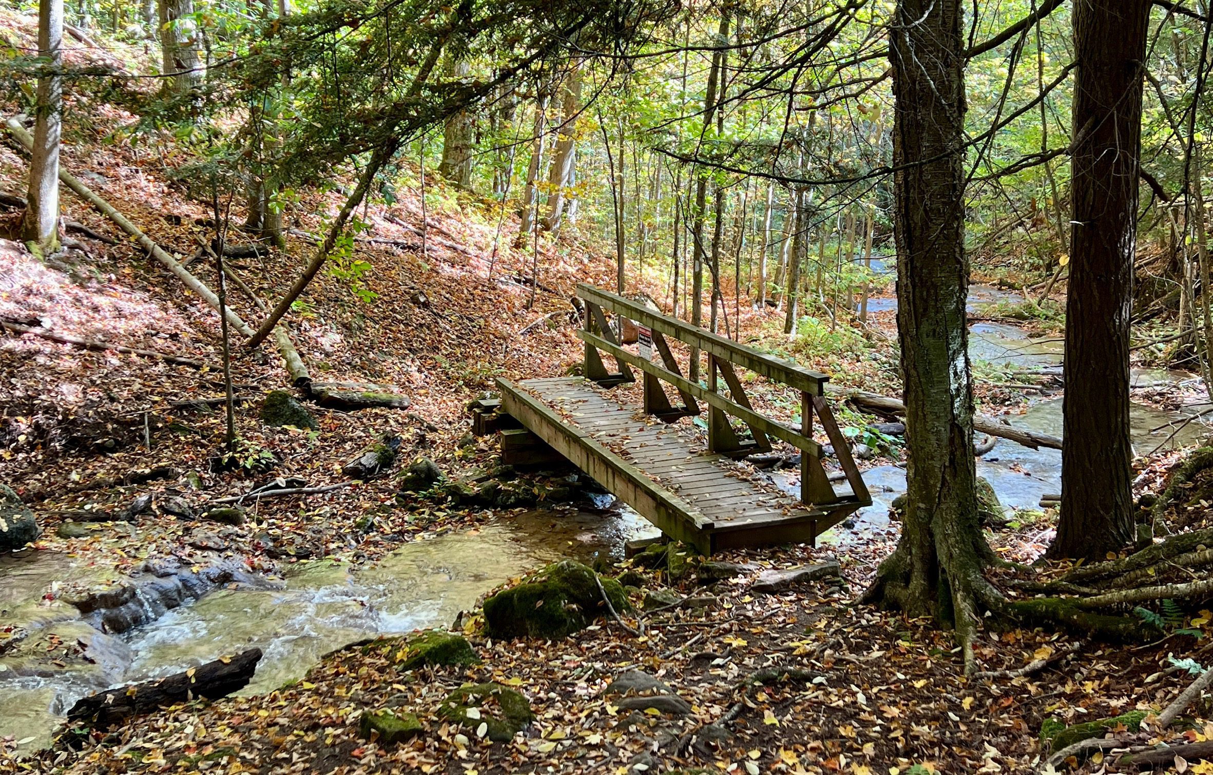
WEDNESDAY WALKERS - Falling Water - Graham's Hill
https://hikesstaging.brucetrail.org/event/wednesday-walkers-falling-water-grahams-hill/Sorry, the registration cut-off time for this hike has been reached.Not a member? Click here to join today!Hosting Club: Beaver Valley
Location (Google Maps): Park in the small BTC parking lot on the north side of Graham’s Hill Road, just west of where the Trail crosses Graham’s Hill Road at km 74.2, Map 26, Edition 31
Hike Leader(s): Margaret Yaraskavitch Click here to contact the hike leader.
Pace: Medium
Terrain: Moderate
Length of Hike: 4.2 kmDescription
This is a there-and-back hike along a varied stretch of Valley edge. Karst topography, old growth forest and streams with waterfalls are on our route as well as meadow and wild fruit trees. There are long views across the Valley.Exploring the Caledon Rail Trail
https://hikesstaging.brucetrail.org/event/exploring-the-caledon-rail-trail-2/Sorry, the registration cut-off time for this hike has been reached.Not a member? Click here to join today!Hosting Club: Caledon Hills
Category: General
Location (Google Maps): Caledon Rail Trail, 14341 Mississauga Road, CaledonHike Leader(s): Lynn Dobson Click here to contact Hike Leader(s)
Pace: Leisurely – 3 km/hour or less
Terrain: Easy – mostly flat and usually good footing
Distance: 8 kmDescription
This hike will start at the Cheltenham Brickyards parking area (free parking, address and GPS above). We will cross the street from the parking lot and be on the Trans Canada Trail from Mississauga Road to Chinguacousy Road. It will be an out and back, turning around at 4 km. The surface is hard packed; easy walking without any roots, rocks or hills. Hikers can wear running shoes or hiking shoes. The pace is leisurely. There are tree canopy sections and open sections.
After the hike participants will have the option of gathering at Cheltenham General Store for a coffee or sweet treat.11:00 am Hike & Picnic
https://hikesstaging.brucetrail.org/event/1100-am-hike-picnic-11/Sorry, the registration cut-off time for this hike has been reached.Not a member? Click here to join today!Hosting Club: Niagara
Category: Loop
Location (Google Maps): Locust Grove Picnic AreaHike Leader(s): Marion Hanover Click here to contact Hike Leader(s)
Pace: Medium
Terrain: Moderate
Distance: 7 kmDescription
Hike around Queenston area. Optional outdoor gathering in Locust Grove including pot luck picnic. - 19October 19, 2023
8:00 am Long Hike Jordan to Moyer / Louth
https://hikesstaging.brucetrail.org/event/800-am-long-hike-jordan-to-moyer-louth-63/Sorry, the registration cut-off time for this hike has been reached.Not a member? Click here to join today!Hosting Club: Niagara
Location (Google Maps):
Jordan Hollow Park 3039 King St Jordan
Pace: Medium
Terrain: Moderate
: 10kDescription
From Jordan Hollow Hike the main trail to Upper and Lower Balls Falls, Moyer Road or Louth and Return. You must register for each hike. Bring Poles, sunscreen, bug spray , snack and a drink and dress for the weather
9:00 Exploring Woodend Conservation Area, sections of the Bruce Trail and Side Trails
https://hikesstaging.brucetrail.org/event/900-exploring-woodend-conservation-area-sections-of-the-bruce-trail-and-side-trails-2/Sorry, the registration cut-off time for this hike has been reached.Not a member? Click here to join today!Hosting Club: Niagara
Location (Google Maps): Woodend Conservation Area, Parking Lot near Taylor Rd
Hike Leader(s): Mary-Lyn Hopper Click here to contact Hike Leader(s)
Pace: Leisurely, Medium
Terrain: ModerateDescription
The series of hikes will provide opportunities to learn about the vegetation in the area, including invasive and native plants.9:15 Short Hike - Jordan Hollow
https://hikesstaging.brucetrail.org/event/915-short-hike-jordan-hollow-79/Sorry, the registration cut-off time for this hike has been reached.Not a member? Click here to join today!Hosting Club: Niagara
Location (Google Maps): Jordan Hollow Park, Jordan Station
Hike Leader(s): Bill Russell Click here to contact Hike Leader(s)
Pace: Medium
Terrain: Strenuous
Distance: 6 kmsDescription
Hike the main and side trails around Jordan Hollow and Ball’s Falls. Bring water and hiking boots.
Nature Seekers - Friends of CHBTC
https://hikesstaging.brucetrail.org/event/nature-seekers-friends-of-chbtc/Sorry, the registration cut-off time for this hike has been reached.Not a member? Click here to join today!Hosting Club: Caledon Hills
Category: Nature Walks
Location (Google Maps): Meet at the Hockley Road Parking Lot: Located on the north side of Hockley Road at the Hockley Road Side Trail. Google Map Coordinates: 43.972857, -80.056330
Directions: From ON-10, turn east onto Hockley Road/Dufferin County Road 7. Drive for 5 kilometres. The parking lot is on the lefthand side.Hike Leader(s): Sandy Green Click here to contact Hike Leader(s)
Pace: Leisurely – 3 km/hour or less
Terrain: Moderate – some hills and/or some poor footing
Distance: 5.5 kmDescription
Plan to enjoy the fall colours and good company on this leisurely exploration of a section of the Hockley Valley Provincial Nature Reserve. Our route will take us along the Hockley Road Side Trail, sections of the main Trail, and the Tom East Side Trail. Bring your choice of hydration and snacks. Sturdy footwear is highly recommended.
Iroquoia End-to-End Hike 7 of 10
https://hikesstaging.brucetrail.org/event/iroquoia-end-to-end-hike-7-of-10/Sorry, the registration cut-off time for this hike has been reached.Not a member? Click here to join today!Hosting Club: Caledon Hills
Category: End-to-End
Location (Google Maps): Meet at Scenic Dr., west of Chateau Crt. at km 40.5. Shuttle to start at Davidson Blvd.Hike Leader(s): Nancy Mooney Click here to contact Hike Leader(s)
Pace: Medium – 3 to 4 km/hour
Terrain: Moderate – some hills and/or some poor footing, Strenuous – hilly with steep climbs and some poor footing
Distance: From 54.9 – 40.5, plus walk from parking, 14.5 km Map 8.Description
This is the seventh hike of ten and takes us through the Dundas Valley Conservation Area, from Sherman Falls along Ancaster Creek, through a wooded and rocky area, to Tiffany Falls Side Trail, across Highway 403 and through the Iroquoia Heights Conservation Area to parking.Kelso Summit
https://hikesstaging.brucetrail.org/event/kelso-summit-2/Sorry, the registration cut-off time for this hike has been reached.Not a member? Click here to join today!Hosting Club: Iroquoia
Category: Thursday Group
Location (Google Maps): Kelso SummitHike Leader(s): Colleen Mabalay Click here to contact Hike Leader(s)
Pace: Medium – 3 to 4 km/hr
Terrain: Moderate – Some hills and/or some poor footing
Distance: approx 7kmDescription
We will hike the main trail and a couple of side trails.Parking reservations required through conservationhalton.ca
- 20October 20, 2023
Niagara-On-The-Lake Tour
https://hikesstaging.brucetrail.org/event/niagara-on-the-lake-tour-44/Sorry, the registration cut-off time for this hike has been reached.Not a member? Click here to join today!Hosting Club: Niagara
Category: Urban
Location (Google Maps): Park on King St near Centre St, just outside of Veteran’s Memorial Park, NOTLHike Leader(s): Margaret Northfield Click here to contact Hike Leader(s)
Pace: Medium
Terrain: Easy
Distance: 5-6kmDescription
Tour around Old Town.Stay afterwards for some social time at Sweets and Swirls cafe
Jackson's Cove to Barrow Bay
https://hikesstaging.brucetrail.org/event/jacksons-cove-to-barrow-bay/Sorry, the registration cut-off time for this hike has been reached.Not a member? Click here to join today!Hike open to BTC Members only.
Hosting Club: Dufferin Hi-Land
Category: General Hike
Location (Google Maps): Bruce Trail parking lot off Bruce Road 9 in Barrow Bay just south of West Shore Road. km 67.9 BTC Map 38.Hike Leader(s): Stuart Law Click here to contact Hike Leader(s)
Pace: Medium
Terrain: Dependent on Conditions, Slippery and Steep Sections, Slippery Sections Likely, Strenuous
Distance: 16 kmsDescription
Join us for this series of Peninsula shuttle hikes from Jackson’s Cove to Cape Chin South on the Bruce Peninsula. The terrain is as demanding as it gets but stunning. Hikes range from 12 to 19.5 km. See individual hike descriptions for details. Please be ready for slippery rocks, cliff tops, poison ivy, bugs and ticks. Hiking boots and poles mandatory. Lots of climbing, some mud and a lot of laughs. Please arrive 15 minutes ahead of time because our departure times are firm. Please bring your own first aid kit with moleskin, 2.5L water, lunch, snack and a change of footwear and a garbage bag (for the shuttle). Please be prepared to use your vehicle for the shuttle. No dogs and no dropouts. Km references are to 31st Edition Bruce Trail Reference.Dufferin Hi-Land 1 of 3
https://hikesstaging.brucetrail.org/event/dufferin-hi-land-1-of-3/Sorry, the registration cut-off time for this hike has been reached.Not a member? Click here to join today!Hike open to BTC Members only.
Hosting Club: Niagara
Category: Car Pool
Location (Google Maps): Meet at lavender on Mulmur-Nottawasaga Townline Rd. by the cemetery, and carpool to km 41.7, 20 Sideroad, and Prince of Wales RD.Hike Leader(s): Vince Zvonar Click here to contact Hike Leader(s)
Pace: Brisk
Terrain: Moderate
Distance: 15.6Description
Kemble Wetlands and Kemble Rock Reserve
https://hikesstaging.brucetrail.org/event/kemble-wetlands-and-kemble-rock-reserve-6/Sorry, the registration cut-off time for this hike has been reached.Not a member? Click here to join today!Hosting Club: Sydenham
Category: General Hike
Location (Google Maps):Roadside parking on the shoulder of Coles and Taylor Sideroads, south of km 140.7 (Map 34)
Hike Leader(s): Carol Graham-Mullin Click here to contact Hike Leader(s)
Pace: Medium: 3 to 4 km/h
Terrain: Moderate: Some hills and/or poor footing, Strenuous: Hilly with steep climbs and some poor footing.
Distance: 5-6 kmDescription
Two loops, Kemble Wetlands and Kemble Rock Reserve . Poles, water and snack suggested. Several options and final route can be decided at trail head. If you are unable to register, please call or text the leader at 226-787-8804. - 21October 21, 2023
Coach Trip: Algonquin Park - Centennial Ridges Trail
https://hikesstaging.brucetrail.org/event/coach-trip-algonquin-park-centennial-ridges-trail/Sorry, the registration cut-off time for this hike has been reached.Not a member? Click here to join today!Hosting Club: Toronto
Category: Day Coach Trips
Location (Google Maps): Centennial Ridges Trail, Algonquin Provincial ParkHike Leader(s): Martina Furrer, Celia Ho, Duro Vukman and Roland Mark Click here to contact Hike Leader(s)
Pace: Moderate
Terrain: Hilly
Distance: 11.5 KMDescription
Bus departure time: 7 AMBus departure location: 10 York Mills Rd.
Join us for an awesome fall hike with spectacular views of the Algonquin Park wilderness. We will split into two groups and hike the Centennial Ridges Trail in opposite directions. Both groups will hike the entire trail at similar paces so that we finish around the same time. The trail is hilly and challenging, with some rocks and routes underfoot. We hope to complete the loop in about 5 hours (including all breaks), no drop-outs. There will be many great view and water stops along the way, and a scenic lunch spot.
Bring lunch, snacks, water (at least 2 litres), sun and rain protection. We will be travelling in a washroom equipped highway coach.
The cost (to be determined) includes coach fare and park admission/bus parking fee.
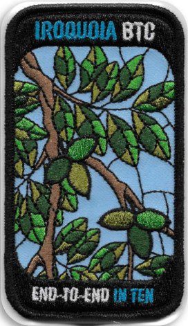
Iroquoia E2E in 10 – Butternut Tree Badge (Oct 21-22, Nov 4-5, Nov 18-19, Dec 2-3, Dec 16-17)
https://hikesstaging.brucetrail.org/event/iroquoia-e2e-in-10-butternut-tree-badge-oct-21-22-nov-4-5-nov-18-19-dec-2-3-dec-16-17/Sorry, the registration cut-off time for this hike has been reached.Not a member? Click here to join today!Hosting Club: Iroquoia
Category: Iroquoia E2E-in-Ten
Location (Google Maps): Iroquoia section – hike schedule will be sent out in advanceHike Leader(s): Freddy Wang Click here to contact Hike Leader(s)
Pace: Brisk – 4 to 5 km/hr
Terrain: Dependent on Conditions, Moderate – Some hills and/or some poor footing, Strenuous – Hilly with steep climbs and some poor footing
Distance: 11-15 kmDescription
This is a special series of 10 hikes to complete the entire Iroquoia section of the Bruce Trail over five weekends. There is an accomplishment badge, included in the registration fee – which was designed by Joe Borges and features the butternut tree.We will be following the main trail southbound starting in Milton and finishing in Grimsby. Please note that you are signing up for the entire series of ten hikes as a Group Hike. The Iroquoia in 10 series is geared to experienced hikers with the expectation of a 3.5 to 5.0 km/hr pace maintained over an 11 to 15 km hike.
Hikers will be expected to wear proper hiking footwear and have layered clothing. Sufficient snacks, water, hiking poles, and wet weather gear (if necessary) are recommended.
The fee goes towards supporting the Iroquoia Bruce Trail Club, which in turn supports the mission of the Bruce Trail Conservancy, which is: “Preserving a ribbon of wilderness, for everyone, forever.”
A maximum of 2 of the 10 hikes can be self-completed as a result of scheduling challenges, but it is intended that this badge be earned while hiking as part of a group led by a certified hike leader. Car shuttles are shared amongst the hikers.
Please note there are no refunds!
TRANSPORTATION
This series will be through hikes and will require car shuttling, you must be willing to drive or to be a passenger. Some parking locations require paid parking, and hikes that enter Conservation Areas (CA) will require reservations. The fee for the E2E-in-Ten does not cover any parking/entry fees for hikers who are not members of the Halton CA and/or Hamilton CA. If the group has enough hikers who are members of a CA, those will be the cars chosen to park in those areas so as to minimize costs but since conservation passes are not free, please consider nominal compensation to the pass holder. At least one hike starts at one CA and possibly ends at another, so parking fees are unavoidable for non-CA members.
Remember, you can only miss two hikes to qualify for this special Butternut Tree badge. You must still complete the distance you have missed. If you miss more than two but still complete the distances on your own, you may apply for the regular club End to End badge.
Car Hike: Wilder Forest, Uxbridge
https://hikesstaging.brucetrail.org/event/car-hike-wilder-forest-uxbridge/Sorry, the registration cut-off time for this hike has been reached.Not a member? Click here to join today!Hosting Club: Toronto
Location (Google Maps): 2499 Brock Road, Uxbridge, ON there is a free parking when you enter the road off brock road beside Horse training facility
Hike Leader(s): Mohammad Aghamiri Click here to contact Hike Leader(s)
Pace: Moderate
Terrain: Variable
Distance: 14-15KMDescription
We will explore Wilder forest and the beautiful sceneries of fall in wilder forest in Uxbridge .Some safety procedures during the hike:
1-Hikers must stay between the leader and the sweep.
2-Hikers must advise the leader or the sweep if they wish to leave the group.
3- Hikers must follow the whistle instructions: 1 blast- stay where you are; 2 blasts come to the leader; 3 blasts – come to the leader quickly.
4-Hike leader may request volunteers to stop at trail intersections, they need to help hikers to the direction the group walk and wait till they see the sweep .
5-Hikers have to make sure they can see the persons behind and in front of them.
https://hikesstaging.brucetrail.org/event/24626/Sorry, the registration cut-off time for this hike has been reached.Not a member? Click here to join today!Hosting Club: Blue Mountains
Category: Organized Hike
Location (Google Maps):Hike Leader(s): Linda Finley Click here to contact Hike Leader(s)
Pace: Medium – 3 to 4 km/hr
Terrain: Moderate – Some hills and/or some poor footingDescription
Len Holley Side Trail, Curly Harnden Side Trail and Bruce’s Caves 9 of 9 hikes Start time:8:30AM Hikers meet at trailhead at 8:30AM
Contact hike leader to confirm start up point.Barrow Bay to Whippoorwill Bay
https://hikesstaging.brucetrail.org/event/barrow-bay-to-whippoorwill-bay/Sorry, the registration cut-off time for this hike has been reached.Not a member? Click here to join today!Hike open to BTC Members only.
Hosting Club: Dufferin Hi-Land
Category: General Hike
Location (Google Maps): Bruce Trail parking lot at the end of the Richardson Access Trail with access from Forty Hills Road. Isthmus Bay Road north of Lion’s Head may be closed for construction so please access via Caudle Sideroad off Hwy 6. Near km 87.4 BTC Map 38.Hike Leader(s): Stuart Law Click here to contact Hike Leader(s)
Pace: Medium
Terrain: Dependent on Conditions, Slippery and Steep Sections, Slippery Sections Likely, Strenuous
Distance: 19.5 kmsDescription
Join us for this series of Peninsula shuttle hikes from Jackson’s Cove to Cape Chin South on the Bruce Peninsula. The terrain is as demanding as it gets but stunning. Hikes range from 12 to 19.5 km. See individual hike descriptions for details. Please be ready for slippery rocks, cliff tops, poison ivy, bugs and ticks. Hiking boots and poles mandatory. Lots of climbing, some mud and a lot of laughs. Please arrive 15 minutes ahead of time because our departure times are firm. Please bring your own first aid kit with moleskin, 2.5L water, lunch, snack and a change of footwear and a garbage bag (for the shuttle). Please be prepared to use your vehicle for the shuttle. No dogs and no dropouts. Km references are to 31st Edition Bruce Trail Reference.Louth Conservation area to Rockway return
https://hikesstaging.brucetrail.org/event/louth-conservation-area-to-rockway-return/Sorry, the registration cut-off time for this hike has been reached.Not a member? Click here to join today!Hosting Club: Niagara
Category: Loop
Location (Google Maps): Louth Conservation Area Parking Lot, Staff AvenueHike Leader(s): Lauren Doig Click here to contact Hike Leader(s)
Pace: Medium
Terrain: Moderate
Distance: 15 km maxDescription
Meet at Louth Conservation Area Parking Lot and head towards Rockway. We will enjoy a few side trails en route.
9:00 Cave Spring Witch Hunt
https://hikesstaging.brucetrail.org/event/900-cave-spring-witch-hunt-10/Sorry, the registration cut-off time for this hike has been reached.Not a member? Click here to join today!Hosting Club: Niagara
Location (Google Maps):
Parking lot Quarry Road Beamsville
Hike Leader(s): Bill Russell Click here to contact Hike Leader(s)
Pace: Leisurely, Medium
Terrain: Moderate
Distance: 6kDescription
Discover the history of the 19th Century Quarry Pioneers and the Cave Spring Witch. Complete this hike and count it towards the Screaming Tunnel Badge.Bring poles and wear good hikers as the terrain is rocky and hilly in parts.

New Badge! Beaver Valley Geology Hike #5
https://hikesstaging.brucetrail.org/event/new-badge-beaver-valley-geology-hike-5/Sorry, the registration cut-off time for this hike has been reached.Not a member? Click here to join today!Hosting Club: Beaver Valley
Location (Google Maps): Meet in the Hogg’s Falls parking lot, km 67.5 to shuttle to Johnston’s Side Road, km 74.3
Hike Leader(s): Glenda Collings Click here to contact the hike leader.
Pace: Medium
Terrain: Moderate, Some rocky footing, Some steep sections, Strenuous
Length of Hike: 6.8 kmDescription
This is a series of 7 hikes to earn the Beaver Valley Geology badge. We will use the criteria listed in Beth Gilhespy’s book, Walking Through Time, Exploring Niagara Escarpment Geology in the Beaver Valley Bruce Trail Section. We’ll boost our knowledge of the local geology along the way as we take the required photos. Hikers are welcome to join any or all of the hikes, however, they must complete all 7 hikes to earn the badge. Bring sufficient water and snacks.Hike Five: Falling Waters Trail
COVID-19 Precautions Before, During and After your Hike
- Each hiker joining a Bruce Trail Club organized hike must perform a self-screening check before hiking.
Find Ontario’s self-assessment tool here: https://covid-19.ontario.ca/self-assessment/ - If you are experiencing COVID-19 symptoms, stay home.
- Personal Protective Equipment:
- Hikers may choose to wear masks
Transportation
It is the Bruce Trail Conservancy’s current policy that car shuttles are allowed. It is at the discrepancy of individual hike leaders to make that decision.
Other Guidelines
- Arrive 15 minutes before the start of the hike.
- Wear sturdy footwear and appropriate attire for the weather and the terrain.
Hiking poles are a good idea in any season, especially if the terrain is rocky or slippery. In winter, snowshoes or icers/crampons are needed when conditions dictate.
Wearing appropriate clothing and footwear prevents injuries and shows consideration for a safe and positive group hiking experience. - Always carry I.D. and your health card.
- Bring sufficient water and snacks (or lunch if indicated). A minimum of 1L of water is recommended on all hikes, and 3L is recommended for long, challenging hikes in the heat of the summer.
- Bring sunscreen and insect repellent (for spring and summer hikes).
- Bring your own first aid kit.
- Please leave dogs at home.
Car Hike: Hockley Valley, Map 18
https://hikesstaging.brucetrail.org/event/car-hike-hockley-valley-map-18-2/Sorry, the registration cut-off time for this hike has been reached.Not a member? Click here to join today!Hosting Club: Toronto
Category: Car Hike
Location (Google Maps): Hockley Provincial Nature ReserveHike Leader(s): Al Brown Click here to contact Hike Leader(s)
Pace: Moderate
Terrain: Challenging, Hilly
Distance: 14 kmDescription
We will complete a loop hike through the Nature reserve on the main and side trails. This is one of the hilliest sections of the Bruce Trail and one of my favorites.After the hike we will stop at the Hockley Resort for refreshments.
To get to the meeting point drive north on Hwy 10 past Orangeville to Hockley Road. Turn right (east) and go about 5 km to the parking area on your left, across from the Black Birch Restaurant.

Urban Walk; Don Valley to The Distillery District
https://hikesstaging.brucetrail.org/event/urban-walk-don-valley-to-the-distillery-district/Sorry, the registration cut-off time for this hike has been reached.Not a member? Click here to join today!Hosting Club: Toronto
Category: Urban Walk
Location (Google Maps): TorontoHike Leader(s): Brian Rideout Click here to contact Hike Leader(s)
Pace: Moderate
Terrain: Flat
Distance: 27.5 kmDescription
This hike follows the Don River south through Toronto to the Distillery District, through a series of ravines and several parks. We will detour to street level when we cross the 401 (trail closed due to construction) and again south of Pottery Rd where we take the Bayview Ave Extension (trail closed due to construction).Please bring a lunch and at least two liters of water. Be prepared for cool / wet weather.
Here is an online map of our route: Don Valley to The Distillery
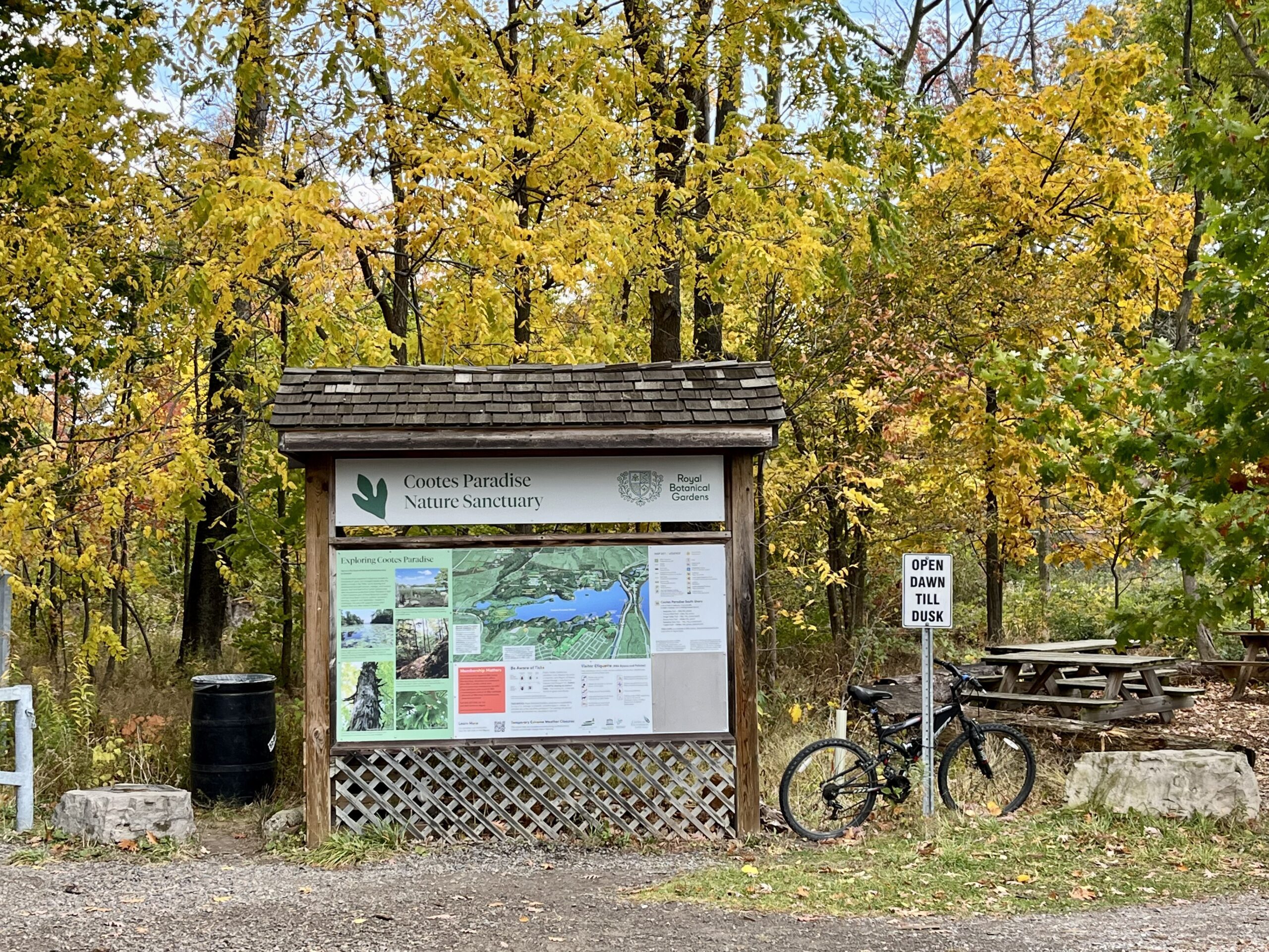
Urban Walk: Coote's Paradise/Hamilton Waterfront Trail
https://hikesstaging.brucetrail.org/event/urban-walk-cootes-paradise-hamilton-waterfront-trail-3/Sorry, the registration cut-off time for this hike has been reached.Not a member? Click here to join today!Hike open to BTC Members only.
Hosting Club: Toronto
Category: Urban Walk
Location (Google Maps):Hike will start from McMaster University GO Bus Terminal. We will meet at Toronto’s Union Station 8:30 AM to take the 8:44 AM Train to Aldershot where we will transfer to the GO Bus for a short ride to McMaster University. On the return we take the GO Train to Toronto from West Harbour GO Train Station. If you have a smart phone then the return fare is just $10 with GO’s Weekend Pass. Seniors fare return from Union is $11.44. Hikers without a smartphone may purchase pass from Hike Leader at Union Station. If meeting us at McMaster you will have to make your way back to start by local transit or Uber and parking fee would apply.
Hike Leader(s): Tom Swales, Tiffany & Steve Harding Click here to contact Hike Leader(s)
Pace: Moderate
Terrain: Variable
Distance: 12-13 kmDescription
This will be a one way hike through the trails of the RBG’s (Royal Botanical Gardens) South Shore Cootes Paradise Trails to Princess Point and then continuing on Hamilton’s Waterfront Trail along Burlington Bay to Bayfront Park which is a 7 minute walk to the West Harbour GO Station. Cootes Paradise is the largest and most diverse of RBG’s sanctuaries. Nestled between the Niagara Escarpment and Lake Ontario the picturesque area is significant as a migratory bird flyover zone and home to a wide variety of flora and fauna. There will be a few hills including one steeper one. Come and enjoy the last part of the fall colour season in the Hamilton area with me and hike leader apprentices Tiffany and Steve Harding. - Each hiker joining a Bruce Trail Club organized hike must perform a self-screening check before hiking.