
Hike Schedule
Join us for a hike! Registration required:
All hikes available to BTC members. Some hikes are open to non-members.
TIP: The calendar view displays up to 7 hikes on a day, but often there are more. Click “More events” to see them all.
Categories
- 18October 18, 2024

Car Hike: Caledon E2E in 5 sections - 2 of 5
https://hikesstaging.brucetrail.org/event/car-hike-caledon-e2e-in-5-sections-2-of-5/Sorry, the registration cut-off time for this hike has been reached.Not a member? Click here to join today!Hosting Club: Iroquoia, Caledon Hills
Category: General Hike
Location (Google Maps): Meet and park at km 31.7 on Innis Lake Rd, north of Finnerty Sideroad, and we carpool to km 16.1Hike Leader(s): Susan Glofcheskie Click here to contact Hike Leader(s)
Pace: Medium – 3 to 4 km/hr
Terrain: Moderate – Some hills and/or some poor footing
Distance: 16 kmDescription
Join us for this Caledon E2E in 5 sections. Sign up for all 5 sections (to be entitled to the badge) or only the ones you are available for.Please bring 2 litres of water, a snack, bug spray, sunscreen, a personal first-aid kit and appropriate clothing. Hiking boots/shoes are mandatory and poles are suggested.
Please arrive by 8 am, so we can leave at 8:15 am to shuttle to our starting point.
Click on the Google link for directions to the meeting place.

Niagara-on-the-Lake Tour
https://hikesstaging.brucetrail.org/event/niagara-on-the-lake-tour-61/Sorry, the registration cut-off time for this hike has been reached.Not a member? Click here to join today!Hosting Club: Niagara
Category: Urban
Location (Google Maps): Meet on King St and Centre St (entrance to Veteran’s Memorial ParkHike Leader(s): Margaret Northfield Click here to contact Hike Leader(s)
Pace: Medium
Terrain: Easy
Distance: 5-6 kmDescription
Each Friday we will explore different neighbourhoods, trails and parkland throughout Historic Niagara-on-the-Lake.Moderate pace with some weeks entirely on sidewalks and roads while others may include a mix of trails and paved pathways. Great way to build up endurance for longer more strenuous hikes.
Prepare for cooler windy conditions on open parkland and along Lake Ontario and Niagara River trails.
Plan to stay for conversation and a warm cup of coffee or tea at Sweets & Swirls, Community Centre, Niagara Stone Road, NOTL
Margaret & Robin
Riverside Woods (Caledon)
https://hikesstaging.brucetrail.org/event/riverside-woods-caledon-2/Sorry, the registration cut-off time for this hike has been reached.Not a member? Click here to join today!Hosting Club: Iroquoia
Category: General Hike
Location (Google Maps): Meet in the parking lot on 1st Line EHS near Orangeville, south of Hockley Valley.Hike Leader(s): Karen Bergmann Click here to contact Hike Leader(s)
Pace: Medium – 3 to 4 km/hr
Terrain: Moderate – Some hills and/or some poor footing
Distance: 8 kmsDescription
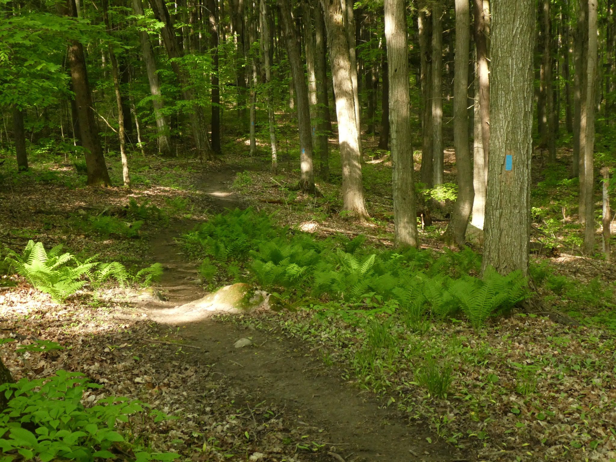
Hiking around the side trails of this new property acquired by the BTC two years ago and then across the road and along the main trail, returning to the new property, continuing along the side trails to the cars. This property used to be a Scout Camp and has several old buildings and varied terrain (forest, meadow, etc). Some hills.The Frontenac Challenge - Multi-day Hike
https://hikesstaging.brucetrail.org/event/cat-hike-the-frontenac-challenge-multi-day-hike/Sorry, the registration cut-off time for this hike has been reached.Not a member? Click here to join today!This is a Multi-Day Hike
You are signing up for the following dates and times:
2024-10-18 at 13:00
2024-10-19 at 08:00
2024-10-20 at 08:00
2024-10-21 at 08:00
2024-10-22 at 08:00
2024-10-23 at 08:00
2024-10-24 at 08:00Hosting Club: Toronto
Category: Car Hike
Location (Google Maps): We meet at Snug Harbour Resort and drive about 9 KM to Frontenac Provincial Park.Hike Leader(s): Fayyaz Mahmood Click here to contact Hike Leader(s)
Pace: Brisk (4-5 km/hr)
Terrain: Challenging, Hilly, Rocky
Distance: 20-25KM each dayDescription
Frontenac Park is located near Kingston about 3-4 hours from Toronto. According to Parks Ontario, the Frontenac Challenge is the ultimate hiking challenge in Ontario! To qualify for the ‘Frontenac Challenge’ badge you need to complete all of Frontenac’s 11 hiking loops, totaling around 160 km!The Frontenac Challenge is managed jointly by Parks Ontario and the Friends of Frontenac. You can find details about the 2023 Frontenac challenge at –
https://www.ontarioparks.com/parksblog/frontenac-challenge/
https://www.friendsoffrontenac.com/challenge-registration
BOARDING & LODGING:
You are responsible for arranging your own food and accomodation. Most often participants find it convenient and cost-effective to stay at Snug Harbour Resort, a short distance from the park. If you intend to stay there, feel free to reach out to the trip leader and let me know whether your email can be shared with other participants. Often there are opportunities for joining others in renting a cabin and jointly preparing meals.HIKING
These hikes are for serious hikers only. You should be prepared for long hiking days. No drop-outs. You should bring your lunch and at least 1.5 – 2 litres of water. You should dress for the weather. Bring your rain gear, if needed.Additional information will be provided to participants nearer to the event.
Only a limited number of spaces are available.
- 19October 19, 2024
Coach Trip: Algonquin Park
https://hikesstaging.brucetrail.org/event/coach-trip-algonquin-park/Sorry, the registration cut-off time for this hike has been reached.Not a member? Click here to join today!Hosting Club: Toronto
Category: Coach Trip
Location (Google Maps): Algonquin Provincial ParkHike Leader(s): Martina Furrer, Duro Vukman, Roland Mark, Felix Wan, Leila Damband Kh Click here to contact Hike Leader(s)
Pace: Fast (5 km/hr or greater), Moderate (3-4 km/hr)
Terrain: Challenging, Hilly, Rocky
Distance: 12Description
Departure 1: 7 AM, 10 York Mills Rd.Departure 2: 7:20 AM, HWY 400 and Major Mackenzie Dr. Park and Ride, in front of the GO bus stop
Join us for an awesome fall hike with spectacular views of the Algonquin Park wilderness. Exact trails/routes to be decided based on conditions and access at the time of the hike. We will split into two groups. Both groups will hike the same route at similar paces so that we finish around the same time. The trails are hilly and challenging, with some rocks and routes underfoot. We hope to complete the hike in about 5 hours (including all breaks), no drop-outs. There will be many great view and water stops along the way, and a scenic lunch spot.
Bring lunch, snacks, water (at least 2 litres), sun and rain protection. We will be travelling in a washroom equipped highway coach.
The cost: $70 for members, $80 for non-members, $40 for children. This includes coach fare and park admission/bus parking fee.
No refreshment/highway stop planned.
25 Km CHALLENGE Hike
https://hikesstaging.brucetrail.org/event/25-km-challenge-hike/Sorry, the registration cut-off time for this hike has been reached.Not a member? Click here to join today!Hosting Club: Dufferin Hi-Land
Category: Special Events
Location (Google Maps): BTC Map #20 1st Line East, Bruce Trail Parking Lot – Rock Hill. Just east of Whitfield south of 10 Side Road (County Road 17).Hike Leader(s): Don Stewart Click here to contact Hike Leader(s)
Pace: Brisk, Fast
Terrain: Moderate, Slippery and Steep Sections, Slippery Sections Likely, Strenuous
Distance: 25 kmsDescription
Challenge yourself, your family, your friends or co-workers to complete the 25 Km trail through the picturesque and serene Boyne River Valley and earn the Dufferin Hi-Land 25 K “Challenge Badge”. This is a fundraising event for our club to assist in the maintenance of the Trail. We look forward to “treating” you with renown Dufferin County fare and hospitality at our checkpoints. I challenge you!Blue Mountains Stained Glass Fundraiser
https://hikesstaging.brucetrail.org/event/blue-mountains-stained-glass-fundraiser/Sorry, the registration cut-off time for this hike has been reached.Not a member? Click here to join today!This is a Multi-Day Hike
You are signing up for the following dates and times:
2024-10-19 at 08:30
2024-10-20 at 08:30
2024-11-02 at 08:30
2024-11-03 at 08:30Hosting Club: Blue Mountains, Beaver Valley
Location (Google Maps): Meet in the Snow Drifters parking lot on Pretty River Road, north east of km 46.8, Map 23, Edition 31
Hike Leader(s): Glenda Collings Click here to contact the hike leader.
Pace: Medium
Terrain: Moderate, Some rocky footing, Some steep sections, Strenuous
Length of Hike: 20.5 kmDescription
You are registering for a 4 day series of hikes to earn the Blue Mountains Stained Glass fundraiser badge. Please dress appropriately for fall weather, which can be cool, cold, rainy or snowy. It’s a good idea to have your icers in the car, you never know! Our October hikes should be a showcase of fall colours. Once the leaves are gone in November we’ll have great views through the bare trees. Hikers may miss one hike and make it up before Nov. 3 to earn the badge. See below for the hike schedule, locations and meeting times. The pace will be medium, a bit slower on the steep hills. All km are from Bruce Trail Guide Edition 31. Please meet 15 minutes before the start time ready to car shuttle. If you have any questions please contact me at beavervalleytrailactivities@gmail.comOctober 19 – Hike starts at 8:30 a.m. Meet at Maple Lane km 67.3, Map 24, at 8:15 a.m. to shuttle to the Snow Drifters parking lot on Pretty River Road, north east of km 46.8. We will be hiking across the Escarpment, then through Petun Conservation Area and Pretty River Provincial Park. Bring your energy for some hill climbing! Hike length 20.5 km
October 20 – Hike starts at 8:30 a.m. Meet at 9/10 Sideroad Nottawasaga, km 14.1, Map 21, at 8:15 a.m. to shuttle to Lavender Cemetery, Mulmur-Nottawasaga Townline, km 00.0. We’ll be hiking through Noisy River Provincial Nature Reserve and part of the Transcarioca Friendship Trail. Hike length 14.7 km
November 2 – Hike starts at 8:30 a.m. Meet at Devil’s Glen Provincial Park off County Road 124, km 29.5, Map 22, at 8:15 a.m. to shuttle to 9/10 Sideroad Nottawasaga, km 14.1. We’ll be hiking through Nottawasaga Bluffs Conservation Area and Devil’s Glen. Hike length 15.4 km
November 3 – Hike starts at 8:30 a.m. Meet at the Snow Drifters parking lot on Pretty River Road, north east of km 46.8, Map 23, at 8:15 a.m. to shuttle to Devil’s Glen Provincial Park off County Road 124, km 29.5. We’ll be hiking through Nottawasaga Lookout Provincial nature Reserve. Hike length 17.3 km
COVID-19 Precautions Before, During and After your Hike
- Each hiker joining a Bruce Trail Club organized hike must perform a self-screening check before hiking.
Find Ontario’s self-assessment tool here: https://covid-19.ontario.ca/self-assessment/ - If you are experiencing COVID-19 symptoms, stay home.
Other Guidelines
- Arrive 15 minutes before the start of the hike.
- Wear sturdy footwear and appropriate attire for the weather and the terrain.
Hiking poles are a good idea in any season, especially if the terrain is rocky or slippery. In winter, snowshoes or icers/crampons are needed when conditions dictate.
Wearing appropriate clothing and footwear prevents injuries and shows consideration for a safe and positive group hiking experience. - Always carry I.D. and your health card.
- Bring sufficient water and snacks (or lunch if indicated). A minimum of 1L of water is recommended on all hikes, and 3L is recommended for long, challenging hikes in the heat of the summer.
- Bring sunscreen and insect repellent (for spring and summer hikes).
- Bring your own first aid kit.
- Please leave dogs at home.
Urban Walk: Boyd Conservation Park Vaughan
https://hikesstaging.brucetrail.org/event/urban-walk-boyd-conservation-park-vaughan/Sorry, the registration cut-off time for this hike has been reached.Not a member? Click here to join today!Hosting Club: Toronto
Location (Google Maps): Boyd Conservation Park, Islington Avenue, Vaughan, ON free parking at the entrance of the park,
There are different public transit routes to this parking lot please check transit maps/google map
Hike Leader(s): Mohammad Aghamiri Click here to contact Hike Leader(s)
Pace: Moderate (3-4 km/hr)
Terrain: Variable
Distance: 12-14Description
Explore the trails that wind through the beautiful valley at Boyd Conservation Area and the William Grainger Greenway. We will have lunch/snack in shelter with seated area,Please bring hiking poles, proper clothing for the season , hiking shoes/boots and lots of water.
Difficulty Level: 2 (Moderate)

Barrow Bay - Rush Cove Loop - PBTC Trail Running Pilot #2
https://hikesstaging.brucetrail.org/event/rush-cove-cape-dundas-loop-pbtc-trail-running-pilot-2/Sorry, the registration cut-off time for this hike has been reached.Not a member? Click here to join today!Hosting Club: Peninsula
Location (Google Maps): Meet up at the BTC Parking Lot in Barrow Bay, on the east side of #2461 Bruce County Road 9. (Map 37).
Hike Leader(s): Margie Gloade Click here to contact Hike Leader(s)
Pace: Fast
Terrain: Difficult
Distance: ~7km or ~14kmDescription
The PBTC is excited to pilot two trail runs as part of their hiking series. These fall 2024 pilot trail runs will help with preliminary plans for a Peninsula E2E trail running series in 2025. The second trail run on Saturday, Oct.19, 2024, will offer two loops starting in the PBTC Parking Lot in Barrow Bay, on the east side of #2461 Bruce County Road 9. [PLEASE NOTE: this start location and route have been updated since the original website post.] Trail runners will connect to the Main Trail from the short Hawthorn ST at the parking lot. Both loops will then follow the Main Trail east for about 2.5 km to the staircase. Trail runners interested in the 7km loop will then follow the Beth Gilhespy ST, to the John Appleton ST, and back to the parking lot.Trail runners interested in the longer distance can enjoy the newly configured trails in this area since BTC secured the Sunrise Shores Nature Reserve this summer. The 14k loop will continue east on the Main Trail until about 4.5km, then turn up the escarpment following the Ivan Lemcke ST, to the Rush Cove ST, until it meets the new Main Trail in Rush Cove, following the Main Trail back (west) to the parking lot.
This is not a race. Trail runners will be expected to stay together – plan for about 2-3 hours. This is technical and challenging terrain for running. You should have some experience running trails, proper footwear, carry your own water/fuel, and fitness to maintain a jogging pace. Car pool if possible. Please join this run and share your feedback for future PBTC trail running events!

9:00 Woodend to Firemens Loop
https://hikesstaging.brucetrail.org/event/900-woodend-to-firemens-loop/Sorry, the registration cut-off time for this hike has been reached.Not a member? Click here to join today!Hosting Club: Niagara
Category: Loop
Location (Google Maps): Meet at the entrance to Woodend Conservation Area, Taylor Rd, Niagara-on-the-LakeHike Leader(s): Margaret Northfield Click here to contact Hike Leader(s)
Pace: Medium
Terrain: Moderate
Distance: 14kmDescription
Hike through Woodend Conservation area through the Screaming Tunnel and into Fireman’s Park, Niagara Falls. We will loop around Fireman’s and head back to Woodend. Bring water and a snack. Poles recommended.
Geology Hike # 4 Woodford Escarpment
https://hikesstaging.brucetrail.org/event/geology-hike-4-woodford-escarpment/Sorry, the registration cut-off time for this hike has been reached.Not a member? Click here to join today!Hike open to BTC Members only.
Hosting Club: Sydenham
Category: Geology Hike
Location (Google Maps): Woodford Community, 107 Woodford Crescent, Owen Sound ON N4K 5W4. Please park behind the building. Loop hike from here.Hike Leader(s): Carol Graham-Mullin Click here to contact Hike Leader(s)
Pace: Leisurely: 3 km/h or less
Terrain: Easy: Mostly flat and good footing., Moderate: Some hills and/or poor footing, Strenuous: Hilly with steep climbs and some poor footing.
Distance: 3.5 km.Description
This is Geology Series # 4 following Beth Gilhespy’s book “Walking Through Time” in the Sydenham Bruce Trail Section. We will be exploring an industrial oddity, a disappearing waterfall, fossils, deep crevices and a rich forest of towering trees. Copies of Beth’s book will be available for purchase. Special member’s only price of $37.00 . Cash, cheque or etransfer. If paying with cash, please bring exact change. A special guest may join us ! Please bring water and a snack if you wish. Proper hiking footwear and hiking poles are recommended.
Urban Walk: Historical Hike - Old Georgetown and Glen Williams
https://hikesstaging.brucetrail.org/event/urban-walk-historical-hike-old-georgetown-and-glen-williams/Sorry, the registration cut-off time for this hike has been reached.Not a member? Click here to join today!Hosting Club: Toronto
Category: Urban Walk
Location (Google Maps): Georgetown Go StationHike Leader(s): Tom Swales and David Rowney Click here to contact Hike Leader(s)
Pace: Leisurely (2-3 km/hr)
Terrain: Variable
Distance: 10KDescription
Come join us for a 10K urban hike on Saturday Oct. 19 starting in Georgetown and learn about the area’s unique history in Glen Williams. Those leaving from Toronto can hop on the “Kitchener Line” Go Train at Union Station (at 9:51 am) or Bloor Go Station (at 10:01 a.m.). or Weston Go Station (10:07 a.m.) to arrive in Georgetown Go Train Station at 11:19 am (you’ll transfer to bus at Mt Pleasant Station in Brampton – a 20 minute stopover – for the rest of your journey). The return bus/train from Georgetown leaves at 3:00p.m. There is a 20-minute stopover at Mount Pleasant Station on the return trip. You’ll be back at Union Station at 4:36 p.m.If you wish, you can also drive to the Georgetown Go Station (north parking lot) for the hike. GPS: 43.656030, -79.919159.
The 2.5 hour hike will take us to the ruins of the historic Barber Mill (first site of hydro power in Ontario), then we will follow along the Credit Valley Footpath to the quaint town of Glen Wiliams (established 1825), with a chance to see artisan workshops and purchase sweets at Kits Kitchen or tea at the Main Street Market. After viewing some historic homes in the village, we will make our way back to Georgetown, following an abandoned rail line that takes us to the Georgetown Train Station, built in 1885. We’ll wander past more historic homes and finish (depending on timing) with a stop at Furnace Room craft brewery (across from the Station), or the Norval Pancake Factory nearby.
This is a Level 1 (easy) hike with a easy/moderate pace, suitable for “fit” beginners. There are some hills and depending on the weather, there could be wet areas along the Credit River footpath. Dress for the time of year, bring hiking boots, poles if you wish, water, sunscreen and lunch/snacks. Go Transit weekend day passes are available online for $10.
- Each hiker joining a Bruce Trail Club organized hike must perform a self-screening check before hiking.
- 20October 20, 2024

RESCHEDULED Bruce Trail Day: The Big Loop Bruce Trail Hike
https://hikesstaging.brucetrail.org/event/rescheduled-bruce-trail-day-the-big-loop-bruce-trail-hike/Sorry, the registration cut-off time for this hike has been reached.Not a member? Click here to join today!Hosting Club: Peninsula
Category: Peninsula Blue Series
Location (Google Maps): Hope Bay Parking (next to Hope Bay Campground): 10 Hope Bay Rd, Wiarton, ON N0H 2T0Hike Leader(s): Kathleen Stahlbaum Click here to contact Hike Leader(s)
Pace: Leisurely, Medium
Terrain: Difficult, Moderate
Distance: 9.5 kmDescription
THIS HIKE HAS BEEN RESCHEDULED TO SUNDAY, OCTOBER 20 DUE TO INCLEMENT WEATHER.Everyone’s invited to join us in celebrating the Bruce Trail with the Big Loop Bruce Trail Hike where we’ll hike the Boundary Bluff and Hart’s Tongue side trails as well as some of Sydney Bay’s main trail through Neyaashiinigmiing. We’ll meander through the rich green woods and along steep, rocky talus slope interspersed with extraordinary vistas overlooking Sydney Bay and scenic views of the Bluffs from below. The fall views are sure to bring about a sense of wonder and awe!
In order to reduce the cost of parking at Cape Croker Park ($15 per vehicle), we will be meeting in the parking lot next to the Hope Bay Campground and carpooling to the Park to begin our hike. Depending on the group size & vehicle capacity, your individual cost for parking will be approximately $5.
This hike is for those looking for a more challenging trek in duration, distance and difficulty. Bring lots of water and a snack or light lunch as we’ll be out for 3-4 hours. Hiking boots and trekking poles are advised due to rocky, uneven, and sometimes-slippery terrain. This hike will run rain or shine.

10:00 Sue-Ann Staff Estate Winery Hike and Wine Tasting Experience
https://hikesstaging.brucetrail.org/event/1000-sue-ann-staff-estate-winery-hike-and-wine-tasting-experience/Sorry, the registration cut-off time for this hike has been reached.Not a member? Click here to join today!Hosting Club: Niagara
Category: In and Out
Location (Google Maps): Park at Sue-Ann Staff Estate Winery 3210 Staff Avenue, JordanHike Leader(s): Sam Rutherford Click here to contact Hike Leader(s)
Pace: Medium
Terrain: Moderate
Distance: 6kDescription
We will hike on the main trail from Sue-Ann Staff Estate Winery through Louth Conservation Area and return back to Sue-Ann Staff Estate Winery by 11:30. Upon return we will enjoy a private structured wine tasting led by one of the knowledgeable and friendly winery staff from 11:30 to 12:00 noon. The cost for the tasting experience is $12.00 per person. Please bring your $12.00 with you as I will collect it prior to the tasting to simplify the payment to Sue-Ann Staff Estate Winery. Thank you.10:00am Invasive Buckthorn Work Party - 2024 - St.Paul's Nature Reserve
https://hikesstaging.brucetrail.org/event/1000am-invasive-buckthorn-work-party-2024-st-pauls-nature-reserve/Sorry, the registration cut-off time for this hike has been reached.Not a member? Click here to join today!Hosting Club: Niagara
Category: Register
Location (Google Maps):St. Pauls Nature Reserve – parking on road side on St.Pauls Ave, Niagara Falls just down from the rail road tracks.
Hike Leader(s): Alicia Aitchison Click here to contact Hike Leader(s)
Pace: Leisurely
Terrain: Moderate
Distance: ~3kmDescription
This work party is to continue with our invasive buckthorn removal at St.Pauls Nature Reserve.We are hoping to get lots of volunteers out and tackle this area in one work party per year.
Volunteers make a difference – come out & join us!
Invasive buckthorn removal methods vary based on how big the buckthorn is – small plants can be pulled by hand and hung upside down so the roots dry out and die. Medium sized are removed with the help of extractigators – special shovel like tools that make pulling much easier & large buckthorn “trees” must be cut with a chainsaw.
BTC Ecologists as well as certified chain sawyers will be there to help us.
Plan on arriving so we can all walk in together at 10am but it’s an easy walk out if anybody wants to leave after a shorter amount of time.
Remember to wear long pants, long sleeves, work gloves, bring lots of water & bring a lunch if you are staying for the duration!
Please register so you will be included in any relevant correspondence.
Urban Walk; Bartley Smith Greenway
https://hikesstaging.brucetrail.org/event/urban-walk-bartley-smith-greenway/Sorry, the registration cut-off time for this hike has been reached.Not a member? Click here to join today!Hosting Club: Toronto
Category: Urban Walk
Location (Google Maps):Bartley Smith Greenway
Hike Leader(s): Brian Rideout Click here to contact Hike Leader(s)
Pace: Leisurely (2-3 km/hr), Moderate (3-4 km/hr)
Terrain: Flat
Distance: 8.8 kmDescription
Please join me Sunday, October 20, 2024 at Finch Station by 9:20 am at the turnstiles at the main entrance. Note there is extended travel time to get to the trail head.We will walk to the YRT terminal where we will take the VIVA Blue bus north to 16th Ave (departs 9:33 am). At 16th Ave we will change to the YRT Rutherford 85 westbound. The ETA for our destination at Keel St is 10:14 am. VIVA / YRT takes the presto card. For VIVA, scan the card before boarding the bus. For YRT you can scan on the bus.
We will hike from Keele and Rutherford to Dufferin and Steeles for an estimated distance of 8.8 km. This includes Keffer Marsh. The terrain is flat except for entering and leaving the ravines.
Please bring at least two liters of water and a light snack. The trail can be muddy so waterproof footwear is recommended. If the possibility of wet feet is an issue for you then you might want to sit this one out.The pub stop after is at Montana’s west of Dufferin on Steeles.
Here is an online map of our route: Bartley Smith Greenway – https://onthegomap.com/s/vjskof0fNote: Registration closes 48 hours before the start of the hike.
Exploring Sydenham Hikes 16 and 17
https://hikesstaging.brucetrail.org/event/exploring-sydenham-hikes-16-and-17/Sorry, the registration cut-off time for this hike has been reached.Not a member? Click here to join today!Hosting Club: Sydenham
Category: General Hike
Location (Google Maps):Meet in the north-east corner of the parking lot at Home Depot on Highway 26 on the east side of Owen Sound.
Hike Leader(s): Bill Snel Click here to contact Hike Leader(s)
Pace: Leisurely: 3 km/h or less
Terrain: Moderate: Some hills and/or poor footing
Distance: 4.6 kmDescription
We will carpool to do the Pines and Clearview loop hikes. This are hikes 16 and 17 in the book, Exploring Sydenham. There is one secret to locate. If you do not have a book and would like one ($30) let me know by using the “Contact hike leader” link. - 21October 21, 2024
Hike 6 of 7 - Caledon Hills E2E
https://hikesstaging.brucetrail.org/event/hike-6-of-7-caledon-hills-e2e/Sorry, the registration cut-off time for this hike has been reached.Not a member? Click here to join today!Hosting Club: Caledon Hills
Category: End-to-End
Location (Google Maps): Meet at 9:15 at the Parking Lot at Hockley Road.
Shuttle to 5th Line EHSHike Leader(s): Jennie Greenfield Click here to contact Hike Leader(s)
Pace: Medium – 3 to 4 km/hour
Terrain: Strenuous – hilly with steep climbs and some poor footing
Distance: 10.0 kmDescription
Hike 6 of 7 – Caledon Hills E2EMore ups and downs throughout this hike. A quick ascent via Hockley Heights Side Trail to the main trail, climbing to Dave’s Pinnacle, across 5th Line to enter a former ski area, crossing through Hockley Valley Resort, through open grasslands, and a conifer plantation, then north on 2nd Line EHS to Hockley Road.
51.8 to 61.1 + 0.25 + 0.45 sidetrails = 10.0 km (Edition 31)
This hike can be logged towards the “60 for 60th Anniversary” badge