
Hike Schedule
Join us for a hike! Registration required.
All hikes available to BTC members. Some hikes are open to non-members.
See Refund Policy for Paid Hikes >
TIP: The calendar view displays up to 7 hikes on a day, but often there are more. Click “View more events” to see them all.
Categories
- 17February 17, 2025

Headwaters Trail in Dundas Valley via Martin Rd, Ancaster
https://hikesstaging.brucetrail.org/event/headwaters-trail-in-dundas-valley-via-spring-valley-trail/Sorry, the registration cut-off time for this hike has been reached.Not a member? Click here to join today!Hike open to BTC Members only.
Hosting Club: Iroquoia
Category: General Hike
Location (Google Maps): Due to remarkable snow levels on the trails, the hike length has been reduced to 8 km and the end time is now 13:30.
We will now meet at the parking lot nearest to the Ancaster Baseball Matthew Krol Field on Martin Road in Ancaster. Near 134 Martin Road, Ancaster.Hike Leader(s): Victoria Best Click here to contact Hike Leader(s)
Pace: Leisurely – 3km/hr or less
Terrain: Dependent on Conditions, Moderate – Some hills and/or some poor footing, Slippery Sections Likely
Distance: 8 kmDescription
Hike the west end of the Dundas Valley Conservation Area.
We will enter the Conservation Area from Martin Road in Ancaster and then hike the Headwaters Trail loop and back to our cars.
Please arrive at 9:15 for a 9:30 start.
There is one to two feet of snow on the trails. If you have them, bring snowshoes so that you can help pack down the trail. Otherwise, hiking boots and icers are required.
Bring a lunch and beverage.
No dogs please.
Family Day Trail Adventure for Everyone
https://hikesstaging.brucetrail.org/event/family-day-trail-adventure-for-everyone/Sorry, the registration cut-off time for this hike has been reached.Not a member? Click here to join today!Hosting Club: Caledon Hills
Category: General
Location (Google Maps): Bruce Trail Parking Lot at Riverside Woods
713377 1st Line EHS, Mono
Google GPS Coordinates: 43.959916, -80.070494Driving Directions:
From Hwy #10 north of Orangeville turn east on Hockley Road.
Drive for 1.1 km.
Continue straight onto Side Road 5 for 1.6 km.
Turn left onto 1st Line EHS for 900 metres.
Continue straight into the parking lot.***DO NOT take 1st Line EHS south from Hockley Road. It is NOT maintained. Google Maps may suggest this impassable route. Follow the above directions.
Hike Leader(s): Sandy Green Click here to contact Hike Leader(s)
Pace: Leisurely – 3 km/hour or less
Terrain: Easy – mostly flat and usually good footing, Moderate – some hills and/or some poor footing
Distance: 1.5 km, 3.5 km, or 7.5 kmDescription
EVENT CANCELLED DUE TO INCLEMENT WEATHER Plan to spend time in nature with family and friends. Join one of three group hike options – 1.5 km, 3.5 km, or 7.5 km. Make a craft and challenge each other to an outdoor game. Dress for the weather. Depending on the snow conditions, icers/crampons are recommended. Bring snacks and beverages to keep you fuelled during the hike. Warm up at the end with hot chocolate.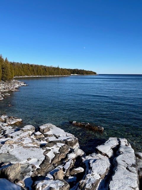
Family Day in Tobermory - Bruce Trail Hike
https://hikesstaging.brucetrail.org/event/family-day-in-tobermory-bruce-trail-hike/Sorry, the registration cut-off time for this hike has been reached.Not a member? Click here to join today!Hosting Club: Peninsula
Category: Winter Hikes
Location (Google Maps): Bruce Peninsula National Park at the Visitor’s Centre located at 120 Chi sin tib dek Rd, Tobermory ON. Meet at the front of the Visitor’s Centre.Hike Leader(s): Caley Doran
Pace: Leisurely (2.0 – 3.0 km/h): A relaxed pace with frequent breaks and a focus on enjoyment., Medium (3.0 – 4.5 km/h): A comfortable pace for most hikers with steady progress.
Terrain: Moderate: Rolling hills, mild slopes and rocky paths.
Distance: 4.8 kmDescription
Family Day in Tobermory! Bruce Trail Hike, Campfire at the Bruce Peninsula National Park Visitor Centre and Family Activities at the Tobermory Community Centre!Our Family Day hike starts at the BPNP Visitor’s Centre. We will hike the Main Bruce Trail to the Burnt Loop Side Trail. This is a lovely winter hike (~4.8 km) through an enchanting forest with pretty views of Georgian Bay, Flower Pot and Bear’s Rump Islands taking approximately 2 1/2 hours. We will hike at steady pace with brief stops for drinks/snacks and water views.
The terrain on the first part of this trail is level, however the Burnt Loop Side Trail is a meandering, rocky trail with some short ups and downs and includes a short rocky beach section. If snow is deep, the remainder of the hike may be challenging for some. For those wishing to return to the Visitor Centre after reaching our first lookout (~1 km), a PBTC Hike Leader will return with you while the rest of the hiking group continues.
Winter hikes require extra thought and preparation. Weather can be unpredictable. Be prepared to bring snowshoes, icers and gators (optional). Hiking poles are essential for winter hikes. Make sure to wear layers of clothing, warm winter hat, winter hiking boots and mittens. Bring a light backpack for water and snacks.
Don’t have your own snowshoes? No problem! Arrive early to the Park Visitors Centre to borrow a pair of snowshoes from the Park for this hike (limited supplies).
After the hike, everyone is welcome to gather together by the fireplace or outdoor campfire at the Visitor’s Centre. Indoor washrooms are available here. The hike is free. However, park admission and parking fees apply.
Caley Doran, a passionate Anishinaabe Interpretive Guide from Saukiing Anishinaabekiing territory, will lead the hike. Caley is dedicated to his roots, and brings a deep connection to Mother Earth and ancestral wisdom to his guided hikes.
CANCELLED- Urban Walk: Toronto Islands Family Day Hike
https://hikesstaging.brucetrail.org/event/urban-walk-toronto-islands-family-day-hike-2/Sorry, the registration cut-off time for this hike has been reached.Not a member? Click here to join today!Hosting Club: Toronto
Category: Cancelled
Location (Google Maps):Meet inside the waiting area of Jack Layton Ferry Terminal at the foot of Bay Street at 10:15AM to take the 10:30 AM Ferry to Ward’s Island. Ferry tickets can be purchased when you arrive or online. Ferry return fares: $10.50 adult, $6.75 student/senior
Hike Leader(s): Ray Berzins Click here to contact Hike Leader(s)
Pace: Moderate (3-4 km/hr)
Terrain: Flat
Distance: 12 kmDescription
CANCELLED Due to heavy snow, cold temperature, high winds and lack of shelter.The Toronto Islands are very peaceful in the Winter Season. We will catch the 3:45 pm or 4:15 pm ferry to be back in the city by 4:30 pm. Bring a lunch, snacks, water, a hot beverage, and icers if available. Dress in warm layers appropriate to the weather. Heated washrooms available. Dropout anytime by walking back to the Ward’s Island Ferry Dock. We will hike to Hanlan’s Point and return to Ward’s Island (only destination served in the Winter) – approximately 6 km each way.

CANCELLED: Youth Hiking Program - Family Day Discovery Hike - GSCA to Inglis
https://hikesstaging.brucetrail.org/event/youth-hiking-program-family-day-discovery-hike-gsca-to-inglis/Sorry, the registration cut-off time for this hike has been reached.Not a member? Click here to join today!Hosting Club: Sydenham
Category: Family Hike
Location (Google Maps): Meet in the parking lot behind the Grey-Sauble Conservation Authority head office (beside the Arboretum).
237897 Inglis Falls Road, Owen SoundHike Leader(s): Jeannine Kralt Click here to contact Hike Leader(s)
Pace: Leisurely: 3 km/h or less
Terrain: Moderate: Some hills and/or poor footing
Distance: 4kmDescription
Join us on this Family Day Discovery Hike from GSCA to Inglis Falls and back – we’ll take our time, and see what we can find. We’ll cross the Sydenham River, hike through forests, climb the Escarpment, check out geological potholes and take a peek at Inglis Falls, returning via mostly the same route. Free ‘Boots on the Trail’ badges are available to youth 18 and under. This is also a great route to choose for the By the Seasons badge.As we’ll be taking our time, this hike is suitable for families, new hikers, and anyone wanting a more leisurely hike. All ages are welcome. We’ll likely take a couple of hours (possibly more), depending on the group – dress in layers, bring a snack, and wear good footwear. Given that February conditions can be variable, an email re: trail conditions to expect will be sent out prior to our hike together. As this is a well-used stretch of trail, it’s anticipated that snowshoes are not necessary. The trail may be slippery-icy or mucky in portions.
If you are unable to register, please contact the hike leader via the link above. Carpooling may be available upon request.
- 18February 18, 2025
CANCELLED Rocklyn Creek to Griersville
https://hikesstaging.brucetrail.org/event/rocklyn-creek-to-griersville-2/Sorry, the registration cut-off time for this hike has been reached.Not a member? Click here to join today!Hosting Club: Sydenham
Category: General Hike
Location (Google Maps): Meet at roadside parking location on Deviation Road where the Bruce Trail crosses the road – see map 28. We will do a quick car shuttle to the parking on Euphrasia St.Vincent Townline at Griersville and will hike back to Deviation Road. Please arrive at Deviation Road at 08:45h so we can do the car shuttle and be hiking by 9 am.Hike Leader(s): Fran Turner
Pace: Brisk: 4 to 5 km/h
Terrain: Moderate: Some hills and/or poor footing
Distance: 9.5 kmDescription
This hike travels along the top of the escarpment, crossing several pretty creeks and waterfalls. At this time of year, the beautiful views northeast to Georgian Bay are not blocked by foliage, so we will enjoy spectacular scenery. There are no major hills to tackle, but the terrain is rugged. I will check the trail conditions the day before the hike and let people know what footwear is needed eg Icers or snowshoes.9:00 Long Hike Wiley Road Short Hills
https://hikesstaging.brucetrail.org/event/900-long-hike-wiley-road-short-hills-46/Sorry, the registration cut-off time for this hike has been reached.Not a member? Click here to join today!Hosting Club: Niagara
Location (Google Maps):
Short Hills Wiley Road Entrance
Hike Leader(s): Alan Laver Click here to contact Hike Leader(s)
Pace: Medium
Terrain: Moderate
Distance: 10kmDescription
Explore Short Hills and the majestic side trails of Scarlett Tanager, Hemlock. Swayze Falls and Terrace. Register for each hikeBring Poles, Icers, snack, and dress for the weather
Urban Walk: Valley View Park Thornhill
https://hikesstaging.brucetrail.org/event/urban-walk-valley-view-park-thornhill-56/Sorry, the registration cut-off time for this hike has been reached.Not a member? Click here to join today!Hosting Club: Toronto
Location (Google Maps): Parking lot is inside Sycamore Drive East of Bayview , north of Bayview Reservoir Park Playground
Hike Leader(s): Mohammad Aghamiri Click here to contact Hike Leader(s)
Pace: Moderate (3-4 km/hr)
Terrain: Level 2 (Intermediate – some hills and uneven surfaces, rocks and roots underfoot)
Distance: 7-8 kmDescription
We will explore Valleyview and Maple View parks, and walk along German Mill Creak,In return we stop in Huntington park and have snack under beautiful shed ,Even it is considered Urban walk, but it is urban hike as we have some up and down hills and tree roots, please bring your Ice cleats and hiking poles
9:15 Short hike, Pelham Road, Short Hills
https://hikesstaging.brucetrail.org/event/915-short-hike-pelham-road-short-hills-10/Sorry, the registration cut-off time for this hike has been reached.Not a member? Click here to join today!Hosting Club: Niagara
Location (Google Maps): Short a hills Provincial Park, Pelham Road entrance
Hike Leader(s): janet davey Click here to contact Hike Leader(s)
Pace: Medium
Terrain: Moderate
Distance: 6 kmsDescription
Hike the main and side trails in Short Hills Provincial Park. Bring hiking boots and water. Keep a pair of icers in your car in case of icy conditions.Forks of the Credit
https://hikesstaging.brucetrail.org/event/forks-of-the-credit/Sorry, the registration cut-off time for this hike has been reached.Not a member? Click here to join today!Hosting Club: Caledon Hills
Category: Tuesday Hikers
Location (Google Maps): Mississauga Rd. intersection with Elora-Cataract Trailway.
Driving direction: From Highway 401, north on Mississauga Rd., pass through Belfountain village, after crossing Cataract Rd. and Elora-Cataract Trailway, park on either side of the road.
Alternate: North on Highway 410, continue on Highway 10, at Caledon Village, left on Charleston Sideroad (24), left on Mississauga Rd., drive 2 km to the roadside parking.Hike Leader(s): Mohammad Shafiq Click here to contact Hike Leader(s)
Pace: Medium – 3 to 4 km/hour
Terrain: Moderate – some hills and/or some poor footing
Distance: 11 kmDescription
Will enter Forks of the Credit Conservation Area using Elora-Cataract Trailway and hike main Bruce Trail, Mill Pond Trail and parts of conservation trails.
Bring water, a warm drink and snack; poles are recommended.
Dress according to weather, in layers, gloves and cleats may be required for safe hiking.
Will observe Forest Bathing for 20 minutes during the hike.Hockley Valley-Tom East Loop
https://hikesstaging.brucetrail.org/event/hockley-valley-tom-east-loop/Sorry, the registration cut-off time for this hike has been reached.Not a member? Click here to join today!Hosting Club: Dufferin Hi-Land
Category: Tuesday Hike
Location (Google Maps):Caledon Hills Section, Map 18, Meet at Hockley Rd parking lot on the north side of Hockley Rd, 250 meters east of 2nd line (near Km 61.3)
Hike Leader(s): Tony Evangelista, Inge Eckerich, Les Babbage , Julie Daley Click here to contact Hike Leader(s)
Pace: Leisurely
Terrain: Moderate, Slippery and Steep Sections
Distance: 5.6 Km, Short hike: 2.5 Km.Description
We will hike a loop consisting of Hockley Rd and Tom East Side Trails and Main Trail. Shorter hike will turn back where the Tom East trail turns sharply to the east. Bring water and snacks. Icers or Snowshoes may be required. Hiking poles are recommended. - 19February 19, 2025

8:30 Niagara Winter End to End #6 Woodend Conservation Area to Queenston Southern BTC Terminus
https://hikesstaging.brucetrail.org/event/830-niagara-winter-end-to-end-6-woodend-conservation-area-to-queenston-southern-btc-terminus-2/Sorry, the registration cut-off time for this hike has been reached.Not a member? Click here to join today!Hosting Club: Niagara
Category: Car Pool
Location (Google Maps): Meet at Queenston Heights Restaurant Parking lot and Car Pool to WoodendHike Leader(s): Sam Rutherford Click here to contact Hike Leader(s)
Pace: Medium
Terrain: Moderate
Distance: 14.5Description
We will be car pooling, Bring Icers and poles. No dogs. To earn your Niagara Winter End to End badge, it must be completed between December 21, 2024 to March 21, 2025.
Because of the potential for bad winter trail conditions we have broken this e2e into 6 hikes rather than 5. Main parking lot will be closed for winter so park near the washroom building. Parking fees may be required.If you have completed all 6 hikes bring $10 for the coveted Winter End to End Badge
LOCATION CHANGED Crawford Lake Conservation area
https://hikesstaging.brucetrail.org/event/mountsberg-conservation-area/Sorry, the registration cut-off time for this hike has been reached.Not a member? Click here to join today!Hosting Club: Iroquoia
Category: Good Companions
Location (Google Maps): Crawford Lake Conservation area
3115 Conservation Rd
Milton
L9T 2X3Hike Leader(s): Jill Parratt Click here to contact Hike Leader(s)
Pace: Medium – 3 to 4 km/hr
Terrain: Easy – Mostly flat and usually good footing
Distance: 7.5Description
Please meet at 9:15 for a 9:30 start.You will need to reserve a time spot at Conservation Halton – Crawford Lake
Use the first parking lot.
We will be hiking around the lake and around the escarpment.
Please bring water, icers if needed.
Jill

Winter Badge Wednesdays: Hockley Valley Provincial Nature Reserve
https://hikesstaging.brucetrail.org/event/winter-badge-wednesdays-hockley-valley-provincial-nature-reserve-2/Sorry, the registration cut-off time for this hike has been reached.Not a member? Click here to join today!Hike open to BTC Members only.
Hosting Club: Caledon Hills
Category: General
Location (Google Maps): Meet at 10 am at the parking area (10 cars) on 3rd Line, north of Hockley Road. (Note: We are not meeting at the main parking area on Hockley Road. Go north on 3rd Line. The parking area is on the east side of the road.) It is best to aim for arriving around 9:45, so we can start hiking as close to 10 am as possible. Thanks!Hike Leader(s): Elizabeth Ganong Click here to contact Hike Leader(s)
Pace: Leisurely – 3 km/hour or less
Terrain: Strenuous – hilly with steep climbs and some poor footing
Distance: Approximately 4 kmDescription
Update: With winter conditions, this hike has become strenuous. The pace of the hike will be slow to manage the deep snow and hills.Looking to get outside and enjoy nature in another season? You may wish to join in on one Wednesday hike in this winter series or all five! Complete all five as part of the series or do a combination of hikes within the series and your own winter hikes, and you will be eligible to receive the Caledon Winter Hiking Badge (further details below and on the CHBTC website under Club Badges).
This Wednesday’s hike is a hilly challenge as we use side trails and the main trail to make a 4 km loop in the Hockley Valley Nature Reserve. Be prepared for winter conditions by bringing warm gear, poles, and icers. You are encouraged to bring water and a snack. No dogs please.
The hike leader for this hike is Elizabeth Ganong. Registrants can expect a reminder/update message one or two days before the hike.
If desired, this hike may be used towards the Caledon Winter Hiking Badge (5 winter hikes in the Caledon section that are 1 ½ hours or longer in length). Please keep a log of your hikes and follow the directions on the CHBTC website under Club Badges to receive your badge.
Limehouse Speyside Loops
https://hikesstaging.brucetrail.org/event/limehouse-speyside-loops/Sorry, the registration cut-off time for this hike has been reached.Not a member? Click here to join today!Hosting Club: Dufferin Hi-Land
Category: General Hike
Location (Google Maps): Limehouse Conservation Area: Parking at the baseball diamonds. Access from Fifth Line south of the village of Limehouse. 43.63294746523793 -79.97092185711668Hike Leader(s): Stuart Law Click here to contact Hike Leader(s)
Pace: Medium
Terrain: Moderate, Slippery Sections Likely, Strenuous
Distance: 9.63 kmsDescription
Join us in the snow on the main trail and the Canada Goose Side Trail to Speyside and back from Limehouse. Snow likely to be deep. Please bring snowshoes and icers. Please also dress in layers and bring water, a warm drink, a snack and a lunch. Check the BTC website for what should be in your backpack. Please be ready to snowshoe at 10:00 sharp. Please remember hiking in the snow is much more strenuous that regular hiking. Please be honest with yourself about your fitness level. No drop outs. We will walk on water a bit. It will be frozen.11:00 am Hike & Picnic
https://hikesstaging.brucetrail.org/event/1100-am-hike-picnic/Sorry, the registration cut-off time for this hike has been reached.Not a member? Click here to join today!Hike open to BTC Members only.
Hosting Club: Niagara
Category: Loop
Location (Google Maps):Locust Grove Picnic Area
Hike Leader(s): Marion Hanover Click here to contact Hike Leader(s)
Pace: Medium
Terrain: Moderate
Distance: 7 kmDescription
Hike around Queenston area. Optional outdoor gathering in Locust Grove including pot luck picnic after the hike. - 20February 20, 2025
9:00 am Long Hike Cave Spring
https://hikesstaging.brucetrail.org/event/900-am-long-hike-cave-spring-3/Sorry, the registration cut-off time for this hike has been reached.Not a member? Click here to join today!Hosting Club: Niagara
Location (Google Maps):
Cave Spring Conservation Area
Hike Leader(s): Alan Laver Click here to contact Hike Leader(s)
Pace: Medium
Terrain: Moderate
Distance: 10kDescription
From Cave Spring Conservation Area explore the trail network on the escarpment You must register for each hike. Bring Poles, snack and a drink and dress for the weatherUrban Walk: Valley View Park Thornhill
https://hikesstaging.brucetrail.org/event/urban-walk-valley-view-park-thornhill-57/Sorry, the registration cut-off time for this hike has been reached.Not a member? Click here to join today!Hosting Club: Toronto
Location (Google Maps): Parking lot is inside Sycamore Drive East of Bayview , north of Bayview Reservoir Park Playground
Hike Leader(s): Mohammad Aghamiri Click here to contact Hike Leader(s)
Pace: Moderate (3-4 km/hr)
Terrain: Level 2 (Intermediate – some hills and uneven surfaces, rocks and roots underfoot)
Distance: 7-8 kmDescription
We will explore Valleyview and Maple View parks, and walk along German Mill Creak,In return we stop in Huntington park and have snack under beautiful shed ,Even it is considered Urban walk, but it is urban hike as we have some up and down hills and tree roots, please bring your Ice cleats and hiking poles
Hiking Around Jordan
https://hikesstaging.brucetrail.org/event/hiking-around-jordan-24/Sorry, the registration cut-off time for this hike has been reached.Not a member? Click here to join today!Hosting Club: Niagara
Category: Hike
Location (Google Maps): Shoarishon Park (formerly known as Jordan Hollow)Hike Leader(s): Bill Russell Click here to contact Hike Leader(s)
Pace: Medium
Terrain: Moderate
Distance: 7 kmDescription
Hike various trails in Jordan (Balls Falls, Jim Rainforth Trail, Bailey Bridge through the village of Jordan
CANCELLED - Silver Creek
https://hikesstaging.brucetrail.org/event/silver-creek/Sorry, the registration cut-off time for this hike has been reached.Not a member? Click here to join today!Hosting Club: Iroquoia
Category: General Hike
Location (Google Maps): Meet roadside on Fallbrook Trail at 9:15 amHike Leader(s): Karen Bergmann Click here to contact Hike Leader(s)
Pace: Medium – 3 to 4 km/hr
Terrain: Moderate – Some hills and/or some poor footing
Distance: 7 kmsDescription
Meeting roadside on Fallbrook Trail at Silver Creek Conservation Area, we will hike the Irwin Quarry Side Trail to the main trail and to Tenth Line. Turning back along the main trail to the Roberts Side Trail to the cars. This hike has some rocky spots and a few hilly bits. Come with icers for your boots. Hike is dependent on weather conditions.