
Hike Schedule
Join us for a hike! Registration required.
All hikes available to BTC members. Some hikes are open to non-members.
See Refund Policy for Paid Hikes >
TIP: The calendar view displays up to 7 hikes on a day, but often there are more. Click “View more events” to see them all.
Categories
- 17February 17, 2024
Car Hike: Bethesda Trail Richmond Hill
https://hikesstaging.brucetrail.org/event/car-hike-bethesda-trail-richmond-hill-15/Sorry, the registration cut-off time for this hike has been reached.Not a member? Click here to join today!Hosting Club: Toronto
Location (Google Maps): Meet at Bethesda Trail Head Parking on Bethesda Sideroad off Bayview Avenue, across from Lake Wilcox. This parking lot is free.
Hike Leader(s): Mohammad Aghamiri Click here to contact Hike Leader(s)
Pace: Moderate
Terrain: Variable
Distance: 14-17KMDescription
Join us to explore Jefferson Forest and Bond lake ,Please bring hiking poles, proper closing and shoes and lots of water,
Please carefully read safety procedures during the hike:
1-Hikers must stay between the leader and the sweep.
2-Hikers must advise the leader or the sweep if they wish to leave the group.
3- Hikers must follow the whistle instructions: 1 blast- stay where you are; 2 blasts come to the leader; 3 blasts – come to the leader quickly.
4-Hike leader may request volunteers to stop at trail intersections, they need to help hikers to the direction the group walk and wait till they see the sweep .
5-Hikers have to make sure they can see the persons behind and in front of them.
Cancelled: Winter Coach Trip: Horseshoe Resort
https://hikesstaging.brucetrail.org/event/winter-coach-trip-horseshoe-resort-2/Sorry, the registration cut-off time for this hike has been reached.Not a member? Click here to join today!Hosting Club: Toronto
Category: Cancelled
Location (Google Maps): Horseshoe ResortHike Leader(s): Martina Furrer, Duro Vukman, George Lennon Click here to contact Hike Leader(s)
Description
Bus departs 10 York Mills Rd at 9:00 AM and Major Mackenzie Dr and HWY 400 Park and Ride at 9:20 AM. If you wish to be picked up at the Major Mackenzie Dr and HWY 400 Park and Ride, select that option when you register. Please arrive 15 minutes before departure. The bus waits for no one.Join us for an awesome day of x-country skiing and snowshoeing/winter hiking. For trail conditions and information about the resort visit: www.horseshoeresort.com
Snowshoers: Join Duro and George for a guided snowshoe hike on the Friends of the Copeland Forests Trails. You must have your own snowshoes (or rent in the city) to participate in this hike. Pack lunch and water; you will be on the trail all day.
Skiers: Spend your day gliding through the beautiful Copeland Forest on trails expertly groomed for classic and skate skiing. All skiing is self-guided.
Ski and snowshoe rentals available. Please book ahead at:
http://horseshoeresort.com/nordic-centre/cross-country-skil
Coach fares must be paid online when you register. Trail fees will be collected in cash on the bus. Masks are mandatory while on the bus.
This trip will run if there is enough snow to ski on. Hikers: It may not be clear ahead of time whether snowshoes, icers, or just boots will be the most appropriate footwear. Come prepared for anything. If the Club cancels this trip, your coach fare will be refunded.
Margaret Paull Side Trail Loop
https://hikesstaging.brucetrail.org/event/margaret-paull-side-trail-loop-2/Sorry, the registration cut-off time for this hike has been reached.Not a member? Click here to join today!Hosting Club: Blue Mountains
Category: Register in person the morning of hike.
Location (Google Maps): Hike meets in the parking lot behind Tim Hortons on First St. in Collingwood.Hike Leader(s): Michael Treuman Click here to contact Hike Leader(s)
Pace: Leisurely – 3 km/hr. or less
Terrain: Moderate – Some hills and/or some poor footing
Distance: 5 kmDescription
We will drive via Grey Road 119 to the end of the 6th Line in the Beaver Valley section. We will hike along the white blazed trail to km 11.3 where it joins up with the Margaret Paull Side Trail. We will follow the side trail back to the white blazed trail, then return to the cars. Bring a snack and water.
Urban Walk: Graffiti Art, Culture & Nature in Toronto
https://hikesstaging.brucetrail.org/event/graffiti-art-culture-nature-in-toronto-2/Sorry, the registration cut-off time for this hike has been reached.Not a member? Click here to join today!Hosting Club: Toronto
Category: Urban Walk
Location (Google Maps): Meet at the South-West corner of Harbord & SpadinaHike Leader(s): Sajedeh Zahraei Click here to contact Hike Leader(s)
Pace: Leisurely
Terrain: FlatDescription
This hike is part of a series of urban hikes exploring graffiti art, culture, and social history in Toronto’s streets, laneways, underpasses, and parks across the city. These hikes provide opportunities for reflection on our own identity, personal history, examining our connection to each other and to the land, fostering a sense of community and belonging. In this hike we will explore Harbord Village, Little Italy, and Kensington.10:00 Behind Brock
https://hikesstaging.brucetrail.org/event/1000-behind-brock/Sorry, the registration cut-off time for this hike has been reached.Not a member? Click here to join today!Hosting Club: Niagara
Category: Loop
Location (Google Maps): Park Decew Road West of Merrittville Hwy. 2370 decew road.Hike Leader(s): Sylvia Wheeler Click here to contact Hike Leader(s)
Pace: Medium
Terrain: Moderate
Distance: 10 kmDescription
Hike the trails around Brock UniversityUrban Walk: Cootes Paradise (By GO Transit)
https://hikesstaging.brucetrail.org/event/urban-walk-cootes-paradise-by-go-transit-2/Sorry, the registration cut-off time for this hike has been reached.Not a member? Click here to join today!Hosting Club: Toronto
Category: Urban Walk
Location (Google Maps):McMaster University GO Bus Terminal. Transit riders may meet at the Great Hall in Union Station at 8:30 to take the 8:45 AM Westbound Lakeshore Line train to Aldershot (or join us at stations on the way). At Aldershot we connect with the GO bus to McMaster University.
Hike Leader(s): Tom Swales, Makhan Dhesi Click here to contact Hike Leader(s)
Pace: Moderate
Terrain: Hilly
Distance: 9Description
Join us for a Winter visit to the scenic trails of Cootes Paradise by McMaster University to Princess Point where a fire pit, skaters, and hot chocolate await. Icers are a must for the trails and hills. From Princess Point we’ll proceed to West Hamilton for GO Bus connections to Aldershot or the express bus to Union Station. You may also return to McMaster. Cootes Paradise is a beautiful nature getaway and the largest, most diverse sanctuary in the Royal Botanical Gardens spanning over 600 hectares. On the trails and their lookouts you may spot wildlife, even in Winter. Princess Point has local bus service if you don’t wish to walk further. Dress warmly for the weather and bring icers and hot drinks.Sydenham River Valley
https://hikesstaging.brucetrail.org/event/sydenham-river-valley/Sorry, the registration cut-off time for this hike has been reached.Not a member? Click here to join today!Hosting Club: Sydenham
Category: Snowshoe Hike
Location (Google Maps): Harrison Park Inn Restaurant Parking Lot, Owen SoundHike Leader(s): Franziska Edney Click here to contact Hike Leader(s)
Pace: Medium: 3 to 4 km/h
Terrain: Moderate: Some hills and/or poor footing, Strenuous: Hilly with steep climbs and some poor footing.
Distance: 6 kmsDescription
We will go north on the fitness trail to the blue trail and hike to the entrance of the Palisades. From there we will follow the blue side trail south, then the white trail towards Inglis Falls. We will hopefully go as far as the Conservation Authority and back to the Park, or cut it a bit shorter, following the ski doo trail back. This is a technical, but beautiful hike with a few hills. We will see nice rock formations, cliffs, forest, hike along the Sydenham river. Poles advised. Bring water, maybe a snack. If interested, we can visit the Harrison Park restaurant after our hike, for a coffee, drink or a snack. Please contact the hike leader at 519 379 2573 if you have questions or cannot register. - 18February 18, 2024
Family Fun Day - Warder Side Trail Loop
https://hikesstaging.brucetrail.org/event/family-fun-day-warder-side-trail-loop/Sorry, the registration cut-off time for this hike has been reached.Not a member? Click here to join today!Hosting Club: Peninsula
Location (Google Maps): Join the PBTC’s Family Fun Day Celebrations starting from the Rotary Hall in Lions Head at 59 Main St in Lions Head. Hikers will gather at the Hall and carpool up to the McCurdy parking lot a few blocks away. Note: Parking will be free at McCurdy this time of year.
Hike Leader(s): Tamara Wilson Click here to contact Hike Leader(s)
Pace: Leisurely
Terrain: ModerateDescription
This is a leisurely, fair weather, 4 km hike. In case of inclement weather, we can play games and visit at the Rotary Hall. We will meet at the Rotary Hall in Lions Head, carpool the few blocks to the McCurdy Parking Lot, do our intro at the Parking Lot and head out. From the McCurdy Parking Lot, we will hike the Main Trail into the Lions Head Nature Reserve, to the Warder Side Trail, Ilse Hanel Side Trail, back along the Main Trail to the parking lot. Please wear appropriate footwear for the conditions (update will be given 2 days in advance). Poles and Crampons are highly recommended. Tim, Liv and I hope this will be a fun, chatty family hike.Iroquoia Odyssey #5 - Waterdown to Burlington
https://hikesstaging.brucetrail.org/event/iroquoia-odyssey-5-waterdown-to-burlington/Sorry, the registration cut-off time for this hike has been reached.Not a member? Click here to join today!Hosting Club: Dufferin Hi-Land
Category: General Hike
Location (Google Maps): Roadside parking on the west side of Guelph Line where the main trail crosses Guelph Line in between Dundas Highway #5 to the south and No. 1 Sideroad to the north.Hike Leader(s): Stuart Law Click here to contact Hike Leader(s)
Pace: Brisk, Medium
Terrain: Moderate, Slippery and Steep Sections, Slippery Sections Likely, Strenuous
Distance: 16.5 kmsDescription
Join us on the fifth of seven shuttle hikes to complete the Iroquoia Section. We will climb up to Waterdown then along to Burlington past the BTC signature property, Fisher’s Pond. Lots and lots of ups and downs. Highlights include the Grindstone Creek valley, the Great Falls in Smokey Hollow and Signal Hill. Views of Burlington and Lake Ontario. Hiking boots, icers and poles essential. Please dress in layers for the weather. Mitts a good idea. Please bring a smile, warm drink, water, a snack and a lunch. Please meet at 8:45 am to be ready to shuttle at 9 am. Please bring a garbage bag and footwear to change into for the shuttle after the hike (it might be muddy).
Urban Walk: Waterfront Trail 5/8 - Bathurst
https://hikesstaging.brucetrail.org/event/urban-walk-waterfront-trail-5-8-bathurst-2/Sorry, the registration cut-off time for this hike has been reached.Not a member? Click here to join today!Hosting Club: Toronto
Category: Urban Walk
Location (Google Maps): Toronto Waterfront TrailHike Leader(s): Brian Rideout Click here to contact Hike Leader(s)
Pace: Moderate
Terrain: Flat
Distance: 9.4 kmDescription
Please join me at Bathurst Station no later than 9:00 am. We will take the streetcar southbound departing 9:38 am, arriving at Adelaide St 9:54 am. If you want to meet us at Bathurst and Adelaide, be there by 9:54 am. We start hiking at 10:00 am.We will hike to the lake and east to Leslie St. The estimated distance is 9.4 km. Here is an online map of our route Bathurst to LeslieBring a snack, at least 2 liters of water, and icers. Dress for cold weather.
Car Hike: Hike #2 to earn the Dufferin Hi-Land Youth and/or Side Trails Badge!
https://hikesstaging.brucetrail.org/event/car-hike-hike-2-to-earn-the-dufferin-hi-land-youth-and-or-side-trails-badge/Sorry, the registration cut-off time for this hike has been reached.Not a member? Click here to join today!Hosting Club: Toronto, Dufferin Hi-Land
Category: Car Hike
Location (Google Maps): We will meet at the Bruce Trail parking lot on 1st Line E north of 8 Sideroad at km 28.3 (Map 20 of the Bruce Trail Reference Guide, Edition 31).Hike Leader(s): Monica Pasquali Click here to contact Hike Leader(s)
Pace: Leisurely
Terrain: Variable
Distance: 6.1 kmDescription
Calling all families with children who love hiking and earning badges!!!This is the second in a series of ten hikes that will be offered throughout 2024 on a roughly monthly basis so that children who are 15 years of age and younger can earn the Dufferin Hi-Land Adventurer Youth Badge and their parents/guardians can earn the Dufferin Hi-Land Side Trails Badge at the same time!!! Details regarding the requirements for each badge can be found here: https://dufferinbrucetrailclub.org/dufferin-bruce-trail-club-badges/ Each of the ten hikes will be a loop hike so no car shuttles will be needed, and each hike will cover a distance of approximately 6-9 km hiked at a leisurely pace (2-3 km/h) so children and adults alike can participate.
This second hike will be a winter hike to explore some side trails north of Boyne Valley Provincial Park, specifically the Rock Hill Park Side Trail, David Hahn Side Trail, Enchanted Forest Side Trail, Oliver Creek Side Trail, and Moss Haven Side Trail. Please dress appropriately for a winter hike by dressing in layers (wear an inner layer that wicks sweat away from your skin, a middle layer that keeps you warm, and an outer layer that protects you from wind and snow), wearing gloves/mittens and a toque, and wearing warm and comfortable footwear that has good traction in snow/ice (icers placed over your boots work great!). Hiking poles or walking sticks are an asset since they will help keep you balanced if the ground is slippery. As well, make sure you bring enough water and food for a 2-3 hour hike since we’ll be covering a total distance of approximately 6.1 km.
🌲 Family Day Hike: Geodetic Side Trail Adventure
https://hikesstaging.brucetrail.org/event/%f0%9f%8c%b2-family-day-hike-geodetic-side-trail-adventure/Sorry, the registration cut-off time for this hike has been reached.Not a member? Click here to join today!Hosting Club: Peninsula
Location (Google Maps): McCurdy Drive Parking – Lion’s Head
Hike Leader(s): Saabir Sohrab Click here to contact Hike Leader(s)
Pace: Medium
Terrain: Difficult, Moderate
Distance: 11Description
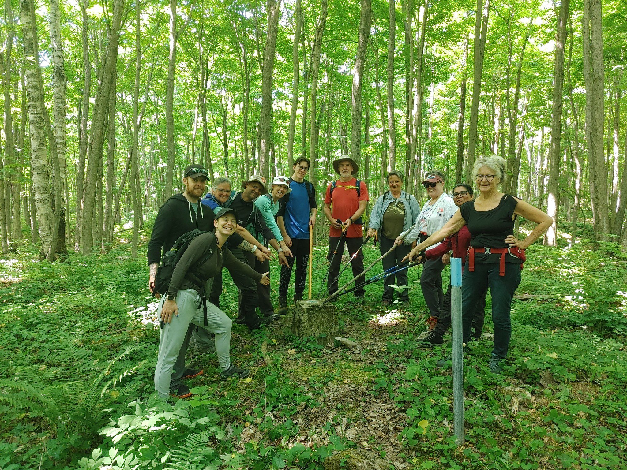
Join us for a Family Day hike starting at McCurdy Dr Parking. We’ll hike 11 km round-trip to the 45th Parallel Geodetic marker, a spot halfway between the equator and the North Pole. The terrain is moderate to difficult. depending on trail conditions. Dress appropriately for variable weather, and bring icer’s if needed—safety is paramount, and adjustments will be made for inclement weather. Expect a 4-5 hour commitment, striking a balance between outdoor exploration and quality time. After the hike, unwind at Lion’s Head Rotary Hall with hot chocolate, board games, and music. It’s more than a hike; an opportunity to connect with nature and the community, with the 45th parallel north adding a special touch to our outing. Lace up your boots, bring your sense of adventure, and make Family Day memorable on the Geodetic Side Trail!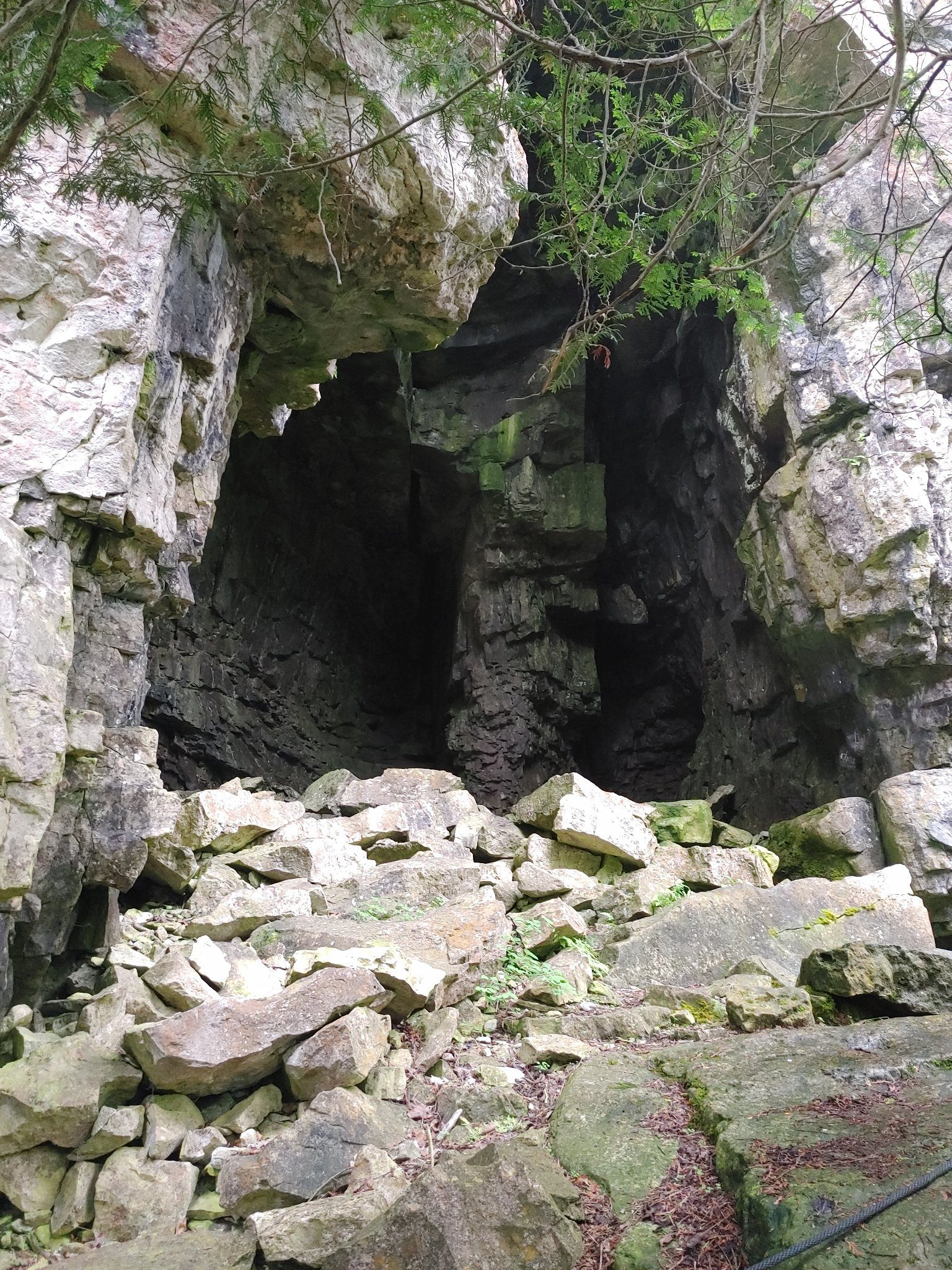
Family Friendly Fun Hike
https://hikesstaging.brucetrail.org/event/family-friendly-fun-hike/Sorry, the registration cut-off time for this hike has been reached.Not a member? Click here to join today!Hosting Club: Peninsula
Location (Google Maps): Rotary Hall, Lion’s Head
Hike Leader(s): Bill Floyd Click here to contact Hike Leader(s)
Pace: Leisurely
Terrain: Moderate
Distance: ~ 4kmDescription
Join us for a free, family day event at the Rotary Hall in Lion’s Head! Guided hikes, music, hot chocolate, board games – what a great recipe for a fun afternoon with your family and neighbours!
This Family Friendly Fun hike is designed for both adults and children hiking with their families. We will leave the Rotary Hall and take the Lion’s Head Village Side Trail to the waterfront Bruce Trail with beautiful views of Isthmus Bay. We will then enjoy the Bannister’s Hill Side Trail loop (1 km) and explore the caves on the Williams’ Cave Side Trail. We will then make our way back to the Rotary Hall.
We will keep a pace that is appropriate for children, and modify the route if required due to weather. Please come prepared in layered clothing, sturdy shoes and be ready for slick conditions on the trail (icers or crampons may be recommended if the conditions are icy).
Bear Cub Badges will be provided to children or youth who complete a Hike Journal (provided at Rotary Hall) for each side trail.
Meet at the Rotary Centre at 1 p.m. and join us after the hike for hot chocolate and board games!
Note: if you are bringing children, please also register them separately for the hike so we know how many to expect. Thank you!
- 19February 19, 2024
Peninsula out & back (km9.6-km17.9)
https://hikesstaging.brucetrail.org/event/peninsula-out-back-km9-6-km17-9/Sorry, the registration cut-off time for this hike has been reached.Not a member? Click here to join today!Hosting Club: Beaver Valley
Location (Google Maps): Meet at parking on the corner of Wright’s Cres (Purple Valley Access Trail) near km 15.6
ED 31 Map 36Hike Leader(s): Kristina Rettie Click here to contact the hike leader.
Pace: Brisk
Terrain: Moderate, Some rocky footing, Strenuous
Length of Hike: 16.6kmDescription
Please join me this Family day for a brisk out and back hike along the South Peninsula. We will park at Purple Valley Access Trail and head south to km 9.6. Here we will turn around and re-trace our steps North to the lookout at Malcolm Bluff (km 17.9) then south back to our cars.Please bring water and snacks. Icers/snowshoes will also be needed. Check and dress for the weather that day.

Family Day Hike - Grimsby
https://hikesstaging.brucetrail.org/event/family-day-hike/Sorry, the registration cut-off time for this hike has been reached.Not a member? Click here to join today!Hosting Club: Iroquoia
Category: General Hike
Location (Google Maps): Meet at the Lion’s Club Pool Parking lot in Grimsby. Please plan to be there by 9:45amHike Leader(s): Ruth Moffatt Click here to contact Hike Leader(s)
Pace: Leisurely – 3km/hr or less
Terrain: Dependent on Conditions, Easy – Mostly flat and usually good footing, Slippery and Steep Sections, Strenuous – Hilly with steep climbs and some poor footing
Distance: 5-6kmDescription
Please join me for a Family Day group hike. All ages and abilities are welcome but the climb up the mountain is a tough climb. If you would like to meet us at the top, we can meet you up top likely around 10:30 -10:45am. Please park in the designated space for Beamer Memorial Conservation AreaBut for everyone else, we will assemble in the Lions Club Pool parking lot and then make our way up the mountain. If there are icy conditions, please bring your icers just in case. Please bring enough water and snacks for the hike which will be about 5km – 6km depending on where you join the hike.
We will hike at a pace that is suitable for all. What better way to celebrate Family Day?!
Honeywood Ridge
https://hikesstaging.brucetrail.org/event/honeywood-ridge-2/Sorry, the registration cut-off time for this hike has been reached.Not a member? Click here to join today!Hosting Club: Dufferin Hi-Land
Category: General Hike
Location (Google Maps):Hike Leader(s): Tom Thayer Click here to contact Hike Leader(s)
Pace: Leisurely, Medium
Terrain: Dependent on Conditions, ModerateDescription
Join us for a Honeywood ridge Family Day Hike!Urban Walk: Toronto Islands Family Day Hike
https://hikesstaging.brucetrail.org/event/urban-walk-toronto-islands-family-day-hike/Sorry, the registration cut-off time for this hike has been reached.Not a member? Click here to join today!Hosting Club: Toronto
Category: Urban Walk
Location (Google Maps):Meet inside the waiting area of Jack Layton Ferry Terminal at the foot of Bay Street at 10:15AM to take the 10:30 AM Ferry to Ward’s Island. Ferry tickets can be purchased when you arrive or online. Ferry return fares: $10.50 adult, $6.75 student/senior
Hike Leader(s): Ray Berzins Click here to contact Hike Leader(s)
Pace: Moderate (3-4 km/hr)
Terrain: Flat, Level 1 (Easy – mostly on flat, well maintained trails with hard-packed surface)
Distance: 12 kmDescription
The Toronto Islands are very peaceful in the Winter Season. We will catch the 3:45 pm or 4:15 pm ferry to be back in the city by 4:30 pm. Bring a lunch, snacks, water, a hot beverage, and icers if available. Dress in warm layers appropriate to the weather. Heated washrooms available. Dropout anytime by walking back to the Ward’s Island Ferry Dock. We will hike to Hanlan’s Point and return to Ward’s Island (only destination served in the Winter) – approximately 6 km each way.
Family Day Hike - Kerncliff Park, Burlington
https://hikesstaging.brucetrail.org/event/family-day-hike-kerncliff-park-burlington/Sorry, the registration cut-off time for this hike has been reached.Not a member? Click here to join today!Hosting Club: Iroquoia
Category: General Hike
Location (Google Maps): Kerncliff Park (lower Parking lot)Hike Leader(s): Madeline Grady Click here to contact Hike Leader(s)
Pace: Medium – 3 to 4 km/hr
Terrain: Moderate – Some hills and/or some poor footing
Distance: about 8 kmDescription
We will be on both blue side trails and the main trail. It’s a wonderful place to enjoy nature in this urban setting. The start is hilly and then we’ll enjoy mostly flat on our way west to King Road. There are some great lookouts to see Burlington and the lake. We’ll loop back and have a hilly finish. Poles and hiking shoes/boots are recommended. Please bring water and a snack.
Silent Moon Night Hike
https://hikesstaging.brucetrail.org/event/silent-moon-night-hike-3/Sorry, the registration cut-off time for this hike has been reached.Not a member? Click here to join today!Hosting Club: Niagara
Category: Night
Location (Google Maps): Kinsman Park BeamsvilleHike Leader(s): Alan Laver Click here to contact Hike Leader(s)
Terrain: Moderate
Distance: 8 kmDescription
This is a silent hike in the woods . Take in the Magical sights and sounds of Cave Springa. Bring night light and dress for the weather . 5 night hikes to earn your badge
- 20February 20, 2024
9:00 Long Hike Wiley Road Short Hills
https://hikesstaging.brucetrail.org/event/900-long-hike-wiley-road-short-hills-26/Sorry, the registration cut-off time for this hike has been reached.Not a member? Click here to join today!Hosting Club: Niagara
Location (Google Maps):
Short Hills Wiley Road Entrance
Pace: Medium
Terrain: Moderate
: 10kmDescription
Explore Short Hills and the majestic side trails of Scarlett Tanager, Hemlock. Swayze Falls and Terrace. Register for each hike
Bring Poles water, snack, Icers and dress for the weather

9:15 Short Hike - Short Hills Park, Pelham Rd
https://hikesstaging.brucetrail.org/event/short-hike-short-hills-park-pelham-rd-2/Sorry, the registration cut-off time for this hike has been reached.Not a member? Click here to join today!Hosting Club: Niagara
Category: Loop
Location (Google Maps): Short Hills Provincial Park, Pelham Rd. St. CatharinesHike Leader(s): Debbie Demizio Click here to contact Hike Leader(s)
Pace: Medium
Terrain: Moderate
Distance: ~ 6kmsDescription
Hike the main and side trails of Short Hills Provincial Park. Bring hiking boots, icers and water. This hike qualifies for the Winter hiking badge. See website for details. https://niagarabrucetrail.club/badges/Speyside Ramble to the Bridge and back
https://hikesstaging.brucetrail.org/event/speyside-ramble-to-the-bridge-and-back/Sorry, the registration cut-off time for this hike has been reached.Not a member? Click here to join today!Hosting Club: Caledon Hills
Category: Tuesday Hikers
Location (Google Maps): Speyside Bruce Trailhead parking lot (Pear Tree Park). Exit Hwy 401 at County Rd. 25, travel north to 15 Sideroad, turn left drive ~200 metres and parking is on the left.Hike Leader(s): Jerry Bakker Click here to contact Hike Leader(s)
Pace: Brisk – 4 to 5 km/hour, Medium – 3 to 4 km/hour
Terrain: Moderate – some hills and/or some poor footing
Distance: 14 kmDescription
The hike will follow the main trail south from the parking lot until the Dufferin Quarry bridge, then turn around and hike back to our cars.It is out and back, so if the conditions are poor or we feel like we have had enough, we will turn around early.Bring snacks and lunch. Also hiking poles and icers are recommended.Walter Tovell and Lookout Side Trail and Main Trail Loop
https://hikesstaging.brucetrail.org/event/walter-tovell-side-trail-main-trail-and-lookout-side-trail/Sorry, the registration cut-off time for this hike has been reached.Not a member? Click here to join today!Hosting Club: Dufferin Hi-Land
Category: Tuesday Hike
Location (Google Maps):Dufferin Hi-Land Section, Map 19. Meet at roadside parking at corner of 2nd Line and 25 Sideroad.
Hike Leader(s): Inge Eckerich, Les Babbage, Julie Daley, Tony Evangelista Click here to contact Hike Leader(s)
Pace: Leisurely
Terrain: Moderate, Slippery and Steep Sections
Distance: 5 kmDescription
We will hike the Walter Tovell Side Trail, Main Trail and Lookout Side Trail. . Icers and/or snowshoes may be required.