
Hike Schedule
Join us for a hike! Registration required.
All hikes available to BTC members. Some hikes are open to non-members.
See Refund Policy for Paid Hikes >
TIP: The calendar view displays up to 7 hikes on a day, but often there are more. Click “View more events” to see them all.
Categories
- 29June 29, 2024

Mulmur and Boyne Valley Provincial Park
https://hikesstaging.brucetrail.org/event/mulmur-and-boyne-valley-provincial-park/Sorry, the registration cut-off time for this hike has been reached.Not a member? Click here to join today!Trip Information
Departure Time: 08:00
Return to City Time: 18:00
Departure Point: York Mills Bus PickupOptional Items
Major Mackenzie and 400 Park and Ride Parking lot ($0.01)Hosting Club: Toronto, Dufferin Hi-Land
Category: Bus Hike
Location (Google Maps): Boyne Valley Provincial Park and Mulmur (map 20)Hike Leader(s): Amir Alemohammad, Mohammad Aghamiri, Mehrnoush Ahmadi Click here to contact Hike Leader(s)
Pace: Moderate (3-4 km/hr)
Terrain: Variable
Distance: 16-18 kmDescription
Bus departs 10 York Mills Rd at 8:00 AM and Major Mackenzie Dr and HWY 400 Park and Ride at 8:30 AM. If you wish to be picked up at the Major Mackenzie Dr and HWY 400 Park and Ride, type ‘yes’ in the additional information field. Please arrive 15 minutes before departure. The bus waits for no oneThis is a fantastic hike to explore Mulmur and the Boyne Valley provincial park. Entering from 10 Sideroad (Road 17) into the main trail (km 30.5, Map 20) we will go south to enter the Boyne Valley on km 20.6. Beautiful side trails, some lookouts and creeks are along the way including Murphy’s Pinnacle Lookout point and Mulmur Lookout side trail. The Boyne valley is always a piece of gem in the Bruce trail. We will end up in the Primrose Bruce Trail parking lot. Drop outs at Km 23.9, 20.6 and First Line E Rd. Please dress according to weather conditions. Boots mandatory poles recommended. Bring at least 4 lit of water, snacks/lunch and be prepared for bugs. Access to the bus is available on the drop out locations. We will have frequent stops to have water and bio breaks and also a 30 min stop for lunch. On the way back we will have a short stop at the nearby local burger shop for refreshments, if there is enough time. We will be back to the York Mills Bus stop by 6:00 pm. We love pets but they are not allowed in this hike.
Car Hike: Hike the Main Trail from Limehouse CA to Speyside Resource Management Area
https://hikesstaging.brucetrail.org/event/car-hike-hike-the-main-trail-north-of-limehouse-ca-to-speyside-resource-management-area/Sorry, the registration cut-off time for this hike has been reached.Not a member? Click here to join today!Hosting Club: Toronto
Category: Car Hike
Location (Google Maps): Meeting Location: Roadside parking at Limehouse at the intersection of 22 Sideroad and Fifth Line. Please do not block driveway or access to the bridge. GPS N43.636859, W-79.979818. Map 12Hike Leader(s): Ross Estrella Click here to contact Hike Leader(s)
Pace: Brisk, Moderate
Terrain: Hilly, Rocky, Variable
Distance: 14 kmsDescription
We will hike the main trail from Limehouse Conservation Area to Speyside Resource Mangement Area. We’ll make this outing a (Hike4Health-Hike4Fun) which allowed us ample time for fun activities and photograhy of the sceneries that catches our eyes along the way. Please bring snacks, lunch and enough water for hydration. Make handy of sunscreen, sun head protection and bug spray as we may be greeted by our friendly mosquitoes. Comfortable/sturdy hiking shoe/boot and poles are strongly recommended. Check weather forecast and dress accordingly. Strongly suggest to bring your personal medication and health ID. Please arrive fifteen minutes early to allow for car shuttling. No drop out allowed.Car Hike: Happy Valley - CANCELLED
https://hikesstaging.brucetrail.org/event/car-hike-happy-valley-3/Sorry, the registration cut-off time for this hike has been reached.Not a member? Click here to join today!Hosting Club: Toronto
Location (Google Maps): Happy Valley, Oak Ridges Trail 16th Sideroad and Weston Road
Hike Leader(s): Mohammad Aghamiri Click here to contact Hike Leader(s)
Pace: Moderate
Terrain: Variable
Distance: 14-17 kmDescription
Come and join the group to view nice sceneries and look out of Happy valleySome safety procedures during the hike:
1-Hikers must stay between the leader and the sweep.
2-Hikers must advise the leader or the sweep if they wish to leave the group.
3- Hikers must follow the whistle instructions: 1 blast- stay where you are; 2 blasts come to the leader; 3 blasts – come to the leader quickly.
4-Hike leader may request volunteers to stop at trail intersections, they need to help hikers to the direction the group walk and wait till they see the sweep .
5-Hikers have to make sure they can see the persons behind and in front of them.
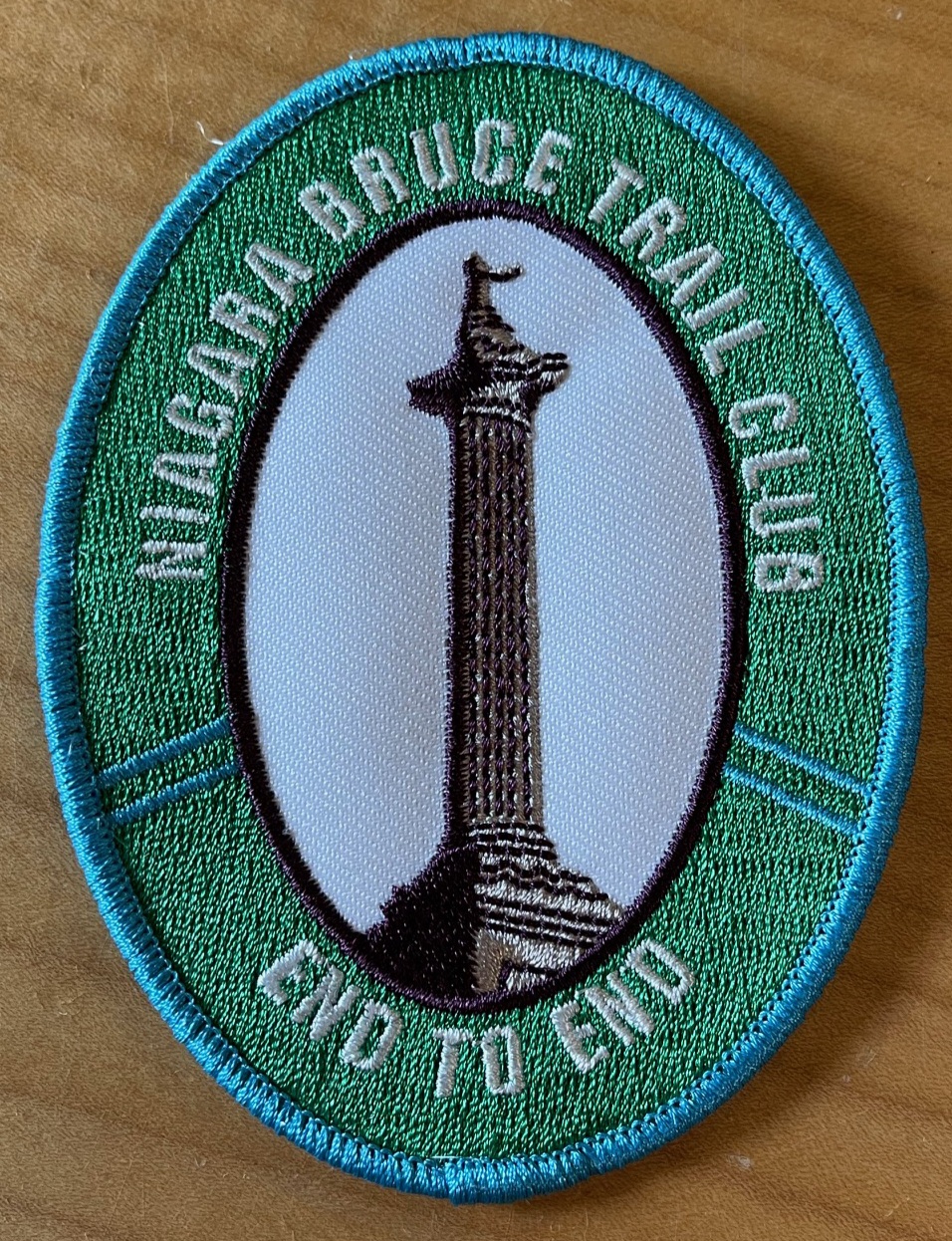
New Badge! Niagara E2E Hike #1
https://hikesstaging.brucetrail.org/event/new-badge-niagara-e2e-hike-1/Sorry, the registration cut-off time for this hike has been reached.Not a member? Click here to join today!Hike open to BTC Members only.
Hosting Club: Niagara
Category: Car Pool
Location (Google Maps): Meet at Grimsby Lions Community Pool, 1 Elm St., Grimsby N43.193201 W79.565301
Carpool to Quarry Rd km 66.7 N43.142846 W79.458913Hike Leader(s): Lauren Doig Click here to contact Hike Leader(s)
Pace: Medium
Terrain: Strenuous
Distance: 15.2Description
Hike the entire Niagara section in 5 hikes from Grimsby to Queenston to receive the NEW BADGE! Please bring snacks and plenty of water. Be prepared for the weather. Poles are recommended. Bring $10 for the new badge on the final day if you have completed all 5 hikes.Car Hike: Bethesda Trail Richmond Hill
https://hikesstaging.brucetrail.org/event/car-hike-bethesda-trail-richmond-hill-28/Sorry, the registration cut-off time for this hike has been reached.Not a member? Click here to join today!Hosting Club: Toronto
Location (Google Maps): Free parking lot at the head of trail Bethesda Side Road off Bayview Ave. across Wilcox lake
Hike Leader(s): Mohammad Aghamiri Click here to contact Hike Leader(s)
Pace: Moderate (3-4 km/hr)
Terrain: Hilly, Level 2 (Intermediate – some hills and uneven surfaces, rocks and roots underfoot)
Distance: 14-15 kmDescription
Join us to explore the trails of York Regional Forest and the Oak Ridges Corridor at Jefferson Forest and Bond lake,From parking lot we hike thought Jefferson forest and continue to Bond Lake and have snack beside the lake and return to parking around 13 to 13.30
Seven Rivers Hike Series - # 7 of 7 - Pretty River
https://hikesstaging.brucetrail.org/event/seven-rivers-hike-series-7-of-7-pretty-river/Sorry, the registration cut-off time for this hike has been reached.Not a member? Click here to join today!Hosting Club: Dufferin Hi-Land
Category: General Hike
Location (Google Maps): Meet at the Snowmobile Parking Lot, 63597 Pretty River Rd north of Duntroon.Hike Leader(s): Margery Cruise,Susan Ford Click here to contact Hike Leader(s)
Pace: Medium
Terrain: Moderate
Distance: 9.9Description
We will walk 380 meters on Pretty River road to catch the main trail, take it to the John Haigh Side Trail reaching the highest point of the Bruce trail. Then we turn around, retrace our steps and follow Pretty River Side Trail. When it joins the main trail, we will follow it back to Pretty River Road and walk east to the parking lot.Directions: From CR 124 and HW 89, north on CR 124 to Singhampton, continue east on CR 124 and then north to Sideroad 33 and 34 Nottawasaga. Turn left and look for Snowmobile Parking Lot.
This is Seven Rivers (aka Headwaters) series consists of 7 hikes: 3 North and 4 South. Hikers completing all 7 hikes in this series will be eligible to purchase a Seven Rivers Hike Series Badge from Dufferin Hi-Land BTC.
Duncan Crevice Caves - loop
https://hikesstaging.brucetrail.org/event/duncan-crevice-caves-loop/Sorry, the registration cut-off time for this hike has been reached.Not a member? Click here to join today!Hosting Club: Sydenham
Category: General Hike
Location (Google Maps): Meet in the north-east corner of the parking lot at Home Depot on Highway 26 on the east side of Owen Sound.Hike Leader(s): Ian Mills Click here to contact Hike Leader(s)
Pace: Medium: 3 to 4 km/h
Terrain: Strenuous: Hilly with steep climbs and some poor footing., There might be muddy sections., There might be sections with water on the trail.
Distance: 10+kmDescription
We will be doing a loop at Duncan Crevice Caves Provincial Nature Reserve (BTC Map # 25) via the Main Trail and Chuck & Pat Grant Side Trail. Wonderful elevations and scenery including Metcalfe Rock via Metcalfe Crevice Side Trail. Closer to the hike date we can investigate if folks would like to do lunch at (Hearts Tavern) Kimberley – please advise the Hike Leader if you are interested. Please advise the Hike Leader if you would prefer to meet at the trail head vs. Car Pool location. - 30June 30, 2024
Hockley Valley Loop
https://hikesstaging.brucetrail.org/event/hockley-valley-loop-2/Sorry, the registration cut-off time for this hike has been reached.Not a member? Click here to join today!Hosting Club: Iroquoia
Category: General Hike
Location (Google Maps):Parking in BT Parking lot on Hockley Valley Road
Hike Leader(s): Pati Greenwood, Jeff Dowsett Click here to contact Hike Leader(s)
Pace: Medium – 3 to 4 km/hr
Terrain: Strenuous – Hilly with steep climbs and some poor footing
Distance: 16 kmDescription
We will hike a loop including the main trail and BT side trails in the Hockley Valley. Bring lunch and plenty of water. Insect repellent is recommended. Wear sturdy footwear and clothing appropriate to conditions. Please arrive by 8:15 am as we will leave promptly at 8:30AM.
Certified Hike Leader (CHL) Training
https://hikesstaging.brucetrail.org/event/certified-hike-leader-chl-course/Sorry, the registration cut-off time for this hike has been reached.Not a member? Click here to join today!Hike open to BTC Members only.
Hosting Club: Peninsula
Category: CHL Training
Location (Google Maps): The Meeting Place
20 Centennial Dr, Tobermory, ON N0H 2R0Hike Leader(s): Saabir Sohrab Click here to contact Hike Leader(s)
Description
Certified Hike Leader (CHL) Training
Duration: One day, from 9 am to 5 pmTrainer: Ruth Moffatt
Location: The Meeting Place (Tobermory)
Materials Provided: Comprehensive student course manual
What to Bring: Please ensure you bring a suitable backpack equipped for leading hikes, along with your own lunch.
Refreshments: Complimentary coffee and cookies will be provided.
Upon successful completion, candidates will receive a CHL Badge and CHL ID Card.
For further details, please visit Hike Ontario’s website

Car Hike: Hike #6 to earn the Dufferin Hi-Land Youth and/or Side Trails Badge!
https://hikesstaging.brucetrail.org/event/car-hike-hike-6-to-earn-the-dufferin-hi-land-youth-and-or-side-trails-badge/Sorry, the registration cut-off time for this hike has been reached.Not a member? Click here to join today!Hosting Club: Toronto, Dufferin Hi-Land
Category: Car Hike
Location (Google Maps): We will meet at roadside parking on 1st Line E north of Highway 89 – where the Boyne Valley ST heads on the road (Map 20 of the Bruce Trail Reference Guide, Edition 31).Hike Leader(s): Monica Pasquali Click here to contact Hike Leader(s)
Pace: Leisurely
Terrain: Variable
Distance: 6.4 kmDescription
Calling all families with children who love hiking and earning badges!!!This is the sixth in a series of ten hikes that will be offered throughout 2024 on a roughly monthly basis so that children who are 15 years of age and younger can earn the Dufferin Hi-Land Adventurer Youth Badge and their parents/guardians can earn the Dufferin Hi-Land Side Trails Badge at the same time!!! Details regarding the requirements for each badge can be found here: https://dufferinbrucetrailclub.org/dufferin-bruce-trail-club-badges/ Each of the ten hikes will be a loop hike so no car shuttles will be needed, and each hike will cover a distance of approximately 6-9 km hiked at a leisurely pace (2-3 km/h) so children and adults alike can participate.
This sixth hike will be an early summer hike to explore some side trails within Boyne Valley Provincial Park, specifically the Boyne Valley Side Trail and Murphy’s Pinnacle Side Trail. Please dress appropriately for an early summer hike by dressing in lightweight and breathable clothing, wearing a sunhat, and wearing comfortable footwear that has good traction. It is also advised that you bring sunscreen, bug spray, a light sweater, and suitable rain apparel in case conditions require their use. As well, make sure you bring enough water and food for a 2-3 hour hike since we’ll be covering a total distance of approximately 6.4 km.
Hopefully you’ll be able to join me on Sunday, June 30th! Until then, happy hiking, everyone!
Urban Walk: Central Don Parks
https://hikesstaging.brucetrail.org/event/urban-walk-central-don-parks-2/Sorry, the registration cut-off time for this hike has been reached.Not a member? Click here to join today!Hosting Club: Toronto
Category: Urban Walk
Location (Google Maps):Meet front entrance Civic Garden Centre Pavilion, Toronto Botanical Gardens – Leslie Street & Lawrence Avenue.
Take Bus #54 Lawrence or #51 Leslie from Eglinton Station on Line 1Hike Leader(s): Tom Swales Click here to contact Hike Leader(s)
Pace: Moderate
Terrain: Variable
Distance: 10-12 kmDescription
We’ll hike a couple of loops through Wilket Creek, Sunnybrook, ET Seton, and Serena Gundy Parks. Those who wish may join us for lunch or coffee at Corks Beer & Wine Bar in Longo’s in Leaside. - 01July 1, 2024
The Forest & Stones Speak - Forest Bathing & Historical Hike
https://hikesstaging.brucetrail.org/event/the-forest-stones-speak-forest-bathing-historical-hike/Sorry, the registration cut-off time for this hike has been reached.Not a member? Click here to join today!Hosting Club: Caledon Hills
Category: Nature Walks
Location (Google Maps): Depart from Riverside Woods parking lot, Map 18, (BTC Ref Guide) off the 1st Line EHS. From Highway 10, take Hockley Valley Rd. East. Turn right onto the 5 Sideroad and then left or north on 1st Line EHS to the parking lot.Hike Leader(s): Janice McClelland and Dan Revington Click here to contact Hike Leader(s)
Pace: Leisurely – 3 km/hour or less
Terrain: Moderate – some hills and/or some poor footing
Distance: 6.5 kmDescription
We begin our walk on the Goodyear Memorial Side Trail, absorbing nature as we walk quietly under the forest cover. Then follow the Rushing River Side Trail down and back from the Nottawasaga River. The Goodyear Memorial Side Trail continues to lead us on through forest to the 2nd Line where we follow the main Bruce Trail to the Vineyard View Side Trail breathing in the view. Our return journey includes the vistas of the Upland Side Trail. On this Canada Day, we will share information and stories of the stone house built in 1857 – standing today, 167 years later – a house that received its historical designation in 2024!Please bring water and carry a lunch. (Options may include a “picnic” lunch towards the end of the walk.)
Canada Day Dundas Valley Loop
https://hikesstaging.brucetrail.org/event/canada-day-dundas-valley-loop/Sorry, the registration cut-off time for this hike has been reached.Not a member? Click here to join today!Hosting Club: Dufferin Hi-Land
Category: General Hike
Location (Google Maps): Iroquoia Section, Map 8. Dundas Valley Conservation Area Parking Lot P3. Take DVCA Trail Centre Entrance off Governors Road, near km 51.8.Hike Leader(s): Stuart Law Click here to contact Hike Leader(s)
Pace: Medium
Terrain: Moderate
Distance: 17.5 kmsDescription
Oh Canada! Join us on a lovely loop hike in the Dundas Valley. We take in part of the Bruce Trail and several DVCA trails. Waterfalls like Sherman, Canterbury, and Cascade. Please bring bug spray, 3L water, snack for “elevensies”, lunch, hiking boots, poles and lots of smiles. Entrance fee to DVCA in effect at gate. Consider buying a Hamilton Conservation Area annual pass. It’s well worth it. Please arrive at 9:15 to be ready to hike at 9:30.Car Hike: Forks Of The Credit, Map 15, Ed 31
https://hikesstaging.brucetrail.org/event/car-hike-forks-of-the-credit-map-15-ed-31/Sorry, the registration cut-off time for this hike has been reached.Not a member? Click here to join today!Hosting Club: Toronto
Category: Car Hike
Location (Google Maps): Forks of the Credit Provincial Park, Map 15, Ed 31Hike Leader(s): Al Brown Click here to contact Hike Leader(s)
Pace: Moderate (3-4 km/hr)
Terrain: Hilly
Distance: 10 KmDescription
Starting at Mississauga Road we will follow the Elora Cataract Trailway into the Forks of the Credit Park and complete a loop hike through the park, returning along the Trailway to the meeting point. There will be an opportunity to see the falls. After the hike those inclined are invited to join me for coffee or tea at the Higher Ground coffee shop in Belfountain.To get to the meeting point go north on Mississauga Road through Belfountain. Continue about 2 km to where the Elora Cataract Trailway crosses Mississauga Road. There is parking on both sides of the road. Beware of no parking areas.
- 02July 2, 2024
8:00 Long Hike Wiley Road Short Hills
https://hikesstaging.brucetrail.org/event/800-long-hike-wiley-road-short-hills-43/Sorry, the registration cut-off time for this hike has been reached.Not a member? Click here to join today!Hosting Club: Niagara
Category: Loop
Location (Google Maps):Short Hills Wiley Road Entrance
Hike Leader(s): Alan Laver Click here to contact Hike Leader(s)
Pace: Medium
Terrain: Moderate
Distance: 10kmDescription
Explore Short Hills and the majestic side trails of Scarlett Tanager, Hemlock. Swayze Falls and Terrace. Register for each hikeBring Poles, Sunscreen, bug spray water, snack, and dress for the weather
9:15 Short hike - Pelham Road, Short Hills
https://hikesstaging.brucetrail.org/event/915-short-hike-pelham-road-short-hills-77/Sorry, the registration cut-off time for this hike has been reached.Not a member? Click here to join today!Hosting Club: Niagara
Category: Loop
Location (Google Maps): Pelham Road entrance, Short Hills Provincial ParkHike Leader(s): janet davey Click here to contact Hike Leader(s)
Pace: Medium
Terrain: Moderate
Distance: 6 kmsDescription
Hike the main and side trails in Shorthills Provincial Park. Bring hiking boots, water, sunscreen and bug spray. Please help prevent the spread of invasive species by cleaning your boots following the hike. Please check yourself for ticks following the hike.7 Rivers Hike Series - #6 of 7 - Mad River
https://hikesstaging.brucetrail.org/event/7-rivers-hike-series-6-of-7-mad-river/Sorry, the registration cut-off time for this hike has been reached.Not a member? Click here to join today!Hosting Club: Dufferin Hi-Land
Category: General Hike
Location (Google Maps): Devil’s Glen Provincial Park – lot on CR 124Hike Leader(s): Margery Cruise,Susan Ford Click here to contact Hike Leader(s)
Pace: Medium
Terrain: Moderate
Distance: 8.6 kmDescription
We will follow the main trail, walk east along Ganaraska Trail, North on Concession Road 8 in Glen Huron. Just past Station Street, we turn west to follow the Mad River Side Trail, then join the main trail and return north to the parking lot.Directions: From CR 124 and HW 89, north on CR 124 to Singhampton, continue east on CR124 to Devil’s Glen Provincial Parking entrance on the right.
This is Seven Rivers (aka Headwaters) series consists of 7 hikes: 3 North and 4 South. Hikers completing all 7 hikes in this series will be eligible to purchase a Seven Rivers Hike Series Badge from Dufferin Hi-Land BTC.