
Hike Schedule
Join us for a hike! Registration required.
All hikes available to BTC members. Some hikes are open to non-members.
See Refund Policy for Paid Hikes >
TIP: The calendar view displays up to 7 hikes on a day, but often there are more. Click “View more events” to see them all.
Categories
- 03July 3, 2024
Monument Hill, Ganaraska
https://hikesstaging.brucetrail.org/event/monument-hill-ganaraska-4/Sorry, the registration cut-off time for this hike has been reached.Not a member? Click here to join today!Hosting Club: Blue Mountains
Category: Register in person the morning of hike.
Location (Google Maps): Tim Hornton’s 281 First Street #4. Collingwood, ON L9Y 1B2Hike Leader(s): David Little Click here to contact Hike Leader(s)
Pace: Medium – 3 to 4 km/hr
Terrain: Moderate – Some hills and/or some poor footing
Distance: 9 kmDescription
This is a loop trail located near Wasaga Beach. Lots of hills and options to take. This will be an exploration of some new trails to hike! Be prepared to explore the variety within this hike. Bring a snack or lunch and water.WEDNESDAY WALKERS - Old Baldy
https://hikesstaging.brucetrail.org/event/wednesday-walkers-old-baldy-2/Sorry, the registration cut-off time for this hike has been reached.Not a member? Click here to join today!Hosting Club: Beaver Valley
Location (Google Maps): Our hike will begin from the parking lot of Old Baldy. km 43.9, Map 25, Edition 31. Any hike participants who do not have a parking pass for Grey Sauble CA can park on the shoulder of Sideroad 7B by the bend in the road and then be shuttled to the parking lot.
Hike Leader(s): Margaret Yaraskavitch Click here to contact the hike leader.
Pace: Medium
Terrain: Moderate, Some rocky footing, Some steep sections
Length of Hike: 5 kmDescription
Our hike takes us atop Old Baldy, the iconic outcrop. The Trail is well-used, the pathway often being “roots and rocks”. There will be a number of lookout spots to view into and across the Beaver Valley. We will hike along the main Trail and then turn back when we reach the road allowance part of the Trail. On the way back we will walk on the Mac Kirk Side Trail, under a canopy of deciduous trees.COVID-19 Precautions Before, During and After your Hike
- Each hiker joining a Bruce Trail Club organized hike must perform a self-screening check before hiking.
Find Ontario’s self-assessment tool here: https://covid-19.ontario.ca/self-assessment/ - If you are experiencing COVID-19 symptoms, stay home.
Other Guidelines
- Arrive 15 minutes before the start of the hike.
- Wear sturdy footwear and appropriate attire for the weather and the terrain.
Hiking poles are a good idea in any season, especially if the terrain is rocky or slippery. In winter, snowshoes or icers/crampons are needed when conditions dictate.
Wearing appropriate clothing and footwear prevents injuries and shows consideration for a safe and positive group hiking experience. - Always carry I.D. and your health card.
- Bring sufficient water and snacks (or lunch if indicated). A minimum of 1L of water is recommended on all hikes, and 3L is recommended for long, challenging hikes in the heat of the summer.
- Bring sunscreen and insect repellent (for spring and summer hikes).
- Bring your own first aid kit.
- Please leave dogs at home.
Evening Hike in Owen Sound followed by an Opportunity for Refreshments
https://hikesstaging.brucetrail.org/event/evening-hike-in-owen-sound-followed-by-an-opportunity-for-refreshments-7/Sorry, the registration cut-off time for this hike has been reached.Not a member? Click here to join today!Hosting Club: Sydenham
Category: An evening walk.
Location (Google Maps): First Avenue East Parking Lot between 8th St East and 7th St East. Owen SoundHike Leader(s): Harriet Nixon Click here to contact Hike Leader(s)
Pace: Brisk: 4 to 5 km/h
Terrain: Moderate: Some hills and/or poor footing
Distance: Approx 5 kmDescription
Join us for an evening hike exploring Owen Sound trails and neighbourhoods, followed by an opportunity for refreshments. No need to show up 15 minutes early for this hike, but please be prepared to start promptly at 7:00 pm. - Each hiker joining a Bruce Trail Club organized hike must perform a self-screening check before hiking.
- 04July 4, 2024
8:00 am Long Hike Jordan to Moyer / Louth
https://hikesstaging.brucetrail.org/event/800-am-long-hike-jordan-to-moyer-louth-66/Sorry, the registration cut-off time for this hike has been reached.Not a member? Click here to join today!Hosting Club: Niagara
Category: In and Out
Location (Google Maps):Jordan Hollow Park 3039 King St Jordan
Hike Leader(s): Alan Laver Click here to contact Hike Leader(s)
Pace: Medium
Terrain: Moderate
Distance: 10kDescription
From Jordan Hollow Hike the main trail to Upper and Lower Balls Falls, Moyer Road or Louth and Return. You must register for each hike. Bring Poles, sunscreen, bug spray , snack and a drink and dress for the weatherHiking in and around Jordan
https://hikesstaging.brucetrail.org/event/hiking-in-and-around-jordan/Sorry, the registration cut-off time for this hike has been reached.Not a member? Click here to join today!Hosting Club: Niagara
Location (Google Maps): Sho’arishon Park, formerly Jordan Hollow Park, Jordan
Hike Leader(s): Bill Russell Click here to contact Hike Leader(s)
Pace: Medium
Terrain: Strenuous
Distance: 7 kmDescription
Hike the main road and side trails around Jordan. Wear hiking boots and bring water, sunscreen and bug spray.Caledon Hills End-to-End Hike 1 of 6
https://hikesstaging.brucetrail.org/event/caledon-hills-end-to-end-hike-1-of-6/Sorry, the registration cut-off time for this hike has been reached.Not a member? Click here to join today!Hosting Club: Caledon Hills
Category: End-to-End
Location (Google Maps): Meet at 9:15 am at the Hockley Road parking area, km 61.1. Shuttle to start at Mono Centre.Hike Leader(s): Nancy Mooney Click here to contact Hike Leader(s)
Pace: Medium – 3 to 4 km/hour
Terrain: Moderate – some hills and/or some poor footing, Strenuous – hilly with steep climbs and some poor footing
Distance: 72.4 – 61.1 + 0.750 and 0.250 side trails and road = 12.3 km totalDescription
This is the first hike in the series going from the north to the south of the Caledon Hills section. The trail will take us through the Whitetail Refuge Nature Reserve, up and down hills, over bridges, and through the Hockley Valley Provincial Nature Reserve. - 05July 5, 2024

9:00 am Niagara on the Lake Tour & Some Yoga
https://hikesstaging.brucetrail.org/event/900-am-niagara-on-the-lake-tour-some-yoga-18/Sorry, the registration cut-off time for this hike has been reached.Not a member? Click here to join today!Hosting Club: Niagara
Category: Urban
Location (Google Maps): Veteran’s Memorial Park, park just outside the park on King St.Hike Leader(s): Robin Garrett Click here to contact Hike Leader(s)
Pace: Medium
Terrain: Easy
Distance: 6 kmDescription
Enjoy the benefits of pausing for a yoga practice as we tour through the trails, parkland and Historic Niagara-on-the-Lake. No mat required. Movement will focus on a flow of standing poses designed especially for hikers. Plan to stay for conversation and a warm cup of coffee or tea at Sweets & Swirls, Community Centre, Niagara Stone Road, NOTL. - 06July 6, 2024
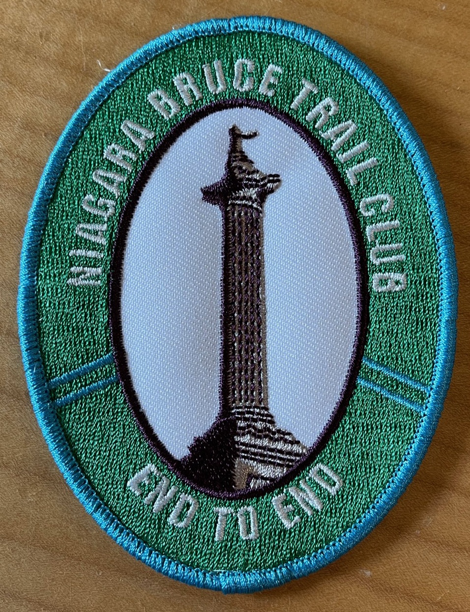
New Badge! Niagara E2E Hike #2
https://hikesstaging.brucetrail.org/event/new-badge-niagara-e2e-hike-2/Sorry, the registration cut-off time for this hike has been reached.Not a member? Click here to join today!Hike open to BTC Members only.
Hosting Club: Niagara
Category: Car Pool
Location (Google Maps): Meet at Louth Conservation Area (Map 4) East of km 51.4. Enter from Staff Ave N43. 121706 W79.351235
Carpool back to Quarry Rd.Hike Leader(s): Lauren Doig Click here to contact Hike Leader(s)
Pace: Medium
Terrain: Strenuous
Distance: 15.3Description
Bring snacks and plenty of water. Poles are recommended. Be prepared for the weather.RIM 2 RIM Badge Hike #1 Pretty River Rim (First in a series of 3 for the Rim2Rim badge)
https://hikesstaging.brucetrail.org/event/rim-2-rim-badge-hike-1-pretty-river-rim-first-in-a-series-of-3-for-the-rim2rim-badge/Sorry, the registration cut-off time for this hike has been reached.Not a member? Click here to join today!This is a Multi-Day Hike
You are signing up for the following dates and times:
2024-07-06 at 08:00
2024-07-27 at 08:00
2024-08-10 at 08:00Hosting Club: Blue Mountains
Category: Register online ONLY
Location (Google Maps): Hike meets in the parking lot behind Tim Hortons on First St. in Collingwood.Hike Leader(s): Hart Fischer Click here to contact Hike Leader(s)
Pace: Medium – 3 to 4 km/hr
Terrain: Moderate – Some hills and/or some poor footing
Distance: 18.5Description
Meet at Trailhead. About 18.5 km with almost 810 m elevation gain. Park your car in the small Bruce Trail Parking Lot [BTPL] on the Pretty River Road [44.428118, -80.276849]. If this small BTPL is filled, use the large Ontario Parks Lower Pretty River lot [44.430983, -80.275474]. Do not park along Pretty River Road as it is a strictly enforced no parking zone by the Town of Blue Mtns. The hike starts in the small BTPL. Proceed north on the white blazed trail until you come to the blue blazed side trail – John Haigh Side Trail. Proceed west past the highest point on the Bruce Trail. Continue until you reach the intersection of the 2nd line and 6th Sideroad. Retrace your steps to the BTPL. Have a break. Proceed east along the white blazed trail until you reach the Blue Mtns Clearview Townline. Head south and continue south past Osprey-The Blue Mountains Townline. Follow the white blazed trail until you reach the blue side trail – Standing Rock & Caves Side Trail. Turn west and take the blue blazed side trail through the Singhampton Caves until it rejoins the white blazed trail again. Turn east (left) and follow the white blazed trail which turns west and then north retracing your steps back to the parking lot. Bring lots of snacks, lunch and water. [gotohttps://www.alltrails.com/explore/map/map-march-8-2023-f875227 for a detailed map of the hike] Check the other schedules dates for associated hike description.Car Hike: Cherry Beach Down town
https://hikesstaging.brucetrail.org/event/car-hike-cherry-beach-down-town-2/Sorry, the registration cut-off time for this hike has been reached.Not a member? Click here to join today!Hosting Club: Toronto
Location (Google Maps): Cherry Beach Parking Lot, at the foot of Cherry Street (Free Parking)
Hike Leader(s): Mohammad Aghamiri Click here to contact Hike Leader(s)
Pace: Moderate
Terrain: Flat
Distance: 14-17 kmDescription
We will hike along the waterfront trail, watch birds signing and more1-Hikers must stay between the leader and the sweep.
2-Hikers must advise the leader or the sweep if they wish to leave the group.
3- Hikers must follow the whistle instructions: 1 blast- stay where you are; 2 blasts come to the leader; 3 blasts – come to the leader quickly.
4-Hike leader may request volunteers to stop at trail intersections, they need to help hikers to the direction the group walk and wait till they see the sweep .
5-Hikers have to make sure they can see the persons behind and in front of them.
Mono Cliffs Provincial Park
https://hikesstaging.brucetrail.org/event/mono-cliffs-provincial-park-8/Sorry, the registration cut-off time for this hike has been reached.Not a member? Click here to join today!Hosting Club: Iroquoia
Category: General Hike
Location (Google Maps):Mono Community Centre Parking Lot
Hike Leader(s): Pati Greenwood, Jeff Dowsett Click here to contact Hike Leader(s)
Pace: Medium – 3 to 4 km/hr
Terrain: Moderate – Some hills and/or some poor footing
Distance: 12 KmDescription
We will hike through the Mono Cliffs Provincial Park on the main Bruce Trail and several side trails. Bring water and snacks. Wear clothing and footwear appropriate to conditions. Insect repellent is recommended.Park in the gravel lot at the Mono Community Centre, Mono Centre Road (County Road 8). Please arrive by 8:15 am as we will leave promptly at 8:30 am.
Car Hike: Scotsdale Farm thru Siver Creek Conservation Area to Terra Cotta Conservation Area.
https://hikesstaging.brucetrail.org/event/car-hike-scotsdale-farm-thru-siver-creek-conservation-area-to-terra-cotta-conservation-area/Sorry, the registration cut-off time for this hike has been reached.Not a member? Click here to join today!Hosting Club: Toronto
Category: Cancelled
Location (Google Maps): Meet at Terra Cotta’s off road parking located on a very short dirt road off Winston Churchill Blvd just south of the Main Trail. GPS N43.726474, W-79.958225. Map 14Hike Leader(s): Ross Estrella Click here to contact Hike Leader(s)
Pace: Brisk, Moderate
Terrain: Hilly, Rocky
Distance: 14 kmsDescription
On a moderate to brisk pace from Scotsdale Farm thru Silver Creek Conservation Area endingat Terra Cotta Conservation Area, we’ll make this strech a (Hike4Health-Hike4Fun). Aside from conditioning our physical and mental capacities we’ll have short fun activities and ample time for picture taking of the amazing sigths that the bruce trail offer. But, don’t be too complacent, you still have prepare for the trail surprises and challenges. Forget not your snacks and lunch, enough water for hydration. Please bring sunscreen, sun head protection and bug spray in the event we’re greeted by friendly mosquitoes. Comfortable and durable hiking shoe/boot and poles are highly recommended. Please have your personal medication and health card at your backpack. Please dress appropriately to weather forecast. Please arrive at 8:15 am (fifteen minutes) early to allow for car shuttling. Allowed no dropout.Bus Hike: Caledon E2E Hike #3 of 5
https://hikesstaging.brucetrail.org/event/bus-hike-caledon-e2e-hike-3-of-5/Sorry, the registration cut-off time for this hike has been reached.Not a member? Click here to join today!Trip Information
Departure Time: 08:30
Return to City Time: 17:00
Departure Point: Kipling Departure PointOptional Items
Hosting Club: Toronto, Caledon Hills
Category: Bus Hike
Location (Google Maps): Innis Lake Road, Caledon East, ONHike Leader(s): Sajedeh Zahraei, Celia Ho Click here to contact Hike Leader(s)
Pace: Moderate
Terrain: Variable
Distance: 13.9 KmDescription
Maps 17-18, km 31.6 – km 44.3 (12.7 km)
Starting Point: Roadside Parking – km 31.6 (on Innis Lake Rd, north of Finnerty Sideroad) (43.918917°N 79.909387°W)
Drop-out Point: 7th Line Parking Area – km 42.2 (located off the 7th Line immediately east of Airport Rd.) (43.960477°N 79.979773°W)
End Point: Parking Area – Mono 5 Sideroad – km 44.3 (on the north side of the road where the Trail crosses) (43.974055°N 79.984988°W)Margaret Paull Side Trail
https://hikesstaging.brucetrail.org/event/two-hike-day-hike-1-margaret-paull-side-trail/Sorry, the registration cut-off time for this hike has been reached.Not a member? Click here to join today!Hosting Club: Blue Mountains
Category: Register in person the morning of hike.
Location (Google Maps): Hike meets in the parking lot behind Tim Hortons on First St. in Collingwood.Hike Leader(s): Bob Moenck Click here to contact Hike Leader(s)
Pace: Leisurely – 3 km/hr. or less
Terrain: Easy – Mostly flat and usually good footing, Strenuous – Hilly with steep climbs and some poor footing
Distance: 5 kmDescription
We will drive via Grey Rd.119 to the end of the 6th Line in the Beaver Valley section. We will hike along the white blazed trail to km 11.3 where it joins up with the Margaret Paull Side Trail. We will follow the side trail back to the white blazed trail, then 6 Distance: 5km return to the cars. Bring water and a snack.
Sydenham Stained Glass Fundraiser Badge Wknd E2E in 8
https://hikesstaging.brucetrail.org/event/sydenham-stained-glass-fundraiser-badge-wknd-e2e-in-8/Sorry, the registration cut-off time for this hike has been reached.Not a member? Click here to join today!This is a Multi-Day Hike
You are signing up for the following dates:
2024-07-06, 2024-07-07, 2024-07-20, 2024-07-21, 2024-08-24, 2024-08-25, 2024-09-28, 2024-09-29Hosting Club: Iroquoia, Sydenham
Category: General Hike
Location (Google Maps): Various – schedule will be emailed to registered hikersHike Leader(s): Freddy Wang Click here to contact Hike Leader(s)
Pace: Brisk – 4 to 5 km/hr
Terrain: Moderate – Some hills and/or some poor footing, Strenuous – Hilly with steep climbs and some poor footing
Distance: 18 to 23 km per dayDescription
Hike weekends: July 6-7, July 20-21, August 24-25, September 28-29Saturday start time: 9:30 AM (9:15 meet)
Sunday start time: 7:30 AM (7:15 meet)
This is a special series of 8 hikes to complete the entire Sydenham section of the Bruce Trail over four weekends. There will be a late start on Saturday and early start on Sunday to accommodate those travelling to the area.
There is an accomplishment badge, included in the registration fee – which was designed by Joe Borges and features the Hart’s-Tongue fern. It is easily identified by its wide, deep green leathery fronds and thought to resemble a deer’s tongue.
For this E2E in 8, we will be following the main trail southbound from Wiarton to Blantyre. Please note that you are signing up for the entire series of eight hikes as a Group Hike. The Sydenham in 8 series is geared to experienced long distance hikers with the expectation of a 3.5 to 4.5 km/hr pace maintained over an 18 to 23 km day. No dropout points have been established and therefore hikers who must drop out, will be responsible for their own transportation. Please be honest about your hiking abilities.
Hikers will be expected to wear proper hiking footwear with the expectation of hot and possibly wet weather, with trail conditions varying from dry to muddy. Please being bug spray/repellant and sunscreen if you use it. Sufficient food and min 2K of water for a full day of hiking is also required. Hiking poles and wet weather gear (if necessary) are recommended. A 10-15 minute on-trail lunch break will be scheduled.
The fee goes towards supporting the Sydenham Bruce Trail Club, which in turn supports the mission of the Bruce Trail Conservancy, which is: “Preserving a ribbon of wilderness, for everyone, forever.”
A maximum of 2 (of the 8) hikes can be self-completed as a result of scheduling challenges, but it is intended that this badge be earned while hiking as part of a group led by a certified hike leader. Car shuttles are shared amongst the hikers.
Please note there are no refunds!
The specifics for each day’s hike will be shared after registration or upon request.
TRANSPORTATION
This series will be through hikes and will require car shuttling, you must be willing to drive or to be a passenger.

9:30 Summer 2024 Black History Series: Chloe Cooley Commemorative Hike #1 of 4
https://hikesstaging.brucetrail.org/event/930-chloe-cooley-commemorative-hike-3/Sorry, the registration cut-off time for this hike has been reached.Not a member? Click here to join today!Hosting Club: Niagara
Category: In and Out
Location (Google Maps):Hike Leader(s): Karen Couch Click here to contact Hike Leader(s)
Pace: Medium
Terrain: Moderate
Distance: 7-8 kmsDescription
This hike will take participants to the place where Chloe Cooley’s brave act of resistance, changed the course of history in NOTL and Canada. 9 JUL 1793 saw the passing of an Act that set the stage for the great freedom movement of enslaved African Americans known as the Underground Railroad. This hike will take us along the General Brock Side Trail (GBST) and on then on the Niagara Parkway (NP). The GBST’s terrain is hilly/moderate, whereas the NP is flat/easy. On the return we will go through the Village Of Queenston and take the new sets of stairs up the escarpment, which some consider steep.For more information about Chloe Cooley click on the link below.
https://www.canadapost-postescanada.ca/blogs/personal/perspectives/chloe-cooley-black-history-month/
PLEASE NOTE: Hikes are offered by volunteers who have committed to their own learning to be able to offer informative and contemplative hike experiences. These hikes are open to all and offered in a spirit of mutual leaning and inclusion.
This hike counts as 1 of 3 required hikes in the Summer 2024 series for the Black History badge. Look to the August schedule for more hikes in this series.
A parking fee applies or use your Niagara Falls Parking Pass. See below for information on how to order (allow at least 2 weeks for delivery by mail).
https://www.niagaraparks.com/visit-niagara-parks/plan-your-visit/parking-pass/
Urban Walk: Coote's Paradise/Hamilton Waterfront Trail
https://hikesstaging.brucetrail.org/event/urban-walk-cootes-paradise-hamilton-waterfront-trail-4/Sorry, the registration cut-off time for this hike has been reached.Not a member? Click here to join today!Hosting Club: Toronto
Category: Urban Walk
Location (Google Maps):Hike will start from McMaster University GO Bus Terminal. We will meet at Toronto’s Union Station 8:30 AM to take the 8:45 AM Train to Aldershot where we will transfer to the GO Bus for a short ride to McMaster University. On the return we take the GO Train to Toronto from West Harbour GO Train Station. If you have a smart phone then the return fare is just $10 with GO’s Weekend Pass. Seniors fare return from Union is $11.44. Hikers without a smartphone may purchase pass from Hike Leader at Union Station. If meeting us at McMaster you will have to make your way back to start by local transit or Uber and parking fee would apply.
Hike Leader(s): Tom Swales Click here to contact Hike Leader(s)
Pace: Moderate
Distance: 12-13 km
Description
This will be a one way hike through the trails of the RBG’s (Royal Botanical Gardens) South Shore Cootes Paradise Trails to Princess Point and then continuing on Hamilton’s Waterfront Trail along Burlington Bay to Bayfront Park which is a 7 minute walk to the West Harbour GO Station. Cootes Paradise is the largest and most diverse of RBG’s sanctuaries. Nestled between the Niagara Escarpment and Lake Ontario the picturesque area is significant as a migratory bird flyover zone and home to a wide variety of flora and fauna. There will be a few hills including one steeper one.