
Hike Schedule
Join us for a hike! Registration required.
All hikes available to BTC members. Some hikes are open to non-members.
See Refund Policy for Paid Hikes >
TIP: The calendar view displays up to 7 hikes on a day, but often there are more. Click “View more events” to see them all.
Categories
- 29June 29, 2023
8:00 am Long Hike Jordan to Moyer / Louth NEW TIME
https://hikesstaging.brucetrail.org/event/800-am-long-hike-jordan-to-moyer-louth-new-time-9/Sorry, the registration cut-off time for this hike has been reached.Not a member? Click here to join today!Hosting Club: Niagara
Location (Google Maps):
Jordan Hollow Park 3039 King St Jordan
Pace: Medium
Terrain: Moderate
: 10kDescription
From Jordan Hollow Hike the main trail to Upper and Lower Balls Falls, Moyer Road or Louth and Return. You must register for each hike. Bring Poles, sunscreen, bug spray , snack and a drink ices and dress for the weather
9:15 Short Hike - Jordan Hollow
https://hikesstaging.brucetrail.org/event/915-short-hike-jordan-hollow-63/Sorry, the registration cut-off time for this hike has been reached.Not a member? Click here to join today!Hosting Club: Niagara
Location (Google Maps): Jordan Hollow Park, Jordan Station
Hike Leader(s): Bill Russell Click here to contact Hike Leader(s)
Pace: Medium
Terrain: Strenuous
Distance: 6 kmsDescription
Hike the main and side trails around Jordan and Balls Falls. Bring hiking boots, water, sunscreen and bug spray.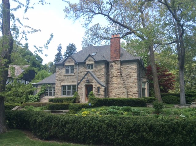
Urban Walk: Kingsway / Humber River
https://hikesstaging.brucetrail.org/event/urban-walk-kingsway-humber-river/Sorry, the registration cut-off time for this hike has been reached.Not a member? Click here to join today!Hosting Club: Toronto
Category: Urban Walk
Location (Google Maps): Meet at the Grenview Blvd. entrance of the Royal York subway station.Hike Leader(s): Roger Harris, Marie- Josée Roy Click here to contact Hike Leader(s)
Pace: Moderate
Terrain: Flat
Distance: 11 kmDescription
We will walk through the historic Kingsway and South Kingsway neighbourhoods, passing through Home Smith Park, King’s Mill Park, and South Humber Park.Except at The Queensway and Riverside Drive, most of the route is shaded. Public washrooms are available at kms 2.5, 6 and 7.5.
We’ll finish at Jane subway station. Drop-outs are available at Old Mill subway station (km 4) and Stephen Dr./Cloverhill Rd. bus stop (km 7).
Please pack one litre of water, a lunch or snacks, a hat and sun screen.
Public washrooms are available at kms 2.5, 6 and 7.5.

Gentle Hike for Gentle Folks
https://hikesstaging.brucetrail.org/event/gentle-hike-for-gentle-folks/Sorry, the registration cut-off time for this hike has been reached.Not a member? Click here to join today!Hosting Club: Iroquoia
Category: General Hike
Location (Google Maps): Oakville, 2524 Valleyridge Dr., OakvilleHike Leader(s): Anne Armstrong Click here to contact Hike Leader(s)
Pace: Leisurely – 3km/hr or less
Terrain: Easy – Mostly flat and usually good footing
Distance: 7 – 8 km,Description
Join me for a leisurely walk in a semi urban environment. Please meet at 9:45 am. for a 10:00 am. start in the parking lot in the children’s playground on Valleyridge Dr., just below Highway 5 in Oakville. We will follow town trails leading into fields and then into Bronte Creek Provincial Park. Bring a snack, water, sunscreen and insect repellent. We many see some of the early summer flowers.
Leader: Anne Armstrong 905 617 3937 hikingrandma@gmail.com
Toronto, Toronto Islands
https://hikesstaging.brucetrail.org/event/toronto-toronto-islands-14/Sorry, the registration cut-off time for this hike has been reached.Not a member? Click here to join today!Hosting Club: Toronto
Location (Google Maps): Meet inside the Jack Layton Ferry Terminal, foot of Bay Street, beyond the cashiers selling the ferry tickets, in the open area with the benches and Muskoka chairs. From Union Station take the LRT one stop to “Ferry Docks” or take bus number #19 or #72 on Bay Street southbound to the Queens Quay. Walk across Queen Quay south through the park to the ferry terminal.
Hike Leader(s): Miriam Stevens, Tom Swales Click here to contact Hike Leader(s)
Pace: Leisurely
Terrain: Flat
Distance: 8-12 kmDescription
After a day’s work, come and “cool off” on the Toronto Islands free of fumes and traffic to enjoy the view of the city skyline and Toronto’s own beautiful island parkland oasis away from the city. Pack a dinner for a sit-down picnic. Note that food is not available for purchase on the islands early in the season. Bring a warm jacket and flashlight. Return ticket for the ferry is approximately $8.70, $5.60 for seniors. The hike will take place rain or shine. Toronto Island Evening Hikes will take place every Thursday in May and June, same time and meeting place. The route and time we return to the city may vary depending if the ferries are running on the Spring or Summer (starts in May) schedule. Contact Hike Leaders via the Contact form for further information or to confirm the current ferry schedule that will be in place the week of the hike. Registration is not required for this hike – just meet the Hike Leader at the above location.
- 30June 30, 2023

9:00Niagara-on-the-Lake Tour
https://hikesstaging.brucetrail.org/event/900niagara-on-the-lake-tour/Sorry, the registration cut-off time for this hike has been reached.Not a member? Click here to join today!Hosting Club: Niagara
Category: Urban
Location (Google Maps): Park on King St near Centre St, just outside of Veteran’s Memorial Park.Hike Leader(s): Margaret Northfield Click here to contact Hike Leader(s)
Pace: Medium
Terrain: Easy
Distance: 6-7kmDescription
Each Friday we will explore some history of Niagara-on-the-Lake while getting a moderate paced walk. Discover where the Niagara River meets Lake Ontario. Experience the Heritage District, woods and the Niagara Parkway.
Some weeks may be totally on sidewalks and roads while others may include a mix of trail and paved pathways.
Great way to build up endurance for longer more strenuous hikes.
Plan to stay for conversation and a coffee at Sweets & Swirls, Community Centre, Niagara Stone Rd., NOTL20

Two Sides of the Beaver Valley - CANCELLED
https://hikesstaging.brucetrail.org/event/two-sides-of-the-beaver-valley/Sorry, the registration cut-off time for this hike has been reached.Not a member? Click here to join today!Hosting Club: Beaver Valley
Location (Google Maps): Meet in the lower parking lot of the Beaver Valley Ski Club
Hike Leader(s): Margaret Yaraskavitch Click here to contact the hike leader.
Pace: Medium
Terrain: Moderate, Some rocky footing, Some steep sections
Length of Hike: 13 kmDescription
The lower Beaver Valley is a beautiful area to enjoy views and long stretches of quiet forest. Our hike begins with a climb up through the Beaver Valley Ski Club. We travel along the west side of the valley crossing small streams. The roadway across the valley takes us down to the Boyne River and up to the east side of the Valley. Views across the valley showcase green slopes. The Valley Crossover Trail takes us back to our original position. Please bring a lunch and adequate water.
Nature's Garden of Wildflowers
https://hikesstaging.brucetrail.org/event/natures-garden-of-wildflowers/Sorry, the registration cut-off time for this hike has been reached.Not a member? Click here to join today!Hosting Club: Peninsula
Location (Google Maps): Petrel Point Nature Reserve. Roadside parking at Trail Entrance. From Highway 6 turn west at the town of Mar on Red Bay Road. Drive along Red Bay Road to its end at Huron road. Drive north on Huron Road roughly three kilometres, then turn left (west) on Petrel Point Road. Petrel Point Road divides the northern and southern halves of the reserve. Please park only on the north side of the road.
Hike Leader(s): Marg Glendon Click here to contact Hike Leader(s)
Pace: Leisurely
Terrain: Easy
Distance: 2 KMDescription
Come join local ecologist Esme Batten from the Nature Conservancy of Canada and explore the Petrel Point Nature Reserve on June 30th. This stunning nature reserve managed by Ontario Nature is home to many native wildflowers, orchids, and carnivorous plants that put on a spectacular display. Due to the unique conditions in this Great Lakes Coastal Meadow Marsh many special plants have adapted to live in this environment, and we will discuss how they have adapted to live here. Please bring snacks, water, a hat, long-sleeved protective clothing, and binoculars and a camera if you have them and be prepared to walk approximately 2km. The path is mostly boardwalk with some natural, uneven walking terrain. - 01July 1, 2023
Car Hike: Cherry Beach Downtown Toronto
https://hikesstaging.brucetrail.org/event/car-hike-cherry-beach-downtown-toronto-4/Sorry, the registration cut-off time for this hike has been reached.Not a member? Click here to join today!Hosting Club: Toronto
Category: Car Hike
Location (Google Maps): Free parking lot at the end of Cherry StreetHike Leader(s): Mohammad Aghamiri Click here to contact Hike Leader(s)
Pace: Moderate
Terrain: Flat
Distance: 14-15KMDescription
Park in Cherry Beach parking lotWe will explore Tommy Thompson park along Lake Ontario and listen to the birds and visit light house at the end of park.
Some safety procedures during the hike:
1-Hikers must stay between the leader and the sweep.
2-Hikers must advise the leader or the sweep if they wish to leave the group.
3- Hikers must follow the whistle instructions: 1 blast- stay where you are; 2 blasts come to the leader; 3 blasts – come to the leader quickly.
4-Hike leader may request volunteers to stop at trail intersections, they need to help hikers to the direction the group walk and wait till they see the sweep .
5-Hikers have to make sure they can see the persons behind and in front of them.
8:30 Kinsmen Park, Beamsville
https://hikesstaging.brucetrail.org/event/830-kinsmen-park-beamsville/Sorry, the registration cut-off time for this hike has been reached.Not a member? Click here to join today!Hike open to BTC Members only.
Hosting Club: Niagara
Category: In and Out
Location (Google Maps): Meet in the parking lot at the end of Frost Rd.Hike Leader(s): Vince Zvonar Click here to contact Hike Leader(s)
Pace: Brisk
Terrain: Moderate
Distance: 12Description
Beaver Valley E2E #4 Eugenia and Hogg's Falls
https://hikesstaging.brucetrail.org/event/beaver-valley-e2e-4-eugenia-and-hoggs-falls/Sorry, the registration cut-off time for this hike has been reached.Not a member? Click here to join today!Hike open to BTC Members only.
Hosting Club: Dufferin Hi-Land
Category: General Hike
Location (Google Maps): West end of North Street at the north end of the village of Eugenia. 44.319895, -80.528232. km 58.3 BTC map 26.Hike Leader(s): Stuart Law Click here to contact Hike Leader(s)
Pace: Medium
Terrain: Dependent on Conditions, Slippery and Steep Sections, Strenuous
Distance: 15.5 kms.Description
Celebrate Canada Day rambling up and down the Beaver Valley with like-minded Humane Hiking enthusiasts. Flags and Canada colours welcome! This is hike 4 of series taking us across the entire BV section of our glorious Bruce Trail. Lots of ups and downs. Could be heat and bugs. Please bring 3L of water, bug spray, a snack, a lunch and a smile. Please be ready to shuttle at 9:15 am sharp.Car Hike: Forks of the Credit
https://hikesstaging.brucetrail.org/event/car-hike-forks-of-the-credit-2/Sorry, the registration cut-off time for this hike has been reached.Not a member? Click here to join today!Hosting Club: Toronto
Category: Car Hike
Location (Google Maps): Forks of the Credit Provincial Park, Map 15Hike Leader(s): Al Brown Click here to contact Hike Leader(s)
Pace: Moderate
Terrain: Variable
Distance: 11 kmDescription
We will complete a loop hike through the PP starting from the Elora Cataract Trailway. The trail passes through rolling glacial hills and open fields and includes a couple serious hills. We will not be passing through the Devil’s Pulpit dues to roadworks on Dominion Street.After the hike those interested may meet in Erin to replace electrolytes.
To get to the meeting point take Mississauga Road north to Belfountain. Continue another 3 km north on Mississauga Road to where the Trailway crosses Mississauga Road. Parking is on both sides of the road.
Canada Day Forest Bathing Walk - Nottawasaga Bluffs Loop
https://hikesstaging.brucetrail.org/event/canada-day-forest-bathing-walk-nottawasaga-bluffs-loop/Sorry, the registration cut-off time for this hike has been reached.Not a member? Click here to join today!Hosting Club: Caledon Hills
Category: Nature Walks
Location (Google Maps): The walk departs from Nottawasaga Valley Conservation Authority parking lot at km 21.9 – BTC Ref Guide, Map 22, in the Blue Mountains section. Driving directions: If proceeding north from Primrose, go west on Highway 10 & 89 (combined) to Highway 124, then north (right) on Highway 124 to Singhampton. At Singhampton, turn right following Highway 124 east and in .75 km turn right on Mill Town Rd. and an immediate left on Ewing Rd., turn left on 17/18 Side Road, right on Concession 10 South, left on 15/16 Side Road, parking lot is on your right. (Roads are clearly shown on Map 22.) $10 + HST parking fee – easy to pay ahead – go to Nottawasaga Valley Conservation Authority, click on Recreation, then parking fees, select on-line parking option and click on hotspot website.Hike Leader(s): Janice McClelland Click here to contact Hike Leader(s)
Pace: Leisurely – 3 km/hour or less
Terrain: Moderate – some hills and/or some poor footingDescription
A quiet walk west along the Bruce Trail through forest and under the eye of interesting Escarpment cliffs, peacefully crossing streams and then following the Nottawasaga Bluffs Lookout Trail, on and through the magical Keyhole Side Trail to re-join the Main Trail. Lunch break at a lookout point. After lunch we quietly continue through forest on the Main Trail to the Hamilton Brothers Side Trail and return to our start point. Hiking boots necessary for short, steep sections on and around the Keyhole Side Trail. Please bring lunch and water. A fine and humble way to appreciate Canada Day!
Hiking to Celebrate Canada Day 🇨🇦
https://hikesstaging.brucetrail.org/event/hiking-to-celebrate-canada-day-%f0%9f%87%a8%f0%9f%87%a6/Sorry, the registration cut-off time for this hike has been reached.Not a member? Click here to join today!Hosting Club: Niagara
Category: Night
Location (Google Maps): We will meet at Tommy Thomson Pavilion Park, precisely where Leslie St. meets Ontario Lake.Hike Leader(s): Mehrnoush Ahmadi Click here to contact Hike Leader(s)
Pace: Medium
Terrain: Easy
Distance: 12 kmDescription
Join us for a thrilling night hike to celebrate Canada Day!Wear comfortable hiking or sports shoes and bring a headlamp or flashlight. We’ll hike for one hour to a beach where we’ll witness a magnificent sunset and enjoy Toronto’s nighttime fireworks.
Bring acrylic markers or paint colors for painting on stones, as well as snacks and drinks to share because we plan to spend time there having fun and enjoying a small picnic. Don’t forget your fully charged mobile phone and dress appropriately for the weather. Coordinate your outfit with red and white colors and have a Canadian flag if you wish. Let’s create unforgettable memories under the starry sky!
- 02July 2, 2023
Discovery Badge Series, 3/5 Shuttle Hike
https://hikesstaging.brucetrail.org/event/discovery-badge-series-3-5-shuttle-hike/Sorry, the registration cut-off time for this hike has been reached.Not a member? Click here to join today!Hosting Club: Caledon Hills
Category: General
Location (Google Maps): Meet at Mono Community Centre, 754483 Mono Centre Rd, Mono, 44.026195, -80.071516Directions to Meeting Location: From ON-10 turn east onto Dufferin Rd. 8/Mono Centre Rd. Drive for approximately 6 km. The Community Centre is on the right hand side.
From Airport Road/County Rd. 18 turn west onto Dufferin Rd. 8/Mono Centre Rd. Drive for 6.5 km. The Community Centre is on the left hand side.
Shuttle to Parking Area – north of km 50.8 on the east side of 5th Line EHS, just south of Hockley Road (43.993572, -80.014057).
Hike Leader(s): Sandy Green and Dominique Garceau Click here to contact Hike Leader(s)
Pace: Medium – 3 to 4 km/hour
Terrain: Strenuous – hilly with steep climbs and some poor footing
Distance: 10.0 kmDescription
THIS HIKE HAS BEEN CANCELLED DUE TO INCLEMENT WEATHER. PARTICIPANTS HAVE BEEN NOTIFIED REGARDING A NEW DATE. Register individually for one, a few, or all of the five Discovery Badge Series hikes. Participants who complete all five hikes will be eligible to receive a CHBTC Discovery Hike Badge. Hike Three explores main Trail and the Hockley Heights, Glacier Valley, Hemlock Ridge, Springwater and Turnbull Side Trails in the Hockley Valley Area. Bring your choice of hydration and snacks. Hiking boots are highly recommended. See June 18, June 25, July 16, and July 23 for details pertaining to the other hikes in the series. (Note: If you wish to purchase badges, the cost of each badge is $10.00 for BTC members and $15.00 for non-members.)
Car Hike: Happy Valley.
https://hikesstaging.brucetrail.org/event/900car-hike-happy-valley/Sorry, the registration cut-off time for this hike has been reached.Not a member? Click here to join today!Hosting Club: Niagara
Category: In and Out
Location (Google Maps): We will meet each other at the free sideroad parking on 16 Sideroad when we cross Weston Rd between King City and Happy Valley.Hike Leader(s): Mehrnoush Ahmadi Click here to contact Hike Leader(s)
Pace: Medium
Terrain: Easy
Distance: 14Description
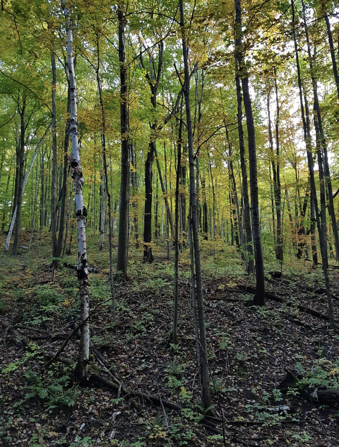
The Oakridge Trail in Happy Valley Forest offers a scenic and serene hiking experience. Explore lush woodlands, diverse terrain, and stunning viewpoints while immersing yourself in the tranquility of this protected forest.Dress appropriately for the weather conditions. Make sure to bring snacks or lunch, and a minimum of 2 litres of water.
During the hike, we will take short water breaks, as well as a 30-minute lunch break.
Every body is welcome! See you there!
Beaver Valley E2E #5 - Beaver Valley Ski Hill Challenge
https://hikesstaging.brucetrail.org/event/beaver-valley-e2e-5-beaver-valley-ski-hill-challenge/Sorry, the registration cut-off time for this hike has been reached.Not a member? Click here to join today!Hike open to BTC Members only.
Hosting Club: Dufferin Hi-Land
Category: General Hike
Location (Google Maps): Roadside parking at the end of Sideroad 13A east of 7th Line, km 89.5 BTC map 27. 44.420867, -80.562233.Hike Leader(s): Stuart Law, Margery Cruise Click here to contact Hike Leader(s)
Pace: Medium
Terrain: Slippery and Steep Sections, Strenuous
Distance: 15.5 kms.Description
Hike 5 in our Humane Hiking Beaver Valley E2E. Lots of ups and downs and of course there is the killer Beaver Valley Ski hill. Strenuous hike for sure. Please bring 3L water, bug spray, sun screen, a snack, a lunch and a smile. Please be ready for the car shuttle at 9:15 sharp.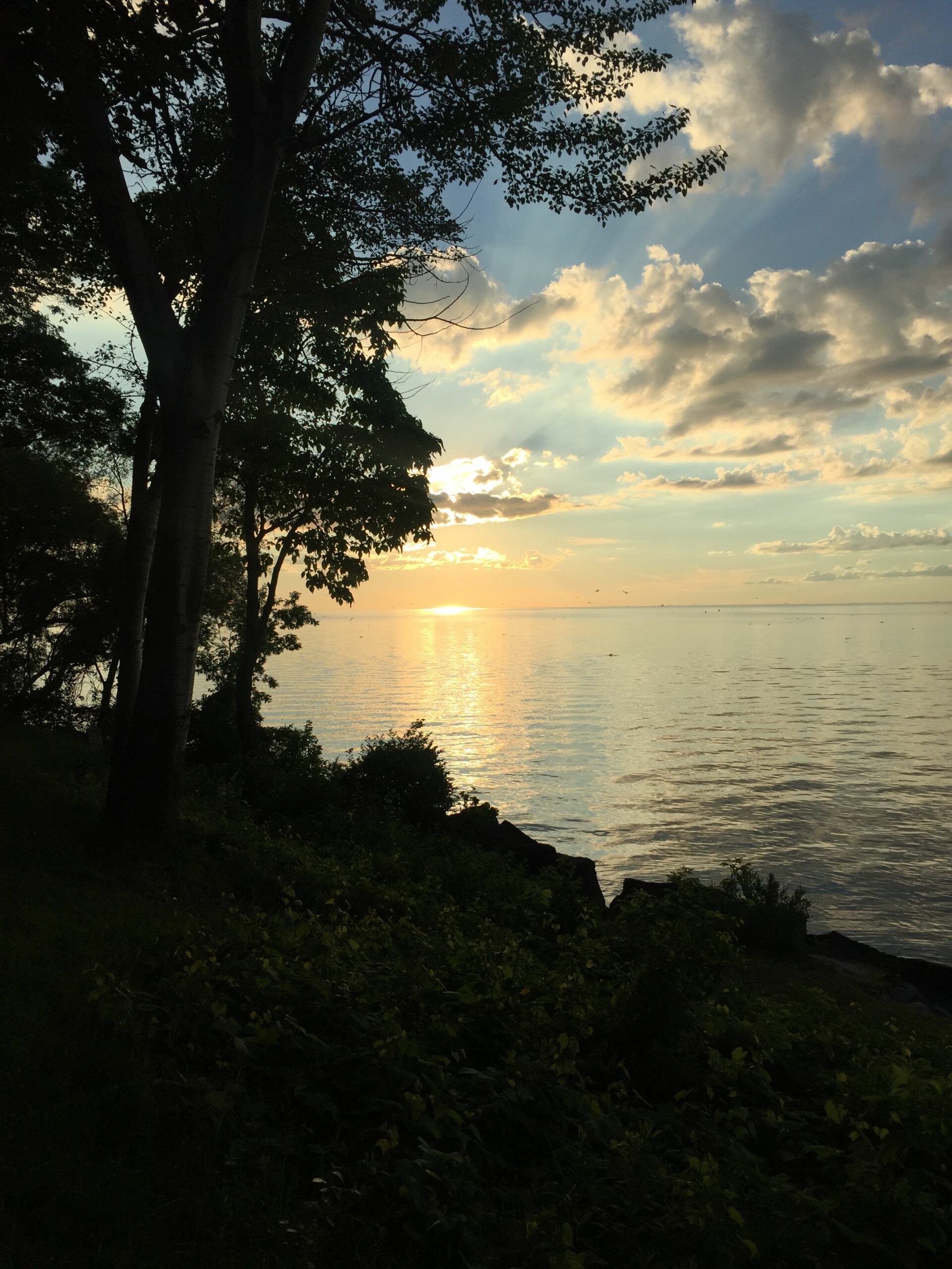
8:30 pm Sunset & Moonrise Night Hike in Niagara-on-the-Lake
https://hikesstaging.brucetrail.org/event/830-pm-sunset-moonrise-night-hike-in-niagara-on-the-lake-4/Sorry, the registration cut-off time for this hike has been reached.Not a member? Click here to join today!Hosting Club: Niagara
Category: Night
Location (Google Maps): Veteran’s Memorial Park, park just outside the park on King St.Hike Leader(s): Robin Garrett Click here to contact Hike Leader(s)
Pace: Medium
Terrain: Easy
Distance: 6-7 kmDescription
Sunset & Moonrise Night Hike – Take in the magic of the setting sun and rising moon over Lake Ontario and the Niagara River. This hike includes a stop to connect with your senses – sights, sounds, smells and the rhythm of your breath. Counts towards your night hike badge (5 night hikes).