
Hike Schedule
Join us for a hike! Registration required.
All hikes available to BTC members. Some hikes are open to non-members.
See Refund Policy for Paid Hikes >
TIP: The calendar view displays up to 7 hikes on a day, but often there are more. Click “View more events” to see them all.
Categories
- 27September 27, 2023
Car Hike: Sydenham End to End 7 of 8
https://hikesstaging.brucetrail.org/event/car-hije-sydenham-end-to-end-7-of-8/Sorry, the registration cut-off time for this hike has been reached.Not a member? Click here to join today!Hike open to BTC Members only.
Hosting Club: Toronto
Category: Car Hike
Location (Google Maps): We will meet very close to km151.3 (GPS N44.764911, W80.944925), roadside parking east of km 151.3 1on Graham’s Hill Rd.Hike Leader(s): Jacqueline Van Dyke Click here to contact Hike Leader(s)
Pace: Brisk
Terrain: Hilly, Variable
Distance: 19kmDescription
This hike is the seventh of an eight part Sydenham End to End series. We’ll pass through an area known for its wide variety of rare ferns and we will have some scenic views.Please ensure you arrive by 8:15 to be ready for an 8:30 departure. This is a car shuttle hike so please be prepared to share equally in the driving.
Check the weather the night before/morning of, the hike and dress accordingly. Bring enough water, snacks, and lunch to last the hike.
Walter's Falls Side Trail and surrounding area
https://hikesstaging.brucetrail.org/event/walters-falls-side-trail-and-surrounding-area/Sorry, the registration cut-off time for this hike has been reached.Not a member? Click here to join today!Hosting Club: Sydenham
Category: General Hike
Location (Google Maps): Meet at Roadside parking on Holland Sydenham Townline, at the junction with Grey Road 29. We’ll meet by the Blue sign for the Walter’s Falls Side TrailHike Leader(s): Fran Turner Click here to contact Hike Leader(s)
Pace: Medium: 3 to 4 km/h
Terrain: Moderate: Some hills and/or poor footing
Distance: 6.4 kmDescription
We will hike the Walter’s Falls loop, enjoying views of the creek and the waterfall. There are some steep rocky sections along this trail. We will then follow the trail west along the closed section of the townline and take a detour north on 2nd Concession S to admire the spectacular view from the crest of the hill. This portion is on a quiet gravel road with very little traffic and it’s a pleasant scenic walk. We’ll then make our way back to the cars.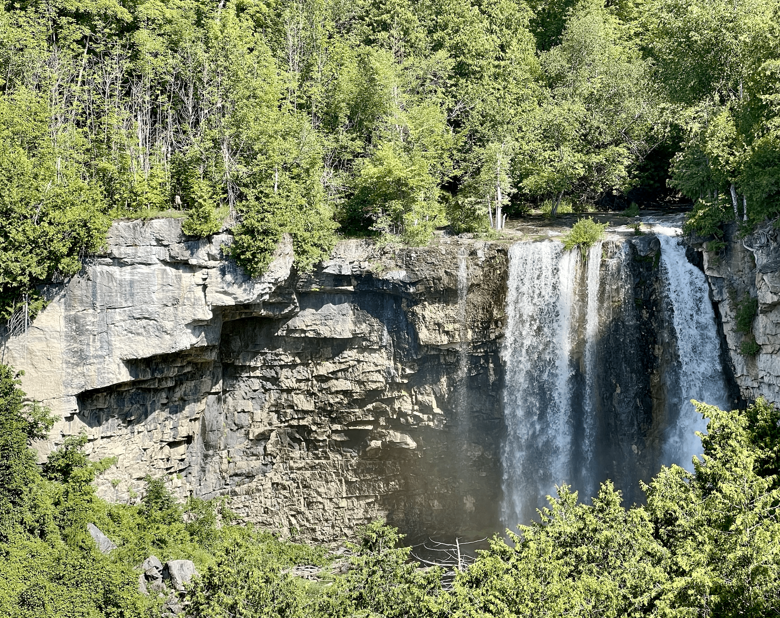
WEDNESDAY WALKERS - Eugenia Falls to Hogg's Fall
https://hikesstaging.brucetrail.org/event/wednesday-walkers-eugenia-falls-to-hoggs-fall/Sorry, the registration cut-off time for this hike has been reached.Not a member? Click here to join today!Hosting Club: Beaver Valley
Location (Google Maps): We will meet in the parking lot of Hogg’s Falls, km 67.5, Map 26, Edition 30. From there we will take the number of vehicles necessary to go to the start of the hike. (Parking at Eugenia Falls CA is paid parking.)
Hike Leader(s): Margaret Yaraskavitch Click here to contact the hike leader.
Pace: Medium
Terrain: Moderate, Some steep sections
Length of Hike: 7 kmDescription
This hike begins with some views of Eugenia Falls, at the crest and through the trees. From there it’s on to the Cuckoo Valley. The beginnings of fall colour may show at the outstanding Cuckoo Valley lookout area. Passing through mature forest and by an upland meadow, we arrive at Hogg’s Falls, an always picturesque scene on the Boyne River
Hilton Falls
https://hikesstaging.brucetrail.org/event/hilton-falls-8/Sorry, the registration cut-off time for this hike has been reached.Not a member? Click here to join today!Hosting Club: Iroquoia
Category: General Hike
Location (Google Maps): Hilton Falls Conservation Area Parking LotHike Leader(s): Susan Glofcheskie & Family Click here to contact Hike Leader(s)
Pace: Brisk – 4 to 5 km/hr, Medium – 3 to 4 km/hr
Terrain: Moderate – Some hills and/or some poor footing
Distance: 10 – 11 kmDescription
This is a loop hike. Parking fee applies (unless you have a Halton Parks pass, a great value) and you must reserve from 9:30 am to 12:30 pm.Hike leader: Susan Glofcheskie: email: glofcheskies@rogers.com. Cell 416-576-3163. Please use email prior to the hike and cell on the day of the hike.
Wear appropriate quick-dry clothing and hiking boots. Bring sunscreen, insect repellant (summer), icers (winter), snacks, a personal first aid kit and 1 – 2 litres of water. For personalized driving directions, click on the hike in the BTC hike calendar, then on (Google Maps) to the right of the word Location, and your smart phone should navigate you to the correct location. Please arrive at least 15 minutes early. If you are unable to attend, please email me as soon as possible in advance of the hike, or text me if it is < 2 hours before the hike.
Good Companions - Spring Valley - Ancaster
https://hikesstaging.brucetrail.org/event/good-companions-spring-valley-ancaster-3/Sorry, the registration cut-off time for this hike has been reached.Not a member? Click here to join today!Hike open to BTC Members only.
Hosting Club: Iroquoia
Category: Good Companions
Location (Google Maps):Ancaster Little League Ball Park – Jerseyville Rd (across from the Ancaster Lions Outdoor Pool) – See map below
Hike Leader(s): Ted Bossence Click here to contact Hike Leader(s)
Pace: Medium – 3 to 4 km/hr
Terrain: Strenuous – Hilly with steep climbs and some poor footing
Distance: 8 – 10 km depending on whether we follow the Headwaters Trail to the end or notDescription
We will follow the Spring Valley Trail, Martins Road, Headwaters Trail etc. in the western part of the Dundas Valley . Bring sunscreen, bug repellant, water and a snack (poles would also be useful). If I cancel due to rain I will notify you by email no later than the night before, so please check your emails before you leave for the hike. Please arrive a few minutes before the 10:00am time since I will be leaving promptly at 10:00.If you need to cancel after the 4:00pm cut-off time, please inform me by email the day before the hike at tedbossence@sympatico.ca , or by text at (905) 334-8752 the morning of the hike.
14:00 Glenridge Quarry Loop
https://hikesstaging.brucetrail.org/event/1400-glenridge-quarry-loop/Sorry, the registration cut-off time for this hike has been reached.Not a member? Click here to join today!Hosting Club: Niagara
Category: Hike
Location (Google Maps): Glenridge Quarry parking lot, St. David’s Rd. Map 3)Hike Leader(s): Larry Lloyd Click here to contact Hike Leader(s)
Pace: Leisurely
Terrain: Easy
Distance: 6 kmDescription
A combination of open trails with spectacular views across Lake Ontario, and wooded trails including the main trail. - 28September 28, 2023
8:00 am Long Hike Jordan to Moyer / Louth
https://hikesstaging.brucetrail.org/event/800-am-long-hike-jordan-to-moyer-louth-60/Sorry, the registration cut-off time for this hike has been reached.Not a member? Click here to join today!Hosting Club: Niagara
Location (Google Maps):
Jordan Hollow Park 3039 King St Jordan
Pace: Medium
Terrain: Moderate
: 10kDescription
From Jordan Hollow Hike the main trail to Upper and Lower Balls Falls, Moyer Road or Louth and Return. You must register for each hike. Bring Poles, sunscreen, bug spray , snack and a drink and dress for the weather
Car Hike: Sydenham End to End 8 of 8
https://hikesstaging.brucetrail.org/event/car-hike-sydenham-end-to-end-8-of-8/Sorry, the registration cut-off time for this hike has been reached.Not a member? Click here to join today!Hike open to BTC Members only.
Hosting Club: Toronto
Category: Car Hike
Location (Google Maps): On this final hike of the Sydenham series, we’ll meet at the Bluewater Park (GPS N44.742514, W81.135140) in Wiarton, where the parking lot is opposite the arena and close to the pool.Hike Leader(s): Jacqueline Van Dyke Click here to contact Hike Leader(s)
Pace: Brisk
Terrain: Hilly, Variable
Distance: 22kmDescription
Wow, it’s Badge Day!!! To purchase a badge, the cost is $10 for BTC members. On this hike, we’ll hike along the well-known Colpoy’s Range Rd (It’s often a place to get very wet feet), have some scenic views, and walk through Oxenden before finishing at Bluewater in Wiarton.Please ensure you arrive prior to 8:15 to be ready for an 8:30 departure. This is a car shuttle hike so please be prepared to share in the shuttling. All Covid protocols will be followed.
Please check the weather the night before/morning of, the hike and dress accordingly. Bring enough water, snacks, and lunch to last the entire hike.
9:15 Short Hike, Jordan Hollow
https://hikesstaging.brucetrail.org/event/915-short-hike-jordan-hollow-76/Sorry, the registration cut-off time for this hike has been reached.Not a member? Click here to join today!Hosting Club: Niagara
Category: Loop
Location (Google Maps): Jordan Hollow Park, Jordan StationHike Leader(s): Bill Russell Click here to contact Hike Leader(s)
Pace: Medium
Terrain: Strenuous
Distance: 6kDescription
Hike the main and side trails around Jordan and Ball’s Falls. Bring hiking boots, water, sunscreen and bug spray.Mt. Nemo CA to Kilbride Public School, Map 10
https://hikesstaging.brucetrail.org/event/mt-nemo-ca-to-kilbride-public-school-map-10-3/Sorry, the registration cut-off time for this hike has been reached.Not a member? Click here to join today!Hosting Club: Iroquoia
Category: Thursday Group
Location (Google Maps):Meet at the back of Kilbride Public School (by park and tennis courts). 6611 Panton St. (just off Kilbride st). Will be a shuttle to the Walker Line access to Mt. Nemo CA
Hike Leader(s): Karen Capindale-Smith Click here to contact Hike Leader(s)
Pace: Medium – 3 to 4 km/hr
Terrain: Strenuous – Hilly with steep climbs and some poor footing
Distance: 12 kmDescription
We will shuttle to Walkers Line access of Mt Nemo CA and follow main BT up escarpment into Conservation Area ( for lovely views of the countryside and hopefully some fall colours) and out along rural roads. We will continue on into Bronte Creek/Cedar Springs Valley. We will finish our hike climbing a strenuous stretch out of the valley and into the village of Kilbride. Driver(s) will be needed to drive back to starting point to recover shuttle car(s). Bring water, snacks, lunch and appropriate clothing layers for the weather. Drivers with Conservation pass may need a reservation to access the Mt Nemo CA parking lot.
Hike Leader: Karen Capindale-Smith; kjcapindale@gmail.com; hike morning use cell (905) 749-0914.
Baked goods can be expected 🙂

New Badge! Beaver Valley Geology Hike #2
https://hikesstaging.brucetrail.org/event/new-badge-beaver-valley-geology-hike-2/Sorry, the registration cut-off time for this hike has been reached.Not a member? Click here to join today!Hosting Club: Beaver Valley
Location (Google Maps): Meet on 6th Line, north of Grey Road 119, km 13.7
Hike Leader(s): Glenda Collings Click here to contact the hike leader.
Pace: Medium
Terrain: Moderate, Some rocky footing, Some steep sections
Length of Hike: 4.3 kmDescription
This is a series of 7 hikes to earn the Beaver Valley Geology badge. We will use the criteria listed in Beth Gilhespy’s book, Walking Through Time, Exploring Niagara Escarpment Geology in the Beaver Valley Bruce Trail Section. We’ll boost our knowledge of the local geology along the way as we take the required photos. Hikers are welcome to join any or all of the hikes, however, they must complete all 7 hikes to earn the badge. Bring sufficient water and snacks.Hike Two: Margaret Paull Side Trail
COVID-19 Precautions Before, During and After your Hike
- Each hiker joining a Bruce Trail Club organized hike must perform a self-screening check before hiking.
Find Ontario’s self-assessment tool here: https://covid-19.ontario.ca/self-assessment/ - If you are experiencing COVID-19 symptoms, stay home.
- Personal Protective Equipment:
- Hikers may choose to wear masks
Transportation
It is the Bruce Trail Conservancy’s current policy that car shuttles are allowed. It is at the discrepancy of individual hike leaders to make that decision.
Other Guidelines
- Arrive 15 minutes before the start of the hike.
- Wear sturdy footwear and appropriate attire for the weather and the terrain.
Hiking poles are a good idea in any season, especially if the terrain is rocky or slippery. In winter, snowshoes or icers/crampons are needed when conditions dictate.
Wearing appropriate clothing and footwear prevents injuries and shows consideration for a safe and positive group hiking experience. - Always carry I.D. and your health card.
- Bring sufficient water and snacks (or lunch if indicated). A minimum of 1L of water is recommended on all hikes, and 3L is recommended for long, challenging hikes in the heat of the summer.
- Bring sunscreen and insect repellent (for spring and summer hikes).
- Bring your own first aid kit.
- Please leave dogs at home.
Iroquoia End-to-End Hike 4 of 10
https://hikesstaging.brucetrail.org/event/iroquoia-end-to-end-hike-4-of-10/Sorry, the registration cut-off time for this hike has been reached.Not a member? Click here to join today!Hosting Club: Caledon Hills
Category: End-to-End
Location (Google Maps): Meet at City View Park off of Kerns Rd., km 76.3. Shuttle to start at Mt. Nemo. Paid parking arrangements to be made prior of hike date.Hike Leader(s): Nancy Mooney Click here to contact Hike Leader(s)
Pace: Medium – 3 to 4 km/hour
Terrain: Easy – mostly flat and usually good footing, Moderate – some hills and/or some poor footing
Distance: From 87.3 to 76.9 plus side trail to parking, 10.7 km. Maps 10, 9Description
This is the fourth hike of ten. Beginning with road walking the hike goes through different forests, past Fisher’s Pond, offers views of Lake Ontario and Burlington, passes Signal Hill and through Kerncliff Park. - Each hiker joining a Bruce Trail Club organized hike must perform a self-screening check before hiking.
- 29September 29, 2023
Car Hike: Tobermory Fall Weekend
https://hikesstaging.brucetrail.org/event/car-hike-tobermory-fall-weekend/Sorry, the registration cut-off time for this hike has been reached.Not a member? Click here to join today!This is a Multi-Day Hike
You are signing up for the following dates:
2023-09-29, 2023-09-30, 2023-10-01Hosting Club: Toronto
Category: Car Hike
Location (Google Maps): Princess Hotel
34 Bay St, Tobermory, ON N0H 2R0Hike Leader(s): Jeanette Vincent. Brenda Menezes. David Royle. Click here to contact Hike Leader(s)
Pace: Moderate
Terrain: Hilly, Rocky, Variable
Distance: 13 -15kmDescription
We continue Greg Vincent’s legacy of weekends away. Please join Jeanette Vincent, Brenda Menezes and David Royle as we explore the Tip o’ the Bruce, Tobermory in the Fall. The beauty of this area of the Bruce Peninsula every season is wonderful! We will take in a number of walks using side trails and the Bruce Trail. Approximately 13-15km/day. We stay and have our meals at a comfortable hotel overlooking Little Tub Harbour. This outing is restricted to those staying with us at the Princess Hotel in Tobermory for the weekend – the hotel fills quickly. You will need a car to access this outing. Please contact the Princess Hotel for a reservation.1-519-592-8282 or info@tobermoryprincesshotel.com and mention Vincent/Royle Fall weekend.
Before registering at the hotel please contact Jeanette: vincentjeanette1604@gmail.com | 519-588-5916 For prices and more details.
9:00 am Niagara-on-the-Lake Tour
https://hikesstaging.brucetrail.org/event/900-am-niagara-on-the-lake-tour-13/Sorry, the registration cut-off time for this hike has been reached.Not a member? Click here to join today!Hosting Club: Niagara
Category: Urban
Location (Google Maps):Veterans Memorial Park, park just outside the park on King Street
Hike Leader(s): Robin Garrett Click here to contact Hike Leader(s)
Pace: Medium
Terrain: Easy
Distance: 6-7 kmDescription
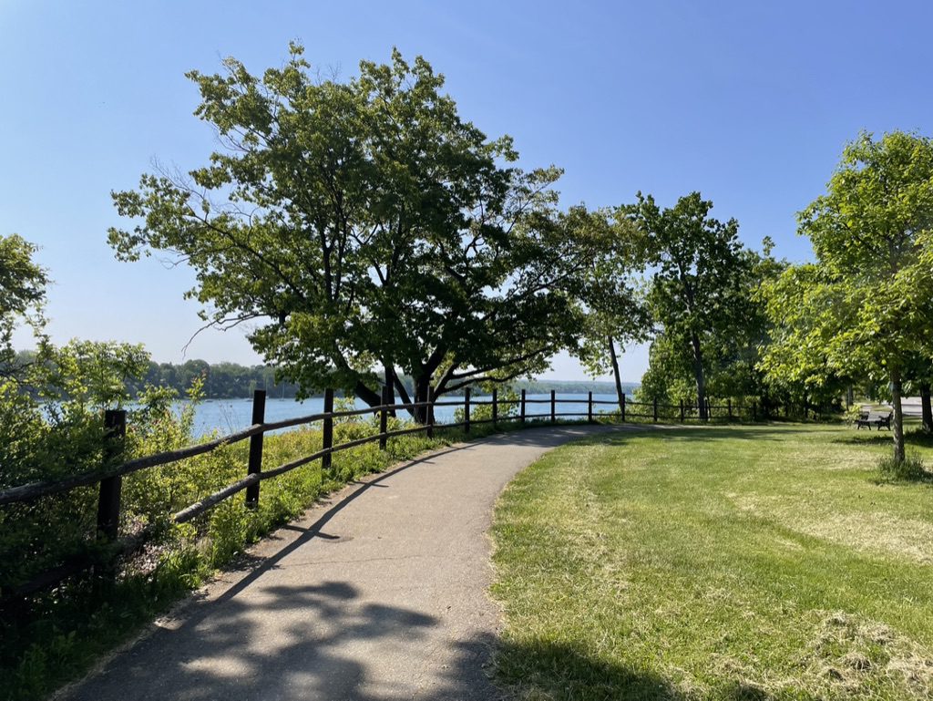
Each Friday we will explore different neighbourhoods, trails and parkland throughout Historic Niagara-on-the-Lake.Moderate pace with some weeks entirely on sidewalks and roads while others may include a mix of trails and paved pathways. Great way to build up endurance for longer more strenuous hikes.
Prepare for cooler windy conditions on open parkland and along Lake Ontario and Niagara River trails.
Plan to stay for conversation and a warm cup of coffee or tea at Sweets & Swirls, Community Centre, Niagara Stone Road, NOTL
Ross McLean loop (Bass Lake)
https://hikesstaging.brucetrail.org/event/ross-mclean-loop-bass-lake-2/Sorry, the registration cut-off time for this hike has been reached.Not a member? Click here to join today!Hosting Club: Sydenham
Category: General Hike
Location (Google Maps):Meet at 9:45 a.m. at Kemble Arena parking lot (319897 Kemble Rock Road, Kemble) to carpool to trail head. Limited parking at trail head. 5 minute drive from Kemble.
Hike Leader(s): Carol Mullin Click here to contact Hike Leader(s)
Pace: Medium: 3 to 4 km/h
Terrain: Moderate: Some hills and/or poor footing, There are crevices or holes which may be hidden by layers of snow. Hike with extreme caution., There might be muddy sections.
Distance: 3.9 km loopDescription
Picturesque view of Bass Lake and the wetlands. Interesting crevices. Approx. 1.5 to 2 hrs. If you are unable to register, please call or text the leader at 226-787-8804.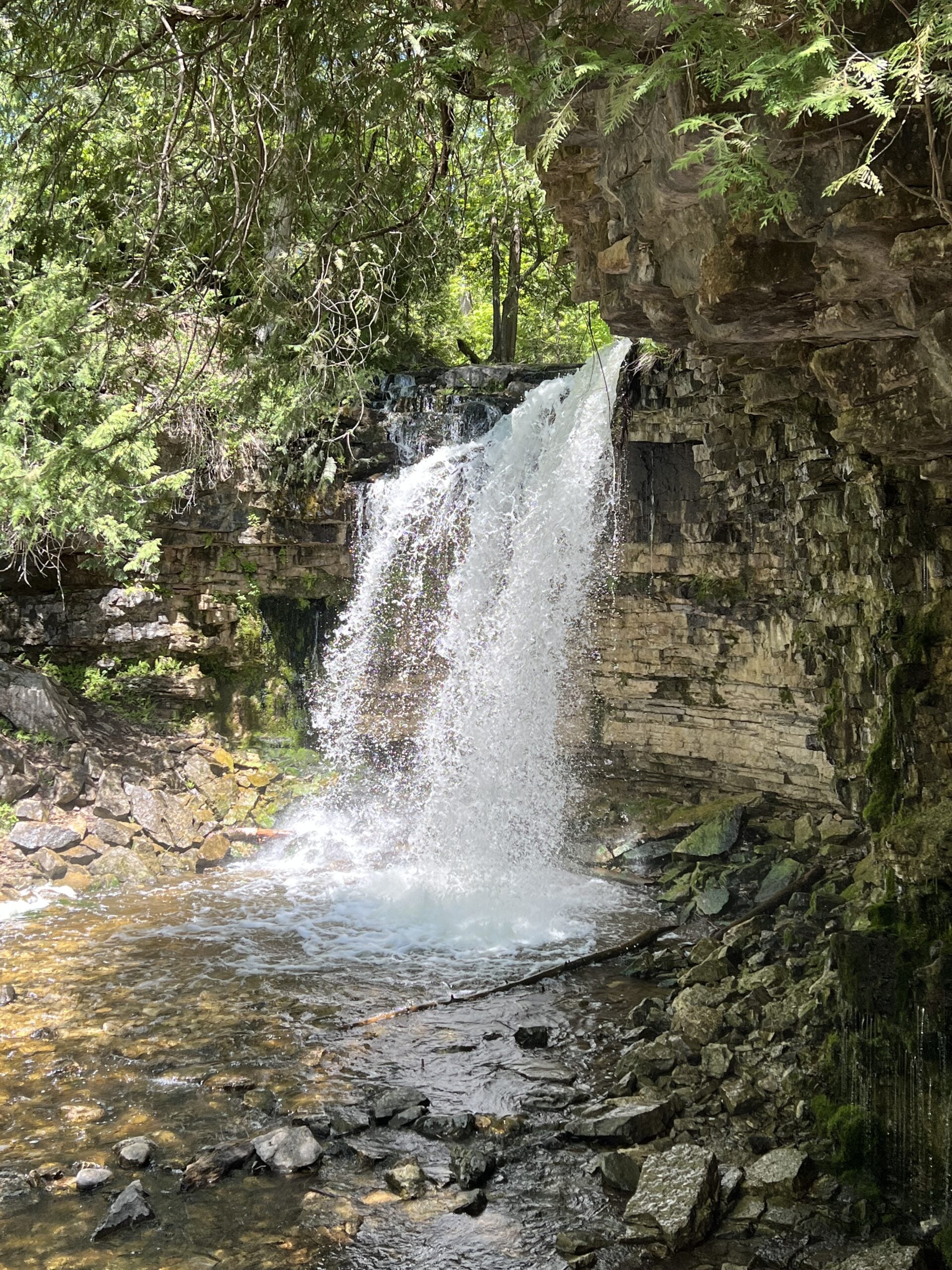
Hilton Falls Ramble
https://hikesstaging.brucetrail.org/event/hilton-falls-ramble-5/Sorry, the registration cut-off time for this hike has been reached.Not a member? Click here to join today!Hosting Club: Iroquoia
Category: General Hike
Location (Google Maps): Hilton Falls Conservation Area, 4985 Campbellville Rd.Hike Leader(s): Anne Armstrong Click here to contact Hike Leader(s)
Pace: Leisurely – 3km/hr or less
Terrain: Easy – Mostly flat and usually good footing
Distance: Approx. 10 km.Description
Join us for a ramble around the Hilton Falls trails. We will use a combination of Bruce Trail Side trails and Conservation Area to explore this beautiful area. Perhaps there will be a good amount of water in the falls. Mostly flat, easy trails with some rocky sections and one long hill to climb. Meet in the main parking lot at 9:45 for a 10:00 am. start. Bring water, a snack, sunscreen and insect repellent. Reservation required, can be made through the Halton Conservation Parks Reservation system. This will be a leisurely paced hike.
Leader:Anne Armstrong 905 617 3937 hikingrandma@gmail.com
8:00 pm Moonlight Night Hike in Niagara-on-the-Lake
https://hikesstaging.brucetrail.org/event/800-pm-moonlight-night-hike-in-niagara-on-the-lake-3/Sorry, the registration cut-off time for this hike has been reached.Not a member? Click here to join today!Hosting Club: Niagara
Category: Night
Location (Google Maps): Veteran’s Memorial Park, park just outside the park on King St.Hike Leader(s): Robin Garrett Click here to contact Hike Leader(s)
Pace: Medium
Terrain: Easy
Distance: 6-7 kmDescription
Moonlight Night Hike – Take in the magic of the rising moon over Lake Ontario and the Niagara River. This hike includes a stop to connect with your senses – sights, sounds, smells and the rhythm of your breath. Counts towards your night hike badge (5 night hikes). - 30September 30, 2023

Steeltown Stomp 2023
https://hikesstaging.brucetrail.org/event/steeltown-stomp-2023/Sorry, the registration cut-off time for this hike has been reached.Not a member? Click here to join today!Hosting Club: Iroquoia
Category: Steeltown Stomp
Location (Google Maps): Mohawk 4 Ice Centre, 710 Mountain Brow Blvd., Hamilton ON, L8T 5A9. Please park at the north end of the parking lot.Event Coordinator(s): Samar Smith Click here to contact Event Coordinator(s)
Event Start Times: 8:00 AM, 8:15 AM, 8:30 AM, 8:45 AMPace: Brisk – 4 to 5 km/hr, Fast – 5+ km/hr, Medium – 3 to 4 km/hr
Terrain: Strenuous – Hilly with steep climbs and some poor footing
Distance: Hike approximately 23 kms and climb up and down approximately 2000 steps.Description
Looking for a distance and strength challenge? The Steeltown Stomp is just what you’ve been looking for!Climb up and down approximately 2000 steps of the escarpment stairs, and hike over 20 kilometres in the Iroquoia Bruce Trail Club’s annual Steeltown Stomp.
This is a self-guided hike along the Bruce Trail, the Escarpment Rail Trail, and the Chedoke Radial Trail, climbing up and down the 7 sets of stairs along the Hamilton Escarpment as you go.
Everyone who completes the route and goes through the two checkpoints will earn the coveted Steeltown Stomp badge.
Please Note: This is an arduous hike and requires a high level of fitness due to the stair climbing required.
Fee: $30 fee includes checkpoint snacks, badge, and helps to support the Bruce Trail Conservancy in its mission to preserve a ribbon of wilderness, for everyone, forever.
Check in: At the registration booth set up at the north end of the parking lot of the Mohawk 4 Ice Centre. We have set up staggered start times – choose 8:00, 8:15, 8:30, or 8:45 when you register and you will start the hike as you are checked in. This is not a race, and you will not be timed.
Checkpoints: Start and end at the Mohawk 4 Ice Centre. There is a second turnaround checkpoint at the Chedoke Golf Course.
Route: Follow the yellow blazes…special yellow blazes will be set up to mark the route. In addition, the route has been set up on the AllTrails app. If you have this downloaded on your phone, you can follow the route using the app.
What to bring: Bring your own water. You will be able to refill your own water bottles at public water fountains along the route. Wear comfortable, sturdy shoes (hiking boots are not necessary), and dress for the weather. Protect yourself from insects and sun.
Safety Precautions: Normal hiker etiquette and safety precautions apply…https://development.brucetrail.org/explore-the-trail/#Bruce-Trail-101
Donations: If you are interested in contributing further to the BTC, please click here.
FAQ’s
What if it rains? This is a rain or shine event.
What if I need to drop out? As we are in an urban area, there are places to meet a taxi or a ride along the way. This must be arranged by you, the participant. If you have to drop out during the event, please let us know by text or phone to Samar Smith at 416-662-9192.
How long will it take to finish? We estimate that the hike will take between 3 and 5 hours.
Are dogs allowed? No. The stairs will be too crowded during this event.
Contact: Samar Smith at iroquoiabrucetrailclub@gmail.com or 416-662-9192
Bus Hike: Fall Colours Dufferin Highland, Murphy's Pinnacle
https://hikesstaging.brucetrail.org/event/bus-hike-fall-colours-dufferin-highland-murphys-pinnacle/Sorry, the registration cut-off time for this hike has been reached.Not a member? Click here to join today!Trip Information
Departure Time: 08:30
Return to City Time: 18:00
Departure Point: York Mills Bus PickupOptional Items
Hosting Club: Toronto
Category: Bus Hike
Location (Google Maps): Dufferin Highland, Murphy’s PinnacleHike Leader(s): Martina Furrer, Brenda Dalglish, Mojgan Haghighat, Celia Ho
Pace: Moderate
Terrain: Hilly, Variable
Distance: Fast group 16 to 18 km, Moderate group 13 kmDescription
Join us for a fantastic fall hike in the Dufferin Highlands (Map 20). Enjoy the fall colours and awesome views from Murphy’s Pinnacle and the Mulmur Lookout.We will split into two groups. The fast group will do the Primrose Loop Side Trail and then follow the main trail north to km 29.6 (about a 16 km hike). If time permits the fast group will also do the Rock Hill Park Side Trail. The moderate group will head straight to Murphy’s Pinnacle and follow the main trail north to km 29.6 (about a 13 km hike).
Pack water, lunch, sun and rain protection.
Refreshment stop in Primrose if time allows.
Bus departs at 8:30 am from 10 York Mills Rd. We hope to be back in the city by 6 pm.

8:30Welland Canals Hike #4 New Badge
https://hikesstaging.brucetrail.org/event/830welland-canals-hike-4-new-badge/Sorry, the registration cut-off time for this hike has been reached.Not a member? Click here to join today!Hosting Club: Niagara
Category: Loop
Location (Google Maps): Jaycee Garden Park, 543 Ontario St., St. Catharines N43.192235 W79.266243Jaycee Garden Park, 543 Ontario St., St. Catharines N43.192235 W79.266243
Hike Leader(s): Lauren Doig Click here to contact Hike Leader(s)
Pace: Medium
Terrain: Easy
Distance: 7 kmDescription
This is the 4th hike in the Welland Canals Badge Series. It will acquaint you with the entry point of 3 of the 4 Welland Canals. Please refer to the Badge section of NBTC website for photo requirements and additional interesting information about the canals. If completed 4 hikes, then bring $10 for badge.Fall Colours in Toronto Parks & Ravines Series: Brick Works - Mud Creek
https://hikesstaging.brucetrail.org/event/fall-colours-in-toronto-parks-ravines-series-brick-works-mud-creek/Sorry, the registration cut-off time for this hike has been reached.Not a member? Click here to join today!Hosting Club: Toronto
Category: Urban Walk
Location (Google Maps): Meet at Evergreen Brick Works in the court yard in front of the CafeHike Leader(s): Sajedeh Zahraei, George Lennon Click here to contact Hike Leader(s)
Pace: Leisurely, Moderate
Terrain: Flat, Variable
Distance: 7.2 KMDescription
This is the first walk in a 4 part series of fall colour walks in Toronto Parks and Ravines. You may sign up for any or all walks in the series. In this urban walk we will complete the Mud Creek Lost Rivers loop exploring three buried waterways as we walk through Evergreen Brick Works, Beltline trail, David Balfour Park and Moore Park Ravine. The trail varies from gravel, dirt, to hard surface. Mostly flat, with some slopes in a couple of sections. The walk will take about 2.5 hours. We will end the walk at Evergreen Brick Works where we will enjoy the ponds, look for birds, turtles, and visit the Framer’s Market and have lunch together (feel free to bring lunch/snacks or buy something at the market). Wear comfortable running shoes or hiking boots. Bring water, snacks, lunch, and anything else you may need.Niagara E2E #5: Quarry Road to Grimsby
https://hikesstaging.brucetrail.org/event/niagara-e2e-5-quarry-road-to-grimsby/Sorry, the registration cut-off time for this hike has been reached.Not a member? Click here to join today!Hike open to BTC Members only.
Hosting Club: Dufferin Hi-Land
Category: General Hike
Location (Google Maps): Grimsby Lions Community Pool. Enter at 1 Elm Street at south end of Coronation Park. Just north of km 83.3 BTC Map 5.Hike Leader(s): Stuart Law Click here to contact Hike Leader(s)
Pace: Medium
Terrain: Moderate, Slippery and Steep Sections, Slippery Sections Likely
Distance: 16 kmsDescription
Join us on this shuttle hike to conclude our trek across the beautiful Niagara Section. Mud and slippery slopes guaranteed. Please bring a garbage bag and an extra pair of footwear for the drive back. Please also bring 2.5L of water, a snack, a lunch, bug spray and sunscreen.Dunedin Ravine Nature Reserve
https://hikesstaging.brucetrail.org/event/dunedin-ravine-nature-reserve/Sorry, the registration cut-off time for this hike has been reached.Not a member? Click here to join today!Hosting Club: Blue Mountains
Category: Register in person the morning of hike.
Location (Google Maps): Hike meets in the parking lot behind Tim Hortons on First St. in Collingwood.Hike Leader(s): Annette Sandberg Click here to contact Hike Leader(s)
Pace: Medium – 3 to 4 km/hr
Terrain: Moderate – Some hills and/or some poor footing
Distance: 6kmDescription
Truth and Reconciliation Orange Shirt Day. Wear Orange! We will head to the Dunedin Ravine Nature Reserve parking on 6/7 Sideroad and Concession 10. Following the white blazed trail south on Concession 10, we enter the nature preserve on the east side. This area covers mixed terrain and provides a chance to experience a variety of habitats. The trail follows along the banks of a tributary of the Noisy River. After crossing Concession 10, we proceed through some farmers fields to a great view at the bench. We will then return following the road. Bring a snack or lunch and water.Urban Walk: Rouge National Urban Park – Mast, Orchard, Cedar, Vista Trails loop.
https://hikesstaging.brucetrail.org/event/urban-walk-rouge-national-urban-park-mast-orchard-cedar-vista-trails-loop/Sorry, the registration cut-off time for this hike has been reached.Not a member? Click here to join today!Hosting Club: Toronto
Category: Urban Walk
Location (Google Maps): Rouge National Urban ParkHike Leader(s): Lindita Kalo, Tom Swales Click here to contact Hike Leader(s)
Terrain: Variable
Distance: 11KmDescription
The meeting point: For TTC riders 9:30am at North/East corner of Sheppard Av East and Kingston Rd. For drivers 9:45am at 7450 Kingston Rd, Glen Rouge Campground parking.We will explore this beautiful section of the Rouge National Urban Park in Toronto, hiking Mast Trail, Orchard Trail, Cedar Trail and Vista Trail. We will hike at moderate paste 4-5km/hour. Bring lunch and water, hiking pools are suggested not mandatory.
For more information on the Rouge National Urban Park visit link https://parks.canada.ca/pn-np/on/rouge
Headwaters Hike Series (North) - #1 of 3 - Noisy River
https://hikesstaging.brucetrail.org/event/headwaters-hike-series-north-1-of-3-noisy-river/Sorry, the registration cut-off time for this hike has been reached.Not a member? Click here to join today!Hike open to BTC Members only.
Hosting Club: Dufferin Hi-Land
Category: General Hike
Location (Google Maps): Meet at roadside parking at km 6.1 (Map 21, Blue Mountains Section) on County Road 9 south of Dunedin.Hike Leader(s): Margery Cruise,Susan Ford Click here to contact Hike Leader(s)
Pace: Medium
Terrain: Moderate, Strenuous
Distance: 10.2 kmDescription
We will hike from km 6.1 km south on the main trail, cross the Noisy River at km 5.5 and hike to km 5.1 where we walk south along Concession 10 and immediately duck into the woods to km 1.0 where the trail reaches a short gravel road off of Lavender Hill Rd. Then we will turn around and follow the trail north to our cars.Directions: from CR 89, north on CR 124 to to Grey CR 9, east to roadside parking on the right.
This is a series of 7 hikes: 3 Headwaters North and 4 Headwaters South. Hikers completing all 7 hikes in this series will be eligible to purchase a Headwaters Hike Series Badge (when available) from Dufferin Hi-Land BTC. The North section is offered in the Fall of 2023, while the south section will be offered in the Spring of 2024.
Car Hike: Bethesda Trail Richmond Hill
https://hikesstaging.brucetrail.org/event/car-hike-bethesda-trail-richmond-hill-12/Sorry, the registration cut-off time for this hike has been reached.Not a member? Click here to join today!Hosting Club: Toronto
Category: Car Hike
Location (Google Maps): Meet at Bethesda Trail Head Parking on Bethesda Sideroad off Bayview Avenue, across from Lake Wilcox. This parking lot is free.Hike Leader(s): Mohammad Aghamiri Click here to contact Hike Leader(s)
Pace: Moderate
Terrain: Variable
Distance: 14-15KMDescription
Join us to explore Jefferson Forest and Bond lake ,Good time to see trees changing colors sign of fall ,
we will repeat this hike possibly 2 more times to see these beautiful wild flowers growing.
Please bring hiking poles, proper closing and shoes and lots of water,
Please carefully read safety procedures during the hike:
1-Hikers must stay between the leader and the sweep.
2-Hikers must advise the leader or the sweep if they wish to leave the group.
3- Hikers must follow the whistle instructions: 1 blast- stay where you are; 2 blasts come to the leader; 3 blasts – come to the leader quickly.
4-Hike leader may request volunteers to stop at trail intersections, they need to help hikers to the direction the group walk and wait till they see the sweep .
5-Hikers have to make sure they can see the persons behind and in front of them.
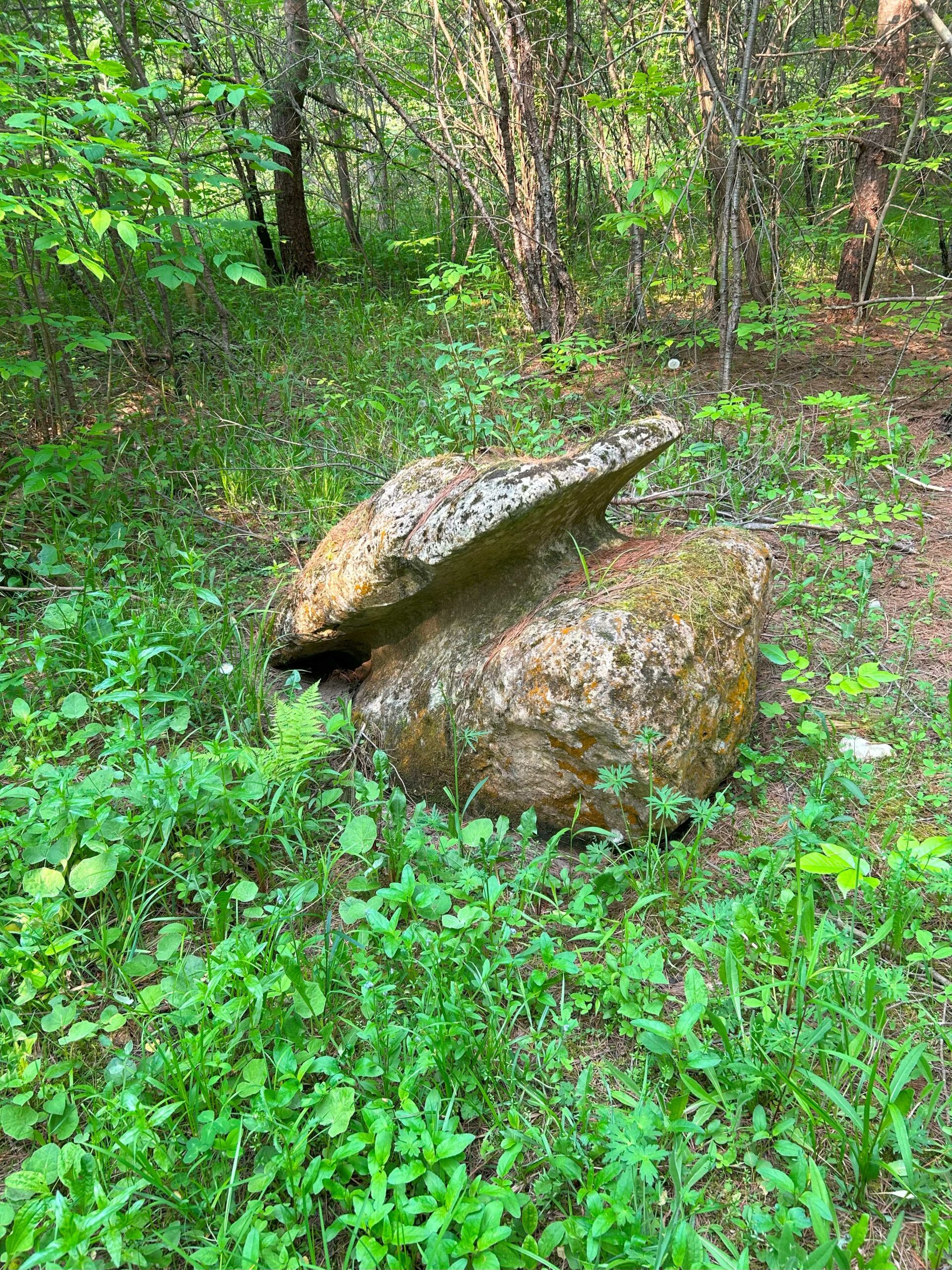
Silent Valley to Woodford – A Geology Hike with Beth Gilhespy
https://hikesstaging.brucetrail.org/event/silent-valley-to-woodford-a-geology-hike-with-beth-gilhespy/Sorry, the registration cut-off time for this hike has been reached.Not a member? Click here to join today!Hosting Club: Sydenham
Location (Google Maps): Meet at 9:45 at the Woodford Community Centre. We will leave some cars there and drive the rest back to Silent Valley to begin our hike.
Hike Leader(s): Beth Gilhespy Click here to contact the hike leader.
Pace: Leisurely
Terrain: Moderate, Some rocky footing, Some steep sections
Length of Hike: 6.5 kmDescription
Join Beth Gilhespy on this hike to explore the beautiful stretch of the Bruce Trail between Silent Valley and Woodford, to see fossils, crevices, a lime kiln, drumlins and many other features! The pace will be slow but steady and exploratory, as participants will be helping scout a route that will be included in Beth’s Sydenham Walking Through Time Geology Hike book, due to be completed in 2024. While about 6.5 km, hikers can expect to be out for about 4 hours. Bring lunch, snacks, water and your curiosity!