
Hike Schedule
Join us for a hike! Registration required.
All hikes available to BTC members. Some hikes are open to non-members.
See Refund Policy for Paid Hikes >
TIP: The calendar view displays up to 7 hikes on a day, but often there are more. Click “View more events” to see them all.
Categories
- 27September 27, 2023
Car Hike: Sydenham End to End 7 of 8
https://hikesstaging.brucetrail.org/event/car-hije-sydenham-end-to-end-7-of-8/Sorry, the registration cut-off time for this hike has been reached.Not a member? Click here to join today!Hike open to BTC Members only.
Hosting Club: Toronto
Category: Car Hike
Location (Google Maps): We will meet very close to km151.3 (GPS N44.764911, W80.944925), roadside parking east of km 151.3 1on Graham’s Hill Rd.Hike Leader(s): Jacqueline Van Dyke Click here to contact Hike Leader(s)
Pace: Brisk
Terrain: Hilly, Variable
Distance: 19kmDescription
This hike is the seventh of an eight part Sydenham End to End series. We’ll pass through an area known for its wide variety of rare ferns and we will have some scenic views.Please ensure you arrive by 8:15 to be ready for an 8:30 departure. This is a car shuttle hike so please be prepared to share equally in the driving.
Check the weather the night before/morning of, the hike and dress accordingly. Bring enough water, snacks, and lunch to last the hike.
Hilton Falls
https://hikesstaging.brucetrail.org/event/hilton-falls-8/Sorry, the registration cut-off time for this hike has been reached.Not a member? Click here to join today!Hosting Club: Iroquoia
Category: General Hike
Location (Google Maps): Hilton Falls Conservation Area Parking LotHike Leader(s): Susan Glofcheskie & Family Click here to contact Hike Leader(s)
Pace: Brisk – 4 to 5 km/hr, Medium – 3 to 4 km/hr
Terrain: Moderate – Some hills and/or some poor footing
Distance: 10 – 11 kmDescription
This is a loop hike. Parking fee applies (unless you have a Halton Parks pass, a great value) and you must reserve from 9:30 am to 12:30 pm.Hike leader: Susan Glofcheskie: email: glofcheskies@rogers.com. Cell 416-576-3163. Please use email prior to the hike and cell on the day of the hike.
Wear appropriate quick-dry clothing and hiking boots. Bring sunscreen, insect repellant (summer), icers (winter), snacks, a personal first aid kit and 1 – 2 litres of water. For personalized driving directions, click on the hike in the BTC hike calendar, then on (Google Maps) to the right of the word Location, and your smart phone should navigate you to the correct location. Please arrive at least 15 minutes early. If you are unable to attend, please email me as soon as possible in advance of the hike, or text me if it is < 2 hours before the hike.
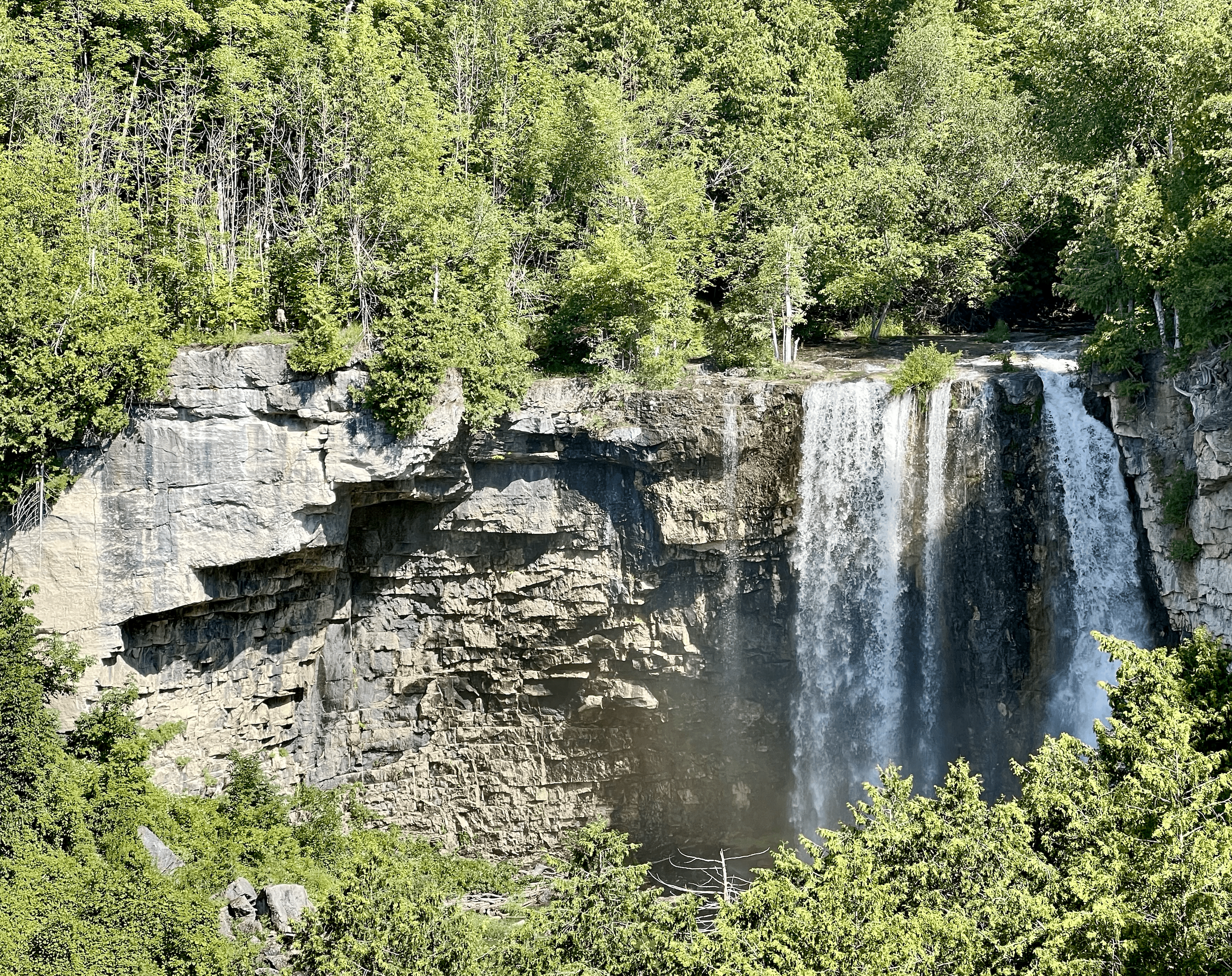
WEDNESDAY WALKERS - Eugenia Falls to Hogg's Fall
https://hikesstaging.brucetrail.org/event/wednesday-walkers-eugenia-falls-to-hoggs-fall/Sorry, the registration cut-off time for this hike has been reached.Not a member? Click here to join today!Hosting Club: Beaver Valley
Location (Google Maps): We will meet in the parking lot of Hogg’s Falls, km 67.5, Map 26, Edition 30. From there we will take the number of vehicles necessary to go to the start of the hike. (Parking at Eugenia Falls CA is paid parking.)
Hike Leader(s): Margaret Yaraskavitch Click here to contact the hike leader.
Pace: Medium
Terrain: Moderate, Some steep sections
Length of Hike: 7 kmDescription
This hike begins with some views of Eugenia Falls, at the crest and through the trees. From there it’s on to the Cuckoo Valley. The beginnings of fall colour may show at the outstanding Cuckoo Valley lookout area. Passing through mature forest and by an upland meadow, we arrive at Hogg’s Falls, an always picturesque scene on the Boyne RiverWalter's Falls Side Trail and surrounding area
https://hikesstaging.brucetrail.org/event/walters-falls-side-trail-and-surrounding-area/Sorry, the registration cut-off time for this hike has been reached.Not a member? Click here to join today!Hosting Club: Sydenham
Category: General Hike
Location (Google Maps): Meet at Roadside parking on Holland Sydenham Townline, at the junction with Grey Road 29. We’ll meet by the Blue sign for the Walter’s Falls Side TrailHike Leader(s): Fran Turner Click here to contact Hike Leader(s)
Pace: Medium: 3 to 4 km/h
Terrain: Moderate: Some hills and/or poor footing
Distance: 6.4 kmDescription
We will hike the Walter’s Falls loop, enjoying views of the creek and the waterfall. There are some steep rocky sections along this trail. We will then follow the trail west along the closed section of the townline and take a detour north on 2nd Concession S to admire the spectacular view from the crest of the hill. This portion is on a quiet gravel road with very little traffic and it’s a pleasant scenic walk. We’ll then make our way back to the cars.Good Companions - Spring Valley - Ancaster
https://hikesstaging.brucetrail.org/event/good-companions-spring-valley-ancaster-3/Sorry, the registration cut-off time for this hike has been reached.Not a member? Click here to join today!Hike open to BTC Members only.
Hosting Club: Iroquoia
Category: Good Companions
Location (Google Maps):Ancaster Little League Ball Park – Jerseyville Rd (across from the Ancaster Lions Outdoor Pool) – See map below
Hike Leader(s): Ted Bossence Click here to contact Hike Leader(s)
Pace: Medium – 3 to 4 km/hr
Terrain: Strenuous – Hilly with steep climbs and some poor footing
Distance: 8 – 10 km depending on whether we follow the Headwaters Trail to the end or notDescription
We will follow the Spring Valley Trail, Martins Road, Headwaters Trail etc. in the western part of the Dundas Valley . Bring sunscreen, bug repellant, water and a snack (poles would also be useful). If I cancel due to rain I will notify you by email no later than the night before, so please check your emails before you leave for the hike. Please arrive a few minutes before the 10:00am time since I will be leaving promptly at 10:00.If you need to cancel after the 4:00pm cut-off time, please inform me by email the day before the hike at tedbossence@sympatico.ca , or by text at (905) 334-8752 the morning of the hike.
14:00 Glenridge Quarry Loop
https://hikesstaging.brucetrail.org/event/1400-glenridge-quarry-loop/Sorry, the registration cut-off time for this hike has been reached.Not a member? Click here to join today!Hosting Club: Niagara
Category: Hike
Location (Google Maps): Glenridge Quarry parking lot, St. David’s Rd. Map 3)Hike Leader(s): Larry Lloyd Click here to contact Hike Leader(s)
Pace: Leisurely
Terrain: Easy
Distance: 6 kmDescription
A combination of open trails with spectacular views across Lake Ontario, and wooded trails including the main trail.