
Hike Schedule
Join us for a hike! Registration required:
All hikes available to BTC members. Some hikes are open to non-members.
TIP: The calendar view displays up to 7 hikes on a day, but often there are more. Click “More events” to see them all.
Categories
- 23September 23, 2023
Car Hike: Hike of 2 lakes King city
https://hikesstaging.brucetrail.org/event/car-hike-hike-of-2-lakes-king-city-8/Sorry, the registration cut-off time for this hike has been reached.Not a member? Click here to join today!Hosting Club: Toronto
Location (Google Maps): Park along Fairfield Dr. or Dufferin Street, Gathering at trail head in Dufferin Street.
Hike Leader(s): Mohammad Aghamiri, Amir Alemohammad Click here to contact Hike Leader(s)
Pace: Moderate
Terrain: Other (Refer to Description), Variable
Distance: 14-15 KMDescription
We will hike in trails around Seneca lake and Mary Lake,pass by Eaton and visit Pine farm where you can enjoy coffee,tea,apple pie during our snack time.Some safety procedures during the hike:
1-Hikers must stay between the leader and the sweep.
2-Hikers must advise the leader or the sweep if they wish to leave the group.
3- Hikers must follow the whistle instructions: 1 blast- stay where you are; 2 blasts come to the leader; 3 blasts – come to the leader quickly.
4-Hike leader may request volunteers to stop at trail intersections, they need to help hikers to the direction the group walk and wait till they see the sweep .
5-Hikers have to make sure they can see the persons behind and in front of them.
8:30 Welland Canals Hikes #2 and #3 Woodend and Sobey's Parking lot
https://hikesstaging.brucetrail.org/event/830-welland-canals-hikes-2-and-3-woodend-and-sobeys-parking-lot/Sorry, the registration cut-off time for this hike has been reached.Not a member? Click here to join today!Hosting Club: Niagara
Category: In and Out
Location (Google Maps): 1. Sobey’s Parking lot, Glendale Ave, St. Catharines N43.136490 W79.216689
2. Woodend Conservation Area, Taylor Rd , NOTL N43.143377 W79.167212Hike Leader(s): Lauren Doig Click here to contact Hike Leader(s)
Pace: Medium
Terrain: Easy
Distance: First hike: 8.5 km Second Hike: 9 kmDescription
We will complete Hikes #2 and #3 of the new Welland Canals Badge series . We will meet at Sobey’s Parking lot at 8:30 and complete the loopish hike. We will then move our vehicles to the start point for the next hike, which is Woodend parking lot on Taylor RdSobey’s Hike: 9 km
Woodend hike 8.5 km
Please refer to the Badge section of the NBTC website for information about all 4 hikes and the required pictures.
Looping through Sydemham #6 of. 9
https://hikesstaging.brucetrail.org/event/looping-through-sydemham-6-of-9/Sorry, the registration cut-off time for this hike has been reached.Not a member? Click here to join today!Hosting Club: Blue Mountains
Category: Organized Hike
Location (Google Maps):Hike Leader(s): AnHong MacNeil Click here to contact Hike Leader(s)
Pace: Medium – 3 to 4 km/hr
Terrain: Moderate – Some hills and/or some poor footing
Distance: 13kmDescription
Derby Forest Trails 6 of 9 hikes Start time: 8:30AM Hikers meet at trailhead at 8:30AM, arrange your own carpooling. Contact leader for details of meet up.
9:00 Twelve Mile Creek Loop
https://hikesstaging.brucetrail.org/event/900-twelve-mile-creek-loop-2/Sorry, the registration cut-off time for this hike has been reached.Not a member? Click here to join today!Hosting Club: Niagara
Category: Loop
Location (Google Maps):Welland Vale Rd. (Pump Station) & Sawmill Rd., St. Catharines
Hike Leader(s): Karen Couch Click here to contact Hike Leader(s)
Pace: Medium
Terrain: Easy
Distance: 15 kmsDescription
Hike along both sides of 12 Mile Creek through St. Catharines.
Urban Walk: 16 Mile Creek, Oakville
https://hikesstaging.brucetrail.org/event/urban-walk-16-mile-creek-oakville-2/Sorry, the registration cut-off time for this hike has been reached.Not a member? Click here to join today!Hosting Club: Toronto
Category: Urban Walk
Location (Google Maps):Starts and ends at Oakville GO Station
Hike Leader(s): Ginny Giraudi Click here to contact Hike Leader(s)
Pace: Moderate
Terrain: Other (Refer to Description)
Distance: 15 kmDescription
If you are planning to travel by GO train to Oakville from Union Station, you can meet apprentice hike leader Tim Wainwright at 8:30 am by the information desk with the clock over it in Union Station in the Great Hall (off Front Street.) Tim will be wearing the blue Bruce Trail shirt. From Union you will be taking the 8:44 am westbound train. Please use the bathroom while on the GO train as there is little time for it at the Oakville GO station. You can also drive to the Oakville Station and meet us there. Parking is free on the weekends.We will all meet at 9:25 am at the Oakville Transit Bus Platform 27 at the Oakville GO Station (click here for station diagram.) From here we will board Bus 13 at 9:40 am and take a short bus ride to the start point of our hike. Oakville Transit buses accept Presto, and if you have paid for the GO train, the fare for the Oakville bus will register as zero. We will walk a 15 km looping trail through the 16-Mile Creek ravine (click here for route map), stopping at the halfway point for lunch (port-a-potties only; bring hand sanitizer and tp) and return to the Oakville GO Station. The trail is stone dust gravel or asphalt and mostly flat except for two steep declines and two long climbs. There is one long set of stairs to descend. The after-hike pub stop is at the Beertown Public House (click here for menu) near the Oakville GO Station.
Duncan Escarpment Caves
https://hikesstaging.brucetrail.org/event/duncan-escarpment-caves/Sorry, the registration cut-off time for this hike has been reached.Not a member? Click here to join today!Hosting Club: Sydenham
Category: General Hike
Location (Google Maps): Meet in the north-east corner of the parking lot at Home Depot on Highway 26 on the east side of Owen Sound.Hike Leader(s): Ian Mills Click here to contact Hike Leader(s)
Pace: Medium: 3 to 4 km/h
Terrain: Strenuous: Hilly with steep climbs and some poor footing., There might be muddy sections., There might be sections with water on the trail.
Distance: 10 kmDescription
We will, be doing a loop at Duncan Crevice Caves Provincial Park via the Main Trail and Chuck Grant Side Trail. Wonderful elevations and scenery including Metcalfe Rock via the Metcalfe Crevice Side Trail. Closer to the hike date we can investigate if folks are interested in having lunch at (Heart’s Tavern) Kimberley. In the event you are unable to register for this hike please text or call the hike leader @ 416-848-8818.Rock Hill/Oliver Creek Loops
https://hikesstaging.brucetrail.org/event/rock-hill-oliver-creek-loops/Sorry, the registration cut-off time for this hike has been reached.Not a member? Click here to join today!Hosting Club: Dufferin Hi-Land
Category: General Hike
Location (Google Maps):Dufferin Hi-Land, Map 20. Meet at Rock Hill parking lot on 1st Line Mulmur, just south of 10 Sideroad (Km 29.4).
Hike Leader(s): Les Babbage Click here to contact Hike Leader(s)
Pace: Medium
Terrain: Moderate, Slippery and Steep Sections
Distance: 8.4 kmDescription
Come check out the early fall colours in Walker’s Woods, one of the Bruce Trail’s finest mature forests, then visit the many crevices of Rock Hill Park. We will hike loops including Main Trail, Oliver Creek and Moss Haven Side Trails, then a loop consisting of Main Trail and Rock Hill Park Side Trail. Option to drop out after 6.8 km. Bring water, snacks.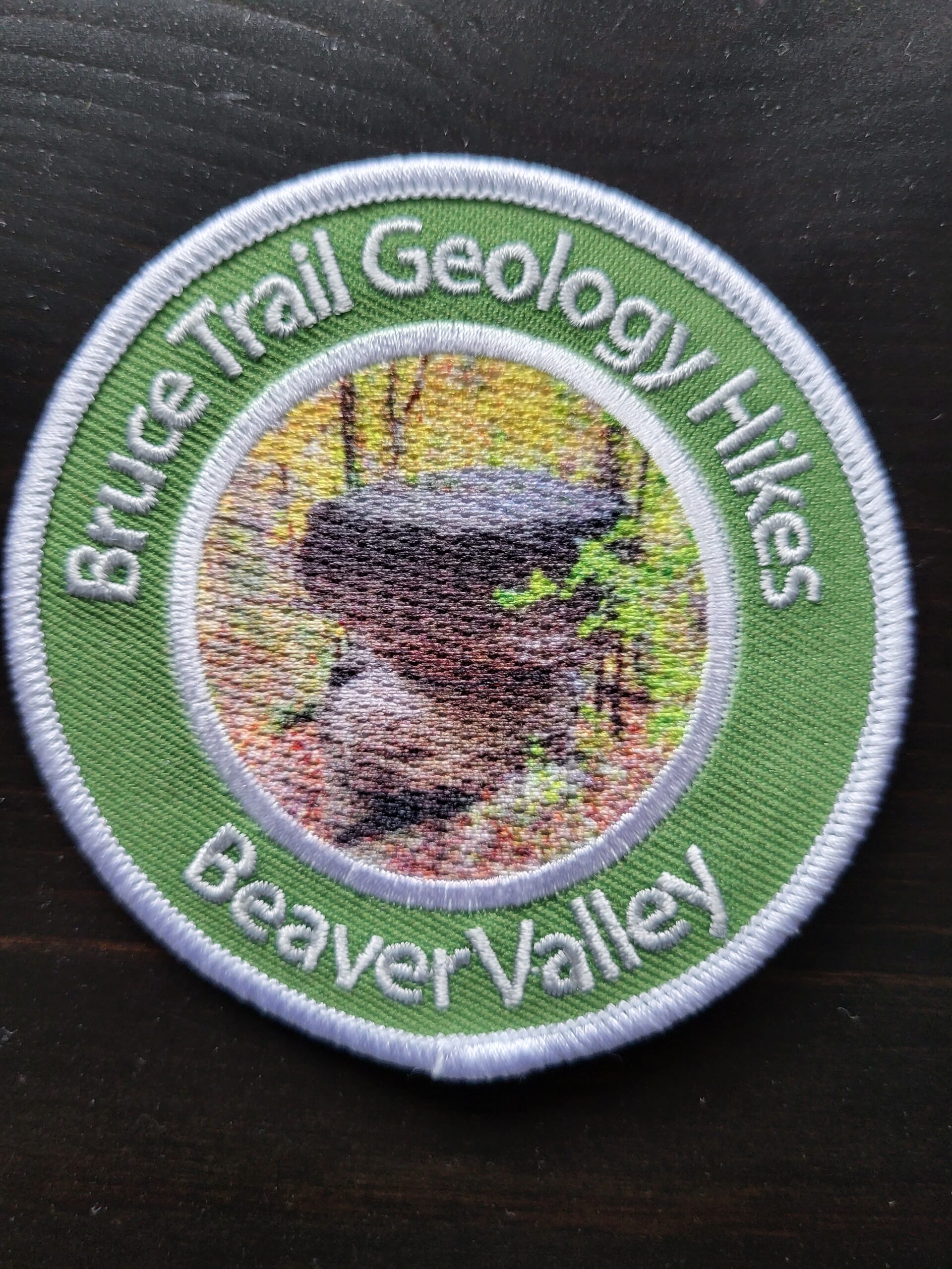
New Badge! Beaver Valley Geology Hike #1
https://hikesstaging.brucetrail.org/event/new-badge-beaver-valley-geology-hike-1/Sorry, the registration cut-off time for this hike has been reached.Not a member? Click here to join today!Hosting Club: Beaver Valley
Location (Google Maps): Meet on the shoulder of 21st Sideroad, near the road allowance leading to the trail, TBM parking area, Map 24. This is paid parking and we will shuttle as many cars as possible to the corner of 21st Sideroad & 4th Line to walk to the start of the hike.
Hike Leader(s): Glenda Collings Click here to contact the hike leader.
Pace: Medium
Terrain: Moderate, Some rocky footing, Some steep sections, Strenuous
Length of Hike: 7.1 kmDescription
This is a series of 7 hikes to earn the Beaver Valley Geology badge. We will use the criteria listed in Beth Gilhespy’s book, Walking Through Time, Exploring Niagara Escarpment Geology in the Beaver Valley Bruce Trail Section. We’ll boost our knowledge of the local geology along the way as we take the required photos. Hikers are welcome to join any or all of the hikes, however, they must complete all 7 hikes to earn the badge. Bring sufficient water and snacks.Hike One: Loree Forest and the Loree Forest Side Trail
COVID-19 Precautions Before, During and After your Hike
- Each hiker joining a Bruce Trail Club organized hike must perform a self-screening check before hiking.
Find Ontario’s self-assessment tool here: https://covid-19.ontario.ca/self-assessment/ - If you are experiencing COVID-19 symptoms, stay home.
- Personal Protective Equipment:
- Hikers may choose to wear masks
Transportation
It is the Bruce Trail Conservancy’s current policy that car shuttles are allowed. It is at the discrepancy of individual hike leaders to make that decision.
Other Guidelines
- Arrive 15 minutes before the start of the hike.
- Wear sturdy footwear and appropriate attire for the weather and the terrain.
Hiking poles are a good idea in any season, especially if the terrain is rocky or slippery. In winter, snowshoes or icers/crampons are needed when conditions dictate.
Wearing appropriate clothing and footwear prevents injuries and shows consideration for a safe and positive group hiking experience. - Always carry I.D. and your health card.
- Bring sufficient water and snacks (or lunch if indicated). A minimum of 1L of water is recommended on all hikes, and 3L is recommended for long, challenging hikes in the heat of the summer.
- Bring sunscreen and insect repellent (for spring and summer hikes).
- Bring your own first aid kit.
- Please leave dogs at home.
Dyer's Bay Cliffs - A Geology Hike with Beth Gilhespy
https://hikesstaging.brucetrail.org/event/dyers-bay-cliffs-a-geology-hike-with-beth-gilhespy/Sorry, the registration cut-off time for this hike has been reached.Not a member? Click here to join today!Hosting Club: Peninsula
Location (Google Maps): Meet up at the Borchardt Road Parking Lot (Bruce Trail Reference Guide Edition 30 – Map 40 ). Parking fees apply to non-residents of Municipality of Northern Bruce Peninsula.
Hike Leader(s): Marg Glendon Click here to contact Hike Leader(s)
Pace: Leisurely, Medium
Terrain: Difficult, Moderate
Distance: ~8 KMDescription
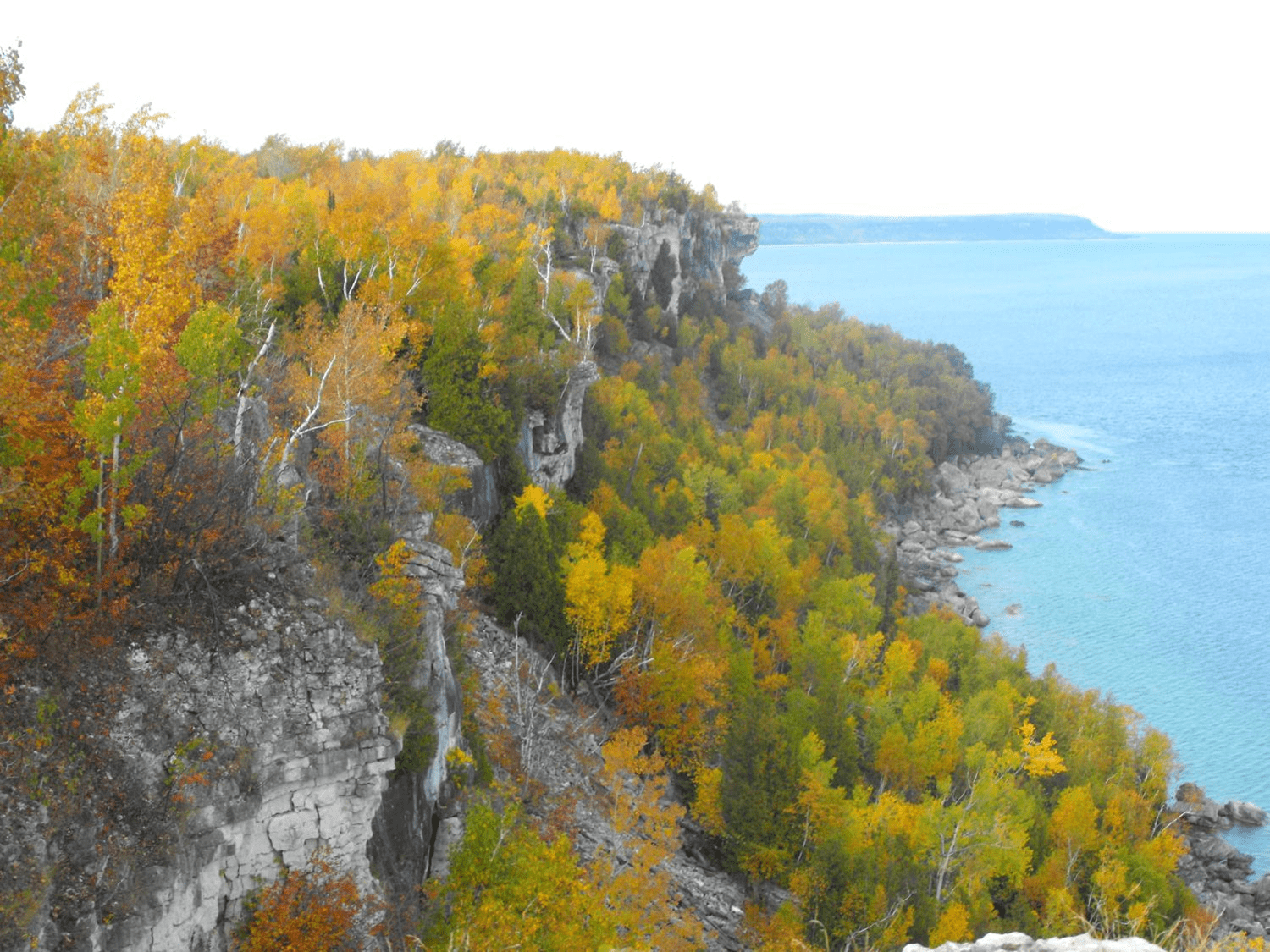
Join Beth Gilhespy on this hike to explore the clifftop shoreline of Dyer’s Bay to see the Devil’s Monument flowerpot, potholes, alvars, caves, natural arches and stunning views! Sturdy footwear is a must on this spectacular but rugged hike. The pace will be slow but steady and exploratory, as participants will be helping scout a route that will be included in Beth’s Saugeen Peninsula Geology Hike book, due to be completed in 2024. While about 8 km, hikers can expect to be out for 5 or 6 hours. Bring lunch, snacks, water and your curiosity!Autumn Forest Bathing Hike - Nottawasaga Bluffs Loop
https://hikesstaging.brucetrail.org/event/autumn-forest-bathing-hike-nottawasaga-bluffs-loop/Sorry, the registration cut-off time for this hike has been reached.Not a member? Click here to join today!Hosting Club: Caledon Hills
Category: Nature Walks
Location (Google Maps): The walk departs from Nottawasaga Valley Conservation Authority parking lot at km 21.9 – BTC Ref Guide, Map 22, in the Blue Mountains section. Driving directions: If proceeding north from Primrose, go west on Highway 10 & 89 (combined) to Highway 124, then north (right) on Highway 124 to Singhampton. At Singhampton, turn right following Highway 124 east and in .75 km turn right on Mill Town Rd. and an immediate left on Ewing Rd., turn left on 17/18 Side Road, right on Concession 10 South, left on 15/16 Side Road, parking lot is on your right. (Roads are clearly shown on Map 22.) $10 + HST parking fee – easy to pay ahead – go to Nottawasaga Valley Conservation Authority, click on Recreation, then parking fees, select on-line parking option and click on hotspot website.Hike Leader(s): Janice McClelland Click here to contact Hike Leader(s)
Pace: Medium – 3 to 4 km/hour
Terrain: Moderate – some hills and/or some poor footing
Distance: 8.2 kmDescription
A quiet hike along the Bruce Trail through forest and under the eye of interesting Escarpment cliffs, peacefully crossing streams and then following the Nottawasaga Bluffs Lookout Trail, on and through the magical Keyhole Side Trail to rejoin the Main Trail. Lunch break at a lookout point. After lunch we quietly continue through forest on the Main Trail to the Hamilton Brothers Side Trail and return to our start point. Hiking boots necessary for short, steep sections on and around the Keyhole Side Trail. Please bring lunch and water. A fine way to appreciate the first day of Autumn! - Each hiker joining a Bruce Trail Club organized hike must perform a self-screening check before hiking.
- 24September 24, 2023
Urban Walk: Forest Hill/Cedarvale Ravine/Beltline Sunday morning walk
https://hikesstaging.brucetrail.org/event/urban-walk-forest-hill-cedarvale-ravine-beltline-sunday-morning-walk-2/Sorry, the registration cut-off time for this hike has been reached.Not a member? Click here to join today!Hosting Club: Toronto
Location (Google Maps): Yonge and St. Clair
Hike Leader(s): Danny Pivnick Click here to contact Hike Leader(s)
Pace: Moderate
Terrain: Flat
Distance: 10kmsDescription
Please join us for a nice relaxing walk through some beautiful parts of Forest Hill into Forest Hill Village before entering the Cedarvale Ravine up towards Eglinton and the Beltline Trail. Following the Beltline Trail back to Yonge St., we will briefly enter Mt. Pleasant Cemetery where we will look at the gravestone of Canada’s longest serving Prime Minister (Mackenzie King). This walk will begin and end at Yonge and St. Clair. For walk route, you can copy and paste the following link into your browser: https://onthegomap.com/s/6arbgc51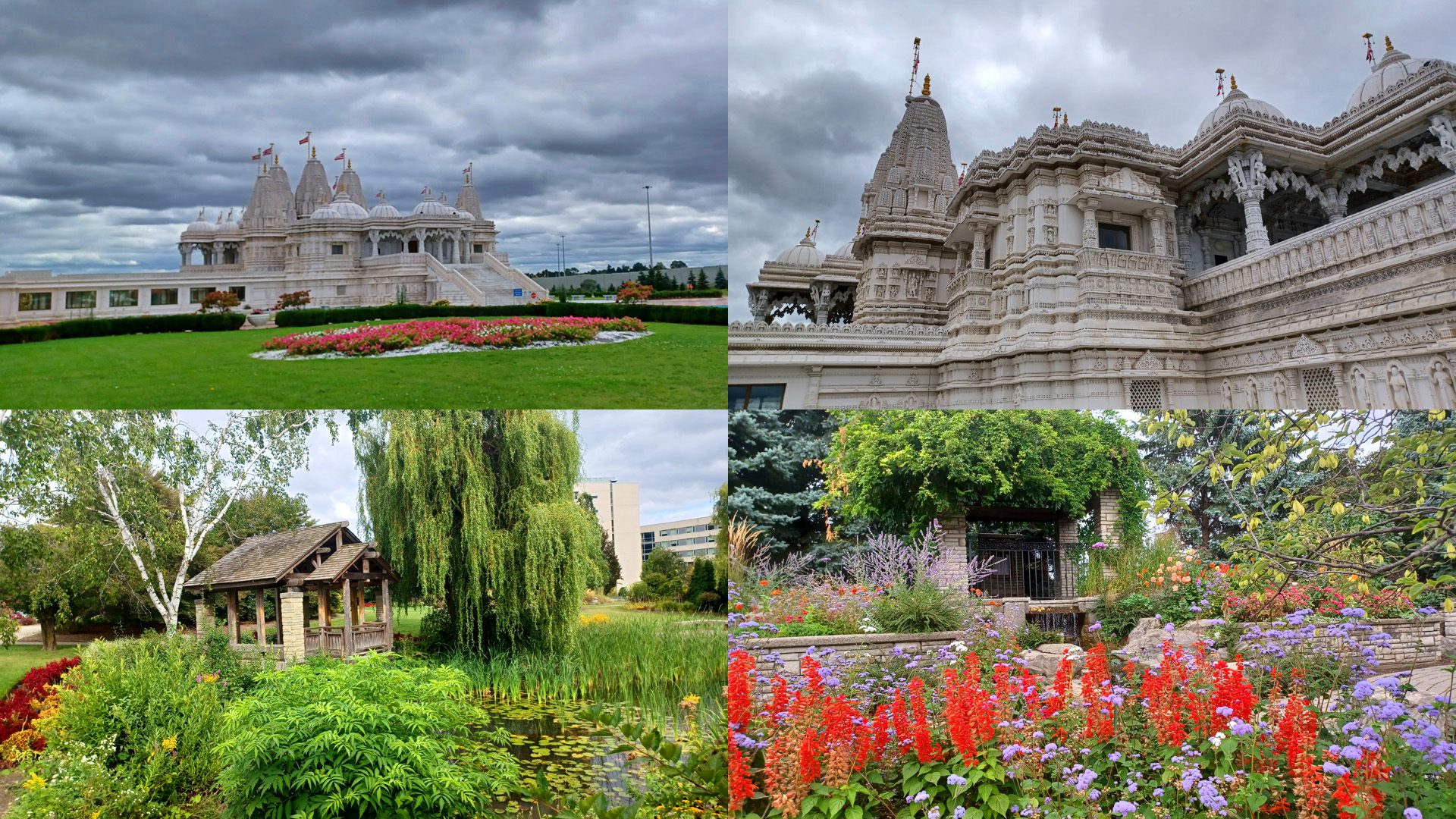
Visiting BAPS Shri Swaminarayan Mandir (a Hindu temple) & afternoon walk to HUMBER ARBORETUM.
https://hikesstaging.brucetrail.org/event/visiting-baps-shri-swaminarayan-mandir-a-hindu-temple-afternoon-walk-to-humber-arboretum/Sorry, the registration cut-off time for this hike has been reached.Not a member? Click here to join today!Hosting Club: Toronto
Category: Urban Walk
Location (Google Maps): TorontoHike Leader(s): Marlon Chen Click here to contact Hike Leader(s)
Pace: Leisurely
Terrain: Flat
Distance: 9 kmDescription
Take TTC Bus and get off at 90 Claireville Dr., then walk 2 min to the temple.Free parking is available, please drive to the main entrance and wait for a while the gate will open for you.
In the morning, We will have a tour to the BAPS Shri Swaminarayan Mandir (a Hindu temple).
After lunch, walk to visiting HUMBER ARBORETUM.
The Mandir is a house of God. Being a very sacred place, all visitors are required to abide by the following rules and regulations applicable to all areas including the Mandir, Haveli and the Museum.
- Shoes: Visitors are required to remove their footwear before entering the Mandir or any part of the Haveli complex. (Shoe racks provided within the Haveli)
- Dress Code: Casual attire. No sleeveless tops. No shorts. No skirts shorter than knee length. Sarong will be provided upon request at the reception desk.
- Conduct: Please do not touch any of the carvings within the Mandir, Exhibition or Haveli. To maintain the spiritual atmosphere observe silence inside the Mandir and the Museum.
We will have lunch at the temple, then around 1:00 pm we walk to visiting the HUMBER ARBORETUM.
If you don’t drive, then you don’t have to go back to the temple. There are buses for you at the HOMBER COLLEGE BUS TERMINAL.
==========================================================================
A short 3 min introductory video, which will help you understand the BAPS prior to the visit of the mandir. BAPS Toronto – A Brief Background – YouTube
==========================================================================
10:00 Autumn Equinox Contemplative Hike
https://hikesstaging.brucetrail.org/event/1000-autumn-equinox-contemplative-hike/Sorry, the registration cut-off time for this hike has been reached.Not a member? Click here to join today!Hosting Club: Niagara
Category: In and Out
Location (Google Maps): Quarry Road to Cave Springs loopHike Leader(s): Angela Lytle Click here to contact Hike Leader(s)
Pace: Leisurely
Terrain: Moderate
Distance: 4 kmDescription
Take some time out at the Autumn Equinox for a contemplative, mostly silent hike which offers an opportunity to reflect on the changing seasons in the beautiful escarpment landscape.The pace will be leisurely to moderate but we will make some stops along the way to immerse ourselves in the forest environment, to reflect on the equal balance of dark and light coinciding with the equinox as we turn towards the darker season, as well as to silently enjoy the nature around us. You will be invited to reflect, listen, breathe.
Most of the hike will be silent, intended to be a meditation on and immersion into the landscape.
While the pace will be moderate, the trail at Cave Springs is rocky in parts and so good footwear is essential and poles recommended. It’s been a wet year so a hat and insect repellant will keep you more comfortable. As always, carry water and be prepared for changeable weather with layers and rain gear.
This is a leisurely, contemplative in-and-out hike from Quarry Rd in Beamsville into Cave Springs conservation area and back. We will depart at 10 am and be back before noon. There is limited parking available at Quarry Rd.
Sydenham Club AGM & Potluck
https://hikesstaging.brucetrail.org/event/sydenham-club-agm-potluck/Sorry, the registration cut-off time for this hike has been reached.Not a member? Click here to join today!Hosting Club: Sydenham
Category: Hike & Potluck
Location (Google Maps): Woodford Community Hall, 107 Woodford Cres., WoodfordHike Leader(s): Maureen McFarland Click here to contact Hike Leader(s)
Pace: Leisurely: 3 km/h or less, Medium: 3 to 4 km/h
Terrain: Easy: Mostly flat and good footing., Moderate: Some hills and/or poor footing
Distance: Various choicesDescription
There will be a couple of hike choices, followed by a short AGM and then a potluck supper. Preregistration is not required. - 25September 25, 2023

Sydenham End to End in Eight Days - Moderate/Brisk pace Up to 25km per day - Please read all details for the hike before registering.
https://hikesstaging.brucetrail.org/event/sydenham-end-to-end-in-eight-days-moderate-brisk-pace-up-to-30km-per-day-please-read-all-details-for-the-hike-before-registering/Sorry, the registration cut-off time for this hike has been reached.Not a member? Click here to join today!Hike open to BTC Members only.
This is a Multi-Day Hike
You are signing up for the following dates:
2023-09-25, 2023-09-26, 2023-09-27, 2023-09-28, 2023-09-29, 2023-09-30, 2023-10-01, 2023-10-02Hosting Club: Iroquoia
Category: General Hike
Location (Google Maps): Sydenham SectionHike Leader(s): Ruth Moffatt Click here to contact Hike Leader(s)
Pace: Brisk – 4 to 5 km/hr, Medium – 3 to 4 km/hr
Terrain: Dependent on Conditions, Moderate – Some hills and/or some poor footing, Strenuous – Hilly with steep climbs and some poor footing
Distance: Up to 25km per day approximately.Description
Sydenham End to End. We will hike everyday for 8 days straight starting in Blantyre and making our way to Wiarton. Please note, you are signing up for all 8 days when you register for this hike. Sydenham section has approximately 50km of road and totals about 170km over all so we will break it into 8 days of varying distances depending on appropriate parking locations. The schedule will be sent to all registered hikers within a month of the start.If you do not live locally, I highly recommend you book accommodations somewhere in Owen Sound which is approximately mid-way of the entire section.
This hike is rated as moderate/brisk – 3-5km per hour depending on terrain. Please be honest about your physical abilities when signing up for this hike. Upon completion of the 8 days, you will be entitled to apply for the new Sydenham ETE badge.
This hike is open to members only. We will hike rain or shine. Please check daily forecast and dress appropriately for the weather. Please carry your own first aid kit, 2 litres of water and enough food and snacks to provide enough energy for a long day of hiking.
We will hike at a steady pace but will break at around 10am, noon and for an afternoon break if we are hiking past 2pm. Everyone will be expected to take turns either being the driver to the start of the hike or driving the drivers back to their vehicles at the end of the day. There will always be time to stop and take photos and enjoy the flora, fauna and scenery along the way.
Completion of all 8 days will qualify you for a new ETE badge, released this year. (see image) Current cost is $10 for members. I will try to make the badges available on our last day.
Please, no dogs.
14:00 Decew House to Morningstar Mill
https://hikesstaging.brucetrail.org/event/1400-decew-house-to-morningstar-mill/Sorry, the registration cut-off time for this hike has been reached.Not a member? Click here to join today!Hosting Club: Niagara
Category: Hike
Location (Google Maps): DeCew House, DeCew Rd., Thorold Map 3, km 29.8)Hike Leader(s): Larry Lloyd Click here to contact Hike Leader(s)
Pace: Medium
Terrain: Easy
Distance: 6 kmDescription
This hike follows the main trail along Lake Moodie to the Morningstar Mill side trail, past DeCew Falls to Morningstar Mill and returns along the same route. - 26September 26, 2023
8:00 Long Hike Wiley Road Short Hills
https://hikesstaging.brucetrail.org/event/800-long-hike-wiley-road-short-hills-33/Sorry, the registration cut-off time for this hike has been reached.Not a member? Click here to join today!Hosting Club: Niagara
Location (Google Maps):
Short Hills Wiley Road Entrance
Pace: Medium
Terrain: Moderate
: 10kmDescription
Explore Short Hills and the majestic side trails of Scarlett Tanager, Hemlock. Swayze Falls and Terrace. Register for each hike
Bring Poles water, snack, sunscreen and bug spray and dress for the weather
Car Hike: Sydenham End to End 6 of 8
https://hikesstaging.brucetrail.org/event/car-hike-sydenham-end-to-end-6-of-8/Sorry, the registration cut-off time for this hike has been reached.Not a member? Click here to join today!Hike open to BTC Members only.
Hosting Club: Toronto
Category: Car Hike
Location (Google Maps): Today we’ll meet at km 115.5 (GPS N44.704859, W80.974322), on the shoulder at the end of Dawson Rd (Keppel-Sarawak Townline), at the Dawson Road Side Trail.Hike Leader(s): Jacqueline Van Dyke Click here to contact Hike Leader(s)
Pace: Brisk
Terrain: Hilly, Variable
Distance: 17kmDescription
This is hike 6 of 8 of a Sydenham End to End series. Today we’ll be looking for fossils and passing by a very large erratic. On your way to the meeting point, you will pass by a set table sculpture and plaque commemorating 113 years of the Kemble Women’s Institute, oldest active women’s institute in the world.Please ensure you arrive prior to 8:15 to be ready for an 8:30 departure. This is a car shuttle hike so be prepared to share equally in the shuttling.
Check the weather the night before/morning of, the hike and dress accordingly. Bring enough water, snacks, and lunch to last the entire hike.
9:15 Short Hike - Pelham Road, Short Hills
https://hikesstaging.brucetrail.org/event/915-short-hike-pelham-road-short-hills-61/Sorry, the registration cut-off time for this hike has been reached.Not a member? Click here to join today!Hosting Club: Niagara
Location (Google Maps): Pelham Road entrance, Short Hills Provincial Park
Hike Leader(s): janet davey Click here to contact Hike Leader(s)
Pace: Medium
Terrain: Moderate
Distance: 6 kmsDescription
Hike the main and side trails of Short Hills Provincial Park. Bring water and bug spray.Scotsdale Farm to Silver Creek Loop
https://hikesstaging.brucetrail.org/event/scotsdale-farm-to-silver-creek-loop/Sorry, the registration cut-off time for this hike has been reached.Not a member? Click here to join today!Hosting Club: Caledon Hills
Category: Tuesday Hikers
Location (Google Maps): Main Parking at Scotsdale Farm near the main houseHike Leader(s): Jennie Greenfield Click here to contact Hike Leader(s)
Pace: Medium – 3 to 4 km/hour
Terrain: Moderate – some hills and/or some poor footing
Distance: 11.5 kmDescription
We will hike the Bennett Heritage Trail, Main Trail, Maureen Smith and Irwin Quarry Side Trails from Scotsdale Farm to Silver Creek Conservation Area and back. The hike will start on the farm lane heading past the heritage buildings and barn at Scotsdale Farm. Most of the hike will be in the forest, at times following the edge of the escarpment with a few ups and downs and rocky sections.There will be stops for water breaks along the way and a longer snack / lunch break later in the hike. Bring plenty of water, lunch, sunscreen, and bug repellent. Hiking boots required, please dress appropriately for weather conditions.

Peter Beecham Side Trail
https://hikesstaging.brucetrail.org/event/peter-beecham-side-trail/Sorry, the registration cut-off time for this hike has been reached.Not a member? Click here to join today!Hosting Club: Dufferin Hi-Land
Category: Tuesday Hike
Location (Google Maps): (Google Maps) Caledon Hills Section, Map 18. Meet at roadside parking on 4th Line East, Mono 1.5 km north of 5 Sideroad.Hike Leader(s): Tony Evangelista, Les Babbage, Inge Eckerick, Julie Daley Click here to contact Hike Leader(s)
Pace: Medium
Terrain: Slippery and Steep Sections, Strenuous
Distance: Long Hike 8.3 km Short Hike 5km or 2.7 kmDescription
From roadside parking at km 55.1, we will hike west via the Peter Beecham Side Trail until we reach the Vineyard View Side Tail (km 59.1). At this point, we will retrace our steps and return to the parking lot connecting with the Griffith Ravine Side Trail along the way.There will be two opportunities for participants to enjoy a shorter hike during the trip. Hikers can join the Griffith Ravine Side Trail at km 56.3 and return to the parking lot. (2.7 km hike) Or after reaching 3rd Line East, hikers can turn back along the Main Trail and via the Griffith Ravine Side Trail return to their cars. (5 km hike)
Bring water, lunch, snacks, and sunscreen. Hiking poles are recommended.

Sydenham Chipper (km128.4-km145.3)
https://hikesstaging.brucetrail.org/event/sydenham-chipper-km128-4-km145-3/Sorry, the registration cut-off time for this hike has been reached.Not a member? Click here to join today!Hosting Club: Beaver Valley
Location (Google Maps): Bruce Trail parking area on Lindenwood rd.
Map 33 ED 30
Km 128.4Hike Leader(s): Kristina Rettie Click here to contact the hike leader.
Pace: Brisk
Terrain: Some rocky footing, Some steep sections, Strenuous
Length of Hike: 16.9kmDescription
Please join us as we chip away through the Sydenham section. This will be a series of 11 hikes that range between 13-19kms with one longer hike of 24km. We will begin our journey at the northern end of Sydenham and work our way south to try and avoid the dangers the falling leaves and snow will bring.If you complete the 11 hikes in this series you will qualify for Sydenham’s new independent badge. Please keep track of your hikes as each hiker will be submitting their own badge request.
All hikes in this series will include a car shuttle and everyone will take a turn as a shuttle driver. Please have your vehicle passenger ready.
Sept 26 hike – meet @km128.4 carpool to 145.3
If you have any questions please text me @ 519-410-9077 (this is the most efficient way)
Please bring plenty of water and snacks/lunch
No dogs
Please text Kristina @ 519-410-9077 for morning of cancelations
COVID-19 Precautions Before, During and After your Hike
- Each hiker joining a Bruce Trail Club organized hike must perform a self-screening check before hiking.
Find Ontario’s self-assessment tool here: https://covid-19.ontario.ca/self-assessment/ - If you are experiencing COVID-19 symptoms, stay home.
Transportation
It is the Bruce Trail Conservancy’s current policy that car shuttles are allowed. It is at the discrepancy of individual hike leaders to make that decision.
Other Guidelines
- Arrive 15 minutes before the start of the hike.
- Wear sturdy footwear and appropriate attire for the weather and the terrain.
Hiking poles are a good idea in any season, especially if the terrain is rocky or slippery. In winter, snowshoes or icers/crampons are needed when conditions dictate.
Wearing appropriate clothing and footwear prevents injuries and shows consideration for a safe and positive group hiking experience. - Always carry I.D. and your health card.
- Bring sufficient water and snacks (or lunch if indicated). A minimum of 1L of water is recommended on all hikes, and 3L is recommended for long, challenging hikes in the heat of the summer.
- Bring sunscreen and insect repellent (for spring and summer hikes).
- Bring your own first aid kit.
- Please leave dogs at home.
- Each hiker joining a Bruce Trail Club organized hike must perform a self-screening check before hiking.