
Hike Schedule
Join us for a hike! Registration required.
All hikes available to BTC members. Some hikes are open to non-members.
See Refund Policy for Paid Hikes >
TIP: The calendar view displays up to 7 hikes on a day, but often there are more. Click “View more events” to see them all.
Categories
- 23August 23, 2023

9:00 Be Inspired by Chloe Cooley on Slavery Remembrance Day in NOTL
https://hikesstaging.brucetrail.org/event/900-discover-black-history-in-notl/Sorry, the registration cut-off time for this hike has been reached.Not a member? Click here to join today!Hike open to BTC Members only.
Hosting Club: Niagara
Category: Urban
Location (Google Maps):Veteran’s Memorial Park. Park on King St. at Centre
Hike Leader(s): Karen Couch Click here to contact Hike Leader(s)
Pace: Medium
Terrain: Easy
Distance: 8 kmDescription
2023 is the 230th anniversary of the passing of the very first piece of anti-slavery legislation in the British Empire, which happened in Niagara-on-the-Lake (NOTL). We have a brave and determined Black woman named Chloe Cooley to thank. This guided hike offers an opportunity to learn about Chloe Cooley and her fight for freedom. It will celebrate the strength and perseverance of people of African heritage who lived in what was once the capital of Upper Canada. We will stop at numerous sites of historical significance. “Today let us remember the…freedom fighters of the past so that they may inspire future generations to build just societies.” unesco.orgThis hike is in the open, so participants are reminded to come prepared for the sun and heat (e.g., sunscreen, hat and water).
Note: Niagara Black history hikes are offered by volunteers who have committed to their own learning, to be able to offer an informative and contemplative hike experience. These hikes are open to all and offered in a spirit of mutual learning and inclusion.
Wodehouse Karst
https://hikesstaging.brucetrail.org/event/wodehouse-karst-5/Sorry, the registration cut-off time for this hike has been reached.Not a member? Click here to join today!Hosting Club: Blue Mountains
Category: Register in person the morning of hike.
Location (Google Maps): Hike meets in the parking lot behind Tim Hortons on First St. in Collingwood.Hike Leader(s): David Little Click here to contact Hike Leader(s)
Pace: Brisk – 4 to 5 km/hr, Medium – 3 to 4 km/hr
Terrain: Moderate – Some hills and/or some poor footing, Strenuous – Hilly with steep climbs and some poor footing
Distance: 11.5kmDescription
We will drive to the Beaver Valley Ski Resort parking lot. The hike starts at the junction of the Beaver Valley Crossover Side Trail and the Kimberly Forest Side Trail. We will hike north on the Kimberly Forest Side Trail to the white blazed trail at km 83.1 then north to km 83.6 to do an in and out hike of the Wodehouse Karst Side Trail. We will then return south on the white blazed trail to the Valley Crossover Side Trail at km 79.5. From here it is all downhill to the Beaver Valley Ski Resort parking lot. Bring lunch and water.
WEDNESDAY WALKERS - Duncan Crevice and Pinnacle Rock
https://hikesstaging.brucetrail.org/event/wednesday-walkers-duncan-crevice-and-pinnacle-rock/Sorry, the registration cut-off time for this hike has been reached.Not a member? Click here to join today!Hosting Club: Beaver Valley
Location (Google Maps): Meet in the small parking lot of Duncan Crevice Caves Provincial Nature Reserve on the 9th Sideroad near Duncan. km 33.3, map 25, Edition 30
Hike Leader(s): Margaret Yaraskavitch Click here to contact the hike leader.
Pace: Medium
Terrain: Moderate
Length of Hike: 4.4 kmDescription
This hike takes us along a pleasant flat forest pathway to the impressive Duncan Crevices. There’s a walk along a field and then it’s on to the massive Pinnacle Rock. We then return to our original parking lot. Please bring water. - 24August 24, 2023
8:00 am Long Hike Jordan to Moyer / Louth
https://hikesstaging.brucetrail.org/event/800-am-long-hike-jordan-to-moyer-louth-55/Sorry, the registration cut-off time for this hike has been reached.Not a member? Click here to join today!Hosting Club: Niagara
Location (Google Maps):
Jordan Hollow Park 3039 King St Jordan
Pace: Medium
Terrain: Moderate
: 10kDescription
From Jordan Hollow Hike the main trail to Upper and Lower Balls Falls, Moyer Road or Louth and Return. You must register for each hike. Bring Poles, sunscreen, bug spray , snack and a drink and dress for the weather
9:15 Short Hike - Jordan Hollow
https://hikesstaging.brucetrail.org/event/915-short-hike-jordan-hollow-71/Sorry, the registration cut-off time for this hike has been reached.Not a member? Click here to join today!Hosting Club: Niagara
Location (Google Maps): Jordan Hollow Park, Jordan Station
Hike Leader(s): Bill Russell Click here to contact Hike Leader(s)
Pace: Medium
Terrain: Strenuous
Distance: 6 kmsDescription
Hike the main and side trails around Jordan and Balls Falls. Bring hiking boots, water, sunscreen and bug spray.Dufferin Hi-Lands End-2-End Hike 4 of 4
https://hikesstaging.brucetrail.org/event/dufferin-hi-lands-end-2-end-hike-4-of-4/Sorry, the registration cut-off time for this hike has been reached.Not a member? Click here to join today!Hosting Club: Caledon Hills
Category: End-to-End
Location (Google Maps): Meet at Mono Community Centre, southwest of km 1.2, on the gravel surface. Shuttle to start at km 15.2. Maps 20, 19.Hike Leader(s): Nancy Mooney Click here to contact Hike Leader(s)
Pace: Medium – 3 to 4 km/hour
Terrain: Easy – mostly flat and usually good footing, Moderate – some hills and/or some poor footing
Distance: From km 15.2 to 0.0, plus walk to parking area, total distance approx. 16 km.Description
This is the last of four hikes to complete the E2E. Following roads, through fields and woodlots then back on the road, the hike will take us to Mono Cliffs Provincial Park. Maps 20, 19.Urban Walk: Evening Ramble, Garrison Creek Discovery Walk
https://hikesstaging.brucetrail.org/event/urban-walk-evening-ramble-garrison-creek-discovery-walk/Sorry, the registration cut-off time for this hike has been reached.Not a member? Click here to join today!Hosting Club: Toronto
Category: Urban Walk
Location (Google Maps): Meet outside exit of Christie Subway StationHike Leader(s): Tom Swales Click here to contact Hike Leader(s)
Pace: Moderate
Terrain: Flat
Distance: 8 kmDescription
Join us for an evening walk following the city of Toronto’s Garrison Creek “Discovery Walk” following the path of the buried creek to Fort York and then along the Harbourfront Waterfront Trail. The pace will be a moderate 3.5 km/hour. - 25August 25, 2023

Blue Series - Hopeness, Jack Poste and Don Irish Side Trails
https://hikesstaging.brucetrail.org/event/peninsula-blue-series-hopeness-jack-poste-and-don-irish-side-trails-3/Sorry, the registration cut-off time for this hike has been reached.Not a member? Click here to join today!Hosting Club: Peninsula
Location (Google Maps):
Roadside Parking at the south end of Cathedral Dr, Lion’s Head, ON N0H 1W0, Canada
Hike Leader(s): Saabir Sohrab Click here to contact Hike Leader(s)
Pace: Medium
Terrain: Difficult, Easy, Moderate
Distance: 14 Approx.Description
This hike is through the mature forest of Hope Bay Forest Provincial Nature Reserve. We will hike the Hopeness, Jack Poste and Don Irish Side Trails and loop back on the main trail for some gorgeous lookouts overlooking the Hope Bay.Dress according to weather. Bring water, lunch and wear appropriate footwear for rugged terrain.Time commitment is approximately 5hrs.Map #37 edition 30
Niagara-on-the-Lake Tour
https://hikesstaging.brucetrail.org/event/niagara-on-the-lake-tour-43/Sorry, the registration cut-off time for this hike has been reached.Not a member? Click here to join today!Hosting Club: Niagara
Category: Urban
Location (Google Maps): Park on King St near Centre St, just outside of Veteran’s Memorial ParkHike Leader(s): Margaret Northfield Click here to contact Hike Leader(s)
Pace: Medium
Terrain: Easy
Distance: 6-7kmDescription
Each Friday we will explore some history of Niagara-on-the-Lake while getting a moderate paced walk. Discover where the Niagara River meets Lake Ontario. Experience the Heritage District, woods and the Niagara Parkway.
Some weeks may be totally on sidewalks and roads while others may include a mix of trail and paved pathways.
Great way to build up endurance for longer more strenuous hikes.
Plan to stay for conversation and a coffee at Sweets & Swirls, Community Centre, Niagara Stone Rd., NOTL20
Trout Hollow Conservancy, along the Big Head River
https://hikesstaging.brucetrail.org/event/trout-hollow-conservancy-along-the-big-head-river/Sorry, the registration cut-off time for this hike has been reached.Not a member? Click here to join today!Hosting Club: Sydenham
Category: Hike & Picnic
Location (Google Maps): Parking area at Beautiful Joe Park in Meaford. From hwy 26, take Victoria Crescent south and keep right at the fork. The park entrance is on your right just before the bridge.Hike Leader(s): Marilyn Jones Click here to contact Hike Leader(s)
Pace: Medium: 3 to 4 km/h
Terrain: Moderate: Some hills and/or poor footing
Distance: 6 kmDescription
Meet at Beautiful Joe Park in Meaford at 9:15. We will walk along the shady river bank crossing some boardwalks, a few ups and down to the dam/mill ruin which will be our turn around point. Back at Beautiful Joe Park we will find a spot to have our own provided lunches (this is not a pot luck). On the hike good boots and poles are recommended, please bring water. If you are unable to register, call or text the hike leader at 705-888-1496.
Hamilton Rainbow Pride Hike
https://hikesstaging.brucetrail.org/event/hamilton-rainbow-pride-hike-3/Sorry, the registration cut-off time for this hike has been reached.Not a member? Click here to join today!Hosting Club: Iroquoia
Category: General Hike
Location (Google Maps): Chedoke Golf Club Parking LotHike Leader(s): BTC Hike Leader Click here to contact Hike Leader(s)
Pace: Medium – 3 to 4 km/hr
Terrain: Easy – Mostly flat and usually good footing
Distance: 8 kmDescription
Please join Brooke Henry and Jackie Randle from the Bruce Trail Conservancy on a Rainbow/Pride Hike to celebrate the 2S-LGBTQ+ community ahead of Hamilton Pride. Whether you are part of the community or a supportive ally, we invite you to show your pride on the Trail by wearing rainbow colours. Be prepared for a moderate hike. We will hike at a medium pace with the planned distance being approximately 8 km.All hikers will receive the Bruce Trail Conservancy Pride Badge as a thank-you for joining us.
Starting at Chedoke Golf Club, the hike will head up the Bruce Trail as it follows the Chedoke Radial Trail before entering the Iroquoia Heights Conservation Area and looping back via the Iroquoia Heights Side Trail.
Hikers are invited to join us after the hike at nearby Steeltown Cider for an optional drink to kick off the weekend.
Parking for the hike is available at Chedoke Golf Club.
If you plan on joining us at Steeltown Cider, please email Brooke Henry at bhenry@brucetrail.org
Please, no dogs.
- 26August 26, 2023

3R2Rs in ONE Day!
https://hikesstaging.brucetrail.org/event/3r2rs-in-one-day/Sorry, the registration cut-off time for this hike has been reached.Not a member? Click here to join today!Hosting Club: Blue Mountains
Category: Experienced hikers ONLY/STRENUOUS
Location (Google Maps): Bruce Trail parking lot on 33/34 SideroadHike Leader(s): Hart Fischer Click here to contact Hike Leader(s)
Pace: Brisk – 4 to 5 km/hr, Medium – 3 to 4 km/hr
Terrain: Strenuous – Hilly with steep climbs and some poor footing
Distance: 38kmDescription
Please refer to the written description of the Spring/Summer/Fall Rim2Rim Badge on the BMBTC website.
All three RIM hikes MUST be completed on the same day. The 3R2Rs in a DAY Challenge badge will be red, orange and yellow to reflect the level of difficulty. Currently, this hike badge is only available by registering on-line.
You must have a vehicle to drive yourself to each RIM.
You are encouraged to have a partner hiker with similar pace to complete the challenge as this will not be a traditional hike led by a leader, everyone’s pace differs. You MUST have a cell phone since there are no leaders/sweeps or drop out spots with volunteers. If you use the designated parking spots you will never be more than 6 kms away from your vehicle. You determine your rest stop frequency, and snack or meal needs as well as refreshments. You can decide what items to leave in the car (extra water and snacks) that don’t need to be carried for each “leg of the challenge”. You can plan to have lunch breaks at your car if desired. You must ensure you have plenty of water in your pack for each RIM.
As this hike requires a significant amount of driving from one RIM to the next, we have included an outline below of the approximate time involved. Car travel times [according to Google Maps] from Bruce Trail Parking on 33/34 Sideroad [44.428118, -80.276849] to Devil’s Glen Provincial Park parking [44.36161, -80.20824] = 14 min for 14 km Car travel times [according to Google Maps] from Devil’s Glen Provincial Park parking [44.36161, -80.20824] to Noisy River Nature Preserve parking [44.27499, -80.20731] = 12 min for 15 km
You and your partner should plan to set a pace between 4-6 km/hr
● Approximate time needed to finish about 40 km @ 6 km/hr = 6 hrs + 40 min + half an hour travel/resting/eating/drinking time = just over 7 hrs
● Approximate time needed to finish about 40 km @ 5 km/hr = 8 hrs + half an hour travel/resting/eating/drinking time = 8 and 1/2 hrs
● Approximate time needed to finish about 40 km @ 4 km/hr = 10 hrs + half an hour travel/resting/eating/drinking time = 10 and 1/2 hrs
(The distance as measured by GPS is actually closer to 38km)
Beaver Valley Annual End to End Event (5 days) NEW BADGE!
https://hikesstaging.brucetrail.org/event/beaver-valley-annual-end-to-end-event-5-days-new-badge/Sorry, the registration cut-off time for this hike has been reached.Not a member? Click here to join today!This is a Multi-Day Hike
You are signing up for the following dates and times:
2023-08-26 at 07:30
2023-08-27 at 07:30
2023-09-02 at 07:30
2023-09-03 at 07:30
2023-09-04 at 07:30Hosting Club: Beaver Valley
Location (Google Maps): Meet at Kolapore Uplands parking lot on Hwy 2, 750 km south of where the trail crosses the road at km 23.8 Map 25.
Hike Leader(s): Glenda Collings Click here to contact the hike leader.
Pace: Medium
Terrain: Moderate, Some rocky footing, Some steep sections, Strenuous
Length of Hike: The 5 hikes will range from approx. 22 km to 28 km. You set your own pace but medium will get the job done in timely fashion.Description
Please note that the event will be subject to current COVID protocols. It is recommended that hikers wear masks on the bus to help protect all of us from risk of contagion.The registration fee of $100.00, members, $110.00 non members includes the online registration fee, transportation to the trail heads, refreshments and the End to End badge. There are no refunds for this event.
Further details of the event will be sent to participants once registration is received. Please arrive at 7:30 a.m. for check in and bus loading. The bus will leave promptly at 8:00 a.m.
COVID-19 Precautions Before and During the hike
- Each hiker joining a Bruce Trail Club organized hike must perform a self-screening check before hiking.
Find Ontario’s self-assessment tool here: https://covid-19.ontario.ca/self-assessment/ - If you are experiencing COVID-19 symptoms, stay home.
- Personal Protective Equipment:
- Hikers may choose to wear masks on the trail and should wear masks on the bus.
Car Hike: Cherry Beach Down town Toronto
https://hikesstaging.brucetrail.org/event/car-hike-cherry-beach-down-town-toronto-2/Sorry, the registration cut-off time for this hike has been reached.Not a member? Click here to join today!Hosting Club: Toronto
Category: Car Hike
Location (Google Maps): Free parking lot at the end of Cherry StreetHike Leader(s): Mohammad Aghamiri, Amir Alemohammad Click here to contact Hike Leader(s)
Pace: Moderate
Terrain: Flat
Distance: 14-15 KMDescription
Park in Cherry Beach parking lotWe will explore Tommy Thompson park along Lake Ontario and listen to the birds and visit light house at the end of park.
Some safety procedures during the hike:
1-Hikers must stay between the leader and the sweep.
2-Hikers must advise the leader or the sweep if they wish to leave the group.
3- Hikers must follow the whistle instructions: 1 blast- stay where you are; 2 blasts come to the leader; 3 blasts – come to the leader quickly.
4-Hike leader may request volunteers to stop at trail intersections, they need to help hikers to the direction the group walk and wait till they see the sweep .
5-Hikers have to make sure they can see the persons behind and in front of them.

Bus Hike: Toronto Section E2E 1 of 4 (Hilton Falls C.A./Speyside)
https://hikesstaging.brucetrail.org/event/bus-hike-toronto-section-e2e-1-of-4-hilton-falls-c-a-speyside/Sorry, the registration cut-off time for this hike has been reached.Not a member? Click here to join today!Trip Information
Departure Time: 08:30
Return to City Time: 17:00
Departure Point: Kipling Departure PointOptional Items
Hosting Club: Toronto
Category: Bus Hike
Location (Google Maps): Toronto Section – Hilton Falls Conservation Area to Speyside Natural AreaHike Leader(s): Tom Swales & Celia Ho Click here to contact Hike Leader(s)
Pace: Moderate
Terrain: Rocky, Variable
Distance: 15 kmDescription
Join us to hike the Toronto section of the Bruce Trail in a series of four moderate pace/moderate distance Level 2 hikes (15-16 km a day). Those who complete all 4 hikes will qualify for the Toronto club’s diamond E2E badge. The badge fee ($5 members/$15 non-members) will be collected on Hike #3.Members may alternatively choose to use the hikes to earn the new stained glass Limehouse stone bridge fundraiser badge. Available to members only the badge fee is $30 and proceeds go to protecting and preserving the Bruce Trail. Please contact the Hike Leader if you are interested in earning the fundraiser badge for further instructions. This badge can be earned only on one of the series of special group hikes led by a BTC Hike Leader and not individually.
Hikers who complete all 4 hikes will qualify for either the diamond badge or stained glass kfundraiser badge, as they have chosen.
Any hikers are welcome to join the hikes regardless of working towards one of E2E badges.
There will be a refreshment/social stop in Milton after the hike before returning to the Kipling Station departure point by 5:30 PM. Dropout at 11,3 km.
Note: This hike will not be visiting the falls at Hilton Falls Conservation Area (we take only the main Bruce Trail).
Hoggs Falls
https://hikesstaging.brucetrail.org/event/hoggs-falls-5/Sorry, the registration cut-off time for this hike has been reached.Not a member? Click here to join today!Hosting Club: Blue Mountains
Category: Register in person the morning of hike.
Location (Google Maps): Hike meets in the parking lot behind Tim Hortons on First St. in Collingwood.Hike Leader(s): Michael Treuman Click here to contact Hike Leader(s)
Pace: Leisurely – 3 km/hr. or less
Terrain: Moderate – Some hills and/or some poor footing
Distance: 5kmDescription
We will park at km 67.5 on the Lower Valley Road in the Beaver Valley section. We will hike on the Hoggs Falls Lower Side Trail, join up with the white blazed trail and continue north. Meeting up with the Hoggs Falls Upper Side Trail, we will hike west to form a loop back to the cars. The trail leads through forests, climbs out of the creek valley and follows along the edge of an open field before dropping down again onto an old logging road and into the beginning of a wide valley. Bring a snack or lunch and water.
9:00 Short Hills & 12 Mile Creek
https://hikesstaging.brucetrail.org/event/900-short-hills-12-mile-creek/Sorry, the registration cut-off time for this hike has been reached.Not a member? Click here to join today!Hosting Club: Niagara
Category: Loop
Location (Google Maps): Park at the end of Lockhart Dr, St CatharinesHike Leader(s): Margaret Northfield Click here to contact Hike Leader(s)
Pace: Medium
Terrain: Moderate
Distance: 12kmDescription
On this loop we will hike up hydro hill to connect with the main Bruce Trail and then connect with 12 Mile Creek and eventually return via the Twelve Side Trail.Poles, water and snack recommended.
Car Hike: A trek, a token, and a treat!
https://hikesstaging.brucetrail.org/event/car-hike-a-trek-a-token-and-a-treat/Sorry, the registration cut-off time for this hike has been reached.Not a member? Click here to join today!Hosting Club: Toronto
Category: Car Hike
Location (Google Maps): We will meet at roadside parking at km 35.2 (Map 17 of the Bruce Trail Reference Guide, Edition 30) on the south side of Coolihans Sideroad where it intersects with Glen Haffy Road.Hike Leader(s): Monica Pasquali Click here to contact Hike Leader(s)
Pace: Leisurely
Terrain: Variable
Distance: 4 kmDescription
Celebrate the end of summer break with a trek, a token, and a treat!First, we’ll do an out-and-back trek (approximately 4 km total) to explore “The Dingle”, which is a narrow-wooded valley in the Caledon Hills section of the Bruce Trail.
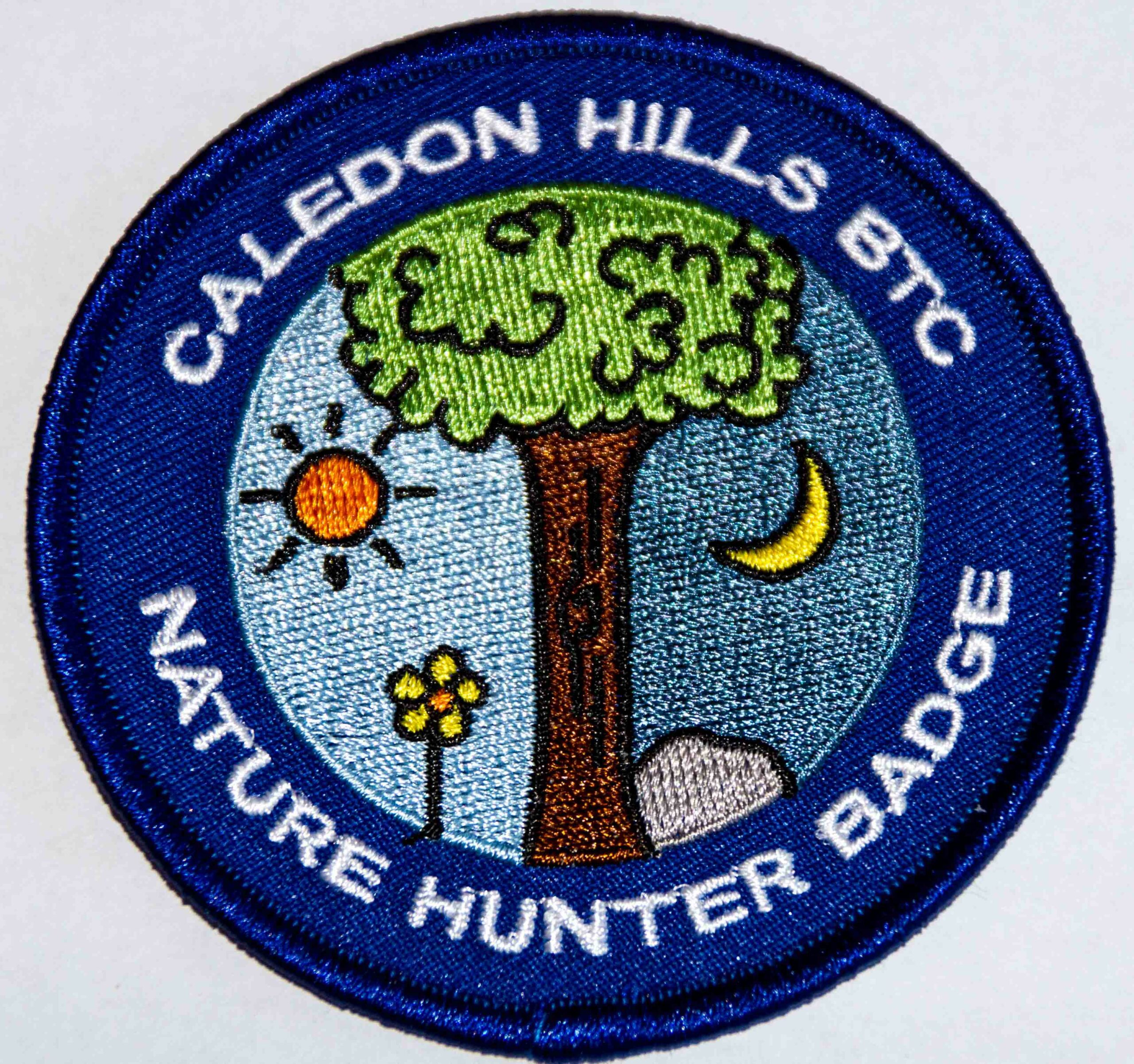
While on our hike, I will provide assistance to hikers of all ages who are interested in earning a token: the Caledon Hills Bruce Trail Club’s Nature Hunter Badge (http://caledonbrucetrail.ca/hiking/club-badges/nature-hunt-badge/)! I will point out and identify trees and wildflowers as we hike, as well as explain plant life cycles. This badge can be earned by children and adults alike, so this hike is for everyone! Please register all people who are planning on coming along on the hike.
Afterwards, we’ll make the short 5-minute drive to Daisy Cones (19258 Airport Road) in order to treat ourselves to some delicious Kawartha Dairy ice cream before we head home.
You should bring enough water and food for a 2-hour hike, comfortable hiking shoes, sun and bug protection, appropriate clothing for the weather, a camera if you want to earn the Nature Hunter Badge, and money if you intend to join us at Daisy Cones after the hike.
Car Hike: Elora Cataract Rail Trail
https://hikesstaging.brucetrail.org/event/car-hike-elora-cataract-rail-trail/Sorry, the registration cut-off time for this hike has been reached.Not a member? Click here to join today!Hosting Club: Toronto
Category: Cancelled
Location (Google Maps): Near Forks of the Credit P.P. Map 15Hike Leader(s): Al Brown Click here to contact Hike Leader(s)
Pace: Moderate
Terrain: Flat
Distance: 12 kmDescription
We will car pool to the start of the hike in Hillsburgh. The trail passes through mixed farmland and the village of Erin. The trail is mostly open with forest canopy in some locations. The trail is a former railway corridor and therefore flat. We can expect to make a brisk pace. Hiking boots are optional.After the hike those so inclined may gather at a restaurant in Erin to replace electrolytes.
The meeting point for the hike is where the Elora Cataract Trail crosses Mississauga Road about 3.5 km north along Mississauga Road from Belfountain.
Rural Rocks & Obese side trails
https://hikesstaging.brucetrail.org/event/rural-rocks-obese-side-trails/Sorry, the registration cut-off time for this hike has been reached.Not a member? Click here to join today!Hosting Club: Sydenham
Category: General Hike
Location (Google Maps): The Owen Sound Galaxy Theatre parking lot. Meet at the tall “Galaxy Centre” sign next to the traffic lights.Hike Leader(s): Ian Mills Click here to contact Hike Leader(s)
Pace: Medium: 3 to 4 km/h
Terrain: Strenuous: Hilly with steep climbs and some poor footing., There might be muddy sections.
Distance: 5 KmDescription
Explore Rural Rocks and Obese side trails which are very rocky is some sections. We will be climbing over, under and between boulders. Good hiking shoes and sticks recommend as this will be rather rugged walking. Map #35 edition 30. If you are unable to register, please call or text the leader @416-848-8818. - Each hiker joining a Bruce Trail Club organized hike must perform a self-screening check before hiking.