Hike Schedule

Join us for a hike! Registration required:

All hikes available to BTC members. Some hikes are open to non-members.

Read hiker guidelines >

TIP: The calendar view displays up to 7 hikes on a day, but often there are more. Click “More events” to see them all.

Show Filters

Categories

Reset Filters
< 2023 >
June 08 - June 11
  • 08
    June 8, 2023

    8:00 am Long Hike Jordan to Moyer / Louth NEW TIME

    8:00 AM-10:30 AM
    06/08/2023
    Sorry, the registration cut-off time for this hike has been reached.
    Not a member? Click here to join today!

    Hosting Club: Niagara

    Location (Google Maps):

    Jordan Hollow Park 3039 King St Jordan

    Hike Leader(s): Alan Laver

    Pace: Medium
    Terrain: Moderate
    10k

    Description

    From Jordan Hollow Hike the main trail to Upper and Lower Balls Falls, Moyer Road or Louth and Return. You must register for each hike. Bring Poles, sunscreen, bug spray , snack and a drink ices and dress for the weather

    Peninsula End to End – Wiarton to Tobermory – 10 days- June 8- 17, 2023

    8:00 AM
    06/08/2023
    Sorry, the registration cut-off time for this hike has been reached.
    Not a member? Click here to join today!

    Hike open to BTC Members only.

    This is a Multi-Day Hike

    You are signing up for the following dates:

    2023-06-08, 2023-06-09, 2023-06-10, 2023-06-11, 2023-06-12, 2023-06-13, 2023-06-14, 2023-06-15, 2023-06-16, 2023-06-17

    Hosting Club: Peninsula

    Location (Google Maps): Peninsula ETE in 10 – Start June 8 Finish June 17
    Please read all details in the hike description before registering for the hike.

    Hike Leader(s): Ruth Moffatt Click here to contact Hike Leader(s)

    Pace: Brisk, Medium
    Terrain: Difficult, Moderate
    Distance: Approx 15-20km per day depending on available parking.

    Description

    Please note there are no refunds or transfers. If you register for this hike and change your mind, please cancel your name from the registered list as there will be others on the waitlist. 

    It is very important to read all the details for this hike prior to registering.

    Overview

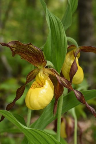
    This is a special series of 10  hikes to complete the Peninsula section of the Bruce Trail.  There will be a new accomplishment badge, included in the registration fee featuring the Turkey Vulture  – which has been designed by Joe Borges and will hopefully be made available on our last day. In addition to hiking the main trail, we will be collecting bird songs via the Merlin app (you do not need a cell phone) to go toward the Peninsula Birder Badge as well as the Fern Badge and Orchid Badge as we see/hear them. A few landlocked Side Trails (like McKay’s Harbour, High Dump, part of Devil’s Monument, Sydney Bay Bluff Lookout) will also be included for those who wish to log trails for the Side Trails badge. If you choose, many other side trails can be done after we finish each day’s hike. This is an option for participants.

    For this E2E in 10, we will be following the main trail northbound eventually finishing in Tobermory. Please note that you are signing up for the entire series of 10 hikes as a Group Hike. The Peninsula in 10 series is geared to experienced long distance hikers with the expectation of a 3  to 5.0 km/ hr. pace maintained over a 15km plus day.  The section is approximately 165km so daily distances will be based on available parking. No dropout points have been established and therefore hikers who must drop out, will be responsible for their own transportation back to their vehicle. Please note that transportation back to your vehicle is very limited in this section.  Please be honest about your hiking abilities. We will hike at a steady pace but there will be plenty of time to take pictures and to enjoy the flora and fauna of this beautiful but challenging section.

    This particular set of 10 hikes is intended to be Moderate/BriskPlease be honest about your degree of physical fitness prior to registration. It is a group hike so it is important you are able to keep pace with the person in front of you.

    This ETE in 10 and the one scheduled in May cannot be combined to complete one ETE but you can register to complete them both if you would like two ETE’s.

    Attire and Daily Hikes. 

    Hikers will be expected to be wearing proper hiking boots and layered clothing with the expectation of cool and possible wet weather.  Sufficient food and water for a full day of hiking is required as well as hiking poles (if you use them), and wet weather gear is strongly recommended. Bug spray is also suggested. Clothing adjustments, bio-breaks are as needed. Please let the sweep person know and they will wait for you. A morning break around 10am and a 10-15 minute on-trail lunch break will be scheduled. An afternoon break will be based on our expected finish time. Depending on weather conditions, these times may vary.

    Fee

    The fee goes towards supporting the Peninsula Bruce Trail Club, which in turn supports the mission of the Bruce Trail Conservancy, which is: “Preserving a ribbon of wilderness, for everyone, forever.”  

    For the time being, registration for the Peninsula E2E-in-Ten will be limited to members of the Bruce Trail Conservancy.  Hikers may be a member of any section.

    Car Shuttles and Missing Hikes

    maximum of 3 (of the 10) hikes can be self-completed as a result of scheduling challenges, but it is intended that this badge be earned while hiking as part of a group led by a certified hike leader. Car shuttles are shared amongst the hikers. If you intend to arrive at the meeting locations with more than yourself in your vehicle, please let the hike leader know in advance. Car pooling to our meeting spot with 2 people in the car is generally ok but we would like to minimize and equalize the driving/shuttling as much as possible so it is fair for all participants. If you know you will miss more than 3 of the hikes, it’s likely best to sign up for another end to end, however, whatever hikes are completed on this series may go toward completion of an independent ETE for the regular Peninsula ETE flowerpot badge. If you are able to complete the hikes you know you will miss ahead of time, all the better.

    Transportation

    This series will be through-hikes and will require car shuttling. You must be willing to drive and/or to be a passenger. Some parking locations require paid parking, and hikes that enter Bruce Peninsula National Park.  The fee for this E2E-in-10 does not include any parking/entry fees for hikers. These costs, where applicable, will be shared amongst all participants unless you have a parking or park pass.

    Leave No Trace

    Please remember, like all hikes, this is a Leave No Trace hike. Pack out whatever you pack in. Do not toss anything onto or into any sections of the trail. We will also try to leave the trail better than we found it so we will be collecting collectable garbage we might see along the way. Daily volunteers to collect trail trash will be supplied with a bag. Dogs will not be welcome on this hike.

    Accommodations

    It is strongly recommended you make reservations for accommodations as soon as you register for the hike. Accommodations can be made anywhere in the Peninsula but I recommend staying in Lion’s Head which is about mid-way of the section. There is a motel, a campground, a hostel, and several B&B’s. Moving from accommodation to accommodation, while in the Peninsula, is doable but generally not recommended. If you require suggestions on where to stay or if you would like a roommate, I can share your email with any other registered participants who are also looking for shared accommodations. Please let me know.

    Daily

    We meet for each hike by at least 7:45am each day. A schedule for meeting and start locations will be sent to each participant in May. We will hike northerly each day. The schedule is subject to change.

    This hike is limited to 12 participants including the hike leader.

    Sydenham E2E Hike 8 of 14

    9:15 AM-2:30 PM
    06/08/2023
    Sorry, the registration cut-off time for this hike has been reached.
    Not a member? Click here to join today!

    Hosting Club: Caledon Hills
    Category: End-to-End
    Location (Google Maps): Meet at roadside parking on Sideroad 15 at km 82.1. Shuttle to start at Grey Sauble Conservation Authority Headquarters, km 92.9.

    Hike Leader(s): Nancy Mooney Click here to contact Hike Leader(s)

    Pace: Medium – 3 to 4 km/hour
    Terrain: Moderate – some hills and/or some poor footing, Strenuous – hilly with steep climbs and some poor footing
    Distance: From km 92.9 to 82.1 plus short side trail, total 11.3 km.

    Description

    From Inglis Falls Conservation Area, this hike will take us up the east side of Owen Sound through the Palisades, a climb up the Centennial Tower to view the city, through a forest, a meadow, past a beaver pond, the edge of the golf course and, more crevices. A shorter distance with lots to see.

    9:15 Short Hike - Jordan Hollow

    9:15 AM-10:45 AM
    06/08/2023
    Sorry, the registration cut-off time for this hike has been reached.
    Not a member? Click here to join today!

    Hosting Club: Niagara
    Category: In and Out
    Location (Google Maps): Jordan Hollow Park, Jordan Station

    Hike Leader(s): Bill Russell Click here to contact Hike Leader(s)

    Pace: Medium
    Terrain: Strenuous
    Distance: 6 kms

    Description

    Hike the main and side trails around Jordan and Balls Falls.  Bring hiking boots, water, sunscreen and bug spray.

    Discover the Flora and Fauna of the Whitetail Refuge Nature Reserve

    9:30 AM-1:00 AM
    06/08/2023
    Sorry, the registration cut-off time for this hike has been reached.
    Not a member? Click here to join today!

    Hosting Club: Caledon Hills
    Category: Nature Walks
    Location (Google Maps): Mono Centre Community Centre, 754483 Mono Centre Road – Park at the east end of the parking lot in the gravel area.

    Hike Leader(s): Gary Hall Click here to contact Hike Leader(s)

    Pace: Leisurely – 3 km/hour or less
    Terrain: Moderate – some hills and/or some poor footing
    Distance: 3 – 4 km

    Description

    Join Mark Whitcombe and Dave Dawe while we explore the new BTC Whitetail Refuge property. Dave is the Land Steward here and loves sharing what he knows of the local flora and fauna along with some rehabilitation considerations. Mark is a generalist ecologist and botanist, and was a former Land Steward for the Pinnacle Rock BTC property up in the Beaver Valley area.

    Blantyre to Walter’s Falls

    9:30 AM
    06/08/2023
    Sorry, the registration cut-off time for this hike has been reached.
    Not a member? Click here to join today!

    Hosting Club: Sydenham
    Category: General Hike
    Location (Google Maps): Roadside parking on the north shoulder where Holland-Sydenham Townline meets County Road 29, at km 10.3 (Map 29)

    Hike Leader(s): Marilyn Jones Click here to contact Hike Leader(s)

    Pace: Medium: 3 to 4 km/h
    Terrain: Moderate: Some hills and/or poor footing, Strenuous: Hilly with steep climbs and some poor footing.
    Distance: 9.5 or 12.8 kms

    Description

    We will carpool from the meeting place to Blantyre (km 0.0, Map 28).  There are some steep descents and climbs, with boardwalks, streams and some lovely views.  When we arrive back at the cars on County Road 29, continuing on to hike the Walter’s Falls loop is optional, another 3.3 kms.  Please bring a lunch or snack and water, bug spray and sunscreen.  If you are unable to register, please call the hike leader at 705-888-1496.

    Toronto, Toronto Islands

    5:45 PM-9:00 PM
    06/08/2023
    Sorry, the registration cut-off time for this hike has been reached.
    Not a member? Click here to join today!

    Hosting Club: Toronto

    Location (Google Maps): Meet inside the Jack Layton Ferry Terminal, foot of Bay Street, beyond the cashiers selling the ferry tickets, in the open area with the benches and Muskoka chairs. From Union Station take the LRT one stop to “Ferry Docks” or take bus number #19 or #72 on Bay Street southbound to the Queens Quay. Walk across Queen Quay south through the park to the ferry terminal.

    Hike Leader(s): Miriam Stevens, Tom Swales Click here to contact Hike Leader(s)

    Pace: Leisurely
    Terrain: Flat
    Distance: 8-12 km

    Description

    After a day’s work, come and “cool off” on the Toronto Islands free of fumes and traffic to enjoy the view of the city skyline and Toronto’s own beautiful island parkland oasis away from the city. Pack a dinner for a sit-down picnic. Note that food is not available for purchase on the islands early in the season. Bring a warm jacket and flashlight. Return ticket for the ferry is approximately $8.70, $5.60 for seniors. The hike will take place rain or shine. Toronto Island Evening Hikes will take place every Thursday in May and June, same time and meeting place. The route and time we return to the city may vary depending if the ferries are running on the Spring or Summer (starts in May) schedule.  Contact Hike Leaders via the Contact form for further information or to confirm the current ferry schedule that will be in place the week of the hike. Registration is not required for this hike – just meet the Hike Leader at the above location.


  • 09
    June 9, 2023

    Blue Series Hike : 5 Side trails combo in Lions Head

    9:00 AM
    06/09/2023
    Sorry, the registration cut-off time for this hike has been reached.
    Not a member? Click here to join today!

    Hike open to BTC Members only.

    Hosting Club: Peninsula

    Location (Google Maps): Cemetery Road Parking (44.967285, -81.230603) in Lions Head

    Hike Leader(s): Saabir Sohrab, Julie Bennett Click here to contact Hike Leader(s)

    Pace: Medium
    Terrain: Moderate
    Distance: 14km

    Description

    Meeting point – Cemetery Road Parking (44.967285, -81.230603) in Lions Head

    We will carpool to the McCurdy Drive Municipal Parking Lot, which is a paid parking lot, and the fee will be split evenly among hikers.

    This is a scenic hike. Beginning our hike on the main trail (81.6), we will pass through Giant Cauldron and Lion’s Head Pothole Side Trails. The route takes us through many scenic lookouts that Lion’s Head is famous for. We exit the main trail (78.0) on to the Inland Side Trail with a detour to explore Donna Baker, McKay’s Harbour, and Geodetic Side Trails (leads to the 45 degrees Geodetic Bench Mark), before returning to the meeting point at Cemetery Road Parking.

    This hike is approximately 14 kilometers at a moderate pace of 3km/h, in rough terrain with ascents and descents navigating rocks and tree roots along the path. Wear sturdy footwear, bring sunscreen, bug repellent, and masks (optional) for carpooling. Allow 6 hours for the hike – includes carpooling, WOW! time, and breaks.

    All kilometre map references are based on the Bruce Trail Guide Book Edition 30, Map #38.

    9:00 am Niagara on the Lake Tour & Some Yoga

    9:00 AM-11:00 AM
    06/09/2023
    Sorry, the registration cut-off time for this hike has been reached.
    Not a member? Click here to join today!

    Hosting Club: Niagara

    Location (Google Maps):

    Veteran’s Memorial Park, park just outside the park on King St.

    Hike Leader(s): Robin Garrett Click here to contact Hike Leader(s)

    Pace: Medium
    Terrain: Easy
    Distance: 6 km

    Description

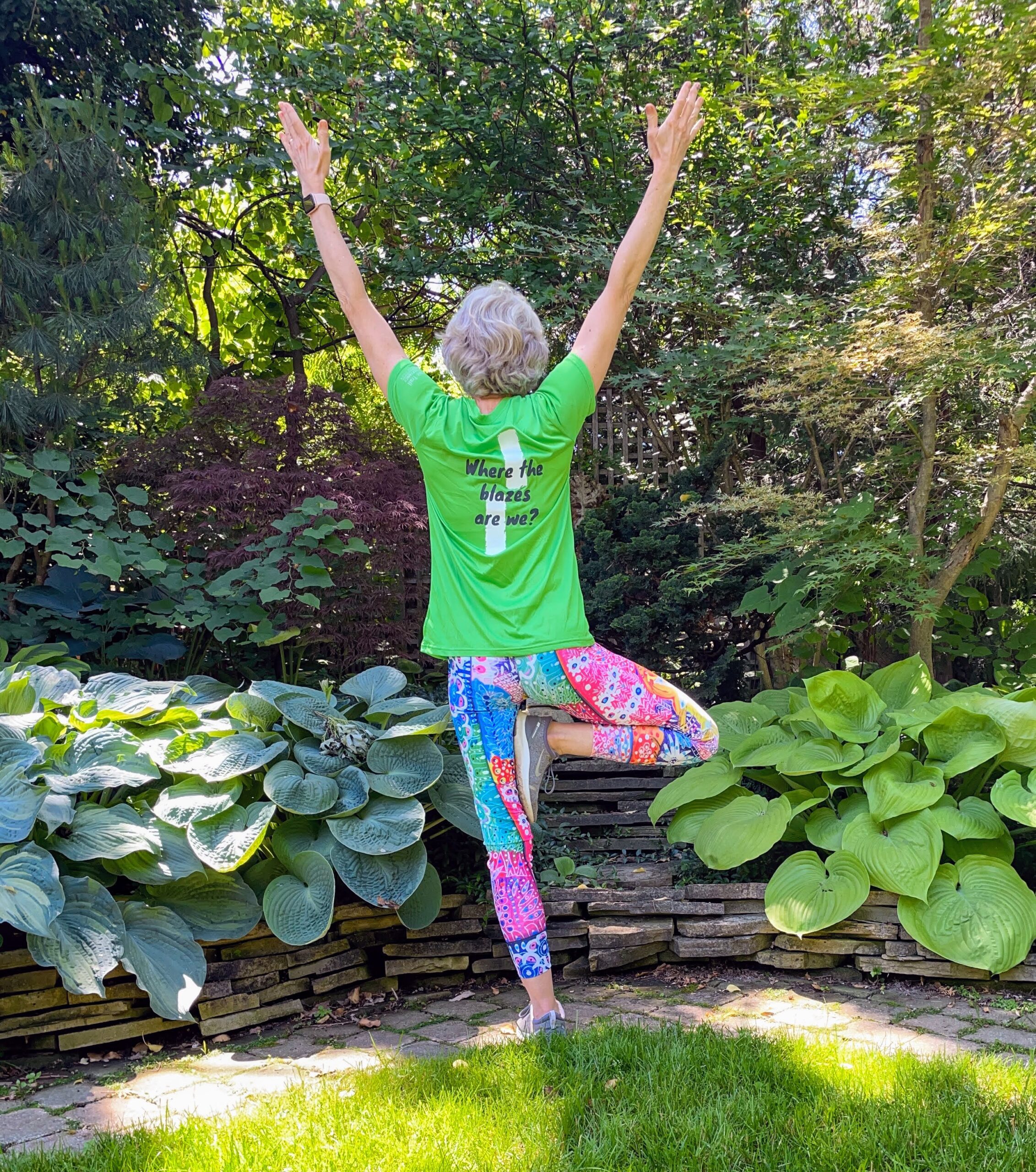
    Enjoy the benefits of pausing for a yoga practice as we tour through the trails, parkland and Historic Niagara-on-the-Lake. No mat required. Movement will focus on a flow of standing poses designed especially for hikers. Plan to stay for conversation and a warm cup of coffee or tea at Sweets & Swirls, Community Centre, Niagara Stone Road, NOTL.

    Friends of CHBTC Weekday Nature Seeker Hike

    9:30 AM-12:00 PM
    06/09/2023
    Sorry, the registration cut-off time for this hike has been reached.
    Not a member? Click here to join today!

    Hosting Club: Caledon Hills
    Category: Nature Walks
    Location (Google Maps): Meet at the Bruce Trail Parking Lot on Mono 5 Sideroad on the north side of the road where the Trail crosses. Google GPS Coordinates: 43.974055, -79.984988

    Directions: From Airport Road turn east onto 5 Sideroad and drive for 600 metres. The parking lot is on the left hand side.

    Hike Leader(s): Sandy Green Click here to contact Hike Leader(s)

    Pace: Leisurely – 3 km/hour or less
    Terrain: Easy – mostly flat and usually good footing
    Distance: 5.5 kilometres

    Description

    Join with other friends of the Caledon Hills Club to leisurely explore parts of the Main Trail, Hockleycrest Side Trail, Darcy’s Side Trail, and the Tall Timbers Bruce Trail Conservancy protected natural area. Bring your choice of hydration and snacks. Sturdy footwear is highly recommended.

  • 10
    June 10, 2023

    Laura Secord Event Hike

    5:45 AM-2:30 PM
    06/10/2023
    Sorry, the registration cut-off time for this hike has been reached.
    Not a member? Click here to join today!

    Hosting Club: Niagara
    Category: Event Hikes
    Location (Google Maps): Niagara Regional Municipality Office, 1815 Sir Isaac Brock Way, Thorold ON L2V 4Y6

    Pace: Medium
    Terrain: Moderate
    Distance: 32 kms

    Description

    This is a self led hike.  Hike along the Bruce Trail from Laura Secord’s homestead in Queenston to Decew House in Thorold.    Participants will be transported by bus from check in to the start of the hike and will hike at their own pace to the final checkpoint.  Masks are optional on buses.  There will be drivers available to drive you back to your car once your hike is over.  Masks must be worn in the car.

    Bring snacks, water and bug spray.  We also recommend sunscreen, basic first aid supplies, spare socks and a cell phone.  There will be 3 checkpoints (2 along the trail and one at the end) to replenish water and snacks and anyone wishing to drop out of the hike should do so at a checkpoint. Hikers are responsible for informing club volunteers of their intention to drop out.

    Event coordinator: Janet Davey, needstogolf@gmail.com

    Hockley Valley - the 4th Line Part 1

    7:45 AM-2:00 PM
    06/10/2023
    Sorry, the registration cut-off time for this hike has been reached.
    Not a member? Click here to join today!

    Hosting Club: Blue Mountains
    Category: Register in person the morning of hike.
    Location (Google Maps): Hike meets in the parking lot behind Tim Hortons on First St. in Collingwood.

    Hike Leader(s): Anhong MacNeil Click here to contact Hike Leader(s)

    Pace: Medium – 3 to 4 km/hr
    Terrain: Moderate – Some hills and/or some poor footing, Strenuous – Hilly with steep climbs and some poor footing
    Distance: 11km

    Description

    We will park on the 4th Line in the Caledon Hills section. We begin hiking at km 54.3 and hike to km 49.0 (Airport Rd) and return. The trail descends by way of switchback, passes through valleys and climbs the eastern ridge. There are significant hills on this hike. Bring a snack or lunch and water.

    Car Hike: Hockley Rd 5 Line to 3rd Line EHS

    8:15 AM-1:30 AM
    06/10/2023
    Sorry, the registration cut-off time for this hike has been reached.
    Not a member? Click here to join today!

    Hosting Club: Toronto
    Category: Car Hike
    Location (Google Maps): Bruce Trail parking lot 5th Line EHS, Hockley Rd,

    Hike Leader(s): Amir Alemohammad, Mohammad Aghamiri Click here to contact Hike Leader(s)

    Pace: Moderate
    Terrain: Challenging, Hilly
    Distance: 14-16 km

    Description

    This will be a beautiful loop hike in Bruce Trail main trail and some sidetrails between 5th and 3rd Line EHS (Hockley Rd). Mostly hilly with some scenic views.

    #4/5 Loop of Toronto Hike for Urban Hiking Badge - 16km

    9:00 AM-2:00 PM
    06/10/2023
    Sorry, the registration cut-off time for this hike has been reached.
    Not a member? Click here to join today!

    Hosting Club: Toronto
    Category: Urban Walk
    Location (Google Maps): Finch Subway Station Passenger Pick Up ( N.W. Yonge Street & Hendon Ave)

    Hike Leader(s): Alina Lin

    Pace: Moderate
    Terrain: Flat
    Distance: 15km

    Description

    Embark on a captivating journey through Toronto’s remarkable urban trail systems. From the scenic Don River in the east to the captivating Waterfront in the south, the tranquil Humber River in the west, and the enchanting Finch Corridor in the north, this diverse collection of trails offers an unforgettable opportunity to explore the city’s  longest trails on foot.

    By interconnecting these four trail systems, which weave through more than ten parks and trails, we are creating an awe-inspiring loop spanning approximately 74 kilometers: https://onthegomap.com/s/c2c1hf3n . As a testament to your accomplishment, completing the entire loop will earn you the Toronto Urban Hiking Badge—the first ever urban hiking badge launched by the Toronto Bruce Trail Club.

    Distance: 16km. Start from Finch Subway Station and end at Leslie St .& Eglinton Ave (Parking Lot #2 Wilket Creek Park)

    Pace: 4kph

    Trail condition: mostly flat and paved. Running shoes are recommended.

    Bring water and snacks. Dress and prepare for the weather.

    Dropouts are available anytime.

    Nature is the Best Teacher: What We Can Discover Along the Bruce Trail

    9:00 AM-3:30 AM
    06/10/2023
    Sorry, the registration cut-off time for this hike has been reached.
    Not a member? Click here to join today!

    Trip Information
    Departure Time: 09:00
    Return to City Time: 03:30
    Departure Point: York Mills Bus Pickup

    Optional Items

    Hosting Club: Toronto
    Category: Bus Hike
    Location (Google Maps): Departure Point: York Mills Subway Station – 10 York Mills Road, North East corner of Yonge St. and York Mills Rd. – Outside York Mills Centre (Look for BTC chartered yellow School Bus)

    Hike Leader(s): Janet Patterson and George Lennon

    Pace: Leisurely
    Terrain: Variable
    Distance: Several hikes throughout the day of 3-5 km

    Description

    In every landscape along the Bruce Trail, we see wildlife and plants that are beautiful and ecologically important. In late spring and early summer, we find abundant wildflowers, mushrooms, and shrubs in the meadows and forests of the Niagara Escarpment. It is a wonderful time for butterflies. Come with us to learn about them. Come join us as we hike on the Bruce Trail and side trails near Georgetown. We’ll break into smaller groups, each with a hike leader and a local guide/expert, and stop regularly to listen to birds and admire flowers. Bring water, snack and lunch, sunscreen, insect repellent, and your camera.

    School Bus transportation will be provided at the special rate of $10.00 (to be prepaid online by credit card upon registration). The TBTC Board has reduced the usual fares for this bus hike in order to broaden the appeal for hiking to newcomers. We encourage those who are not currently members of the BTC to come join us on this hike to learn about the Niagara Escarpment.

    Toronto Urban Badge Hike - 1 of 7

    10:00 AM-1:15 PM
    06/10/2023
    Sorry, the registration cut-off time for this hike has been reached.
    Not a member? Click here to join today!

    Hosting Club: Toronto
    Category: Urban Walk
    Location (Google Maps): Toronto, Ontario, Canada

    Hike Leader(s): Brian Rideout Click here to contact Hike Leader(s)

    Pace: Moderate
    Terrain: Flat
    Distance: 11 km

    Description

    Please join me at the south west corner of Finch and Weston by 10 AM.  We will hike south on the Humber Recreational Trail to Scarlet and Eglinton (km 30.2 to km 19.2).  Here is an online map with km markings of our route for all 7 hikes for the Toronto Urban Badge.

    Please make sure you bring at least 2 liters of water, a lunch, bug spray and sunscreen.

    Memorial Forest

    10:00 AM
    06/10/2023
    Sorry, the registration cut-off time for this hike has been reached.
    Not a member? Click here to join today!

    Hosting Club: Sydenham
    Category: General Hike
    Location (Google Maps): Parking area at the west end of Young’s Dr., east of km 105.8 (Map 32)

    Hike Leader(s): Ian Mills Click here to contact Hike Leader(s)

    Pace: Medium: 3 to 4 km/h
    Terrain: Moderate: Some hills and/or poor footing, There might be muddy sections., There might be sections with water on the trail.

    Description

    Looping via Memorial Forest, Merle Gunby Side Trails and main trail providing great views of Jones Falls where we can have a light snack. If you are unable to register please call the hike leader @ 416-848-8818.

    Memorial Hike For Maureen Smith - Scotsdale Farm- CANCELLED due to poor air quality advisory

    10:00 AM-12:30 PM
    06/10/2023
    Sorry, the registration cut-off time for this hike has been reached.
    Not a member? Click here to join today!

    Hosting Club: Toronto
    Category: Cancelled
    Location (Google Maps): Scotsdale Farm Parking. Take Trafalgar Road north to where it merges with Highway 7. Continue north on Highway Trafalgar/Highway 7 to Halton Regional Road 3 (Signs for Regional Rd 3/Trafalgar Road N/Ballinafad/Brisbane) and turn right. Continue on Trafalgar/Regional Road 3 for 600 metres and driveway for Scotsdale Farm will be on the right. There is a blue and white sign.

    Hike Leader(s): Tom Swales, David Royle Click here to contact Hike Leader(s)

    Pace: Moderate
    Terrain: Variable
    Distance: 8 – 10 km

    Description

    Due to the poor air quality advisory by Environment Canada this hike is cancelled and will be rescheduled to a future date, likely in the Fall.

    Join Maureen’s family and friends and the Toronto Bruce Trail Club to celebrate her life and years of service to the club on a moderate loop hike of 10 km on the trails around Scotsdale Farm near Georgetown. From leading hikes when based on Wards Island to serving as club president to founding the Halton Hills Chapter of the club, Maureen has had a long lasting impact. Let’s remember Maureen and give thanks by hiking the trails she spent much time on and loved followed by fellowship and post hike refreshments at The St. George Pub 7 Main Street N., Georgetown.

    Friends of CHBTC Weekend Nature Seekers

    1:00 PM-3:30 PM
    06/10/2023
    Sorry, the registration cut-off time for this hike has been reached.
    Not a member? Click here to join today!

    Hosting Club: Caledon Hills
    Category: Nature Walks
    Location (Google Maps): Meet at the Bruce Trail Parking Lot on Mono 5 Sideroad on the north side of the road where the Trail crosses. Google GPS Coordinates: 43.974055, -79.984988

    Directions: From Airport Road turn east onto 5 Sideroad and drive for 600 metres. The parking lot is on the left hand side.

    Hike Leader(s): Sandy Green Click here to contact Hike Leader(s)

    Pace: Leisurely – 3 km/hour or less
    Terrain: Easy – mostly flat and usually good footing
    Distance: 5.5 kilometres

    Description

    Join with other friends of the Caledon Hills Club to leisurely explore parts of the Main Trail, Hockleycrest Side Trail, Darcy’s Side Trail, and the Tall Timbers Bruce Trail Conservancy protected natural area. Bring your choice of hydration and snacks. Sturdy footwear is highly recommended.

  • 11
    June 11, 2023

    Toronto section E2E 3/4

    8:00 AM-2:00 AM
    06/11/2023
    Sorry, the registration cut-off time for this hike has been reached.
    Not a member? Click here to join today!

    Hosting Club: Niagara, Toronto
    Category: Car Pool
    Location (Google Maps): We will meet each other at the roadside parking area where the main trail intersects with Heritage Rd. It’s important to avoid blocking access to the gate in that area.

    Hike Leader(s): Mehrnoush Ahmadi Click here to contact Hike Leader(s)

    Pace: Medium
    Terrain: Moderate
    Distance: 17km

    Description

    This is the third leg of the Toronto section E2E hike, which is divided into four parts. Each part requires separate registration.

    If you would like to receive the badge for completing the
    E2E, there is a fee of ten dollars.

    IF THE HIKERS WOULD LIKE TO OBTAIN THE NEW FOUND RAISING BADGE, they have the option to e-transfer the fee (The fee is $30.00 for BTC members and $40.00 for non-members) to the TBTC treasurer’s email at tbtctreasurer211@gmail.com and receive it when you complete the section.

    Please note that this is a carpool hike, so it’s important to come with an empty car and be prepared for carpooling and sharing rides.

    Dress appropriately for the weather conditions. Make sure to bring snacks, lunch, and a minimum of 2 litres of water.

    During the hike, we will take short water breaks, as well as a 30-minute lunch break.

    Every body is welcome! See you there!

    Tribute Hike for Greg Vincent - Crawford Lake and Bruce Trail Loop

    10:00 AM-12:30 PM
    06/11/2023
    Sorry, the registration cut-off time for this hike has been reached.
    Not a member? Click here to join today!

    Hosting Club: Toronto
    Category: Car Hike
    Location (Google Maps): Crawford Lake Conservation Area

    Hike Leader(s): Jeanette Vincent Click here to contact Hike Leader(s)

    Pace: Leisurely
    Terrain: Variable
    Distance: 8km

    Description

    The meeting point is at the parking lot next to the Visitor Centre.
    Anne Schlarp-McArthur and I welcome you to Greg Vincent’s Tribute Hike. We will hike around Crawford Lake, a rare example of a meromictic lake and the Bruce Trail on our way to the Nassagaweya Canyon with great views and looping back to the Longhouse Village.
    This will be one of the last days of spring before the summer’s canopy of leaves appear and it was one of Greg’s favourite times of year. He couldn’t wait to see the first ephemeral wildflowers to enjoy and share with others. For those who want a shorter walk there will be a dropout and you may want to visit the reconstructed Longhouse Village or the Visitor Centre until we return for lunch.  Wear hiking boots or good walking shoes, bring a snack, water and be prepared for the weather forecast of the day. No dogs. Indoor washrooms are available and indoor seating areas if needed. Bring lunch, a refreshment and lawn chair as we will find an outdoor area for lunch once the hike is completed. If you choose to come for lunch only, arrive by noon. https://torontobrucetrailclub.org/a-tribute-to-gregory-paul-vincent-1935-2022
    Entry fee to the park is $7.50 to $10.50 and registration is required – please make your reservation at https://www.conservationhalton.ca/parks/crawford-lake/
    NOTE: Two weeks before the event the registration will open for the entry fee to the park and please make your reservation on the start date May 28, 2023.
    Directions:
    From Kitchener, take the 401 Eastbound toward Toronto. Take exit 312 then turn right on Guelph Line towards Campbellville/Burlington. After 4 km turn left onto Conservation Road.
    From Toronto, take the 401 Westbound. Take exit 312 then turn left on Guelph Line towards Campbellville/Burlington. After 4 km turn left onto Conservation Road.

    Sunday Social Hike - Loop hike on Owen Sound's West Rocks

    1:30 PM-3:30 PM
    06/11/2023
    Sorry, the registration cut-off time for this hike has been reached.
    Not a member? Click here to join today!

    Hosting Club: Sydenham
    Category: General Hike
    Location (Google Maps):

    Parking at the north end of Georgian Bluffs Concession 3 Derby, north of km 98.7 (Map 32)

    Hike Leader(s): Bill Snel Click here to contact Hike Leader(s)

    Pace: Leisurely: 3 km/h or less
    Terrain: Easy: Mostly flat and good footing.
    Distance: 4 km

    Description

    We will hike north to the Derby Forest Side Trail then east to the the escarpment edge above Owen Sound. Then south until we come out on Concession 3 Derby and then a short road piece back to our cars. For more information contact Bill Snel at w.snel2@gmail.com or call landline (519) 470-0584.  If you are unable to register, please contact the leader to let him know you will be attending.

Please click here to add yourself to this hike? (Note there is a limit of x people allowed for this hike)