
Hike Schedule
Join us for a hike! Registration required.
All hikes available to BTC members. Some hikes are open to non-members.
See Refund Policy for Paid Hikes >
TIP: The calendar view displays up to 7 hikes on a day, but often there are more. Click “View more events” to see them all.
Categories
- 22May 22, 2023

Monday only Niagara End to End
https://hikesstaging.brucetrail.org/event/monday-only-niagara-end-to-end/Sorry, the registration cut-off time for this hike has been reached.Not a member? Click here to join today!Hosting Club: Niagara
Category: Event Hikes
Location (Google Maps):Monday May 22: Queenston Heights Park, Niagara Parkway, Niagara-on-the-Lake, ON 43.1593144, -79.055405
Terrain: Moderate
Distance: 28Description
This is the NBTC Annual End to End Event over 3 days from Grimsby to Queenston.
You are Registering for Monday only
Participants will be transported by bus from check in to the start of the hike and will hike at their own pace to the final checkpoint.It is a self led hike
Day 3 28k :https://www.plotaroute.com/route/995636?units=kmBring snacks, water and bug spray.
We would also recommend sunscreen, basic first aid supplies, spare socks and a cell phone.
There will be 3 checkpoints on each day along the trail to replenish water and snacks and anyone wishing to drop out of the hike should do so where possible at the checkpoint. Trail angels will also be available should hikers become incapacitated and unable to reach a checkpoint. Hikers are responsible for informing the Organizing Niagara Personnel of their intention to drop out.
Clappison Woods to Smokey Hollow MAP 9
https://hikesstaging.brucetrail.org/event/clappison-woods-to-smokey-hollow-map-9-2/Sorry, the registration cut-off time for this hike has been reached.Not a member? Click here to join today!Hosting Club: Iroquoia
Category: General Hike
Location (Google Maps): Park at Clappison Corners Walmart Parking Lot -east side -also parking lot above near Dollar Tree-we will meet in the grassy area between parking lotsHike Leader(s): Cathie Green Click here to contact Hike Leader(s)
Pace: Medium – 3 to 4 km/hr
Terrain: Moderate – Some hills and/or some poor footing
Distance: Approximately 12 kmsDescription
There and Back through Clappison Woods – we will follow that along to Grindstone Creek and Smokey Hollow FallsSome steep and rocky trail as well as staircase to view the Great Falls – Pack water, snack, wear weather appropriate clothing, hiking poles, boots recommended as well as bug spray
- 23May 23, 2023
8:00 NEW TIME Long Hike Wiley Road Short Hills
https://hikesstaging.brucetrail.org/event/800-new-time-long-hike-wiley-road-short-hills-4/Sorry, the registration cut-off time for this hike has been reached.Not a member? Click here to join today!Hosting Club: Niagara
Location (Google Maps):
Short Hills Wiley Road Entrance
Pace: Medium
Terrain: Moderate
: 10kmDescription
Explore Short Hills and the majestic side trails of Scarlett Tanager, Hemlock. Swayze Falls and Terrace. Register for each hike
Bring Poles water, snack, sunscreen and bug spray and dress for the weather
Spring Birds and Blooms
https://hikesstaging.brucetrail.org/event/spring-birds-and-blooms/Sorry, the registration cut-off time for this hike has been reached.Not a member? Click here to join today!Hosting Club: Peninsula
Location (Google Maps): Meet up at Dyers Bay Parking Lot 45.162455727854116, -81.34088304473234 . We will carpool to Britain Lake Road to Lillie Parking area km 113.4. Parking fees may be in effect for non-resident vehicles at Dyers Bay.
Hike Leader(s): Marg Glendon Click here to contact Hike Leader(s)
Pace: Leisurely
Terrain: Easy, Moderate
Distance: ~1.5 km with possibility of extended the hike distance, if time allows.Description
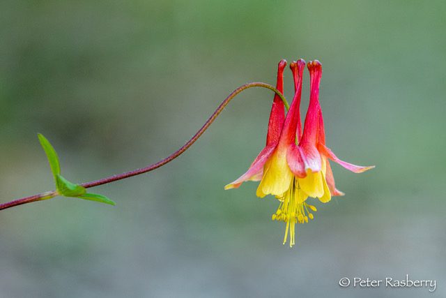
Join Peter Rasberry for a leisurely Spring hike on the Cottrill Lake Side Trail. This lovely sidetrail winds 1.4km through both mixed and hardwood forest, and along the shore of this small inland lake. This should be peak time for both spring wildflowers, and bird migration, so it will be a leisurely walk focusing on the identification and appreciation of both! If time permits, we will have the option of adding on the Anne and Clayton Roberts Side Trail.We will meet at the parking lot in Dyers Bay 45.162455727854116, -81.34088304473234 at 9:00 am, and car pool out the Britain Lake Road to the start of our hike at the Lillie Parking area km 113.4. Parking fees may be in effect for non-resident vehicles at Dyers Bay. Dress appropriately, bring snacks, water, cameras, binoculars and field guides. Insect repellant might also be useful.
This hike (including car pooling) is approximately 3 hours in duration.
9:15 Short hike - Pelham Road, Short Hills
https://hikesstaging.brucetrail.org/event/915-short-hike-pelham-road-short-hills-44/Sorry, the registration cut-off time for this hike has been reached.Not a member? Click here to join today!Hosting Club: Niagara
Location (Google Maps): Pelham Road entrance, Short Hills Provincial Park
Hike Leader(s): janet davey Click here to contact Hike Leader(s)
Pace: Medium
Terrain: Moderate
Distance: 6 kmsDescription
Hike the main and side trails in Short Hills Provincial Park. Bring hiking boots, water and bug spray.Forks of the Credit
https://hikesstaging.brucetrail.org/event/forks-of-the-credit-15/Sorry, the registration cut-off time for this hike has been reached.Not a member? Click here to join today!Hosting Club: Caledon Hills
Category: Tuesday Hikers
Location (Google Maps): Mississauga Rd. intersection with Elora-Cataract Trailway.
Driving direction: From Highway 401, north on Mississauga Rd., pass through Belfountain village, after crossing Cataract Rd. and Elora-Cataract Trailway, park on either side of the road.
Alternate: North on Highway 410, continue on Highway 10, at Caledon Village, left on Charleston Sideroad (24), left on Mississauga Rd., drive 2 km to the roadside parking.Hike Leader(s): Mohammad Shafiq Click here to contact Hike Leader(s)
Pace: Medium – 3 to 4 km/hour
Terrain: Moderate – some hills and/or some poor footing
Distance: 13 kmDescription
Will enter Forks of the Credit Conservation Area using the Elora-Cataract Trailway and hike the main Bruce Trail, Mill Pond, Cataract and Dorothy Medhurst Side Trails and parts of conservation trails. Lunch break at a lovely spot on the Credit River, one of the sweet spots on the river.
Bring 2 bottles of water and snack; poles are recommended.Will observe Forest Bathing for 20 minutes during the hike.
Distance will be adjusted depending on weather, ie reduced if too warm.
Hike leader contact: 416-566-0503
- 24May 24, 2023

Toronto End to End - 2 day, brisk $30 fee/members only
https://hikesstaging.brucetrail.org/event/toronto-end-to-end-2-day-brisk/Sorry, the registration cut-off time for this hike has been reached.Not a member? Click here to join today!Hike open to BTC Members only.
This is a Multi-Day Hike
You are signing up for the following dates and times:
2023-05-24 at 07:30
2023-05-31 at 07:30Hosting Club: Iroquoia
Category: Special Event
Location (Google Maps): Limehouse Conservation Area
Intersection of 22 Sideroad and 5th LineHike Leader(s): Ruth Moffatt Click here to contact Hike Leader(s)
Pace: Brisk – 4 to 5 km/hr
Terrain: Dependent on Conditions, Strenuous – Hilly with steep climbs and some poor footing
Distance: May 24th about 29km; May 31 about 21kmDescription
This is a two day fundraiser hike for the Toronto Bruce Trail Club. Your fee includes the new stained glass badge featuring the historic limestone arch over Blackcreek. The fee goes towards supporting the Toronto Bruce Trail Club, which in turn supports the mission of the Bruce Trail Conservancy “preserving a ribbon of wilderness, for everyone, forever”.
https://hikingthegta.com/2015/06/23/limehouse/
Please meet at the same location both days and try to be 15 min early so we can leave promptly.
Please come prepared with at least 2 litres of water, snacks, lunch, bug spray, sun screen, first aid kit, and poles if you use them.
The hike will be a quick pace with not a lot of stopping 4km -5km per hour. Please be honest about your hiking abilities.
Like all hikes, this is a Leave No Trace. Please pack out what ever you pack in.
We will take time to collect any trail trash we see.
Since the top end of Toronto is land locked, we will do a do-si-do car shuttle which works really well for the 2.5km at the top end. It’ll all be explained when we get there.
Please come prepared to share in the cost of admission at Hilton Falls, where the hike starts on May 31.This is a car shuttle hike – please bring a mask in case anyone on the hike would prefer everyone in the vehicle to wear one.
If you have any questions, please do not hesitate to contact the hike leader.
Blue Mountains E2E Hike #6 in a series of 6 hikes
https://hikesstaging.brucetrail.org/event/blue-mountains-e2e-hike-6-in-a-series-of-6-hikes/Sorry, the registration cut-off time for this hike has been reached.Not a member? Click here to join today!Hosting Club: Blue Mountains
Category: Organized Hike
Location (Google Maps): Hike meets in the parking lot behind Tim Hortons on First St. in Collingwood.Hike Leader(s): David Little Click here to contact Hike Leader(s)
Pace: Medium – 3 to 4 km/hr
Terrain: Moderate – Some hills and/or some poor footing
Distance: 13.5kmDescription
We will park the cars at km 67.3 on Maple Lane and car shuttle to km 55.7 to begin the hike. The trail ascends the Escarpment with a steep climb over large rocks and heads through a forest and some fields. On the top of the escarpment the trail passes through a deciduous forest. There are spectacular views of Georgian Bay and Collingwood as the trail makes its way along and just below the Escarpment. Bring a snack or lunch and water. Don’t forget to mail in your log and choose your payment option for your well deserved End2End badge. Map 23/24 Edition 30Pull Party - removing invasives along the trail
https://hikesstaging.brucetrail.org/event/pull-party-removing-invasives-along-the-trail-2/Sorry, the registration cut-off time for this hike has been reached.Not a member? Click here to join today!Hosting Club: Niagara
Location (Google Maps): St Paul St Niagara Falls, north of Mountain Rd. Park on west side of road to enter
Hike Leader(s): Mary-Lyn Hopper Click here to contact Hike Leader(s)
Terrain: Easy
Description

Hermitage Loops
https://hikesstaging.brucetrail.org/event/hermitage-loops-2/Sorry, the registration cut-off time for this hike has been reached.Not a member? Click here to join today!Hosting Club: Iroquoia
Category: Good Companions
Location (Google Maps):Hermitage parking lot, Dundas Valley Conservation Area, 621 Sulphur Springs Rd, near corner of Sulphur Springs Rd and Mineral Springs Rd.
Hike Leader(s): Craig Sim Click here to contact Hike Leader(s)
Pace: Medium – 3 to 4 km/hr
Terrain: Moderate – Some hills and/or some poor footing
Distance: 7k (approximate)Description
Meet in Hermitage parking lot, Dundas Valley Conservation Area, 621 Sulphur Springs Rd, near corner of Sulphur Springs Rd and Mineral Springs Rd. We will do loops within DVCA. One specific hill quite steep. Wear hiking boots. Dress in layers appropriate to weather, bring snack and water. Be aware of Covid protocols. We leave at 10am. To cancel day of hike text cell#289-659-0007. Cell day of hike only. - 25May 25, 2023
8:00 am Long Hike Jordan to Moyer / Louth NEW TIME
https://hikesstaging.brucetrail.org/event/800-am-long-hike-jordan-to-moyer-louth-new-time-4/Sorry, the registration cut-off time for this hike has been reached.Not a member? Click here to join today!Hosting Club: Niagara
Location (Google Maps):
Jordan Hollow Park 3039 King St Jordan
Pace: Medium
Terrain: Moderate
: 10kDescription
From Jordan Hollow Hike the main trail to Upper and Lower Balls Falls, Moyer Road or Louth and Return. You must register for each hike. Bring Poles, sunscreen, bug spray , snack and a drink ices and dress for the weather
Woodford to Bognor Marsh
https://hikesstaging.brucetrail.org/event/woodford-to-bognor-marsh/Sorry, the registration cut-off time for this hike has been reached.Not a member? Click here to join today!Hosting Club: Sydenham
Category: General Hike
Location (Google Maps): Bognor Marsh Conservation Area parking lot, northwest corner of County Road 18 and 4th Concession S, at km 29.4 (Map 30)Hike Leader(s): Maureen McFarland Click here to contact Hike Leader(s)
Pace: Medium: 3 to 4 km/h
Terrain: Moderate: Some hills and/or poor footing, Strenuous: Hilly with steep climbs and some poor footing.
Distance: 12.5 kmsDescription
We meet at Bognor Marsh and carpool to Woodford Community Centre. From there we hike south back to Bognor Marsh. Much of this hike is along the escarpment edge, with good views off to the east. It is a rugged section, with lots of crevices and a few climbs up and down the excarpment. We end at Bognor Marsh with views over the marsh and of the shore birds who make the marsh their home. Bognor Marsh may be quite wet in springtime. Bring a lunch or snack, and plenty of water. If you have a Grey Sauble Conservation Authority Parking Pass bring it too. Parking at Bognor Marsh is not free. If you are unable to register, please call or text Maureen McFarland at 647-918-4180 to let her know you are coming.9:15 Short hike - Jordan Hollow
https://hikesstaging.brucetrail.org/event/915-short-hike-jordan-hollow-58/Sorry, the registration cut-off time for this hike has been reached.Not a member? Click here to join today!Hosting Club: Niagara
Location (Google Maps): Jordan Hollow Park
Hike Leader(s): Bill Russell Click here to contact Hike Leader(s)
Pace: Medium
Terrain: Strenuous
Distance: 6 kmsDescription
Hike the main trail and side trails around Jordan and Balls Falls. Bring hiking boots, water and bug spray.Sydenham E2E Hike 6 of 14
https://hikesstaging.brucetrail.org/event/sydenham-e2e-hike-6-of-14/Sorry, the registration cut-off time for this hike has been reached.Not a member? Click here to join today!Hosting Club: Caledon Hills
Category: End-to-End
Location (Google Maps): Meet in parking lot at Grey-Bruce Tourist Information Office west of km 104.4. Enter from Hwy 6, just north of the junction of Hwys 6 and 21. Shuttle to start at km 115.5.Hike Leader(s): Nancy Mooney Click here to contact Hike Leader(s)
Pace: Medium – 3 to 4 km/hour
Terrain: Easy – mostly flat and usually good footing, Moderate – some hills and/or some poor footing
Distance: From km 115.5 – 104.4 plus a bit of side trail. Total distance 11.5 km.Description
This hike is relatively easy as we leave the Georgian Bluffs area and approach Owen Sound via rail trail and roads. There are some areas with crevices and nice views along the way. Lunch or ice cream after!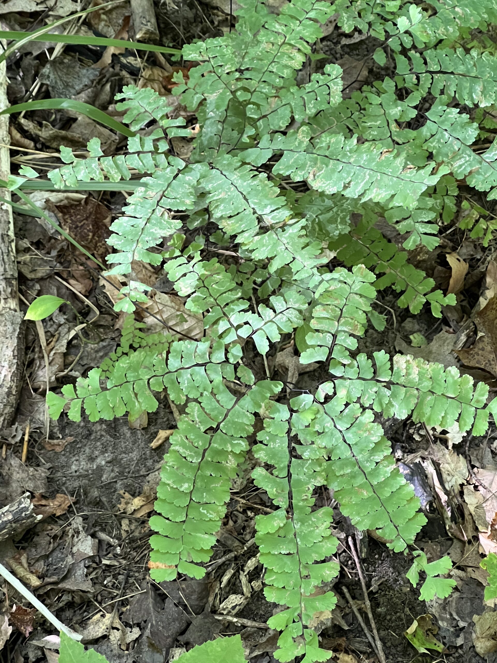
Hilton Falls Wildflower Treasures
https://hikesstaging.brucetrail.org/event/hilton-falls-wildflower-treasures/Sorry, the registration cut-off time for this hike has been reached.Not a member? Click here to join today!Hosting Club: Iroquoia
Category: Thursday Group
Location (Google Maps): Hilton Falls Conservation Area, 4985 Campbellville Rd. MiltonHike Leader(s): Anne Armstrong Click here to contact Hike Leader(s)
Pace: Leisurely – 3km/hr or less
Terrain: Easy – Mostly flat and usually good footing
Distance: 10 – 11 Km.Description
Hilton Falls Beaver Meadow route has some areas of a large concentration of wildflowers including variegated Trilliums and Perfoliate Bellwort. There are also some unusual ferns. Join us for this lovely circular route to search for wildflowers. We will stop at the falls for our snack. Bring water, a snack, sunscreen, insect repellent and poles if using.
Leader: Anne Armstrong 905 617 3937 hikingrandma@gmail.com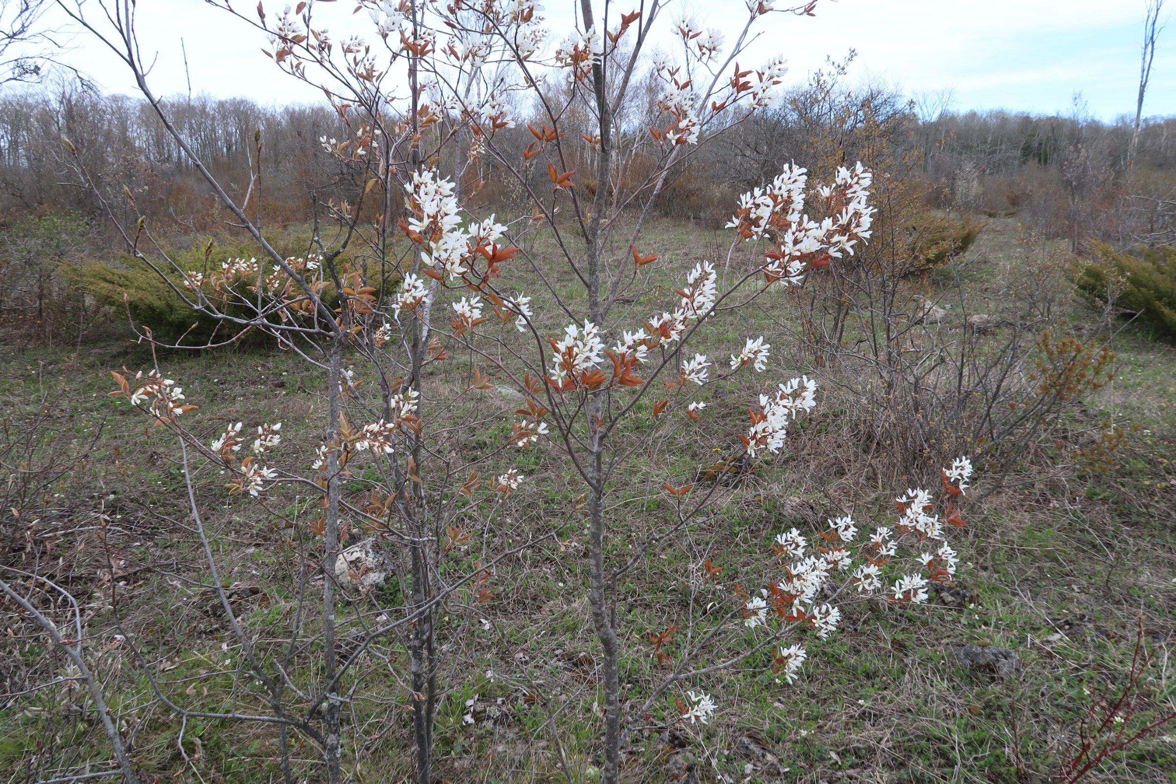
Spring Interpretive Hike
https://hikesstaging.brucetrail.org/event/spring-interpretive-hike/Sorry, the registration cut-off time for this hike has been reached.Not a member? Click here to join today!Hosting Club: Peninsula
Location (Google Maps): Meet at the intersection of Crooked Toe Road and Boundary Road at 24.4 KM. Arrive a few minutes early so that we can begin the hike at 10 a.m.
Hike Leader(s): Marg Glendon Click here to contact Hike Leader(s)
Pace: Leisurely, Medium
Terrain: Easy, Moderate
Distance: ~5 kmDescription
Spring is here! Let’s explore the signs of Spring at the McIver Wetland and adjoining hardwood forest with Bob Knapp, a PBTC Land Steward. Bob will provide interpretation for this Spring hike. This wetland is a popular site for migrating birds, amphibians and reptiles. The hardwood forest will be coming alive with an unfurling of new green leaves, while fern and mossy rocks frame early Spring wildflowers. We will finish our hike with lunch on the cabin deck together.Bring a light backpack with a snack, water and lunch. Wear a hat, long sleeved protective clothing. Bring insect repellent. At this time of year, there may be some wet spots, please wear waterproof hiking boots. A camera, binoculars and gators might be helpful, but not essential.
This hike will be about 3 hours in duration.

Toronto, Toronto Islands
https://hikesstaging.brucetrail.org/event/toronto-toronto-islands-16/Sorry, the registration cut-off time for this hike has been reached.Not a member? Click here to join today!Hosting Club: Toronto
Location (Google Maps): Meet inside the Jack Layton Ferry Terminal, foot of Bay Street, beyond the cashiers selling the ferry tickets, in the open area with the benches and Muskoka chairs. From Union Station take the LRT one stop to “Ferry Docks” or take bus number #19 or #72 on Bay Street southbound to the Queens Quay. Walk across Queen Quay south through the park to the ferry terminal.
Hike Leader(s): Miriam Stevens, Tom Swales Click here to contact Hike Leader(s)
Pace: Leisurely
Terrain: Flat
Distance: 8-12 kmDescription
After a day’s work, come and “cool off” on the Toronto Islands free of fumes and traffic to enjoy the view of the city skyline and Toronto’s own beautiful island parkland oasis away from the city. Pack a dinner for a sit-down picnic. Note that food is not available for purchase on the islands early in the season. Bring a warm jacket and flashlight. Return ticket for the ferry is approximately $8.70, $5.60 for seniors. The hike will take place rain or shine. Toronto Island Evening Hikes will take place every Thursday in May and June, same time and meeting place. The route and time we return to the city may vary depending if the ferries are running on the Spring or Summer (starts in May) schedule. Contact Hike Leaders via the Contact form for further information or to confirm the current ferry schedule that will be in place the week of the hike. Registration is not required for this hike – just meet the Hike Leader at the above location.