
Hike Schedule
Join us for a hike! Registration required:
All hikes available to BTC members. Some hikes are open to non-members.
TIP: The calendar view displays up to 7 hikes on a day, but often there are more. Click “More events” to see them all.
Categories
- 22May 22, 2024
Boyne Valley
https://hikesstaging.brucetrail.org/event/boyne-valley-6/Sorry, the registration cut-off time for this hike has been reached.Not a member? Click here to join today!Hosting Club: Blue Mountains
Category: Register in person the morning of hike.
Location (Google Maps): Hike meets in the parking lot behind Tim Hortons on First St. in Collingwood.Hike Leader(s): David Little Click here to contact Hike Leader(s)
Pace: Medium – 3 to 4 km/hr
Terrain: Moderate – Some hills and/or some poor footing
Distance: 14 kmDescription
We will drive to the parking area on Centre Road, south of the 5
Sideroad, at the edge of the forest in Dufferin Hi-Land section. We will proceed to make
a two loop hike through the Boyne Valley Provincial Park. The hike will include great
views from Murphy’s Pinnacle. Bring a snack or lunch and water.WEDNESDAY WALKERS - Margaret Paull ST Loop
https://hikesstaging.brucetrail.org/event/wednesday-walkers-margaret-paull-st-loop-2/Sorry, the registration cut-off time for this hike has been reached.Not a member? Click here to join today!Hosting Club: Beaver Valley
Location (Google Maps): Park on the 6th Line, Km 13.7 Map 24, Edition 31
Hike Leader(s): Margaret Yaraskavitch Click here to contact the hike leader.
Pace: Medium
Terrain: Moderate
Length of Hike: 3.9 kmDescription
An enjoyable walk with lots of opportunities for stops and photos. We’ll walk by a creek, view a flowerpot and a waterfall, and see the E.C. Carr Observatory buildings along our route. Country laneways with farm views, as well. Please bring water and a snack.COVID-19 Precautions Before, During and After your Hike
- Each hiker joining a Bruce Trail Club organized hike must perform a self-screening check before hiking.
Find Ontario’s self-assessment tool here: https://covid-19.ontario.ca/self-assessment/ - If you are experiencing COVID-19 symptoms, stay home.
Other Guidelines
- Arrive 15 minutes before the start of the hike.
- Wear sturdy footwear and appropriate attire for the weather and the terrain.
Hiking poles are a good idea in any season, especially if the terrain is rocky or slippery. In winter, snowshoes or icers/crampons are needed when conditions dictate.
Wearing appropriate clothing and footwear prevents injuries and shows consideration for a safe and positive group hiking experience. - Always carry I.D. and your health card.
- Bring sufficient water and snacks (or lunch if indicated). A minimum of 1L of water is recommended on all hikes, and 3L is recommended for long, challenging hikes in the heat of the summer.
- Bring sunscreen and insect repellent (for spring and summer hikes).
- Bring your own first aid kit.
- Please leave dogs at home.
- Each hiker joining a Bruce Trail Club organized hike must perform a self-screening check before hiking.
- 23May 23, 2024
NEW TIME 8:00 am Long Hike Jordan to Moyer / Louth
https://hikesstaging.brucetrail.org/event/new-time-800-am-long-hike-jordan-to-moyer-louth-2/Sorry, the registration cut-off time for this hike has been reached.Not a member? Click here to join today!Hosting Club: Niagara
Location (Google Maps):
Jordan Hollow Park 3039 King St Jordan
Pace: Medium
Terrain: Moderate
: 10kDescription
From Jordan Hollow Hike the main trail to Upper and Lower Balls Falls, Moyer Road or Louth and Return. You must register for each hike. Bring Poles, sunscreen, bug spray , snack and a drink and dress for the weather
"A Singular Place" #2
https://hikesstaging.brucetrail.org/event/a-singular-place-2/Sorry, the registration cut-off time for this hike has been reached.Not a member? Click here to join today!Hosting Club: Caledon Hills
Category: General
Location (Google Maps): We will meet at roadside parking on Centreville Creek Road, next to one of the entrances of the Oak Ridges Trail.Hike Leader(s): Dan Revington Click here to contact Hike Leader(s)
Pace: Medium – 3 to 4 km/hour
Terrain: Moderate – some hills and/or some poor footing
Distance: Approximately 10 kmDescription
This is the second of two hikes in The Dingle of the Caledon Hills. The first hike, on May 4, covers the adventures of the children and teachers who attended the historic 1872 Dingle Schoolhouse when it was used as a school.The second hike will focus on world famous Canadian artist Rosemary Kilbourn. She bought the Dingle Schoolhouse after it closed as a school, and for over sixty years she made this beautiful place deep in the woods her home and studio. Ms. Kilbourn’s archivist and niece will join us on this hike, and will share stories about this remarkable, talented, and deeply spiritual woman. Our walk through the dingle will help us appreciate how Ms. Kilbourn’s work was inspired by the living presence of the land around her beloved home.
Urban Walk; Valley View and Maple view Parks Thornhill
https://hikesstaging.brucetrail.org/event/urban-walk-valley-view-and-maple-view-parks-thornhill-5/Sorry, the registration cut-off time for this hike has been reached.Not a member? Click here to join today!Hosting Club: Toronto
Location (Google Maps): Parking lot at the corner of Bayview Ave, and Sycamore Dr. South of Highway 7
Sycamore Dr. is 2 blocks south of highway 7,parking lot is across plaza of Dollarama and Star boxHike Leader(s): Mohammad Aghamiri Click here to contact Hike Leader(s)
Pace: Moderate
Terrain: Variable
Distance: 7-8 kmDescription
We will explore Valleyview and Maple view parks, and walk along German Mill Creek,9:15 Short Hike, Jordan Hollow
https://hikesstaging.brucetrail.org/event/915-short-hike-jordan-hollow-111/Sorry, the registration cut-off time for this hike has been reached.Not a member? Click here to join today!Hosting Club: Niagara
Category: Hike
Location (Google Maps): Jordan Hollow Park, Jordan StationHike Leader(s): Bill Russell Click here to contact Hike Leader(s)
Pace: Medium
Terrain: Strenuous
Distance: ~ 6kmsDescription
Hike the main and side trails around Jordan and Balls Falls. Bring hiking boots, water, sunscreen and bug spray.Lincoln Views-Frost Rd
https://hikesstaging.brucetrail.org/event/lincoln-views-frost-rd-2/Sorry, the registration cut-off time for this hike has been reached.Not a member? Click here to join today!Hosting Club: Iroquoia
Category: Thursday Group
Location (Google Maps):Kinsmen Park, parking lot end of Frost Rd, 3820 Frost Rd, near Kinsmen Rd and Frost Rd, Beamsville/Lincoln
Hike Leader(s): Craig Sim Click here to contact Hike Leader(s)
Pace: Medium – 3 to 4 km/hr
Terrain: Moderate – Some hills and/or some poor footing
Distance: 8-10kmDescription
Beautiful views of farmland from escarpment. A lovely hike, quite rocky at times, some hills. Wear hiking boots or shoes with good tread. Dress in layers according to weather, including rain gear. Bring water and snack. Optional outing for beverage/food after.
Urban Walk: Toronto Islands Evening Walk
https://hikesstaging.brucetrail.org/event/urban-walk-toronto-islands-evening-walk-4/Sorry, the registration cut-off time for this hike has been reached.Not a member? Click here to join today!Hosting Club: Toronto
Location (Google Maps): Jack Layton Ferry Terminal, near the gates to Wards Island Ferry. Arrive 20 minutes prior to departure to check in with hike leader.
From Union Station take the LRT and get off at the stop Ferry Docks.Walk up to the Ferry Docks on Queens Quay West, street level. at the foot of Bay Street.
Hike Leader(s): Miriam Stevens Click here to contact Hike Leader(s)
Pace: Leisurely
Terrain: Flat
Distance: 6-9 kmDescription
After a day’s work come and “cool off” on the Toronto Islands free of fumes and traffic. Enjoy the view of the city skyline and Toronto’s beautiful island parkland.
Pack a dinner for a sit down picnic. Food is not available for purchase on the Islands early in the season. Also bring a warm jacket and flashlight.
Return fare ticket for the ferry approx $10.00 less for seniors.
Hikes will take place rain or shine.
Toronto Island evening hikes will take place every THURSDAY in MAY and JUNE 2024.
Same time and same meeting place. No preregistration is required – just show up at the ferry docks at 5:40 PM and sign with the hike leader.
Full Moon Walk @ Edward Gardens - 7km
https://hikesstaging.brucetrail.org/event/full-moon-walk-edward-gardens-7km/Sorry, the registration cut-off time for this hike has been reached.Not a member? Click here to join today!Hosting Club: Toronto
Category: Urban Walk
Location (Google Maps): Parking Lot #2 Wilket Creek Park,Hike Leader(s): Alina Lin
Pace: Moderate
Terrain: Flat, Variable
Distance: 6 km -8kmDescription
🌕✨ Join Us for a Magical Full Moon Hike at Edward Gardens! ✨🌕Meet at the Parking Lot #2 Wilket Creek Park, nearby the intersection of Leslie St & Eglinton Ave, GPS ( 43.716342, -79.350592)
Embark on an enchanting journey under the glow of the Flower Moon. Known also as the Planting Moon, Milk Moon, and Hare Moon, this May full moon has been celebrated across cultures for its beauty and significance.
As we wander through the lush landscapes of Edward Gardens, bathed in moonlight, we’ll connect with nature and each other, embracing the tranquility and wonder of the night. The Flower Moon symbolizes growth and new beginnings, making it the perfect time to plant the seeds of new friendships and nurture our connection to the natural world.
Whether you are an avid hiker, a nature lover, or simply looking for a unique way to spend your evening, this hike promises to be an unforgettable experience. Together, we’ll witness the moon’s radiant beauty, share stories, and maybe even spot some nocturnal wildlife.
🌕 What to Bring:
- Comfortable walking shoes
- mosquitos proof cloth
- Bug spray in case the mosquitos are heavy
- A flashlight or headlamp
- Water and snacks
- A sense of adventure and wonder
Let the magic of the Flower Moon guide our steps and inspire our hearts. We look forward to sharing this special night with you.
RSVP now and join us for a night of lunar enchantment! 🌕🌸
- 24May 24, 2024

Car Hike: Toronto E2E in 4 sections - 4 of 4
https://hikesstaging.brucetrail.org/event/car-hike-toronto-e2e-in-4-sections-4-of-4/Sorry, the registration cut-off time for this hike has been reached.Not a member? Click here to join today!Hosting Club: Iroquoia, Toronto
Category: General Hike
Location (Google Maps): Meet at 866 Boston Mills Rd, Terra Cotta, southwest of km 48.3 at Boston Mills Rd just west of the Mississauga Rd intersection. Coordinates N43.75089458147345, W-79.9514382908325. Click on the Google link for personalized driving instructions.Hike Leader(s): Susan Glofcheskie Click here to contact Hike Leader(s)
Pace: Medium – 3 to 4 km/hr
Terrain: Moderate – Some hills and/or some poor footing
Distance: 12 kmDescription
This is the fourth of a four-series hike of the complete Toronto Club section of the Bruce Trail.Please bring gaiters and poles for the slippery mud. Bring 1.5 to 2 litres of water, bug spray, sunscreen and a snack. Hiking boots/shoes are mandatory. For further details, refer to hike 1 of 4 on May 3.
Please arrive by 8 am at km 48.3, so we can leave at 8:15 am to shuttle to our starting point (km 38.7).
This is a series of 4 hikes to complete the Toronto section. You must sign up for all 4 hikes if you wish an ETE badge at a cost of $5 members/$15 non-members.

Car Hike: CHBTC 60th Anniversary E2E Badge Combo 5/5
https://hikesstaging.brucetrail.org/event/car-hike-chbtc-60th-anniversary-e2e-badge-combo-5-5/Sorry, the registration cut-off time for this hike has been reached.Not a member? Click here to join today!Hike open to BTC Members only.
Hosting Club: Toronto, Caledon Hills
Category: Car Hike
Location (Google Maps): Hike #5 – Badge Day!! We’ll meet 200m south of the Mono Centre, west of km 72.2. Please park in the gravel surface lot GPS N44.026195, W80.071516Hike Leader(s): Jacquie Van Dyke Click here to contact Hike Leader(s)
Pace: Moderate
Terrain: Variable
Distance: 12km plus a short side trailDescription
Come to one, a few, or all of these hikes to celebrate Caledon’s 60th anniversary! It’s badge day for those completing all 5 of these hikes who have had a good chance to qualify for BOTH of Caledon’s NEW badges. Today, on the last of these five hikes, we’ll meet 200m south of Mono Centre in the unpaved portion of the parking lot. There usually is a port-a-potty there.We’ll stop for a short snack break and perhaps a lunch break (depending on speed of hikers), so please bring enough food to last the hike, 2L of water, bug repellent, sunblock, and proper hiking attire. Hiking boots/shoes are mandatory. It may be rainy so ensure you have rain gear with you.
9:00 am Niagara-on-the-Lake Tour
https://hikesstaging.brucetrail.org/event/900-am-niagara-on-the-lake-tour-24/Sorry, the registration cut-off time for this hike has been reached.Not a member? Click here to join today!Hosting Club: Niagara
Location (Google Maps): Veterans Memorial Park, park just outside the park on King Street
Hike Leader(s): Robin Garrett Click here to contact Hike Leader(s)
Pace: Medium
Terrain: Easy
Distance: 6-7 kmDescription
Robin Garrett & Margaret Northfield are a team! Each Friday one of us will lead our group through different neighbourhoods, trails and parkland throughout Historic Niagara-on-the-Lake.Moderate pace with some weeks entirely on sidewalks and roads while others may include a mix of trails and paved pathways. Great way to build up endurance for longer more strenuous hikes.
Prepare for cooler windy conditions on open parkland and along Lake Ontario and Niagara River trails.
Plan to stay for conversation and a warm cup of coffee or tea at Sweets & Swirls, Community Centre, Niagara Stone Road, NOTL
- 25May 25, 2024
Blue Mountains Annual End to End-TWO DAY EVENT.
https://hikesstaging.brucetrail.org/event/blue-mountains-annual-end-to-end-two-day-event-2/Sorry, the registration cut-off time for this hike has been reached.Not a member? Click here to join today!This is a Multi-Day Hike
You are signing up for the following dates and times:
2024-05-25 at 06:30
2024-05-26 at 06:30Hosting Club: Blue Mountains
Category: End-to-End
Location (Google Maps): Meet/park at Highlands Nordic Duntroon OntarioHike Leader(s): Paul Swindall Click here to contact Hike Leader(s)
Pace: Brisk – 4 to 5 km/hr
Terrain: Moderate – Some hills and/or some poor footing
Distance: 69 km -Day 1: 37km Day 2: 32kmDescription
Join us this spring for the Blue Mountains Bruce Trail Club annual End-to-End hike event. This 2 Day Hike is for those hikers keen on a great big challenge You will wind your way through the beautiful and varied terrain of the Blue Mountains Club trails. Enjoy the early signs of nature awakening at this time of the year, the beautiful vistas and the rugged escarpment. You will cover the 69 km distance of our section which runs from Lavender to Swiss Meadows. Checkpoint stations will be offered approximately every 10 kms offering snacks, water refill and assistance along the way. A BBQ at Highlands Nordic is included at the end of Saturday Hike commencing at 2:00 pm. Hike details will be emailed to participants shortly after registration is received. Note, this event consists of longer distances and is generally not suitable for beginning hikers.
Blue Mountains THREE DAY End to End - THREE DAY EVENT
https://hikesstaging.brucetrail.org/event/blue-mountains-three-day-end-to-end-three-day-event/Sorry, the registration cut-off time for this hike has been reached.Not a member? Click here to join today!This is a Multi-Day Hike
You are signing up for the following dates and times:
2024-05-25 at 07:00
2024-05-26 at 07:00
2024-05-27 at 07:00Hosting Club: Blue Mountains
Category: End-to-End
Location (Google Maps): Day 1 Parking/Meeting location is at Nottawasaga Bluffs Conservation Area. Day 2 & 3 parking will be near Pretty River Valley Provincial Park. Details will follow after registrationHike Leader(s): Robert Johnston Click here to contact Hike Leader(s)
Pace: Brisk – 4 to 5 km/hr
Terrain: Moderate – Some hills and/or some poor footing
Distance: 67 kmDescription
Join us this spring for the Blue Mountains Bruce Trail Club THREE DAY End-to-End hike event. This 3 Day hike is for those hikers wanting to complete our section over three days. Approximate Daily Hike Lengths: Day 1–22Km, Day 2–20Km, Day 3–25Km. You will wind your way through the beautiful and varied terrain of the Blue Mountains Club trails. Enjoy the early signs of nature awakening at this time of the year, the beautiful vistas and the rugged escarpment. You will cover the 67 km distance of our section which runs from Lavender to Swiss Meadows. Checkpoint stations will be offered approximately every 10 kms with snacks, water refill and assistance. A BBQ is included on the Saturday at the end of the hike day, at Highlands Nordic, and will commence at 2:00 pm. Details will be emailed to participants shortly after registration is received. Note, this event consists of longer distances and is generally not suitable for beginning hikers.
8:00 Brisk Morning Hike Along the 12-Mile Creek
https://hikesstaging.brucetrail.org/event/800-brisk-morning-hike-along-the-12-mile-creek/Sorry, the registration cut-off time for this hike has been reached.Not a member? Click here to join today!Hosting Club: Niagara
Category: In and Out
Location (Google Maps): https://www.google.com/maps/place/5+St+Paul+Crescent,+St.+Catharines,+ON+L2R+3P7/@43.1547593,-79.2493514,16z/data=!3m1!4b1!4m6!3m5!1s0x89d3504cabc1ff5f:0x22bf383a2aafe1cd!8m2!3d43.1547594!4d-79.244738!16s%2Fg%2F11c5fkv8dp?entry=ttuHike Leader(s): Faye Perkins Click here to contact Hike Leader(s)
Pace: Brisk
Terrain: Moderate
Distance: 12 kmDescription
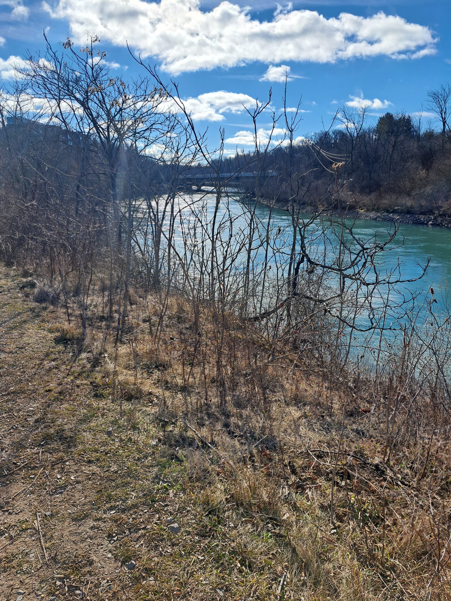
Join us for a brisk hike or slow run along the 12-Mile Creek, before the festivities of St. Catharines “Go Green Event” begins. You are also welcome to join the Nature Hike immediately following your early morning workout, to learn how we can ensure that this ribbon of natural paradise remains intact.We will meet at the “Gateway to St. Catharines”, which is at the corner of Ontario and St. Paul Streets. The hike leader will be wearing a bright yellow coat.
Everyone is welcone, but this is an indepedent hike with limited support. Bring water and other fuel as required.
This is part of St. Catharines’ Go Green Event, so please leave your car at home, if you can. There is free parking in downtown St. Catharines on Saturdays.
Car Hike: Happy Valley 136
https://hikesstaging.brucetrail.org/event/car-hike-happy-valley-2/Sorry, the registration cut-off time for this hike has been reached.Not a member? Click here to join today!Hosting Club: Toronto
Location (Google Maps): Happy Valley, Oak Ridges Trail 16th Sideroad & Weston Road
Hike Leader(s): Mohammad Aghamiri Click here to contact Hike Leader(s)
Pace: Moderate
Terrain: Rocky, Variable
Distance: 14-17 kmDescription
Come and join the group to view nice scenery and look out of Happy valleySome safety procedures during the hike:
1-Hikers must stay between the leader and the sweep.
2-Hikers must advise the leader or the sweep if they wish to leave the group.
3- Hikers must follow the whistle instructions: 1 blast- stay where you are; 2 blasts come to the leader; 3 blasts – come to the leader quickly.
4-Hike leader may request volunteers to stop at trail intersections, they need to help hikers to the direction the group walk and wait till they see the sweep .
5-Hikers have to make sure they can see the persons behind and in front of them.
Bus Hike: Caledon E2E - Hike #1 of 5
https://hikesstaging.brucetrail.org/event/bus-hike-caledon-e2e-hike-1-of-5/Sorry, the registration cut-off time for this hike has been reached.Not a member? Click here to join today!Trip Information
Departure Time: 08:30
Return to City Time: 17:00
Departure Point: Kipling Departure PointOptional Items
Hosting Club: Toronto, Caledon Hills
Category: Bus Hike
Location (Google Maps): Cheltenham BadlandsHike Leader(s): Sajedeh Zahraei; Celia Ho Click here to contact Hike Leader(s)
Pace: Moderate
Terrain: Flat, Variable
Distance: 16 KmDescription
Maps 14-15, km 0.0 – km 16.0 (16.0 km)Starting Point: Bruce Trail Entrance – km 0.0 (on Creditview Rd) (43.768001°N 79.943125°W)
Drop-out Point: – km 8.4 (McLaren Road and Puckering Lane)
End Point: Roadside Parking – km 16.0 (along the southwest shoulder of the Willoughby Rd and Escarpment Sideroad intersection) (43.831244°N 79.980588°W)
Car Hike: Rouge Valley Vista Trail & Mast Trail Hike - 14km
https://hikesstaging.brucetrail.org/event/car-hike-rouge-valley-vista-trail-mast-trail-hike-14km/Sorry, the registration cut-off time for this hike has been reached.Not a member? Click here to join today!Hosting Club: Toronto
Category: Car Hike
Location (Google Maps): Rouge Valley Conservation Centre parking lot.Hike Leader(s): Alina Lin
Pace: Moderate
Terrain: Challenging, Hilly, Variable
Distance: 12km -15kmDescription
Meet at the main parking lot next to the Rouge Valley Conservation Centre, GPS (43.81780727235202, -79.17176449225887).We will hike along the two main trails: Vista Trail and Mast Trail. The route includes a mix of flat and hilly terrains.
Be prepared for some muddy sections. Bring at least 1 liter of water. Wear sunscreen and a hat. Bug spray may also be needed.
This hike will take place rain or shine.
9:00 Easy Does It Hike, downtown St. Catharines
https://hikesstaging.brucetrail.org/event/900-easy-does-it-hike-downtown-st-catharines/Sorry, the registration cut-off time for this hike has been reached.Not a member? Click here to join today!Hosting Club: Niagara
Category: In and Out
Location (Google Maps): Meet in the parking lot, corner of 8 St Paul West and Westchester Cr.https://maps.app.goo.gl/wF7UKHNgjjNXzdDv8
Hike Leader(s): Diane Marlatt Click here to contact Hike Leader(s)
Pace: Leisurely
Terrain: Easy
Distance: 3+ kilometersDescription
We will have a casual walk on city sidewalks and hiking paths. Rain or Shine. Wear sturdy footwear, optional: a hat, sun glasses and poles if you have them.Alternate parking available @ 37 Ontario St., St Catharines.

9:30 Spring Blooms: Centennial Lilac & Botanical Gardens
https://hikesstaging.brucetrail.org/event/930-spring-blooms-centennial-lilac-botanical-gardens-2/Sorry, the registration cut-off time for this hike has been reached.Not a member? Click here to join today!Hosting Club: Niagara
Category: In and Out
Location (Google Maps):Centennial Lilac Gardens parking, 14004 Niagara River Parkway, Niagara Falls, ON; north of Floral Clock parking.
Hike Leader(s): Karen Couch Click here to contact Hike Leader(s)
Pace: Medium
Terrain: Easy
Distance: 6-8 kmsDescription
Experience the colours and scents of this unique garden on the north side of the Floral Clock, featuring over 200 varieties. Then walk along the Niagara River Parkway to loop through the Botanical Gardens while enjoying the spring blossoms.7 Rivers Hike Series - #4 of 4 - Pine River
https://hikesstaging.brucetrail.org/event/7-rivers-hike-series-south-4-of-4-pine-river/Sorry, the registration cut-off time for this hike has been reached.Not a member? Click here to join today!Hike open to BTC Members only.
Hosting Club: Dufferin Hi-Land
Category: General Hike
Location (Google Maps): Whitfield Church at 677002 Centre RdHike Leader(s): Margery Cruise Click here to contact Hike Leader(s)
Pace: Medium
Terrain: Moderate
Distance: 10.75 kmDescription
We will hike north on Centre Road to a fork in the road, then take the left road and west. Then, we follow the main trail into the woods along the Pine River until we get to where the trail crosses the road. Then, we will continue west and north along to main trail with a detour to climb to Bell Lookout and back. Then we continue to hike along the Pine River Fishing Pond to 15 Sideroad. We turn right and follow the main trail to Prince of Wales Road. From here we hike east on the Kilgorie Side Trail and come out to River Road. We will cross the road and hike along the Pine River retracing our steps, heading up the gravel road to the parking area.
This is a badge hike so if you have done all 7 hikes, you have earned a badge!
Nature Hike - The Gateway of St. Catharines and along 12 Mile Creek
https://hikesstaging.brucetrail.org/event/nature-hike-the-gateway-of-st-catharines-ans-along-12-mile-creek/Sorry, the registration cut-off time for this hike has been reached.Not a member? Click here to join today!Hosting Club: Niagara
Category: Hike
Location (Google Maps): Westchester Cres and Regional Rd 42Hike Leader(s): Mary-Lyn Hopper Click here to contact Hike Leader(s)
Pace: Medium
Terrain: Moderate
Distance: 6kDescription
We will observe natural environment along 12 Mile Creek. Bring water bottles and wear sunscreen if required. Wear closed toed footwear.
Toronto Urban Badge Hike - 5 of 7
https://hikesstaging.brucetrail.org/event/toronto-urban-badge-hike-5-of-7-4/Sorry, the registration cut-off time for this hike has been reached.Not a member? Click here to join today!Hosting Club: Toronto
Location (Google Maps):
Toronto, Ontario, Canada
Hike Leader(s): Brian Rideout Click here to contact Hike Leader(s)
Pace: Moderate
Terrain: Flat
Distance: 9.6 kmDescription
Please join me at the north east corner of Bathurst and Finch by 10 AM. We will hike east on the Finch Hydro Corridor Trail and south along East Don Parklands to Sheppard and Leslie (km 41.6 to km 51.2). Here is an online map with km markings of our route for all 7 hikes for the Toronto Urban Badge.Please make sure you bring at least 2 liters of water, a lunch, bug spray and sunscreen.
Georgian Bluffs - top of Kemble Mountain
https://hikesstaging.brucetrail.org/event/georgian-bluffs-top-of-kemble-mountain-3/Sorry, the registration cut-off time for this hike has been reached.Not a member? Click here to join today!Hosting Club: Sydenham
Category: General Hike
Location (Google Maps): The Owen Sound Galaxy Cinema parking lot. Meet at the tall “Galaxy Centre” sign next to the traffic lights.Hike Leader(s): Ian Mills Click here to contact Hike Leader(s)
Pace: Medium: 3 to 4 km/h
Terrain: Moderate: Some hills and/or poor footing, There might be muddy sections., There might be sections with water on the trail.
Distance: 9kmDescription
Starting at 142.6 (Map 34) and taking the Main Trail south and looping with Side Trails – Mystery Cabin & Coles & Maple Cross Ridge & Nels Maher. Pack a snack along with water. Proper hiking footwear highly recommended.Blue Mountains End to End BBQ ONLY - not just for hikers!
https://hikesstaging.brucetrail.org/event/blue-mountains-end-to-end-bbq-only-not-just-for-hikers/Sorry, the registration cut-off time for this hike has been reached.Not a member? Click here to join today!Hike open to BTC Members only.
Hosting Club: Blue Mountains
Location (Google Maps): Parking/BBQ location is at Nordic Highlands. 1182 Nottawasaga Rd, Concession 10 N Nottawasaga Rd S, Duntroon, ON L0M 1H0
Hike Leader(s): Helen Stukator Click here to contact Hike Leader(s)
Pace: Leisurely – 3 km/hr. or less
Terrain: Easy – Mostly flat and usually good footing
Distance: 1 kmDescription
We’re firing up the Grill with hot dogs and hamburgers! Blue Mountain Club Members and friends are invited to join in at the E2E BBQ. Come on out to socialize and welcome our hikers in after their first day.Please note if you are registered for either the 2 Day or 3 Day E2E you are already registered for the BBQ. No need to register and pay for this.
There is no badge for this event other than the coveted mustard and ketchup stain!
Registration will be open until Friday, May 24.
BBQ will be held Saturday 25 May 1 pm to 4 pm at Highlands Nordic