
Hike Schedule
Join us for a hike! Registration required.
All hikes available to BTC members. Some hikes are open to non-members.
See Refund Policy for Paid Hikes >
TIP: The calendar view displays up to 7 hikes on a day, but often there are more. Click “View more events” to see them all.
Categories
- 09March 9, 2023
9:00 am Long Hike Jordan to Moyer / Louth
https://hikesstaging.brucetrail.org/event/900-am-long-hike-jordan-to-moyer-louth-40/Sorry, the registration cut-off time for this hike has been reached.Not a member? Click here to join today!Hosting Club: Niagara
Location (Google Maps):
Jordan Hollow Park 3039 King St Jordan
Pace: Medium
Terrain: Moderate
: 10kDescription
From Jordan Hollow Hike the main trail to Upper and Lower Balls Falls, Moyer Road or Louth and Return. You must register for each hike. Bring Poles, snack and a drink ices and dress for the weather
9:15 Short hike - Jordan Hollow
https://hikesstaging.brucetrail.org/event/915-short-hike-jordan-hollow-47/Sorry, the registration cut-off time for this hike has been reached.Not a member? Click here to join today!Hosting Club: Niagara
Location (Google Maps): Jordan Hollow Park
Hike Leader(s): Bill Russell Click here to contact Hike Leader(s)
Pace: Medium
Terrain: Strenuous
Distance: 6 kmsDescription
Hike the main trail and side trails around Jordan and Balls Falls. Bring hiking boots, icers and water.Silent Valley
https://hikesstaging.brucetrail.org/event/silent-valley-10/Sorry, the registration cut-off time for this hike has been reached.Not a member? Click here to join today!Hosting Club: Sydenham
Category: Snowshoe Hike
Location (Google Maps): Meet in the north-east corner of the parking lot at Home Depot on Highway 26 on the east side of Owen Sound.Hike Leader(s): Marilyn Jones Click here to contact Hike Leader(s)
Pace: Medium: 3 to 4 km/h
Terrain: Strenuous: Hilly with steep climbs and some poor footing., There might be icy and slippery sections.
Distance: 4.6 kmsDescription
Depending on snow and weather conditions we will snowshoe a variety of blue and white trails. Distance to be decided the day of the hike. Poles are recommended. Please bring snowshoes, icers, water and a snack. Map 30. Please contact hike leader if you are unable to register or are not interested in car pooling. - 10March 10, 2023
Margaret Paull Loop
https://hikesstaging.brucetrail.org/event/margaret-paull-loop/Sorry, the registration cut-off time for this hike has been reached.Not a member? Click here to join today!Hosting Club: Beaver Valley
Location (Google Maps): Meet on 6th Line, north of Grey Road 119 (also called Sideroad 15), km 13.7, Map 24, Edition 30. Do not block driveway, gate or farm entrance.
Hike Leader(s): Glenda Collings Click here to contact the hike leader.
Pace: Medium
Terrain: Moderate, Some steep sections
Length of Hike: Approx. 4 kmDescription
This will be a fairly short, but lovely loop, as we hike into the woods, past a flowerpot created by the waves of an ancient glacial lake, along Indian Creek and through fields with views. Who knows what the conditions will be in this crazy winter we’re having so be prepared. Possibly snowshoes, icers/cleats, just our boots?COVID-19 Precautions Before, During and After your Hike
- Each hiker joining a Bruce Trail Club organized hike must perform a self-screening check before hiking.
Find Ontario’s self-assessment tool here: https://covid-19.ontario.ca/self-assessment/ - If you are experiencing COVID-19 symptoms, stay home.
- Personal Protective Equipment:
- Hikers may choose to wear masks
Transportation
It is the Bruce Trail Conservancy’s current policy that car shuttles are allowed. It is at the discrepancy of individual hike leaders to make that decision.
Other Guidelines
- Arrive 15 minutes before the start of the hike.
- Wear sturdy footwear and appropriate attire for the weather and the terrain.
Hiking poles are a good idea in any season, especially if the terrain is rocky or slippery. In winter, snowshoes or icers/crampons are needed when conditions dictate.
Wearing appropriate clothing and footwear prevents injuries and shows consideration for a safe and positive group hiking experience. - Always carry I.D. and your health card.
- Bring sufficient water and snacks (or lunch if indicated). A minimum of 1L of water is recommended on all hikes, and 3L is recommended for long, challenging hikes in the heat of the summer.
- Bring sunscreen and insect repellent (for spring and summer hikes).
- Bring your own first aid kit.
- Please leave dogs at home.

9:00 am Niagara-on-the-Lake Tour
https://hikesstaging.brucetrail.org/event/900-am-niagara-on-the-lake-tour-9/Sorry, the registration cut-off time for this hike has been reached.Not a member? Click here to join today!Hosting Club: Niagara
Category: Urban
Location (Google Maps): Veterans Memorial Park, park just outside the park on King StreetHike Leader(s): Robin Garrett Click here to contact Hike Leader(s)
Pace: Medium
Terrain: Easy
Distance: 6-7 kmDescription
Each Friday we will explore different neighbourhoods, trails and parkland throughout Historic Niagara-on-the-Lake.Moderate pace with some weeks entirely on sidewalks and roads while others may include a mix of trails and paved pathways. Great way to build up endurance for longer more strenuous hikes.
Prepare for cooler windy conditions on open parkland and along Lake Ontario and Niagara River trails.
Plan to stay for conversation and a warm cup of coffee or tea at Sweets & Swirls, Community Centre, Niagara Stone Road, NOTL
- Each hiker joining a Bruce Trail Club organized hike must perform a self-screening check before hiking.
- 11March 11, 2023
Winter Version R2R Noisy River Rim. #3 in a series of 3 hikes
https://hikesstaging.brucetrail.org/event/winter-version-r2r-noisy-river-rim-3-in-a-series-of-3-hikes/Sorry, the registration cut-off time for this hike has been reached.Not a member? Click here to join today!Hosting Club: Blue Mountains
Category: Experienced hikers ONLY/STRENUOUS
Location (Google Maps): Contact hike leader for meeting place.Hike Leader(s): Hart Fischer Click here to contact Hike Leader(s)
Pace: Brisk – 4 to 5 km/hr
Terrain: Strenuous – Hilly with steep climbs and some poor footing
Distance: 6-12kmDescription
Please be prepared with icers’s or snowshoes.We will park at the side of the road at the Noisy River Provincial Park on Cty. Rd. 9. We will descend into the park crossing the Noisy River before ascending to Conc. 9 Nottawasaga Rd S. At this point, we will turn around and hike back to Cty. Rd. 9. This 2km stretch will be repeated two more times for a total of 6km. A very hilly hike. There might be an option to extend this hike after the badge requirements are met. Bring lots of water, snacks and lunch. No morning of hike sign-ins. Complete the online form to order your Winter Rim to Rim badge and send in your logged hikes.Car Hike: Cherry Beach Downtown Toronto
https://hikesstaging.brucetrail.org/event/car-hike-cherry-beach-downtown-toronto-3/Sorry, the registration cut-off time for this hike has been reached.Not a member? Click here to join today!Hosting Club: Toronto
Category: Car Hike
Location (Google Maps): Cherry Beach, TorontoHike Leader(s): Mohammad Aghamiri Click here to contact Hike Leader(s)
Pace: Moderate
Terrain: Flat
Distance: 14-15KMDescription
Park in Cherry Beach parking lot which is free.We will explore: Tommy Thompson Park (Leslie Street Spit), on Lake Ontario. Beautiful swans, nice views of Downtown Toronto and possibly songs of birds

Winter Coach Trip: Highlands Nordic (Duntroon)
https://hikesstaging.brucetrail.org/event/winter-coach-trip-highlands-nordic-duntroon-2/Sorry, the registration cut-off time for this hike has been reached.Not a member? Click here to join today!Trip Information
Departure Time: 08:30
Return to City Time: 18:30
Departure Point: York Mills Bus PickupTrip Activities
Guided snowshoeing on the Bruce Trail ($0.01)
Self-guided snowshoeing on Highlands Nordic's Trails ($20)
Ski Trail Pass ($30)
Optional Items
I would like to be picked up at the Major Mackenzie Dr and HWY 400 Park and Ride ($0.01)
Snowshoe rental (snowshoes rented at Highlands Nordic cannot be taken onto the Bruce Trail) ($18)
Classic ski rental ($28)
Skate ski rental ($45)Hosting Club: Toronto
Category: Coach Trips
Location (Google Maps): Highlands NordicHike Leader(s): Martina Furrer, Brenda Dalglish, Duro Vukman Click here to contact Hike Leader(s)
Description
Bus departs 10 York Mills Rd at 8:30 AM and Major Mackenzie Dr and HWY 400 Park and Ride at 8:50 AM. If you wish to be picked up at the Major Mackenzie Dr and HWY 400 Park and Ride, select that option when you register. Please arrive 15 minutes before departure. The bus waits for no one.Join us for our last cross-country ski and snowshoe trip of 2023! For trail conditions and information about the resort visit https://highlandsnordic.ca/.
Snowshoers: Join Brenda for a guided snowshoe hike on the beautiful Bruce Trail. You must have your own snowshoes (or rent in the city) to participate in this hike. Pack lunch and water; you will be on the trail all day.
Skiers: Spend your day gliding through forests and fields on trails expertly groomed for classic and skate skiing. Enjoy beautiful views of the countryside and Georgian Bay. All skiing is self-guided.
Coach fares must be paid online when you register. Trail fees will be collected in cash on the bus. Masks are mandatory while on the bus.
9:00 Woodend St Paul Avenue Loop
https://hikesstaging.brucetrail.org/event/900-woodend-st-paul-avenue-loop/Sorry, the registration cut-off time for this hike has been reached.Not a member? Click here to join today!Hosting Club: Niagara
Category: Loop
Location (Google Maps): Entrance (15.2 km Map 2) Woodend Conservation Area off Taylor RdHike Leader(s): Sam Rutherford Click here to contact Hike Leader(s)
Pace: Medium
Terrain: Moderate
Distance: 15kDescription
Hike a loop from Woodend Conservation through hilly terrain to St Paul Ave, Niagara
Falls. We will pass through the Screaming Tunnel and Fireman’s Park.
9:00 AM Rim of Africa CANCELLED
https://hikesstaging.brucetrail.org/event/900-am-rim-of-africa-2/Sorry, the registration cut-off time for this hike has been reached.Not a member? Click here to join today!Hosting Club: Niagara
Category: Loop
Location (Google Maps):Beginning at the Short Hills Provincial Park parking lot on Pelham Rd. Map 3 – north of km 40.9
Hike Leader(s): Karen Couch Click here to contact Hike Leader(s)
Pace: Medium
Terrain: Moderate
Distance: 5.3 kmDescription
This hike features gently rolling terrain, a majestic Carolinian forest, Terrace Creek Falls and numerous streams. Hike and find out about the Rim of Africa Trail in South Africa and the BTC’s International Friendships Trails. This trail is also part of Niagara Side Trail challenge.Note: The footing on this hiking trail could be impacted by mud and/or icy conditions. Come prepared with hiking poles and icers.
Dunedin Nature Reserve ** CANCELLED
https://hikesstaging.brucetrail.org/event/dunnedin-nature-reserve/Sorry, the registration cut-off time for this hike has been reached.Not a member? Click here to join today!Hosting Club: Blue Mountains
Category: Cancelled
Location (Google Maps): Hike meets in the parking lot behind Tim Hortons on First St. in Collingwood.Hike Leader(s): Jennifer Roy Click here to contact Hike Leader(s)
Pace: Medium – 3 to 4 km/hr
Terrain: Moderate – Some hills and/or some poor footing
Distance: 8kmDescription
We will head to Dunedin Valley Nature Preserve parking on 6/7 Sideroad at Conc. 10. Following the white blazed trail south on Conc. 10, we enter the nature preserve on the east side. We will loop through the Dunedin Nature Reserve. This area covers mixed terrain and habitats. The trail follows along the banks of a tributary of the Noisy River in a loop back to Conc.10. After crossing Conc.10, we proceed through some farmers fields to a great view at the bench. Continuing across the field and down a hill to Cty. Rd. 9, we will turn around and retrace our steps back to the cars. Bring water and a snack.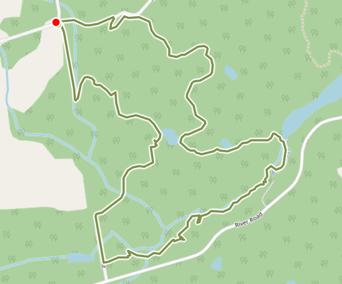
Horse and Around Snowshoe Hike
https://hikesstaging.brucetrail.org/event/horse-and-around-snowshoe-hike/Sorry, the registration cut-off time for this hike has been reached.Not a member? Click here to join today!Hosting Club: Dufferin Hi-Land
Category: General Hike
Location (Google Maps): Pine River Nature Reserve. Second Line and 15 Sideroad in Mulmur Ontario.From Orangeville, head north on hwy #10 to hwy #89. Turn left and head west to county road #124. Turn right and head north to 15 Sideroad. Turn right and follow to 2nd line. Parking is on the east side of 2nd Line, just north of 15 Sideroad
Hike Leader(s): Tom Thayer, Susan Bate Click here to contact Hike Leader(s)
Pace: Leisurely, Medium
Terrain: Dependent on Conditions, Moderate, Strenuous
Distance: 6 kmDescription
Please Note: Snowshoes are RequiredWe will be doing a 6km snowshoe hike starting on the Pine River Nature Reserve and weather permitting, following a horse trail, crossing a pond on Ministry of Natural Resources property and along the Pine River then north to enter the Pine River Nature Reserve once again.
If the weather is not permitting us to cross the pond safely, we will be mainly traversing the Pine River Nature Reserve on an alternate route but will still be visiting the Pine River Pond.
This hike has an average elevation decline and gain of 110 meters and if the weather does permit our crossing, there will most likely be some deep snow.
Be sure to bring Snowshoes, Water, and a snack.
- 12March 12, 2023
Limehouse Loop
https://hikesstaging.brucetrail.org/event/limehouse-loop-2/Sorry, the registration cut-off time for this hike has been reached.Not a member? Click here to join today!Hosting Club: Dufferin Hi-Land
Category: General Hike
Location (Google Maps): Limehouse Conservation Area parking at the baseball diamonds. Access from Fifth Line.Hike Leader(s): Stuart Law
Pace: Medium
Terrain: Moderate, Slippery Sections Likely
Distance: 13.5 kmsDescription
Join us for a loop hike in the snow on the Black Creek Side Trail, the Canada Goose Side Trail, the Charles Hildebrandt Side Trail and the main Trail connecting them all. We will be walking in the woods, through the fields and along a country road. Mercifully the rocky parts of the trail will be smoothed over with snow but be warned, the snow will be deep and the going will be tough in spots. We are proudly Canadian though so we should be able to handle it. Please bring icers, a warm drink, water, a snack, an appreciation of nature and a smile.
Migration Monitor Hike
https://hikesstaging.brucetrail.org/event/migration-monitor-hike/Sorry, the registration cut-off time for this hike has been reached.Not a member? Click here to join today!Hosting Club: Peninsula
Location (Google Maps): Parking for all hikes start at km 109.7, 30th Ed Ref Manual. Park adjacent to Cape Chin Mail boxes on Cape Chin North Road
Hike1 (Mar 12, 26, Apr 9): Otter Lake/Cape Chin Loop – see details below
Hike 2 (Mar 19, Apr 2, Apr 16): Borchardt/Cotrill Lk Loop – see details belowHike Leader(s): Tamara Wilson Click here to contact Hike Leader(s)
Pace: Brisk, Leisurely
Terrain: Difficult
Distance: Each hike ranges 10 to 12 kmDescription
Join us as we look for clues of spring’s arrival on Cape Chin North. We will alternate two routes on a weekly basis, watching for seasonal changes along the wetlands, small inland lakes, woodlands and escarpment shoreline. We will stop, look and listen for the arrival of plants and flowers, birds and other harbingers of spring. Hikes are weather dependent and will be cancelled for treacherous local driving conditions (mud), rain, snow or very strong winds. Always check the road and weather conditions for the entire length of your trip up as local weather can be quite different. Some hikes may recommend snow shoe hikes (I will let you know). Poles and crampons are recommended for navigating wet and slippery conditions typical of spring hikes. It is recommended to bring snacks and water for the hike. A dry set of socks and shoes is a good idea for the trip home. A sweep, topic experts – all are welcome!Alternating hikes:
Hike1 (Mar 12, 26, Apr 9): From km 109.7 parking, Otter Lk ST (2.2 km), up Cape Chin N Rd (past Tagwerk) to Cape Chin Meadow ST (1km) to Cape Chin Driveway (2.5 km) to house, North along MT back to parked vehicles (3.6 km ) – Total 9.3 km approx
Hike 2: (Mar 19, Apr 2, Apr 16) – From km 109.7 parking, MT North through Cape Chin Woods to Borchardt Parking (2.3 km), Minhinnik ST (1.7km) to Lillie Parking Lot, Take Cotrill Lk ST (1.4km) to Anne and Clayton Robert’s St (turn right) back to Britain Lk Rd (1km). At this point we will either a) follow Britain Lk Rd and reverse the route that we took (Minhinnik to Borchardt back along Borchardt to parking) – approx 12km OR b) if conditions are good, we will follow the Main Trail back along the escarpment to Borchardt PL and hike back to the vehicles along Borchardt.
Glen Stewart Ravine/Toronto Beaches/Winter Stations
https://hikesstaging.brucetrail.org/event/glen-stewart-ravine-toronto-beaches-winter-stations/Sorry, the registration cut-off time for this hike has been reached.Not a member? Click here to join today!Hosting Club: Toronto
Category: Urban Walk
Location (Google Maps): Meet in front of Toronto Public Library Beaches Branch 2161 Queen Street East. Take the #64 Main Street Bus Southbound from Main Street Subway Station to Queen Street and walk two blocks west to the library on the south side of Queen Street.Hike Leader(s): Tom Swales Click here to contact Hike Leader(s)
Pace: Moderate
Terrain: Flat, Variable
Distance: 8 kmDescription
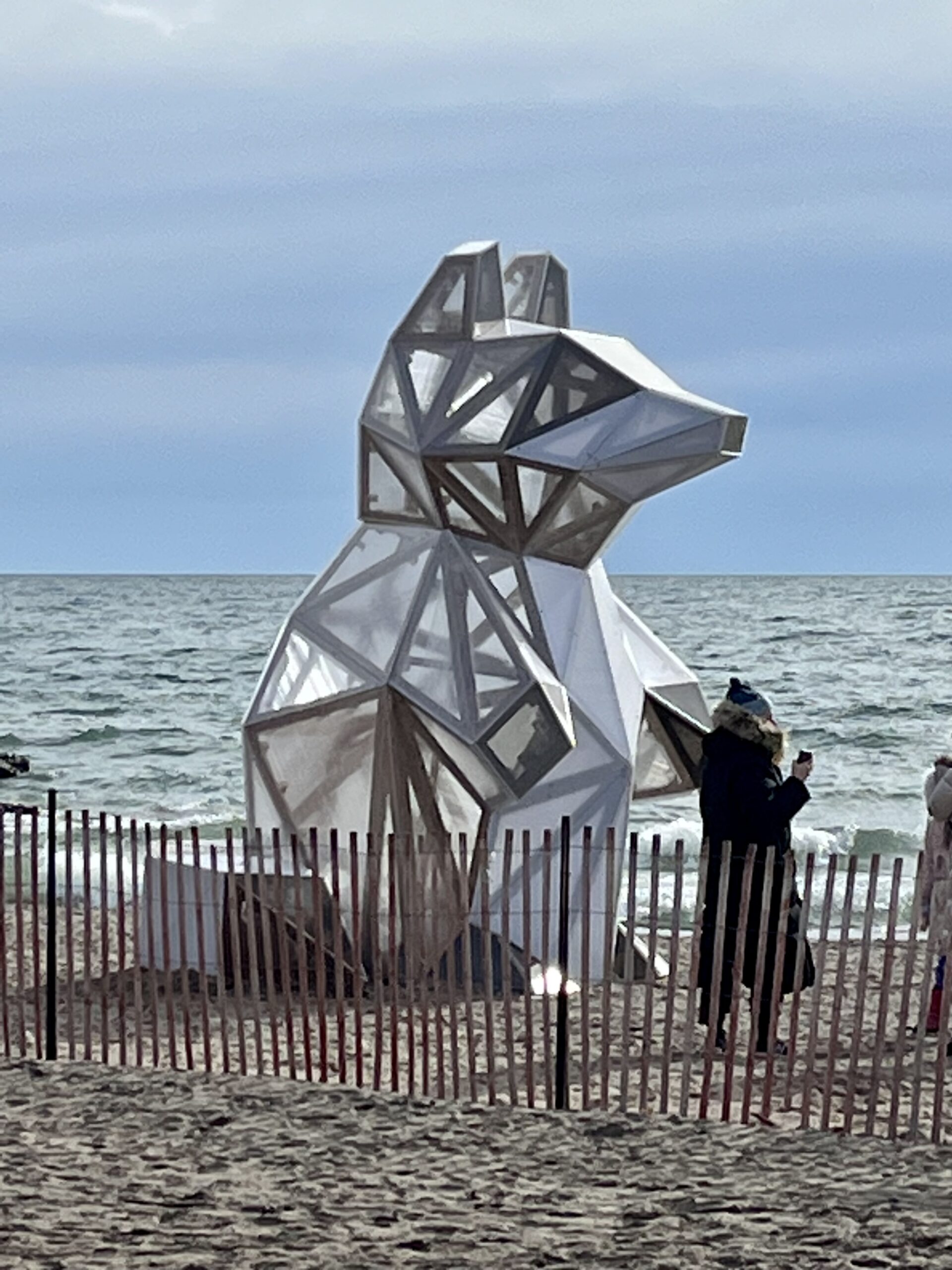
Join us for a walk along the boardwalk of Toronto’s Beaches area and Ashbridge’s Bay as we view the public art installations of “Winter Stations” along Woodbine Beach. Then from Ashbridge’s Bay we will walk to the east end of the boardwalk and for those who wish, north in the peaceful Glen Stewart Ravine to Kingston Road for an optional pub stop at “The Feathers”. Bring icers if planning to hike through the Glen Stewart Ravine.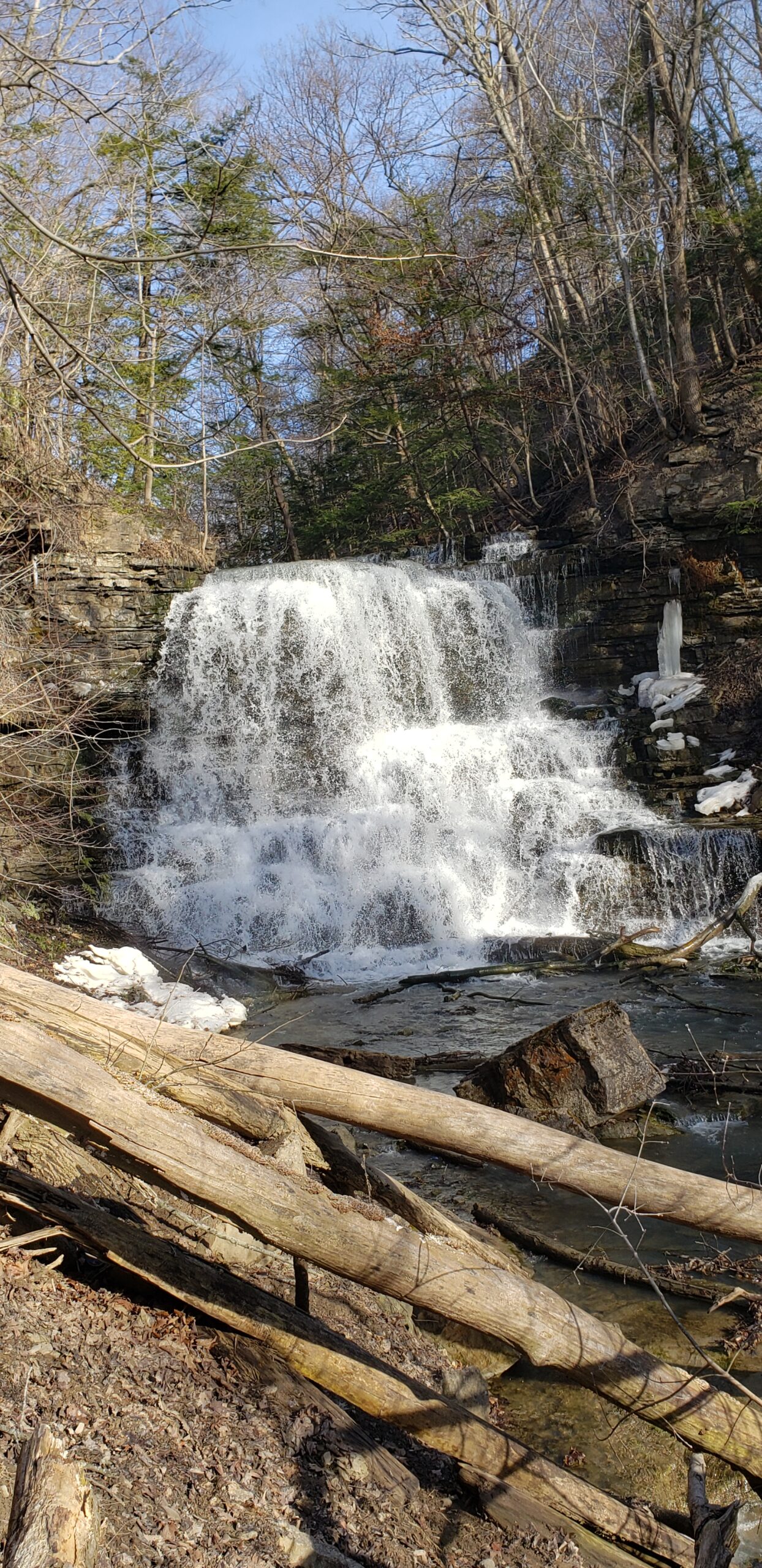
Youth Hike at Decew Falls (Ages 18-25 only)
https://hikesstaging.brucetrail.org/event/youth-hike-at-decew-falls-ages-18-25-only/Sorry, the registration cut-off time for this hike has been reached.Not a member? Click here to join today!Hosting Club: Niagara
Category: Youth Hike
Location (Google Maps): 2714 Decew Rd, St. Catharines, ON L2R 6P7Right next to the intersection of Decew Road and Cataract Road. Parking lot beside the hydro pumping station. Also known as Morningstar Mill.
Hike Leader(s): Nolan Repovs Click here to contact Hike Leader(s)
Pace: Leisurely
Terrain: Moderate, Strenuous
Distance: 3 kmDescription
Ages 18-25 onlyA great chance to connect with like minded young people, and possibly network, or just enjoy the hike.
Join us for a nice hike at Decew Falls!
Where appropriate footwear, likely to be snowy. Weather looks like it’ll be around zero degrees.
We will meet at the parking lot at noon, start the hike around 12:10pm
Snowshoe Clearview loop
https://hikesstaging.brucetrail.org/event/snowshoe-clearview-loop/Sorry, the registration cut-off time for this hike has been reached.Not a member? Click here to join today!Hosting Club: Sydenham
Category: General Hike
Location (Google Maps): Meet in the north-east corner of the parking lot at Home Depot on Highway 26 on the east side of Owen Sound.Hike Leader(s): Bill Snel Click here to contact Hike Leader(s)
Pace: Leisurely: 3 km/h or less
Terrain: Moderate: Some hills and/or poor footing
Distance: 2.8 kmDescription
Carpool to snowshoe the Clearview Side Trail loop. Map 31. If you are unable to register, please contact Bill Snel at w.snel2@gmail.com or landline at (519) 470-0584.