
Hike Schedule
Join us for a hike! Registration required.
All hikes available to BTC members. Some hikes are open to non-members.
See Refund Policy for Paid Hikes >
TIP: The calendar view displays up to 7 hikes on a day, but often there are more. Click “View more events” to see them all.
Categories
- 05March 5, 2023
Car Hike: Greenwood Conservation Area: Learn about environment protection and wildlife
https://hikesstaging.brucetrail.org/event/car-hike-greenwood-conservation-area-learn-about-environment-protection-and-wildlife/Sorry, the registration cut-off time for this hike has been reached.Not a member? Click here to join today!Hosting Club: Toronto
Category: Car Hike
Location (Google Maps): Greenwood Conservation North Entrance, 5th Concession Rd, Pickering, ON. From Toronto, take Don Valley hwy 404 northbound and get on 401 hwy eastbound towards Pickering. Take exit 399 to hwy 1 Brock Road and head northbound. Take a right at 5th Concession road. If there is no parking in the parking lot, park on the north side of the street.Hike Leader(s): KJ Chong; Jacqueline Van Dyke Click here to contact Hike Leader(s)
Pace: Moderate
Terrain: Variable
Distance: 11 km (EDIT: distance may be lower eg. 8 km depending on conditions)Description
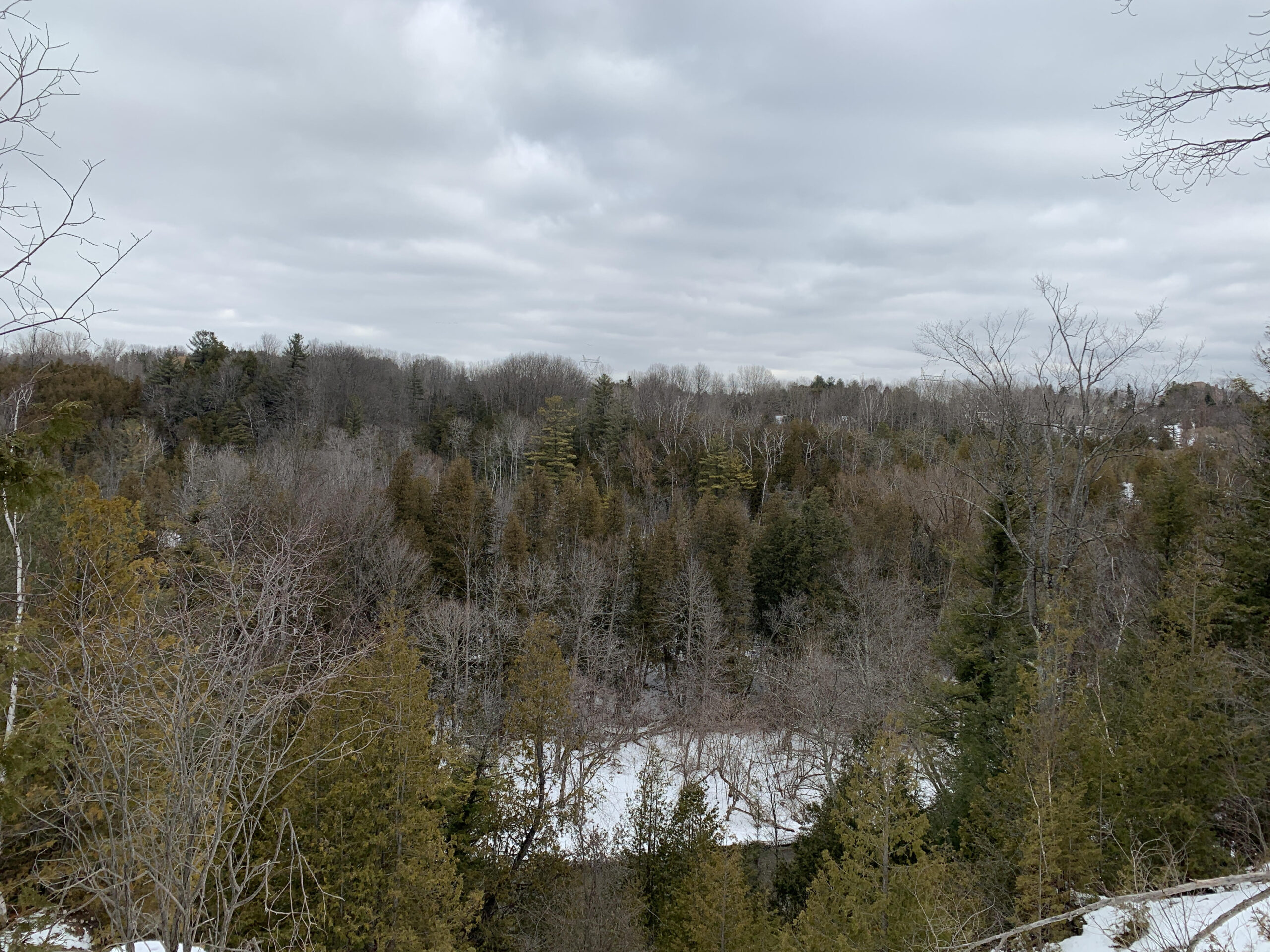
An educational hike into Greenwood Conservation Area, a beautiful area with forests, creeks and a look outpoint. This hike will have multiple stops to share information about environmental protection, wildlife in the area and interesting plants and invasive species. We will also visit a barn ruins and see farm remnants along the way. It is expected to be icy but generally gentle slopes. There will be two times in which we cross over some (likely frozen) water with wooden logs and one area in which there will be a rope along a few feet of slope. Please note one section will be hiking around an off leash dog park to reach a look out point.Mandatory equipment: icers – if you do not have at trail head, you will be turned away.
Please leave your dogs at home.
Drop out at around 8 km.
Mono Centre - Mono Cliffs
https://hikesstaging.brucetrail.org/event/mono-centre-mono-cliffs/Sorry, the registration cut-off time for this hike has been reached.Not a member? Click here to join today!Hosting Club: Dufferin Hi-Land
Category: General Hike
Location (Google Maps): Red P BTC parking lot at the Mono Community Centre (off 2nd Line EHS), 200 m south of Mono Centre.Hike Leader(s): Stuart Law Click here to contact Hike Leader(s)
Pace: Medium
Terrain: Moderate, Slippery Sections Likely
Distance: 13 kmsDescription
Join us on a snowy Sunday hike on some new BTC trails just south of Mono Centre (Turnball and Springwater) together with the South Outlier and Laidlaw Side Trails and parts of the Main Trail connecting them all. We will be exploring some land purchased by the BTC in 2022. Our donor money in action! Given all the snow we have had and the snow expected in the days before the hike, we could well be snow shoeing instead of hiking in which case we will shorten the length of our hike. Please have your snow shoes in the car just in case. Snow shoeing will be optional though so those not wishing to do so remain most welcome. Icers mandatory. Please pack a warm drink, some water, a snack, a lunch, an appreciation of nature and a smile. Optional pub stop after.
Dundas Valley Double Loop Cancelled
https://hikesstaging.brucetrail.org/event/dundas-valley-double-loop/Sorry, the registration cut-off time for this hike has been reached.Not a member? Click here to join today!Hosting Club: Iroquoia
Category: General Hike
Location (Google Maps): Dundas Valley Conservation Area, 650 Governor’s Rd. DundasHike Leader(s): Anne Armstrong Click here to contact Hike Leader(s)
Pace: Medium – 3 to 4 km/hr
Terrain: Moderate – Some hills and/or some poor footing
Distance: Approx. 10 km.Description
Join us to hike the lovely trails and hills of the Dundas Valley Conservation Area with its many hills and ravines. Park in the last parking lot of the Governor’s Rd. entrance and make your way up to the trail centre which has bathrooms. The hike starts at 10:00 am. so try to arrive by 9:45 am. Bring water, a snack/lunch, icers and poles if using. Parking fee or Conservation Area pass.
Leader: Anne Armstrong 905 617 3937 hikingrandma@gmail.com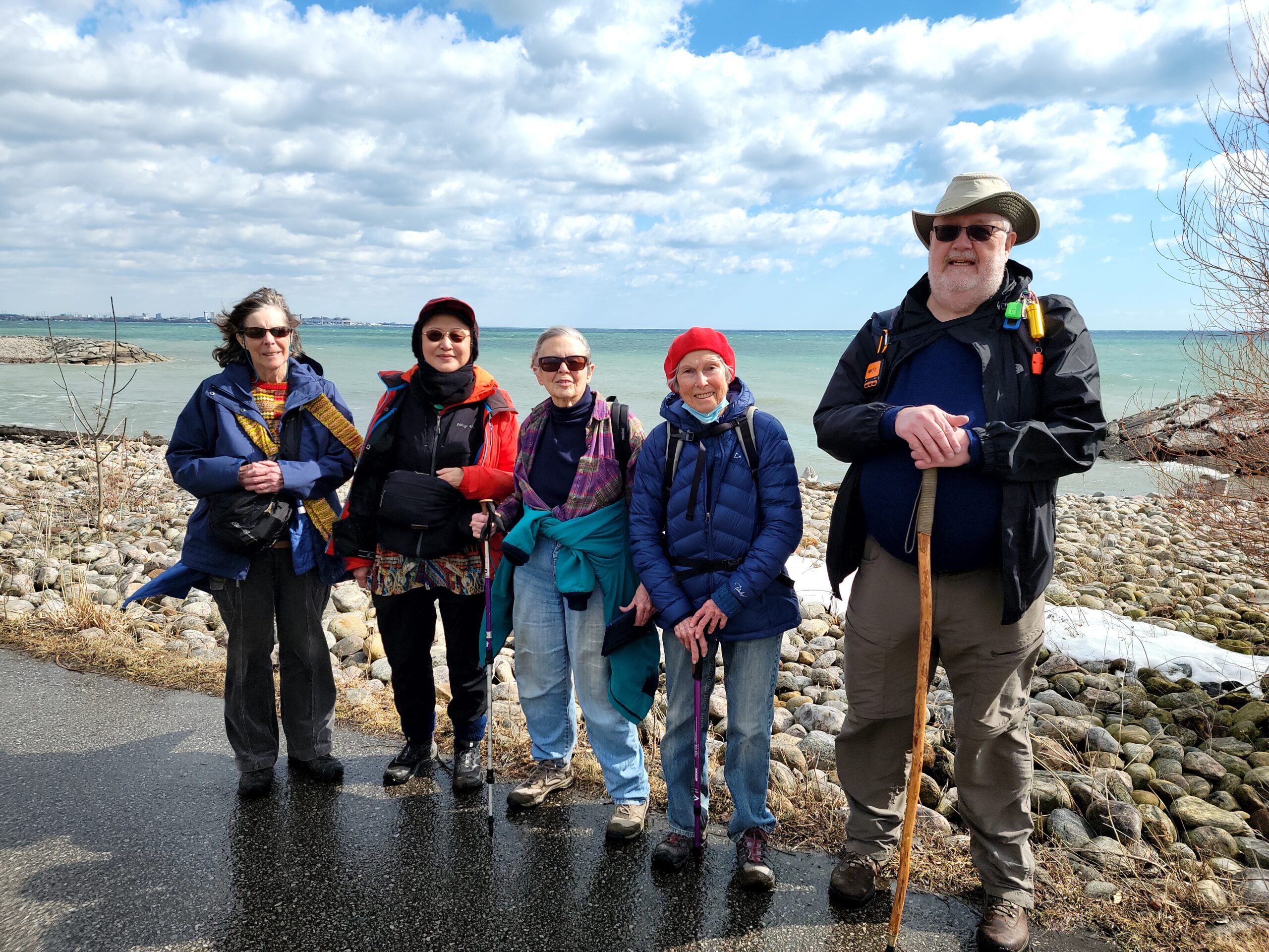
Urban Walk: Waterfront Trail 8/8 - Beechgrove to Pickering!
https://hikesstaging.brucetrail.org/event/urban-walk-waterfront-trail-8-8-beechgrove-to-pickering/Sorry, the registration cut-off time for this hike has been reached.Not a member? Click here to join today!Hosting Club: Toronto
Location (Google Maps): Scarborough/Durham Waterfront Trail
Hike Leader(s): Brian Rideout Click here to contact Hike Leader(s)
Pace: Moderate
Terrain: Flat
Distance: 11.9 kmDescription
This hike is cancelled due to snow accumulation.Please meet me at Kennedy Station by 10:05 am. We will take the 86 Scarborough bus departing 10:19 am, arriving 10:54 am. We start hiking 11:00 am.
Due to a trail closure the hike will start at Port Union. We will hike along the Waterfront Trail through Port Union and Rouge Hill to Pickering GO. The estimated distance is 9.8 km. Here is an online map of our route – Port Union to Pickering
Bring a snack, at least 2 liters of water, and icers. Dress for cold weather.
Snowshoe Cottonwood Side Trail
https://hikesstaging.brucetrail.org/event/snowshoe-cottonwood-side-trail/Sorry, the registration cut-off time for this hike has been reached.Not a member? Click here to join today!Hosting Club: Sydenham
Category: Snowshoe Hike
Location (Google Maps): Meet in the north-east corner of the parking lot at Home Depot on Highway 26 on the east side of Owen Sound.Hike Leader(s): Maureen McFarland Click here to contact Hike Leader(s)
Pace: Leisurely: 3 km/h or less
Terrain: Easy: Mostly flat and good footing.
Distance: 2.1 kmsDescription
Come out and explore Sydenham Bruce Trail Club’s newest side trail. This is an easy snowshoe on flat terrain. Great for beginners and families. There is a beautiful, huge cottonwood tree on the property. Fun fact – Cottonwoods are the fastest growing trees in North America and can grow as much as 6’ per year. In spring the female cottonwood trees produce a cottony substance that helps with seed dispersal. We will also visit a waterfall.If you don’t have snowshoes, they can be borrowed for free from the Owen Sound library. If you are unable to register, please call or text Maureen at 647-918-4180.
- 06March 6, 2023
Car Hike: Toronto E2E 1/3
https://hikesstaging.brucetrail.org/event/car-hike-toronto-e2e-1-3/Sorry, the registration cut-off time for this hike has been reached.Not a member? Click here to join today!Hike open to BTC Members only.
Hosting Club: Toronto
Category: Car Hike
Location (Google Maps): We will meet at km 17.4 (GPS N43.615163, W79.975157) on the east side of the road where the trail crosses Fourth Line.Hike Leader(s): Jacquie Van Dyke Click here to contact Hike Leader(s)
Pace: Brisk
Terrain: Rocky, Variable
Distance: 18 kmDescription
This is the first of three hikes to hike the Toronto section E2E. We will be hiking in later winter/early spring conditions (mud, ice, snow) so be prepared for it all. Please bring your icers, gaitors, and poles. Hiking boots/shoes are mandatory. Please bring at least 2L of water, snacks, and your lunch.We will be shuttling to Hilton Falls CA parking, close to Appleby Line, and hiking by the location of the first blaze on the Bruce Trail. Please note, we will need to pay for parking at Hilton Falls. If any hiker has an annual pass, please let me know. Pass holders can do this shuttle and the rest of the hikers are expected to pay the driver $2. If there are no pass holders, hikers will share the cost of the parking. Hikers are expected to follow all Covid 19 restrictions.
Please arrive by 7:45 so we can get organized. We will begin our shuttle at 8:00 am.
- 07March 7, 2023
9:00 Long Hike Rockway
https://hikesstaging.brucetrail.org/event/900-long-hike-wiley-road-short-hills-15/Sorry, the registration cut-off time for this hike has been reached.Not a member? Click here to join today!Hosting Club: Niagara
Location (Google Maps): Rockway
Hike Leader(s): Alan Laver Click here to contact Hike Leader(s)
Pace: Medium
Terrain: Moderate
Distance: 10kmDescription
Explore Rockway and Louth Conservation area . Register for each hike
Bring Poles water, snack and Dress for the weather, Icers and layers/p>
9:15 Short hike - Rotary Park, St. Catharines
https://hikesstaging.brucetrail.org/event/915-short-hike-rotary-park-st-catharines/Sorry, the registration cut-off time for this hike has been reached.Not a member? Click here to join today!Hosting Club: Niagara
Category: In and Out
Location (Google Maps): Rotary Park, St CatharinesHike Leader(s): janet davey Click here to contact Hike Leader(s)
Pace: Medium
Terrain: Moderate
Distance: 6 kmsDescription
Hike the trails in Rotary Park. Bring hiking boots, water and icers.Loree Forest
https://hikesstaging.brucetrail.org/event/loree-forest-2/Sorry, the registration cut-off time for this hike has been reached.Not a member? Click here to join today!Hosting Club: Beaver Valley
Location (Google Maps): Park at km 0 in Beaver Valley section (Maple Lane)
Map 24, Edition 30Hike Leader(s): Kristina Rettie Click here to contact the hike leader.
Pace: Brisk
Terrain: Moderate, Some steep sections
Length of Hike: 13.5kmDescription
This in and out hike will take us along the top of Blue Mountain and Craigleith and part way around Loree Forest. We will take the Len Gertler Side Trail back to the main trail as we re-trace our steps back to the cars. If there is lots of snow we will shorten this hike to keep it within 4hrs.Please bring snacks and water
Please no dogs
Please text Kristina @ 519-410-9077 for morning of cancelations
COVID-19 Precautions Before, During and After your Hike
- Each hiker joining a Bruce Trail Club organized hike must perform a self-screening check before hiking.
Find Ontario’s self-assessment tool here: https://covid-19.ontario.ca/self-assessment/ - If you are experiencing COVID-19 symptoms, stay home.
- Personal Protective Equipment:
- Hikers may choose to wear masks
Transportation
It is the Bruce Trail Conservancy’s current policy that car shuttles are allowed. It is at the discrepancy of individual hike leaders to make that decision.
Other Guidelines
- Arrive 15 minutes before the start of the hike.
- Wear sturdy footwear and appropriate attire for the weather and the terrain.
Hiking poles are a good idea in any season, especially if the terrain is rocky or slippery. In winter, snowshoes or icers/crampons are needed when conditions dictate.
Wearing appropriate clothing and footwear prevents injuries and shows consideration for a safe and positive group hiking experience. - Always carry I.D. and your health card.
- Bring sufficient water and snacks (or lunch if indicated). A minimum of 1L of water is recommended on all hikes, and 3L is recommended for long, challenging hikes in the heat of the summer.
- Bring sunscreen and insect repellent (for spring and summer hikes).
- Bring your own first aid kit.
- Please leave dogs at home.
Hockley Valley-Tom East Loop
https://hikesstaging.brucetrail.org/event/hockley-valley-tom-east-loop-3/Sorry, the registration cut-off time for this hike has been reached.Not a member? Click here to join today!Hosting Club: Dufferin Hi-Land
Category: Tuesday Hike
Location (Google Maps): Caledon Hills Section, Map 18, Meet at Hockley Rd parking lot on the north side of Hockley Rd, 250 meters east of 2nd line (near Km 61.3)Hike Leader(s): Inge Eckerich, Les Babbage , Julie Daley, Tony Evangelista Click here to contact Hike Leader(s)
Pace: Leisurely
Terrain: Slippery and Steep Sections
Distance: 5.6 Km, Short hike: 2.5 Km.Description
We will hike a loop consisting of Hockley Rd and Tom East Side trails and Main Trail. Shorter hike will turn back where the Tom East trail turns sharply to the east. Bring icers. Snowshoes may be requiredGlen Haffy Conservation Area and Glen Haffy Side Trail loop
https://hikesstaging.brucetrail.org/event/glen-haffy-conservation-area-and-glen-haffy-side-trail-loop/Sorry, the registration cut-off time for this hike has been reached.Not a member? Click here to join today!Hosting Club: Caledon Hills
Category: Tuesday Hikers
Location (Google Maps): Glen Haffy Conservation Area/Mono MillsHike Leader(s): Doris Harper Click here to contact Hike Leader(s)
Pace: Medium – 3 to 4 km/hour
Terrain: Moderate – some hills and/or some poor footing
Distance: 10.5 kmDescription
Starting from the parking area on Coolihans Sideroad, {map 17 of the BTC Trail guide}, we will hike the main trail through Glen Haffy and connect to the Glen Haffy Side Trail. We will hike the 4.8 km of the side trail back to the parking area on Coolihans Sideroad. If there is snow, consider bringing snowshoes. Icers, gators and poles highly recommended; trail is hilly and can be slippery. Bring water and snacks.Please check email before leaving home as the hike may be cancelled due to weather conditions.
If you need to cancel on the day of the hike please notify hike leader directly. Thank you
Doris Harper
harpt7c@gmail.com
519-589-4114

7:00 pm Moonlight Night Hike in Niagara-on-the-Lake
https://hikesstaging.brucetrail.org/event/700-pm-moonlight-night-hike-in-niagara-on-the-lake-2/Sorry, the registration cut-off time for this hike has been reached.Not a member? Click here to join today!Hosting Club: Niagara
Category: Night
Location (Google Maps): Veteran’s Memorial Park, park just outside the park on King St.Hike Leader(s): Robin Garrett Click here to contact Hike Leader(s)
Pace: Medium
Terrain: Easy
Distance: 6-7 kmDescription
Moonlight Night Hike – Take in the magic of the rising moon over Lake Ontario and the Niagara River. This hike includes a stop to connect with your senses – sights, sounds, smells and the rhythm of your breath. Counts towards your night hike badge (5 night hikes).Moonlight Hike - 11th Line Loops
https://hikesstaging.brucetrail.org/event/moonlight-hike-11th-line-loops/Sorry, the registration cut-off time for this hike has been reached.Not a member? Click here to join today!Hosting Club: Blue Mountains
Category: Register on-line or sign-in morning of hike
Location (Google Maps): Hike meets in the parking lot behind Tim Hortons on First St. in Collingwood.Hike Leader(s): Bob Moenck Click here to contact Hike Leader(s)
Pace: Leisurely – 3 km/hr. or less
Terrain: Moderate – Some hills and/or some poor footing
Distance: 5kmDescription
We will drive to a suitable start point for a hike through the many loop trails off the Eleventh Line, just west of Collingwood. The trails are mostly in the trees and well sheltered. The hike will be about two hours. March’s full moon is commonly called the Full Worm Moon only by Southern Native American tribes. Northern American tribes such as the Shawnee tribe, called it the Sap Moon instead, as a reminder for the tribes that they can begin tapping maple syrup. In general, March’s full moon is known for the beginning of spring and new agricultural cycles. Bring a snack and water. Moonlight Badge available for $10 MEMBERS/ $15 NON-MEMBERS - Each hiker joining a Bruce Trail Club organized hike must perform a self-screening check before hiking.
- 08March 8, 2023

8:30 Merritt Trail Hike Series #2
https://hikesstaging.brucetrail.org/event/830-merritt-trail-hike-series-2/Sorry, the registration cut-off time for this hike has been reached.Not a member? Click here to join today!Hosting Club: Niagara
Category: Car Pool
Location (Google Maps): Meet at the Parking Lot at Book Depot , 67 Front St North Thorold, 43.128058, -79.202189
Carpool to parking lot on Merritt Island, WellandHike Leader(s): Sam Rutherford Click here to contact Hike Leader(s)
Pace: Brisk
Terrain: Easy
Distance: 15kDescription
Hike from Merritt Island , Welland to Thorold along the Welland Canal on mainly paved trails. Bring snacks and a drink .Earn the Merrritt Trail badge for all 3 hikes
Inglis Falls/Harrison Park Loop
https://hikesstaging.brucetrail.org/event/inglis-falls-harrison-park-loop/Sorry, the registration cut-off time for this hike has been reached.Not a member? Click here to join today!Hosting Club: Blue Mountains
Category: Register on-line or sign-in morning of hike
Location (Google Maps): Hike meets in the parking lot behind Tim Hortons on First St. in Collingwood.Hike Leader(s): Annette Sandberg Click here to contact Hike Leader(s)
Pace: Medium – 3 to 4 km/hr
Terrain: Moderate – Some hills and/or some poor footing
Distance: 8-10kmDescription
We will park in Harrison Park, Owen Sound and start out south on the Palisades Side Trail before taking the white blazed trail to Inglis Falls at km 94.5 of the Sydenham section. After viewing the falls, we will return to the cars via Harrison Park Side Trail. Varied terrain and spectacular falls. Bring snacks and water. Option: Lunch on the way home or at Harrison Park cafe.9:00 Kinsman Park to Locust Lane Winery
https://hikesstaging.brucetrail.org/event/900-kinsman-park-to-locust-lane-winery-2/Sorry, the registration cut-off time for this hike has been reached.Not a member? Click here to join today!Hosting Club: Niagara
Category: In and Out
Location (Google Maps):Kinsman Park parking lot
Hike Leader(s): Karen Limardi Click here to contact Hike Leader(s)
Pace: Medium
Terrain: Moderate
Distance: 6-7 KMDescription
A beautiful hike on the trail. We will pass lovely vineyards, creek beds and farmers fields. There will be a teeny tiny bit of road walking on this hike. Hiking boots and poles highly recommended as the terrain can be extremely slippery if wet or icy. Please bring water, poles and dress in layers.
Sixteen Mile Creek Wanderings
https://hikesstaging.brucetrail.org/event/sixteen-mile-creek-wanderings/Sorry, the registration cut-off time for this hike has been reached.Not a member? Click here to join today!Hosting Club: Iroquoia
Category: Good Companions
Location (Google Maps): Sixteen Mile Creek – River Glen Blvd./Neyagawa Blvd.Intersection, OakvilleHike Leader(s): Anne Armstrong Click here to contact Hike Leader(s)
Pace: Leisurely – 3km/hr or less
Terrain: Easy – Mostly flat and usually good footing
Distance: Approx. 9 km.Description
Although this oasis sits in the middle of Oakville, once on the trail system one would not know it. The trails are on sides of the Sixteen Mile Creek and are sometimes on top of the banks and other times down beside the creek. The valley is rich in history, both Indigenous and early settlers from Europe and the USA. Come join us for this beautiful hike and learn more about the valley. Meet on the southeast corner of Neyagawa Blvd. and River Glen Blvd. at 9:45 am. for a 10:00 am. start. Park in the lot beside the baseball fields. Bring water, a snack. Icers may be necessary and poles are useful. We will be going down two long hills and up two.
Leader: Anne Armstrong 905 617 3937 hikingrandma@gmail.com