
Hike Schedule
Join us for a hike! Registration required.
All hikes available to BTC members. Some hikes are open to non-members.
See Refund Policy for Paid Hikes >
TIP: The calendar view displays up to 7 hikes on a day, but often there are more. Click “View more events” to see them all.
Categories
- 09March 9, 2024
Noisy River Rim EARLY START
https://hikesstaging.brucetrail.org/event/noisy-river-rim-early-start/Sorry, the registration cut-off time for this hike has been reached.Not a member? Click here to join today!Hosting Club: Blue Mountains
Category: Register online ONLY
Location (Google Maps): .Hike Leader(s): Hart Fischer Click here to contact Hike Leader(s)
Pace: Brisk – 4 to 5 km/hr
Terrain: Strenuous – Hilly with steep climbs and some poor footing
Distance: 6 kmDescription
CONTACT Hike Leader to get directions for meet-up point. We will park at the side of the road at the Noisy River Provincial Park on County Road 9. We will descend into the park crossing the Noisy River before ascending to Concession 9. At this point, we will turn around and hike back to County Road 9. This 2km stretch will be repeated two more times for a total of 6kms. A very hilly hike. Bring lots of water, snacks and lunch. Purchase your Winter R2R badge online if all three hikes were completed ($10.00).CANCELLED Winter Coach Trip: Arrowhead Provincial Park
https://hikesstaging.brucetrail.org/event/winter-coach-trip-arrowhead-provincial-park-3/Sorry, the registration cut-off time for this hike has been reached.Not a member? Click here to join today!Hosting Club: Toronto
Category: Cancelled
Location (Google Maps): Arrowhead Provincial ParkHike Leader(s): Martina Furrer, Frank Ye, Jen Zhang Click here to contact Hike Leader(s)
Description
Cancelled because spring appears to be here to stay.No trail fees at Arrowhead! Bus cost includes park admission.
Bus departs 10 York Mills Rd at 8:00 AM and Major Mackenzie Dr and HWY 400 Park and Ride at 8:20 AM. If you wish to be picked up at the Major Mackenzie Dr and HWY 400 Park and Ride, select that option when you register. Please arrive 15 minutes before departure. The bus waits for no one.
Join us for an awesome day of winter fun at Arrowhead Provincial Park. For information about trail conditions visit: https://www.ontarioparks.com/skireport. For information about the park visit: https://www.ontarioparks.com/park/arrowhead. Join Frank and Jen for a guided snowshoe hike, or enjoy self-guided skiing on trails groomed for classic and skate skiing. After skiing or snowshoeing spend some time ice skating (if open) in the forest.
There are no food services in the park. Pack water/tea and lunch.
Ski and snowshoe rentals available.
Coach fares and park admission must be paid online when you register. Masks are recommended while on the bus.
Car Hike: Boyd Conservation Park Vaughan125
https://hikesstaging.brucetrail.org/event/car-hike-boyd-conservation-park-vaughan-4/Sorry, the registration cut-off time for this hike has been reached.Not a member? Click here to join today!Hosting Club: Toronto
Location (Google Maps): Boyd Conservation Park, Islington Avenue, Vaughan, ON free parking at the entrance of the park
Hike Leader(s): Mohammad Aghamiri , 19 Willowbrook Rd Click here to contact Hike Leader(s)
Pace: Moderate
Terrain: Variable
Distance: 14-15KMDescription
Explore the trails that wind through the beautiful valley at Boyd Conservation Area and the William Grainger Greenway. We will have lunch/snack in shelter with seated area,It is winter time all participants are required to have Ice cleats with them, have proper shoes, warm clothing and hot drinks with you.
Please carefully read safety procedures during the hike:
1-Hikers must stay between the leader and the sweep.
2-Hikers must advise the leader or the sweep if they wish to leave the group.
3- Hikers must follow the whistle instructions: 1 blast- stay where you are; 2 blasts come to the leader; 3 blasts – come to the leader quickly.
4-Hike leader may request volunteers to stop at trail intersections, they need to help hikers to the direction the group walk and wait till they see the sweep .
5-Hikers have to make sure they can see the persons behind and in front of them.
9:00 am Hydro Hill Training
https://hikesstaging.brucetrail.org/event/900-am-hydro-hill-training-3/Sorry, the registration cut-off time for this hike has been reached.Not a member? Click here to join today!Hosting Club: Niagara
Category: In and Out
Location (Google Maps):Lockhart Drive, St Catharines, by the large yellow swing gate.
Hike Leader(s): Suzanne Gourluck Click here to contact Hike Leader(s)
Pace: Brisk
Terrain: Strenuous
Distance: 6 kmsDescription
This challenging “hike” is intended for those wishing to train for future challenging hikes. Choose your own pace to go up and down the moderately steep hill for 90 minutes with a brief flat walk partway through. The terrain is a hard packed gravel surface. Bring water, hiking poles, snack and dress for the weather.Spring Grind 2024 Hike Series: Hike 1 of 5 - Dundas Valley Conservation Area
https://hikesstaging.brucetrail.org/event/spring-grind-2024-hike-series-hike-1-of-5-dundas-valley-conservation-area/Sorry, the registration cut-off time for this hike has been reached.Not a member? Click here to join today!Hike open to BTC Members only.
Hosting Club: Dufferin Hi-Land
Category: General Hike
Location (Google Maps): Meet Point: Sanctuary Park parking lot, Sanctuary Dr., Dundas Ontario.Hike Leader(s): Gilles Gagnon Click here to contact Hike Leader(s)
Pace: Brisk, Medium
Terrain: Dependent on Conditions, Moderate, Slippery and Steep Sections
Distance: 19 kmDescription
This the first of five “small group” hikes from March through to June, progressively increasing in both length and total ascent. We’ll start with a 19 km/ 450meter ascent hike, progressing to 25 km with up to approximately 1000 meters of total ascent over the 4 month period. By its nature, this hike will suit experienced hikers who want to up their game. This first hike will be a loop hike within the Dundas Valley Conservation area. Normally, icers are required this time of year. Have them available just in case.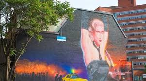
Urban Walk: Graffiti Art, Culture & Nature in Toronto
https://hikesstaging.brucetrail.org/event/urban-walk-graffiti-art-culture-nature-in-toronto/Sorry, the registration cut-off time for this hike has been reached.Not a member? Click here to join today!Hosting Club: Toronto
Category: Urban Walk
Location (Google Maps): Meet in front of Allan GardensHike Leader(s): Sajedeh Zahraei Click here to contact Hike Leader(s)
Pace: Leisurely
Terrain: FlatDescription
This hike is part of a series of urban hikes exploring graffiti art, culture, and social history in Toronto’s streets, laneways, underpasses, and parks across the city. These hikes provide opportunities for reflection on our own identity, personal history, examining our connection to each other and to the land, fostering a sense of community and belonging. In this hike we will explore Carlton Street and Church-Wellesley Village. - 10March 10, 2024

Beaver Valley Winter ETE 6-8 days during March Break 2024 - Please read all details before registering for this hike.
https://hikesstaging.brucetrail.org/event/beaver-valley-winter-ete-6-8-days-during-march-break-2024-please-read-all-details-before-registering-for-this-hike/Sorry, the registration cut-off time for this hike has been reached.Not a member? Click here to join today!Hike open to BTC Members only.
This is a Multi-Day Hike
You are signing up for the following dates and times:
2024-03-10 at 08:30
2024-03-11 at 08:30
2024-03-12 at 08:30
2024-03-13 at 08:30
2024-03-14 at 08:30
2024-03-15 at 08:30
2024-03-16 at 08:30
2024-03-17 at 08:30Hosting Club: Iroquoia, Beaver Valley
Category: General Hike
Location (Google Maps): Blantyre to Swiss Meadows – we will hike southboundHike Leader(s): Ruth Moffatt Click here to contact Hike Leader(s)
Pace: Brisk – 4 to 5 km/hr, Medium – 3 to 4 km/hr
Terrain: Dependent on Conditions, Strenuous – Hilly with steep climbs and some poor footing
Distance: Between 15 and 24km per dayDescription
Beaver Valley Winter End 2 End on March Break.
In this series of 6-8 hikes you will get a chance to test your strength, endurance and perseverance! You will be rewarded with the breathtaking views of winter in the valley, good company and of course the new Beaver Valley winter ETE badge.
This E2E is intended for strong hikers/experienced snowshoers only. We will be hiking at a steady pace with very few short breaks to be sure we keep warm. As we need to be prepared for variable weather conditions, you will be required to carry icers and snowshoes with you on each hike. It will be tough hiking so be sure of your physical ability before signing up for this hike. If the snow is deep, please be prepared to take a turn breaking trail through the snow.
Please do not register for this hike unless you can commit to all 8 days.
This will be a team effort from start to finish like all group hikes are. We will help each other get it done!
As we all know Mother Nature can throw us curve balls at times so please respect the decisions of the leader in case of inclement weather/road & parking conditions. We may need to adjust our meeting location and possibly postpone the hike. Likewise, please be prepared to allow a window of between 6 & 8 days to complete this hike. If we can hike it in 6, we will, but if there are snowy conditions and plenty of snow on the ground, please be prepared to hike it in 7 or 8 days. Your flexibility is very important and a decision closer to the start date will be made based on conditions and the forecast. Also, depending on whether we need 6, 7 or 8 days, we may hike later than the projected finishing time.
Make sure to dress in layers according to the weather conditions presented on hike day.
A hike schedule will be sent to registered participants prior to our start date. We will hike north to south – Blantyre to Swiss Meadows. Again, the schedule could change day-to-day, depending on the conditions.
Due to parking restrictions we will only be accepting 12 hikers including the hike leader.
The Beaver Valley Winter E2E is a club lead series that can only be completed with a club leader.
All hikes in this series will include a car shuttle and everyone will take a turn as a shuttle driver. Please have your vehicle passenger-ready.
If you have any questions please email me.
Please bring plenty of water and snacks/lunch.
No dogs
My contact (text number) will be provided to each registrant.
COVID-19 Precautions Before, During and After your Hike
- Each hiker joining a Bruce Trail Club organized hike must perform a self-screening check before hiking.
Find Ontario’s self-assessment tool here: https://covid-19.ontario.ca/self-assessment/ - If you are experiencing COVID-19 symptoms, stay home.
Transportation
It is the Bruce Trail Conservancy’s current policy that car shuttles are allowed. It is at the discrepancy of individual hike leaders to make that decision. Please bring a face mask if you would prefer to wear one while in the shuttle vehicle.
Other Guidelines
- Arrive 15 minutes before the start of the hike.
- Wear sturdy footwear and appropriate attire for the weather and the terrain.
Hiking poles are a good idea in any season, especially if the terrain is rocky or slippery. In winter, snowshoes or icers/crampons are needed when conditions dictate.
Wearing appropriate clothing and footwear prevents injuries and shows consideration for a safe and positive group hiking experience. - Always carry I.D. and your health card.
- Bring sufficient water and snacks (or lunch if indicated). A minimum of 1L of water is recommended on all hikes, and 3L is recommended for long, challenging hikes in the heat of the summer.
- Bring sunscreen and insect repellent (for spring and summer hikes).
- Bring your own first aid kit.
- Please leave dogs at home.
Iroquoia Odyssey #7 - Kilbride to Hilton Falls Conservation Area
https://hikesstaging.brucetrail.org/event/iroquoia-odyssey-7-kilbride-to-hilton-falls-conservation-area/Sorry, the registration cut-off time for this hike has been reached.Not a member? Click here to join today!Hosting Club: Dufferin Hi-Land
Category: General Hike
Location (Google Maps): Hilton Falls Conservation Area parking lot. Enter from Campbellville Road. Fee and online reservation required at Conservation Halton.Hike Leader(s): Stuart Law Click here to contact Hike Leader(s)
Pace: Medium
Terrain: Moderate, Slippery and Steep Sections, Slippery Sections Likely, Strenuous
Distance: 21 kmsDescription
Join us on the seventh of seven shuttle hikes to complete the Iroquoia Section. We will pass through Halton gems Calcium Pits, Crawford Lake and Rattlesnake Conservation Areas, then do some road walking to pass under the 401 to reach the Hilton Falls Conservation Area. Hike may have to be re-worked if the Kelso Conservation Area is open to us as well. Please stay tuned. Hiking boots, icers and poles essential. Please dress in layers for the weather. Please bring a smile, warm drink, water, a snack and a lunch. Please meet at 8:45 am to be ready to shuttle. Please bring a garbage bag and footwear to change into for the shuttle after the hike (it will be very muddy). Fee and online reservation required at Conservation Halton.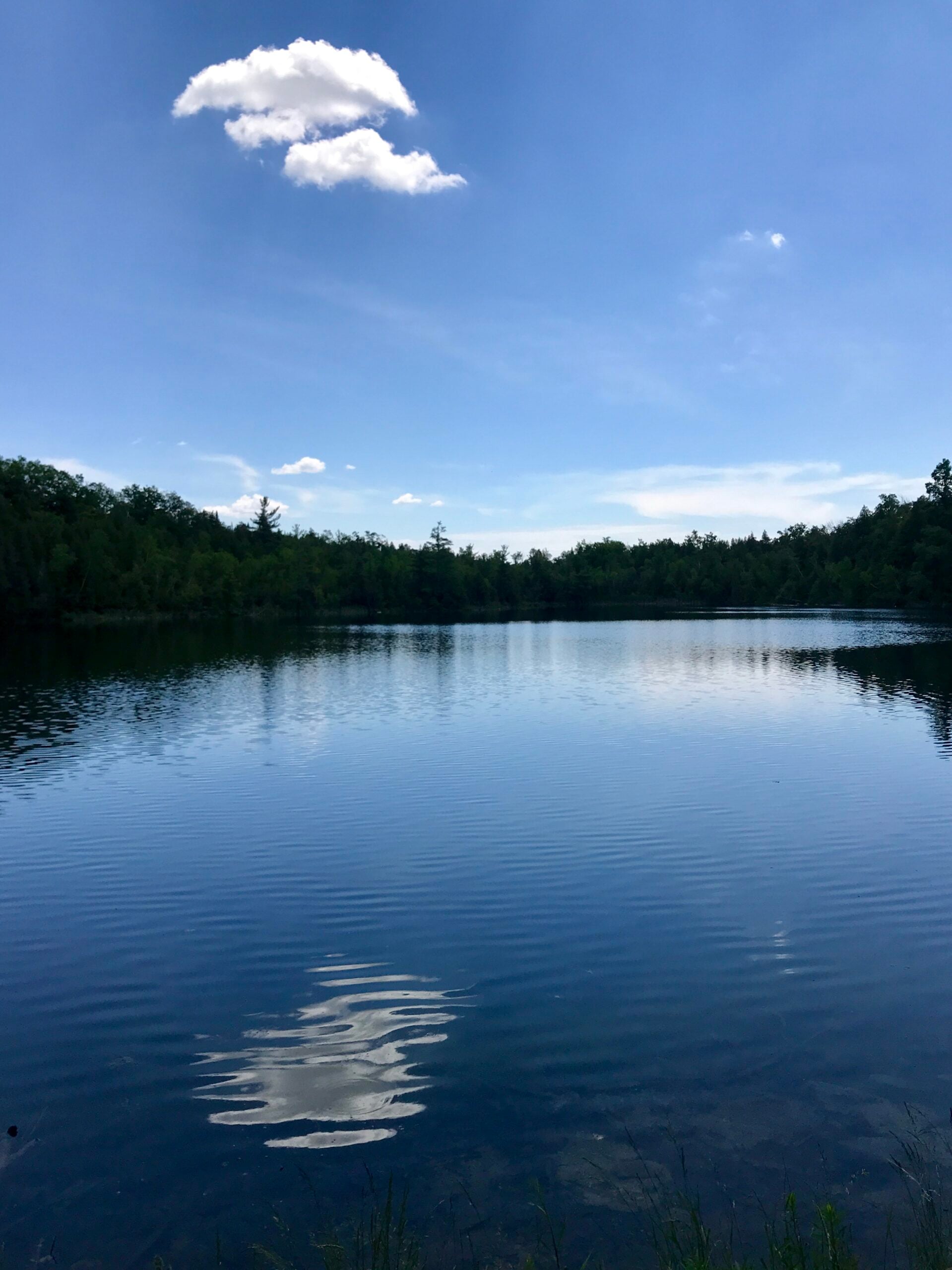
March 10 at 10am for 10km Hike at Crawford Lake
https://hikesstaging.brucetrail.org/event/march-10-at-10am-for-10km-hike-at-crawford-lake/Sorry, the registration cut-off time for this hike has been reached.Not a member? Click here to join today!Hosting Club: Iroquoia
Category: General Hike
Location (Google Maps): Crawford LakeHike Leader(s): Anita Bergsma Click here to contact Hike Leader(s)
Pace: Medium – 3 to 4 km/hr
Terrain: Moderate – Some hills and/or some poor footing
Distance: 10kmDescription
Join us for a 10km hike on March 10 at 10 am at Crawford Lake. This is suitable for intermediate to advanced hikers.There is a cost to enter Crawford Lake or flash your Halton Conservation Card.
Meet in the parking lot.
Proper hiking boots is a must! Bring hiking poles, food/snacks, water, hat, and rain gear.
Arrive at 9:45am for roll call/check in. Hike will start at 10 am sharp
Please, no dogs or children.

Urban Walk: Garrison Creek Ghost Hike: Earls Court Park to Fort York
https://hikesstaging.brucetrail.org/event/urban-walk-garrison-creek-ghost-hike-earls-court-park-to-fort-york/Sorry, the registration cut-off time for this hike has been reached.Not a member? Click here to join today!Hosting Club: Toronto, Caledon Hills
Category: Urban Walk
Location (Google Maps): Meet in front of Joseph J. Piccininni Community Centre, 1369 Saint Clair Avenue West. Arrive by way of Line 1 on the St. Clair Streetcar or Line 2 from Lansdowne Station on bus 47A to Earlscourt Loop.Hike Leader(s): Andrew Proczek Click here to contact Hike Leader(s)
Pace: Moderate
Terrain: Flat
Distance: 12 kmDescription
Come and join me for a repeat of one of three ghost hikes offered in 2022. The ghosts are not former people but places and in this case a historical creek, long ago buried. Your fun assignment will be to find evidence of the Creek that was and to count the number of life size canoes placed along the route. This time around we will be walking in the reverse West To East, and North to South direction, ending at Fort York, which has free admission during March Break. You will have the opportunity to explore the exhibits at your leisure at the end of the hike.Public washrooms at the Joseph J Piccininni Community Centre to start (0 km), at Christie Pits Park (4 km), Trinity Bellwoods Park (7.5), Norway Park (10 km) and at The Fort York Visitor’s Centre (12 km).
Dropouts with TTC access anywhere along the route.
The route: https://onthegomap.com/s/e9k43bm0
Waterfront Trail 8/8 - Beechgrove to Pickering!
https://hikesstaging.brucetrail.org/event/waterfront-trail-8-8-beechgrove-to-pickering-2/Sorry, the registration cut-off time for this hike has been reached.Not a member? Click here to join today!Hosting Club: Toronto
Category: Urban Walk
Location (Google Maps): Scarborough/Durham Waterfront TrailHike Leader(s): Brian Rideout Click here to contact Hike Leader(s)
Pace: Moderate
Terrain: Flat
Distance: 11.9 kmDescription
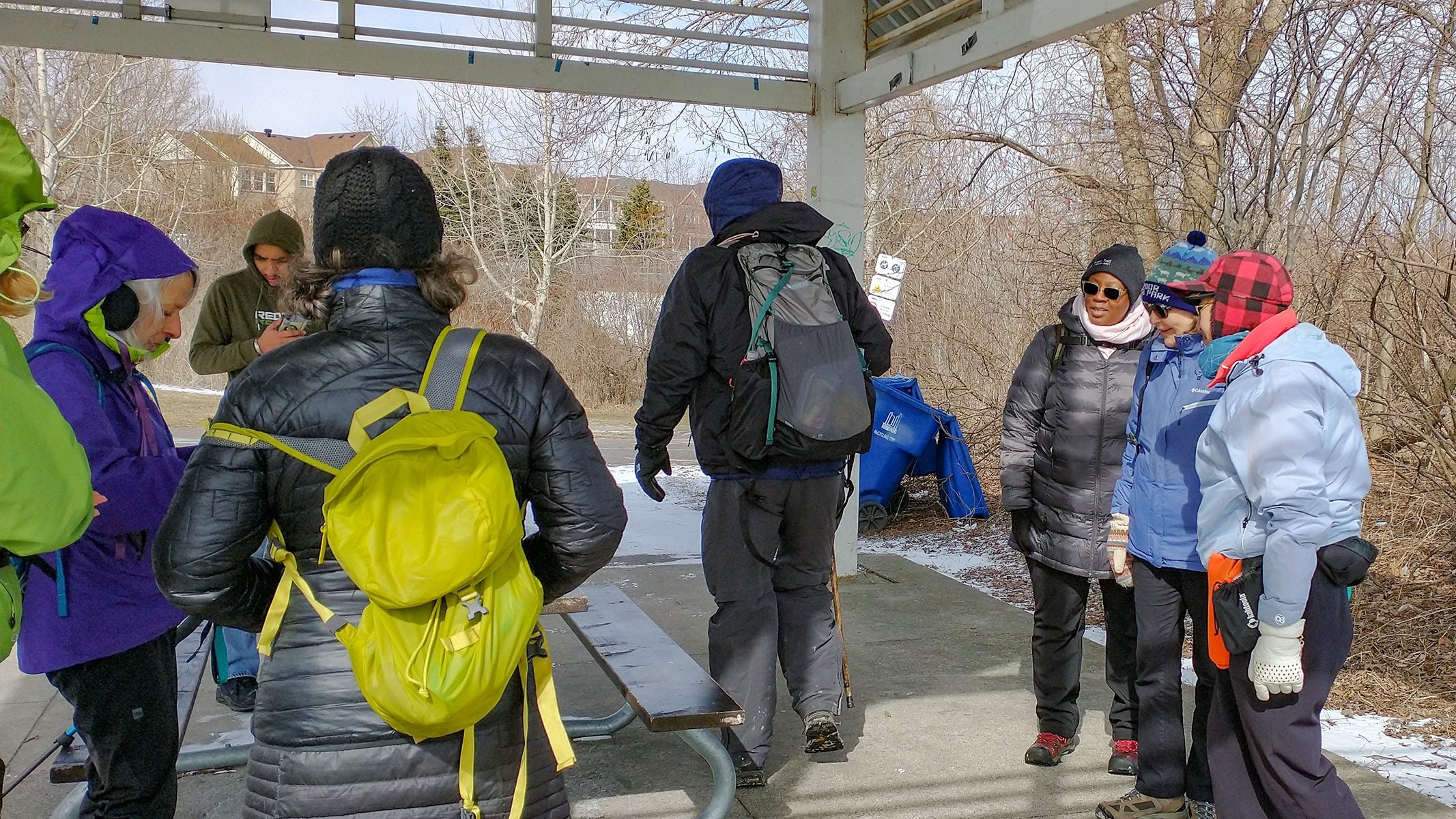
Please meet me at Kennedy Station by 10:04 am. We will take the 86 Scarborough bus departing 10:19 am. We will transfer to the 54 Lawrence Ave bus, arriving at Port Union Rd at 10:54 am. We start hiking 11:00 am.We will hike south to Lake Ontario and along the Waterfront Trail through Port Union and Rouge Hill to Pickering GO. The estimated distance is 9.8 km. Here is an online map of our route – Port Union to Pickering.
Bring a snack, at least 2 liters of water, and icers. Dress for cold weather.
Sunday Social hike - Snowshoe Bayview Escapment Side Trail loop
https://hikesstaging.brucetrail.org/event/sunday-social-hike-snowshoe-bayview-escapment-side-trail-loop/Sorry, the registration cut-off time for this hike has been reached.Not a member? Click here to join today!Hosting Club: Sydenham
Category: Snowshoe Hike
Location (Google Maps): Meet in the north-east corner of the parking lot at Home Depot on Highway 26 on the east side of Owen Sound.Hike Leader(s): Bill Snel Click here to contact Hike Leader(s)
Pace: Leisurely: 3 km/h or less
Terrain: Moderate: Some hills and/or poor footing
Distance: 4.5 kmDescription
Carpool to the Bayview Escarpmwnt Side Trail and then snowshoe the Exploring Sydenham loop 12 / Looping Though Sydenham 2nd edition loop 6. This winds mostly through bush that should provide some protection from the weather. If unable to register or for information contact Bill Snel at w.snel2@gmail.com or landline (519) 470-0584. - Each hiker joining a Bruce Trail Club organized hike must perform a self-screening check before hiking.
- 11March 11, 2024
Beamsville Hike
https://hikesstaging.brucetrail.org/event/beamsville-hike/Sorry, the registration cut-off time for this hike has been reached.Not a member? Click here to join today!Hosting Club: Niagara, Caledon Hills
Category: In and Out
Location (Google Maps): Meet in parking lot at Kinsmen Park, BeamsvilleHike Leader(s): Kathleen Manson Click here to contact Hike Leader(s)
Pace: Fast
Terrain: Moderate
Distance: 8kmDescription
We will head east and visit Cave Springs CA and return.It is mostly level with some hills and a lot of tricky footing.
Hiking poles are highly recommended. Wear supportive hiking boots with good tread. There are a lot of rocks and crevices.
Please arrive 15 minutes early.
If your plans change, please self-cancel as soon as possible so that other members may take your spot.
Hike Leader reserves the right to modify the hike.
- 12March 12, 2024
Urban Walk: Valley View Park Thornhill
https://hikesstaging.brucetrail.org/event/urban-walk-valley-view-park-thornhill-15/Sorry, the registration cut-off time for this hike has been reached.Not a member? Click here to join today!Hosting Club: Toronto
Location (Google Maps): Parking lot at the corner of Bayview Ave, and Sycamore Dr. South of Highway 7
Hike Leader(s): Mohammad Aghamiri Click here to contact Hike Leader(s)
Pace: Moderate
Terrain: Hilly
Distance: 7-8 kmDescription
We will explore Valleyview and Huntington park and walk along German Mill Creek,It is winter time and trail is hilly bring proper clothing, ,hiking boots ,and ice cleats.
9:00 Rockway Long Hike
https://hikesstaging.brucetrail.org/event/900-rockway-long-hike-2/Sorry, the registration cut-off time for this hike has been reached.Not a member? Click here to join today!Hosting Club: Niagara
Location (Google Maps): Meet at Rockway Parking lot on Pelham Rd
Hike Leader(s): Vic Gammon Click here to contact Hike Leader(s)
Pace: Fast
Terrain: Strenuous
Distance: +/- 10kmsDescription
To avoid the muddy conditions, we will be meeting at Rockway Parking lot (On Pelham Rd near Wessel) instead of Short Hills. We’ll hike out for 75 minutes then back to the parking lot. Bring water, poles, and icers if slippery. Please check the weather and dress appropriately.9:15 Short Hike - Short Hills Park, Pelham Rd
https://hikesstaging.brucetrail.org/event/915-short-hike-short-hills-park-pelham-rd/Sorry, the registration cut-off time for this hike has been reached.Not a member? Click here to join today!Hosting Club: Niagara
Category: Loop
Location (Google Maps): Short Hills Provincial Park, Pelham Rd lotHike Leader(s): Helen Hermansen Click here to contact Hike Leader(s)
Pace: Medium
Terrain: Moderate
Distance: 6kDescription
Hike the main and side trails of Short Hills Provincial Park. Bring hiking boots and water. Icers may be required.Mineral Spring to Dundas Valley Trail Centre Loop
https://hikesstaging.brucetrail.org/event/mineral-spring-to-dundas-valley-trail-centre-loop/Sorry, the registration cut-off time for this hike has been reached.Not a member? Click here to join today!Hosting Club: Caledon Hills
Category: Tuesday Hikers
Location (Google Maps): Parking lot on Martin Road behind the Ancaster Rotary Centre
(385 Jerseyville Rd W, Ancaster, ON L9G 3L5)Hike Leader(s): Jerry Bakker Click here to contact Hike Leader(s)
Pace: Medium – 3 to 4 km/hour
Terrain: Moderate – some hills and/or some poor footing
Distance: 11 kmDescription
We will hike down the hill into the beautiful forests of Mineral Springs. Then we will follow the Headwaters Trail eventually finding our way to the Hamilton-Brant Rail Trail. Following the rail trail, we will stop for lunch at the Dundas Valley Trail Centre. After our refueling, we will take various trails back up to the Ancaster Rotary Centre.It may be muddy but there are not rocks!
Silver Creek- Great Esker Side Trail
https://hikesstaging.brucetrail.org/event/silver-creek-great-esker-side-trail-3/Sorry, the registration cut-off time for this hike has been reached.Not a member? Click here to join today!Hosting Club: Dufferin Hi-Land
Category: Tuesday Hike
Location (Google Maps):Toronto Section, Map 13, Meet at intersection of 8th Line and 27th Sideroad, just north of Km 32.2 at 9.30 am
Hike Leader(s): Inge Eckerich, Les Babbage, Julie Daley, Tony Evangelista Click here to contact Hike Leader(s)
Pace: Leisurely
Terrain: Moderate, Slippery and Steep Sections
Distance: 6.0 kmDescription
We will hike a loop on the Main trail and Great Esker side trail. Short hike can return at any time. Icers and/or snowshoes may be required.