
Hike Schedule
Join us for a hike! Registration required.
All hikes available to BTC members. Some hikes are open to non-members.
See Refund Policy for Paid Hikes >
TIP: The calendar view displays up to 7 hikes on a day, but often there are more. Click “View more events” to see them all.
Categories
- 12March 12, 2023
Limehouse Loop
https://hikesstaging.brucetrail.org/event/limehouse-loop-2/Sorry, the registration cut-off time for this hike has been reached.Not a member? Click here to join today!Hosting Club: Dufferin Hi-Land
Category: General Hike
Location (Google Maps): Limehouse Conservation Area parking at the baseball diamonds. Access from Fifth Line.Hike Leader(s): Stuart Law
Pace: Medium
Terrain: Moderate, Slippery Sections Likely
Distance: 13.5 kmsDescription
Join us for a loop hike in the snow on the Black Creek Side Trail, the Canada Goose Side Trail, the Charles Hildebrandt Side Trail and the main Trail connecting them all. We will be walking in the woods, through the fields and along a country road. Mercifully the rocky parts of the trail will be smoothed over with snow but be warned, the snow will be deep and the going will be tough in spots. We are proudly Canadian though so we should be able to handle it. Please bring icers, a warm drink, water, a snack, an appreciation of nature and a smile.
Migration Monitor Hike
https://hikesstaging.brucetrail.org/event/migration-monitor-hike/Sorry, the registration cut-off time for this hike has been reached.Not a member? Click here to join today!Hosting Club: Peninsula
Location (Google Maps): Parking for all hikes start at km 109.7, 30th Ed Ref Manual. Park adjacent to Cape Chin Mail boxes on Cape Chin North Road
Hike1 (Mar 12, 26, Apr 9): Otter Lake/Cape Chin Loop – see details below
Hike 2 (Mar 19, Apr 2, Apr 16): Borchardt/Cotrill Lk Loop – see details belowHike Leader(s): Tamara Wilson Click here to contact Hike Leader(s)
Pace: Brisk, Leisurely
Terrain: Difficult
Distance: Each hike ranges 10 to 12 kmDescription
Join us as we look for clues of spring’s arrival on Cape Chin North. We will alternate two routes on a weekly basis, watching for seasonal changes along the wetlands, small inland lakes, woodlands and escarpment shoreline. We will stop, look and listen for the arrival of plants and flowers, birds and other harbingers of spring. Hikes are weather dependent and will be cancelled for treacherous local driving conditions (mud), rain, snow or very strong winds. Always check the road and weather conditions for the entire length of your trip up as local weather can be quite different. Some hikes may recommend snow shoe hikes (I will let you know). Poles and crampons are recommended for navigating wet and slippery conditions typical of spring hikes. It is recommended to bring snacks and water for the hike. A dry set of socks and shoes is a good idea for the trip home. A sweep, topic experts – all are welcome!Alternating hikes:
Hike1 (Mar 12, 26, Apr 9): From km 109.7 parking, Otter Lk ST (2.2 km), up Cape Chin N Rd (past Tagwerk) to Cape Chin Meadow ST (1km) to Cape Chin Driveway (2.5 km) to house, North along MT back to parked vehicles (3.6 km ) – Total 9.3 km approx
Hike 2: (Mar 19, Apr 2, Apr 16) – From km 109.7 parking, MT North through Cape Chin Woods to Borchardt Parking (2.3 km), Minhinnik ST (1.7km) to Lillie Parking Lot, Take Cotrill Lk ST (1.4km) to Anne and Clayton Robert’s St (turn right) back to Britain Lk Rd (1km). At this point we will either a) follow Britain Lk Rd and reverse the route that we took (Minhinnik to Borchardt back along Borchardt to parking) – approx 12km OR b) if conditions are good, we will follow the Main Trail back along the escarpment to Borchardt PL and hike back to the vehicles along Borchardt.
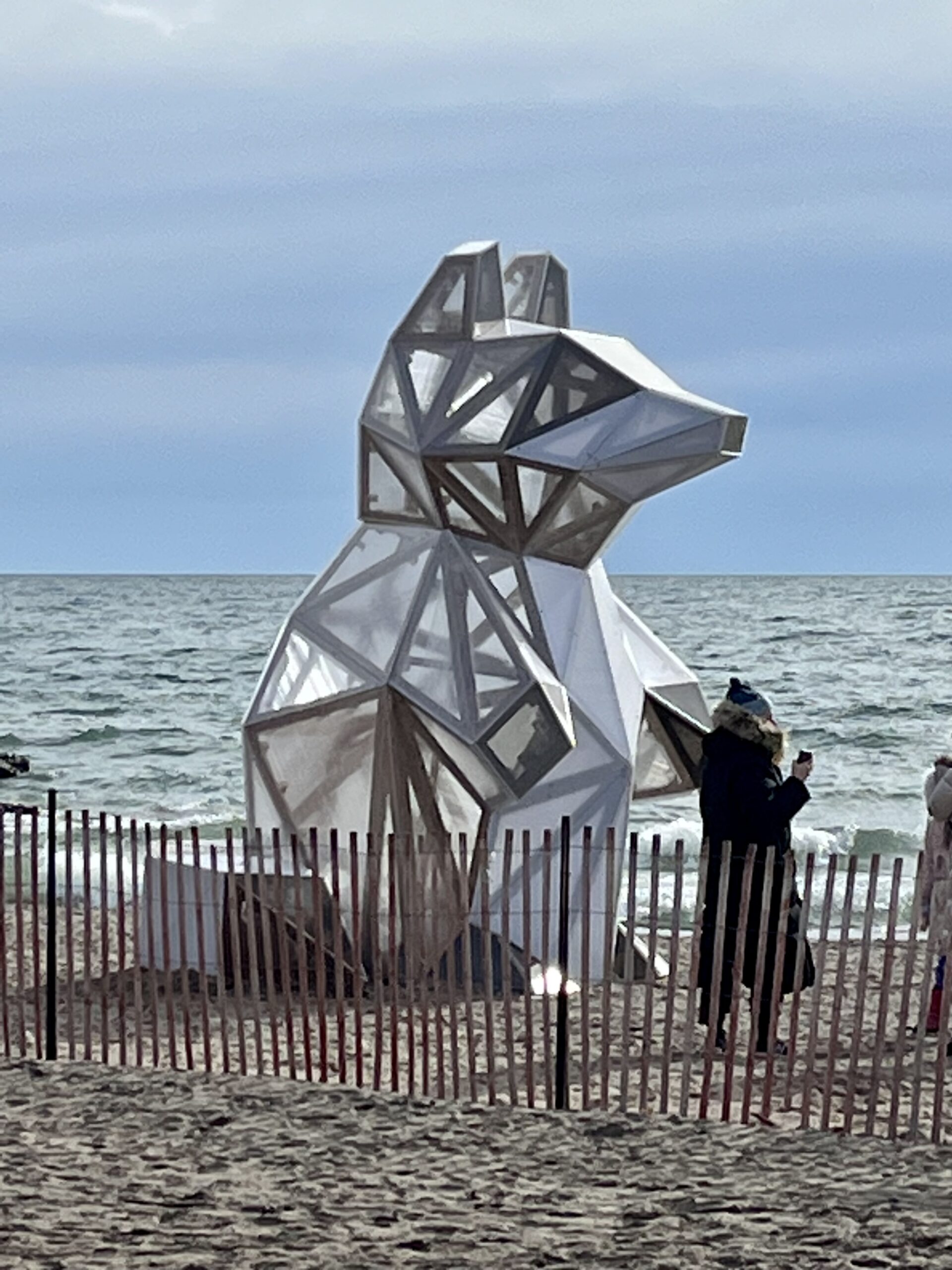
Glen Stewart Ravine/Toronto Beaches/Winter Stations
https://hikesstaging.brucetrail.org/event/glen-stewart-ravine-toronto-beaches-winter-stations/Sorry, the registration cut-off time for this hike has been reached.Not a member? Click here to join today!Hosting Club: Toronto
Category: Urban Walk
Location (Google Maps): Meet in front of Toronto Public Library Beaches Branch 2161 Queen Street East. Take the #64 Main Street Bus Southbound from Main Street Subway Station to Queen Street and walk two blocks west to the library on the south side of Queen Street.Hike Leader(s): Tom Swales Click here to contact Hike Leader(s)
Pace: Moderate
Terrain: Flat, Variable
Distance: 8 kmDescription
Join us for a walk along the boardwalk of Toronto’s Beaches area and Ashbridge’s Bay as we view the public art installations of “Winter Stations” along Woodbine Beach. Then from Ashbridge’s Bay we will walk to the east end of the boardwalk and for those who wish, north in the peaceful Glen Stewart Ravine to Kingston Road for an optional pub stop at “The Feathers”. Bring icers if planning to hike through the Glen Stewart Ravine.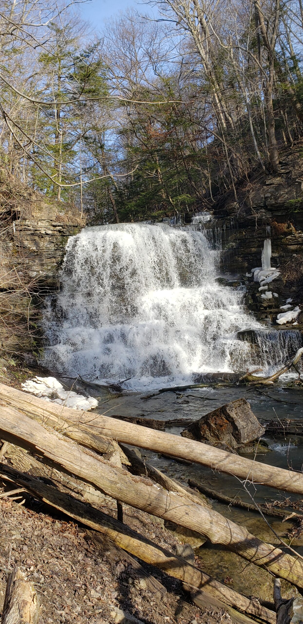
Youth Hike at Decew Falls (Ages 18-25 only)
https://hikesstaging.brucetrail.org/event/youth-hike-at-decew-falls-ages-18-25-only/Sorry, the registration cut-off time for this hike has been reached.Not a member? Click here to join today!Hosting Club: Niagara
Category: Youth Hike
Location (Google Maps): 2714 Decew Rd, St. Catharines, ON L2R 6P7Right next to the intersection of Decew Road and Cataract Road. Parking lot beside the hydro pumping station. Also known as Morningstar Mill.
Hike Leader(s): Nolan Repovs Click here to contact Hike Leader(s)
Pace: Leisurely
Terrain: Moderate, Strenuous
Distance: 3 kmDescription
Ages 18-25 onlyA great chance to connect with like minded young people, and possibly network, or just enjoy the hike.
Join us for a nice hike at Decew Falls!
Where appropriate footwear, likely to be snowy. Weather looks like it’ll be around zero degrees.
We will meet at the parking lot at noon, start the hike around 12:10pm
Snowshoe Clearview loop
https://hikesstaging.brucetrail.org/event/snowshoe-clearview-loop/Sorry, the registration cut-off time for this hike has been reached.Not a member? Click here to join today!Hosting Club: Sydenham
Category: General Hike
Location (Google Maps): Meet in the north-east corner of the parking lot at Home Depot on Highway 26 on the east side of Owen Sound.Hike Leader(s): Bill Snel Click here to contact Hike Leader(s)
Pace: Leisurely: 3 km/h or less
Terrain: Moderate: Some hills and/or poor footing
Distance: 2.8 kmDescription
Carpool to snowshoe the Clearview Side Trail loop. Map 31. If you are unable to register, please contact Bill Snel at w.snel2@gmail.com or landline at (519) 470-0584. - 13March 13, 2023
Car Hike: Toronto E2E 2/3
https://hikesstaging.brucetrail.org/event/car-hike-toronto-e2e-2-3/Sorry, the registration cut-off time for this hike has been reached.Not a member? Click here to join today!Hike open to BTC Members only.
Hosting Club: Toronto
Category: Car Hike
Location (Google Maps): We will meet north of km 32.2 on the eastern shoulder of Eighth Line at the southernmost intersection with Sideroad 27 (GPS N43.686276, W79.975578)Hike Leader(s): Jacquie Van Dyke Click here to contact Hike Leader(s)
Pace: Brisk
Terrain: Rocky, Variable
Distance: 16 kmDescription
This is the second of three hikes in this series to complete the Toronto E2E. We will be hiking in late winter/early spring conditions (mud, ice, snow) so be prepared for it all. Please have your icers, gaitors, and poles at the ready. Hiking boots/shoes are mandatory. We will stop for snacks and lunch so bring 2L of water, snacks, and your lunch.We will be shuttling to our starting point so pleased be prepared to shuttle. All Covid 19 restrictions will be followed.
Today we will be hiking past the “Hole in the Wall” in Limehouse.

9:00 In Honour Of Chloe Cooley
https://hikesstaging.brucetrail.org/event/900-in-honour-of-chloe-cooley/Sorry, the registration cut-off time for this hike has been reached.Not a member? Click here to join today!Hosting Club: Niagara
Category: In and Out
Location (Google Maps): General Brock Side Trail Parking Area- on Niagara River Parkway, east of the John St. E intersectionHike Leader(s): Karen Couch Click here to contact Hike Leader(s)
Pace: Brisk
Terrain: Easy
Distance: 15 kmsDescription
On March 14, 1793 Chloe Cooley, an enslaved Black woman in Queenston, was bound, thrown in a boat and sold across the river to a new owner in the United States. Her brave act of resistance paved the way to freedom for so many others like her & set the stage for the great freedom movement of enslaved African Americans to Canada known as the Underground Railway. Participants will walk along the Niagara Parkway to the site where a plaque marks the place where this incident took place, and then return along the same route.Kemble Wetlands and Kemble Rock Reserve
https://hikesstaging.brucetrail.org/event/kemble-wetlands-and-kemble-rock-reserve-5/Sorry, the registration cut-off time for this hike has been reached.Not a member? Click here to join today!Hosting Club: Sydenham
Category: Snowshoe Hike
Location (Google Maps):Roadside parking on the shoulder of Coles and Taylor Sideroads, south of km 140.7 (Map 34)
Hike Leader(s): Carol Mullin Click here to contact Hike Leader(s)
Pace: Medium: 3 to 4 km/h
Terrain: Moderate: Some hills and/or poor footing, There might be icy and slippery sections.
Distance: 5-6 kmDescription
Two loops, Kemble Wetlands and Kemble Rock Reserve but avoiding crevice sections. Route to be adjusted that day depending on snow/ice. Poles, water and snack suggested. Ice grippers or snowshoes depending on conditions. Approx. 2-2.5 hrs. If you are unable to register, please call or text the leader at 226-787-8804. - 14March 14, 2023
9:00 Long Hike Rockway
https://hikesstaging.brucetrail.org/event/900-long-hike-wiley-road-short-hills-16/Sorry, the registration cut-off time for this hike has been reached.Not a member? Click here to join today!Hosting Club: Niagara
Location (Google Maps): Rckway
Hike Leader(s): Alan Laver Click here to contact Hike Leader(s)
Pace: Medium
Terrain: Moderate
Distance: 10kmDescription
Explore Rockway and Louth Conservation area Register for each hike
Bring Poles water, snack and Dress for the weather, Icers and layers/p>
9:15 Short hike - Rotary Park, St. Catharines
https://hikesstaging.brucetrail.org/event/915-short-hike-rotary-park-st-catharines-2/Sorry, the registration cut-off time for this hike has been reached.Not a member? Click here to join today!Hosting Club: Niagara
Location (Google Maps): Rotary Park, St Catharines
Hike Leader(s): janet davey Click here to contact Hike Leader(s)
Pace: Medium
Terrain: Moderate
Distance: 6 kmsDescription
Hike the trails in Rotary Park. Bring hiking boots, water and icers.Looping Through Island Lake Conservation Area
https://hikesstaging.brucetrail.org/event/looping-through-island-lake-conservation-area/Sorry, the registration cut-off time for this hike has been reached.Not a member? Click here to join today!Hosting Club: Caledon Hills
Category: Tuesday Hikers
Location (Google Maps): Vicki Barron Lakeside Trail parking area at the end of Hurontario St., Orangeville.Hike Leader(s): Doris Harper Click here to contact Hike Leader(s)
Pace: Medium – 3 to 4 km/hour
Terrain: Easy – mostly flat and usually good footing
Distance: 11 kmDescription
From the parking lot on Hurontario St., we will loop hike the Vicki Barron Lakeside Trail, Sugar Bush Trail and Memorial Forest Trails, about 11 km, looping back to the parking lot. Bring water, snacks, icers, poles(optional)Following the hike we can visit the near by Fionn MacCool’s Pub and celebrate St. Patricks Day, a few days early.
Please check email before leaving home; hike may be canceled due to unpleasant weather conditions.
If something comes up the day of the hike, and you want to cancel your participation in the hike, please notify hike leader directly. Thanks.
Doris Harper
519-589-4114
harpt7c@gmail
Pacific Slope Friendship Trail to Hoggs Falls
https://hikesstaging.brucetrail.org/event/pacific-slope-friendship-trail-to-hoggs-falls/Sorry, the registration cut-off time for this hike has been reached.Not a member? Click here to join today!Hosting Club: Beaver Valley
Location (Google Maps): park @ km 74.3 in the Beaver Valley section (Johnston’s Sideroad)
Map 26 Edition 30Hike Leader(s): Kristina Rettie Click here to contact the hike leader.
Pace: Brisk
Terrain: Moderate, Some steep sections
Length of Hike: 14kmDescription
This out and back hike will take us down the Pacific Slope Friendship Trail with a side trip along Stew Hilts Side Trail. Once we get back on main trail we will hike down to Hoggs falls for a quick lunch break. After lunch we will follow the main trail northbound right back to our cars.Please bring lunch/snacks and water
Please no dogs
Please text Kristina @ 519-410-9077 for morning of cancelations
COVID-19 Precautions Before, During and After your Hike
- Each hiker joining a Bruce Trail Club organized hike must perform a self-screening check before hiking.
Find Ontario’s self-assessment tool here: https://covid-19.ontario.ca/self-assessment/ - If you are experiencing COVID-19 symptoms, stay home.
- Personal Protective Equipment:
- Hikers may choose to wear masks
Transportation
It is the Bruce Trail Conservancy’s current policy that car shuttles are allowed. It is at the discrepancy of individual hike leaders to make that decision.
Other Guidelines
- Arrive 15 minutes before the start of the hike.
- Wear sturdy footwear and appropriate attire for the weather and the terrain.
Hiking poles are a good idea in any season, especially if the terrain is rocky or slippery. In winter, snowshoes or icers/crampons are needed when conditions dictate.
Wearing appropriate clothing and footwear prevents injuries and shows consideration for a safe and positive group hiking experience. - Always carry I.D. and your health card.
- Bring sufficient water and snacks (or lunch if indicated). A minimum of 1L of water is recommended on all hikes, and 3L is recommended for long, challenging hikes in the heat of the summer.
- Bring sunscreen and insect repellent (for spring and summer hikes).
- Bring your own first aid kit.
- Please leave dogs at home.
Boyne Valley: Moss Haven, Oliver Creek Side Trails
https://hikesstaging.brucetrail.org/event/boyne-valley-moss-haven-oliver-creek-side-trails/Sorry, the registration cut-off time for this hike has been reached.Not a member? Click here to join today!Hosting Club: Dufferin Hi-Land
Category: Tuesday Hike
Location (Google Maps): Dufferin HiLand Section, Map 20. Meet at Rock Hill Parking lot on 1st Line East, Mulmur, just south of 10 Sideroad (km 29.4)Hike Leader(s): Inge Eckerich, Les Babbage, Julie Daley, Tony Evangelista Click here to contact Hike Leader(s)
Pace: Leisurely
Terrain: Moderate
Distance: 7.0 km; Short hike 2.5 kmDescription
We will hike a loop including the Main trail, Moss Haven and Oliver Creek side trails. Short hike returns to parking lot from the top of Enchanted Forest side trail. Snowshoes may be required. Bring icers.
Urban Walk
https://hikesstaging.brucetrail.org/event/urban-walk/Sorry, the registration cut-off time for this hike has been reached.Not a member? Click here to join today!Hosting Club: Iroquoia
Category: General Hike
Location (Google Maps): Meet DUNDURN CASTLE 610 York St Hamilton Parking LotHike Leader(s): Cathie Green Click here to contact Hike Leader(s)
Pace: Medium – 3 to 4 km/hr
Terrain: Easy – Mostly flat and usually good footing
Distance: 6-8 kmsDescription
Meet at 10 am at Dundurn Castle Parking Lot(no fees) off York St Hamilton-easy access from 403We will hike along the ridge to the stairs leading us down to Hamilton Bay Waterfront and hike the paved path to Bayfront Park and hike along some of their
bayfront trails – we will return along city side streets -Please wear suitable clothing and footwear for the weather/Poles, Icers/ water, snack.
OPTIONAL Social afterwards to have lunch at the Admiral Inn across the street from parking lot-
If interested in lunch-email me at cathiekygreen@gmail.com and/or text me 416-931-2095 to let me know
- Each hiker joining a Bruce Trail Club organized hike must perform a self-screening check before hiking.
- 15March 15, 2023

8:30 Merritt Trail Hike Series #3
https://hikesstaging.brucetrail.org/event/830-merritt-trail-hike-series-3/Sorry, the registration cut-off time for this hike has been reached.Not a member? Click here to join today!Hosting Club: Niagara
Category: Car Pool
Location (Google Maps): Meet at the Parking Lot at Port Dalhousie Parking Lot and Car pool to Book Depot , 67 Front St North Thorold, 43.128058, -79.202189Hike Leader(s): Sam Rutherford Click here to contact Hike Leader(s)
Pace: Brisk
Terrain: Easy
Distance: 15kDescription
Hike from Thorold on mainly paved trails to Port Dalhousie. Bring snacks and a drink .Earn the Merritt Trail badge for all 3 hikes. Badge Presentation after the hike $10 per badge
Swiss Meadows
https://hikesstaging.brucetrail.org/event/swiss-meadows-2/Sorry, the registration cut-off time for this hike has been reached.Not a member? Click here to join today!Hosting Club: Blue Mountains
Category: Register on-line or sign-in morning of hike
Location (Google Maps): Hike meets in the parking lot behind Tim Hortons on First St. in Collingwood.Hike Leader(s): Flo Kusiak Click here to contact Hike Leader(s)
Pace: Leisurely – 3 km/hr. or less
Terrain: Moderate – Some hills and/or some poor footing
Distance: 5kmDescription
We will follow the white blazed trail through the valley to the Swiss Meadows Side Trail. After hiking the side trail, we will continue on the white blazed trail to explore the beginning of the Beaver Valley section before returning to the cars. Lovely views along the escarpment overlooking the bay. Some poor footing, a variety of terrain with lots of ups and downs. Bring snacks and water.Good Companions - Eastward and Return from Chedoke Golf Course
https://hikesstaging.brucetrail.org/event/good-companions-eastward-and-return-from-chedoke-golf-course-2/Sorry, the registration cut-off time for this hike has been reached.Not a member? Click here to join today!Hike open to BTC Members only.
Hosting Club: Iroquoia
Category: Good Companions
Location (Google Maps): Chedoke Golf Course Parking Lot, Hamilton (See map below)Hike Leader(s): Ted Bossence Click here to contact Hike Leader(s)
Pace: Medium – 3 to 4 km/hr
Terrain: Dependent on Conditions, Moderate – Some hills and/or some poor footing, Slippery and Steep Sections, Slippery Sections Likely
Distance: 7.5 kmDescription
We will head east from the Chedoke Golf Course parking lot along the radial line and then onto the Bruce Trail up the escarpment. We will need to cross busy Beckett’s Drive/Queen Street Hill. We will then follow the Bruce Trail to the top of the escarpment and then descending to the city streets and return via the tree lined streets to the radial trail and the golf course parking lot.Bring icers, water and a snack. Walk will be cancelled in case of poor weather/driving conditions (please check your email the evening before).
Please arrive 10 minutes before the start time and we will start walking at 10:00 am sharp! Please inform me by email at tedbossence@sympatico.ca if you cancel after the registration cut-off time on the Tuesday and by text at 905 334-8752 if you cancel the morning of the hike.