
Hike Schedule
Join us for a hike! Registration required.
All hikes available to BTC members. Some hikes are open to non-members.
See Refund Policy for Paid Hikes >
TIP: The calendar view displays up to 7 hikes on a day, but often there are more. Click “View more events” to see them all.
Categories
- 12March 12, 2023
Limehouse Loop
https://hikesstaging.brucetrail.org/event/limehouse-loop-2/Sorry, the registration cut-off time for this hike has been reached.Not a member? Click here to join today!Hosting Club: Dufferin Hi-Land
Category: General Hike
Location (Google Maps): Limehouse Conservation Area parking at the baseball diamonds. Access from Fifth Line.Hike Leader(s): Stuart Law
Pace: Medium
Terrain: Moderate, Slippery Sections Likely
Distance: 13.5 kmsDescription
Join us for a loop hike in the snow on the Black Creek Side Trail, the Canada Goose Side Trail, the Charles Hildebrandt Side Trail and the main Trail connecting them all. We will be walking in the woods, through the fields and along a country road. Mercifully the rocky parts of the trail will be smoothed over with snow but be warned, the snow will be deep and the going will be tough in spots. We are proudly Canadian though so we should be able to handle it. Please bring icers, a warm drink, water, a snack, an appreciation of nature and a smile.
Migration Monitor Hike
https://hikesstaging.brucetrail.org/event/migration-monitor-hike/Sorry, the registration cut-off time for this hike has been reached.Not a member? Click here to join today!Hosting Club: Peninsula
Location (Google Maps): Parking for all hikes start at km 109.7, 30th Ed Ref Manual. Park adjacent to Cape Chin Mail boxes on Cape Chin North Road
Hike1 (Mar 12, 26, Apr 9): Otter Lake/Cape Chin Loop – see details below
Hike 2 (Mar 19, Apr 2, Apr 16): Borchardt/Cotrill Lk Loop – see details belowHike Leader(s): Tamara Wilson Click here to contact Hike Leader(s)
Pace: Brisk, Leisurely
Terrain: Difficult
Distance: Each hike ranges 10 to 12 kmDescription
Join us as we look for clues of spring’s arrival on Cape Chin North. We will alternate two routes on a weekly basis, watching for seasonal changes along the wetlands, small inland lakes, woodlands and escarpment shoreline. We will stop, look and listen for the arrival of plants and flowers, birds and other harbingers of spring. Hikes are weather dependent and will be cancelled for treacherous local driving conditions (mud), rain, snow or very strong winds. Always check the road and weather conditions for the entire length of your trip up as local weather can be quite different. Some hikes may recommend snow shoe hikes (I will let you know). Poles and crampons are recommended for navigating wet and slippery conditions typical of spring hikes. It is recommended to bring snacks and water for the hike. A dry set of socks and shoes is a good idea for the trip home. A sweep, topic experts – all are welcome!Alternating hikes:
Hike1 (Mar 12, 26, Apr 9): From km 109.7 parking, Otter Lk ST (2.2 km), up Cape Chin N Rd (past Tagwerk) to Cape Chin Meadow ST (1km) to Cape Chin Driveway (2.5 km) to house, North along MT back to parked vehicles (3.6 km ) – Total 9.3 km approx
Hike 2: (Mar 19, Apr 2, Apr 16) – From km 109.7 parking, MT North through Cape Chin Woods to Borchardt Parking (2.3 km), Minhinnik ST (1.7km) to Lillie Parking Lot, Take Cotrill Lk ST (1.4km) to Anne and Clayton Robert’s St (turn right) back to Britain Lk Rd (1km). At this point we will either a) follow Britain Lk Rd and reverse the route that we took (Minhinnik to Borchardt back along Borchardt to parking) – approx 12km OR b) if conditions are good, we will follow the Main Trail back along the escarpment to Borchardt PL and hike back to the vehicles along Borchardt.
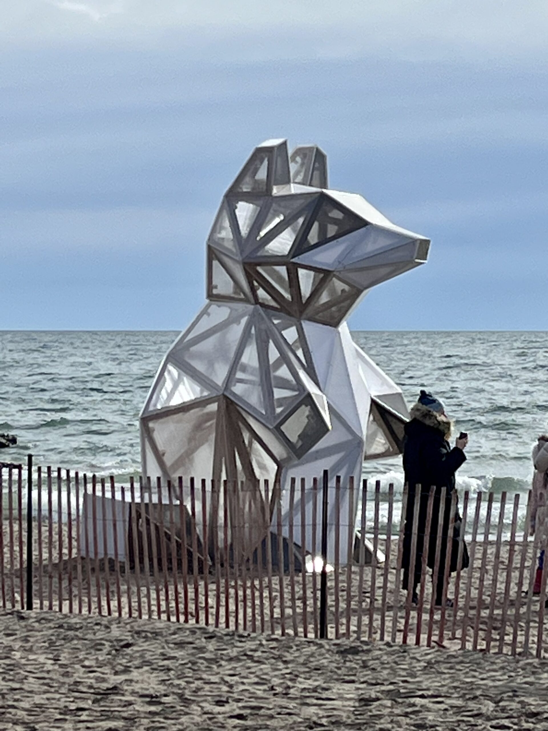
Glen Stewart Ravine/Toronto Beaches/Winter Stations
https://hikesstaging.brucetrail.org/event/glen-stewart-ravine-toronto-beaches-winter-stations/Sorry, the registration cut-off time for this hike has been reached.Not a member? Click here to join today!Hosting Club: Toronto
Category: Urban Walk
Location (Google Maps): Meet in front of Toronto Public Library Beaches Branch 2161 Queen Street East. Take the #64 Main Street Bus Southbound from Main Street Subway Station to Queen Street and walk two blocks west to the library on the south side of Queen Street.Hike Leader(s): Tom Swales Click here to contact Hike Leader(s)
Pace: Moderate
Terrain: Flat, Variable
Distance: 8 kmDescription
Join us for a walk along the boardwalk of Toronto’s Beaches area and Ashbridge’s Bay as we view the public art installations of “Winter Stations” along Woodbine Beach. Then from Ashbridge’s Bay we will walk to the east end of the boardwalk and for those who wish, north in the peaceful Glen Stewart Ravine to Kingston Road for an optional pub stop at “The Feathers”. Bring icers if planning to hike through the Glen Stewart Ravine.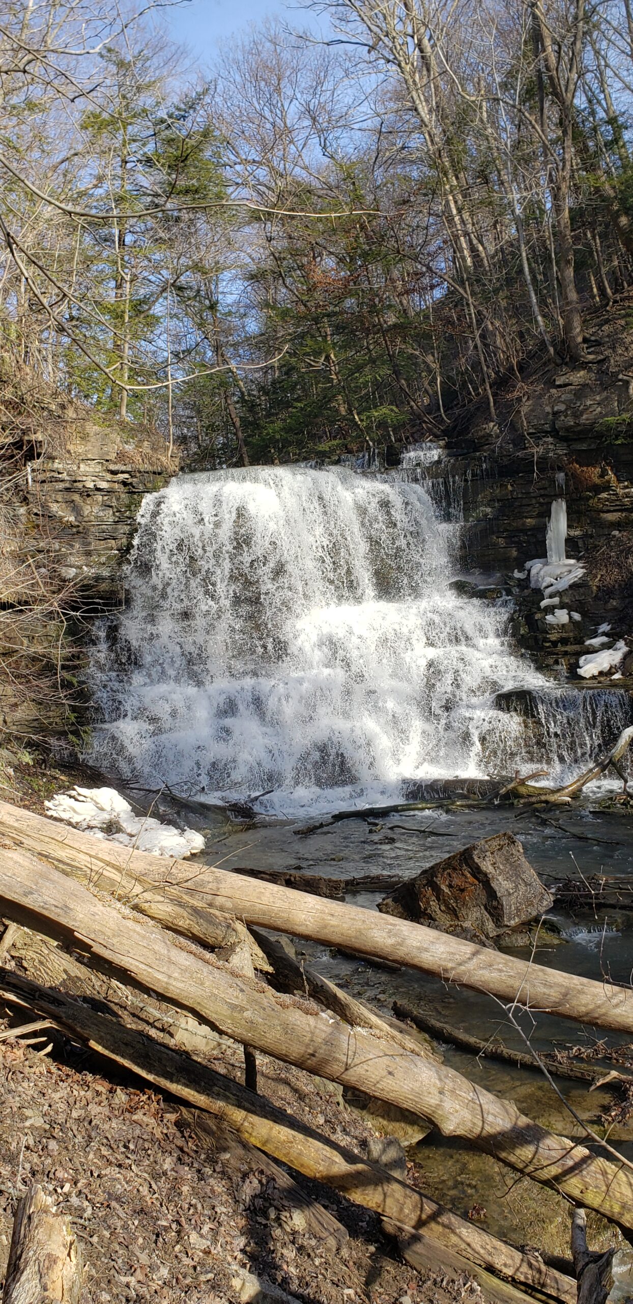
Youth Hike at Decew Falls (Ages 18-25 only)
https://hikesstaging.brucetrail.org/event/youth-hike-at-decew-falls-ages-18-25-only/Sorry, the registration cut-off time for this hike has been reached.Not a member? Click here to join today!Hosting Club: Niagara
Category: Youth Hike
Location (Google Maps): 2714 Decew Rd, St. Catharines, ON L2R 6P7Right next to the intersection of Decew Road and Cataract Road. Parking lot beside the hydro pumping station. Also known as Morningstar Mill.
Hike Leader(s): Nolan Repovs Click here to contact Hike Leader(s)
Pace: Leisurely
Terrain: Moderate, Strenuous
Distance: 3 kmDescription
Ages 18-25 onlyA great chance to connect with like minded young people, and possibly network, or just enjoy the hike.
Join us for a nice hike at Decew Falls!
Where appropriate footwear, likely to be snowy. Weather looks like it’ll be around zero degrees.
We will meet at the parking lot at noon, start the hike around 12:10pm
Snowshoe Clearview loop
https://hikesstaging.brucetrail.org/event/snowshoe-clearview-loop/Sorry, the registration cut-off time for this hike has been reached.Not a member? Click here to join today!Hosting Club: Sydenham
Category: General Hike
Location (Google Maps): Meet in the north-east corner of the parking lot at Home Depot on Highway 26 on the east side of Owen Sound.Hike Leader(s): Bill Snel Click here to contact Hike Leader(s)
Pace: Leisurely: 3 km/h or less
Terrain: Moderate: Some hills and/or poor footing
Distance: 2.8 kmDescription
Carpool to snowshoe the Clearview Side Trail loop. Map 31. If you are unable to register, please contact Bill Snel at w.snel2@gmail.com or landline at (519) 470-0584.