
Hike Schedule
Join us for a hike! Registration required.
All hikes available to BTC members. Some hikes are open to non-members.
See Refund Policy for Paid Hikes >
TIP: The calendar view displays up to 7 hikes on a day, but often there are more. Click “View more events” to see them all.
Categories
- 05November 5, 2023
2:00pm Decew House
https://hikesstaging.brucetrail.org/event/200pm-decew-house/Sorry, the registration cut-off time for this hike has been reached.Not a member? Click here to join today!Hosting Club: Niagara
Category: In and Out
Location (Google Maps): Decew House. Decew Road. ThoroldHike Leader(s): Sylvia Wheeler Click here to contact Hike Leader(s)
Pace: Medium
Terrain: Moderate
Distance: 8 kmDescription
Hike from Decew House along Lake Moodie and on to Morningstar Mill, returning on the same route
Beaver Valley ETE for the Stained Glass Badge
https://hikesstaging.brucetrail.org/event/beaver-valley-ete-for-the-stained-glass-badge/Sorry, the registration cut-off time for this hike has been reached.Not a member? Click here to join today!This is a Multi-Day Hike
You are signing up for the following dates and times:
2023-11-05 at 08:30
2023-11-06 at
2023-11-07 at
2023-11-08 at
2023-11-09 at
2023-11-10 atHosting Club: Iroquoia, Beaver Valley
Category: Special Event
Location (Google Maps): Meet at the skiers parking lot in Kolopore on Grey Rd 2 which is 650m south of where the trail crosses the road.Hike Leader(s): Ruth Moffatt Click here to contact Hike Leader(s)
Pace: Brisk – 4 to 5 km/hr, Medium – 3 to 4 km/hr
Terrain: Moderate – Some hills and/or some poor footing, Strenuous – Hilly with steep climbs and some poor footing
Distance: Between 15 and 24km each dayDescription
This hike series, normally done over 8 days, will be reduced to 6 due to time constraints. To qualify for the badge, you should attend every day. If 6 continuous days is not possible, you may elect to make-up one of the days on your own. Perhaps you might like to split the longest scheduled day to complete it over two other days – it’s up to you. I’d the day is made up prior to the completion, you will still qualify to get your badge on the last day.
This special stained glass badge, depicting the tenacious cedar, was designed by Joe Borges and is featured along the Beaver Valley section of trail in many, many spots.
This hike series is a fundraiser for Beaver Valley Club and will include an experienced hike leader familiar with the trail & all logistics. Your fee includes your badge, guidance and maybe a treat or two. Please be prepared to share in some of the car shuttles. There are no refunds.
This hike is rated as a Medium pace but since it’s a group hike, we take care of one another and can hike only as quickly as our sweep. It’s important to try to keep pace with the person in front of you.Please bring the 10 essentials to carry in your backpack including enough snacks, lunch and recommended 2 litres of water as well as a First Aid Kit. Please check the weather and ensure you have rain gear if there is rain forecast.
If there is a piece of Beaver Valley section of trail you need, you are welcome to join for that day or days. A full schedule will be emailed in advance of the start date.
Vicki Barron Lakeside Trail
https://hikesstaging.brucetrail.org/event/vicki-barron-lakeside-trail/Sorry, the registration cut-off time for this hike has been reached.Not a member? Click here to join today!Hosting Club: Niagara
Category: Loop
Location (Google Maps): We will meet each other at Vicki Barron Parking, 10 Hockley Rd, Orangeville, ON L9W 2Z.Hike Leader(s): Mehrnoush Ahmadi Click here to contact Hike Leader(s)
Pace: Medium
Terrain: Easy
Distance: 15 kmDescription
Important Notice: FALL BACK
SET YOUR CLOCKS BACK AN HOUR
Discover the perfect escape at this easy, gorgeous trail just 50 minutes from Toronto. Immerse yourself in the tranquility of a beautiful boardwalk that gracefully winds through both water and land. Let the scenic surroundings captivate you as you enjoy a leisurely stroll, offering a serene retreat not far from the bustling energy of the city.
Please dress appropriately according to the weather.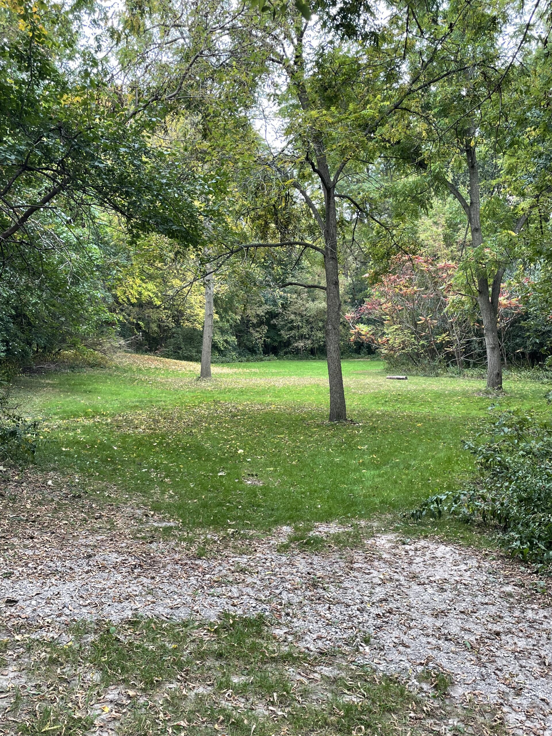
Urban Walk: Hinder Area-Earl Bales Park & Some Yoga
https://hikesstaging.brucetrail.org/event/urban-hike-hinder-area-earl-bales-park-some-yoga/Sorry, the registration cut-off time for this hike has been reached.Not a member? Click here to join today!Hosting Club: Toronto
Category: Urban Walk
Location (Google Maps): We will meet at the TTC bus platform area inside Finch Station (bus # 36). See Meeting details below.Hike Leader(s): Leonora Rochwerger Click here to contact Hike Leader(s)
Pace: Moderate
Terrain: Variable
Distance: 8 kmDescription
Description: We will start our hike at the Herbert G. Carnegie Centennial Centre and will walk along the West Don River Trail through the beautiful forested ravine system of the Hinder Area. Along the way, we will find a flat area to pause – weather permitting- and do some gentle Yoga standing poses- no Yoga mat is required. We will continue our hike through Earl Bales Park, where we will stop for lunch. After lunch, we will start our way back and end our hike on Bathurst St, North of Sheppard Ave.Route map (approximate): https://onthegomap.com/s/6dmpit3j
How to get there and get home: We will meet as a group no later than 09:00 at the TTC bus platform inside Finch Station, in order to take together bus #36. If you are arriving by subway- go up (without exiting) to the TTC bus platform. Otherwise, enter the Finch station and walk to the TTC bus platform.
To go back to Finch Station at the end of the hike, the Bus # 7 runs North on Bathurst, with a transfer to Bus #36 Eastbound towards Finch Station.What to bring: Proper walking /hiking shoes, at least 1.5 liters of water and a packed lunch. Appropriate clothing for the weather. No Yoga mats required. No dogs allowed

Urban Walk: Hamilton Beach Trail Walk
https://hikesstaging.brucetrail.org/event/urban-walk-hamilton-beach-walk/Sorry, the registration cut-off time for this hike has been reached.Not a member? Click here to join today!Hosting Club: Toronto
Category: Urban Walk
Location (Google Maps): Burlington GO Station to Hamilton Beach TrailHike Leader(s): Ginny Giraudi Click here to contact Hike Leader(s)
Pace: Moderate
Terrain: Flat
Distance: 13 kmDescription
If you are coming from Union Station, take the 9:03 am Westbound Lakeshore train to Burlington GO Station. We will meet inside the Burlington GO Station Building near the bathrooms and we will start hiking at 10 am. If you are driving, you can park at Burlington GO Station for free on the weekends. We will hike from Burlington GO to the Hamilton Beach Trail stopping for lunch at Confederation Park and then we will return to the Burlington GO Station by taking the #12 GO Bus that leaves from Centennial Pkwy north of the QEW in Hamilton. You may consider buying a 10 dollar weekend GO day pass that is only available as an e-ticket that you activate on your phone. Please see the route map here.Sunday Social Hike - Ron Savage loop
https://hikesstaging.brucetrail.org/event/ron-savage-loop-4/Sorry, the registration cut-off time for this hike has been reached.Not a member? Click here to join today!Hosting Club: Sydenham
Category: General Hike
Location (Google Maps): The Owen Sound Galaxy Theatre parking lot. Meet at the tall “Galaxy Centre” sign next to the traffic lights.Hike Leader(s): Bill Snel Click here to contact Hike Leader(s)
Pace: Leisurely: 3 km/h or less
Terrain: Moderate: Some hills and/or poor footing
Distance: 5.7 kmDescription
We will carpool to the Glen for a nice loop hike in the Glen Management area and good views from the cliff tops. Contact is Bill Snel at w.snel2@gmail.com or landline (519) 470-0584. If unable to register phone the hike leader. - 06November 6, 2023
9:00 Observing While Hiking
https://hikesstaging.brucetrail.org/event/900-observing-while-hiking/Sorry, the registration cut-off time for this hike has been reached.Not a member? Click here to join today!Hosting Club: Niagara
Category: Loop
Location (Google Maps): Fireman’s Park, Lower Parking Lot. The entrance to the parking lot is on Dorchester just after the railway tracksHike Leader(s): Mary-Lyn Hopper Click here to contact Hike Leader(s)
Pace: Medium
Terrain: Moderate
Distance: Aprox 6 kmDescription
Hike along the trails around Fireman’s park looking and listening at birds and wildlifeThe Train Wreck Hike
https://hikesstaging.brucetrail.org/event/the-train-wreck-hike/Sorry, the registration cut-off time for this hike has been reached.Not a member? Click here to join today!Hosting Club: Caledon Hills
Category: General
Location (Google Maps): Meet at the roadside parking at the junction of Escarpment Side Road and Willoughby Road, km 15.9 (Map 15).
Car Pool to roadside parking at Mountain View Side Trail on Mountain View Road. Google Map Coordinates: 43.894254, -79.922522, north of km 26.8 (Map 16).Hike Leader(s): Dan Revington Click here to contact Hike Leader(s)
Pace: Medium – 3 to 4 km/hour
Terrain: Moderate – some hills and/or some poor footing
Distance: 10.2 kmDescription
In 1907, a passenger train went off the tracks on the steep Horseshoe Valley curve on the Niagara Escarpment. Seven people were killed and dozens were injured. The Bruce Trail passes close to the location of this disaster. Join us for a hike that includes panoramic views from Escarpment Road, and to learn about the tragic history of the famous Horseshoe Curve Rail Disaster.Bring your choice of hydration and snacks. We will be going through the forest, as well as walking on roads. Sturdy footwear is essential.
Kerncliff Park
https://hikesstaging.brucetrail.org/event/kerncliff-park/Sorry, the registration cut-off time for this hike has been reached.Not a member? Click here to join today!Hosting Club: Iroquoia
Category: General Hike
Location (Google Maps):Kerncliff Park
parking lot “former quarry” access off Kerns Rd.Hike Leader(s): Madeline Grady Click here to contact Hike Leader(s)
Pace: Medium – 3 to 4 km/hr
Terrain: Moderate – Some hills and/or some poor footing
Distance: about 8 kmDescription
We will be on both blue side trails and the main trail. It’s a wonderful place to enjoy nature in this urban area. The start is hilly and then we’ll enjoy mostly flat on our way west to King Road. There are some great lookouts to see Burlington and the lake. We’ll loop back and have a hilly finish. Poles and hiking shoes/boots are recommended. Please bring water and a snack. - 07November 7, 2023
NEW TIME 9:00 Long Hike Wiley Road Short Hills
https://hikesstaging.brucetrail.org/event/800-long-hike-wiley-road-short-hills-39/Sorry, the registration cut-off time for this hike has been reached.Not a member? Click here to join today!Hosting Club: Niagara
Location (Google Maps):
Short Hills Wiley Road Entrance
Hike Leader(s): Alan Laver Click here to contact Hike Leader(s)
Pace: Medium
Terrain: Moderate
Distance: 10kmDescription
Explore Short Hills and the majestic side trails of Scarlett Tanager, Hemlock. Swayze Falls and Terrace. Register for each hike
Bring Poles water, snack, sunscreen and bug spray and dress for the weather
9:15 Short Hike - Pelham Road, Short Hills
https://hikesstaging.brucetrail.org/event/915-short-hike-pelham-road-short-hills-67/Sorry, the registration cut-off time for this hike has been reached.Not a member? Click here to join today!Hosting Club: Niagara
Location (Google Maps): Pelham Road entrance, Short Hills Provincial Park
Hike Leader(s): janet davey Click here to contact Hike Leader(s)
Pace: Medium
Terrain: Moderate
Distance: 6 kmsDescription
Hike the main and side trails of Short Hills Provincial Park. Bring water.Noisy River North
https://hikesstaging.brucetrail.org/event/noisy-river-north/Sorry, the registration cut-off time for this hike has been reached.Not a member? Click here to join today!Hosting Club: Dufferin Hi-Land
Category: Tuesday Hike
Location (Google Maps): Blue Mountain Section, Map 21, Meet at 6.1, roadside parking on County Rd 9Hike Leader(s): Julie Daley, Les Babbage, Inge Eckerich, Tony Evangelista Click here to contact Hike Leader(s)
Pace: Medium
Terrain: Moderate
Distance: 7.8 km, short hike 3kmDescription
This is an in and out hike, consisting of farmer’s fields, wooded areas, riverside vistas, and some road walking. Those wishing a short hike will turn around at Concession 10. Please bring a snack, appropriate clothing for the weather, and equipment (ie poles). Carpooling is available at Super Burger (hwy 10 & 89) at 8:45.Dufferin Hi-Land - 2nd Line EHS
https://hikesstaging.brucetrail.org/event/dufferin-hi-land-2nd-line-ehs/Sorry, the registration cut-off time for this hike has been reached.Not a member? Click here to join today!Hosting Club: Caledon Hills
Category: Tuesday Hikers
Location (Google Maps): Meet at 2nd Line EHS parking, north of Mono Centre.
Driving directions: Go on Highway 410 north, continue on Highway 10 north, drive through Orangeville, turn right on Mono Centre Rd. (8), left on 2nd Line EHS to parking at km 2.2, north of 20 Sideroad (Edition 31, map 19).
Please note parking is not at Mono Community Centre but further on 2nd Line EHS.Hike Leader(s): Mohammad Shafiq Click here to contact Hike Leader(s)
Pace: Medium – 3 to 4 km/hour
Terrain: Moderate – some hills and/or some poor footing
Distance: 12 kmDescription
Will car shuttle to Hurontario Street, just south of Highway 89, km 14.1 (Edition 31, map 20) and hike main Bruce Trail and McCarson’s Lake Side Trail for a 12 km hike that includes about 5 km road walk. The hike will help our colleagues to complete Dufferin section end-to-end. Kindly be prepared to participate in car shuttle.
Bring snacks and your choice of hydration. Poles are recommended.
Dress according to weather, it’s getting chilly.
Hike leader contact # 416-566-0503
Sydenham Chipper (km98.7-km115.5)
https://hikesstaging.brucetrail.org/event/sydenham-chipper-km100-9-km115-5/Sorry, the registration cut-off time for this hike has been reached.Not a member? Click here to join today!Hosting Club: Beaver Valley
Location (Google Maps): Roadside parking at the end of Concession 3
Map 32 ED 30
km98.7Hike Leader(s): Kristina Rettie Click here to contact the hike leader.
Pace: Brisk
Terrain: Some rocky footing, Some steep sections, Strenuous
Length of Hike: 16.8kmDescription
Please join us as we chip away through the Sydenham section. This will be a series of 11 hikes that range between 13-19kms with one longer hike of 24km. We will begin our journey at the northern end of Sydenham and work our way south to try and avoid the dangers the falling leaves and snow will bring.If you complete the 11 hikes in this series you will qualify for Sydenham’s new independent badge. Please keep track of your hikes as each hiker will be submitting their own badge request.
All hikes in this series will include a car shuttle and everyone will take a turn as a shuttle driver. Please have your vehicle passenger ready.
Nov 7 hike – meet@km98.7 carpool to 115.5
If you have any questions please text me @ 519-410-9077 (this is the most efficient way)
Please bring plenty of water and snacks/lunch
No dogs
Please text Kristina @ 519-410-9077 for morning of cancelations
COVID-19 Precautions Before, During and After your Hike
- Each hiker joining a Bruce Trail Club organized hike must perform a self-screening check before hiking.
Find Ontario’s self-assessment tool here: https://covid-19.ontario.ca/self-assessment/ - If you are experiencing COVID-19 symptoms, stay home.
Transportation
It is the Bruce Trail Conservancy’s current policy that car shuttles are allowed. It is at the discrepancy of individual hike leaders to make that decision.
Other Guidelines
- Arrive 15 minutes before the start of the hike.
- Wear sturdy footwear and appropriate attire for the weather and the terrain.
Hiking poles are a good idea in any season, especially if the terrain is rocky or slippery. In winter, snowshoes or icers/crampons are needed when conditions dictate.
Wearing appropriate clothing and footwear prevents injuries and shows consideration for a safe and positive group hiking experience. - Always carry I.D. and your health card.
- Bring sufficient water and snacks (or lunch if indicated). A minimum of 1L of water is recommended on all hikes, and 3L is recommended for long, challenging hikes in the heat of the summer.
- Bring sunscreen and insect repellent (for spring and summer hikes).
- Bring your own first aid kit.
- Please leave dogs at home.
- Each hiker joining a Bruce Trail Club organized hike must perform a self-screening check before hiking.
- 08November 8, 2023
Car Hike: Caledon Section - White and Blue Trails hike (2) - 18KM
https://hikesstaging.brucetrail.org/event/car-hike-caledon-section-white-and-blue-trails-hike-2-18km/Sorry, the registration cut-off time for this hike has been reached.Not a member? Click here to join today!Hosting Club: Toronto
Category: Car Hike
Location (Google Maps):We meet at Hockley Road Parking Area just east of 61.3KM located on the North side of Hockley Road. Please do not park on Hockley Road.
Hike Leader(s): Fayyaz Mahmood Click here to contact Hike Leader(s)
Pace: Fast
Terrain: Challenging, Rocky
Distance: 17 KMDescription
This is the second hike is a series of fast paced hikes on the Main Trail and the Side Trails (ST) on Map 18, in the Caledon section.
From the parking lot we will enter the Main Trail at 61.3KM, Map 18 (Ed. 30) and walk South on the trail to 5th Line EHS, Map 18, 52.3KM. We will then turn back and hike through the Griffith Ravine ST on the way back to return to the parking lot.
Bring 1.5 – 2 liters of water and your lunch. Please dress for the weather.
Hiking boots are required. No dogs.Balsam Wetlands - Glen Huron
https://hikesstaging.brucetrail.org/event/balsam-wetlands-glen-huron/Sorry, the registration cut-off time for this hike has been reached.Not a member? Click here to join today!Hosting Club: Blue Mountains
Category: Register in person the morning of hike.
Location (Google Maps): Hike meets in the parking lot behind Tim Hortons on First St. in Collingwood.Hike Leader(s): David Little Click here to contact Hike Leader(s)
Pace: Medium – 3 to 4 km/hr
Terrain: Moderate – Some hills and/or some poor footing
Distance: 10 kmDescription

Niagara E2E - Hike #2
https://hikesstaging.brucetrail.org/event/niagara-e2e-hike-2/Sorry, the registration cut-off time for this hike has been reached.Not a member? Click here to join today!Hosting Club: Niagara
Category: Car Pool
Location (Google Maps): Meet at the Rockway Presbyterian Church at 2100 Pelham Road near the Rockway Conservation Area parking lot and carpool to Quarry Road parking lot N 43.142846º, W 79.458913º
The Rockway Conservation Area parking lot is still closed. The church is 450m west of the parking lot on the south side of Pelham Road.Hike Leader(s): Sam Rutherford Click here to contact Hike Leader(s)
Pace: Medium
Terrain: Moderate
Distance: 20.2Description
Niagara E2E in 5 hikes. Hike #2 is the longest at 20.2 kms so pack snacks, lunch and lots of water. Be prepared for weather. Poles are recommended. Please bring $10 for the badge once you have completed all 5 hikes.Return to the Hollow
https://hikesstaging.brucetrail.org/event/return-to-the-hollow/Sorry, the registration cut-off time for this hike has been reached.Not a member? Click here to join today!Hosting Club: Iroquoia
Category: Good Companions
Location (Google Maps): City View Park, Kerns Rd. BurlingtonHike Leader(s): Anne Armstrong Click here to contact Hike Leader(s)
Pace: Leisurely – 3km/hr or less
Terrain: Moderate – Some hills and/or some poor footing
Distance: Approx. 9 km.Description
Today we hike to Smokey Hollow and back. This is a favourite hike destination, a place rich in history. It’s hard to imagine this spot bustling with light industry and busy with trade and commerce. This is a “there and back hike”. Please meet in the south parking lot of City View Park at 9:45am. for a 10:00 am. start. Bring water , a snack and sunscreen. Poles would be useful for some rocky sections and climbing back up from the Hollow.
Leader: Anne Armstrong 905-617-3937 hikingrandma@gmail.com Note: If cancelling the morning of the hike please call or text me.Lincoln Views-Frost Rd
https://hikesstaging.brucetrail.org/event/lincoln-views-frost-rd/Sorry, the registration cut-off time for this hike has been reached.Not a member? Click here to join today!Hosting Club: Niagara, Iroquoia
Category: Good Companions
Location (Google Maps): Kinsmen Park, parking lot end of Frost Rd, near Kinsmen Rd and Frost Rd, Beamsville/LincolnHike Leader(s): Craig Sim Click here to contact Hike Leader(s)
Pace: Medium – 3 to 4 km/hr
Terrain: Moderate – Some hills and/or some poor footing, Strenuous – Hilly with steep climbs and some poor footing
Distance: 8-10kmDescription
Beautiful views of farmland from escarpment. A lovely hike, quite rocky at times, some hills. Wear hiking boots or shoes with good tread. Dress in layers according to weather, including rain gear. Bring water and snack. For last minute cancellation cell 289-659-0007 day of hike only.