
Hike Schedule
Join us for a hike! Registration required.
All hikes available to BTC members. Some hikes are open to non-members.
See Refund Policy for Paid Hikes >
TIP: The calendar view displays up to 7 hikes on a day, but often there are more. Click “View more events” to see them all.
Categories
- 05November 5, 2022
Car Hike:: Cherry Beach Downtown Toronto
https://hikesstaging.brucetrail.org/event/car-hike-cherry-beach-downtown-toronto/Sorry, the registration cut-off time for this hike has been reached.Not a member? Click here to join today!Hosting Club: Toronto
Category: Car Hike
Location (Google Maps): Cherry Beach Downtown TorontoHike Leader(s): Mohammad Aghamiri Click here to contact Hike Leader(s)
Pace: Brisk, Moderate
Terrain: Flat
Distance: 12 – 16 kmDescription
We will hike along lake Ontario in down town Toronto.
Urban Walk - Rattray Marsh
https://hikesstaging.brucetrail.org/event/urban-walk-clarkson-go-station-to-port-credit-go-station/Sorry, the registration cut-off time for this hike has been reached.Not a member? Click here to join today!Hosting Club: Toronto
Category: Urban Walk
Location (Google Maps): Hike starts at Clarkson GO Station and ends at Port Credit GO Station.Hike Leader(s): Ginny Giraudi Click here to contact Hike Leader(s)
Pace: Moderate
Terrain: Flat
Distance: 12 kmDescription
If you are taking the GO Train from Union Station, please board the 8:44 am Lakeshore Westbound train to Clarkson GO Station. Please try to sit in the railway car near the middle of the train on the raised platform. I will meet you on the same raised platform as the train pulls into Clarkson GO Station at 9:20 am. You may also drive to Clarkson GO station and park for free. Please meet us at the same location, on the raised platform where the train from Union GO Station will pull in at 9:20 am.The hike follows the waterfront trail through Rattray Marsh, Jack Darling and Saddington parks ending in Port Credit for lunch at the Archtop Coffee Bar and Market.

Enjoy the last of the fall colours at Murphy's Pinnacle
https://hikesstaging.brucetrail.org/event/enjoy-the-last-of-the-fall-colours-at-murphys-pinnacle/Sorry, the registration cut-off time for this hike has been reached.Not a member? Click here to join today!Trip Information
Departure Time: 08:30
Return to City Time: 18:00
Departure Point: York Mills Bus PickupOptional Items
Hosting Club: Toronto
Category: Bus Hike
Location (Google Maps): Dufferin Highlands, Murphy’s PinnacleHike Leader(s): Martina Furrer and Duro Vukman Click here to contact Hike Leader(s)
Pace: Moderate
Terrain: Hilly, Variable
Distance: Fast group: 16 km, Moderate group: 13 kmDescription
Join us for a fantastic late fall hike in the Dufferin Highlands (Map 20). Enjoy the last of the fall colours and awesome views from Murphy’s Pinnacle (promise we won’t miss it this time) and the Mulmur Lookout.We will split into two groups. The fast group will do the Primrose Loop Side Trail and then follow the main trail north to km 29.6 (about a 16 km hike). If time permits the fast group will also do the Rock Hill Park Side Trail. The moderate group will head straight to Murphy’s Pinnacle and follow the main trail north to km 29.6 (about a 13 km hike).
Pack water, lunch, sun and rain protection.
Bus departs at 8:30 am from 10 York Mills Rd.
Waterdown - North Burlington
https://hikesstaging.brucetrail.org/event/waterdown-north-burlington/Sorry, the registration cut-off time for this hike has been reached.Not a member? Click here to join today!Hosting Club: Iroquoia
Category: General Hike
Location (Google Maps): Red P Bruce Trail parking at south entrance City View Park (second left on Kerns Road coming south from Highway 5). Near km 76.9, BTC Map 9.Hike Leader(s): Stuart Law Click here to contact Hike Leader(s)
Pace: Medium – 3 to 4 km/hr
Terrain: Slippery Sections Likely, Strenuous – Hilly with steep climbs and some poor footing
Distance: 16.5 kmsDescription
Join us on a hike from City View Park to No. 1 Sideroad and back on the Main Trail taking in all the Side Trails on the way too. We will take in the famous Signal Hill and Fisher’s Pond. There will be a lot of up and down in terms of the many valleys we will encounter and streams we will cross. Happily, a lot of the trail is owned by the BTC – our donations in action! Please bring 2L of water, a snack, a lunch, a smile and an appreciation of nature. Please arrive at 9:15 to be ready to go by 9:30. - 06November 6, 2022
9:00 Louth Conservation Area
https://hikesstaging.brucetrail.org/event/900-louth-conservation-area/Sorry, the registration cut-off time for this hike has been reached.Not a member? Click here to join today!Hosting Club: Niagara
Category: Loop
Location (Google Maps): Louth Conservation AreaHike Leader(s): Alicia Aitchison Click here to contact Hike Leader(s)
Pace: Medium
Terrain: Moderate
Distance: ~ 6 kmDescription
NOTE – THIS IS THE FIRST DAY DAYLIGHT SAVINGS TIME ENDS – MAKE SURE YOU’VE GOT THE RIGHT TIME!Join us for a hike through beautiful Louth Conservation Area – we will walk the newly created, award winning side trails to see both the upper & lower falls.
Terrain can be challenging with lots of beautiful rocks & some hills.
Meet at the Louth Conservation Area parking lot on Staff Avenue.
Registration required.
Biodiversity Fall Nature Walk: A Season in Transition
https://hikesstaging.brucetrail.org/event/biodiversity-fall-nature-walk-a-season-in-transition/Sorry, the registration cut-off time for this hike has been reached.Not a member? Click here to join today!Hosting Club: Caledon Hills
Category: Nature Walks
Location (Google Maps): Roadside parking on Coolihans Sideroad where the Trail crosses the road.Directions: From Airport Road, head east on Coolihans Sideroad for 1.4 kilometres.
Hike Leader(s): Sandra Green Click here to contact Hike Leader(s)
Pace: Leisurely – 3 km/hour or less
Terrain: Moderate – some hills and/or some poor footing
Distance: 5 kilometresDescription
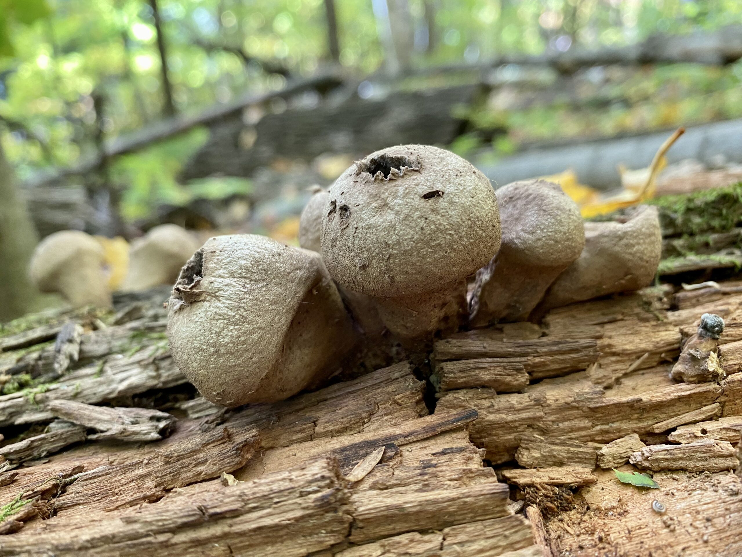
Join us as we explore the transitioning season of diverse ecosystems and lookouts over the Oak Ridges Moraine and Niagara Escarpment in the Glen Haffy Conservation Area. Mycology enthusiast Jonathan will be joining us on this Nature Walk.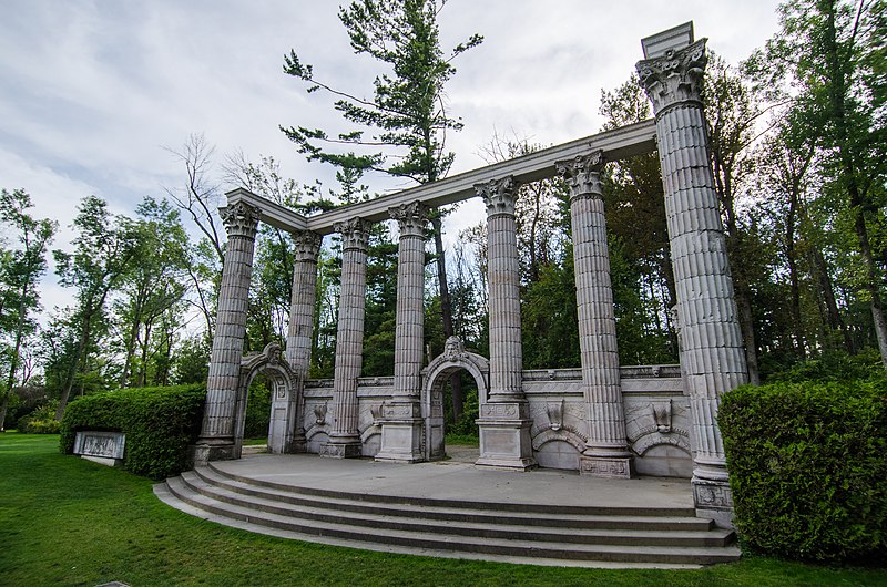
Guildwood Go circular hike via the bluffs and the Doris McCarthy Trail
https://hikesstaging.brucetrail.org/event/guildwood-go-circular-hike-via-the-bluffs-and-the-doris-mccarthy-trail/Sorry, the registration cut-off time for this hike has been reached.Not a member? Click here to join today!Hosting Club: Toronto
Category: Urban Walk
Location (Google Maps): Meet at Guildwood Go Station in the new building in the seating area by the Service counter and washrooms. Coming by Go train on the Lakeshore East Line, take the 9:20 a.m. from Union Station to arrive at 9:47. (Please be advised that there is no Go Train service on the Lakeshore West Line on this day. Buses to replace train service.) Coming by bus, a Scarborough East TTC #86 departs from Kennedy Subway Station every 20 minutes. Or coming by car, access Guildwood Station from Kingston Road. Please try to arrive 15 minutes early.Hike Leader(s): Andrew Proczek, Tom Swales Click here to contact Hike Leader(s)
Pace: Moderate
Terrain: Flat, Other (Refer to Description)
Distance: 13 kmDescription
Come and enjoy the last of the Fall colors with fantastic views of Lake Ontario from the Bluffs. From Guildwood Go we will head South to Guild Park boardwalk and then turn West to pick up two parks, South Marine Park & Sylvan Park (our lunch spot). Connecting with the Doris McCarthy trail we will descend to the lake and then head East as far as Guild Park and Gardens completing the loop before returning to Guildwood Go. This is a flat hike except for a descent along a side trail from Sylvan Park and the climb from the lake to the top of the Bluffs at Guild Park towards the end of the hike. Hikers taking the TTC can also take advantage of an early drop out once we arrive at Guild Park at approx. 1:30 pm.The route: https://onthegomap.com/s/i4hdm4jc
Public washrooms at Guildwood Go and at Guild Inn, 10.4 km into our hike. A nature stop at Sylvan Park will also be available.
- 07November 7, 2022
Greater Niagara Circle Route hike #1 of 5
https://hikesstaging.brucetrail.org/event/greater-niagara-circle-route-hike-1-of-5/Sorry, the registration cut-off time for this hike has been reached.Not a member? Click here to join today!Hike open to BTC Members only.
This is a Multi-Day Hike
You are signing up for the following dates:
2022-11-07, 2022-11-08, 2022-11-22, 2022-11-23, 2022-11-24Hosting Club: Niagara, Iroquoia
Category: General Hike
Location (Google Maps): For our first hike we will meet at Kingsbridge Park in Chippewa (located just upstream from the Falls) and will then carpool to the Butler’s Barrack’s parking lot on John Street East in NIAGARA-ON-THE-LAKE where we will begin hiking at 8:30. All meet times for this series of hikes will be 8:00AM because of the distances involved. We will be doing the circle in a clockwise progression.Hike Leader(s): Bryon Robertson Click here to contact Hike Leader(s)
Pace: Brisk – 4 to 5 km/hr
Terrain: Easy – Mostly flat and usually good footing
Distance: 28.5km.Description
This series of five hikes is geared toward the experienced hiker capable of maintaining a sustained 3.5 km./hr to 5.0 km./hr. pace for the day. The combined hike distances of 144 km. make this the longest hike offered by the Niagara Section and the equivalent of doing a sectional E2E for many of the other sections. It is in fact the longest side trail in the entire Bruce Trail Conservancy. Although generally flat and almost entirely paved the speeds and distances involved (between 26 and 34 km. ) make this a difficult series. Hikers will be expected to wear proper hiking boots and clothing, because of changing weather conditions and be carrying sufficient water and food for a full day of hiking.9:00 Hiking in and around Rotary Park
https://hikesstaging.brucetrail.org/event/900-hiking-in-and-around-rotary-park/Sorry, the registration cut-off time for this hike has been reached.Not a member? Click here to join today!Hosting Club: Niagara
Category: Hike
Location (Google Maps): 395 Pelham Road, regional Road 69, St. CatharinesHike Leader(s): Sheila Massey Click here to contact Hike Leader(s)
Pace: Medium
Terrain: ModerateDescription
Hiking various trails in and around Rotary Park and along 12 Mile Creek
7:00 pm Moonlight Night Hike in Niagara-on-the-Lake
https://hikesstaging.brucetrail.org/event/700-pm-moonlight-night-hike-in-niagara-on-the-lake/Sorry, the registration cut-off time for this hike has been reached.Not a member? Click here to join today!Hosting Club: Niagara
Category: Night
Location (Google Maps): Veteran’s Memorial Park, park just outside the park on King St.Hike Leader(s): Robin Garrett Click here to contact Hike Leader(s)
Pace: Medium
Terrain: Easy
Distance: 6-7 kmDescription
Moonlight Night Hike – Take in the magic of the rising moon over Lake Ontario and the Niagara River. This hike includes a stop to connect with your senses – sights, sounds, smells and the rhythm of your breath. Counts towards your night hike badge (5 night hikes). - 08November 8, 2022

Greater Niagara Circle Route hike #2 of 5
https://hikesstaging.brucetrail.org/event/greater-niagara-circle-route-hike-2-of-5/Sorry, the registration cut-off time for this hike has been reached.Not a member? Click here to join today!Hike open to BTC Members only.
This is a Multi-Day Hike
You are signing up for the following dates and times:
2022-11-08 at 08:00Hosting Club: Niagara, Iroquoia
Location (Google Maps): Our second meeting point will be at Old Fort Erie Parking lot in Fort Erie. We will then carpool to Kingsbridge Park in Chippawa to begin our hike. All meet times will be at 8:00AM and we will be doing the circle in a clockwise progression.
Hike Leader(s): Bryon Robertson Click here to contact Hike Leader(s)
Pace: Brisk – 4 to 5 km/hr
Terrain: Easy – Mostly flat and usually good footing
Distance: 28.5 km.Description
This series of hikes is geared toward the experienced hiker capable of maintaining a steady 3.5 km./hr. to 5.0 km./ hr. pace over relatively easy terrain but for extended distances. The hikes are therefore somewhat similar to sectional E2Es and good experience for those considering these hikes for next year, or hikers just wanting to stay in shape before the holidays. Despite being mainly over paved trail, hikers are expected to wear proper hiking clothes and hiking boots, due to changeable and probable wet weather conditions. Hikers are also expected to carry sufficient water and food supplies for personal use, over an entire day of hiking, and a brief on trail lunch stop has been allowed for. Badges will be available for purchase by successful hikers upon completion of the series in N-O-T-L ($10.00).
9:00 NEW TIME Long Hike Wiley Road Short Hills
https://hikesstaging.brucetrail.org/event/900-new-time-long-hike-wiley-road-short-hills/Sorry, the registration cut-off time for this hike has been reached.Not a member? Click here to join today!Hosting Club: Niagara
Category: Loop
Location (Google Maps):Short Hills Wiley Road Entrance
Hike Leader(s): Alan Laver Click here to contact Hike Leader(s)
Pace: Medium
Terrain: Moderate
Distance: 10kmDescription
Explore Short Hills and the majestic side trails of Scarlett Tanager, Hemlock. Swayze Falls and Terrace. Register for each hike
Bring Poles water, snack and dress for the weather
Speyside, Map 12
https://hikesstaging.brucetrail.org/event/speyside-map-12-3/Sorry, the registration cut-off time for this hike has been reached.Not a member? Click here to join today!Hosting Club: Caledon Hills
Category: Tuesday Hikers
Location (Google Maps): Pear Tree parking lot, 15 Sideroad.
Driving directions: From Highway 401 going west, turn right (north) on Road 25, left on 15 Sideroad, drive about 300 m to Pear Tree parking lot on the left.Hike Leader(s): Mohammad Shafiq
Pace: Medium – 3 to 4 km/hour
Terrain: Moderate – some hills and/or some poor footing
Distance: 13 kmDescription
Will hike southwards from the parking lot, main Bruce Trail, Al Shaw Side Trail and parts of Hilton Falls Side Trail. Usual COVID precautions are prudent; maintaining social distance, keeping face mask handy.
Ensure proper gear for the weather, dress in layers, poles are strongly recommended.
Bring water and snack.
Hike leaders phone contact for hiking day: 416-566-0503