
Hike Schedule
Join us for a hike! Registration required:
All hikes available to BTC members. Some hikes are open to non-members.
TIP: The calendar view displays up to 7 hikes on a day, but often there are more. Click “More events” to see them all.
Categories
- 15November 15, 2023
Niagara E2E - Hike #3
https://hikesstaging.brucetrail.org/event/niagara-e2e-hike-3/Sorry, the registration cut-off time for this hike has been reached.Not a member? Click here to join today!Hosting Club: Niagara
Category: Car Pool
Location (Google Maps): Meet at Decew House Heritage Park map 3 km 31.2 and carpool to Rockway Presbyterian Church Parking lot at 2100 Pelham Road (corner of Ninth & Pelham). The church is 450m west of the Rockway Conservation Parking lot which is still closed. There is also construction around the church parking lot so be careful where you park.Hike Leader(s): Sam Rutherford Click here to contact Hike Leader(s)
Pace: Medium
Terrain: Moderate
Distance: 17.5kDescription
Niagara E2E in 5 hikes. Hike#3 is 17.5 kms so please bring enough snacks and water. Be prepared for the weather. Poles are recommended. Please bring $10 for badge once you have completed all 5 hikes.Black Bank
https://hikesstaging.brucetrail.org/event/black-bank-4/Sorry, the registration cut-off time for this hike has been reached.Not a member? Click here to join today!Hosting Club: Blue Mountains
Category: Register in person the morning of hike.
Location (Google Maps): Hike meets in the parking lot behind Tim Hortons on First St. in Collingwood.Hike Leader(s): Myra Campbell Click here to contact Hike Leader(s)
Pace: Medium – 3 to 4 km/hr
Terrain: Moderate – Some hills and/or some poor footing
Distance: 8.2Description
We will drive to and park some cars at 20 Sideroad and Prince of Wales Road (km 41.7) in the Dufferin Hi-Land section. We will then drive to km 49.7 on County Road 21 where we will begin the hike. We will follow a steep descent to the Black Bank River then climb out of the valley. After we cross Prince of Wales Road, there is an ascent to the top of the escarpment providing great views over the valley. We have a long gradual descent to the cars at the end of the hike at km 41.7. Bring a snack or lunch and water.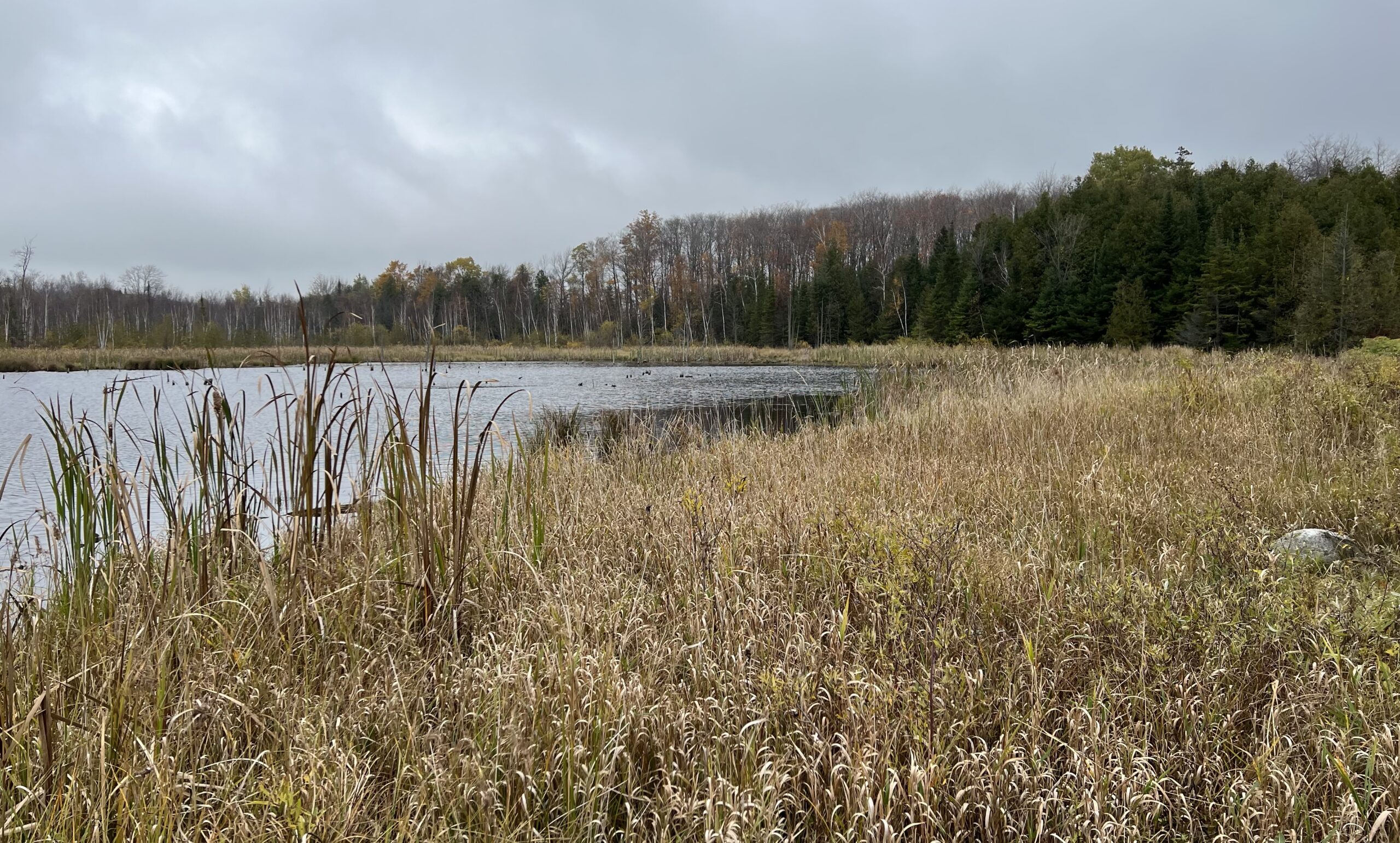
WEDNESDAY WALKERS - Young Wetland
https://hikesstaging.brucetrail.org/event/wednesday-walkers-young-wetland/Sorry, the registration cut-off time for this hike has been reached.Not a member? Click here to join today!Hosting Club: Beaver Valley
Location (Google Maps): Park in the parking lot at the Epping John Muir Lookout near km 94.3, Map 27, Edition 31
Hike Leader(s): Margaret Yaraskavitch Click here to contact the hike leader.
Pace: Medium
Terrain: Easy
Length of Hike: 4.8 kmDescription
This hike is a there-and-back walk. We begin on the edge of the Beaver Valley and then head towards a beaver pond. A walk along the edge of fields takes us into a wood lot, then to the Young Wetland. Birds are often sighted on the water. From there, we stroll the rest of the BTC-managed Young property to Sideroad 19, seeing fields regenerating towards a natural state. We walk back to the parking area, where we can enjoy a panoramic view into the Beaver Valley.Easy Does It
https://hikesstaging.brucetrail.org/event/easy-does-it-2/Sorry, the registration cut-off time for this hike has been reached.Not a member? Click here to join today!Hosting Club: Iroquoia
Category: Good Companions
Location (Google Maps): Oakville, Valleyridge Dr.Hike Leader(s): Anne Armstrong Click here to contact Hike Leader(s)
Pace: Leisurely – 3km/hr or less
Terrain: Easy – Mostly flat and usually good footing
Distance: Approx 7-8 km.Description
Come join me for a hike into Bronte Creek Provincial Park along urban and forest trails and along the east bank of Bronte Creek. Meet in the children’s playground on the west side of Valleyridge Dr., just below Dundas St. at 9:45 am. for a 10:00 am. start. Bring water, a snack and poles if using. We should have good views over the creek.
Leader: Anne Armstrong 905 617 3937 hikingrandma@gmail.com - 16November 16, 2023
NEW TIME 9:00 am Long Hike Jordan to Moyer / Louth
https://hikesstaging.brucetrail.org/event/800-am-long-hike-jordan-to-moyer-louth-67/Sorry, the registration cut-off time for this hike has been reached.Not a member? Click here to join today!Hosting Club: Niagara
Location (Google Maps):
Jordan Hollow Park 3039 King St Jordan
Hike Leader(s): Alan Laver Click here to contact Hike Leader(s)
Pace: Medium
Terrain: Moderate
Distance: 10kDescription
From Jordan Hollow Hike the main trail to Upper and Lower Balls Falls, Moyer Road or Louth and Return. You must register for each hike. Bring Poles, sunscreen, bug spray , snack and a drink and dress for the weather
9:15 Short Hike - Jordan Hollow
https://hikesstaging.brucetrail.org/event/915-short-hike-jordan-hollow-83/Sorry, the registration cut-off time for this hike has been reached.Not a member? Click here to join today!Hosting Club: Niagara
Location (Google Maps): Jordan Hollow Park, Jordan Station
Hike Leader(s): Bill Russell Click here to contact Hike Leader(s)
Pace: Medium
Terrain: Strenuous
Distance: 6 kmsDescription
Hike the main and side trails around Jordan Hollow and Ball’s Falls. Bring water and hiking boots.Hilton Falls Conservation Area Trails
https://hikesstaging.brucetrail.org/event/hilton-falls-conservation-area-trails/Sorry, the registration cut-off time for this hike has been reached.Not a member? Click here to join today!Hosting Club: Iroquoia
Category: Thursday Group
Location (Google Maps):Hilton Falls Conservation Area parking lot, Campbellville Rd/Side Rd 5 East of Guelph Line Rd. Reservation required with valid Conservation pass or fee for parking.
Hike Leader(s): Karen Capindale-Smith Click here to contact Hike Leader(s)
Pace: Brisk – 4 to 5 km/hr
Terrain: Moderate – Some hills and/or some poor footing
Distance: 13kmDescription
We will hike the Beaver Dam loop and part of the Hilton Falls and Red Oak Trails at a brisk speed. There will an opportunity to visit the falls and stop for other sights along the way but we will be walking at a clip. Please bring water, a snack and appropriate layers for the weather.Contact Information: kjcapindale@gmail.com; Hike morning use cell (905)749-0914
Baked goods can be expected 🙂

Easy Hike- Safety and Fall Prevention on the Trail
https://hikesstaging.brucetrail.org/event/easy-hike-safety-and-fall-prevention-on-the-trail/Sorry, the registration cut-off time for this hike has been reached.Not a member? Click here to join today!Hosting Club: Peninsula
Location (Google Maps): 681 Cape Hurd Road, Tobermory
Hike Leader(s): Marg Glendon Click here to contact Hike Leader(s)
Pace: Leisurely
Terrain: Easy
Distance: ~4 KMDescription
Falls on a hike! Each one of us has experienced a fall of some kind on the Bruce Trail. Want to learn how you can reduce your risk of falling?We are so pleased that Pat Turner, Retired Occupational Therapist and hiking enthusiast, will join us today! Pat will introduce us to a few practical exercises and share tips which you can integrate into your routine hikes. These simple daily exercises and tips will enhance and ensure that any hike is safe, enjoyable and helps to prevent falls. Important information for any hiker!
Today’s hike is about ~4 Km, generally on flat terrain along a wide path which leads to a rocky shore.
Escarpment Biosphere Conservancy stewards this interesting nature reserve and conducts rattlesnake and bat research onsite during the Spring, Summer and Fall season. To learn more about volunteering with EBC or about Alvar Bay Nature Reserve go here: https://escarpment.ca/see-our-preserves/bruce-county-and-huron-shore/cape-hurd-alvar-bay . We are thankful for EBC’s stewardship of this property and trails.
Duration: 2 hours
Parking : Park on the west side of Cape Hurd Road near the entrance to Alvar Bay Nature Reserve
No washrooms onsite.
Wear layers, hat, mittens and boots with good tread. Bring a light backpack with water and snack.
Bayview Escarpment Loop
https://hikesstaging.brucetrail.org/event/bayview-escarpment-loop-7/Sorry, the registration cut-off time for this hike has been reached.Not a member? Click here to join today!Hosting Club: Sydenham
Category: General Hike
Location (Google Maps): Roadside parking on St.Vincent-Sydenham Townline, 1 km north of Sideroad 24 at km 55.2 (Map 30)Hike Leader(s): Franziska Edney Click here to contact Hike Leader(s)
Pace: Medium: 3 to 4 km/h
Terrain: Moderate: Some hills and/or poor footing
Distance: 4.5 kmDescription
This hike will take us along the white trail on top of the escarpment, also called the Lebanon Mountain Friendship Trail, and along the Department of National Defence property . We will walk back to our cars via the Bayview Escarpment Side Trail. Poles advised. Please contact or text the hike leader at 519 379 2573 if unable to register. - 17November 17, 2023

9:00 Niagara-on-the-lake Tour
https://hikesstaging.brucetrail.org/event/900-niagara-on-the-lake-tour-14/Sorry, the registration cut-off time for this hike has been reached.Not a member? Click here to join today!Hosting Club: Niagara
Category: Urban
Location (Google Maps): Meet on King St near Centre St, just outside of Veteran’s Memorial ParkHike Leader(s): Margaret Northfield Click here to contact Hike Leader(s)
Pace: Medium
Terrain: Easy
Distance: 5-6kmDescription
Each Friday we will explore different neighbourhoods, trails and parkland throughout Historic Niagara-on-the-Lake.
Moderate pace with some weeks entirely on sidewalks and roads while others may include a mix of trails and paved pathways. Great way to build up endurance for longer more strenuous hikes.
Prepare for cooler windy conditions on open parkland and along Lake Ontario and Niagara River trails.
Plan to stay for conversation and a warm cup of coffee or tea at Sweets & Swirls, Community Centre, Niagara Stone Road, NOTL
Loop with Loree Forest and Loree Side Trail - Cancelled
https://hikesstaging.brucetrail.org/event/loop-with-loree-forest-and-loree-side-trail/Sorry, the registration cut-off time for this hike has been reached.Not a member? Click here to join today!Hosting Club: Beaver Valley
Location (Google Maps): Meet at the corner of 21st Sideroad & 4th Line near km 2.3, Map 24, Edition 31
Hike Leader(s): Glenda Collings Click here to contact the hike leader.
Pace: Medium
Terrain: Moderate, Some steep sections
Length of Hike: 8.1 kmDescription
We will be hiking to Loree Forest from Intercept Side Trail, getting some cardio on the few climbs on the way. Once we loop the forest, we’ll continue down to the Loree side Trail, then walk back to our cars. The leaves will be gone so there will be great views – a perk of late fall hiking. Bring a snack and sufficient water. Speaking of late fall, our outing will depend on what the weather does and you’ll be kept in the loop on that.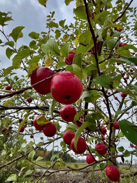
Easy Hike - John Appleton Sidetrail and the Palmer Property Hike
https://hikesstaging.brucetrail.org/event/easy-hike-john-appleton-sidetrail-and-the-palmer-property-hike/Sorry, the registration cut-off time for this hike has been reached.Not a member? Click here to join today!Hosting Club: Peninsula
Location (Google Maps): Meet at Bruce County 9 with access via the parking lot which is across from the old Barrow Bay general store.
Hike Leader(s): Marg Glendon Click here to contact Hike Leader(s)
Pace: Leisurely
Terrain: Easy, Moderate
Distance: ~ 3 1/2 KMDescription
Join Brian Popelier, BTC Ecologist on this hike as we learn about the restoration of this lovely BTC Nature Reserve. We will take a stroll here to see nature’s bounty and imagine how birds and animals depend on it for nourishment and nest building. Then – a hop, skip and jump away is the John Appleton Sidetrail and Hawthorne Sidetrail which creates a loop with the main trail , in total ~3 km. This well protected walk in the woods path meanders through the property crossing crevices and a few very short “up and down” sections.Map #:38

Urban Walk: Rattray Marsh Evening Hike
https://hikesstaging.brucetrail.org/event/urban-walk-rattray-marsh-evening-hike/Sorry, the registration cut-off time for this hike has been reached.Not a member? Click here to join today!Hosting Club: Toronto
Category: Urban Walk
Location (Google Maps):Clarkson GO Station
Hike Leader(s): Ginny Giraudi Click here to contact Hike Leader(s)
Pace: Moderate
Terrain: Flat
Distance: 12 kmDescription
We will meet inside the Clarkson GO Station near the bathrooms at 6:30 pm and walk along the lake through Rattray Marsh to Port Credit (see route here.) Head lamps or flashlights are required as the sun will have set. The after hike stop is the Archtop Coffee Bar and Market in Port Credit. Hikers can take the 23 Lakeshore Westbound Miway bus back to the Clarkson GO (Presto is accepted) or they can use the nearby Port Credit GO Station to return home. - 18November 18, 2023
Car Hike: Hike of 2 lakes King city
https://hikesstaging.brucetrail.org/event/car-hike-hike-of-2-lakes-king-city-9/Sorry, the registration cut-off time for this hike has been reached.Not a member? Click here to join today!Hosting Club: Toronto
Category: Car Hike
Location (Google Maps): Park along Fairfield Dr. or Dufferin Street, Gathering at trail head in Dufferin Street.Hike Leader(s): Mohammad Aghamiri Click here to contact Hike Leader(s)
Pace: Moderate
Terrain: Variable
Distance: 14-17KMDescription
Will explore Toronto part of Rouge park along Rouge river and Little Rouge Creek,Some safety procedures during the hike:
1-Hikers must stay between the leader and the sweep.
2-Hikers must advise the leader or the sweep if they wish to leave the group.
3- Hikers must follow the whistle instructions: 1 blast- stay where you are; 2 blasts come to the leader; 3 blasts – come to the leader quickly.
4-Hike leader may request volunteers to stop at trail intersections, they need to help hikers to the direction the group walk and wait till they see the sweep .
5-Hikers have to make sure they can see the persons behind and in front of them.
Bus Hike: Hockley Valley and Mono Cliffs
https://hikesstaging.brucetrail.org/event/bus-hike-hockley-valley-and-mono-cliffs-2/Sorry, the registration cut-off time for this hike has been reached.Not a member? Click here to join today!Trip Information
Departure Time: 08:30
Return to City Time: 18:00
Departure Point: York Mills Bus PickupOptional Items
Hosting Club: Toronto
Category: Bus Hike
Location (Google Maps): Hockley Valley and Mono CliffsHike Leader(s): Martina Furrer, Brenda Menezes, Mojgan Haghighat, Duro Vukman Click here to contact Hike Leader(s)
Pace: Moderate
Terrain: Hilly
Distance: Fast group: 16 to 18 km, Moderate group: about 13 kmDescription
Join us for an awesome hike with great views and fun hills. We will split into two groups and hike from Hockley Valley to the Split Rock Side Trail. Moderate group will hike about 13 km, and the fast group 16 to 18 km. Refreshments after if time allows.
Bus departs York Mills Station at 8:30 am.

International Hike
https://hikesstaging.brucetrail.org/event/international-hike-2/Sorry, the registration cut-off time for this hike has been reached.Not a member? Click here to join today!Hosting Club: Niagara
Category: Urban
Location (Google Maps): Meet in the parking lot of the Floral Showhouse, 7145 Niagara River Pkwy, Niagara FallsHike Leader(s): Margaret Northfield Click here to contact Hike Leader(s)
Pace: Medium
Terrain: Easy
Distance: 10kmDescription
See the majestic Falls from several vantage points. We will hike both sides of the Niagara River, crossing the Rainbow Bridge and going to Goat Island.Bring passport or Nexus to cross the border. Bring $1 for the bridge fee.
A drink and snack are recommended. This hike will take 3-4 hours depending upon the ease/difficulty of border crossings. Please allow extra time.
Black Bank to Lavender
https://hikesstaging.brucetrail.org/event/black-bank-to-lavender/Sorry, the registration cut-off time for this hike has been reached.Not a member? Click here to join today!Hosting Club: Blue Mountains
Category: Register in person the morning of hike.
Location (Google Maps): Hike meets in the parking lot behind Tim Hortons on First St. in Collingwood.Hike Leader(s): David Little Click here to contact Hike Leader(s)
Pace: Medium – 3 to 4 km/hr
Terrain: Moderate – Some hills and/or some poor footing
Distance: 8 kmDescription
Car shuttle hike. We will drive to km 55.7 on the Mulmur-Nottawasaga Townline in the Dufferin Hi-Land section and leave the cars. We will then shuttle to km 47.5 on Centre Road to begin the hike. The trail climbs steeply up the east slope of the valley, passes through forest and alongside open fields. It has beautiful views to the east across the Nottawasaga Lowlands. Bring a snack and water.
Car Hike: A March and a Market
https://hikesstaging.brucetrail.org/event/car-hike-a-march-and-a-market/Sorry, the registration cut-off time for this hike has been reached.Not a member? Click here to join today!Hosting Club: Toronto
Category: Car Hike
Location (Google Maps): We will meet at the parking lot of Spirit Tree Estate Cidery located at 1137 Boston Mills Rd, Caledon. (Map 14 of the Bruce Trail Reference Guide, Edition 30)Hike Leader(s): Monica Pasquali Click here to contact Hike Leader(s)
Pace: Leisurely
Terrain: Flat, Variable
Distance: 5.8 kmDescription
Celebrate the upcoming holidays with a march along the Bruce Trail and a visit to a local artisan market!First, we’ll do an out-and-back march along the main trail of the Bruce Trail as it flows out of the Toronto section and into the Caledon Hills section. We will begin our hike at the Spirit Tree Estate Cidery parking lot and then follow the main trail on Boston Mills Road and Creditview Road in order to reach the Cheltenham Badlands. We will continue our hike along the main trail that runs through the Badlands, as well as walk along Olde Baseline Road for a short distance in order to see the Badlands in all their glory! We will then retrace our steps to return to Spirit Tree Estate Cidery.
After our hike, we’ll visit the “Handcrafted with Love” artisan market at Spirit Tree Estate Cidery to do a little holiday shopping, and we’ll follow that up with a delicious pizza lunch enjoyed outdoors at the cidery.
For the main Bruce Trail in the Toronto section: Children under 13 years of age who participate in this hike will be eligible for the Toronto Bruce Trail Club’s Youth Badge (https://torontobrucetrailclub.org/the-trail/badges) – all family members who are planning on joining us should register for the hike, including children.
For the main Bruce Trail in the Caledon section: While on our hike within the Cheltenham Badlands, I will provide assistance to hikers of all ages who are interested in earning the Caledon Hills Bruce Trail Club’s Nature Hunter Badge (http://caledonbrucetrail.ca/hiking/club-badges/nature-hunt-badge/). I will point out and identify trees and wildflowers as we hike, as well as explain plant life cycles. You should bring enough water and food for a 2-hour hike, comfortable hiking shoes, appropriate clothing for the weather, a camera if you want to work on the Caledon Hills Bruce Trail Club’s Nature Hunter Badge, and money if you intend to join us for shopping and lunch at Spirit Tree Estate Cidery (https://spirittreecider.com/) after the hike.
9:15am Woodend
https://hikesstaging.brucetrail.org/event/915am-woodend/Sorry, the registration cut-off time for this hike has been reached.Not a member? Click here to join today!Hosting Club: Niagara
Category: In and Out
Location (Google Maps):Woodend Conservation Area – km 14.1. Enter from Taylor Rd., 140 north of Warner Rd.
Hike Leader(s): Karen Couch Click here to contact Hike Leader(s)
Pace: Leisurely
Terrain: Moderate
Distance: 6 kmDescription
Hike the main trail and portions of two side trails. The Niagara College Side Trail feature various points of interest while the main trail we will follow offers a view of multi-layered rock formations and a large block of dolostone that has broken away from the Escarpment. Look for Indigenous Marker Trees.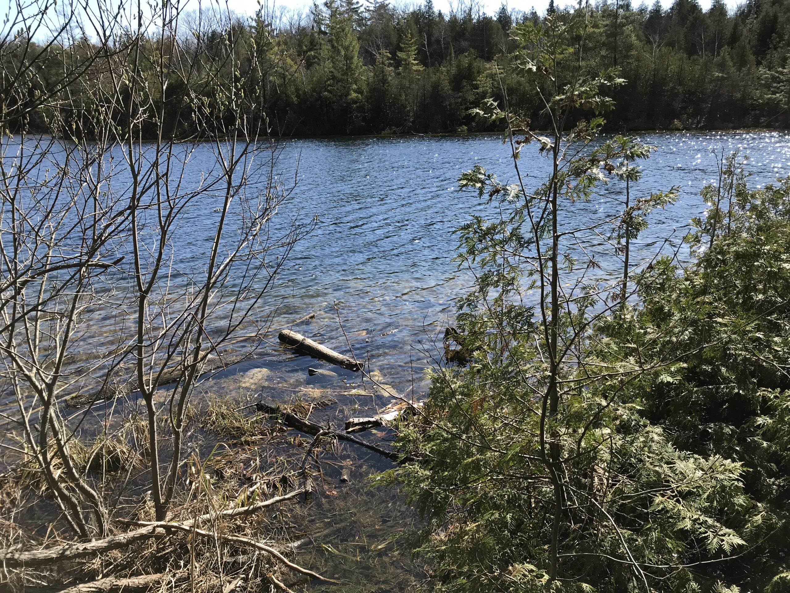
Car Hike; Crawford Lake Loop
https://hikesstaging.brucetrail.org/event/car-hike-crawford-lake-loop-2/Sorry, the registration cut-off time for this hike has been reached.Not a member? Click here to join today!Hosting Club: Toronto
Category: Car Hike
Location (Google Maps): 10 a.m. from Crawford Lake Conservation Area – 3115 Conservation Rd. Milton ON L9T 2X3, Canada (map)
Meeting point is at the parking lot next to the Visitor CentreHike Leader(s): Jeanette Vincent Click here to contact Hike Leader(s)
Pace: Moderate (3-4 km/hr)
Terrain: Variable
Distance: 8kmDescription
We will hike around Crawford Lake, a rare example of a meromictic lake and the Bruce Trail on our way to the Nassagaweya Canyon with great views and looping back to the Longhouse Village. Crawford Lake is also an important site for global scientific research. Click here to learn more about these studies and how our rare meromictic lake may help scientists define a new proposed epoch: the Anthropocene.Additional Notes:
- Reservations are not required but are recommended. If you book online, you can reserve your spot and save money on gate fees.
- Click to reserve. https://www.conservationhalton.ca/parks/crawford-lake/
For the hike
What to bring: water and snacks/lunch
What to wear: Wear hiking boots or good walking shoes. Be prepared for the weather forecast of the day.Silent Valley Loops
https://hikesstaging.brucetrail.org/event/silent-valley-loops-3/Sorry, the registration cut-off time for this hike has been reached.Not a member? Click here to join today!Hosting Club: Sydenham
Category: General Hike
Location (Google Maps): Meet in the north-east corner of the parking lot at Home Depot on Highway 26 on the east side of Owen Sound.Hike Leader(s): Maureen McFarland Click here to contact Hike Leader(s)
Pace: Medium: 3 to 4 km/h
Terrain: Moderate: Some hills and/or poor footing, Strenuous: Hilly with steep climbs and some poor footing., There might be icy and slippery sections., There might be muddy sections., There might be sections with water on the trail.
Distance: 6 kmsDescription
We will carpool to Silent Valley and hike a couple of loops – the Silent Valley Side Trail to the Avalanche Pass Side Trail. From there will we pick up the main trail going south to where it meets the Wilson Homestead Side Trail. Following the Wilson Homestead Side Trail, we pass the foundation of the settlers’ barn and well. Further on, we pass the remains of the plane that crashed in the forest 40 years ago. Good footwear is required for this hike. The Avalanche Pass Side Trail runs through an area of large boulders below the escarpment edge which can be slippery. November conditions are unpredictable, have your icers with you. Map 30. If you are unable to register, please call or text the hike leader at 647-918-4180.