
Hike Schedule
Join us for a hike! Registration required.
All hikes available to BTC members. Some hikes are open to non-members.
See Refund Policy for Paid Hikes >
TIP: The calendar view displays up to 7 hikes on a day, but often there are more. Click “View more events” to see them all.
Categories
- 19November 19, 2023
Lavender to Kilgorie
https://hikesstaging.brucetrail.org/event/lavender-to-kilgorie/Sorry, the registration cut-off time for this hike has been reached.Not a member? Click here to join today!Hosting Club: Dufferin Hi-Land
Category: General Hike
Location (Google Maps): Roadside parking on Centre Road in Kilgorie near post boxes. 30 metres south of River Road. Km 33.8 BTC Map 20.Hike Leader(s): Stuart Law Click here to contact Hike Leader(s)
Pace: Medium
Terrain: Dependent on Conditions, Moderate, Slippery Sections Likely
Distance: 18.3 kmsDescription
Join us for a quiet Sunday shuttle hike from Lavender to Kilgorie in the beautiful Dufferin Section. We will pass through Black Bank and the new Honeywood Section of trail opened last year. We will end our hike on the banks of the Pine River heading into Kilgorie. Please bring a garbage bag for your dirty boots and a pair of clean footwear to change into for the ride back (we will leave that stuff in the cars at the end of the hike). Please bring 2L of water, a warm drink, a snack, and a lunch. Please have your icers in your backpack just in case. Boots mandatory. Poles recommended. Please arrive at 8:45 to be ready to shuttle at 9 am sharp.
Sunday Rambles - McCormack Loop
https://hikesstaging.brucetrail.org/event/sunday-rambles-mccormack-loop/Sorry, the registration cut-off time for this hike has been reached.Not a member? Click here to join today!Hosting Club: Iroquoia
Category: General Hike
Location (Google Maps): De Lottinville ParkHike Leader(s): Colleen Mabalay Click here to contact Hike Leader(s)
Pace: Medium – 3 to 4 km/hr
Terrain: Moderate – Some hills and/or some poor footing
Distance: 6kmDescription
Arrive 15mins before 10am start.Meet at Delottinville Park on Newcombe Rd, Dundas
Bring water. Be prepared for weather conditions (icers).
If you need to cancel on day of hike please text me at (905) 815-7100
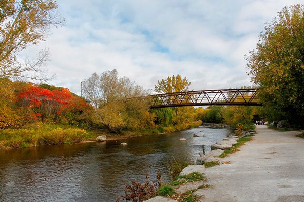
Urban Walk: Credit River Ravine
https://hikesstaging.brucetrail.org/event/urban-walk-credit-river-ravine/Sorry, the registration cut-off time for this hike has been reached.Not a member? Click here to join today!Hosting Club: Toronto
Category: Urban Walk
Location (Google Maps): Erindale Park MississaugaHike Leader(s): Ginny Giraudi Click here to contact Hike Leader(s)
Pace: Moderate
Terrain: Flat
Distance: 10 kmDescription
The Credit River ravine park system is beautiful in any season. Join me for this 10 km Sunday morning loop along the Credit River from Dundas to the 403 and back again through the U of T nature trail. The walk will start at the heated bathroom building in the first parking lot north of Dundas in Erindale Park and it will end at the very popular Apricot Tree Cafe on Dundas just west of Mississauga Road. Erindale park is easily accessible by Mississauga Miway buses leaving both Islington and Kipling subway stations.10:00 Decew to Morningstar Mill
https://hikesstaging.brucetrail.org/event/1000-decew-to-morningstar-mill-2/Sorry, the registration cut-off time for this hike has been reached.Not a member? Click here to join today!Hosting Club: Niagara
Category: Hike
Location (Google Maps):Hike Leader(s): Sylvia Wheeler Click here to contact Hike Leader(s)
Pace: Fast
Terrain: Moderate
Distance: 8 kmDescription
Car Hike: Forks of the Credit
https://hikesstaging.brucetrail.org/event/car-hike-forks-of-the-credit-3/Sorry, the registration cut-off time for this hike has been reached.Not a member? Click here to join today!Hosting Club: Toronto
Category: Car Hike
Location (Google Maps): Forks of the Credit Provincial Park and Elora Cataract TrailwayHike Leader(s): Al Brown Click here to contact Hike Leader(s)
Pace: Moderate
Terrain: Hilly
Distance: 10 kmDescription
This will be an 10 km loop hike into the Forks of the Credit Park from the Elora Cataract Trailway. We will hike around the Kettle Lake and up to see the falls. After the hike those interested are invited to take refreshments in the village of Erin. Hiking boots are recommended plus cool weather clothing.To get to the meeting place drive north on Mississauga Road passing through the village of Belfountain. About 5 km north of Belfountain the Trailway crosses Mississauga Road. There is parking on the shoulders here but beware of no parking areas.
Sunday Social Hike - Memorial Forest loop
https://hikesstaging.brucetrail.org/event/memorial-forest-loop-9/Sorry, the registration cut-off time for this hike has been reached.Not a member? Click here to join today!Hosting Club: Sydenham
Category: General Hike
Location (Google Maps): Roadside parking at the west end of Georgian Bluffs Young’s Dr. east of km 105.8 (Map 32)Hike Leader(s): Bill Snel Click here to contact Hike Leader(s)
Pace: Leisurely: 3 km/h or less
Terrain: Moderate: Some hills and/or poor footing
Distance: 3.2 kmDescription
A loop hike in the area of Jones Falls both below and above the escarpment. Contact is Bill Snel at w.snel2.com or landline (519) 470-0584. If unable to register phone the hike leader. - 20November 20, 2023

Toronto End to End in 2
https://hikesstaging.brucetrail.org/event/toronto-end-to-end-in-2/Sorry, the registration cut-off time for this hike has been reached.Not a member? Click here to join today!Hosting Club: Iroquoia, Toronto
Category: General Hike
Location (Google Maps): Meeting place and trailhead coordinates will be emailed to registered hikers the week beforeHike Leader(s): Steven White Click here to contact Hike Leader(s)
Pace: Brisk – 4 to 5 km/hr
Terrain: Moderate – Some hills and/or some poor footing
Distance: 24-27 km per dayDescription
This series of hikes will entitle the successful hiker to obtain the new stained glass badge – a beautiful and unique badge. This series of hikes is for the experienced hiker due to pace (Brisk) , strenuous sections of Toronto trail and length of hike each day. Hikers should anticipate fall and winter conditions – boots, icers, poles, gators, layered clothing and come water, snacks, lunch, first aid kit. We will take turns shuttling from meeting place to trailhead each day and a driver will need to take the shuttle drivers back to their car at the end of the hike. We will meet each day at 7:45 and shuttle to trailhead – hikers should arrive 15 minutes early to ensure ready to leave at 7:45. Anticipate most hikes will take approx 6-7 hours including lunch and snack breaks. Please ensure you are physically able to manage the pace of this hike, potential wintry conditions and daily distance before registering. Refunds are not permitted. Your fee includes the badge.Car Hike: Toronto in 3 (New Fund Raising Badge)
https://hikesstaging.brucetrail.org/event/car-hike-toronto-in-3-new-fund-raising-badge/Sorry, the registration cut-off time for this hike has been reached.Not a member? Click here to join today!Hike open to BTC Members only.
This is a Multi-Day Hike
You are signing up for the following dates and times:
2023-11-20 at 08:30
2023-11-27 at 08:30
2023-12-04 at 08:30Hosting Club: Toronto
Category: Car Hike
Location (Google Maps): Km 17.4, 4th line. Coordinates N 43.615163,W 79.975157Hike Leader(s): Smadar Junkin Click here to contact Hike Leader(s)
Pace: Brisk
Terrain: Challenging, Variable
Distance: 17.4 kmsDescription
Registered hikers will earn a new badge. The new Toronto stained glass badge!!!You are registering for the three days – November 20, November 27, and Dec 4th.
Hikers need to complete all three hikes with the leader. Hikers are allowed to miss one hike that they will make up on their own and still qualify for the badge. Please keep a log of the missed hikes and give them to the leader on the last day.
The fee goes towards supporting the Toronto Bruce Trail Club, which in turn supports the mission of the Bruce Trail Conservancy “preserving a ribbon of wilderness, for everyone, forever”.
For the time being registration is limited to members of the Bruce Trail Conservancy.
This hike is intended to be BRISK (4-5k per hour). Register only if you are capable of sustaining this pace for the day over varied/rocky terrain.Hikers are expected to follow the COVID 19 guideline and stay home if they have symptoms.
Hikers may choose to wear masks.
Arrive 15 minutes early, wear sturdy footwear, always carry ID cards, bring 2 litres of water, bring your own first aid kit.
9:00 Observing While Hiking
https://hikesstaging.brucetrail.org/event/900-observing-while-hiking-2/Sorry, the registration cut-off time for this hike has been reached.Not a member? Click here to join today!Hosting Club: Niagara
Location (Google Maps): Fireman’s Park, Lower Parking Lot. The entrance to the parking lot is on Dorchester just after the railway tracks
Hike Leader(s): Mary-Lyn Hopper Click here to contact Hike Leader(s)
Pace: Medium
Terrain: Moderate
Distance: Aprox 6 kmDescription
Hike along the trails around Fireman’s park looking and listening at birds and wildlife
Welland Canals Hikes
https://hikesstaging.brucetrail.org/event/welland-canals-hikes-2/Sorry, the registration cut-off time for this hike has been reached.Not a member? Click here to join today!This is a Multi-Day Hike
You are signing up for the following dates and times:
2023-11-20 at 09:00
2023-11-21 at 09:00
2023-11-23 at 09:00Hosting Club: Niagara, Iroquoia
Category: General Hike
Location (Google Maps): Nov 20, 2023 – Meet in the parking lot by Allanburg Bridge 18.9km
Nov 21, 2023 – Pt 1 – Meet at Woodend Conservation, Taylor Rd 8.5km Pt 2 – Meet in Sobeys Parking lot by Johannsson’s Bar 9km
Nov 23, 2023 – Meet in the public parking lot in Port DalhousieHike Leader(s): Ruth Moffatt Click here to contact Hike Leader(s)
Pace: Brisk – 4 to 5 km/hr, Medium – 3 to 4 km/hr
Terrain: Moderate – Some hills and/or some poor footing
Distance: Day 1 18.9km, Day 2 17.5km Day 3 7kmDescription
This is a special 4 part series of hikes to commemorate the 200th anniversary of the Welland Canal. I will try to have the badges available on the last day of the hike. $10 members/$15 non-members.Please bring enough food and water for a lengthy day hike on the first two days. Our third day is a quick 7km. Dress for the expected and forecasted weather. Bring icers just in case. Please pack a first aid kit, and all the other items required for a day hike. No dogs, please.
- 21November 21, 2023
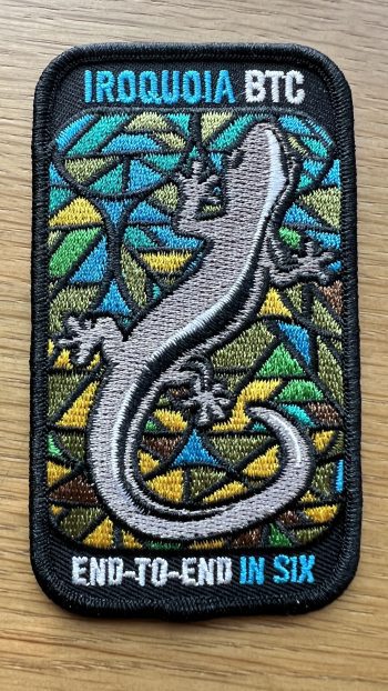
Car Hike: Iroquoia-in-6 Fundraising Hike Series
https://hikesstaging.brucetrail.org/event/iroquoia-in-6-fundraising-hike-series/Sorry, the registration cut-off time for this hike has been reached.Not a member? Click here to join today!Hike open to BTC Members only.
This is a Multi-Day Hike
You are signing up for the following dates:
2023-11-21, 2023-11-22, 2023-11-23, 2023-12-05, 2023-12-06, 2023-12-07Hosting Club: Toronto
Category: Car Hike
Location (Google Maps): We will meet for the first hike at the Grimsby Lions Community Pool. Enter at 1 Elm St. at the south end of Coronation Park.Hike Leader(s): Fayyaz Mahmood Click here to contact Hike Leader(s)
Pace: Moderate
Terrain: Challenging
Distance: Distances will range between 15 and 26km.Description
This is a special series of 6 hikes to complete the entire Iroquoia section of the Bruce Trail. The badge, included in the registration fee, was designed by Joe Borges and features the endangered Jefferson Salamander.
For this E2E in 6, we will be following the trail northbound, eventually finishing at the Toronto/Iroquoia border. The Iroquoia in 6 series is geared to experienced long distance hikers with the expectation of a 3-4 km/hr pace maintained over an 18 to 25km day. This pace must also be maintained on the hills, not just on the flat or gentle gradients. No dropout points have been established and therefore hikers who must drop out, will be responsible for their own transportation back to their vehicles. Please be honest about your hiking abilities.
Hikers will be expected to be wearing proper hiking footwear and layered clothing with the expectation of cool and possible wet weather and icy trail conditions. Sufficient food and water for a full day of hiking is required and hiking poles, crampons (icers) and wet weather gear are recommended. A 10-15 minute on-trail lunch break will be scheduled. The time will depend on weather conditions.
The fee goes towards supporting the Iroquoia Bruce Trail Club, which in turn supports the mission of the Bruce Trail Conservancy, which is: “Preserving a ribbon of wilderness, for everyone, forever.”
A maximum of 1 (of the 6) hikes can be self-completed as a result of scheduling challenges, but it is intended that this badge should be earned while hiking as part of a group led by a certified hike leader. If you miss more than one hike but still complete the distances on your own, you may apply for the regular club E2E badge. The hiking schedule will be sent to all registered participants prior to our start date.
PLEASE NOTE… THERE ARE NO REFUNDS!!
This series of linear hikes will require car shuttling and you must be willing to share in the driving. Some parking locations require paid parking, and hikes that enter Halton Conservation Areas may require reservations. The fee for the E2E-in-6 does not cover any parking/entry fees for hikers who are not members of the Halton CA and/or Hamilton CA. If the group has enough hikers who are members of a CA, those passes will be utilized (thank you in advance) to minimize costs. Since conservation passes are not free, please consider nominal compensation to the pass holder. At least one hike begins in one CA and possibly ends at another, so parking fees are unavoidable for non-CA members.
NEW TIME 9:00 Long Hike Wiley Road Short Hills
https://hikesstaging.brucetrail.org/event/800-long-hike-wiley-road-short-hills-41/Sorry, the registration cut-off time for this hike has been reached.Not a member? Click here to join today!Hosting Club: Niagara
Location (Google Maps):
Short Hills Wiley Road Entrance
Hike Leader(s): Alan Laver Click here to contact Hike Leader(s)
Pace: Medium
Terrain: Moderate
Distance: 10kmDescription
Explore Short Hills and the majestic side trails of Scarlett Tanager, Hemlock. Swayze Falls and Terrace. Register for each hike
Bring Poles water, snack, sunscreen and bug spray and dress for the weather

Sydenham Chipper (km68.4-83.8)
https://hikesstaging.brucetrail.org/event/sydenham-chipper-km68-4-83-8/Sorry, the registration cut-off time for this hike has been reached.Not a member? Click here to join today!Hosting Club: Beaver Valley
Location (Google Maps): Roadside parking on the Southside of Sideroad 22.
Map 31 ED 30
Km68.4Hike Leader(s): Kristina Rettie Click here to contact the hike leader.
Pace: Brisk
Terrain: Some rocky footing, Some steep sections, Strenuous
Length of Hike: 14.9km (actually 11.5-KOA trail is closed for the season)Description
Please join us as we chip away through the Sydenham section. This will be a series of 11 hikes that range between 13-19kms with one longer hike of 24km. We will begin our journey at the northern end of Sydenham and work our way south to try and avoid the dangers the falling leaves and snow will bring.If you complete the 11 hikes in this series you will qualify for Sydenham’s new independent badge. Please keep track of your hikes as each hiker will be submitting their own badge request.
All hikes in this series will include a car shuttle and everyone will take a turn as a shuttle driver. Please have your vehicle passenger ready.
Nov 21 hike – meet@km68.4 carpool to 83.8
If you have any questions please text me @ 519-410-9077 (this is the most efficient way)
Please bring plenty of water and snacks/lunch
No dogs
Please text Kristina @ 519-410-9077 for morning of cancelations
COVID-19 Precautions Before, During and After your Hike
- Each hiker joining a Bruce Trail Club organized hike must perform a self-screening check before hiking.
Find Ontario’s self-assessment tool here: https://covid-19.ontario.ca/self-assessment/ - If you are experiencing COVID-19 symptoms, stay home.
Transportation
It is the Bruce Trail Conservancy’s current policy that car shuttles are allowed. It is at the discrepancy of individual hike leaders to make that decision.
Other Guidelines
- Arrive 15 minutes before the start of the hike.
- Wear sturdy footwear and appropriate attire for the weather and the terrain.
Hiking poles are a good idea in any season, especially if the terrain is rocky or slippery. In winter, snowshoes or icers/crampons are needed when conditions dictate.
Wearing appropriate clothing and footwear prevents injuries and shows consideration for a safe and positive group hiking experience. - Always carry I.D. and your health card.
- Bring sufficient water and snacks (or lunch if indicated). A minimum of 1L of water is recommended on all hikes, and 3L is recommended for long, challenging hikes in the heat of the summer.
- Bring sunscreen and insect repellent (for spring and summer hikes).
- Bring your own first aid kit.
- Please leave dogs at home.
9:15 Short Hike - Rotary Park, St. Catharines
https://hikesstaging.brucetrail.org/event/915-short-hike-rotary-park-st-catharines-9/Sorry, the registration cut-off time for this hike has been reached.Not a member? Click here to join today!Hosting Club: Niagara
Category: In and Out
Location (Google Maps): Rotary Park, St.CatharinesHike Leader(s): janet davey Click here to contact Hike Leader(s)
Pace: Medium
Terrain: Moderate
Distance: 6 kmsDescription
Hike the trails around Rotary Park in St. Catharines. Bring water and hiking boots.
Murray Stewart Trail and Bolton Camp Loop
https://hikesstaging.brucetrail.org/event/murray-stewart-trail-and-bolton-camp-loop-2/Sorry, the registration cut-off time for this hike has been reached.Not a member? Click here to join today!Hosting Club: Dufferin Hi-Land
Category: Tuesday Hike
Location (Google Maps): (Google Maps) The Murray Stewart Trail is located in Bolton. For carpooling meet at Party City (4th Ave. at Highway 10 in Orangeville) at 8:30 am. Or from King Street and Hwy 50 (Queen Street) drive east on King Street for 0.4 km and turn left onto Humber Lea Rd. Go up the hill to Kingsview Drive and turn right. After 0.4 km, turn left onto Kingsview Drive. The trailhead is located just past the stop sign on your right at the Kingsview Drive and Longwood Drive intersection. Park on Kingsview Drive for a 9:30 am start.Hike Leader(s): Tony Evangelista, Les Babbage, Inge Eckerich, Julie Daley Click here to contact Hike Leader(s)
Pace: Medium
Terrain: Easy, Slippery Sections Likely
Distance: Long Hike 7 km Short Hike 3 kmDescription
We will hike the Murray Stewart Trail to the end and then turn back to hike the Bolton Camp loop. The loop rejoins the Murray Stewart Trail and heads back to the parked cars on Kingsview Drive. Those completing a shorter hike will walk to the end of the Murray Stewart Trail and then return directly to the parked cars without completing the Bolton Camp Loop.Bring water and snacks. Poles are recommended Icers may be needed
Optional refreshment stop after the hike at Coffee Time in Bolton
Dufferin Hi-Land; Kilgorie
https://hikesstaging.brucetrail.org/event/dufferin-hi-land-kilgorie/Sorry, the registration cut-off time for this hike has been reached.Not a member? Click here to join today!Hosting Club: Caledon Hills
Category: Tuesday Hikers
Location (Google Maps): Meet at BTC parking lot on 1st Line E, km 28.3 (Edition 31, map 20).
Driving directions: North on Highway 410, continue on Highway 10; at Primrose continue on Prince of Wales Rd., turn right on Dufferin Rd. 17 (10 Sideroad), right on 1st Line E to BTC parking. If coming from other directions use appropriate navigation.Hike Leader(s): Mohammad Shafiq Click here to contact Hike Leader(s)
Pace: Medium – 3 to 4 km/hour
Terrain: Strenuous – hilly with steep climbs and some poor footing
Distance: 12.5 kmDescription
Will shuttle to Sideroad 20, km 40.7 (Edition 31, map 21). Be prepared to participate in the shuttle and return to ensure all hikers get to their cars after the hike.
Will hike main Bruce Trail through Kilgorie area; bring your choice of hydration and snacks.
Dress according to weather, poles are recommended.The hike will help our colleagues in Dufferin end-to-end.
Hike leaders contact # 416-566-0503
- Each hiker joining a Bruce Trail Club organized hike must perform a self-screening check before hiking.
- 22November 22, 2023
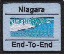
Niagara E2E - Hike #4
https://hikesstaging.brucetrail.org/event/niagara-e2e-hike-4/Sorry, the registration cut-off time for this hike has been reached.Not a member? Click here to join today!Hosting Club: Niagara
Category: Car Pool
Location (Google Maps): Meet at Woodend Conservation Area Taylor Road and carpool to Decew House Heritage ParkHike Leader(s): Sam Rutherford Click here to contact Hike Leader(s)
Pace: Medium
Terrain: Moderate
Distance: 14.6kDescription
Niagara E2E in 5 hikes. Hike#4 covers 14.6 kms. Bring snacks and water. Poles are recommended. Please bring $10 for badge once you have completed all 5 hikes.Pretty River Loop
https://hikesstaging.brucetrail.org/event/pretty-river-loop/Sorry, the registration cut-off time for this hike has been reached.Not a member? Click here to join today!Hosting Club: Blue Mountains
Category: Register in person the morning of hike.
Location (Google Maps): Hike meets in the parking lot behind Tim Hortons on First St. in Collingwood.Hike Leader(s): Richard Edwards Click here to contact Hike Leader(s)
Pace: Medium – 3 to 4 km/hr
Terrain: Moderate – Some hills and/or some poor footing
Distance: 7 kmDescription
We will carpool from Tim’s in Collingwood to the snowmobilers parking lot near km 46.1. From here we will walk along the road to km 46.8 to begin the hike. We will follow the white blazed trail up a steep ascent to an upland cedar forest with nice views and then to another ascent along the prettiest babbling brook this side of paradise. The Pretty River Side Trail will take us back down the escarpment and then to our cars. Bring a snack and water.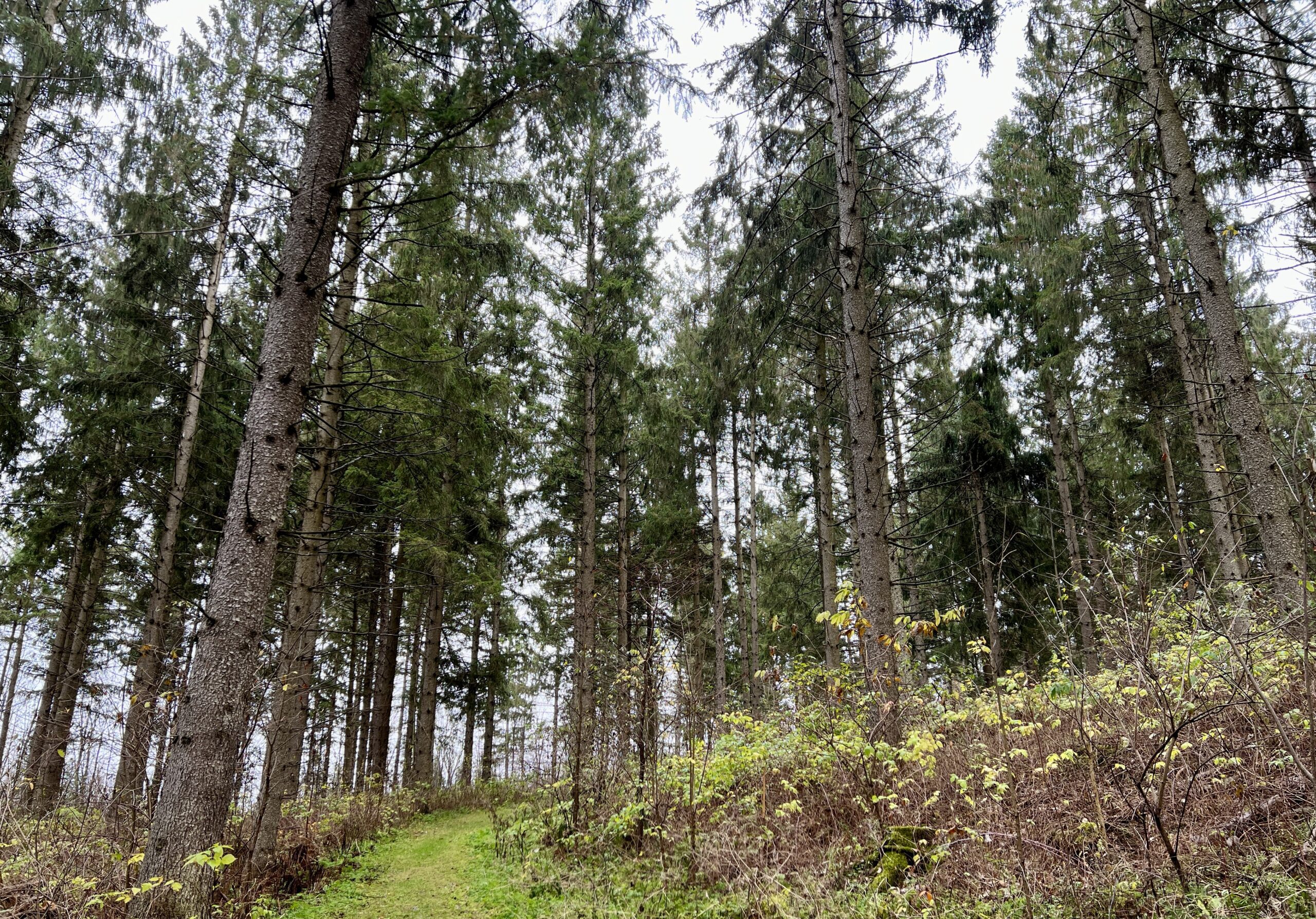
Valley Crest and Sligo Side Trail
https://hikesstaging.brucetrail.org/event/valley-crest-and-sligo-side-trail/Sorry, the registration cut-off time for this hike has been reached.Not a member? Click here to join today!Hosting Club: Beaver Valley
Location (Google Maps): Meet on the south side shoulder of Sideroad 19 at Km 92.3 Map 27 Edition 31
Hike Leader(s): Margaret Yaraskavitch Click here to contact the hike leader.
Pace: Medium
Terrain: Easy, Moderate
Length of Hike: 8 kmsDescription
This hike is a little longer than other Wednesday Walker hikes but the terrain is quite flat. We’ll walk through strips of BTC protected land near fields with views across the Valley. From there, we use the Sligo Side Trail and then loop back on to the Main Trail. On this route, we’ll stop in a couple of places to talk about (historic) tree planting practices.COVID-19 Precautions Before, During and After your Hike
- Each hiker joining a Bruce Trail Club organized hike must perform a self-screening check before hiking.
Find Ontario’s self-assessment tool here: https://covid-19.ontario.ca/self-assessment/ - If you are experiencing COVID-19 symptoms, stay home.
Other Guidelines
- Arrive 15 minutes before the start of the hike.
- Wear sturdy footwear and appropriate attire for the weather and the terrain.
Hiking poles are a good idea in any season, especially if the terrain is rocky or slippery. In winter, snowshoes or icers/crampons are needed when conditions dictate.
Wearing appropriate clothing and footwear prevents injuries and shows consideration for a safe and positive group hiking experience. - Always carry I.D. and your health card.
- Bring sufficient water and snacks (or lunch if indicated). A minimum of 1L of water is recommended on all hikes, and 3L is recommended for long, challenging hikes in the heat of the summer.
- Bring sunscreen and insect repellent (for spring and summer hikes).
- Bring your own first aid kit.
- Please leave dogs at home.
Good Companions Cootes Paradies South Shore
https://hikesstaging.brucetrail.org/event/good-companions-cootes-paradies-south-shore/Sorry, the registration cut-off time for this hike has been reached.Not a member? Click here to join today!Hosting Club: Iroquoia
Category: Good Companions
Location (Google Maps): Meet at the Princess Point parking lot at the end of Macklin Street North in Hamilton. Macklin Street North is accessed either from Main Street West or King Street West, depending on which way you enter Hamilton. Please note that this is Royal Botanical Gardens property so you must use either an RBG parking pass or pay at the parking machines. Parking can be paid for by the hour.Hike Leader(s): Janina Vanderpost Click here to contact Hike Leader(s)
Pace: Medium – 3 to 4 km/hr
Terrain: Moderate – Some hills and/or some poor footing
Distance: 9 kmDescription
Meeting at 9:45 am for a 10:00am start, this hike will take us through woodland and park trails along the south shore of Cootes Paradise. The walk will include the Sassafras Point Trail and possibly Caleb’s Walk. While essentially a “there and back” walk there will be some variation in trails going and returning. - Each hiker joining a Bruce Trail Club organized hike must perform a self-screening check before hiking.