
This is a fast paced hike on the Main Trail and the Side Trails (ST) on Map 18, in Hockley Valley, Caledon Hills section.
We will walk North from the parking lot Map 18, 45.5KM (Ed 30) on the Main Trail taking the Hemlock Ridge (ST), until we reach 4th Line EHS (54.3KM). We return back, hiking the Glacier Valley Side Trail ST, Hockley Crest ST, Harmony ST and the Darcy ST coming out on Mono 5 Sideroad to walk back to the cars.
Bring 1.5 – 2 liters of water and your lunch. Please dress for the weather.
Hiking boots are required. No dogs.
Hike Schedule
Join us for a hike! Registration required.
All hikes available to BTC members. Some hikes are open to non-members.
See Refund Policy for Paid Hikes >
TIP: The calendar view displays up to 7 hikes on a day, but often there are more. Click “View more events” to see them all.
Niagara
Iroquoia
Toronto
Caledon Hills
Dufferin Hi-Land
Blue Mountains
Beaver Valley
Sydenham
Peninsula
All Clubs
Show Filters
Categories
Reset Filters
- 11November 11, 2023
Merritthon (New Limited Edition Badge
https://hikesstaging.brucetrail.org/event/merritthon-new-limited-addition-badge/Sorry, the registration cut-off time for this hike has been reached.Not a member? Click here to join today!Hosting Club: Niagara
Category: Event Hikes
Location (Google Maps):Port Dalhousie Heritage District, Public Parking Lot St Catharines
Terrain: Easy
Distance: 45Description
Celebrate the 200 year anniversary of the Welland Canal and earn a New Limited Edition Badge. We will award 100 Badges this year and 100 Next Year
Looking for a distance challenge? We invite Hikers, Runners, joggers Walkers and Strollers
The Merrithon is a long distance hike from Port Colborne to Port Dalhousie along the welland Canal. This is a self-guided hike along mainly paved trail.
A Map of the trail can be found at http://niagarabrucetrail.club/wp/badges/ under the Merritthon badgeEveryone who completes the route and goes through all of the checkpoints will earn the Limited Edition Prestigious Merritthon Badge
Fee: $50 includes Bus transport to start of hike, checkpoints, badge and helps to support the Bruce Trail Conservancy in its mission to preserve a ribbon of wilderness, for everyone, forever.
BUS LEAVES AT 7:00 SHARP. Late arrivers will need to check in and make their own way to Port Colborne
BUS Leaves at 7:00 Sharp. Late arrivals must make their own way to the start after checking in at Port Dalhousie
Check in: At Port Dalhousie Parking Lot St Catharines from 6:40. Buses will transport hikers to Port Colborne.
Route: Follow the yellow blazes from Port Colborne to Port Dalhousie back to the parking lot
What to bring: Bring your own water and snacks. Wear comfortable sturdy shoes and dress for the weather.Extra water and snacks will be available at the checkpoints.
COVID Safety Precautions: Please note the precautions before, during and after your hike… https://development.brucetrail.org/pages/explore-the-trail/hike-schedule.
FAQ’s
What if it rains? This is a rain or shine event.
What if I need to drop out? Trail Angel’s will be available from the checkpoints.
How long will it take to finish? We estimate that the hike will take between 8 and 9 hours. If you do not reach the last checkpoint by 4:00pm you will have to withdraw
Is my ticket/registration transferable/refundable? yes. Refundable up to 10 days before event but not transferrable. Please let us know if you cannot make it.
Contact: Alan Laver alanjlaver@gmail.com 416 303 5613

Bus Hike: Blue Mountains End to End Part IV of VI
https://hikesstaging.brucetrail.org/event/blue-mountains-end-to-end-part-iv/Sorry, the registration cut-off time for this hike has been reached.Not a member? Click here to join today!Trip Information
Departure Time: 08:00
Return to City Time: 19:00
Departure Point: York Mills Bus PickupOptional Items
Hosting Club: Toronto
Category: Bus Hike
Location (Google Maps): Map 22 of the Bruce Trail Reference and Guide. Km 34.2 to 21.9kmHike Leader(s): George Lennon and Michael Humpage Click here to contact Hike Leader(s)
Pace: Moderate
Terrain: Variable
Distance: 12.3kmDescription
Bus departs 10 York Mills Rd at 8:00 AM and Major Mackenzie Dr and HWY 400 Park and Ride at 8:20 AM. If you wish to be picked up at the Major Mackenzie Dr and HWY 400 Park and Ride, type ‘yes’ in the additional information field. Please arrive 15 minutes before departure. The bus waits for no one.We will begin the hike at km 34.2 by winding our way through forest and farmland to the entrance of Devil’s Glen Provincial Park. We will walk to the nearby lookout platform to admire the steep bedrock gorge at the edge of the escarpment. The lower valley walls are steep and covered with dense deciduous forest. Rare harts tongue and smooth cliff brake ferns grow on these steep cliffs. We will descend a series of natural steps down to the Mad River. Then we climb uphill switchbacks to reach the junction with the Ganaraska Trail that stretches from here to Port Hope. The Bruce Trail continues along the Escarpment edge to McKinney’s Hill and its superb view to the east. The trail passes Freedom Rock and the Nottawasaga Bluffs Lookout. Some white cedar trees in this park are well over 1,000 years old. We will end the day’s hike at km 21.9, and then head for Shelburne for refreshments before our return to Toronto.
** Hikers are required to bring a mask and wear it on the bus. Masks must fit properly and cover the nose, mouth and chin. For the highest level of protection against Covid-19, respiratory viruses or the flu, KN95 or N95 masks are recommended. **
Car Hike: Rouge National Park Toronto
https://hikesstaging.brucetrail.org/event/car-hike-rouge-national-park-toronto-7/Sorry, the registration cut-off time for this hike has been reached.Not a member? Click here to join today!Hosting Club: Toronto
Category: Car Hike
Location (Google Maps): Rouge Park, Zoo Road Parking Lot, off Meadowvale Road north of Sheppard AveHike Leader(s): Mohammad Aghamiri Click here to contact Hike Leader(s)
Pace: Moderate
Terrain: Hilly
Distance: 14-17KMDescription
Will explore Toronto part of Rouge park along Rouge river and Little Rouge Creek,Some safety procedures during the hike:
1-Hikers must stay between the leader and the sweep.
2-Hikers must advise the leader or the sweep if they wish to leave the group.
3- Hikers must follow the whistle instructions: 1 blast- stay where you are; 2 blasts come to the leader; 3 blasts – come to the leader quickly.
4-Hike leader may request volunteers to stop at trail intersections, they need to help hikers to the direction the group walk and wait till they see the sweep .
5-Hikers have to make sure they can see the persons behind and in front of them.
Car Hike: Caledon Section - White and Blue Trails hike (3) - 19KM
https://hikesstaging.brucetrail.org/event/car-hike-caledon-section-white-and-blue-trails-hike-3-19km/Sorry, the registration cut-off time for this hike has been reached.Not a member? Click here to join today!Hosting Club: Toronto
Category: Car Hike
Location (Google Maps):We meet at the Mono 5 Sideroad parking on the North side of the road where the trail crosses the road.
Hike Leader(s): Fayyaz Mahmood Click here to contact Hike Leader(s)
Pace: Brisk
Terrain: Challenging, Rocky
Distance: 18.8KMDescription
Devilish Madness at Glen Huron
https://hikesstaging.brucetrail.org/event/devilish-madness-at-glen-huron/Sorry, the registration cut-off time for this hike has been reached.Not a member? Click here to join today!Hosting Club: Blue Mountains
Category: Register in person the morning of hike.
Location (Google Maps): Hike meets in the parking lot behind Tim Hortons on First St. in Collingwood.Hike Leader(s): Sandy McNair Click here to contact Hike Leader(s)
Pace: Medium – 3 to 4 km/hr
Terrain: Moderate – Some hills and/or some poor footing
Distance: 11 kmDescription
Starting at Glen Huron the trail will immediately climb the escarpment, taking us through a variety of mixed forests to the edge of the Devils Glen Provincial Park. We will then encounter multiple switchbacks to descend to the Mad River Side Trail where we enjoy seeing this river grow as we travel along the river bank to return to our cars. Bring a snack or lunch and water.Quarry Rd, in and back, 15 km
https://hikesstaging.brucetrail.org/event/quarry-rd-in-and-back-15-km/Sorry, the registration cut-off time for this hike has been reached.Not a member? Click here to join today!Hike open to BTC Members only.
Hosting Club: Niagara
Category: In and Out
Location (Google Maps): Meet at Quarry Rd. by the trail crossing.Hike Leader(s): Vince Zvonar Click here to contact Hike Leader(s)
Pace: Brisk
Terrain: Moderate
Distance: 15Description
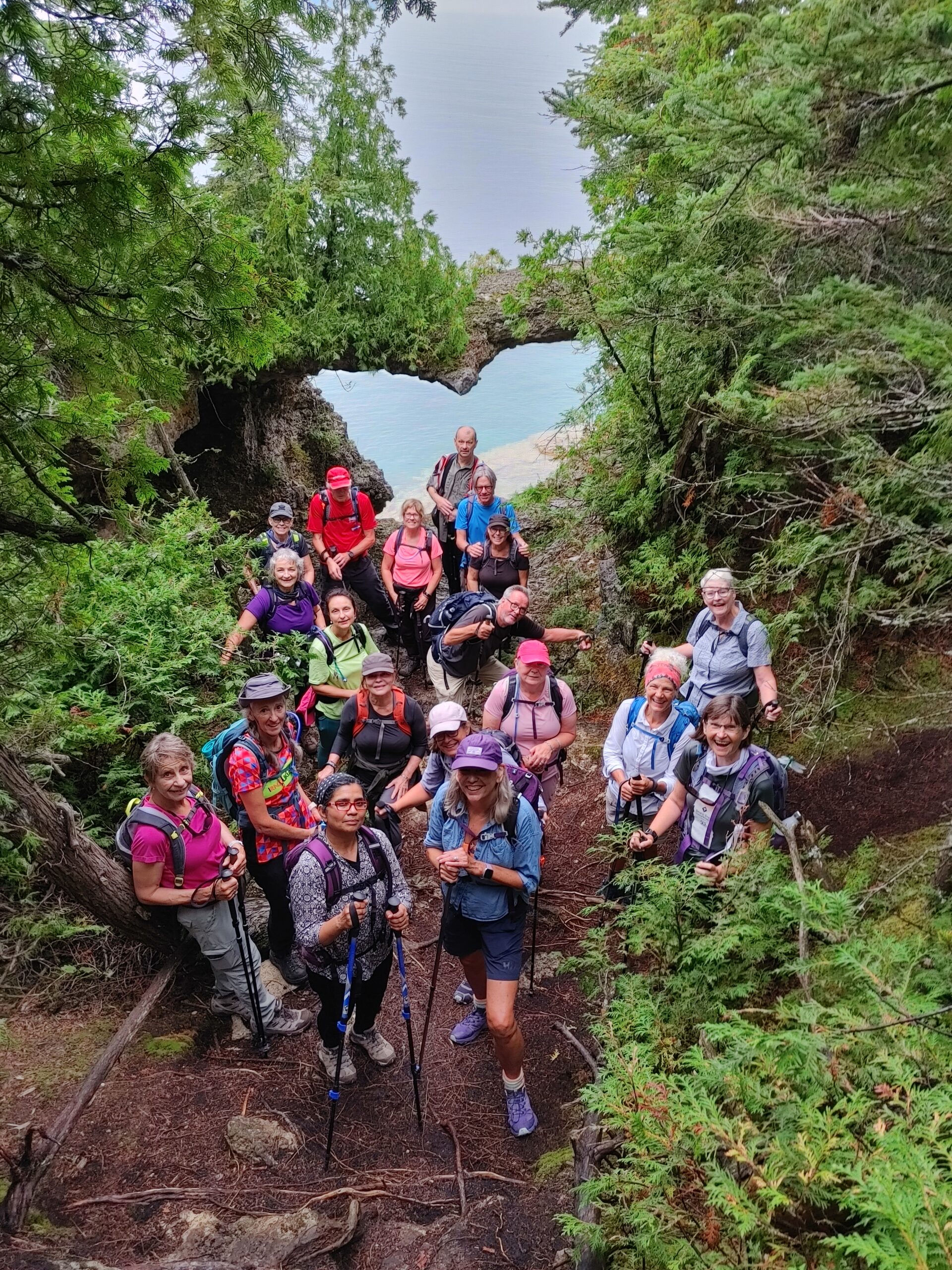
Dolostone Arch Side Trail
https://hikesstaging.brucetrail.org/event/dolostone-arch-side-trail/Sorry, the registration cut-off time for this hike has been reached.Not a member? Click here to join today!Hosting Club: Peninsula
Location (Google Maps): Dunk’s Bay Parking Lot
Hike Leader(s): Saabir Sohrab Click here to contact Hike Leader(s)
Pace: Medium
Terrain: Difficult, Moderate
Distance: ~3.5kmDescription
Explore the recently added Dolostone Arch Side Trail in the Peninsula. This scenic trek features two striking rock formations: a captivating natural arch overhang and a limestone grotto.Prepare for the weather and ensure you have water, some light snacks, and sturdy footwear for the rugged terrain.
Expect to spend about 2 hours on this adventure.
- 12November 12, 2023
Car Hike: Scotsdale Farm – White and Blue Trails hike – 18.5KM
https://hikesstaging.brucetrail.org/event/car-hike-scotsdale-farm-white-and-blue-trails-hike-18-5km/Sorry, the registration cut-off time for this hike has been reached.Not a member? Click here to join today!Hosting Club: Toronto
Category: Car Hike
Location (Google Maps):We meet in the parking lot at Scotsdale Farm. Enter from Trafalgar Road, 1.7KM from where Trafalgar Road leaves Highway 7.
Hike Leader(s): Fayyaz Mahmood Click here to contact Hike Leader(s)
Pace: Brisk
Terrain: Challenging, Rocky
Distance: 18.5KMDescription
We will hike the Main trail and Side Trails (ST) in the Scotsdale Farm / Silver Creek area. We start on the Bennett Heritage ST going North to join the Main Bruce trail at 35.1KM, Map 13, Ed 30. We turn back on the Main trail and join the Great Esker ST at 33.4KM. We leave the Great Esker trail to take the new Trafalgar ST, Reservoir ST and finally the Duff Pit ST to return back to the Main trail at 28.4KM. We take the Main trail going north until 31.2KM and take the Maureen Smith ST to return back on the Bennett Heritage ST to return back to the parking lot.
Dress according to the weather. Hiking boots are required.
Bring your lunch and 1.5-2 litres of water. No dogs.Niagara ETE in Seven - Brisk Pace - Led by Smadar Junkin - Please read all details before registering.
https://hikesstaging.brucetrail.org/event/niagara-ete-in-seven-brisk-pace-led-by-smadar-junkin-please-read-all-details-before-registering/Sorry, the registration cut-off time for this hike has been reached.Not a member? Click here to join today!This is a Multi-Day Hike
You are signing up for the following dates and times:
2023-11-12 at 08:30
2023-11-25 at 08:30
2023-11-26 at 08:30
2023-12-02 at 08:30
2023-12-03 at 08:30
2023-12-09 at 08:30
2023-12-10 at 08:30Hosting Club: Niagara
Category: Event Hikes
Location (Google Maps): Nov 12: Meet at Woodend Conservation Area, Taylor Road, Niagara-on-the-Lake, 43.1432995, -79.1672588, Carpool to the BTC Southern Terminus 14184 Niagara River Pkwy, Niagara-on-the-Lake, 43.1602848, -79.052315.
Nov 25 Meet at Decew House, Decew Rd Thorold. 43.1078074, -79.2498458. Carpool to Woodend Conservation Area, Taylor Road, Niagara-on-the-Lake, 43.1432995, -79.1672588.
Nov 26: Meet at Roland Rd parking lot east of Effingham St 43.090278, -79.305073. Carpool to Decew House, Decew Rd Thorold. 43.1078074, -79.2498458
Dec 2: Meet at 3640 Glen Rd Jordan 43.139030, -79.373893. Carpool to Roland Rd parking lot east of Effingham St 43.090278, -79.305073.
Dec 3: Meet at 3774 Quarry Rd Beamsville, 43.142799, -79.458922. Carpool to 3640 Glen Rd Jordan 43.139030, -79.373893.
Dec 9: Meet at Mountainview Conservation Area, Beamsville 43.1577899 -79.4974062. Carpool to 3774 Quarry Rd Beamsville, 43.142799, -79.458922
Dec 10: Meet at Grimsby Lions Club Pool 1 Elm St 43.193201, -79.565301. Carpool to Mountainview Conservation Area, Beamsville 43.1577899 -79.4974062Hike Leader(s): Niagara Hike Leader Click here to contact Hike Leader(s)
Pace: Brisk
Terrain: Moderate
Distance: 12 – 15k per dayDescription
Meet time is 8:15 for 8:30 start. . This is a special series of 7 hikes to complete the Niagara section of the Bruce Trail. There will be a new accomplishment badge, included in the registration fee featuring the White-tailed deer – which has been designed by Joe Borges and will be made available on our last day. The White-tailed deer is common throughout Niagara. For this E2E in 7, we will be following the main trail east to west eventually finishing in Grimsby. Some days we will hike east to west and other days, west to east depending on parking availability. Please note that you are signing up for the entire series of 7 hikes as a Group Hike. The Niagara in 7 series is geared to experienced long distance hikers with the expectation of a 3 to 5.0 km/ hr. pace maintained over a day up to 15km. The section is approximately 85km so daily distances will be based on available parking. No dropout points have been established and therefore hikers who must drop out, will be responsible for their own transportation back to their vehicle. Please be honest about your hiking abilities. We will hike at a steady pace but there will be plenty of time to take pictures and to enjoy the flora and fauna of this beautiful but challenging section.
Again, this particular set of 7 hikes is intended to be Moderate/Brisk. Please be honest about your degree of physical fitness prior to registration. It is a group hike so it is important you are able to keep pace with the person in front of you.
Attire and Daily Hikes.
Hikers will be expected to be wearing proper hiking boots and layered clothing with the expectation of hot and humid weather. Sufficient food and 2 litres of water for a full day of hiking is required as well as hiking poles (if you use them). Check the daily forcast and prepare for wet weather, as well. Bug spray is strongly suggested. Clothing adjustments, bio-breaks are as needed. Please let the sweep person know and they will wait for you. A morning break around 10am and a 10-15 minute on-trail lunch break will be scheduled. An afternoon break will be based on our expected finish time. Depending on weather conditions, these times may vary. Please check for ticks everyday. Wear a wide brimmed hat and hang your backpack up off the ground. This area is endemic to black-legged ticks.
Fee
The fee goes towards supporting the Niagara Bruce Trail Club, which in turn supports the mission of the Bruce Trail Conservancy, which is: “Preserving a ribbon of wilderness, for everyone, forever.” For the time being, registration for the Niagara E2E-in-seven will be limited to members of the Bruce Trail Conservancy. Hikers may be a member of any section.
Car Shuttles and Missing Hikes
A maximum of 2 (of the 7) hikes can be self-completed as a result of scheduling challenges, but it is intended that this badge be earned while hiking as part of a group led by a certified hike leader. Car shuttles are shared amongst all hikers. If you intend to arrive at the meeting locations with more than yourself in your vehicle, please let the hike leader know in advance. Car pooling to our meeting spot with 2 people in the car is generally ok but we would like to minimize and equalize the driving/shuttling as much as possible so it is fair for all participants. If you know you will miss more than 2 of the hikes, it’s likely best to sign up for another end to end, however, whatever hikes are completed on this series may go toward completion of an independent ETE for the regular Niagara section. If you are able to complete the hikes you know you will miss ahead of time, all the better.
Transportation
This series will be through-hikes and will require car shuttling. You must be willing to drive and/or to be a passenger. Some parking locations require paid parking, and hikes that enter Niagara Parks. The fee for this E2E-in-7 does not include any parking/entry fees for hikers. These costs, where applicable, will be shared amongst all participants unless you have a parking or park pass.
Leave No Trace
Please remember, like all hikes, this is a Leave No Trace hike. Pack out whatever you pack in. Do not toss anything onto or into any sections of the trail. We will also try to leave the trail better than we found it so we will be collecting collectable garbage we might see along the way. Daily volunteers to collect trail trash will be supplied with a bag. Dogs will not be welcome on this hike.
Daily
We meet for each hike by at least 6:45am each day. The schedule is subject to change. Please set aside July 24th as a potential alternate day in the event of weather related postponement.
This hike is limited to 12 participants including the hike leader.
9:30 Hiking in and around Port Weller West
https://hikesstaging.brucetrail.org/event/930-hiking-in-and-around-port-weller-west/Sorry, the registration cut-off time for this hike has been reached.Not a member? Click here to join today!Hosting Club: Niagara
Category: Loop
Location (Google Maps): Lock 1, Welland Canal, 325 Lakeshore Road, St. Catharines, L2M 7Z3Hike Leader(s): Sheila Massey Click here to contact Hike Leader(s)
Pace: Medium
Terrain: Easy
Distance: 6kDescription
This hike will follow a trail along the Welland Canal, walk through Mary Malcolmson Eco Park, continue to Sunset Beach, follow Walker’s Creek Trail, visit flower murals along the fences of the Port Weller Community Centre, follow the trails of Malcomson Park and return to Lock 1 of the Canal.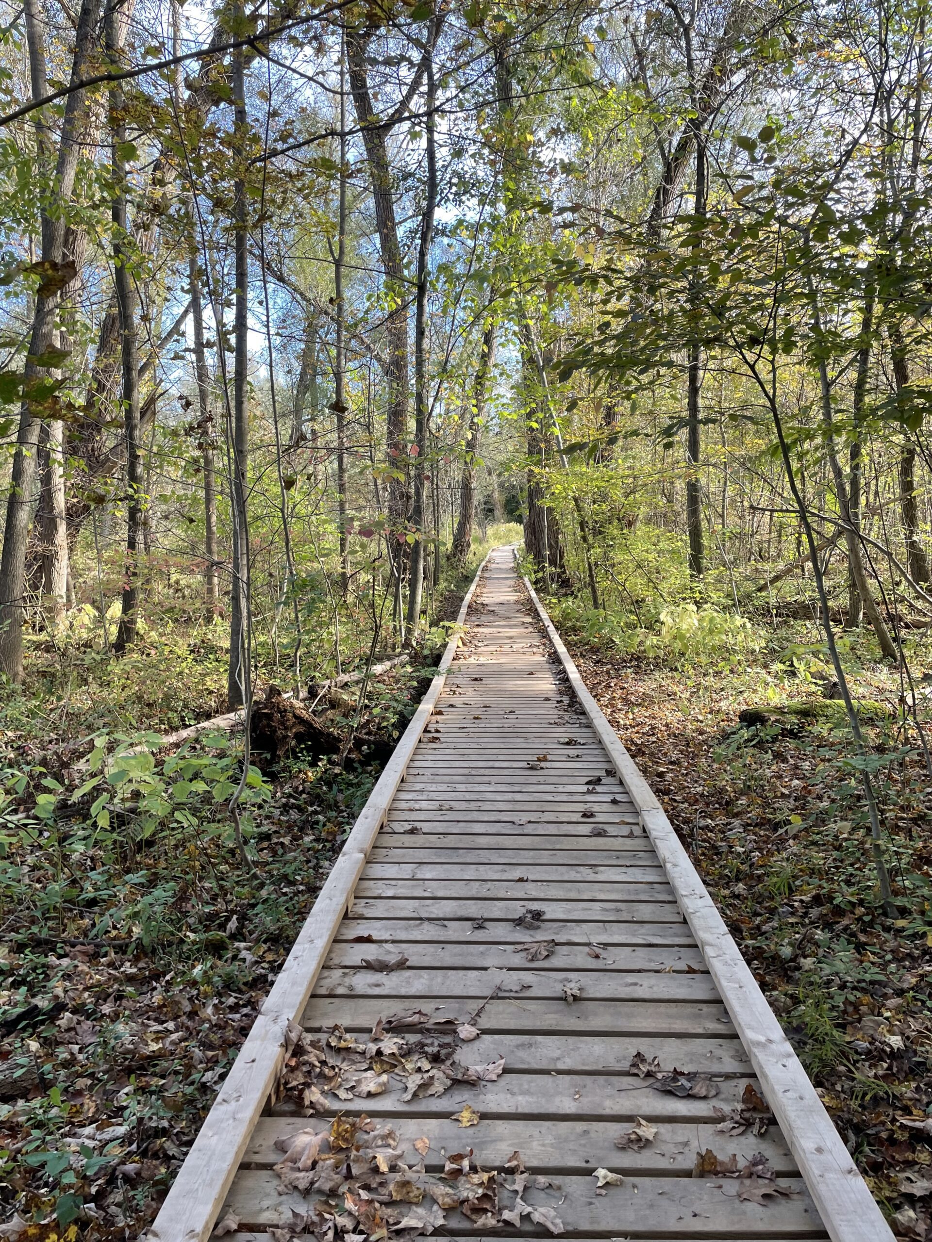
Sunday Rambles - River & Ruin
https://hikesstaging.brucetrail.org/event/sunday-rambles-river-ruin/Sorry, the registration cut-off time for this hike has been reached.Not a member? Click here to join today!Hosting Club: Iroquoia
Category: General Hike
Location (Google Maps): Park at Kilbride Park behind the public schoolHike Leader(s): Colleen Mabalay Click here to contact Hike Leader(s)
Pace: Medium – 3 to 4 km/hr
Terrain: Moderate – Some hills and/or some poor footing, Strenuous – Hilly with steep climbs and some poor footing
Distance: Approx 7.5Description
Arrive 15mins early for 10am start.Bring water & snacks as will be taking a short break. Be prepared for winter conditions if we get snow before hike – hiking poles, icers.
If you need to cancel day of hike please text me at (905) 815-7100
- 13November 13, 2023
Memorial Forest to Jones Falls Loop
https://hikesstaging.brucetrail.org/event/memorial-forest-to-jones-falls-loop-3/Sorry, the registration cut-off time for this hike has been reached.Not a member? Click here to join today!Hosting Club: Sydenham
Category: General Hike
Location (Google Maps):Parking area at the west end of Young’s Drive, off Nicol’s Gully Road, east of km 105.8 (Map 32)
Hike Leader(s): Sheri Hatcher Click here to contact Hike Leader(s)
Pace: Medium: 3 to 4 km/h
Terrain: Moderate: Some hills and/or poor footing
Distance: Approximately 6 kmDescription
We will walk along the base of the escarpment on the Memorial Forest Side Trail and ascend through a crevasse to join the Main Trail along the top of the escarpment. We will head to Jones Falls and explore the area. We will then take the Merle Gunby Side Trail loop and join up with the Main Trail again. This hike ends with a steep descent back to the parking lot. Please arrive 15 minutes before the start time. If you are unable to register, please call or text the leader at 519-270-5068.11:00 am Hike & Picnic
https://hikesstaging.brucetrail.org/event/1100-am-hike-picnic-12/Sorry, the registration cut-off time for this hike has been reached.Not a member? Click here to join today!Hosting Club: Niagara
Category: Loop
Location (Google Maps): Locust Grove Picnic AreaHike Leader(s): Marion Hanover Click here to contact Hike Leader(s)
Pace: Medium
Terrain: Moderate
Distance: 7 kmDescription
Hike around Queenston area. Optional outdoor gathering in Locust Grove including pot luck picnic after the hike. - 14November 14, 2023
NEW TIME 9:00 Staff Avenue Louth
https://hikesstaging.brucetrail.org/event/800-long-hike-wiley-road-short-hills-40/Sorry, the registration cut-off time for this hike has been reached.Not a member? Click here to join today!Hosting Club: Niagara
Location (Google Maps): Staff Avenue Louth
Hike Leader(s): Alan Laver Click here to contact Hike Leader(s)
Pace: Medium
Terrain: Moderate
Distance: 10kmDescription
Explore Short Hills and the majestic side trails of Scarlett Tanager, Hemlock. Swayze Falls and Terrace. Register for each hike
Bring Poles water, snack, sunscreen and bug spray and dress for the weather
9:15 Short Hike - Rotary Park, St. Catharines
https://hikesstaging.brucetrail.org/event/915-short-hike-pelham-road-short-hills-68/Sorry, the registration cut-off time for this hike has been reached.Not a member? Click here to join today!Hosting Club: Niagara
Location (Google Maps): Rotary Park, St. Catharines
Hike Leader(s): janet davey Click here to contact Hike Leader(s)
Pace: Medium
Terrain: Moderate
Distance: 6 kmsDescription
Hike the trails around Rotary Park in St. Catharines. Bring water.Hiking through Hamilton on the Chedoke Radial Trail. This is a shuttle hike. Please car pool if you can, parking is limited.
https://hikesstaging.brucetrail.org/event/hiking-through-hamilton-on-the-chedoke-radial-trail-this-is-a-shuttle-hike-please-car-pool-if-you-can-parking-is-limited/Sorry, the registration cut-off time for this hike has been reached.Not a member? Click here to join today!Hosting Club: Caledon Hills
Category: Tuesday Hikers
Location (Google Maps): Meet at roadside parking on Kimberly Dr. in Hamilton; km 29.4 Iroquoia section of the BTC Trail Guide. Park by the Kimberly Dr. access Side Trail. We will car pool to the parking area on Scenic Dr. to start the hike.Hike Leader(s): Doris Harper Click here to contact Hike Leader(s)
Pace: Medium – 3 to 4 km/hour
Terrain: Moderate – some hills and/or some poor footing
Distance: 11 kmDescription
From roadside parking on Kimberly Dr., we will shuttle to the parking area on Scenic Dr. GPS 43.245533 -79.930693.We will hike mainly on the Chedoke Radial Trail from where we can enjoy great views over the lake and the city. The trail also wanders through forested areas.
Bring water , snacks, poles(optional). Comfortable sturdy shoes or boots recommended. Dress for the weather, and the forecast.
We will also be accompanying hikers on their End t0 End journey of the Bruce Trail.
Humber Valley Heritage Trail
https://hikesstaging.brucetrail.org/event/humber-valley-heritage-trail-8/Sorry, the registration cut-off time for this hike has been reached.Not a member? Click here to join today!Hosting Club: Dufferin Hi-Land
Category: Tuesday Hike
Location (Google Maps): (Google Maps) Dick’s Dam Park is located in Bolton. For carpooling, meet at the parking area on the east side of the Party City/Winners building, (Hwy10 and 4th Ave. in Orangeville) at 8:30 am. Or from King Street and Hwy 50 (Queen St.) in downtown Bolton, drive north on Queen St. (Hwy 50) and in 0.5 km cross the bridge over the Humber River. Turn left on Hickman St., then right on Glasgow Rd. Follow Glasgow Rd. around the bend to parking on your left at Dick’s Dam Park for a 9:30 am start.Hike Leader(s): Tony Evangelista, Les Babbage, Inge Eckerich, Julie Daley Click here to contact Hike Leader(s)
Pace: Medium
Terrain: Moderate, Slippery and Steep Sections
Distance: Long Hike 9 km Short Hike 4kmDescription
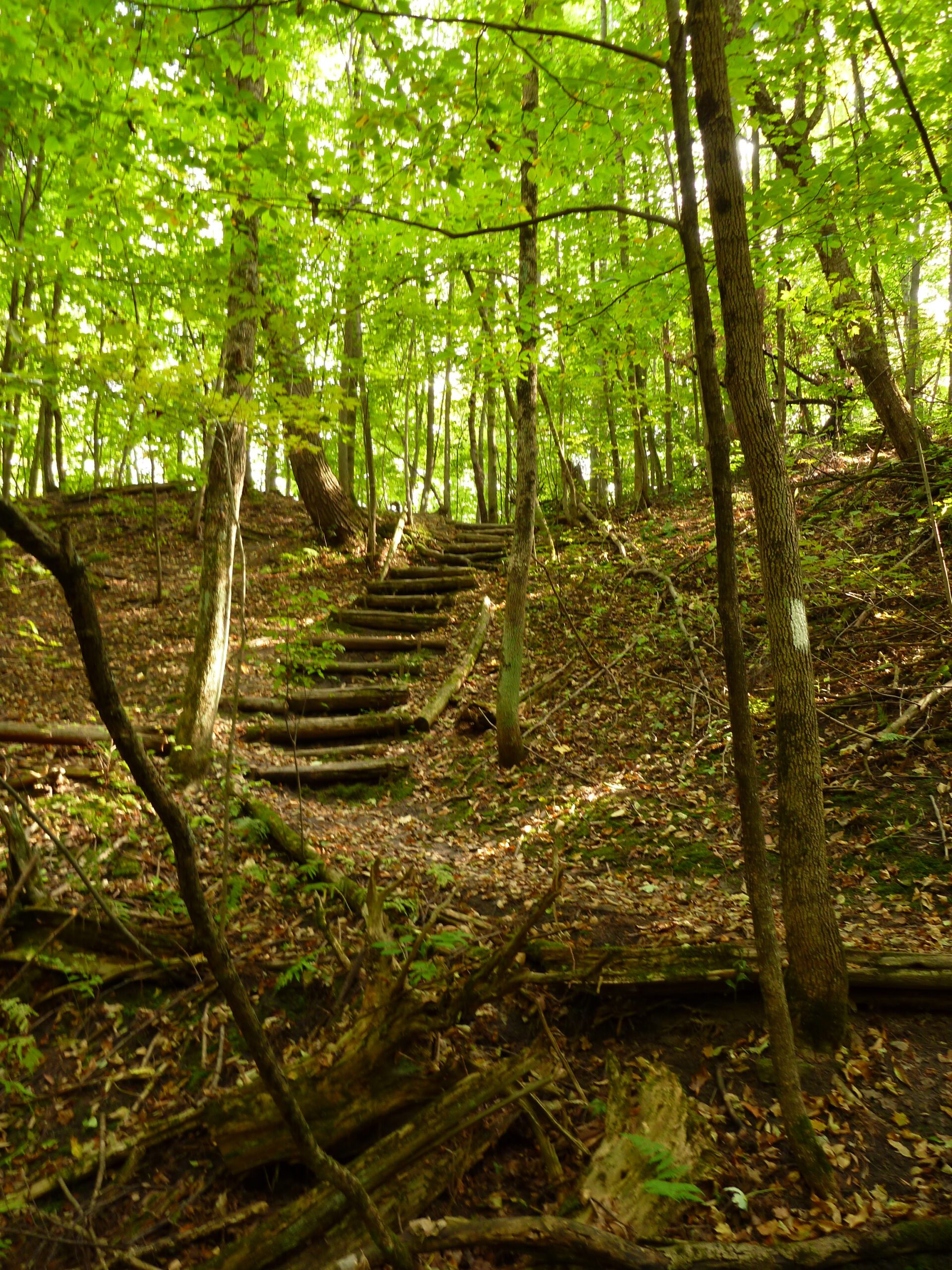
We will car shuttle to the parking area at Castlederg Sideroad and then hike back to the cars at Dick’s Dam. The short hike can end at the car(s) stationed at Duffy’s Lane and Emil Kolb’s parking lot.Hiking poles are recommended. Bring lunch, water, and snacks.
Optional refreshment stop after the hike at Coffee Time in Bolton.

Sydenham Chipper (km83.8-km98.7)
https://hikesstaging.brucetrail.org/event/sydenham-chipper-km83-8-km100-9/Sorry, the registration cut-off time for this hike has been reached.Not a member? Click here to join today!Hosting Club: Beaver Valley
Location (Google Maps): Park on the West Side of 10th Concession S, just south of the Bruce Trail
Map 32, Ed 30
Km83.8Hike Leader(s): Kristina Rettie Click here to contact the hike leader.
Pace: Brisk
Terrain: Some rocky footing, Some steep sections, Strenuous
Length of Hike: 14.9kmDescription
Please join us as we chip away through the Sydenham section. This will be a series of 11 hikes that range between 13-19kms with one longer hike of 24km. We will begin our journey at the northern end of Sydenham and work our way south to try and avoid the dangers the falling leaves and snow will bring.If you complete the 11 hikes in this series you will qualify for Sydenham’s new independent badge. Please keep track of your hikes as each hiker will be submitting their own badge request.
All hikes in this series will include a car shuttle and everyone will take a turn as a shuttle driver. Please have your vehicle passenger ready.
Nov 14 hike – meet@km83.8 carpool to 98.7
If you have any questions please text me @ 519-410-9077 (this is the most efficient way)
Please bring plenty of water and snacks/lunch
No dogs
Please text Kristina @ 519-410-9077 for morning of cancelations
COVID-19 Precautions Before, During and After your Hike
- Each hiker joining a Bruce Trail Club organized hike must perform a self-screening check before hiking.
Find Ontario’s self-assessment tool here: https://covid-19.ontario.ca/self-assessment/ - If you are experiencing COVID-19 symptoms, stay home.
Transportation
It is the Bruce Trail Conservancy’s current policy that car shuttles are allowed. It is at the discrepancy of individual hike leaders to make that decision.
Other Guidelines
- Arrive 15 minutes before the start of the hike.
- Wear sturdy footwear and appropriate attire for the weather and the terrain.
Hiking poles are a good idea in any season, especially if the terrain is rocky or slippery. In winter, snowshoes or icers/crampons are needed when conditions dictate.
Wearing appropriate clothing and footwear prevents injuries and shows consideration for a safe and positive group hiking experience. - Always carry I.D. and your health card.
- Bring sufficient water and snacks (or lunch if indicated). A minimum of 1L of water is recommended on all hikes, and 3L is recommended for long, challenging hikes in the heat of the summer.
- Bring sunscreen and insect repellent (for spring and summer hikes).
- Bring your own first aid kit.
- Please leave dogs at home.
- Each hiker joining a Bruce Trail Club organized hike must perform a self-screening check before hiking.