
Hike Schedule
Join us for a hike! Registration required.
All hikes available to BTC members. Some hikes are open to non-members.
See Refund Policy for Paid Hikes >
TIP: The calendar view displays up to 7 hikes on a day, but often there are more. Click “View more events” to see them all.
Categories
- 11November 11, 2024

Iroquoia E2E Series 2 of 8
https://hikesstaging.brucetrail.org/event/iroquoia-e2e-series-2-of-8/Sorry, the registration cut-off time for this hike has been reached.Not a member? Click here to join today!Hosting Club: Iroquoia
Location (Google Maps): Meeting place: Roadside Parking Kimberly Drive – at the Kimberly Drive Side Trail
Hike Leader(s): Pati Greenwood, Jeff Dowsett Click here to contact Hike Leader(s)
Pace: Medium – 3 to 4 km/hr
Terrain: Moderate – Some hills and/or some poor footing
Distance: 13.5Description
Join us for this second hike of the of 8 hike series to complete the Iroquoia Section of the Bruce Trail. Register for all 8 hikes (to be entitled to the badge) or only the ones you are available for. Car shuffle and other hike details will be emailed to registered hikers a few days prior to the hike. Bring plenty of water and a snack. Wear appropriate clothing for conditions. Hiking boots are mandatory and hiking poles are suggested. Please arrive at the meeting place by 8:15 am as we will leave promptly at 8:30 am to shuffle to our starting point. - 12November 12, 2024
Urban Walk: Valley View Park Thornhill
https://hikesstaging.brucetrail.org/event/urban-walk-valley-view-park-thornhill-32/Sorry, the registration cut-off time for this hike has been reached.Not a member? Click here to join today!Hosting Club: Toronto
Location (Google Maps): Parking lot at the corner of Bayview Ave, and Sycamore Dr. South of Highway 7
Sycamore Dr. is 3blocks south of highway 7 and 2 blocks north of John Street, parking lot is across plaza of Dollarama and Star boxHike Leader(s): Mohammad Aghamiri Click here to contact Hike Leader(s)
Pace: Moderate (3-4 km/hr)
Terrain: Level 2 (Intermediate – some hills and uneven surfaces, rocks and roots underfoot)
Distance: 7-8 kmDescription
We will explore Valleyview and Maple view parks, and walk along German Mill Creek, for a distance of 7-8 km. Difficulty Level: 2 (Moderate)9:00 Long Hike Wiley Road Short Hills
https://hikesstaging.brucetrail.org/event/900-long-hike-wiley-road-short-hills-43/Sorry, the registration cut-off time for this hike has been reached.Not a member? Click here to join today!Hosting Club: Niagara
Category: Loop
Location (Google Maps):Short Hills Wiley Road Entrance
Hike Leader(s): Alan Laver Click here to contact Hike Leader(s)
Pace: Medium
Terrain: Moderate
Distance: 10kmDescription
Explore Short Hills and the majestic side trails of Scarlett Tanager, Hemlock. Swayze Falls and Terrace. Register for each hikeBring Poles, Icers, snack, and dress for the weather
9:15 Short hike - Pelham Road, Short Hills
https://hikesstaging.brucetrail.org/event/915-short-hike-pelham-road-short-hills/Sorry, the registration cut-off time for this hike has been reached.Not a member? Click here to join today!Hosting Club: Niagara
Category: Loop
Location (Google Maps): Pelham Road entrance, Short Hills Provincial ParkHike Leader(s): janet davey Click here to contact Hike Leader(s)
Pace: Medium
Terrain: Moderate
Distance: 6 kmsDescription
Hike the main and side trails in Shorthills Provincial Park. Bring hiking boots and water. Please help prevent the spread of invasive species by cleaning your boots following the hike.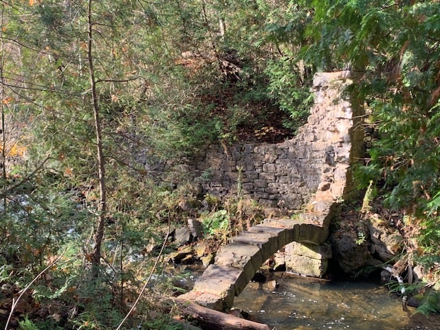
Exploring Limehouse – Hole in the Wall, Kilns and Trails
https://hikesstaging.brucetrail.org/event/exploring-limehouse-hole-in-the-wall-kilns-and-trails-2/Sorry, the registration cut-off time for this hike has been reached.Not a member? Click here to join today!Hosting Club: Caledon Hills
Category: Tuesday Hikers
Location (Google Maps): Meet at Limehouse Conservation Area on Fifth Line near km 20.3 Map 12 Edition 31. From Hwy 401 take Trafalgar Rd. North. At Sideroad 22 turn left and follow 3 km to village of Limehouse. Turn left on Fifth Line and follow south for one km to parking at ball diamonds on your left.Hike Leader(s): Jennie Greenfield Click here to contact Hike Leader(s)
Pace: Medium – 3 to 4 km/hour
Terrain: Moderate – some hills and/or some poor footing
Distance: 9.5 kmDescription
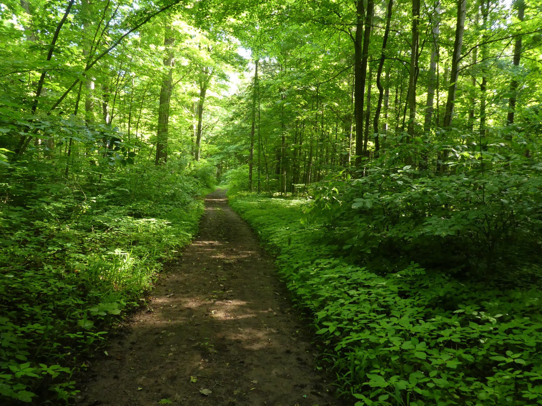
We will hike the main trail and the Black Creek and Todd Bordes Meadowland Side Trails north of Limehouse to 5th Line and back. Along the way we will pass the remains of an old mill on Black Creek, lime kilns, and a restored powder magazine. We will hike along the edge of fields, through forest and meadowland, the highlight being the rock fissures and crevices around the ‘Hole-in-the-Wall’.We will stop for water breaks along the way and a longer snack/lunch break later in the hike. Bring plenty of water and something to eat. Hiking boots required, please dress appropriately for weather conditions.
Twiss Rd to Crawford Lake return
https://hikesstaging.brucetrail.org/event/twiss-rd-to-crawford-lake-return-2/Sorry, the registration cut-off time for this hike has been reached.Not a member? Click here to join today!Hosting Club: Iroquoia
Category: General Hike
Location (Google Maps): Meet roadside on Twiss Road at 9:15 am.Hike Leader(s): Karen Bergmann Click here to contact Hike Leader(s)
Pace: Medium – 3 to 4 km/hr
Terrain: Moderate – Some hills and/or some poor footing
Distance: 10 kmsDescription
We will hike to Crawford Lake and around the trails and back to Twiss Road. There are some rocky sections along the way. Please bring water and a snack. Hike is dependent on weather conditions.Bayview Escarpment
https://hikesstaging.brucetrail.org/event/bayview-escarpment-5/Sorry, the registration cut-off time for this hike has been reached.Not a member? Click here to join today!Hosting Club: Beaver Valley, Sydenham
Location (Google Maps): Bayview Escarpment Provincial Nature Reserve (north)
Off road parking along the St.Vincent-Sydenham Townline at the entrance signs to the Bayview Escarpment Nature Preserve.
Map 30, ED 31Hike Leader(s): Kristina Rettie Click here to contact the hike leader.
Pace: Brisk
Terrain: Moderate, Some rocky footing
Length of Hike: 13kmDescription
This loop hike will take us around the Bayview Escarpment using main trail and the River Kwai Side Trail. We will hike through mixed hardwood forest, deep crevices, high cliffs and possibly hear the sounds of explosives coming from the Meaford Land Forces Training Centre.Be prepared with snowshoes & icers
Please bring snacks and water.
No dogs!
Call or text Kristina for morning of cancelations @ 519-410-9077
COVID-19 Precautions Before, During and After your Hike
- Each hiker joining a Bruce Trail Club organized hike must perform a self-screening check before hiking.
Find Ontario’s self-assessment tool here: https://covid-19.ontario.ca/self-assessment/ - If you are experiencing COVID-19 symptoms, stay home.
- Personal Protective Equipment:
- Hikers may choose to wear masks
Transportation
It is the Bruce Trail Conservancy’s current policy that car shuttles are allowed. It is at the discrepancy of individual hike leaders to make that decision.
Other Guidelines
- Arrive 15 minutes before the start of the hike.
- Wear sturdy footwear and appropriate attire for the weather and the terrain.
Hiking poles are a good idea in any season, especially if the terrain is rocky or slippery. In winter, snowshoes or icers/crampons are needed when conditions dictate.
Wearing appropriate clothing and footwear prevents injuries and shows consideration for a safe and positive group hiking experience. - Always carry I.D. and your health card.
- Bring sufficient water and snacks (or lunch if indicated). A minimum of 1L of water is recommended on all hikes, and 3L is recommended for long, challenging hikes in the heat of the summer.
- Bring sunscreen and insect repellent (for spring and summer hikes).
- Bring your own first aid kit.
- Please leave dogs at home.
City View Park, Burlington, Map 9.
https://hikesstaging.brucetrail.org/event/city-view-park-burlington-map-9-4/Sorry, the registration cut-off time for this hike has been reached.Not a member? Click here to join today!Hosting Club: Caledon Hills
Category: Tuesday Hikers
Location (Google Maps): City View Park, Burlington.
From Highway 403 going west, turn right on Brant Street, left on Dundas Street, left on Kerns Rd., take second turn left into City View Park to the parking lot.Hike Leader(s): Mohammad Shafiq Click here to contact Hike Leader(s)
Pace: Medium – 3 to 4 km/hour
Terrain: Moderate – some hills and/or some poor footing
Distance: 11 kmDescription
(This hike is the replacement of an earlier Tuesday Hike that was canceled due to rain).
From City View Park will connect with main Bruce Trail and hike to Smokey Hollow waterfall, also hike Kings ST and Eric Best ST on the way. After snack break will trace back our steps and return to parking.
Bring water, snack for refreshment break at Smokey Hollow.
Dress for the weather.
Poles are recommended.Tuesday Hikes 20 Year Anniversary End-to-End - Hike 9
https://hikesstaging.brucetrail.org/event/tuesday-hikes-20-year-anniversary-end-to-end-hike-9/Sorry, the registration cut-off time for this hike has been reached.Not a member? Click here to join today!Hosting Club: Dufferin Hi-Land
Category: Tuesday Hike
Location (Google Maps):Dufferin Hi-Land Map 21, Km 53.1. Meet at BTC parking lot on south side of 30 Sideroad Mulmur, 100 metres east of the trail crossing.
Hike Leader(s): Julie Daley;Inge Eckerich;Les Babbage;Tony Evangelista Click here to contact Hike Leader(s)
Pace: Leisurely
Terrain: Moderate, Slippery and Steep Sections
Distance: 6.4 km; Drop out at Km 48.8 can be arranged (2.1 km)Description
In 2004 a group of Dufferin Hi-Land BTC members began organizing Tuesday hikes. For their first venture, they hiked a 10 hike/10 week end-to-end series of the DH section. Join us as we recreate this series to celebrate the 20th anniversary of Tuesday hiking and recognize the pioneers who started it all.Hike 9 continues east, down Black Bank Hill, then up again to woods and open fields turning north onto 1st Line road allowance to 30 Sideroad. We will car shuttle from 30 Sideroad parking back to Centre Rd parking.
Bring water and snacks.
- Each hiker joining a Bruce Trail Club organized hike must perform a self-screening check before hiking.
- 13November 13, 2024
Wednesday Walkers: Bognor Marsh
https://hikesstaging.brucetrail.org/event/wednesday-walkers-bognor-marsh/Sorry, the registration cut-off time for this hike has been reached.Not a member? Click here to join today!Hosting Club: Beaver Valley
Location (Google Maps): Meet in the parking lot of Bognor Marsh Management Area. This is a Grey Sauble Conservation Authority fee site.
Hike Leader(s): Margaret Yaraskavitch Click here to contact the hike leader.
Pace: Medium
Terrain: Moderate, Some rocky footing, Some steep sections
Length of Hike: 5 kmsDescription
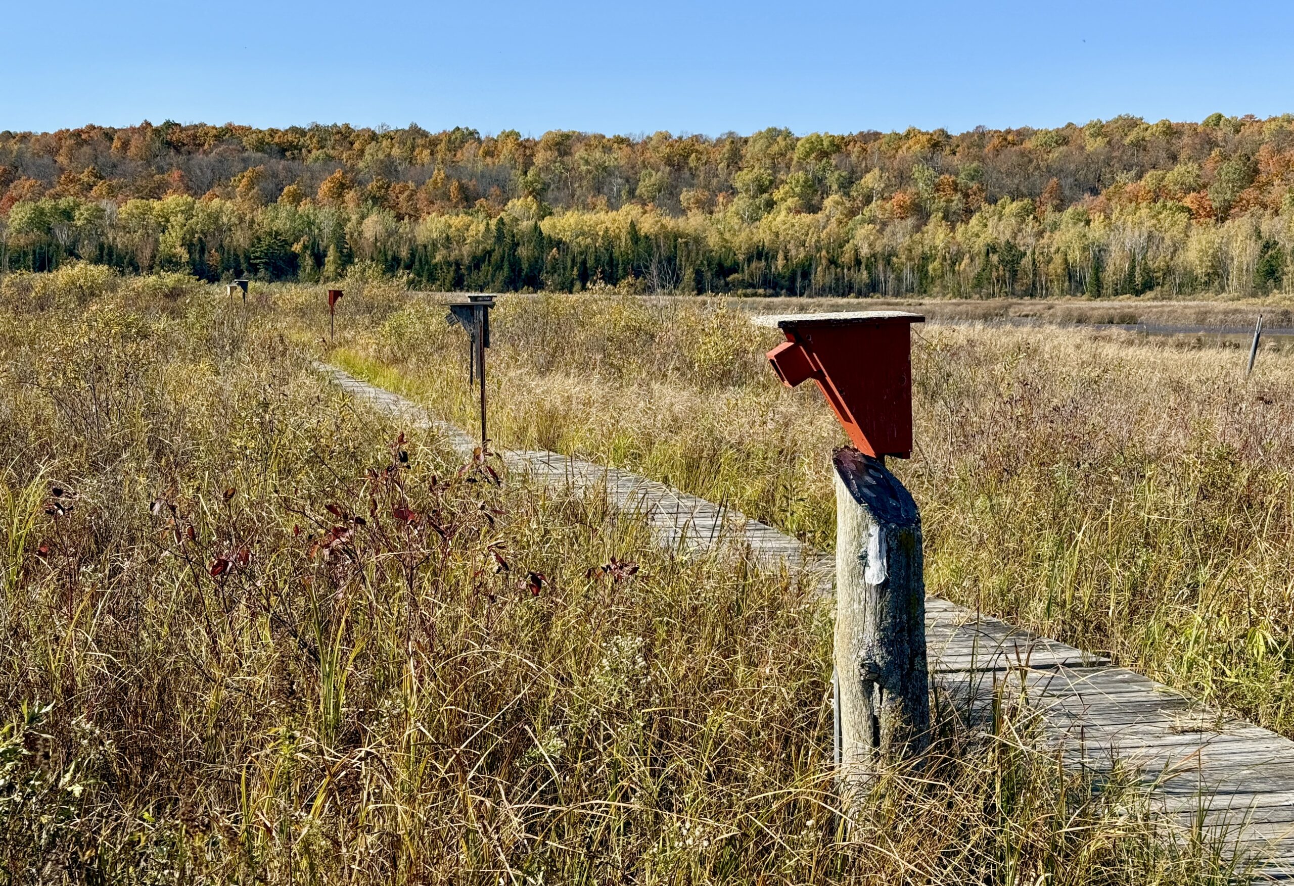
We’ll follow the Main Trail from the parking lot and walk on the marsh boardwalks. The Trail then starts upland along an old cart trail along the scarp face. We’ll use the Bognar Marsh Side Trail to return towards the parking lot.COVID-19 Precautions Before, During and After your Hike
- Each hiker joining a Bruce Trail Club organized hike must perform a self-screening check before hiking.
Find Ontario’s self-assessment tool here: https://covid-19.ontario.ca/self-assessment/ - If you are experiencing COVID-19 symptoms, stay home.
Other Guidelines
- Arrive 15 minutes before the start of the hike.
- Wear sturdy footwear and appropriate attire for the weather and the terrain.
Hiking poles are a good idea in any season, especially if the terrain is rocky or slippery. In winter, snowshoes or icers/crampons are needed when conditions dictate.
Wearing appropriate clothing and footwear prevents injuries and shows consideration for a safe and positive group hiking experience. - Always carry I.D. and your health card.
- Bring sufficient water and snacks (or lunch if indicated). A minimum of 1L of water is recommended on all hikes, and 3L is recommended for long, challenging hikes in the heat of the summer.
- Bring sunscreen and insect repellent (for spring and summer hikes).
- Bring your own first aid kit.
- Please leave dogs at home.
Good Companions - Two Loops from City View Park Burlington
https://hikesstaging.brucetrail.org/event/good-companions-two-loops-from-city-view-park-burlington-3/Sorry, the registration cut-off time for this hike has been reached.Not a member? Click here to join today!Hosting Club: Iroquoia
Category: Good Companions
Location (Google Maps):North Parking Lot off Kerns Road (Near Dundas Street)
City View Park
BurlingtonHike Leader(s): Ted Bossence Click here to contact Hike Leader(s)
Pace: Medium – 3 to 4 km/hr
Terrain: Strenuous – Hilly with steep climbs and some poor footing
Distance: 7.5 kmDescription
We will do a loop on the East side of Kerns Road including the Ian Reid Side Trail and then do a loop using the main Bruce Trail and King Road Side Trail on the West side of Kerns. A couple of the hills will be steep and may be slippery. We will stop for a snack between the two loops. Bring water, a snack, sunscreen. Hiking poles recommended. Please arrive at least 10 minutes prior to start time as I will be leaving on time. In case of rain, I will cancel the hike so please check your email the night before the hike. I will be providing contact information on the day before the hike in case you need to cancel after 4:00 pm on that day or the morning of the hike.Frank's Lime Kiln
https://hikesstaging.brucetrail.org/event/franks-lime-kiln/Sorry, the registration cut-off time for this hike has been reached.Not a member? Click here to join today!Hosting Club: Blue Mountains
Category: Organized Hike
Location (Google Maps): We will carpool to the parking lot on 91near Duntroon. GPS location 44.388871-80.236727. We will visit the Lime Kiln if hikers are interested then proceed north on the main trail which has beautiful views out to the Bay and farmland, especially as the leaves are down. We will also see many interesting rock formations. We will hike north for approx 45 minutes, passing the Wedding Tree, then retrace our steps back to the cars. NOTE: 10AM start time from Tim’s.Hike Leader(s): Flo Kusiak Click here to contact Hike Leader(s)
Pace: Leisurely – 3 km/hr. or less
Terrain: Moderate – Some hills and/or some poor footing
Distance: 4kmDescription
Please email me if you will be meeting at the parking lot on County Road 91 near the lime kiln.Car Hike: Midweek Fitness Hike in the Hilton Falls Conservation Area (about 10-11 km)
https://hikesstaging.brucetrail.org/event/car-hike-midweek-fitness-hike-in-the-hilton-falls-conservation-area-about-10-11-km-2/Sorry, the registration cut-off time for this hike has been reached.Not a member? Click here to join today!Hosting Club: Toronto
Category: Car Hike
Location (Google Maps): Hilton Falls Conservation area, main parking lotHike Leader(s): Natalia Svechnikova Click here to contact Hike Leader(s)
Pace: Moderate (3-4 km/hr)
Terrain: Rocky, Variable
Distance: 10-12 kmDescription
Please join me for a midweek hike in the Hilton Falls Conservation Area. It is a moderate hike on main trails which are not difficult. Although the fall colours season will be over, it will be still beautiful out there with trails covered in fallen leaves. We will hike to the falls and the reservoir and enjoy fresh air and nice views. There will be short stops for snacks and water, but otherwise, we will try to keep pace.Please dress for the weather and wear hiking boots or shoes. Always bring at least 2 L of water and have your rain gear with you. You can book your entrance fee online for $10.50 ($8.25 for seniors) or buy them at the gate for $12 plus HST.
We will meet at the visitors’/office building near the main parking lot around 10 am and start hiking at 10:15 am. I plan to finish the hike around 1 pm.
Please note that this hike will be cancelled if there is a thunderstorm, heavy rain or dangerous windy conditions.
11:00 Hike and Picnic
https://hikesstaging.brucetrail.org/event/1100-hike-around-queenston/Sorry, the registration cut-off time for this hike has been reached.Not a member? Click here to join today!Hike open to BTC Members only.
Hosting Club: Niagara
Category: Hike
Location (Google Maps): Locust Grove Picnic Area, off Niagara Parkway at Queenston turnaboutHike Leader(s): Sheila Massey Click here to contact Hike Leader(s)
Pace: Medium
Terrain: Moderate
Distance: 7 kmDescription
Hike varies from flat trails to climb up the Escarpment. It can be rocky in places; wear suitable footwear. Dress in layers for cooler weather. - Each hiker joining a Bruce Trail Club organized hike must perform a self-screening check before hiking.
- 14November 14, 2024
Urban Walk: Valley View Park Thornhill
https://hikesstaging.brucetrail.org/event/urban-walk-valley-view-park-thornhill-33/Sorry, the registration cut-off time for this hike has been reached.Not a member? Click here to join today!Hosting Club: Toronto
Location (Google Maps): Parking lot at the corner of Bayview Ave, and Sycamore Dr. South of Highway 7
Sycamore Dr. is 3blocks south of highway 7 and 2 blocks north of John Street, parking lot is across plaza of Dollarama and Star boxHike Leader(s): Mohammad Aghamiri Click here to contact Hike Leader(s)
Pace: Moderate (3-4 km/hr)
Terrain: Level 2 (Intermediate – some hills and uneven surfaces, rocks and roots underfoot)
Distance: 7-8 kmDescription
We will explore Valleyview and Maple view parks, and walk along German Mill Creek, for a distance of 7-8 km. Difficulty Level: 2 (Intermediate)9:00 am Long Hike Jordan to Moyer / Louth
https://hikesstaging.brucetrail.org/event/900-am-long-hike-jordan-to-moyer-louth-2/Sorry, the registration cut-off time for this hike has been reached.Not a member? Click here to join today!Hosting Club: Niagara
Location (Google Maps):
Jordan Hollow Park 3039 King St Jordan
Pace: Medium
Terrain: Moderate
: 10kDescription
From Jordan Hollow Hike the main trail to Upper and Lower Balls Falls, Moyer Road or Louth and Return. You must register for each hike. Bring Poles, snack and a drink and dress for the weatherHiking Around Jordan
https://hikesstaging.brucetrail.org/event/hiking-around-jordan-8/Sorry, the registration cut-off time for this hike has been reached.Not a member? Click here to join today!Hosting Club: Niagara
Location (Google Maps): Jordan Hollow, across from Boo’s Restaurant
Now known as Shoarishon ParkHike Leader(s): Bill Russell Click here to contact Hike Leader(s)
Pace: Medium
Terrain: ModerateDescription
Hiking various trails in and around Jordan, (Balls Falls, Jim Rainforth Trail and Bailey Bridge through the Village of Jordan.Skinner’s Woods and Views over Georgian Bay
https://hikesstaging.brucetrail.org/event/skinners-woods-and-views-over-georgian-bay/Sorry, the registration cut-off time for this hike has been reached.Not a member? Click here to join today!Hosting Club: Sydenham
Category: General Hike
Location (Google Maps): The Owen Sound Galaxy Cinema parking lot. Meet at the tall “Galaxy Centre” sign next to the traffic lights.Hike Leader(s): Maureen McFarland Click here to contact Hike Leader(s)
Pace: Medium: 3 to 4 km/h
Terrain: Moderate: Some hills and/or poor footing, There might be icy and slippery sections., There might be muddy sections., There might be sections with water on the trail.
Distance: 8 kmsDescription
We will carpool to the start of this loop hike. We begin on the Len Holley Side Trail, then follow the snowmobile trail to Skinner’s Woods Side Trail. When we reach the escarpment we will walk along the top to the Curly Harnden Side Trail, then return to our cars via the side trail. With the leaves gone, we will enjoy some nice views over Georgian Bay and the islands. It may be wet underfoot, or if the morning is particularly cold, there could be some ice. Bring along your icers and poles, and a snack. Approximately 2 1/2 hours hiking time plus travel time to and from the hike start.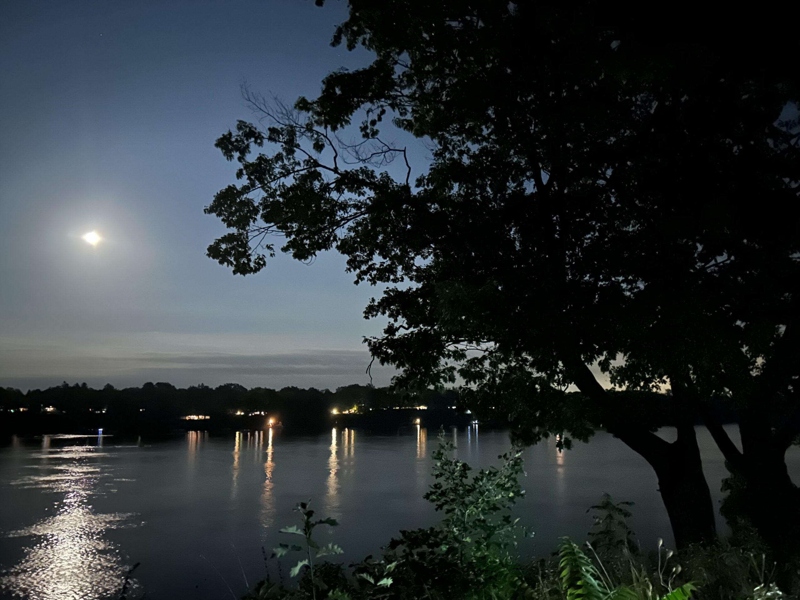
7:00 pm Moonlight Night Hike in Niagara-on-the-Lake
https://hikesstaging.brucetrail.org/event/700-pm-moonlight-night-hike-in-niagara-on-the-lake-7/Sorry, the registration cut-off time for this hike has been reached.Not a member? Click here to join today!Hosting Club: Niagara
Category: Night
Location (Google Maps): Veteran’s Memorial Park, park just outside the park on King St.Hike Leader(s): Robin Garrett Click here to contact Hike Leader(s)
Pace: Medium
Terrain: Easy
Distance: 6-7 kmDescription
Moonlight Night Hike – Take in the magic of the rising moon over Lake Ontario and the Niagara River. This hike includes a stop to connect with your senses – sights, sounds, smells and the rhythm of your breath. Counts towards your night hike badge (5 night hikes).