
Hike Schedule
Join us for a hike! Registration required.
All hikes available to BTC members. Some hikes are open to non-members.
See Refund Policy for Paid Hikes >
TIP: The calendar view displays up to 7 hikes on a day, but often there are more. Click “View more events” to see them all.
Categories
- 04June 4, 2025
WEDNESDAY WALKERS - Margaret Paull ST Loop
https://hikesstaging.brucetrail.org/event/wednesday-walkers-margaret-paull-st-loop-3/Sorry, the registration cut-off time for this hike has been reached.Not a member? Click here to join today!Hosting Club: Beaver Valley
Location (Google Maps): Park on the 6th Line, access from Hwy 119, Km 13.7 Map 24, Edition 31
Hike Leader(s): Margaret Yaraskavitch Click here to contact the hike leader.
Pace: Medium
Terrain: Moderate
Length of Hike: 3.9 kmDescription
An enjoyable walk with lots of opportunities for stops and photos. We’ll walk by a creek, view a flowerpot and a waterfall, and see the E.C. Carr Observatory buildings along our route. Country laneways with farm views, as well. Please bring water and a snack.
Bent Rim 2 Loop
https://hikesstaging.brucetrail.org/event/bent-rim-2-loop/Sorry, the registration cut-off time for this hike has been reached.Not a member? Click here to join today!Hosting Club: Iroquoia
Category: General Hike
Location (Google Maps): Meet in the small parking lot on 6th Line.Hike Leader(s): Karen Bergmann Click here to contact Hike Leader(s)
Pace: Medium – 3 to 4 km/hr
Terrain: Moderate – Some hills and/or some poor footing
Distance: 9 kmsDescription
We will hike the Bent Rim 2 bike trail and back through the Halton Forest. Meet at 9:15 (earlier if possible) in the small parking lot on 6th Line, about 3 kms north of Campbellville Rd. Bring bug spray, in case the bugs have awakened.Evening Hike in Owen Sound followed by an Opportunity for Refreshments
https://hikesstaging.brucetrail.org/event/evening-hike-in-owen-sound-followed-by-an-opportunity-for-refreshments-16/Sorry, the registration cut-off time for this hike has been reached.Not a member? Click here to join today!Hosting Club: Sydenham
Category: An evening walk.
Location (Google Maps): Meet in the municipal parking lot by the river on the west side of 1st Ave E between 7th St E and 8th St E in Owen SoundHike Leader(s): Harriet Nixon Click here to contact Hike Leader(s)
Pace: Brisk: 4 to 5 km/h
Terrain: Moderate: Some hills and/or poor footing
Distance: Approx 6 kmDescription
Join us for a brisk evening hike exploring Owen Sound trails and neighbourhoods, followed by an opportunity to socialize over refreshments. There is no need to show up 15 minutes early for this hike, but we will leave promptly at 7:00 pm - 05June 5, 2025
8:00 am Long Hike Glen Road Jordan NEW TIME
https://hikesstaging.brucetrail.org/event/800-am-long-hike-glen-road-jordan-new-time-6/Sorry, the registration cut-off time for this hike has been reached.Not a member? Click here to join today!Hosting Club: Niagara
Location (Google Maps):
Glen Road Jordan
Pace: Medium
Terrain: Moderate
: 10kDescription
This will be our permanent Thursday Location until Bridge repairs complete. From Glen Road explore the trail network on the escarpment towards Balls Falls and Moyer Road.You must register for each hike. Bring Poles, snack bug spray, sunscreen and a drink. Dress for the weather

Urban Walk: Toronto Islands Evening Walk
https://hikesstaging.brucetrail.org/event/urban-walk-toronto-islands-evening-walk-15/Sorry, the registration cut-off time for this hike has been reached.Not a member? Click here to join today!Hosting Club: Toronto
Location (Google Maps):
Jack Layton Ferry Terminal, near the gates to Wards Island Ferry. Arrive 20 minutes prior to departure to check in with hike leader.
From Union Station take the LRT and get off at the stop Ferry Docks.Walk up to the Ferry Docks on Queens Quay West, street level. at the foot of Bay Street.
Hike Leader(s): Miriam Stevens Click here to contact Hike Leader(s)
Pace: Leisurely (2-3 km/hr)
Terrain: Flat
Distance: 6-9 kmDescription
After a day’s work come and “cool off” on the Toronto Islands free of fumes and traffic. Enjoy the view of the city skyline and Toronto’s beautiful island parkland.
Pack a dinner for a sit down picnic. Also bring a warm jacket and flashlight.
Return fare ticket for the ferry is $9.11 for adults, $5.86 for seniors
Hikes will take place rain or shine.
Toronto Island evening hikes will take place every Thursday in May and June 2025.
Same time and same meeting place. No preregistration is required – just show up at the ferry docks at 5:40 PM and sign in with the hike leader. - 06June 6, 2025

Car Hike: 22th Annual Excellent Orchid Adventure Weekend (2 overnights)
https://hikesstaging.brucetrail.org/event/car-hike-22th-annual-excellent-orchid-adventure-weekend-2-overnights/Sorry, the registration cut-off time for this hike has been reached.Not a member? Click here to join today!This is a Multi-Day Hike
You are signing up for the following dates and times:
2025-06-06 at
2025-06-07 at
2025-06-08 atHosting Club: Toronto
Category: Car Hike
Location (Google Maps):Princess Hotel
34 Bay St, Tobermory, ON N0H 2R0Hike Leader(s): Jeanette Vincent. Brenda Menezes. David Royle. Click here to contact Hike Leader(s)
Pace: Leisurely (2-3 km/hr)
Terrain: Level 2 (Intermediate – some hills and uneven surfaces, rocks and roots underfoot), Rocky, Variable
Distance: 10 – 12 KmDescription
We continue Greg Vincent’s legacy of weekends away. Please join Jeanette Vincent, Brenda and David Royle as we explore the Tip o’ the Bruce, Tobermory in search of orchids and other flowers. Our search will extend to Flowerpot Island (cost approx. $60.00 for the glass bottom ferry and Parks Canada fee). The wildflowers in the Tobermory area at this time of year are wonderful and our slow paced walks will focus on these and other flowers and the area’s great views. We stay and have our meals at a comfortable hotel overlooking Little Tub Harbour. Approximately 10/12km/day.Before registering at the hotel please contact us for the price package of the hotel for the weekend.
This outing is restricted to those staying with us at the Princess Hotel in Tobermory for the weekend – the hotel fills quickly. You will need a car to access this outing. Please contact the Princess Hotel for a reservation.1-519-592-8282 or info@tobermoryprincesshotel.com and mention Vincent/Royle Excellent Orchid weekend.
Toronto BTC End to End Stained Glass Fundraiser
https://hikesstaging.brucetrail.org/event/toronto-btc-end-to-end-stained-glass-fundraiser/Sorry, the registration cut-off time for this hike has been reached.Not a member? Click here to join today!This is a Multi-Day Hike
You are signing up for the following dates:
2025-06-06, 2025-06-07, 2025-06-08Hosting Club: Toronto, Beaver Valley
Location (Google Maps): Meet on the east side of the road where the trail crosses 4th Line. Do not park in front of the junk yard. km 17.4, Map 12 Bruce Trail Guide,, N 43.625638, W 79.990703
Hike Leader(s): Glenda Collings Click here to contact the hike leader.
Pace: Medium
Terrain: Moderate, Some rocky footing, Some steep sections
Length of Hike: Between approx. 17 & 18 kmDescription
Join us for a a 3 day hike to earn the Stained Glass fundraiser badge. The medium hike pace will range between 3 to 4 km per hour, sometimes a bit more than 4 km per hour on easy flat terrain, with a snack and lunch break. Hikers may request a personal bio break, clothing adjustment, drink stop, etc. at any time during the hike by notifying the leader or sweep. The hikes range from approx. 17 to 18 km. Please self evaluate your ability to manage the pace and length of these hikes. Life does happen, so hikers will be able to miss one hike and make it up on their own before the end of June. A full hike schedule, with meet locations, will be sent to hikers after registration. If you have any questions please use the “Contact hike leader” option on the online schedule. - 07June 7, 2025
School Bus Hike: Loree Forest and Swiss Meadows
https://hikesstaging.brucetrail.org/event/school-bus-hike-loree-forest-and-swiss-meadows/Sorry, the registration cut-off time for this hike has been reached.Not a member? Click here to join today!Trip Information
Departure Time: 08:00
Return to City Time: 19:00
Departure Point: York Mills Bus PickupOptional Items
Hosting Club: Toronto
Category: Bus Hike
Location (Google Maps): Loree Forest and Swiss MeadowsHike Leader(s): Martina Furrer, Roland Mark Click here to contact Hike Leader(s)
Pace: Moderate (3-4 km/hr)
Terrain: Hilly, VariableDescription
Join us for a great hike in the Beaver Valley section. We will hike 15 km at a 4 km/hr pace, stopping to enjoy the awesome views of Georgian Bay from various spots along the top of the escarpment. A few fun hills, hopefully some spring wildflowers, and forest cover for shade. Refreshment stop in the Village at Blue Mountain. This area has lots of poison ivy so wear long pants for protection. Also pack a lunch and two litres of water.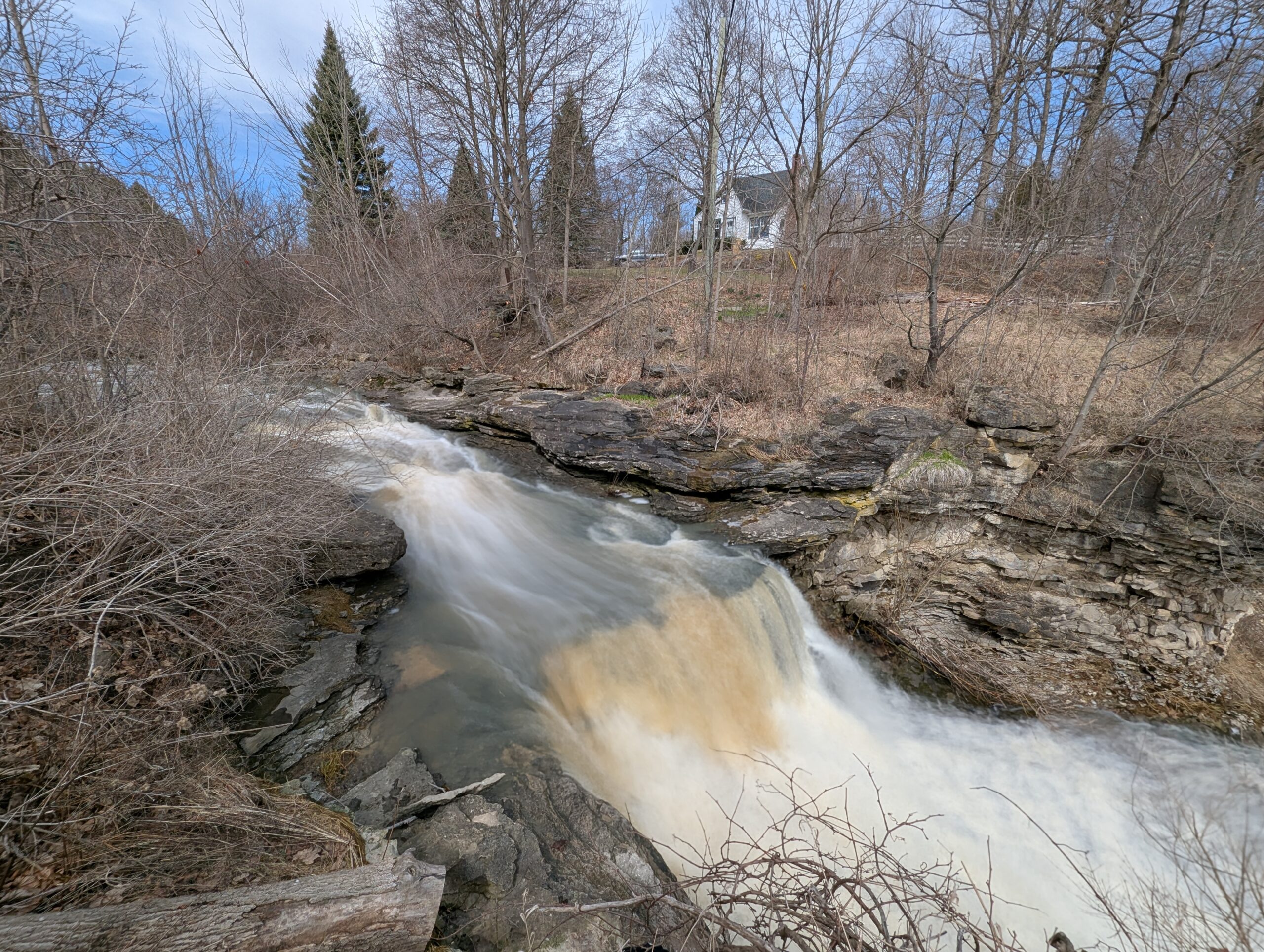
School Bus Hike: Niagara E2E #6 of 6
https://hikesstaging.brucetrail.org/event/bus-hike-niagara-e2e-6-of-6/Sorry, the registration cut-off time for this hike has been reached.Not a member? Click here to join today!Trip Information
Departure Time: 08:30
Return to City Time: 18:00
Departure Point: Kipling Departure PointOptional Items
Hosting Club: Toronto
Category: Bus Hike
Location (Google Maps): Niagara Section Kms 72.3 to 81.7, plus Beamers Falls Side TrailHike Leader(s): Felix Wan, Tim Wainwright Click here to contact Hike Leader(s)
Pace: Moderate (3-4 km/hr)
Terrain: Variable
Distance: 13.0 kmDescription
Join us for our final walk in the Niagara E2E bus hike series. On today’s hike we’ll start at the Mountainview Conservation Area, and cross over Thirty Mile Creek and a small waterfall on our way to Beamer Memorial Conservation Area outside of Grimsby. This marks the end of the Niagara Section of the Bruce Trail, but those who wish to can continue on a loop trail around the conservation area with a side trip to Beamers Falls.There will be a refreshment stop on the way back to Toronto.
Dropout point at 9.4 km.
Bring a packed lunch, two litres of water, and sun/rain/bug protection as needed.
Map 5 in the Bruce Trail Guide
LETS LOOK FOR BOBOLINKS
https://hikesstaging.brucetrail.org/event/lets-look-for-bobolinks-2/Sorry, the registration cut-off time for this hike has been reached.Not a member? Click here to join today!Hosting Club: Blue Mountains
Category: Organized Hike
Location (Google Maps): Tim Hortons on First St. in CollingwoodHike Leader(s): Richard Edwards Click here to contact Hike Leader(s)
Pace: Leisurely – 3 km/hr. or less
Terrain: Moderate – Some hills and/or some poor footing
Distance: 6 kmDescription
Please join us for this birding hike, led by birding enthusiasts Dick Edwards and Kate Jaczko. We will carpool to Cty Rd 9 west of Dunedin (map 22, km 10.6) and follow the trail north past a beautiful meadow where bobolinks nest in early June . We will look for singing males defending their territories. Past the meadow, the trail skirts a farm field and descends through forest to the Dunedin Nature Reserve. Here a mix of hardwoods, cedars, and a sparkling stream should provide more birds and spring wildflowers. The trail loops back to con. 10 where we back-track to bobolink meadow and then to our cars having completed 6 km double loop.
Spaces will be limited to 30 hikers, so please register in advance.
Mayor's Walk - Grimsby 9:45am
https://hikesstaging.brucetrail.org/event/mayors-walk/Sorry, the registration cut-off time for this hike has been reached.Not a member? Click here to join today!Hosting Club: Iroquoia
Category: Mayor’s Walk
Location (Google Maps): Please arrive by 9:45 for check-in, Lion’s Club Pool parking lot 1 Elm Street, GrimsbyHike Leader(s): Ruth Moffatt Click here to contact Hike Leader(s)
Pace: Medium – 3 to 4 km/hr
Terrain: Dependent on Conditions, Strenuous – Hilly with steep climbs and some poor footing
Distance: 4-5kmDescription
In cooperation with Ontario Trails Council, we are pleased to participate in the Mayor’s Walk.Please join Grimsby Mayor, Jeff Jordan for the Mayor’s Walk. This hike will take us from the parking lot, up Gibson Street and up the Iroquoia Bruce Trail and around to the hawk watch area and back to the pool parking lot. Please expect the distance to be about 4-5km and to take up to 2 hours. The hike up the hill is strenuous and would not be suitable for individuals who are not used to climbing.
Please bring enough water and snacks and wear suitable hiking footwear.

Urban Walk: Toronto Urban Badge Hike - 6 of 7
https://hikesstaging.brucetrail.org/event/urban-walk-toronto-urban-badge-hike-6-of-7/Sorry, the registration cut-off time for this hike has been reached.Not a member? Click here to join today!Hosting Club: Toronto
Category: Urban Walk
Location (Google Maps): East Don River TrailHike Leader(s): Brian Rideout Click here to contact Hike Leader(s)
Pace: Moderate (3-4 km/hr)
Terrain: Flat
Distance: 9 kmDescription
Please join me at the south east corner of Sheppard Ave East and Leslie by 10 AM. We will hike south through several parks to Don Mills (S of Overlea) (km 51.7 to km 62.4). Here is an online map with km markings of our route for all 7 hikes for the Toronto Urban Badge: https://onthegomap.com/s/c2c1hf3nPlease make sure you bring at least 2 liters of water, a lunch, bug spray and sunscreen.
Pride on the Trail: A Rainbow Hike for All
https://hikesstaging.brucetrail.org/event/pride-on-the-trail-a-rainbow-hike-for-all/Sorry, the registration cut-off time for this hike has been reached.Not a member? Click here to join today!Hosting Club: Peninsula
Category: Rainbow Hike
Location (Google Maps): Halfway Log Dump Parking Lot, Bruce Peninsula National ParkHike Leader(s): Marg Glendon & Tainin Hopkinson Click here to contact Hike Leader(s)
Pace: Leisurely (2.0 – 3.0 km/h): A relaxed pace with frequent breaks and a focus on enjoyment., Medium (3.0 – 4.5 km/h): A comfortable pace for most hikers with steady progress.
Terrain: Difficult: Steep ascents/descents, rocky scrambling, and some rugged escarpment paths., Easy: Flat forested sections or lowland trails., Moderate: Rolling hills, mild slopes and rocky paths.
Distance: 2 km or 6 kmDescription
Join us for a family-friendly Rainbow Hike for 2SLGBTQ+ folx and allies at Halfway Log Dump. A Bruce Peninsula National Park Interpreter will accompany us on our hike, sharing information about the unique ecosytem here and providing examples of Queer Ecology in Nature. Meet at the Halfway Log Dump parking lot at the entrance to Halfway Log Dump Side Trail .Here, the Bruce Trail winds through the beautiful Bruce Peninsula National Park. Our first 1 km of hiking will be on generally flat terrain bringing us to the pristine, aquamarine water of the Georgian Bay shoreline. Here we will take time to enjoy the view and soak in the sensational signs of Spring, have lunch and explore the shore. Then, for those wishing to hike the more rugged section of the trail, we will continue north covering some demanding terrain. Good balance and stamina is required for walking this section of the trail. This out and back hike portion of the afternoon will be about 1 ½ hour in duration. Upon returning to the rest of the group at the shoreline, we will take a few minutes to share our experiences with one another. If you would prefer to continue gently exploring the shoreline rather than the longer hike, a PBTC Hike Leader will stay with this group and remain here until the other hiking group returns. If participants would like to linger longer, the rest of the group will say goodbye and return to our vehicles via Halfway Log Dump Sidetrail. In total, our hiking afternoon will take about 3 ½ hour. Outdoor compost toilets are available at the parking lot and at the shoreline. Bruce Peninsula National Park fees for admission and parking apply. No parking reservation is required at this time of year.Weather can be unpredictable at this time of year. Wear layers, hat, sturdy footwear with good tread and closed toes.
Bring a back pack for snacks and lunch, water bottle, blanket for sitting, hiking poles and binoculars (optional).
Interested in extending your day? Join us at the Bruce Peninsula National Park Visitor’s Centre for an informative presentation about the beauty and diversity of bird species on the Saugeen Peninsula, and current research about resident and migrating bird species living here. No registration required. Free!

Youth Hiking Program - Discovery Hike - Cottonwood Loop
https://hikesstaging.brucetrail.org/event/youth-hiking-program-discovery-hike-cottonwood-loop-3/Sorry, the registration cut-off time for this hike has been reached.Not a member? Click here to join today!Hosting Club: Sydenham
Category: Family Hike
Location (Google Maps):Roadside parking on the east side of 11 Line, approximately 3 km north of Highway 26, at the entrance to the Cottonwood Side Trail, Map 30, Edition 31
Carpooling may be available upon request.
Hike Leader(s): Jeannine Kralt Click here to contact Hike Leader(s)
Pace: Leisurely: 3 km/h or less
Terrain: Easy: Mostly flat and good footing.
Distance: 2.1kmDescription
This hike will be a discovery hike along the Cottonwood Loop – we’ll take our time, and see what we can find. This trail is a stand-alone trail, separate from the rest of the Bruce Trail. We’ll hike through forests, near a hidden waterfall, past a particularly large cottonwood tree, and to a lookout along a ridge. This property is the original location of the Rows homestead – their farmhouse can be seen at Moreston Village at Grey Roots.The Cottonwood Loop counts towards the Junior Hiker badge and is also featured in Ron Savage’s new book, Exploring Sydenham. There will be sufficient time to find the related code en route. It’s also a great trail to use for the By the Seasons badge.
As we’ll be taking our time, this hike is suitable for families, new hikers, and anyone wanting a more leisurely hike – all ages are welcome. We’ll likely take upwards of a couple of hours, depending on the group – dress in layers, bring a snack, and wear good footwear. An email re: trail conditions to expect will be sent out prior to our hike together. We’re hoping for a lovely late spring hike!
If you are unable to register, or if you have any questions/concerns, please contact the hike leader (Jeannine) via the link above. Parking is roadside. Carpooling may be available upon request.