
Hike Schedule
Join us for a hike! Registration required.
All hikes available to BTC members. Some hikes are open to non-members.
See Refund Policy for Paid Hikes >
TIP: The calendar view displays up to 7 hikes on a day, but often there are more. Click “View more events” to see them all.
Categories
- 15June 15, 2025
Paid Hike (non mem/mem different price)
https://hikesstaging.brucetrail.org/event/paid-hike-non-mem-mem-different-price/Sorry, the registration cut-off time for this hike has been reached.Not a member? Click here to join today!Hosting Club: Iroquoia
Category: Special Event
Location (Google Maps): This is the locationHike Leader(s): BTC Staff Click here to contact Hike Leader(s)
Pace: Medium – 3 to 4 km/hr
Terrain: Moderate – Some hills and/or some poor footing
Distance: 12Description
this is the info about the hike
Black Bank
https://hikesstaging.brucetrail.org/event/black-bank/Sorry, the registration cut-off time for this hike has been reached.Not a member? Click here to join today!Hosting Club: Iroquoia
Category: General Hike
Location (Google Maps): Meet roadside at 9:15 at the corner of 20th Side Road and Prince of Wales Rd, just north of Kilgorie.Hike Leader(s): Karen Bergmann Click here to contact Hike Leader(s)
Pace: Medium – 3 to 4 km/hr
Terrain: Moderate – Some hills and/or some poor footing, Strenuous – Hilly with steep climbs and some poor footing
Distance: 9 kmsDescription
This hike will take us into a challenging valley with rocks and hills and then through a cattle pasture and over a few stiles. Black Bank is in the Dufferin Section. You are welcome to ride with me from Mississauga if you don’t want to drive. I’ll send an email a couple of days prior to the hike to remind you and see who wants to carpool.
Urban Walk: Toronto Urban Badge Hike - 6 of 7
https://hikesstaging.brucetrail.org/event/urban-walk-toronto-urban-badge-hike-6-of-7-2/Sorry, the registration cut-off time for this hike has been reached.Not a member? Click here to join today!Hosting Club: Toronto
Category: Urban Walk
Location (Google Maps): East Don River TrailHike Leader(s): Brian Rideout Click here to contact Hike Leader(s)
Pace: Moderate (3-4 km/hr)
Terrain: Flat
Distance: 9 kmDescription
Please join me at the south east corner of Sheppard Ave East and Leslie by 10 AM. We will hike south through several parks to Don Mills (S of Overleigh) (km 51.7 to km 62.4). Here is an online map with km markings of our route for all 7 hikes for the Toronto Urban Badge: https://onthegomap.com/s/c2c1hf3nPlease make sure you bring at least 2 liters of water, a lunch, bug spray and sunscreen.
Basic Hike
https://hikesstaging.brucetrail.org/event/basic-hike/Sorry, the registration cut-off time for this hike has been reached.Not a member? Click here to join today!Hosting Club: Iroquoia
Category: Easy Does It Hikes
Location (Google Maps): Here is the locationHike Leader(s): BTC Staff Click here to contact Hike Leader(s)
Pace: Medium – 3 to 4 km/hr
Terrain: Moderate – Some hills and/or some poor footing, Strenuous – Hilly with steep climbs and some poor footing
Distance: 12Description
Here is the information about the hike - 16June 16, 2025
Multi-Day Hike Test
https://hikesstaging.brucetrail.org/event/multi-day-hike-test/Sorry, the registration cut-off time for this hike has been reached.Not a member? Click here to join today!This is a Multi-Day Hike
You are signing up for the following dates:
2025-06-16, 2025-06-17, 2025-06-18, 2025-06-19Hosting Club: Iroquoia
Category: Stained Glass Badge End to End Fundraiser Hike
Location (Google Maps): This is the location for each hike…Hike Leader(s): BTC Staff Click here to contact Hike Leader(s)
Pace: Brisk – 4 to 5 km/hr
Terrain: Strenuous – Hilly with steep climbs and some poor footing
Distance: 25Description
here is the information about the hike seriesMember-Only Hike
https://hikesstaging.brucetrail.org/event/member-only-hike/Sorry, the registration cut-off time for this hike has been reached.Not a member? Click here to join today!Hike open to BTC Members only.
Hosting Club: Iroquoia
Category: General Hike
Location (Google Maps): This is the location of the hikeHike Leader(s): Ryan Mickeloff Click here to contact Hike Leader(s)
Pace: Medium – 3 to 4 km/hr
Terrain: Strenuous – Hilly with steep climbs and some poor footing
Distance: 6Description
information about the hike - 17June 17, 2025
Free Hike
https://hikesstaging.brucetrail.org/event/free-hike/Sorry, the registration cut-off time for this hike has been reached.Not a member? Click here to join today!Hosting Club: Iroquoia
Category: Afternoon/Evening Hikes
Location (Google Maps): this is the locationHike Leader(s): Iroquoia Hike Leader Click here to contact Hike Leader(s)
Pace: Medium – 3 to 4 km/hr
Terrain: Strenuous – Hilly with steep climbs and some poor footing
Distance: 12Description
description of the hike8:00 Long Hike Wiley Road Short Hills (NEW TIME)
https://hikesstaging.brucetrail.org/event/800-long-hike-wiley-road-short-hills-new-time-7/Sorry, the registration cut-off time for this hike has been reached.Not a member? Click here to join today!Hosting Club: Niagara
Location (Google Maps):
Short Hills Wiley Road Entrance
Pace: Medium
Terrain: Moderate
: 10kmDescription
Explore Short Hills and the majestic side trails of Scarlett Tanager, Hemlock. Swayze Falls and Terrace. Register for each hikeBring Poles, Sun Screen Bug Spray, snack, and dress for the weather
Dufferin Hi-Land 60th Anniversary Highlight Hikes, Hike# 9 : Primrose Loop Side Trail to Murphy's Pinnacle
https://hikesstaging.brucetrail.org/event/dufferin-hi-land-60th-anniversary-highlight-hikes-hike-9-primrose-loop-side-trail-to-murphys-pinnacle/Sorry, the registration cut-off time for this hike has been reached.Not a member? Click here to join today!Hosting Club: Dufferin Hi-Land
Category: Tuesday Hike
Location (Google Maps):Dufferin Hi-land. Map 20. Meet at roadside parking on Prince of Wales Rd. (County Rd. 19) where the Primrose Loop Side Trail crosses Prince of Wales Rd. From Primrose (intersection of Hwy 10 and 89) drive north for about 1.5 km. Parking is about 0.7 km north of the bridge on the east side of the road.
Hike Leader(s): Tony Evangelista, Les Babbage, Inge Eckerick, Julie Daley Click here to contact Hike Leader(s)
Pace: Medium
Terrain: Dependent on Conditions, Moderate
Distance: Long hike 7 km Short hike 3 kmDescription
Join us in celebrating the 60th anniversary of the Dufferin High-Land Bruce Trail Club. The Club plans to award a 60th Anniversary badge to any hiker who completes 60 km of Dufferin- H-Land trails- Main or Side Trails. Our Tuesday Hike group is offering a series of 10 hikes, covering most of the highlights of our section that meet this requirement. If you can’t make all of the hikes, make-ups are allowed. Just hike 60k in Dufferin during 2025 and you qualify for the badge.Today we will hike the Primrose Loop Side Trail on the west side of Prince of Wales Rd. Then, after crossing the road and returning to the cars, we will head toward the Main Trail where we will turn left towards Murphy’s Pinnacle, climb to the top, and take in some stunning views before returning to the parking area. The short hike will end after completing the Primrose Loop Side Trail.
Bring snacks, water, sunscreen, and insect repellant. Hiking poles are recommended.

Silver Creek and Walking Fern
https://hikesstaging.brucetrail.org/event/silver-creek-and-walking-fern/Sorry, the registration cut-off time for this hike has been reached.Not a member? Click here to join today!Hosting Club: Iroquoia
Category: General Hike
Location (Google Maps): Meet roadside on Fallbrook Trail at 9:15 amHike Leader(s): Karen Bergmann Click here to contact Hike Leader(s)
Pace: Medium – 3 to 4 km/hr
Terrain: Moderate – Some hills and/or some poor footing
Distance: 9 kmsDescription
Meeting roadside on Fallbrook Trail at Silver Creek Conservation Area, we will hike the Irwin Quarry Side Trail to the main trail and to Tenth Line. We will then hike in and back on the Walking Fern Side Trail. A challenging trail for footwork but is well worth it. Then it’s back up the main trail to the Roberts Side Trail to the cars. This hike has some crazy rocky spots and a few hilly bits. Come with water and a snack and bug spray. - 18June 18, 2025

Scotsdale Farm the Easy Way
https://hikesstaging.brucetrail.org/event/scotsdale-farm-the-easy-way-3/Sorry, the registration cut-off time for this hike has been reached.Not a member? Click here to join today!Hosting Club: Iroquoia
Category: Good Companions
Location (Google Maps): Scottsdale Farm, 13807 Trafalgar Rd.Hike Leader(s): Anne Armstrong Click here to contact Hike Leader(s)
Pace: Leisurely – 3km/hr or less
Terrain: Easy – Mostly flat and usually good footing
Distance: Approx. 9 km.Description
Please join in this pleasant area for hiking in one of my favourite spots. We will use blue side trails to explore this heritage farm with its early history and visit Bruce Trail’s lovely Roberts Side Trail with a delightful pond and hopefully still surrounded by yellow iris. Meet in the main parking lot at 9:45 am. for a 10:00 am. start. Bring water, a snack, sunscreen and insect repellent. Walking poles might be useful. I will send out a message the night before with my contact information. - 19June 19, 2025
8:00 am Long Hike Glen Road Jordan NEW TIME
https://hikesstaging.brucetrail.org/event/800-am-long-hike-glen-road-jordan-new-time-8/Sorry, the registration cut-off time for this hike has been reached.Not a member? Click here to join today!Hosting Club: Niagara
Location (Google Maps):
Glen Road Jordan
Pace: Medium
Terrain: Moderate
: 10kDescription
This will be our permanent Thursday Location until Bridge repairs complete. From Glen Road explore the trail network on the escarpment towards Balls Falls and Moyer Road.You must register for each hike. Bring Poles, snack bug spray, sunscreen and a drink. Dress for the weather
Caledon End to End Stained Glass Fundraiser Badge
https://hikesstaging.brucetrail.org/event/caledon-end-to-end-stained-glass-fundraiser-badge/Sorry, the registration cut-off time for this hike has been reached.Not a member? Click here to join today!This is a Multi-Day Hike
You are signing up for the following dates:
2025-06-19, 2025-06-20, 2025-06-26, 2025-06-27Hosting Club: Caledon Hills, Beaver Valley
Location (Google Maps): First hike meets on the southwest shoulder of Willoughby Rd & Escarpment Sideroad, km 15.9, Map15, Edition 31 BTC Guidebook, N 43.831244, W 79.980588
Hike Leader(s): Glenda Collings Click here to contact the hike leader.
Pace: Medium
Terrain: Moderate, Some steep sections
Length of Hike: 15.9 km + approx. 2 km to walk to parking on Boston Mills RoadDescription
Join us for a set of four hikes in the Caledon BTC section to earn the Stained Glass fundraiser badge. The medium hike pace will range between 3 to 4 km per hour, sometimes a bit more than 4 km per hour on easy flat terrain, with a snack and lunch break. Hikers may request a personal bio break, clothing adjustment, drink stop, etc. at any time during the hike by notifying the leader or sweep. The hikes range from approx. 18 to 19.5 km. Please self evaluate your ability to manage the pace and length of these hikes. Life does happen, so hikers will be able to miss one hike and make it up on their own before June 27. A full hike schedule, with meet locations, will be sent to hikers after registration. If you have any questions please use the “Contact hike leader” option on the online schedule.
Urban Walk: Toronto Islands Evening Walk
https://hikesstaging.brucetrail.org/event/urban-walk-toronto-islands-evening-walk-17/Sorry, the registration cut-off time for this hike has been reached.Not a member? Click here to join today!Hosting Club: Toronto
Location (Google Maps):
Jack Layton Ferry Terminal, near the gates to Wards Island Ferry. Arrive 20 minutes prior to departure to check in with hike leader.
From Union Station take the LRT and get off at the stop Ferry Docks.Walk up to the Ferry Docks on Queens Quay West, street level. at the foot of Bay Street.
Hike Leader(s): Miriam Stevens Click here to contact Hike Leader(s)
Pace: Leisurely (2-3 km/hr)
Terrain: Flat
Distance: 6-9 kmDescription
After a day’s work come and “cool off” on the Toronto Islands free of fumes and traffic. Enjoy the view of the city skyline and Toronto’s beautiful island parkland.
Pack a dinner for a sit down picnic. Also bring a warm jacket and flashlight.
Return fare ticket for the ferry is $9.11 for adults, $5.86 for seniors
Hikes will take place rain or shine.
Toronto Island evening hikes will take place every Thursday in May and June 2025.
Same time and same meeting place. No preregistration is required – just show up at the ferry docks at 5:40 PM and sign in with the hike leader. - 20June 20, 2025

Afternoon hike - Halton Agreement Forest
https://hikesstaging.brucetrail.org/event/afternoon-hike-halton-agreement-forest-7/Sorry, the registration cut-off time for this hike has been reached.Not a member? Click here to join today!Hosting Club: Iroquoia
Category: Afternoon/Evening Hikes
Location (Google Maps): Meet roadside at 4:15 pm on 10 Side Road, off Guelph Line, north of Campbelville.Hike Leader(s): Karen Bergmann Click here to contact Hike Leader(s)
Pace: Medium – 3 to 4 km/hr
Terrain: Moderate – Some hills and/or some poor footing
Distance: 6 kmsDescription
We will hike around the bike trails in this lovely Forest. Bring bug spray.
Solstice Ice Cream Walk
https://hikesstaging.brucetrail.org/event/solstice-ice-cream-walk/Sorry, the registration cut-off time for this hike has been reached.Not a member? Click here to join today!Hike open to BTC Members only.
Hosting Club: Iroquoia
Category: General Hike
Location (Google Maps): It is the start of summer!! Meet by 7:15pm for a 7:30 pm departure at the gazebo on the waters edge at Bayfront Park (200 Harbour Front Drive) in Hamilton. We will walk to Princess Point and back and then have the option of having Ice Cream on the nearby hill as the sun sets on the harbour. Bring water, hat and sunglasses. There are picnic tables but I suggest bringing a chair or blanket in case it is busy.Hike Leader(s): Paul Toffoletti Click here to contact Hike Leader(s)
Pace: Medium – 3 to 4 km/hr
Terrain: Easy – Mostly flat and usually good footing
Distance: 6kmDescription
- 21June 21, 2025

Urban Walk: Don Valley to The Distillery District
https://hikesstaging.brucetrail.org/event/urban-walk-don-valley-to-the-distillery-district-3/Sorry, the registration cut-off time for this hike has been reached.Not a member? Click here to join today!Hosting Club: Toronto
Category: Urban Walk
Location (Google Maps): Don River – Steeles to Distillery DistrictHike Leader(s): Brian Rideout Click here to contact Hike Leader(s)
Pace: Moderate (3-4 km/hr)
Terrain: Flat
Distance: 27.5 kmDescription
This hike follows the Don River south from Steeles Ave East at Leslie St through Toronto to the Distillery District, through a series of ravines and several parks. We will detour to street level when we cross the 401 (trail closed due to construction) and again south of Pottery Rd where we take the Bayview Ave Extension (trail closed due to construction). Those who register will receive an itinerary.Please bring a lunch and at least two liters of water. Be prepared for cool / wet weather. Pub stop after at The Spaghetti Factory.
Here is an online map of our route: Don Valley to The Distillery
"Dipping Your Toes" into Forest Bathing on the Summer Solstice
https://hikesstaging.brucetrail.org/event/dipping-your-toes-into-forest-bathing-on-the-summer-solstice/Sorry, the registration cut-off time for this hike has been reached.Not a member? Click here to join today!Hosting Club: Dufferin Hi-Land
Category: Nature Walks
Location (Google Maps): Dufferin Hi-Land section, BTC Reference Guide, Map 20. Meet at the dead end of 2nd Line East (west of main trail km 24.3)Hike Leader(s): Janice McClelland Click here to contact Hike Leader(s)
Pace: Leisurely – 3 km/hour or less
Terrain: Moderate – some hills and/or some poor footing
Distance: 5.5 kmDescription
We invite you to join us on this Forest Bathing walk where we especially welcome newcomers to hiking and/or Forest Bathing, as part of the Dufferin Hi-Land Bruce Trail Club Summer Solstice weekend. Forest Bathing is simply walking quietly along the footpath and letting nature sink into your senses. The soft gurgling of Oliver Creek, the songs of birds and the dappled light of the forest will give you peace. We will observe quiet during our walk, with plenty of time to chat and get to know each other before the walk, during our lunch break along the trail and after the walk. Please bring water & lunch. “Dip your toes into Forest Bathing!”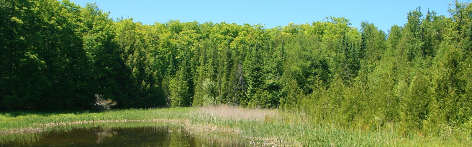
Learn to Identify Flora and Fauna
https://hikesstaging.brucetrail.org/event/learn-to-identify-flora-and-fauna/Sorry, the registration cut-off time for this hike has been reached.Not a member? Click here to join today!Hosting Club: Dufferin Hi-Land
Category: Special Events
Location (Google Maps): Meet at Prince of Wales and 15 Sideroad.Hike Leader(s): Tom Thayer Click here to contact Hike Leader(s)
Pace: Leisurely
Terrain: Easy, ModerateDescription
Join us for a hike through Pine River Nature Reserve and learn how to use the iNaturalist App to help the Bruce Trail protect endangered/at-risk species, monitor existing species, identify invasive species that need to be removed, and learn about the plans to enhance and enrich biodiversity.Interact with the Bruce Trail Conservancy’s Conservation and Ecology specialists, meet some of our new trail ambassadors, and learn more about how the Dufferin Hi-Land Bruce Trail Club is working with the BTC to provide a sustainable and healthy future for generations to come.
Please Note: You will need a mobile device with the iNaturalist App installed and updated in order to take part in this event. You can download the app from the App Store or Google Play Store. More information about the iNaturalist program is available here: https://development.brucetrail.org/what-we-do/#iNaturalist
Everyone is welcome, member and non-member alike.