
Hike Schedule
Join us for a hike! Registration required.
All hikes available to BTC members. Some hikes are open to non-members.
See Refund Policy for Paid Hikes >
TIP: The calendar view displays up to 7 hikes on a day, but often there are more. Click “View more events” to see them all.
Categories
- 05May 5, 2025
Dufferin Hi-Land End-to-End #3 of 4
https://hikesstaging.brucetrail.org/event/dufferin-hi-land-end-to-end-3-of-4/Sorry, the registration cut-off time for this hike has been reached.Not a member? Click here to join today!Hosting Club: Iroquoia, Dufferin Hi-Land
Category: General Hike
Location (Google Maps): Roadside Parking, Prince of Wales Road, km 40.7Hike Leader(s): Pati Greenwood, Jeff Dowsett Click here to contact Hike Leader(s)
Pace: Medium – 3 to 4 km/hr
Terrain: Moderate – Some hills and/or some poor footing, Slippery Sections Likely
Distance: 12.5 kmDescription
This is an end-to-end hiking series to complete the Dufferin Highlands section of the Bruce Trail in 4 hikes, join us for one, some or all.The hikes will be undertaken at a medium pace of approximately 4 km/hour for 13 – 15 kms each hike. Please consider your fitness level before registering, this is a group hike, and everyone is expected to keep pace with the person in front of them for the duration of the hike.
The weather can be changeable at this time of year, so dress in layers for any possibility. The terrain may be wet and slippery in sections, wear hiking boots and bring hiking poles. Bring a snack, plenty of water and other hydration as needed.
We will be travelling from south to north over the series. The series will require car shuffles, and everyone will be expected to participate as drivers.
Today’s hike, the third of four, will be 12.5 km in length. Please plan to arrive at the meeting place by 8:15 am as we will start the car shuffle at 8:30 am sharp.
Further details will be provided to registered hikers a few days prior to the hike.
- 06May 6, 2025
8:00 Long Hike Wiley Road Short Hills (NEW TIME)
https://hikesstaging.brucetrail.org/event/800-long-hike-wiley-road-short-hills-new-time/Sorry, the registration cut-off time for this hike has been reached.Not a member? Click here to join today!Hosting Club: Niagara
Category: Loop
Location (Google Maps):Short Hills Wiley Road Entrance
Hike Leader(s): Alan Laver Click here to contact Hike Leader(s)
Pace: Medium
Terrain: Moderate
Distance: 10kmDescription
Explore Short Hills and the majestic side trails of Scarlett Tanager, Hemlock. Swayze Falls and Terrace. Register for each hikeBring Poles, Sun Screen Bug Spray, snack, and dress for the weather
Urban Walk: Valley View Park Thornhill
https://hikesstaging.brucetrail.org/event/urban-walk-valley-view-park-thornhill-73/Sorry, the registration cut-off time for this hike has been reached.Not a member? Click here to join today!Hosting Club: Toronto
Location (Google Maps): Parking lot is inside Sycamore Drive East of Bayview , across Starbucks plaza
Hike Leader(s): Mohammad Aghamiri Click here to contact Hike Leader(s)
Pace: Moderate (3-4 km/hr)
Terrain: Hilly, Level 2 (Intermediate – some hills and uneven surfaces, rocks and roots underfoot)
Distance: 7-8 kmDescription
We will explore Valleyview and Maple View parks, and walk along German Mill Creak, in return we stop in Huntington park and have snack under beautiful shed ,Even it is considered Urban walk, it is urban hike as we have some up and down hills and tree roots, please bring your hiking poles, water and snacks

Car Hike: Spring Birding Silver Creek
https://hikesstaging.brucetrail.org/event/car-hike-spring-birding-silver-creek/Sorry, the registration cut-off time for this hike has been reached.Not a member? Click here to join today!Hosting Club: Toronto
Category: Car Hike
Location (Google Maps): Silver CreekHike Leader(s): Janet Patterson Click here to contact Hike Leader(s)
Pace: Leisurely (2-3 km/hr)
Terrain: Variable
Distance: approx 3 – 4 kmDescription
Join BTC ecologist Mara McHaffie and members of the Toronto Bruce Trail Club’s Biodiversity Team on a hike to learn about birds along the Bruce Trail. This will be a leisurely walk with plenty of stops to observe and listen to the birds we find. This hike will be geared towards beginner birders (no experience necessary) but all are welcome. The BTC’s Silver Creek property boasts a variety of habitats, including meadows, forests, ponds and streams, so we expect to see a good diversity of birds. Some will be just passing through during migration, while others will be staying for the breeding season.During the hike, we will discuss how you can use apps like iNaturalist, Merlin Bird ID and eBird to enhance your birding experience. If you’d like to try them out for yourself, please download them ahead of time, as cell service can be spotty at this location.
Besides water and snacks, bring binoculars if you have them, and please dress for the weather. Note that due to the slow pace and frequent stops, you may want to dress more warmly than you would for a faster-paced hike.
While there is no regular public parking at this location, we will have the gate open to allow parking on site. Parking is available just inside the farm gate off Highway 7, just west of where Trafalgar side trail enters the property (just west of the intersection of Highway 7 and Trafalgar Rd). A sign will be placed at the entrance and PLEASE NOTE that due to the divided road, you can only turn right into the property while travelling southwest on Highway 7 (no left turn). Refer to the map for more details: https://drive.google.com/file/d/1-GvFUz_TAnTi9iqKkJSyRwYNxZM3xxX3/view?usp=drive_link
Dufferin Hi-Land 60th Anniversary Highlight Hikes, Hike #3: Oliver Creek and Walker's Woods: Spring Wildflowers and Trees -
https://hikesstaging.brucetrail.org/event/dufferin-hi-land-60th-anniversary-highlight-hikes-hike-3-oliver-creek-and-walkers-woods-spring-wildflowers-and-trees/Sorry, the registration cut-off time for this hike has been reached.Not a member? Click here to join today!Hosting Club: Dufferin Hi-Land
Category: Tuesday Hike
Location (Google Maps):Dufferin Hi-Land Section, Map 20. Meet at north end of 2nd Line EHS off 8 Sideroad where the road ends and the 2nd Line EHS Side Trail begins (near Km 24.3). Park on the west side of 2nd Line south of the first driveway.
Hike Leader(s): Brenda Carling, Les Babbage Click here to contact Hike Leader(s)
Pace: Leisurely
Terrain: Moderate
Distance: 6 km; Short hike: 3 kmDescription
Join us in celebrating the 60th anniversary of the Dufferin Hi-Land Bruce Trail Club. The Club plans to award a 60th Anniversary badge to any hiker who completes 60 km of Dufferin Hi-Land trails – Main or Side Trails. Our Tuesday Hike group is offering a series of 10 hikes, covering most of the highlights of our section that meet this requirement. If you can’t make all of the hikes, make ups are allowed. Just hike 60K in Dufferin during 2025 and you qualify for the badge.Today, Brenda Carling will lead us as we explore and identify the trees and blooming wildflowers along the Oliver Creek Side Trail and the Main Trail through Walker’s Woods. Bring a camera, snacks and water.
Mono Cliffs, Map 19
https://hikesstaging.brucetrail.org/event/mono-cliffs-map-19/Sorry, the registration cut-off time for this hike has been reached.Not a member? Click here to join today!Hosting Club: Caledon Hills
Category: Tuesday Hikers
Location (Google Maps): Mono Community Centre Parking, just south of Mono Centre.
Driving direction: From Highway 410 go north, continue on Highway 10, pass through Orangeville, continue to Mono Centre Rd. (8), turn right, road will merge with 2nd Line EHS north, parking on the right just before Mono Centre.Hike Leader(s): Mohammad Shafiq Click here to contact Hike Leader(s)
Pace: Medium – 3 to 4 km/hour
Terrain: Moderate – some hills and/or some poor footing
Distance: 12-13 kmDescription
Will hike main Bruce Trail, South Outlier, Walter Tovell, McCarston’s Lake and Lookout Side Trails.
Bring water, snack, bug spray and sun protection. Poles recommended. - 07May 7, 2025

Halton Agreement Forest
https://hikesstaging.brucetrail.org/event/halton-agreement-forest-3/Sorry, the registration cut-off time for this hike has been reached.Not a member? Click here to join today!Hosting Club: Iroquoia
Category: General Hike
Location (Google Maps): Meet roadside on 4th Line at 9:15 am. Up Guelph Line from the 401, turn right on 10 Side Road and follow the curve as it becomes 4th Line.Hike Leader(s): Karen Bergmann Click here to contact Hike Leader(s)
Pace: Medium – 3 to 4 km/hr
Terrain: Moderate – Some hills and/or some poor footing
Distance: 8 kmsDescription
We will hike around the bike trails in this lovely Forest, including The Den and The Pines. Expect to see lots of wildflowers and hear the busy birds.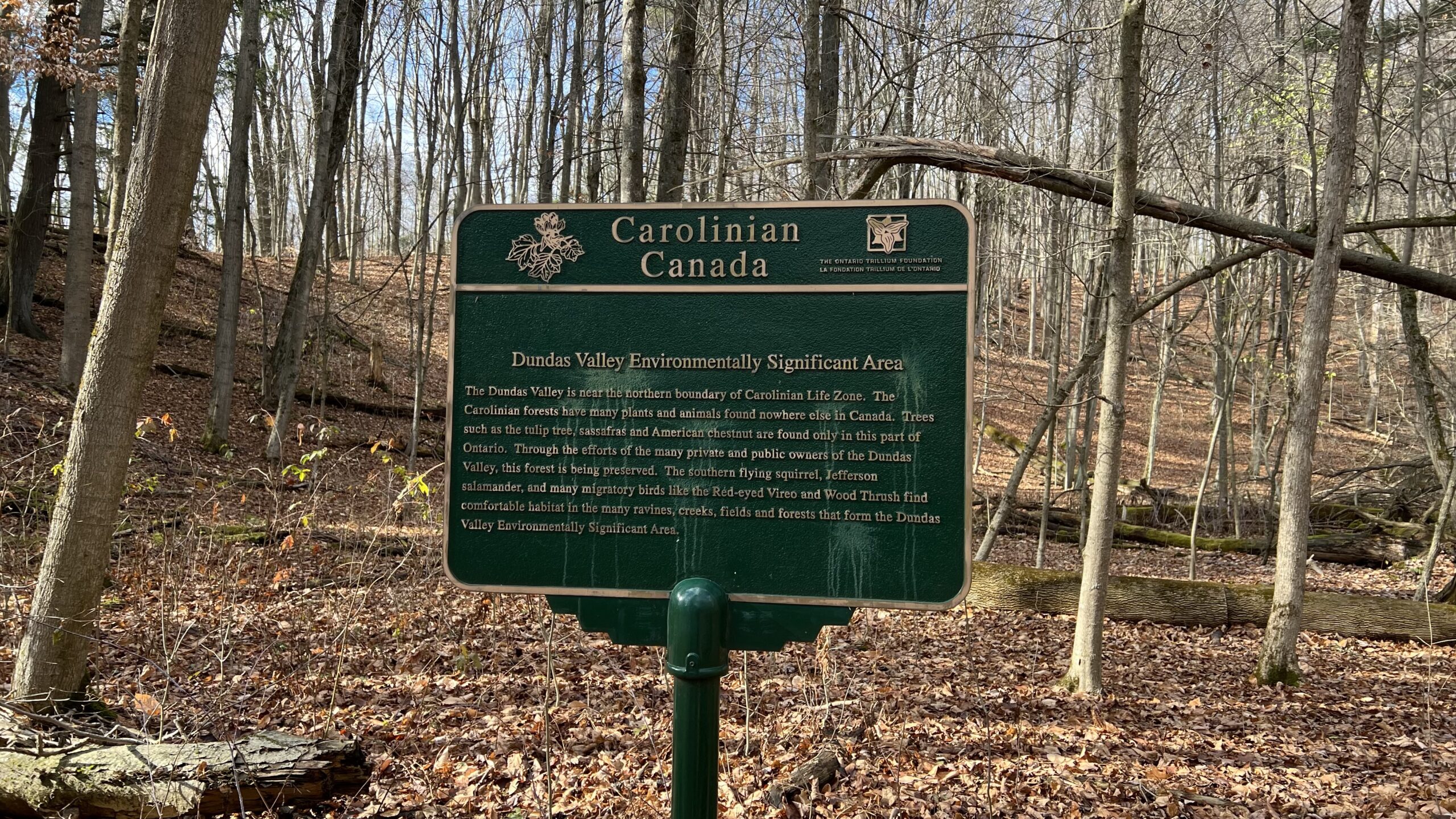
Good Companions - Dundas Valley from Sanctuary Park
https://hikesstaging.brucetrail.org/event/good-companions-dundas-valley-from-sanctuary-park-2/Sorry, the registration cut-off time for this hike has been reached.Not a member? Click here to join today!Hike open to BTC Members only.
Hosting Club: Iroquoia
Category: Good Companions
Location (Google Maps):Parking lot for Sanctuary Park – See map and address below (if parking lot is full, park on adjacent side streets)
Hike Leader(s): Ted Bossence Click here to contact Hike Leader(s)
Pace: Medium – 3 to 4 km/hr
Terrain: Strenuous – Hilly with steep climbs and some poor footing
Distance: 8 kmDescription
From Sanctuary Park we will hike the Spring Creek trail and parts of the Sawmill trail to the Trail Centre. After a break, (washrooms “should” be available at the trail centre) we will walk to the south side of the rail trail and take the Main Loop, Sulphur Creek, local access trails and rail trail back to the parking lot.Please arrive 15 minutes before the start time. I will be leaving at 10:00 am sharp. Bring water, sunscreen, insect repellant, a first aid kit and a snack. Poles are highly recommended due to the number of hills and some hills may be slippery if it has rained recently. I will cancel the hike in case of rain. Please check your email the evening before the hike in case of a cancellation. If you must cancel after the 4:00 pm Tuesday cut-off time I will be sending contact info on the Tuesday.
Midweek fitness hike in the Pretty River Valley Provincial Park (spring flowers and gorgeous lookouts long hike)
https://hikesstaging.brucetrail.org/event/midweek-fitness-hike-in-the-pretty-river-valley-provincial-park-spring-flowers-and-gorgeous-lookouts-long-hike/Sorry, the registration cut-off time for this hike has been reached.Not a member? Click here to join today!Hosting Club: Toronto
Category: Car Hike
Location (Google Maps):Pretty River Valley Provincial Park and Petun Conservation Area
Hike Leader(s): Natalia Svechnikova Click here to contact Hike Leader(s)
Pace: Moderate (3-4 km/hr)
Terrain: Hilly, Level 2 (Intermediate – some hills and uneven surfaces, rocks and roots underfoot), Rocky, Variable
Distance: about 17 kmDescription
Please join me for an enjoyable spring flowers hike on the Bruce Trail (main and side trails) in the Pretty River River Provincial Park and the Petun Conservation Area. We will be following a relatevily challenging loop of ca 17 km from the south of the park (the Pretty River Road) moving up north to the north-west following the Bruce Trail main and side trails into the Petun Conservation area and down south passing many gorgeaus lookouts.Please note that this is a long hike and a relatively long day trip if you are coming from the GTA.
We will try to keep a moderate pace of about 3 km/h while slowing down uphill. The trail is challenging with a few uphill sections after which we will stop for short water breaks. There will be a lunch break for about 20 min. We should be back to the parking lot around 4:30 pm.
Please be dressed for the weather, wear hiking shoes/boots, bring extra layers and pack your rain gear (just in case), at least 2 L of water, light lunch and snacks, your sunglasses and/or hut.
We will meet on the dedicated Pretty River PP parking lot on the Pretty River Road (exact map location 44.43147754685496, -80.27512513140113) around 10:45 am and start hiking at 11:00 am.
Please note that this hike is not suitable for a rainy/stormy day and will be cancelled in case of inclement weather.
11:00 am Hike & Picnic
https://hikesstaging.brucetrail.org/event/1100-am-hike-picnic-2/Sorry, the registration cut-off time for this hike has been reached.Not a member? Click here to join today!Hike open to BTC Members only.
Hosting Club: Niagara
Category: Loop
Location (Google Maps): Locust Grove Picnic AreaHike Leader(s): Marion Hanover Click here to contact Hike Leader(s)
Pace: Medium
Terrain: Moderate
Distance: 7 kmDescription
Hike around Queenston area. Optional outdoor gathering in Locust Grove including pot luck picnic after the hike.Evening Hike in Owen Sound followed by an Opportunity for Refreshments
https://hikesstaging.brucetrail.org/event/evening-hike-in-owen-sound-followed-by-an-opportunity-for-refreshments-15/Sorry, the registration cut-off time for this hike has been reached.Not a member? Click here to join today!Hosting Club: Sydenham
Category: An evening walk.
Location (Google Maps): Meet in the municipal parking lot by the river on the west side of 1st Ave E between 7th St E and 8th St E in Owen Sound.Hike Leader(s): Harriet Nixon Click here to contact Hike Leader(s)
Pace: Brisk: 4 to 5 km/h
Terrain: Moderate: Some hills and/or poor footing
Distance: Approx 5 kmDescription
Join Hike Leader Harriet Nixon for a brisk evening hike exploring paths and neighbourhoods in the city of Owen Sound, followed by an opportunity to socialize at one of the local establishments. There is no need to show up 15 minutes early for this hike, but we will leave promptly at 7:00 pm. - 08May 8, 2025
8:00 am Long Hike Glen Road Jordan NEW TIME
https://hikesstaging.brucetrail.org/event/800-am-long-hike-glen-road-jordan-new-time-2/Sorry, the registration cut-off time for this hike has been reached.Not a member? Click here to join today!Hosting Club: Niagara
Location (Google Maps):
Glen Road Jordan
Pace: Medium
Terrain: Moderate
: 10kDescription
This will be our permanent Thursday Location until Bridge repairs complete. From Glen Road explore the trail network on the escarpment towards Balls Falls and Moyer Road.You must register for each hike. Bring Poles, snack bug spray, sunscreen and a drink. Dress for the weather
RESCHEDULED from March 31 - Blue Loop Hikes #4 - Short Hills
https://hikesstaging.brucetrail.org/event/blue-loop-hikes-4-short-hills/Sorry, the registration cut-off time for this hike has been reached.Not a member? Click here to join today!Hosting Club: Niagara, Iroquoia
Category: General Hike
Location (Google Maps): Parking Area off Roland RoadHike Leader(s): Pati Greenwood, Jeff Dowsett Click here to contact Hike Leader(s)
Pace: Medium – 3 to 4 km/hr
Terrain: Moderate – Some hills and/or some poor footing
Distance: 10 kmDescription
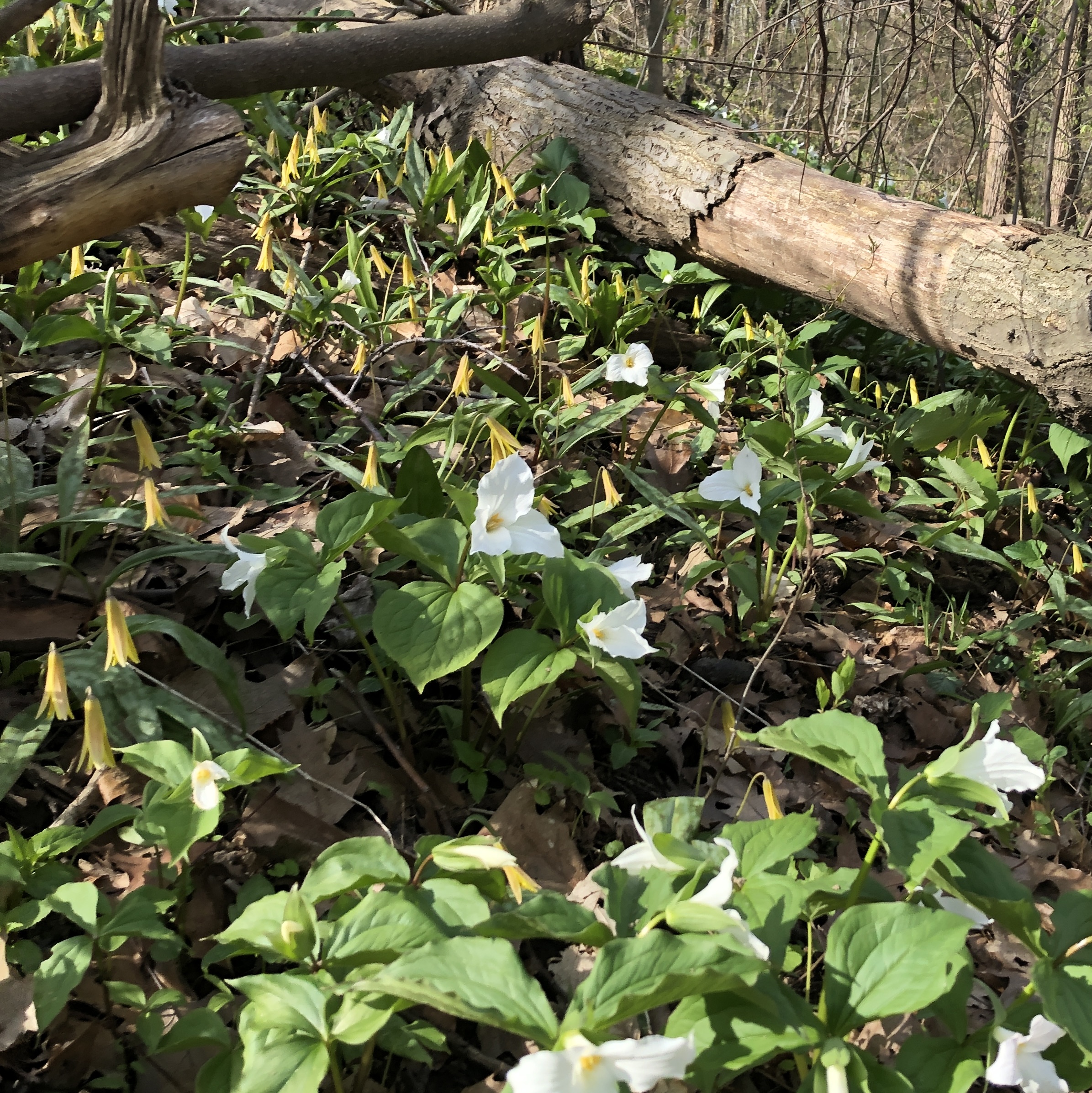
This hike has been rescheduled from March 31.This is a series of loop hikes exploring various BT Blue trails in wintry and early spring conditions. Join us for one, some or all.
Today’s hike will explore the main trail and the Black Walnut Side Trail in a 10 km loop through Short Hills Provincial Park.
Bring a snack and plenty of water, and other hydration as needed. Wear hiking boots and bring hiking poles. Icers may also be required.
Please arrive at the meeting place by 8:15 am as we will leave promptly at 8:30 am.
Urban Walk: Valley View Park Thornhill
https://hikesstaging.brucetrail.org/event/urban-walk-valley-view-park-thornhill-72/Sorry, the registration cut-off time for this hike has been reached.Not a member? Click here to join today!Hosting Club: Toronto
Location (Google Maps): Parking lot is inside Sycamore Drive East of Bayview , across Starbucks plaza
Hike Leader(s): Mohammad Aghamiri Click here to contact Hike Leader(s)
Pace: Moderate (3-4 km/hr)
Terrain: Hilly, Level 2 (Intermediate – some hills and uneven surfaces, rocks and roots underfoot)
Distance: 7-8 kmDescription
We will explore Valleyview and Maple View parks, and walk along German Mill Creak, in return we stop in Huntington park and have snack under beautiful shed ,Even it is considered Urban walk, it is urban hike as we have some up and down hills and tree roots, please bring your hiking poles, water and snacks
9:00 Fireman’s Park Circuit
https://hikesstaging.brucetrail.org/event/900-firemans-park-circuit/Sorry, the registration cut-off time for this hike has been reached.Not a member? Click here to join today!Hosting Club: Niagara
Category: Loop
Location (Google Maps): Fireman’s Park, Dorchester Road, Niagara FallsHike Leader(s): Suzanne Gourluck Click here to contact Hike Leader(s)
Pace: Brisk
Terrain: Moderate
Distance: 10 kmDescription
We will weave around Fireman’s Park on various trails eventually making our way over to the Main Trail and returning to the parking lot.
Dress for the weather and bring poles, water and a snack if you wish.Hiking Around Cave springs. NEW LOCATION
https://hikesstaging.brucetrail.org/event/hiking-around-cave-springs-new-location-7/Sorry, the registration cut-off time for this hike has been reached.Not a member? Click here to join today!Hosting Club: Niagara
Location (Google Maps):
Cave Springs Conservation Area)
Hike Leader(s): Bill Russell Click here to contact Hike Leader(s)
Pace: Medium
Terrain: Moderate
Distance: 6kDescription
Hiking in and around Cave SpringsSpring Flower Photography at Splitrock Narrows
https://hikesstaging.brucetrail.org/event/spring-flower-photography-at-splitrock-narrows/Sorry, the registration cut-off time for this hike has been reached.Not a member? Click here to join today!Hosting Club: Caledon Hills
Category: Nature Walks
Location (Google Maps): Splitrock Narrows Nature Reserve 755437 2nd Line EHS Mono. Take Hwy 10 North from Orangeville to 25 Sideroad then east on 25 Sideroad to 2nd Line EHS and then north on 2nd Line to parking lot on east side of road.Hike Leader(s): Gary Hall Click here to contact Hike Leader(s)
Pace: Leisurely – 3 km/hour or less
Terrain: Easy – mostly flat and usually good footing
Distance: 3 – 4 kmDescription
Whether using an expensive camera or a cell phone, Splitrock Narrows offers excellent opportunities to view and photograph spring flowers. We’ll take some time to discuss how to make the best of your photography. Be prepared to get your knees dirty. You do not have to be an expert photographer to enjoy this slow paced nature walk.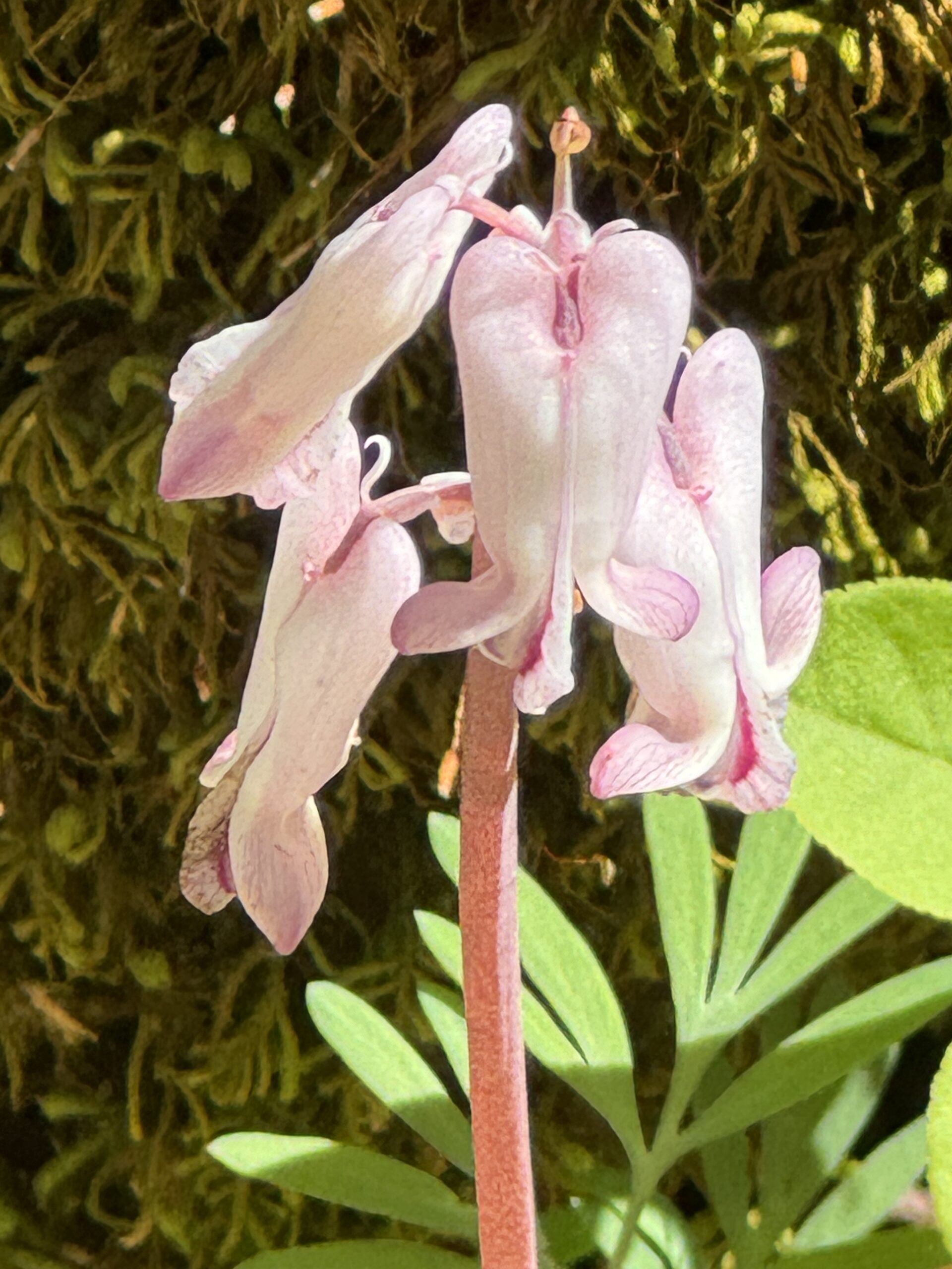
Wildflowers at Scotsdale Farm
https://hikesstaging.brucetrail.org/event/wildflowers-at-scotsdale-farm/Sorry, the registration cut-off time for this hike has been reached.Not a member? Click here to join today!Hosting Club: Iroquoia
Category: Wildflowers and Spring Ephemerals
Location (Google Maps): Scotsdale Farm13807 Trafalgar Rd.Hike Leader(s): Anne Armstrong Click here to contact Hike Leader(s)
Pace: Leisurely – 3km/hr or less
Terrain: Moderate – Some hills and/or some poor footing
Distance: Apprx. 9 km.Description
Spring is a wonderful time to hike especially if you are a wildflower enthusiast. Please join us to hike the lovely trails of this area as we continue our search for wildflowers or Spring Ephemerals as they are know. Please meet in the main parking lot of Scotsdale Farm at 9:45 am. for a 10:00 am. start. (If the main lot is closed due to filming there is another parking lot on your right as you drive in. This sometimes happens. ) Be prepared for some rocky sections with difficult footing. Bring water, a snack, sunscreen and insect repellent. Our snack will be beside a lovely creek. Poles would be useful.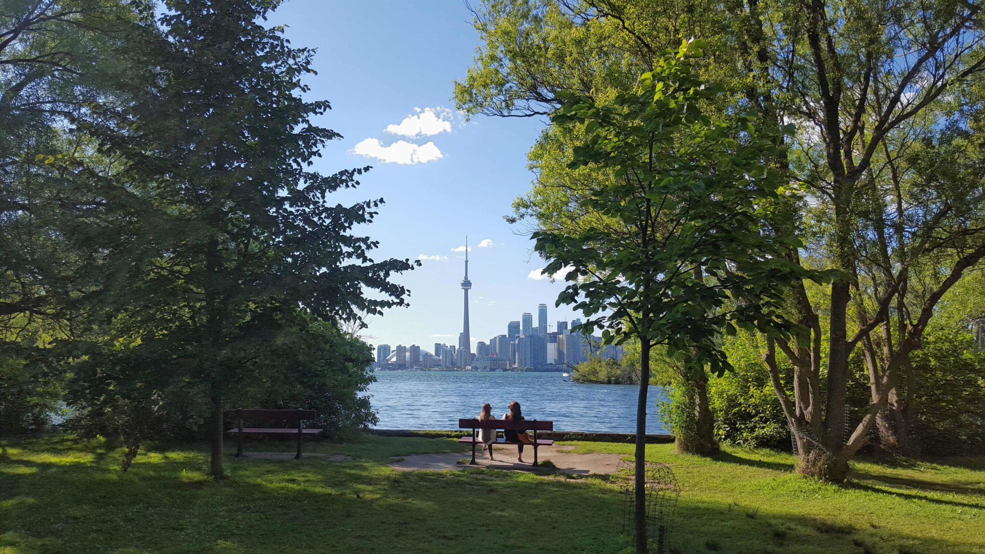
Urban Walk: Toronto Islands Evening Walk
https://hikesstaging.brucetrail.org/event/urban-walk-toronto-islands-evening-walk-11/Sorry, the registration cut-off time for this hike has been reached.Not a member? Click here to join today!Hosting Club: Toronto
Location (Google Maps):
Jack Layton Ferry Terminal, near the gates to Wards Island Ferry. Arrive 20 minutes prior to departure to check in with hike leader.
From Union Station take the LRT and get off at the stop Ferry Docks.Walk up to the Ferry Docks on Queens Quay West, street level. at the foot of Bay Street.
Hike Leader(s): Miriam Stevens Click here to contact Hike Leader(s)
Pace: Leisurely (2-3 km/hr)
Terrain: Flat
Distance: 6-9 kmDescription
After a day’s work come and “cool off” on the Toronto Islands free of fumes and traffic. Enjoy the view of the city skyline and Toronto’s beautiful island parkland.
Pack a dinner for a sit down picnic. Food is not available for purchase on the Islands early in the season. Also bring a warm jacket and flashlight.
Return fare ticket for the ferry is $9.11 adults and $5.86 seniors.
Hikes will take place rain or shine.
Toronto Island evening hikes will take place every Thursday in May and June 2025.
Same time and same meeting place. No preregistration is required – just show up at the ferry docks at 5:40 PM and sign in with the hike leader.