
Hike Schedule
Join us for a hike! Registration required.
All hikes available to BTC members. Some hikes are open to non-members.
See Refund Policy for Paid Hikes >
TIP: The calendar view displays up to 7 hikes on a day, but often there are more. Click “View more events” to see them all.
Categories
- 29April 29, 2025
Urban Walk: Valley View Park Thornhill
https://hikesstaging.brucetrail.org/event/urban-walk-valley-view-park-thornhill-75/Sorry, the registration cut-off time for this hike has been reached.Not a member? Click here to join today!Hosting Club: Toronto
Location (Google Maps): Parking lot is inside Sycamore Drive East of Bayview , across Starbucks plaza
Hike Leader(s): Mohammad Aghamiri Click here to contact Hike Leader(s)
Pace: Moderate (3-4 km/hr)
Terrain: Hilly, Level 2 (Intermediate – some hills and uneven surfaces, rocks and roots underfoot)
Distance: 7-8 kmDescription
We will explore Valleyview and Maple View parks, and walk along German Mill Creak, in return we stop in Huntington park and have snack under beautiful shed ,Even it is considered Urban walk, it is urban hike as we have some up and down hills and tree roots, please bring your hiking poles, water and snacks
9:00 Decew House (LOCATION CHANGE)
https://hikesstaging.brucetrail.org/event/900-decew-house-location-change-5/Sorry, the registration cut-off time for this hike has been reached.Not a member? Click here to join today!Hosting Club: Niagara
Location (Google Maps): Decew House St Catharines
Pace: Medium
Terrain: Moderate
: 10kmDescription
Explore 12 mile creek and surrounding areas. Register for each hikeBring Poles, snack, and dress for the weather
9:15 Short Hike - Rotary Park, St. Catharines
https://hikesstaging.brucetrail.org/event/915-short-hike-rotary-park-st-catharines-16/Sorry, the registration cut-off time for this hike has been reached.Not a member? Click here to join today!Hosting Club: Niagara
Location (Google Maps): Rotary Park, St. Catharines
Hike Leader(s): janet davey Click here to contact Hike Leader(s)
Pace: Medium
Terrain: Moderate
Distance: 6 kmsDescription
Hike the trails around Rotary Park. Bring hiking boots and water.Culham Trail Streetsville
https://hikesstaging.brucetrail.org/event/culham-trail-streetsville/Sorry, the registration cut-off time for this hike has been reached.Not a member? Click here to join today!Hosting Club: Caledon Hills
Category: Tuesday Hikers
Location (Google Maps): Vic Johnston Community Centre – Church St., Streetsville (Park in the lower lot near ball diamond).
From Hwy 401 come south on Mississauga Rd. Pass Argentia Rd. and, at the next lights, turn left to stay on Mississauga Rd. Follow 3 km into Streetsville (where Mississauga Rd. becomes Queen St.) and turn left on Church St. OR,
From QEW or Hwy 403 come north on Erin Mills Pkwy, then – just south of Erin Mills Town Centre Mall – turn right on Eglinton, then left at lights on to Mississauga Rd. Follow for 2 km to right turn at Church St.Hike Leader(s): Peter Leeney
GPS Location: 43.5800, -79.70878Hike Leader(s): Peter Leeney Click here to contact Hike Leader(s)
Pace: Medium – 3 to 4 km/hour
Terrain: Easy – mostly flat and usually good footing
Distance: 10 kmDescription
We will hike north along the Credit River for approx. 5 km and return by the same route. Possible lunch after in Streetsville.Dufferin Hi-Land 60th Anniversary Highlight Hikes, Hike 2: Split Rock/Lookout Side Trails
https://hikesstaging.brucetrail.org/event/dufferin-hi-land-60th-anniversary-highlight-hikes-hike-2-split-rock-lookout-side-trails/Sorry, the registration cut-off time for this hike has been reached.Not a member? Click here to join today!Hosting Club: Dufferin Hi-Land
Category: Tuesday Hike
Location (Google Maps):Dufferin Hi-Land Section, Map 19. Meet at Split Rock parking lot on 2nd line EHS about 1.5 km north of 25 Sideroad
Hike Leader(s): Inge Eckerich, Julie Daley, Tony Evangelista Les Babbage Click here to contact Hike Leader(s)
Pace: Leisurely
Terrain: Moderate
Distance: Long hike 6 km, Short hike 3.7 kmDescription
Join us in celebrating the 60th anniversary of the Dufferin Hi-Land Bruce Trail Club. The Club plans to award a 60th Anniversary badge to any hiker who completes 60 km of Dufferin Hi-Land trails – Main or Side Trails. Our Tuesday Hike group is offering a series of 10 hikes, covering most of the highlights of our section that meet this requirement. If you can’t make all of the hikes, make ups are allowed. Just hike 60K in Dufferin during 2025 and you qualify for the badge.Today’s hike will include the Split Rock, 2nd Line EHS Walter Tovell and Lookout Side Trails
10:00am Invasive Species Removal Hike
https://hikesstaging.brucetrail.org/event/1000am-invasive-species-removal-hike/Sorry, the registration cut-off time for this hike has been reached.Not a member? Click here to join today!Hosting Club: Niagara
Category: Leisurely
Location (Google Maps): 85 Park Road South, Grimsby, ONHike Leader(s): Michele Altobelli Click here to contact Hike Leader(s)
Pace: Leisurely
Terrain: Moderate
Distance: 4kmDescription
Join us to HELP FILL THE CRIB!!We will hike in from Ridge Road picking invasive plants such as garlic mustard and greater celandine along the way (reusable grocery bags or garbage bags work well). Once at the crib location, we will dump our bags and pick garlic mustard in that area for a while, dump it, then hike back out. Plenty of native spring plants to admire along the way – reducing invasive plants will give these species a chance to thrive!
- you must register and submit a completed waiver for this hike
- Students under 16 MUST be accompanied by a parent/guardian on this hike (please refer to the BTC link https://brucetrailorg.b-cdn.net/wp-content/uploads/2022/06/VOL.05.01_Minors_Volunteering_Policy_-_Approved_February_2016.pdf )
- 16 or more but under 18? Bring a waiver signed by a guardian.
- students wishing to receive community service hours (4Hours) MUST bring service forms from school.
- Please wear clothes for work – long pants tucked into socks, appropriate footwear (no sandals), long sleeves and work gloves
- please bring empty bags for collecting
- 30April 30, 2025

Caledon-in-5 Stained Glass Fundraising series
https://hikesstaging.brucetrail.org/event/caledon-in-5-stained-glass-fundraising-series/Sorry, the registration cut-off time for this hike has been reached.Not a member? Click here to join today!Hike open to BTC Members only.
This is a Multi-Day Hike
You are signing up for the following dates:
2025-04-30, 2025-05-07, 2025-05-14, 2025-05-21, 2025-05-28Hosting Club: Toronto, Caledon Hills
Category: Car Hike
Location (Google Maps): Hike 1: Meet at roadside parking along the southwest shoulder of the Willoughby Rd and Escarpment Sideroad intersection, km 15.9 (Map 15, Edition 31).
Directions: From Hwy #10 head west on Escarpment Sideroad for approximately 1.5 km.Hike Leader(s): Jacquie Van Dyke Click here to contact Hike Leader(s)
Pace: Moderate (3-4 km/hr)
Terrain: Variable
Distance: Hike distances range from 13 km to 16 km.Description
Come and join us on these 5 hikes to earn Caledon’s Stained Glass Fundraising badge, which is part of the collectable Bruce Trail Club’s stained glass themed fundraiser set. This series of 5 hikes will take place on consecutive Wednesdays, beginning April 30. Bring snacks and your choice of hydration. In early April, hike details for hikes 2 – 5, will be emailed to participants. On this first hike, please meet and be ready for an 8:30 shuttle. We’ll hike through the Badlands (which may be muddy) and the Forks of the Credit Provincial Park. Please note: in order to earn the Stained Glass badge, you may miss one hike but must make it up by the last day of the series (May 28).
8:30 Welland Canals Badge Hike #4 Port Dalhousie
https://hikesstaging.brucetrail.org/event/830-welland-canals-badge-hike-4-port-dalhousie/Sorry, the registration cut-off time for this hike has been reached.Not a member? Click here to join today!Hike open to BTC Members only.
Hosting Club: Niagara
Category: Loop
Location (Google Maps): Park at Port Dalhousie Public Parking lot. No payment necessary.Hike Leader(s): Suzanne Gourluck Click here to contact Hike Leader(s)
Pace: Medium
Terrain: Easy
Distance: 7 kmDescription
DON’T FORGET TO BRING $10. This is the final hike in the Welland Canal series of 4 hikes. You will see the original entry point of 3 of the 4 canals as well as other interesting things relating to the canals. Bring snacks/water and dress for the weather.
Please bring $10 if you have completed all 4 hikes and would like the Welland Canal badge.
Good Companions - Waterfront-urban Hike
https://hikesstaging.brucetrail.org/event/good-companions-waterfront-urban-hike/Sorry, the registration cut-off time for this hike has been reached.Not a member? Click here to join today!Hosting Club: Iroquoia
Category: Good Companions
Location (Google Maps): Park at the Royal Hamilton Yacht Club, on the harbour in the vicinity of where Bay Street North, MacNab Street North and Guise Street intersect.Hike Leader(s): Janina Vanderpost Click here to contact Hike Leader(s)
Pace: Medium – 3 to 4 km/hr
Terrain: Easy – Mostly flat and usually good footing
Distance: 8kmDescription
Meeting 9:45am for a 10am start, this hike will be a loop hike. This hike was intended as a winter hike and involves some urban walking. First we will head east along the newly developed waterfront toward the Haida ( last remaining WWII Tribal class destroyer in the world) is docked. We will proceed into Hamilton’s north end to visit a few historical sites including Christ’s Church Cathedral, proceding down James Street N past Liuna Station and the old Customs House. Then west to hike Bayfront Park Trails and return to RHYC. Lunch at RHYC.Cancelled Wednesday Walkers - Mud Free Urban Walk Collingwood
https://hikesstaging.brucetrail.org/event/wednesday-walkers-mud-free-urban-walk-collingwood-2/Sorry, the registration cut-off time for this hike has been reached.Not a member? Click here to join today!Hosting Club: Beaver Valley
Location (Google Maps): Meet in the parking area behind MacDonald’s.
Hike Leader(s): Glenda Collings Click here to contact the hike leader.
Pace: Medium
Terrain: Easy
Length of Hike: 1 1/2 hoursDescription
April is a muddy time of year on our Beaver Valley Trail, so let’s get out on some urban walks this month, have some exercise and enjoy the camaraderie we find with group walks. Dress appropriately for the weather and bring water, In Collingwood we’ll take in the waterfront and some of the city’s trail system.Car Hike: Midweek fitness hike in the Hockley Valley (spring flowers hike)
https://hikesstaging.brucetrail.org/event/car-hike-midweek-fitness-hike-in-the-hockley-valley-spring-flowers-hike/Sorry, the registration cut-off time for this hike has been reached.Not a member? Click here to join today!Hosting Club: Toronto
Category: Car Hike
Location (Google Maps): Hockley Valley Provincial Nature ReserveHike Leader(s): Natalia Svechnikova Click here to contact Hike Leader(s)
Pace: Moderate (3-4 km/hr)
Terrain: Hilly, Level 2 (Intermediate – some hills and uneven surfaces, rocks and roots underfoot), Variable
Distance: about 14 kmDescription
Please join me for an enjoyable spring flowers hike on the Bruce Trail (main and side trails). We will be following a loop of ca 14 km and try to keep a moderate pace of about 3 km/h. The trail is a bit hilly with a few uphill sections after which we will stop for short water breaks. There will be a lunch break for about 20 min. We should be back to the parking lot around 3:30 pm.Please be dressed for the weather, wear hiking shoes/boots and pack your rain gear (just in case), at least 2 L of water, light lunch and snacks, your sunglasses and/or hut.
We will meet on the dedicated Hockley Valley PNR / Bruce Trail parking lot on the Hockley Road (opposit side of the Hockley Valley Resort and the Black Birch Restaurant (exact map location
43.9728974807774, -80.05570691699788) just before 10:30 am and start hiking at 10:30 am.
Please note that this hike will be cancelled in case of inclement weather.

Afternoon hike - DATE CHANGE - Halton Agreement Forest
https://hikesstaging.brucetrail.org/event/afternoon-hike-halton-agreement-forest-5/Sorry, the registration cut-off time for this hike has been reached.Not a member? Click here to join today!Hosting Club: Iroquoia
Category: Afternoon/Evening Hikes
Location (Google Maps): Meet roadside on 10 Side Road, off Guelph Line, north of Campbelville.Hike Leader(s): Karen Bergmann Click here to contact Hike Leader(s)
Pace: Medium – 3 to 4 km/hr
Terrain: Moderate – Some hills and/or some poor footing
Distance: 6 kmsDescription
We will hike around the bike trails in this lovely Forest. I expect we’ll see some spring wildflowers. - 01May 1, 2025
8:00 am Long Hike Glen Road Jordan NEW TIME
https://hikesstaging.brucetrail.org/event/800-am-long-hike-glen-road-jordan-new-time/Sorry, the registration cut-off time for this hike has been reached.Not a member? Click here to join today!Hosting Club: Niagara
Category: In and Out
Location (Google Maps):Glen Road Jordan
Hike Leader(s): Alan Laver Click here to contact Hike Leader(s)
Pace: Medium
Terrain: Moderate
Distance: 10kDescription
This will be our permanent Thursday Location until Bridge repairs complete. From Glen Road explore the trail network on the escarpment towards Balls Falls and Moyer Road.You must register for each hike. Bring Poles, snack bug spray, sunscreen and a drink. Dress for the weather
Urban Walk: Valley View Park Thornhill
https://hikesstaging.brucetrail.org/event/urban-walk-valley-view-park-thornhill-74/Sorry, the registration cut-off time for this hike has been reached.Not a member? Click here to join today!Hosting Club: Toronto
Location (Google Maps): Parking lot is inside Sycamore Drive East of Bayview , across Starbucks plaza
Hike Leader(s): Mohammad Aghamiri Click here to contact Hike Leader(s)
Pace: Moderate (3-4 km/hr)
Terrain: Hilly, Level 2 (Intermediate – some hills and uneven surfaces, rocks and roots underfoot)
Distance: 7-8 kmDescription
We will explore Valleyview and Maple View parks, and walk along German Mill Creak, in return we stop in Huntington park and have snack under beautiful shed ,Even it is considered Urban walk, it is urban hike as we have some up and down hills and tree roots, please bring your hiking poles, water and snacks

Friends of Frontenac Park Perimeter Challenge: Six Hikes spread over May 1-12
https://hikesstaging.brucetrail.org/event/friends-of-frontenac-park-perimeter-challenge-six-hikes-spread-over-may-1-12/Sorry, the registration cut-off time for this hike has been reached.Not a member? Click here to join today!Hike open to BTC Members only.
This is a Multi-Day Hike
You are signing up for the following dates and times:
2025-05-01 at 08:45
2025-05-03 at
2025-05-05 at
2025-05-07 at
2025-05-09 at
2025-05-12 atHosting Club: Iroquoia
Category: General Hike
Location (Google Maps): Frontenac Provincial Park, South Frontenac Ontario
Six hikes with 3 different meeting locations.Hike Leader(s): Louise Langlais Click here to contact Hike Leader(s)
Pace: Medium – 3 to 4 km/hr
Terrain: Strenuous – Hilly with steep climbs and some poor footing
Distance: 14-23 kmDescription
I will be leading a series of 6 hikes for the Perimeter Challenge in Frontenac Provincial Park, on May 1,3,5, 7, 9, and 12.
The hikes will vary from 14 km to 23 km in length, and will be There-and-Back so we don’t have to shuttle vehicles.These hikes will also be posted for the Rideau Trail Association, with a limited number of spots for each club. Please do not register unless you are serious about attending and only after you have a place to stay.
Note the GPS coordinates are to show where the park is located but not for the actual meeting location for each hike, as there are 3 different start points. This information will be emailed to registrants prior to the hike.
A day/parking pass in the park will be required for two of the hikes.
Participants will be responsible for finding their own accommodations.
If you want the badge from the Friends of Frontenac, you will need to register here: https://www.friendsoffrontenac.com/product/register-for-perimeter-challenge/
Peninsula End2End in 18 Series
https://hikesstaging.brucetrail.org/event/peninsula-end2end-in-18-series/Sorry, the registration cut-off time for this hike has been reached.Not a member? Click here to join today!Hike open to BTC Members only.
This is a Multi-Day Hike
You are signing up for the following dates:
2025-05-01, 2025-05-02, 2025-05-15, 2025-05-16, 2025-05-29, 2025-05-30, 2025-06-12, 2025-06-13, 2025-06-26, 2025-06-27, 2025-09-04, 2025-09-05, 2025-09-18, 2025-09-19, 2025-10-02, 2025-10-03, 2025-10-16, 2025-10-17Hosting Club: Peninsula
Category: Peninsula E2E
Location (Google Maps):Hike Leader(s): Randy Vanderlaan, Saabir Sohrab Click here to contact Hike Leader(s)
Pace: Leisurely (2.0 – 3.0 km/h): A relaxed pace with frequent breaks and a focus on enjoyment.
Terrain: Difficult: Steep ascents/descents, rocky scrambling, and some rugged escarpment paths., Moderate: Rolling hills, mild slopes and rocky paths.Description
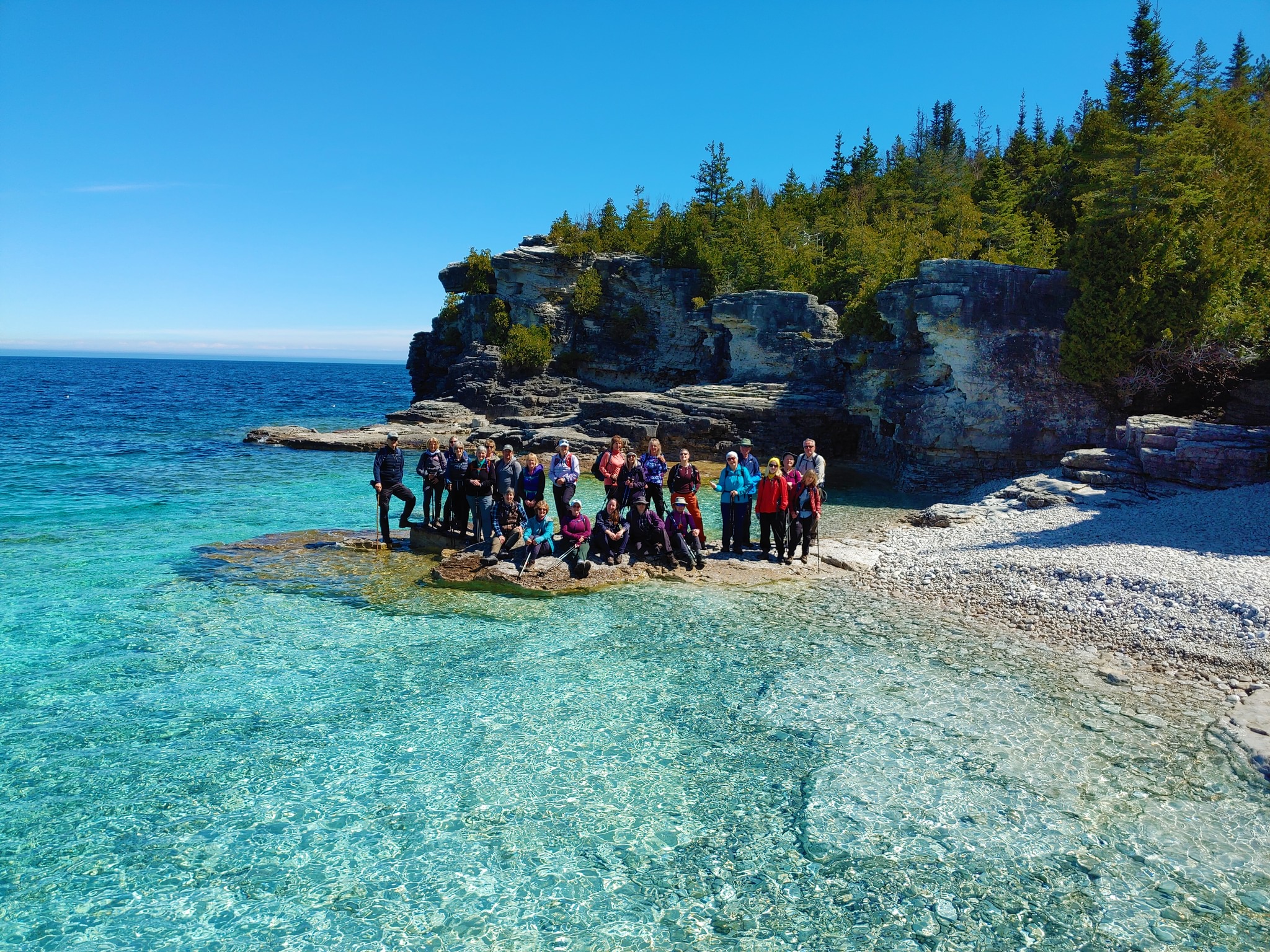
Peninsula End to End in 18 hikesOpen to Bruce Trail Conservancy (BTC) Members Only.Non-members can join by signing up for a one-year BTC membership [$75] before registering at Bruce Trail Conservancy Memberships.
Participant Limit: Maximum of 30 participants, including the hike leader and sweep(s).
Registration Fee: BTC Members: $200 – includes Bus Shuttle, Bruce Peninsula National Park (BPNP) Fees, and Badge Fee. Surplus, if any, supports Peninsula Bruce Trail Club’s hike program.
Confirm Your Registration via E-transfer of $200 to HikeWithPBTC@gmail.com – Note: No refunds, hiker substitutions, or guest hikers.
Hike Leadership:
Led by PBTC Certified Hike Leader(s) and Sweep(s).
Pace: Moderate/Medium
Terrain: Moderate/Difficult
Average Hike Distance: Approximately 8 – 12 KM per day, [one of the hikes is 14 KM]
Hike Overview:
Complete the Peninsula section of the Bruce Trail over 18 hikes.
Direction: Northbound from Wiarton to Tobermory.
Group Hike Format: Participants must be committed to the entire series.
Series is designed for intermediate hikers comfortable with moderate challenges, including longer distances and elevation gains.
Expected Pace: Up to 3 km/hr over 8 – 12km, with the longest section being 14km. Average pace may be slower than 3 km/hr, depending upon the experience of the hikers.
Total Distance: Approximately 165 km with no dropout points.
Time allocated for photography and appreciation of local flora and fauna.
Participant Requirements:
Ensure you are physically fit to participate in this series
Attire: Proper hiking boots, layered clothing for varying weather, and wet weather gear. Hiking poles are recommended.
Essentials: Sufficient food [lunch], snacks and water for a full day, bug spray.
Breaks: Morning, 15-30 minute on-trail lunch, and afternoon breaks, weather-dependent.
Participant is required to sign a BTC Waiver of Liability
Transportation:
Bus shuttle to trailhead and from end of hike, avoiding car shuttles.
Typical Meeting Time: Around 9 AM, with return times varying based on daily hiking distance and bus schedule.
Environmental Responsibility:
Adherence to Leave No Trace principles.
Collective effort in trail cleanliness.
Note: Dogs are not permitted on this hike.
Accommodation Options:
Early reservations are recommended.
Suggested locations: Near meeting points or centrally in Lion’s Head.
Options include motels, campgrounds, hostels, and B&Bs.
Schedule and Communication:
Detailed itinerary will be sent to participants prior to each two-day hike segment.
Schedule subject to change.
Join us for this memorable hiking adventure and be part of a community dedicated to preserving and enjoying the natural beauty of the Bruce Trail.
Hiking Around Cave springs. NEW LOCATION
https://hikesstaging.brucetrail.org/event/hiking-around-cave-springs-new-location-6/Sorry, the registration cut-off time for this hike has been reached.Not a member? Click here to join today!Hosting Club: Niagara
Location (Google Maps):
Cave Springs Conservation Area)
Hike Leader(s): Bill Russell Click here to contact Hike Leader(s)
Pace: Medium
Terrain: Moderate
Distance: 6kDescription
Hiking in and around Cave Springs
*Sights of Kerncliff and Cityview
https://hikesstaging.brucetrail.org/event/sights-of-kerncliff-and-cityview/Sorry, the registration cut-off time for this hike has been reached.Not a member? Click here to join today!Hike open to BTC Members only.
Hosting Club: Iroquoia
Category: Thursday Group
Location (Google Maps):Meet at the north end of Havendale Blvd. in Mansfield Park. On street parking available on Havendale Blvd. and Monmouth Drive. Try to arrive by 9:20 as we will depart at 9:30. See map 9 of the Trail Guide (formerly Havendale Blvd Side Trail). We will walk through Kerncliff and Cityview Parks out to King Road area and back using side trails. Bring water and optional snack. We will go for a tea or coffee at the nearby Tim Hortons on Brant Street after the hike, for those who wish to join us.
Hike Leader(s): Paul Toffoletti Click here to contact Hike Leader(s)
Pace: Medium – 3 to 4 km/hr
Terrain: Strenuous – Hilly with steep climbs and some poor footing
Distance: 6kmDescription
Urban Walk: Toronto Islands Evening Walk
https://hikesstaging.brucetrail.org/event/urban-walk-toronto-islands-evening-walk-10/Sorry, the registration cut-off time for this hike has been reached.Not a member? Click here to join today!Hosting Club: Toronto
Category: Urban Walk
Location (Google Maps):Jack Layton Ferry Terminal, near the gates to Wards Island Ferry. Arrive 20 minutes prior to departure to check in with hike leader.
From Union Station take the LRT and get off at the stop Ferry Docks.Walk up to the Ferry Docks on Queens Quay West, street level. at the foot of Bay Street.
Hike Leader(s): Miriam Stevens Click here to contact Hike Leader(s)
Pace: Leisurely (2-3 km/hr)
Terrain: Flat
Distance: 6-9 kmDescription
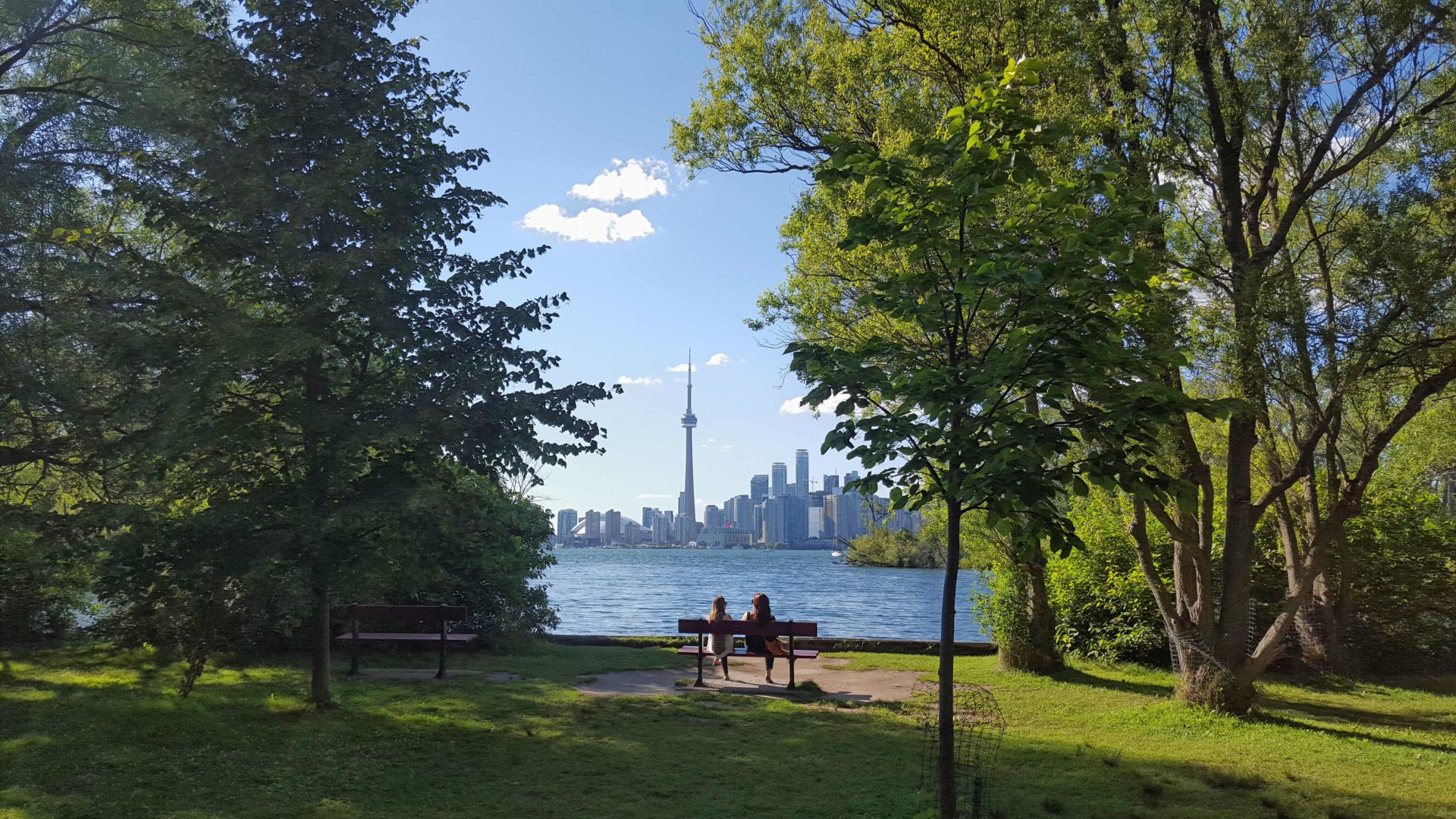
After a day’s work come and “cool off” on the Toronto Islands free of fumes and traffic. Enjoy the view of the city skyline and Toronto’s beautiful island parkland.
Pack a dinner for a sit down picnic. Food is not available for purchase on the Islands early in the season. Also bring a warm jacket and flashlight.
Return fare ticket for the ferry is $9.11 adults and $5.86 seniors.
Hikes will take place rain or shine.
Toronto Island evening hikes will take place every Thursday in May and June 2025.
Same time and same meeting place. No preregistration is required – just show up at the ferry docks at 5:40 PM and sign in with the hike leader. - 02May 2, 2025
Niagara-on-the-Lake Tour
https://hikesstaging.brucetrail.org/event/niagara-on-the-lake-tour-6/Sorry, the registration cut-off time for this hike has been reached.Not a member? Click here to join today!Hosting Club: Niagara
Category: Urban
Location (Google Maps): Park on King St, Centre St near Veteran’s Memorial ParkHike Leader(s): Margaret Northfield Click here to contact Hike Leader(s)
Pace: Medium
Terrain: Easy
Distance: 6-7kmDescription
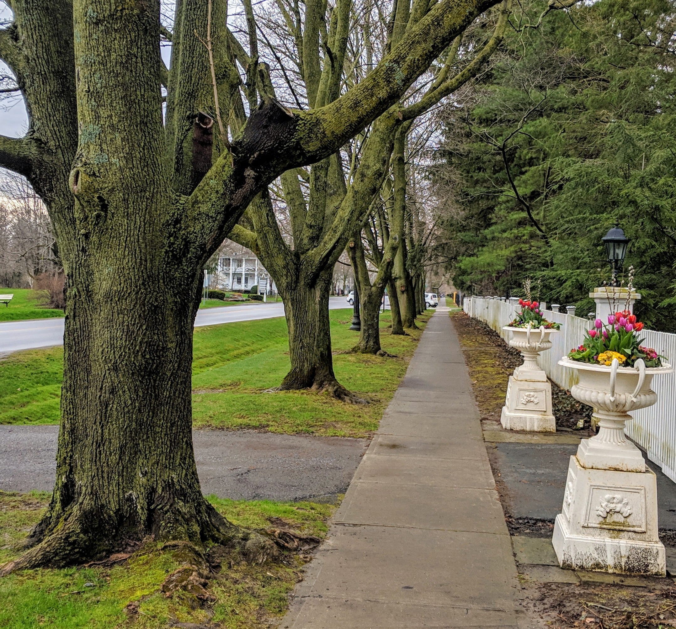
Each Friday we will explore different neighbourhoods, trails and parkland throughout Historic Niagara-on-the-Lake.Moderate pace with some weeks entirely on sidewalks and roads while others may include a mix of trails and paved pathways. Great way to build up endurance for longer more strenuous hikes.
Prepare for cooler windy conditions on open parkland and along Lake Ontario and Niagara River trails.
Plan to stay for conversation and a warm cup of coffee or tea at Sweets and Swirls, Community Centre, 14 Anderson Lane, (just off Niagara Stone Rd), NOTL