
Hike Schedule
Join us for a hike! Registration required:
All hikes available to BTC members. Some hikes are open to non-members.
TIP: The calendar view displays up to 7 hikes on a day, but often there are more. Click “More events” to see them all.
Categories
- 12April 12, 2025
Fort to Fort FIRST DAY ONLY April 12, 2025
https://hikesstaging.brucetrail.org/event/fort-to-fort-first-day-only-april-12-2025/Sorry, the registration cut-off time for this hike has been reached.Not a member? Click here to join today!Hosting Club: Niagara
Category: Event Hikes
Location (Google Maps):Kingsbridge Park, Niagara Parkway, Niagara Falls, ON
Hike Leader(s): Lauren Doig Click here to contact Hike Leader(s)
Pace: Medium
Terrain: Easy
Distance: 27kmDescription
Meet at Kingsbridge Park at 6:45 a.m. You will be bussed to Fort George. Hike from Fort George to Kingsbridge Park , approximately 27 km. Small hills involved but mostly paved paths with some road walking. 2 checkpoints along the way. This hike is for hikers who are only going to do Day 1 of the Fort to Fort.This is a self-led hike.
Masks are optional on buses.
Registration is $50 for one day. Fee includes bus, parking pass, and checkpoints .
Event Co-ordinator: Lauren Doig, ldoig52@gmail.com

Fort to Fort ENTIRE 2 DAY, April 12, 13, 2025
https://hikesstaging.brucetrail.org/event/fort-to-fort-entire-2-day-april-12-13-2025/Sorry, the registration cut-off time for this hike has been reached.Not a member? Click here to join today!Hosting Club: Niagara
Category: Event Hikes
Location (Google Maps):Kingsbridge Park, Chippawa, Ont
Hike Leader(s): Lauren Doig Click here to contact Hike Leader(s)
Pace: Medium
Terrain: Easy
Distance: 57 km over 2 daysDescription
You are SIGNING UP FOR BOTH DAYSNew Badge!
Hike the entire length of the Niagara Parkway, from Fort George to Fort Erie, over two days. Enjoy approximately 27 KM each day of beautiful river scenery. Small hills involved but mostly paved paths with some road walking. This is a self-led hike.Meet at Kingsbridge Park each day at 6:45. You will be bussed to starting point each day.
Registration is $65 (members) or $75 (non-members). Fee includes bus, parking pass, checkpoints and badge.
Event Coordinator: Lauren Doig, ldoig52@gmail.com
Saturday Shorts: Palgrave Forest
https://hikesstaging.brucetrail.org/event/saturday-shorts-palgrave-forest/Sorry, the registration cut-off time for this hike has been reached.Not a member? Click here to join today!Hosting Club: Caledon Hills
Category: General
Location (Google Maps): Meet at the parking lot at Palgrave Rotary Park, 17357 Peel Regional Road 50 (Highway 50), Palgrave. It is at the north end of Palgrave on the east side of Highway 50. This is our meeting spot. We will walk together to Palgrave Forest on the west side of Highway 50. It is best to aim for arriving around 8:15 am, so we can start hiking as close to 8:30 as possible. Thanks!Hike Leader(s): Elizabeth Ganong Click here to contact Hike Leader(s)
Pace: Leisurely – 3 km/hour or less, Medium – 3 to 4 km/hour
Terrain: Easy – mostly flat and usually good footing, Moderate – some hills and/or some poor footing
Distance: Approximately 6 kmDescription
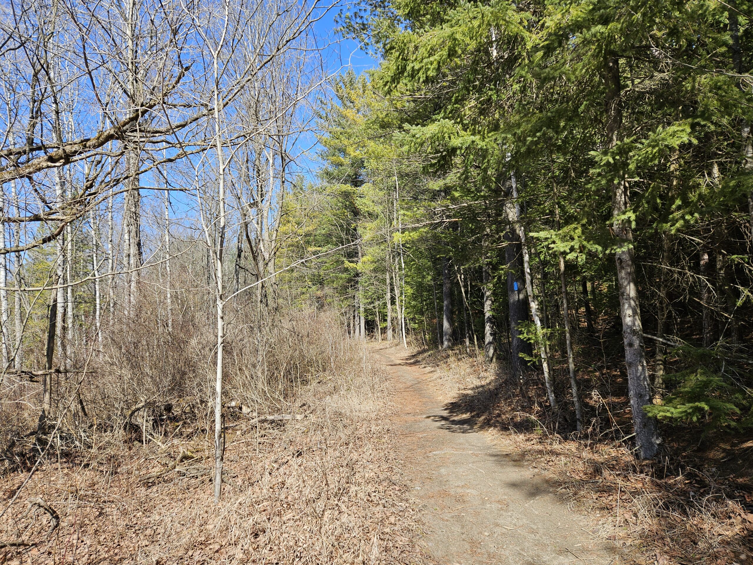
Looking to get out on a Saturday but not give up your whole day? Saturday Shorts, a hiking series, will get you out in a small group on a short hike. This Saturday’s approximately 6 km hike takes us through Palgrave Forest. The route will be a “there-and-back” with a change-up on the way back. The trails are expected to be dry, muddy, or wet in parts. Bring water and a snack, if desired. Weather permitting, there will be a ten-minute break. No dogs please. Registrants can expect a reminder/update message one or two days before the hike. Please note the early start time as this is a very popular multi-use spot on the weekends. Most of the route is wide, but there might be times when we need to step out of the way for cyclists to pass.School Bus Hike: Hockley Valley
https://hikesstaging.brucetrail.org/event/school-bus-hike-hockley-valley-and-mono-cliffs/Sorry, the registration cut-off time for this hike has been reached.Not a member? Click here to join today!Trip Information
Departure Time: 08:30
Return to City Time: 18:00
Departure Point: York Mills Bus PickupOptional Items
Hosting Club: Toronto
Category: Bus Hike
Location (Google Maps): Hockley ValleyHike Leader(s): Martina Furrer, Marie-Josée Roy, Leila Damband and Roland Mark Click here to contact Hike Leader(s)
Pace: Brisk (4-5 km/hr), Moderate (3-4 km/hr)
Terrain: Challenging, Hilly, Level 2 (Intermediate – some hills and uneven surfaces, rocks and roots underfoot)
Distance: Fast (18 km), moderate (13 km)Description
Join us for an awesome hike with great views and fun hills. We will split into two groups and hike north from Hockley Valley Rd to Mono Centre. The moderate group, led by Roland and Leila, will hike about 13 km. The fast group, led by Martina and Marie-Josée, will hike about 18 km. Refreshments after if time allows.Bus departs 10 York Mills Rd at 8:3o AM, and should be back in the city by 6 PM.
Car Hike: Happy Valley, King city
https://hikesstaging.brucetrail.org/event/car-hike-happy-valley-king-city-6/Sorry, the registration cut-off time for this hike has been reached.Not a member? Click here to join today!Hosting Club: Toronto
Location (Google Maps): Please park along 16th Sideroad
Hike Leader(s): Mohammad Aghamiri Click here to contact Hike Leader(s)
Pace: Moderate (3-4 km/hr)
Terrain: Level 2 (Intermediate – some hills and uneven surfaces, rocks and roots underfoot)
Distance: 12-14Description
Will explore through the happy valley forest and visit nice look out ,We have short stops for water,bio and 15-20 minutes for snack,Please dress for winter and bring your ice cleats and hiking poles
Devil's Pulpit - Forks of the Credit
https://hikesstaging.brucetrail.org/event/car-hike-devils-pulpit/Sorry, the registration cut-off time for this hike has been reached.Not a member? Click here to join today!Hosting Club: Toronto, Caledon Hills
Category: Car Hike
Location (Google Maps): Devil’s Pulpit – Meet at roadside parking, km 6.6 on the east side of Creditview Road immediately north of Grange Sideroad. 43.791491, -79.975229. Map 14 Edition 30. Please arrive fifteen minutes early.Hike Leader(s): Ross Estrella Click here to contact Hike Leader(s)
Pace: Brisk (4-5 km/hr), Moderate (3-4 km/hr)
Terrain: Challenging, Hilly, Level 2 (Intermediate – some hills and uneven surfaces, rocks and roots underfoot), Rocky
Distance: 12 kmsDescription
Beat the winter blues already?! Join me for a warm-up hike in preparation for your spring and warmer day hikes ahead. At a moderate to brisk pace we’ll explore (descend/ascend) the Devil’s Pulpit and nearby side trails. The pulpit calls for sturdy and comfortable hiking shoes/boots. Hiking poles are strongly recommended and bring your icers just in case. Bring your choice of hydration, snacks and lunch. Make sure you carry your health card and personal medication at all times. Dress for the weather.
Rainbow Hike: Tiffany Falls to Dundas Trail Centre & Ancaster
https://hikesstaging.brucetrail.org/event/rainbow-hike-tiffany-falls-to-dundas-trail-centre-ancaster/Sorry, the registration cut-off time for this hike has been reached.Not a member? Click here to join today!Hosting Club: Iroquoia
Category: Rainbow Hike
Location (Google Maps): Taking HSR bus from the King & Bay bus stop (in front of Jackson Square) to hike start at Tiffany Falls.Hike Leader(s): Doug O’Neill Click here to contact Hike Leader(s)
Pace: Medium – 3 to 4 km/hr
Terrain: Moderate – Some hills and/or some poor footing
Distance: 11 kmsDescription
You’re invited to an all-inclusive LGBTQ-friendly spring hike!Look for me at the King & Bay bus stop (in olive-green Bruce Trail cap) no later than 9 a.m. Together we’ll take 9:13 a.m. 5A Meadowlands/McMaster bus (25 mins), get off at Harper’s Garden Centre (on Wilson) and walk 5 minutes to Tiffany Falls Parking Lot.
Bus fares: $2.50-3.50.
After visiting the falls, we’ll follow the main trail to Sherman Falls, then continue into Dundas Valley Conservation Area, passing Canterbury Falls, fascinating limestone formations and the Hermitage ruins. With any luck, we’ll see early spring flowers.
We’ll stop at the Dundas Valley Trail Centre (former train station) for lunch—and selfies in front of the vintage train cars. There’s a fountain to refill your water bottles, picnic tables, and interpretive centre. After lunch, we’ll retrace a portion of our earlier route, then follow the Heritage Trail to Ancaster, where we have the option of visiting the hiker-themed Trail Café before catching the 5A-Greenhill (via McMaster) bus from corner of Wilson and Rousseau back to downtown Hamilton/McNab terminal.
Bring water, snacks, lunch.
Complimentary Bruce Trail Rainbow badges and/or stickers to all participants! Email any questions to the Hike Leader – “Click here to contact Hike Leader” on this form.
Cancelled due to ice storm - Dufferin Hi-Land 60th Anniversary Side Trail Highlights
https://hikesstaging.brucetrail.org/event/dufferin-hi-land-60th-anniversary-side-trail-highlights-4/Sorry, the registration cut-off time for this hike has been reached.Not a member? Click here to join today!Hosting Club: Dufferin Hi-Land
Category: Cancelled
Location (Google Maps): Park at roadside parking on north side of bridge over Boyne River on Prince of Wales Rd (Dufferin Rd 19) 1.2 km north of Hwy 89Hike Leader(s): su Bate, Carol Foley Click here to contact Hike Leader(s)
Pace: Brisk
Terrain: Dependent on Conditions, Moderate, Slippery Sections Likely
Distance: 12 kmsDescription
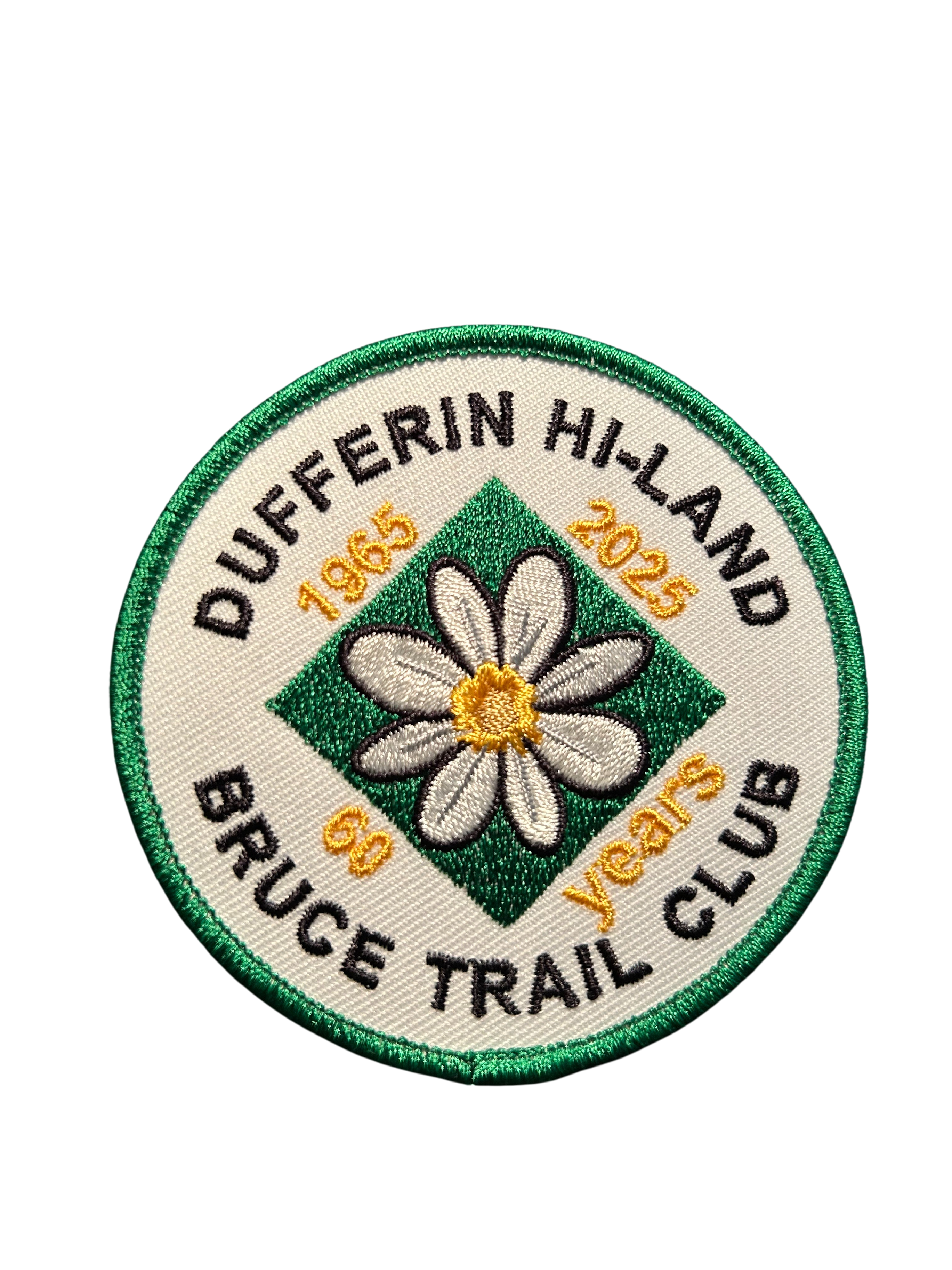
This is the 4th in a series of 6 loop hikes; each hike is between 9-12km in length. If you hike all 6 of the hikes in this series, or otherwise hike 60 km in Dufferin during 2025, you qualify for the 60th Anniversary badge.Bring a drink and a snack, ICERS for your feet because the trail can be slippery, muddy and icy at this time of the year. Dress for the weather!Follow Prince of Wales Side Trail north to Primrose Loop Side Trail. Take the left fork and follow Primrose Loop to intersection with Bruce Main Trail at km 16.7. We will take the Main Trail north, including a side trip up the Murphy’s Pinnacle Side Trail, then east to Boyne Valley Side Trail (km 18.8). Follow Boyne Valley east to 1st Line, south then west to Bruce Main Trail at km 15.2. Follow Main Trail north to km 16.7, then Primrose Loop, taking left fork where the loop begins, returning to parking via Prince of Wales Side Trail.
Urban Walk: Coote's Paradise/Hamilton Waterfront Trail
https://hikesstaging.brucetrail.org/event/urban-walk-cootes-paradise-hamilton-waterfront-trail/Sorry, the registration cut-off time for this hike has been reached.Not a member? Click here to join today!Hosting Club: Toronto
Category: GO Train Hike
Location (Google Maps):Hike will start from McMaster University GO Bus Terminal. We will meet at Toronto’s Union Station 8:13 AM to take the 8:28 AM Train to Aldershot where we will transfer to the GO Bus for a short ride to McMaster University. On the return we take the GO Train to Toronto from West Harbour GO Train Station. If you have a smart phone then the return fare is just $10 with GO’s Weekend Pass. Seniors fare return from Union is $11.44. Hikers without a smartphone may purchase pass from Hike Leader at Union Station. If meeting us at McMaster you will have to make your way back to start by local transit or Uber and parking fee would apply.
Hike Leader(s): Tom Swales Click here to contact Hike Leader(s)
Pace: Moderate (3-4 km/hr)
Terrain: Level 2 (Intermediate – some hills and uneven surfaces, rocks and roots underfoot), Variable
Distance: 12-13 kmDescription
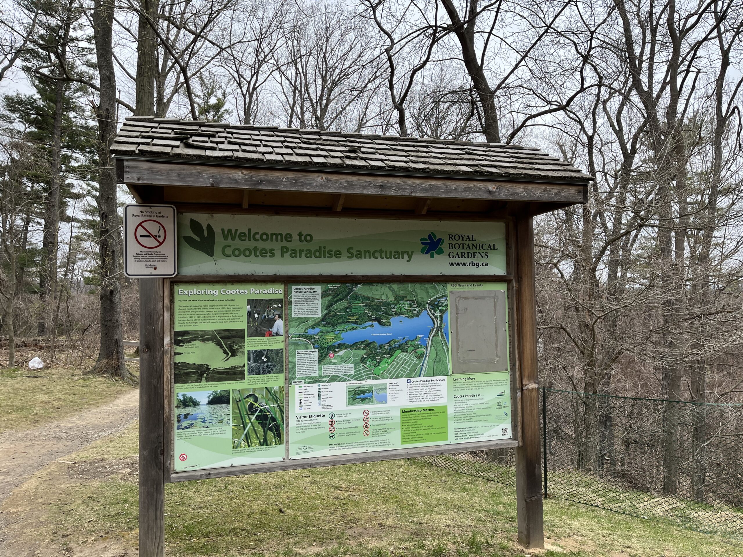
This will be a one way hike through the trails of the RBG’s (Royal Botanical Gardens) South Shore Cootes Paradise Trails to Princess Point and then continuing on Hamilton’s Waterfront Trail along Burlington Bay to Bayfront Park which is a 7 minute walk to the West Harbour GO Station. Cootes Paradise is the largest and most diverse of RBG’s sanctuaries. Nestled between the Niagara Escarpment and Lake Ontario the picturesque area is significant as a migratory bird flyover zone and home to a wide variety of flora and fauna. There will be a few hills including one steeper one. Due to the transportation connection this hike will be limited to 17 hikers only.Fern Crevice -Black Ash Trail
https://hikesstaging.brucetrail.org/event/fern-crevice-black-ash-trail/Sorry, the registration cut-off time for this hike has been reached.Not a member? Click here to join today!Hosting Club: Blue Mountains
Category: Cancelled
Location (Google Maps): Hike meets in the parking lot behind Tim Hortons on First St. in Collingwood.
NOTE: AFTERNOON START TIMEHike Leader(s): Mary Jane McIntyre Click here to contact Hike Leader(s)
Pace: Medium – 3 to 4 km/hr
Terrain: Moderate – Some hills and/or some poor footing
Distance: 6 kmsDescription
NOTE: AFTERNOON START TIMEWe will drive to the Black Ash Creek Side Trail parking lot on the 2nd Line
(Parking fee: $10). This will be a hike to recognize and celebrate our Indigenous
peoples. We will start on this new side trail and then pick up the white blazed trail in the
Petun Conservation Area. We will continue along until we cross the road at the Russ
McConnell Side Trail. Following the side trail we reconnect with the white blazed trail
taking us around the escarpment to take in all the views. Perhaps, we will continue on to the
John Haigh Side Trail.There will be some hiking on 2nd line to get back to the cars.
Bring a snack and water.
CANCELLED: Youth Hiking Program - Discovery Hike - GSCA to Inglis
https://hikesstaging.brucetrail.org/event/youth-hiking-program-discovery-hike-gsca-to-inglis/Sorry, the registration cut-off time for this hike has been reached.Not a member? Click here to join today!Hosting Club: Sydenham
Category: Family Hike
Location (Google Maps):Meet in the parking lot behind the Grey-Sauble Conservation Authority head office (beside the Arboretum).
237897 Inglis Falls Road, Owen SoundCarpooling may be available upon request
Hike Leader(s): Jeannine Kralt Click here to contact Hike Leader(s)
Pace: Leisurely: 3 km/h or less
Terrain: Moderate: Some hills and/or poor footing
Distance: 4kmDescription
Join us on this Discovery Hike from GSCA to Inglis Falls and back – we’ll take our time, and see what we can find. We’ll cross the Sydenham River, hike through forests, climb the Escarpment, check out geological potholes and take a peek at Inglis Falls, returning via mostly the same route. Free ‘Boots on the Trail’ badges are available to youth 18 and under. This is also a great route to choose for the By the Seasons badge.As we’ll be taking our time, this hike is suitable for families, new hikers, and anyone wanting a more leisurely hike. All ages are welcome. We’ll likely take a couple of hours (possibly more), depending on the group and conditions – dress in layers, bring a snack, and wear good footwear. Given that April conditions can be variable, an email re: trail conditions to expect will be sent out prior to our hike together. The trail may be slippery-icy or mucky in portions.
If you are unable to register, please contact the hike leader via the link above. Carpooling may be available upon request.

8:00 pm Moonlight Night Hike in Niagara-on-the-Lake
https://hikesstaging.brucetrail.org/event/800-pm-moonlight-night-hike-in-niagara-on-the-lake-8/Sorry, the registration cut-off time for this hike has been reached.Not a member? Click here to join today!Hosting Club: Niagara
Category: Night
Location (Google Maps):Veteran’s Memorial Park, park just outside the park on King St.
Hike Leader(s): Robin Garrett Click here to contact Hike Leader(s)
Pace: Medium
Terrain: Easy
Distance: 6-7 kmDescription
Moonlight Night Hike – Take in the magic of the rising moon over Lake Ontario and the Niagara River. This hike includes a stop to connect with your senses – sights, sounds, smells and the rhythm of your breath. Counts towards your night hike badge (5 night hikes).