
Hike Schedule
Join us for a hike! Registration required.
All hikes available to BTC members. Some hikes are open to non-members.
See Refund Policy for Paid Hikes >
TIP: The calendar view displays up to 7 hikes on a day, but often there are more. Click “View more events” to see them all.
Categories
- 02February 2, 2025
Car Hike: Kortright Conservation Area
https://hikesstaging.brucetrail.org/event/car-hike-kortright-conservation-area/Sorry, the registration cut-off time for this hike has been reached.Not a member? Click here to join today!Hosting Club: Toronto
Category: Car Hike
Location (Google Maps): Kortright Conservation AreaHike Leader(s): Frank Ye & Jen Zhang Click here to contact Hike Leader(s)
Pace: Moderate (3-4 km/hr)
Terrain: Hilly, Level 2 (Intermediate – some hills and uneven surfaces, rocks and roots underfoot), Variable
Distance: 12 KMDescription
Icers are mandatory.Meet at Pierre Berton Resource Library 4921 Rutherford Road Vaughan east of Islington Ave
We will hike Kortright Conservation Area. The hike is about 12 KM. Please arrive 15 minutes early.
Nassagaweya Canyon, from Crawford Lake (reservations required)
https://hikesstaging.brucetrail.org/event/nassagaweya-canyon-from-crawford-lake-reservations-required-2/Sorry, the registration cut-off time for this hike has been reached.Not a member? Click here to join today!Hosting Club: Iroquoia
Category: General Hike
Location (Google Maps): Meet in the first parking lot at Crawford Lake. You will need to reserve your time at conservationhalton.caHike Leader(s): Karen Bergmann Click here to contact Hike Leader(s)
Pace: Medium – 3 to 4 km/hr
Terrain: Moderate – Some hills and/or some poor footing
Distance: 9 kmsDescription
We will hike through the park and down into the canyon and back up into the park for a large loop. There are some rocks along the way and a couple of steep hills (going down into the canyon and then back up). Bring icers, just in case. Hike is dependent on weather conditions.
Mono Winterfest Scenic Hike
https://hikesstaging.brucetrail.org/event/mono-winterfest-scenic-hike/Sorry, the registration cut-off time for this hike has been reached.Not a member? Click here to join today!Hosting Club: Caledon Hills, Dufferin Hi-Land
Category: General
Location (Google Maps): Location: Meet at the Mono Community Centre parking lot, 200 m south of Mono Centre, Dufferin County Road 8Directions: Drive north on Hwy 10 past Orangeville. Continue to Mono Centre Road/ Dufferin Road 8 at Camilla. Turn right and follow this road into Mono Centre. The Community Centre parking lot is on your right, about 200 meters before you reach the crossroads.
Hike Leader(s): Richard Smythe Click here to contact Hike Leader(s)
Pace: Leisurely – 3 km/hour or less, Medium – 3 to 4 km/hour
Terrain: Moderate – some hills and/or some poor footing
Distance: 3 km or 7 to 8 kmDescription
Warm up for Mono Winterfest with a morning hike by the ponds of the Whitetail Refuge Nature Reserve and Mono Cliffs. We aim to have you back at the Mono Community Centre for the start of Winterfest at noon. There will be an opportunity to leave the hike after about 3 km as we pass by Mono Centre Park. Please dress for the weather and have your icers ready.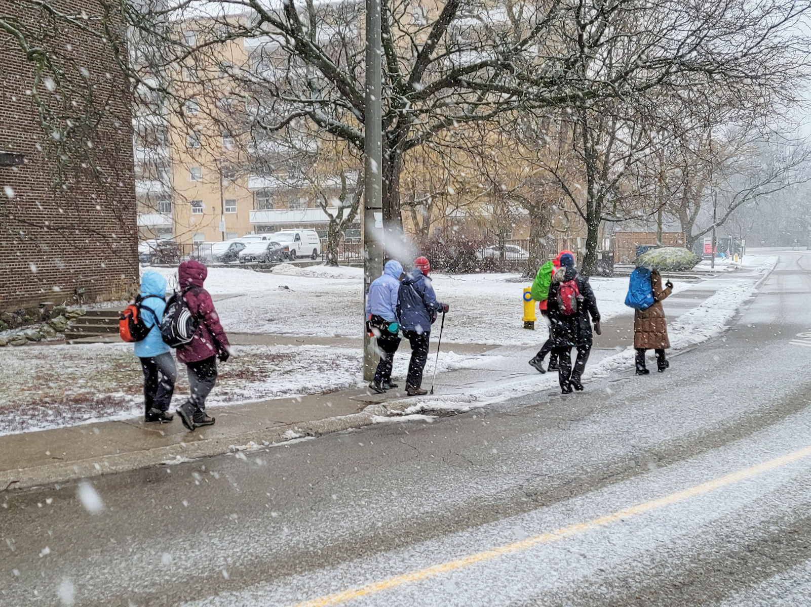
Urban Walk: Waterfront Trail 3/11 – Long Branch
https://hikesstaging.brucetrail.org/event/urban-walk-waterfront-trail-3-11-long-branch/Sorry, the registration cut-off time for this hike has been reached.Not a member? Click here to join today!Hosting Club: Toronto
Category: Urban Walk
Location (Google Maps): CanadaHike Leader(s): Brian Rideout Click here to contact Hike Leader(s)
Pace: Moderate (3-4 km/hr)
Terrain: Flat
Distance: 9 kmDescription
Please join me at Kipling Station by 9:15 am. We will take the 123 bus departing 9:30 am, arriving 9:53 am. If you want to meet us at the Long Branch loop, be there by 9:53 am. We start hiking at 10:00 am.We will hike to the lake and then east to Parklawn. There we can catch a bus to Old Mill Station or take the Lakeshore bus / streetcar. The estimated distance is 9 km. Here is an online map of our route – Long Branch to Parklawn
Bring a snack, at least 2 liters of water, and icers. Dress for cold weather.
Hiking around Port Weller West
https://hikesstaging.brucetrail.org/event/hiking-around-port-weller-west/Sorry, the registration cut-off time for this hike has been reached.Not a member? Click here to join today!Hosting Club: Niagara
Category: Hike
Location (Google Maps): Charles Ansell Park, St. CatharinesHike Leader(s): Sheila Massey Click here to contact Hike Leader(s)
Pace: Medium
Terrain: Easy
Distance: 6kDescription
Following paths along the Welland Canal, through Malcolmson Eco Park to Sunset Beach and Walker Creek trails in Port Weller West. - 03February 3, 2025
Jones Falls Loop followed by Pot Luck Lunch
https://hikesstaging.brucetrail.org/event/jones-falls-loop-followed-by-pot-luck-lunch-2/Sorry, the registration cut-off time for this hike has been reached.Not a member? Click here to join today!Hike open to BTC Members only.
Hosting Club: Sydenham
Category: Snowshoe Hike
Location (Google Maps):Memorial Forest. At the end of Young’s Drive
Hike Leader(s): Sheri Hatcher Click here to contact Hike Leader(s)
Pace: Medium: 3 to 4 km/h
Terrain: Moderate: Some hills and/or poor footing
Distance: Approximately 6 kmDescription
Weather permitting, we will walk along the Pottawatomi River, crossover a field and then join the Blue Side Trail. We will then ascend through a crevasse to the Main Trail along the top of the escarpment. We will hike to Jones Falls and explore the area. We will then take the Merle Gunby Side Trail loop and join up with the Main Trail again. This hike ends with a steep descent back to the parking lot. We will gather for a pot luck lunch following the hike. I will provide the hot soup and drinks. We will be leaving precisely at 9:30. Please contact me through the built in Contact the Hike Leader option if you have any questions or unable to register.
Humber Valley Heritage Trail
https://hikesstaging.brucetrail.org/event/humber-valley-heritage-trail-2/Sorry, the registration cut-off time for this hike has been reached.Not a member? Click here to join today!Hike open to BTC Members only.
Hosting Club: Caledon Hills
Category: General
Location (Google Maps): Meet in the parking lot at Dick’s Dam Park, 250 Glasgow Road, Bolton. It is best to aim for arriving around 9:50, so we can start hiking as close to 10 am as possible. Thanks!Hike Leader(s): Elizabeth Ganong Click here to contact Hike Leader(s)
Pace: Medium – 3 to 4 km/hour
Terrain: Moderate – some hills and/or some poor footing
Distance: Approximately 6 kmDescription
Enjoy a there and back hike along the Humber River! We will hike for about an hour as we follow the trail upriver from Dick’s Dam Park. We’ll stop for a short standing break and then return to the parking lot following the same trail downriver.Be prepared for winter conditions by bringing warm gear, poles, and crampons/icers. You are encouraged to bring water and a snack, if desired. No dogs please.
Registrants can expect a reminder/update message one or two days before the hike. For this hike, registrants can bring a friend who is not yet a BTC member. Please send the hike leader a message indicating that a friend will be joining you. A paper registration sheet will be available for your friend to sign in, so please factor that into your arrival time.
Following the hike, we’ll stop in at a local eatery. All are welcome.
- 04February 4, 2025
Urban Walk: Valley View Park Thornhill
https://hikesstaging.brucetrail.org/event/urban-walk-valley-view-park-thornhill-52/Sorry, the registration cut-off time for this hike has been reached.Not a member? Click here to join today!Hosting Club: Toronto
Location (Google Maps): Parking lot is inside Sycamore Drive East of Bayview , north of Bayview Reservoir Park Playground
Hike Leader(s): Mohammad Aghamiri Click here to contact Hike Leader(s)
Pace: Moderate (3-4 km/hr)
Terrain: Level 2 (Intermediate – some hills and uneven surfaces, rocks and roots underfoot)
Distance: 7-8 kmDescription
We will explore Valleyview and Maple View parks, and walk along German Mill Creak,In return we stop in Huntington park and have snack under beautiful shed ,Even it is considered Urban walk, but it is urban hike as we have some up and down hills and tree roots, please bring your Ice cleats and hiking poles
9:00 Long Hike Wiley Road Short Hills
https://hikesstaging.brucetrail.org/event/900-long-hike-wiley-road-short-hills-44/Sorry, the registration cut-off time for this hike has been reached.Not a member? Click here to join today!Hosting Club: Niagara
Category: Loop
Location (Google Maps):Short Hills Wiley Road Entrance
Hike Leader(s): Alan Laver Click here to contact Hike Leader(s)
Pace: Medium
Terrain: Moderate
Distance: 10kmDescription
Explore Short Hills and the majestic side trails of Scarlett Tanager, Hemlock. Swayze Falls and Terrace. Register for each hikeBring Poles, Icers, snack, and dress for the weather
9:15 Short hike, Pelham Road, Short Hills
https://hikesstaging.brucetrail.org/event/915-short-hike-pelham-road-short-hills-9/Sorry, the registration cut-off time for this hike has been reached.Not a member? Click here to join today!Hosting Club: Niagara
Location (Google Maps): Short a hills Provincial Park, Pelham Road entrance
Hike Leader(s): janet davey Click here to contact Hike Leader(s)
Pace: Medium
Terrain: Moderate
Distance: 6 kmsDescription
Hike the main and side trails in Short Hills Provincial Park. Bring hiking boots and water. Keep a pair of icers in your car in case of icy conditions.Boston Mills / Mississauga Rd.
https://hikesstaging.brucetrail.org/event/boston-mills-mississauga-rd-2/Sorry, the registration cut-off time for this hike has been reached.Not a member? Click here to join today!Hosting Club: Caledon Hills
Category: Tuesday Hikers
Location (Google Maps): Parking at Boston Mills Rd., just west of its intersection with Mississauga Rd.
Driving directions: From Highway 410 north, continue on Highway 10, left on King Street, right on Mississauga Rd., left on Boston Mills Rd. to the parking at dead end.Hike Leader(s): Mohammad Shafiq Click here to contact Hike Leader(s)
Pace: Medium – 3 to 4 km/hour
Terrain: Moderate – some hills and/or some poor footing
Distance: 12 kmDescription
Main Bruce Trail and Rockside Trail, there and back; will hike about 6 km reaching into Terra Cotta and return after snack break.
Bring a warm drink, snack; poles are recommended, icers are necessary.
After hike there is optional stop at nearby coffee place, to be decided.
In winter always check your email before driving, hike may be postponed in adverse weather.Hockley Valley Nature Reserve
https://hikesstaging.brucetrail.org/event/hockley-valley-nature-reserve/Sorry, the registration cut-off time for this hike has been reached.Not a member? Click here to join today!Hosting Club: Dufferin Hi-Land
Category: Tuesday Hike
Location (Google Maps):(Google Maps)Caledon Hills Section, Map 18. Meet at the parking area on 3rd Line EHS about 2 km north of Hockley Rd. for a 9:30 am start.
Hike Leader(s): Les Babbage, Inge Eckerich, Julie Daley, Tony Evangelista Click here to contact Hike Leader(s)
Pace: Leisurely, Medium
Terrain: Slippery and Steep Sections, Strenuous
Distance: 4 kmDescription
We will hike a loop consisting of Isabel East Side Trail, Main Trail and Glen Cross Side Trail. Snowshoes or icers will be required, depending on conditions. If unsure, contact the hike leaders. Bring water and snacks. Hiking poles are recommended. - 05February 5, 2025

8:30 Niagara Winter End to End #4 Roland Road to Decew House
https://hikesstaging.brucetrail.org/event/830-niagara-winter-end-to-end-4-roland-road-to-decew-house-2/Sorry, the registration cut-off time for this hike has been reached.Not a member? Click here to join today!Hosting Club: Niagara
Category: Car Pool
Location (Google Maps): Meet at Decew House Heritage Park and Car Pool to Short Hills Parking Lot at Roland Road.Hike Leader(s): Sam Rutherford Click here to contact Hike Leader(s)
Pace: Medium
Terrain: Moderate
Distance: 12.4 kmsDescription
We will be car pooling, Bring Icers and poles. No dogs. To earn your Niagara Winter End to End badge, it must be completed between December 21, 2024 to March 21, 2025.
Because of the potential for bad winter trail conditions we have broken this e2e into 6 hikes rather than 5Woodford Escarpment
https://hikesstaging.brucetrail.org/event/woodford-escarpment/Sorry, the registration cut-off time for this hike has been reached.Not a member? Click here to join today!Hosting Club: Blue Mountains
Category: Organized Hike
Location (Google Maps): We meet in the parking lot behind Tim Horton’s on First St.in Collingwood. Then we drive to Woodford and park behind the Community Centre north of Hwy. #26.Hike Leader(s): Frank Huggins Click here to contact Hike Leader(s)
Pace: Medium – 3 to 4 km/hr
Terrain: Moderate – Some hills and/or some poor footing
Distance: 6kmDescription
We will hike south on the white blazed trail about 3kms. We will return via the Crevice Springs side trail. Bring a snack and water.Hike changed to Cityview Park
https://hikesstaging.brucetrail.org/event/mount-nemo-loop-reservation-required-3/Sorry, the registration cut-off time for this hike has been reached.Not a member? Click here to join today!Hosting Club: Iroquoia
Category: General Hike
Location (Google Maps): Parking lot at second entrance to Cityview ParkHike Leader(s): Karen Bergmann Click here to contact Hike Leader(s)
Pace: Medium – 3 to 4 km/hr
Terrain: Moderate – Some hills and/or some poor footing
Distance: 6-8 kmsDescription
We will explore the trails to the north of the park and down into Kerncliff Park.Bring icers for your boots. Hike is dependent on weather conditions.
Roaming in the Snow
https://hikesstaging.brucetrail.org/event/roaming-in-the-snow/Sorry, the registration cut-off time for this hike has been reached.Not a member? Click here to join today!Hosting Club: Iroquoia
Category: Good Companions
Location (Google Maps): Princess Point RBGHike Leader(s): Anne Armstrong Click here to contact Hike Leader(s)
Pace: Leisurely – 3km/hr or less
Terrain: Moderate – Some hills and/or some poor footing
Distance: Approx. 9 km.Description
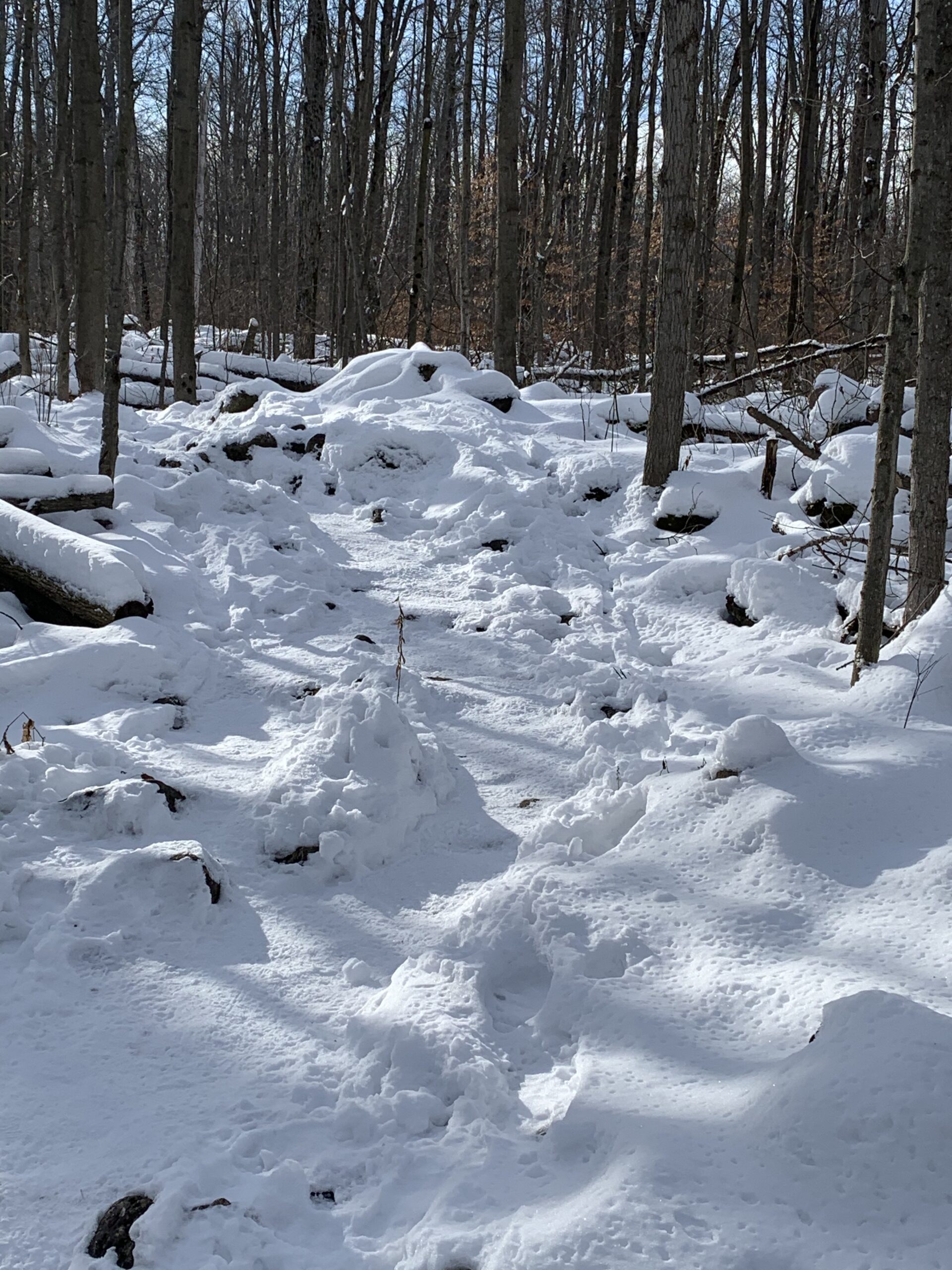
Come enjoy Princess Point in the snow. We will hike the trails of this beautiful RBG property to include Princess Point, Ginger Valley, Sassafras Trail, Caleb’s Walk and Churchill Park. Meet in the parking lot of Princess Point at 9:45 am. for a 10:00 am. start. Bring water, a snack and poles if using. Icers may be necessary. There is a fee for parking or an RBG membership.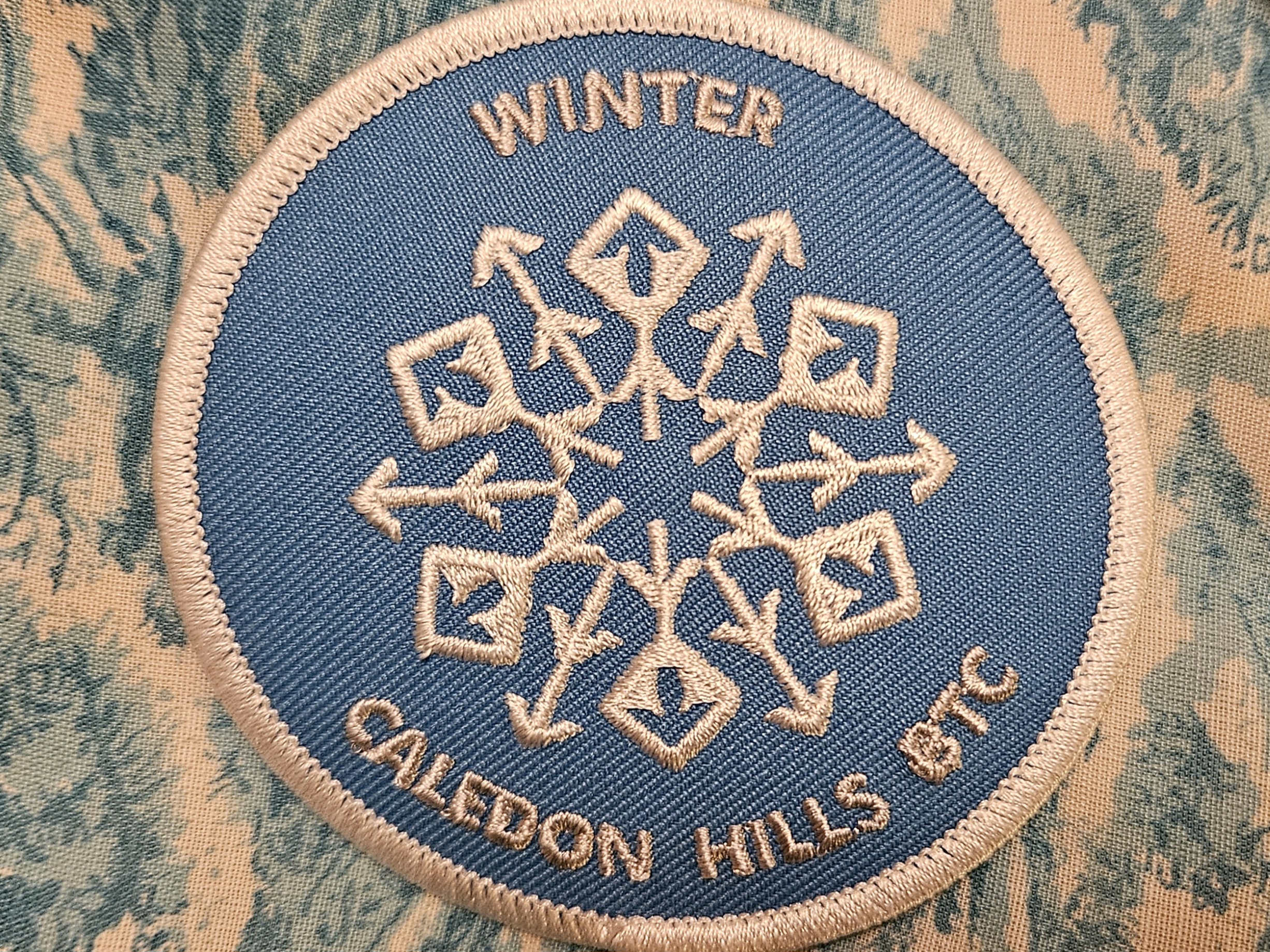
Winter Badge Wednesdays: Riverside Woods Nature Reserve
https://hikesstaging.brucetrail.org/event/winter-badge-wednesdays-riverside-woods-nature-reserve/Sorry, the registration cut-off time for this hike has been reached.Not a member? Click here to join today!Hike open to BTC Members only.
Hosting Club: Caledon Hills
Category: General
Location (Google Maps): Meet at 10 am at the BTC parking lot, 713377 1st Line EHS, Mono. Go north on 1st Line from Side Road 5. Access is closed going south on 1st Line from Hockley Road during the winter. It is best to aim for arriving around 9:45, so we can start hiking as close to 10 am as possible. Thanks!Hike Leader(s): Jennie Greenfield; Elizabeth Ganong Click here to contact Hike Leader(s)
Pace: Medium – 3 to 4 km/hour
Terrain: Easy – mostly flat and usually good footing, Moderate – some hills and/or some poor footing
Distance: Between 4 and 5 kmDescription
Looking to get outside and enjoy nature in another season? You may wish to join in on one Wednesday hike in this winter series or all five! Complete all five as part of the series or do a combination of hikes within the series and your own winter hikes, and you will be eligible to receive the Caledon Winter Hiking Badge (further details below and on the CHBTC website under Club Badges).This Wednesday’s hike explores Riverside Woods on side trails and gentler nature reserve trails on a 4 or 5 km route. Be prepared for winter conditions by bringing warm gear, poles, and icers. You are encouraged to bring water and a snack. No dogs please.
The hike leader for this hike is Jennie Greenfield. Registrants can expect a reminder/update message from Jennie one or two days before the hike.
If desired, this hike may be used towards the Caledon Winter Hiking Badge (5 winter hikes in the Caledon section that are 1 ½ hours or longer in length). Please keep a log of your hikes and follow the directions on the CHBTC website under Club Badges to receive your badge.
Winter Wednesday Walkers - McCluskey's Rock
https://hikesstaging.brucetrail.org/event/winter-wednesday-walkers-mccluskeys-rock-2/Sorry, the registration cut-off time for this hike has been reached.Not a member? Click here to join today!Hosting Club: Beaver Valley
Location (Google Maps): Meet on the shoulder of Sideroad 7B on the curve where the trail enters the forest, km 43.5, Map 25, Edition 31. Do not attempt to drive up 7B from Grey Road 13, there is no winter maintenance. Instead access 7B from south of Kimberley – Grey Road 13 to Artemesia-Euphrasia Townline to 3rd Line A, then 7B.
Hike Leader(s): Glenda Collings Click here to contact the hike leader.
Pace: Medium
Length of Hike: approx. 4 km
Description
We will hike north along the top of the escarpment on the main trail to McCluskey’s Rock and then back, taking in the Ken Young Side Trail. Views to be had. On winter hikes we may encounter bare ground, light snow, deep snow, or ice. Please bring snowshoes and icers to our Winter Wednesday Walkers outings. Wear appropriate clothing for the weather plus water and a snack.COVID-19 Precautions Before, During and After your Hike
- Each hiker joining a Bruce Trail Club organized hike must perform a self-screening check before hiking.
Find Ontario’s self-assessment tool here: https://covid-19.ontario.ca/self-assessment/ - If you are experiencing COVID-19 symptoms, stay home.
Other Guidelines
- Arrive 15 minutes before the start of the hike.
- Wear sturdy footwear and appropriate attire for the weather and the terrain.
Hiking poles are a good idea in any season, especially if the terrain is rocky or slippery. In winter, snowshoes or icers/crampons are needed when conditions dictate.
Wearing appropriate clothing and footwear prevents injuries and shows consideration for a safe and positive group hiking experience. - Always carry I.D. and your health card.
- Bring sufficient water and snacks (or lunch if indicated). A minimum of 1L of water is recommended on all hikes, and 3L is recommended for long, challenging hikes in the heat of the summer.
- Bring sunscreen and insect repellent (for spring and summer hikes).
- Bring your own first aid kit.
- Please leave dogs at home.
Evening Hike in Owen Sound followed by an Opportunity for Refreshments
https://hikesstaging.brucetrail.org/event/evening-hike-in-owen-sound-followed-by-an-opportunity-for-refreshments-12/Sorry, the registration cut-off time for this hike has been reached.Not a member? Click here to join today!Hosting Club: Sydenham
Category: An evening walk.
Location (Google Maps): Meet in the municipal parking lot by the river on the West side of 1st Ave East between 7th St East and 8th St East in Owen SoundHike Leader(s): Harriet Nixon Click here to contact Hike Leader(s)
Pace: Brisk: 4 to 5 km/h
Terrain: Easy: Mostly flat and good footing., There might be icy and slippery sections.
Distance: Approx 5 kmDescription
Join us for a brisk winter evening hike exploring Owen Sound neighbourhoods and trails. Please bring icers, in case there are icy conditions. There is no need to show up 15 minutes early for this hike, but we will leave promptly at 7:00 pm. Following the hike there is an opportunity to socialize over refreshments. - Each hiker joining a Bruce Trail Club organized hike must perform a self-screening check before hiking.