
Hike Schedule
Join us for a hike! Registration required.
All hikes available to BTC members. Some hikes are open to non-members.
See Refund Policy for Paid Hikes >
TIP: The calendar view displays up to 7 hikes on a day, but often there are more. Click “View more events” to see them all.
Categories
- 05January 5, 2025
Fundraiser/Stained Glass Badge End-to-End Series
https://hikesstaging.brucetrail.org/event/fundraiser-stained-glass-badge-end-to-end-series/Sorry, the registration cut-off time for this hike has been reached.Not a member? Click here to join today!This is a Multi-Day Hike
You are signing up for the following dates and times:
2025-01-05 at 08:30
2025-01-12 at 08:30
2025-01-19 at 08:30
2025-01-26 at 08:30
2025-02-02 at 08:30Hosting Club: Caledon Hills
Category: Cheltenham Badlands Stained Glass E2E Badge
Location (Google Maps): Meet at km 15.9, roadside parking along the southwest shoulder of Willoughby Road near Escarpment Sideroad intersection, 43.831244, -79.980588. (Map 15, Edition 31)Directions: From Hwy #10 head west on Escarpment Sideroad for approximately 1.5 km.
Hike Leader(s): Sandy Green and Lana Hubbard Click here to contact Hike Leader(s)
Pace: Medium – 3 to 4 km/hour
Terrain: Moderate – some hills and/or some poor footing
Distance: 16 kilometresDescription
Earn the Cheltenham Badlands Stained Glass/Fundraiser badge, which is part of the collectable Bruce Trail Clubs stained glass-themed fundraiser set. This five-hike end-to-end series takes place on Sundays in January and February. Hike distances range from 13 km to 16 km. Bring snacks and your choice of hydration. Icers/crampons are required. Participants take turns shuttling. Full hike details will be sent through the auto-response message.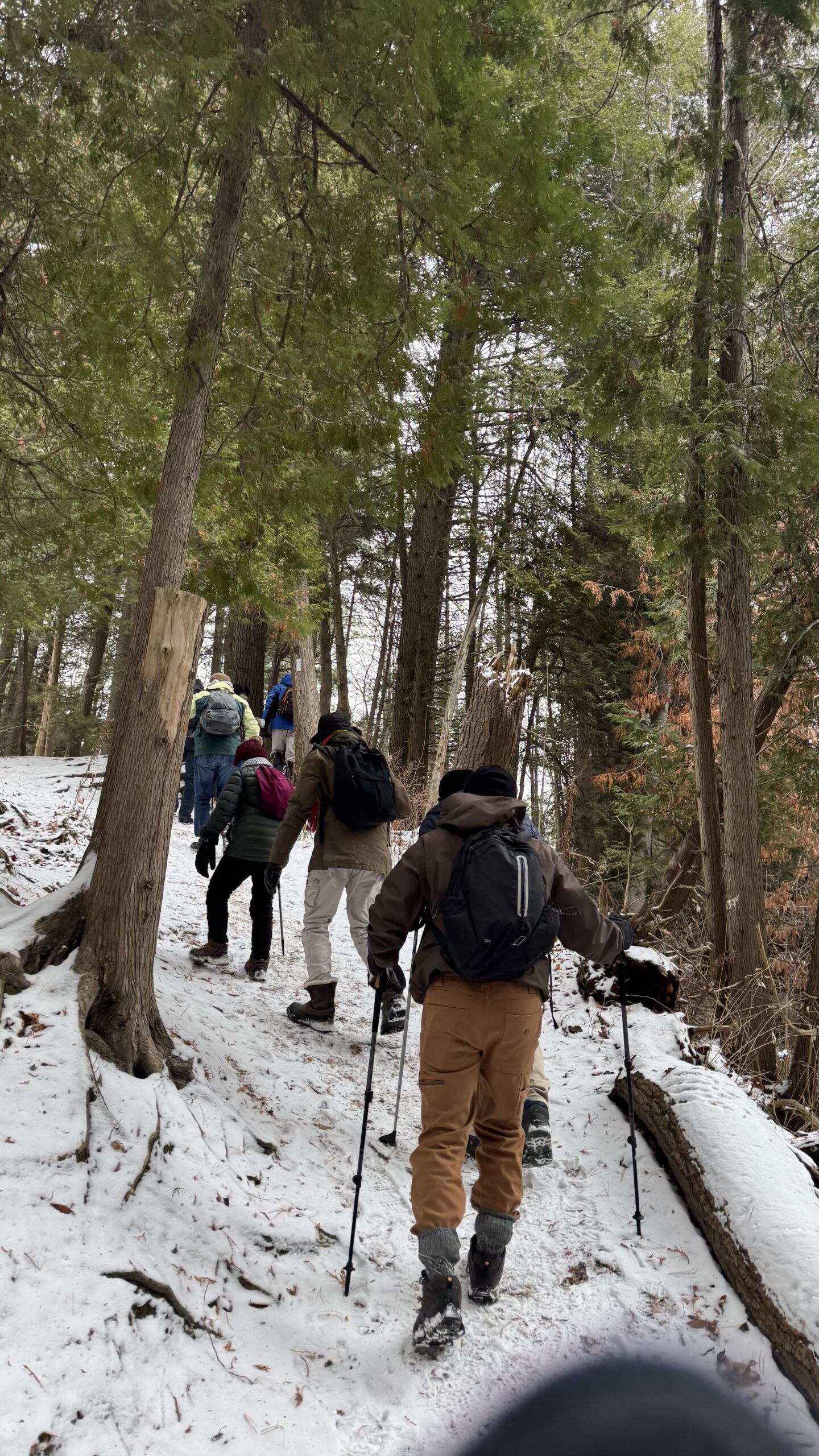
Car Hike: Exploring Uxbridge Trails (Wilder Forest, Walker Woods, and Glen Major Forest)
https://hikesstaging.brucetrail.org/event/car-hike-exploring-uxbridge-trails-wilder-forest-walker-woods-and-glen-major-forest-3/Sorry, the registration cut-off time for this hike has been reached.Not a member? Click here to join today!Hosting Club: Toronto, Peninsula
Location (Google Maps):
2499 Brock Rd, Uxbridge, ON L9P 1R4. We will meet at the East Duffins Headwaters parking lot at the WILDER FOREST trail head. As soon as you got off the Brock Road, passing the horse back riding facility, there is a free designated parking lot 70 meters down the lane to your right. It includes a sign board for East Duffins Headwaters with a map of the trails. Please do not park on the lane or in the horse back riding property.
Hike Leader(s): Amir Alemohammad Click here to contact Hike Leader(s)
Pace: Moderate (3-4 km/hr)
Terrain: Hilly, Level 2 (Intermediate – some hills and uneven surfaces, rocks and roots underfoot), Variable
Distance: Approx.12-14 KmDescription
Join us for a delightful winter hike in Uxbridge, as we explore Wilder Forest, Walker Woods, and Glen Major Forest on a scenic loop starting from Brock Road. We’ll pass Concession Road 6, heading west and back, while also venturing onto several side trails for even more stunning views.What to Expect:
•Beautiful scenic views and lookouts facing south
•A mix of hilly and flat terrain
•Frequent 2-minute breaks for hydration and photos, with a 10-20 minute lunch/snack stop
•Stay on designated trails at all times
What to Bring and Wear:
•Winter boots and icers (mandatory)
•Hiking poles (recommended)
•At least 2 liters of water
•Your favorite snacks and lunch (pack your own refreshments for an outdoor meal)
•Dress in layers for variable weather; cold and windy conditions are likely
Important Details:
•Stay on the designated trails
•Be prepared for the elements and enjoy the adventure!
Looking forward to seeing you on the trail!
Don’t forget your camera and a smile as we explore the beauty of the Uxbridge trails!
Car Hike: Iroquoia Winter E2E 6/6
https://hikesstaging.brucetrail.org/event/car-hike-iroquoia-winter-e2e-6-6-2/Sorry, the registration cut-off time for this hike has been reached.Not a member? Click here to join today!Hike open to BTC Members only.
Hosting Club: Toronto
Category: Car Hike
Location (Google Maps):Twiss rd at #8. N 43.429065,W 79.927324
Hike Leader(s): Smadar Junkin Click here to contact Hike Leader(s)
Pace: Brisk (4-5 km/hr)
Terrain: Level 2 (Intermediate – some hills and uneven surfaces, rocks and roots underfoot)
Distance: 17 kmDescription
Last hike, badge day! We will car shuttle to Glen Eden, we will walk to highway 401 bridge and back ( about 0.5 km extra). Glen Eden is a paid parking. I’ll have details closer to the hike day. If anyone has a parking pass please let me know. Everyone is expected to share in the paring cost. Hike is about 7 km shorter than indicated on the map because of winter closure for hiking in the ski area. Bring icers, snowshoes and 2litres of water. Date may change due to extreme winter conditions.10:00 Decew to Morningstar Mill
https://hikesstaging.brucetrail.org/event/1000-decew-to-morningstar-mill-4/Sorry, the registration cut-off time for this hike has been reached.Not a member? Click here to join today!Hosting Club: Niagara
Category: In and Out
Location (Google Maps): Decew House St CatharinesHike Leader(s): Sylvia Wheeler Click here to contact Hike Leader(s)
Terrain: Moderate
Distance: 5kDescription
Hike the main trail from Decew House, along the edge of Lake Moodie and on to Morningstar Mill - 06January 6, 2025
Hike 1 of 5 - Toronto Winter E2E
https://hikesstaging.brucetrail.org/event/hike-1-of-5-toronto-winter-e2e/Sorry, the registration cut-off time for this hike has been reached.Not a member? Click here to join today!Hike open to BTC Members only.
Hosting Club: Caledon Hills
Category: End-to-End
Location (Google Maps): Meet at 9:15 am at BTC Pear Tree Parking Lot, on 15 Sideroad, 200 m southwest of Halton Rd. 25Shuttle to start at Hilton Falls (parking fee at Hilton Falls)
Hike Leader(s): Jennie Greenfield Click here to contact Hike Leader(s)
Pace: Medium – 3 to 4 km/hour
Terrain: Moderate – some hills and/or some poor footing, Strenuous – hilly with steep climbs and some poor footing
Distance: 11.9 kmDescription
This is hike 1 of 5 of a Toronto E2E in no particular order or direction.Toronto Boundary sign north past Hilton Falls Conservation Area climbing the escarpment. Following the escarpment the trail has several look out points, crosses the Dufferin Quarry Bridge and continues on through escarpment forest. Rough footing.
0 to 11.4 + .5 of road from Hilton Falls = 11.9 km total
- 07January 7, 2025
9:00 Long Hike Wiley Road Short Hills
https://hikesstaging.brucetrail.org/event/900-long-hike-wiley-road-short-hills-39/Sorry, the registration cut-off time for this hike has been reached.Not a member? Click here to join today!Hosting Club: Niagara
Location (Google Maps):
Short Hills Wiley Road Entrance
Pace: Medium
Terrain: Moderate
: 10kmDescription
Explore Short Hills and the majestic side trails of Scarlett Tanager, Hemlock. Swayze Falls and Terrace. Register for each hikeBring Poles, Icers, snack, and dress for the weather
9:15 Short hike, Pelham Road, Short Hills
https://hikesstaging.brucetrail.org/event/915-short-hike-pelham-road-short-hills-7/Sorry, the registration cut-off time for this hike has been reached.Not a member? Click here to join today!Hosting Club: Niagara
Category: Loop
Location (Google Maps): Short a hills Provincial Park, Pelham Road entranceHike Leader(s): janet davey Click here to contact Hike Leader(s)
Pace: Medium
Terrain: Moderate
Distance: 6 kmsDescription
Hike the main and side trails in Short Hills Provincial Park. Bring hiking boots and water. Keep a pair of icers in your car in case of icy conditions.Fisher's Pond and Highview Survey
https://hikesstaging.brucetrail.org/event/fishers-pond-and-highview-survey/Sorry, the registration cut-off time for this hike has been reached.Not a member? Click here to join today!Hosting Club: Caledon Hills
Category: Tuesday Hikers
Location (Google Maps): Meet where the Trail crosses Guelph Line — 1.5 km north of Dundas St. and 300 meters south of No. 1 Sideroad. Park on the west side of Guelph LIne — look for the stile. Parking is limited so car pooling is a good idea. BTC Map 9.Hike Leader(s): Peter Leeney Click here to contact Hike Leader(s)
Pace: Medium – 3 to 4 km/hour
Terrain: Moderate – some hills and/or some poor footing
Distance: 9 kmDescription
From parking on Guelph Line we will hike by Fisher’s Pond and through Highview Survey as far as Dundas St. Return by the same route. Hike is 9 km but if the weather is good we can add an extra 2 km on the Main Trail east of Guelph Line.Hockleycrest Loop Hike
https://hikesstaging.brucetrail.org/event/hockleycrest-loop-hike/Sorry, the registration cut-off time for this hike has been reached.Not a member? Click here to join today!Hosting Club: Dufferin Hi-Land
Category: Tuesday Hike
Location (Google Maps): Caledon Hills Section, Map 18
Meet at the Bruce Trail parking lot on the north side of 5 Sideroad Mono, about 500 metres east of Airport Rd (km 45.7, Edition 31)Hike Leader(s): Julie Daley, Les Babbage, Inge Eckerich, Tony Evangelista Click here to contact Hike Leader(s)
Pace: Leisurely
Terrain: Moderate
Distance: 6.6 km, shorter hike 3.7 kmDescription
We will hike the Main Trail to Airport Road, returning by way of Hockleycrest Side Trail. The shorter hike will take Hockley Hollow, Hockleycrest and Harmony Side Trails. Bring icers, poles and snack. Snowshoes may be helpful, depending on the conditions.
Beaver Valley Winter E2E
https://hikesstaging.brucetrail.org/event/beaver-valley-winter-e2e/Sorry, the registration cut-off time for this hike has been reached.Not a member? Click here to join today!Hike open to BTC Members only.
This is a Multi-Day Hike
You are signing up for the following dates:
2025-01-07, 2025-01-14, 2025-01-21, 2025-01-28, 2025-02-04, 2025-02-11, 2025-02-25, 2025-03-04Hosting Club: Beaver Valley
Location (Google Maps): First hike will meet at km 13.7 on Sixth Line (please do not block farmers gates or laneways when parking)
Map 24, ED 31
We will car pool to km 0 on Maple Lane and hike back to our cars at 13.7Hike Leader(s): Kristina Rettie Click here to contact the hike leader.
Pace: Brisk, Medium
Terrain: Some rocky footing, Some steep sections, Strenuous
Length of Hike: hikes range between 13km-19km (conditions will determine pace, be prepared for anything between 3-5km/hr)Description
Beaver Valley Winter End 2 End!In this series of 8 hikes you will get a chance to test your strength, endurance and perseverance! You will be rewarded with the breathtaking views of winter in the valley, good company and of course a BEAVER VALLEY WINTER END2END BADGE!!!
This E2E is intended for strong hikers/experienced snowshoers only. We will be hiking at a steady pace with very few short breaks to be sure we keep warm. As we need to be prepared for variable weather conditions, you will be required to carry icers and snowshoes with you on each hike. It will be tough hiking so be sure of your physical ability before signing up for this hike. If the snow is deep, please be prepared to take a turn blazing trail.
This will be a team effort from start to finish! Who wants to join the team?
As we all know Mother Nature can throw us curve balls at times. I will ask each hiker to please respect the decisions of the leader in case of inclement weather/road & parking conditions. We may need to adjust our meeting location and possibly postpone the hike.
Make sure to dress accordingly with the weather conditions presented on hike day.
A hike schedule will be sent to registered participants.
Due to parking restrictions we will only be accepting 12 hikers including the hike leader.
The Beaver Valley Winter E2E is a club lead series that can only be completed with a club leader.
All hikes in this series will include a car shuttle and everyone will take a turn as a shuttle driver. Please have your vehicle passenger ready.
If you have any questions please text me (Kristina) @ 519-410-9077 (this is the most efficient way)
Please bring plenty of water and snacks/lunch
No dogs
Please text Kristina @ 519-410-9077 for morning of cancelations
COVID-19 Precautions Before, During and After your Hike
- Each hiker joining a Bruce Trail Club organized hike must perform a self-screening check before hiking.
Find Ontario’s self-assessment tool here: https://covid-19.ontario.ca/self-assessment/ - If you are experiencing COVID-19 symptoms, stay home.
Transportation
It is the Bruce Trail Conservancy’s current policy that car shuttles are allowed. It is at the discrepancy of individual hike leaders to make that decision.
Other Guidelines
- Arrive 15 minutes before the start of the hike.
- Wear sturdy footwear and appropriate attire for the weather and the terrain.
Hiking poles are a good idea in any season, especially if the terrain is rocky or slippery. In winter, snowshoes or icers/crampons are needed when conditions dictate.
Wearing appropriate clothing and footwear prevents injuries and shows consideration for a safe and positive group hiking experience. - Always carry I.D. and your health card.
- Bring sufficient water and snacks (or lunch if indicated). A minimum of 1L of water is recommended on all hikes, and 3L is recommended for long, challenging hikes in the heat of the summer.
- Bring sunscreen and insect repellent (for spring and summer hikes).
- Bring your own first aid kit.
- Please leave dogs at home.
- Each hiker joining a Bruce Trail Club organized hike must perform a self-screening check before hiking.
- 08January 8, 2025

8:30 Niagara Winter End to End #1 Grimsby to Kinsmen Park
https://hikesstaging.brucetrail.org/event/830-niagara-winter-end-to-end-1-grimsby-to-kinsmen-park/Sorry, the registration cut-off time for this hike has been reached.Not a member? Click here to join today!Hosting Club: Niagara
Category: Car Pool
Location (Google Maps): Meet at Kinsmen Park Frost Rd Beamsville. Carpool to Lions Pool Grimsby 43.193201 79.565301Hike Leader(s): Sam Rutherford Click here to contact Hike Leader(s)
Pace: Medium
Terrain: Moderate
Distance: 13.5kmsDescription
We will be car pooling. Bring icers and poles. Dress for the weather, bring water and snacks. No dogs. To earn your Niagara Winter End to End badge, it must be completed between December 21, 2024 to March 21, 2025. Because of the potential for bad winter trail conditions we have broken this E2E into 6 hikes rather than 5.Winter Wednesday Walkers - Margaret Paull Loop CANCELLED
https://hikesstaging.brucetrail.org/event/winter-wednesday-walkers-margaret-paull-loop-2/Sorry, the registration cut-off time for this hike has been reached.Not a member? Click here to join today!Hosting Club: Beaver Valley
Location (Google Maps): Meet on 6th Line, north of Grey Road 119 (also called Sideroad 15), km 13.7, Map 24, Edition 31. Do not block driveway, gate or farm entrance.
Hike Leader(s): Glenda Collings Click here to contact the hike leader.
Pace: Medium
Terrain: Moderate
Length of Hike: Approx. 4 kmDescription
This will be a fairly short, but lovely loop, as we hike into the woods, past a flowerpot created by the waves of an ancient glacial lake, along Indian Creek and through fields with views. On winter hikes we may encounter bare ground, light snow, deep snow, or ice. Please bring snowshoes and icers to our Winter Wednesday Walkers outings. Wear appropriate clothing for the weather plus water and a snack.COVID-19 Precautions Before, During and After your Hike
- Each hiker joining a Bruce Trail Club organized hike must perform a self-screening check before hiking.
Find Ontario’s self-assessment tool here: https://covid-19.ontario.ca/self-assessment/ - If you are experiencing COVID-19 symptoms, stay home.
Other Guidelines
- Arrive 15 minutes before the start of the hike.
- Wear sturdy footwear and appropriate attire for the weather and the terrain.
Hiking poles are a good idea in any season, especially if the terrain is rocky or slippery. In winter, snowshoes or icers/crampons are needed when conditions dictate.
Wearing appropriate clothing and footwear prevents injuries and shows consideration for a safe and positive group hiking experience. - Always carry I.D. and your health card.
- Bring sufficient water and snacks (or lunch if indicated). A minimum of 1L of water is recommended on all hikes, and 3L is recommended for long, challenging hikes in the heat of the summer.
- Bring sunscreen and insect repellent (for spring and summer hikes).
- Bring your own first aid kit.
- Please leave dogs at home.
Cancelled: Winter Badge Wednesdays: Glen Haffy
https://hikesstaging.brucetrail.org/event/winter-badge-wednesdays-glen-haffy/Sorry, the registration cut-off time for this hike has been reached.Not a member? Click here to join today!Hike open to BTC Members only.
Hosting Club: Caledon Hills
Category: General
Location (Google Maps): Meet at 10 am at the roadside parking on Coolihans Sideroad, km 35.0 Map 17, near where the Trail crosses the road. This is just west of the intersection of Glen Haffy Road and Coolihans Sideroad. It is best to aim for arriving around 9:45, so we can start hiking as close to 10 am as possible. Thanks!Hike Leader(s): Elizabeth Ganong Click here to contact Hike Leader(s)
Pace: Medium – 3 to 4 km/hour
Terrain: Moderate – some hills and/or some poor footing
Distance: Under 4 km (with an optional extension)Description
Looking to get outside and enjoy nature in another season? You may wish to join in on one Wednesday hike in this winter series or all five! Complete all five as part of the series or do a combination of hikes within the series and your own winter hikes, and you will be eligible to receive the Caledon Winter Hiking Badge (further details below and on the CHBTC website under Club Badges).This Wednesday’s hike is at Glen Haffy. If the trails are snowy, we’ll hike the main Bruce Trail and Glen Haffy’s red loop, which makes a route under 4 km. If the trails are clear, a 5 km route may be used. Be prepared for winter conditions by bringing warm gear, poles, and icers. You are encouraged to bring water and a snack. No dogs please.
The hike leader for this hike is Elizabeth Ganong. Registrants can expect a reminder/update message one or two days before the hike.
If desired, this hike may be used towards the Caledon Winter Hiking Badge (5 winter hikes in the Caledon section that are 1 ½ hours or longer in length). Please keep a log of your hikes and follow the directions on the CHBTC website to receive your badge.
Good Companions - Shell Park and Bronte Trails
https://hikesstaging.brucetrail.org/event/good-companions-shell-park-and-bronte-trails/Sorry, the registration cut-off time for this hike has been reached.Not a member? Click here to join today!Hosting Club: Iroquoia
Category: Good Companions
Location (Google Maps):Shell Park, Lakeshore Road, Bronte (parking lot closest to Lakeshore Road) See map below
Hike Leader(s): Ted Bossence Click here to contact Hike Leader(s)
Pace: Medium – 3 to 4 km/hr
Terrain: Dependent on Conditions, Easy – Mostly flat and usually good footing
Distance: 7.5 kmDescription
We will hike through Shell Park and trails in Bronte to Bronte Creek and Bronte Harbour, returning via the lake and pioneer cemetery. Bring icers, water and a snack. Please arrive at least 10 minutes before the start time, I will be leaving on time. If you are unable to come and cancel after 4:00 pm on the day before the hike I will provide an email with contact information on the tuesday.In case of rain or blizzard conditions I will cancel, so please check your email the evening before the hike.
Evening Hike in Owen Sound followed by an Opportunity for Refreshments
https://hikesstaging.brucetrail.org/event/evening-hike-in-owen-sound-followed-by-an-opportunity-for-refreshments-11/Sorry, the registration cut-off time for this hike has been reached.Not a member? Click here to join today!Hosting Club: Sydenham
Category: An evening walk.
Location (Google Maps): Meet in the municipal parking lot by the river on the West side of 1st Ave East between 7th St East and 8th St East in Owen Sound.Hike Leader(s): Harriet Nixon Click here to contact Hike Leader(s)
Pace: Brisk: 4 to 5 km/h
Terrain: Easy: Mostly flat and good footing., There might be icy and slippery sections.
Distance: Approx 5 kmDescription
Join us for a winter evening hike exploring Owen Sound neighbourhoods and trails. Please bring icers, in case there are icy conditions. There is no need to arrive 15 minutes early for this hike, but we will leave promptly at 7:00 pm. There will be an opportunity to socialize over refreshments following the hike. - Each hiker joining a Bruce Trail Club organized hike must perform a self-screening check before hiking.