
Hike Schedule
Join us for a hike! Registration required.
All hikes available to BTC members. Some hikes are open to non-members.
See Refund Policy for Paid Hikes >
TIP: The calendar view displays up to 7 hikes on a day, but often there are more. Click “View more events” to see them all.
Categories
- 18August 18, 2024
Car Hike: Boyne Valley Provincial Park! - CANCELLED
https://hikesstaging.brucetrail.org/event/car-hike-boyne-valley-provincial-park/Sorry, the registration cut-off time for this hike has been reached.Not a member? Click here to join today!Hike open to BTC Members only.
Hosting Club: Caledon Hills
Category: General
Location (Google Maps): Boyne Valley Provincial Park, Map 20 of the BTC Trail Guide. County Rd. 19 (Prince of Wales Rd.) Parking Area – west of km 15.2 – approximately 80 metres south of the Prince of Wales Side Trail.Hike Leader(s): Dylan “Lana” Hubbard Click here to contact Hike Leader(s)
Pace: Brisk – 4 to 5 km/hour
Terrain: Strenuous – hilly with steep climbs and some poor footing
Distance: 17 kmDescription
Join us for an invigorating hike starting from the parking lot on Prince of Wales Rd. We’ll explore the Prince of Wales Side Trail, Primrose Loop Side Trail, main trail, and Boyne Valley Side Trail, looping back via the main trail and Prince of Wales Side Trail. Along the way, we’ll hike up the short side trail to Murphy’s Pinnacle, where you’ll be rewarded with a stunning view of the surrounding landscape – great for Instagram!Bring lunch, plenty of water, and hiking poles if you use them, as the trail is hilly. Dress for the weather and note that this hike will happen rain or shine!
This hike is a 2SLGBTQIA+ friendly space. Everyone is welcome to join us for this adventure and enjoy the beauty of the trails together.
Directions:
Boyne Valley Provincial Park, Map 20 of the BTC Trail Guide. County Rd. 19 (Prince of Wales Rd. ) Parking Area – west of km 15.2 – approximately 80 metres south of the Prince of Wales side Trail.
Exploring Sydenham Hike #13
https://hikesstaging.brucetrail.org/event/exploring-sydenham-hike-13/Sorry, the registration cut-off time for this hike has been reached.Not a member? Click here to join today!Hosting Club: Sydenham
Category: General Hike
Location (Google Maps):Meet in the north-east corner of the parking lot at Home Depot on Highway 26 on the east side of Owen Sound.
Hike Leader(s): Bill Snel Click here to contact Hike Leader(s)
Pace: Leisurely: 3 km/h or less
Terrain: Moderate: Some hills and/or poor footing
Distance: 13.2 kmDescription
We will carpool to do a loop hike in the Bayview area. This will be hike 13 in the book Exploring Sydenham. There will be a secret to find. If you do not yet have the book I will have some for sale at $30 (cash or e-transfer). This hike will start in the morning due to its length. Ensure that you come prepared for a longer hike by bring at least 2 l of water and a lunch.Cancelled - (risk of thunderstorms) 10:00 NBTC SUMMER Nature Hike
https://hikesstaging.brucetrail.org/event/1000-nbtc-summer-nature-hike-2/Sorry, the registration cut-off time for this hike has been reached.Not a member? Click here to join today!Hosting Club: Niagara
Category: Cancelled
Location (Google Maps):Louth Conservation Area
Hike Leader(s): Helen Hermansen Click here to contact Hike Leader(s)
Pace: Medium
Terrain: Moderate
Distance: ~5kmDescription
NBTC SUMMER NATURE HIKEJoin us for the NBTC Nature Hike series to learn more about the biodiversity along the Niagara Escarpment. We will explore the trails throughout Louth Conservation Area which offer beauty in all four seasons. Hikes will be held January, May, August & October – it will be amazing to see all the changes throughout the seasons. Your hike leaders, members of the NBTC Biodiversity Committee, will share their knowledge of the amazing flora & fauna along the trail as well as any biodiversity projects in the works for this year.
Parking is at the Louth Conservation Area Parking Lot on Staff Ave. Hiking boots and poles are recommend as the terrain is very rocky in sections.
Note that the hike will be rescheduled in the event of heavy rains or heavy snow.
Urban Walk: G Ross Lord Park
https://hikesstaging.brucetrail.org/event/urban-walk-g-ross-lord-park/Sorry, the registration cut-off time for this hike has been reached.Not a member? Click here to join today!Hosting Club: Toronto
Category: Urban Walk
Location (Google Maps): G. Ross Lord ParkHike Leader(s): Brian Rideout Click here to contact Hike Leader(s)
Pace: Moderate
Terrain: Flat
Distance: 8.5 kmDescription
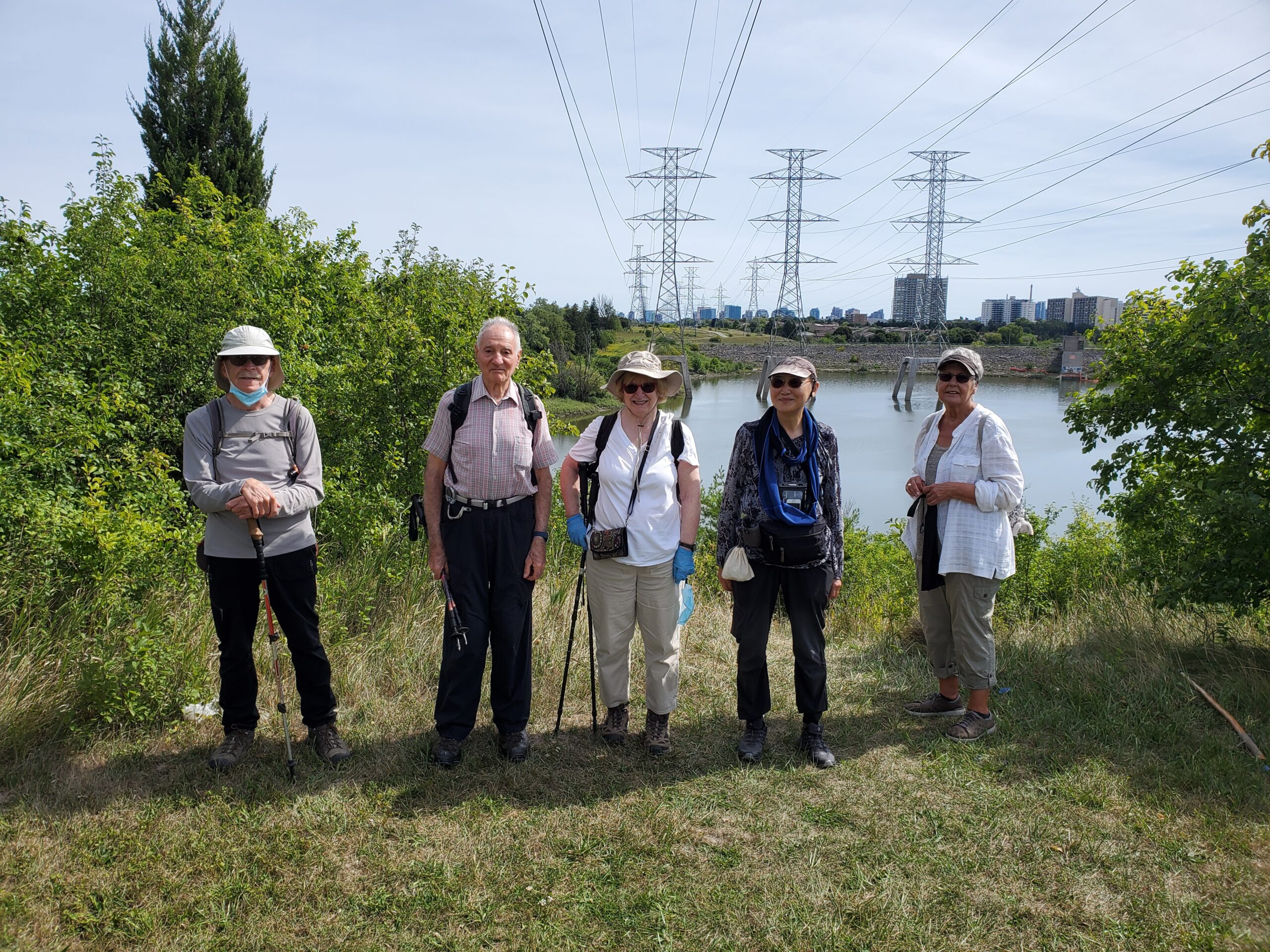
Please meet be by 10:30 am (by the bus stop) in the parking lot of the plaza on the south east corner of Steeles Ave West and Dufferin St.We will hike south through G Ross Lord Park, returning to Steeles for an estimated distance of 8.5 km. The pub stop is Montana’s on Steeles west of Dufferin for those who wish to join me.
Bring a snack, 2 liters of water, bug spray and sun screen.
Here is an online map of our route G Ross Lord Park
Note: Registration closes 48 hours before the start of the hike.
- 19August 19, 2024No events
- 20August 20, 2024
8:00 Long Hike Wiley Road Short Hills
https://hikesstaging.brucetrail.org/event/800-long-hike-wiley-road-short-hills-50/Sorry, the registration cut-off time for this hike has been reached.Not a member? Click here to join today!Hosting Club: Niagara
Location (Google Maps):
Short Hills Wiley Road Entrance
Pace: Medium
Terrain: Moderate
: 10kmDescription
Explore Short Hills and the majestic side trails of Scarlett Tanager, Hemlock. Swayze Falls and Terrace. Register for each hikeBring Poles, Sunscreen, bug spray water, snack, and dress for the weather
9:15 Short hike Short Hills Park Pelham Rd
https://hikesstaging.brucetrail.org/event/915-short-hike-short-hills-park-pelham-rd-9/Sorry, the registration cut-off time for this hike has been reached.Not a member? Click here to join today!Hosting Club: Niagara
Category: Loop
Location (Google Maps): Short Hills Provincial Park, PelhamRdHike Leader(s): Debbie Demizio Click here to contact Hike Leader(s)
Pace: Medium
Terrain: ModerateDescription
Hike the trails in Short Hills Provincial Park. Please bring water, sunscreen and bug spray. Following the hike check ourself for ticks and clean boots to prevent the spread of invasive species.City View Park, Burlington, Map 9.
https://hikesstaging.brucetrail.org/event/city-view-park-burlington-map-9-2/Sorry, the registration cut-off time for this hike has been reached.Not a member? Click here to join today!Hosting Club: Caledon Hills
Category: Tuesday Hikers
Location (Google Maps): City View Park, Burlington.
From Highway 403 going west, turn right on Brant Street, left on Dundas Street, left on Kerns Rd., take second turn left into City View Park to the parking lot.Hike Leader(s): Mohammad Shafiq Click here to contact Hike Leader(s)
Pace: Medium – 3 to 4 km/hour
Terrain: Moderate – some hills and/or some poor footing
Distance: 11 kmDescription
From City View Park will connect with main Bruce Trail and hike to Smokey Hollow waterfall, also hike Kings ST and Eric Best ST on the way. After snack break will trace back our steps and return to parking.
It’s an opportunity to get back to hiking after well deserved summer break and reconnect with fellow hikers.
Bring water, snack for refreshment break at Smokey Hollow.
Poles are recommended.
Limehouse Loop
https://hikesstaging.brucetrail.org/event/limehouse-loop-5/Sorry, the registration cut-off time for this hike has been reached.Not a member? Click here to join today!Hosting Club: Iroquoia
Category: Easy Does It Hikes
Location (Google Maps): LimehouseHike Leader(s): Anne Armstrong Click here to contact Hike Leader(s)
Pace: Leisurely – 3km/hr or less
Terrain: Moderate – Some hills and/or some poor footing
Distance: Approx. 6 – 7 km.Description
This hike will be in an area with an interesting history of quarrying limestone with old lime kilns as well as the famous “Hole in the Wall”. We will use main trail and side trails to explore the area to see the former lime kilns and the activity in this area. There will be one challenging area where the footing is tricky as we climb through the “hole”. Meet in the parking lot on Fifth Line, next to the baseball fields at 9:45 for a 10:00 am. start. Bring water, a snack, insect repellent, sunscreen and poles if using.Please contact the hike leader via this form if you have any questions.

Afternoon Hike - Great Esker Side Trail (Scotsdale Farm)
https://hikesstaging.brucetrail.org/event/great-esker-side-trail-scotsdale-farm/Sorry, the registration cut-off time for this hike has been reached.Not a member? Click here to join today!Hosting Club: Iroquoia
Category: Afternoon/Evening Hikes
Location (Google Maps): Meet roadside on 8th Line at the Great Esker Side Trail trailhead.Hike Leader(s): Karen Bergmann Click here to contact Hike Leader(s)
Pace: Medium – 3 to 4 km/hr
Terrain: Moderate – Some hills and/or some poor footing
Distance: 5 kmsDescription
We will hike around the Great Esker Side Trail and a bit on the main trail. This is a loop hike and there are a few hilly bits. Bring bug spray/bug net. - 21August 21, 2024
Easy Does It Hike, Glenridge Quarry Naturalization Site
https://hikesstaging.brucetrail.org/event/easy-does-it-hike-glenridge-quarry-naturalization-site/Sorry, the registration cut-off time for this hike has been reached.Not a member? Click here to join today!Hosting Club: Niagara
Category: Hike
Location (Google Maps): 1860 Sir Isaac Brock Way, St. Catharines, ON L2T 4C2Hike Leader(s): Diane Marlatt Click here to contact Hike Leader(s)
Pace: Leisurely
Terrain: Easy
Distance: 5 KmDescription
Wodehouse Karst
https://hikesstaging.brucetrail.org/event/wodehouse-karst-7/Sorry, the registration cut-off time for this hike has been reached.Not a member? Click here to join today!Hike open to BTC Members only.
Hosting Club: Blue Mountains
Category: Register in person the morning of hike.
Location (Google Maps): Hike meets in the parking lot behind Tim Hortons on First St. in Collingwood.Hike Leader(s): David Little Click here to contact Hike Leader(s)
Pace: Medium – 3 to 4 km/hr
Terrain: Moderate – Some hills and/or some poor footing
Distance: 11.5 kmDescription
We will drive to the Beaver Valley Ski Resort parking lot. The hike starts at the junction of the Beaver Valley Crossover Side Trail and the Kimberly Forest Side Trail. We will hike north on the Kimberly Forest Side Trail to the white blazed trail at km
83.1 then north to km 83.6 to do an in and out hike of the Wodehouse Karst Side Trail We will then return south on the white blazed trail to the Valley Crossover Side Trail at km 79.5. From here it is all downhill to the Beaver Valley Ski Resort parking lot. Bring lunch and water.WEDNESDAY WALKERS - Falling Water - Graham's Hill
https://hikesstaging.brucetrail.org/event/wednesday-walkers-falling-water-grahams-hill-2/Sorry, the registration cut-off time for this hike has been reached.Not a member? Click here to join today!Hosting Club: Beaver Valley
Location (Google Maps): Park in the small BTC parking lot on the north side of Graham’s Hill Road, just west of where the Trail crosses Graham’s Hill Road at km 74.2, Map 26, Edition 31
Hike Leader(s): Margaret Yaraskavitch Click here to contact the hike leader.
Pace: Medium
Terrain: Moderate, Some rocky footing, Some steep sections
Length of Hike: 4.2 kmDescription
This is a there-and-back hike along a varied stretch of Valley edge. Karst topography, old growth forest and streams with waterfalls are on our route as well as meadow and wild fruit trees. There are long views across the Valley.COVID-19 Precautions Before, During and After your Hike
- Each hiker joining a Bruce Trail Club organized hike must perform a self-screening check before hiking.
Find Ontario’s self-assessment tool here: https://covid-19.ontario.ca/self-assessment/ - If you are experiencing COVID-19 symptoms, stay home.
Other Guidelines
- Arrive 15 minutes before the start of the hike.
- Wear sturdy footwear and appropriate attire for the weather and the terrain.
Hiking poles are a good idea in any season, especially if the terrain is rocky or slippery. In winter, snowshoes or icers/crampons are needed when conditions dictate.
Wearing appropriate clothing and footwear prevents injuries and shows consideration for a safe and positive group hiking experience. - Always carry I.D. and your health card.
- Bring sufficient water and snacks (or lunch if indicated). A minimum of 1L of water is recommended on all hikes, and 3L is recommended for long, challenging hikes in the heat of the summer.
- Bring sunscreen and insect repellent (for spring and summer hikes).
- Bring your own first aid kit.
- Please leave dogs at home.
Car Hike: Midweek Fitness Hike in the Forks of the Credit Provincial Park (ca 10 km)
https://hikesstaging.brucetrail.org/event/car-hike-midweek-fitness-hike-in-the-forks-of-the-credit-provincial-park-ca-10-km/Sorry, the registration cut-off time for this hike has been reached.Not a member? Click here to join today!Hosting Club: Toronto
Category: Car Hike
Location (Google Maps):Forks of the Credit Provincial Park (McLaren Road entrance)
Hike Leader(s): Natalia Svechnikova Click here to contact Hike Leader(s)
Pace: Moderate
Terrain: Hilly, Variable
Distance: ca 10 kmDescription
Please join me for an enjoyable fitness hike on a hilly part of the park. We will hike a 10 km loop with one section going up hill. The trail has mostly treed sections as well as a few open areas. There will be a lunch stop near the Credit River. Be prepared wearing comfortable cloths, hiking shoes/boots. Please bring at least 2 L of water, a light lunch/snacks, sun screen and bug spray optional. We will on the parking lot at the trail head and map poster to the right of the washroom facilities. You have to drive to the main entrance on the McLaren Road and pay for the parking. - Each hiker joining a Bruce Trail Club organized hike must perform a self-screening check before hiking.