
Hike Schedule
Join us for a hike! Registration required.
All hikes available to BTC members. Some hikes are open to non-members.
See Refund Policy for Paid Hikes >
TIP: The calendar view displays up to 7 hikes on a day, but often there are more. Click “View more events” to see them all.
Categories
- 14August 14, 2024
Easy Does It, in and out hike
https://hikesstaging.brucetrail.org/event/easy-does-it-in-and-out-hike/Sorry, the registration cut-off time for this hike has been reached.Not a member? Click here to join today!Hosting Club: Niagara
Category: In and Out
Location (Google Maps): Pelham Municipal parking lotHike Leader(s): Diane Marlatt Click here to contact Hike Leader(s)
Pace: Leisurely
Terrain: Easy
Distance: 5-6 KmDescription
Beaver Valley Geology Hike Badge Hike #3/8
https://hikesstaging.brucetrail.org/event/beaver-valley-geology-hike-badge-hike-3-8/Sorry, the registration cut-off time for this hike has been reached.Not a member? Click here to join today!Hosting Club: Blue Mountains
Category: Register online ONLY
Location (Google Maps): Hike meets in the parking lot behind Tim Hortons on First St. in Collingwood.Hike Leader(s): Annette Sandberg Click here to contact Hike Leader(s)
Pace: Medium – 3 to 4 km/hr
Terrain: Moderate – Some hills and/or some poor footing
Distance: 10.4 kmDescription
The Mill Creek Valley: “Castle Ramparts” at Stop 8 (Pages 63/64) The Manitoulin Dolostone layer of the Niagara Escarpment forms a steep edge along the valley of Mill Creek. Over time the thinly bedded rock breaks away from the cliff face and lies scattered along the slope. Many shell and horn coral fossils can be found in these flat, shingle-like rocks. Note that when leaves are fully out in the summer months the “castle ramparts” may be hard to see. A photograph of the talus rock below the cliff will be sufficient for this badge location.WEDNESDAY WALKERS - Stew Hilt's Side Trail
https://hikesstaging.brucetrail.org/event/wednesday-walkers-stew-hilts-side-trail/Sorry, the registration cut-off time for this hike has been reached.Not a member? Click here to join today!Hosting Club: Beaver Valley
Location (Google Maps): Meet in the parking lot at the end of Johnston’s Side Road off of Grey Road 32, km 74.3, Map 26, Edition 31
Hike Leader(s): Margaret Yaraskavitch Click here to contact the hike leader.
Pace: Medium
Terrain: Moderate, Some rocky footing, Some steep sections
Length of Hike: 5.9 kmDescription
This hike takes us through BTC protected land. We will walk through a mature deciduous forest on the Main Trail and then we’ll walk the Stew Hilt’s Side Trail. Crossing a stream, we reach a waterfall, usually trickling in the fall. Our route will have us return on the higher Main Trail which provides a beautiful view of the Cuckoo Valley, showcasing fall colour.COVID-19 Precautions Before, During and After your Hike
- Each hiker joining a Bruce Trail Club organized hike must perform a self-screening check before hiking.
Find Ontario’s self-assessment tool here: https://covid-19.ontario.ca/self-assessment/ - If you are experiencing COVID-19 symptoms, stay home.
Other Guidelines
- Arrive 15 minutes before the start of the hike.
- Wear sturdy footwear and appropriate attire for the weather and the terrain.
Hiking poles are a good idea in any season, especially if the terrain is rocky or slippery. In winter, snowshoes or icers/crampons are needed when conditions dictate.
Wearing appropriate clothing and footwear prevents injuries and shows consideration for a safe and positive group hiking experience. - Always carry I.D. and your health card.
- Bring sufficient water and snacks (or lunch if indicated). A minimum of 1L of water is recommended on all hikes, and 3L is recommended for long, challenging hikes in the heat of the summer.
- Bring sunscreen and insect repellent (for spring and summer hikes).
- Bring your own first aid kit.
- Please leave dogs at home.
- Each hiker joining a Bruce Trail Club organized hike must perform a self-screening check before hiking.
- 15August 15, 2024
8:00 am Long Hike Jordan to Moyer / Louth
https://hikesstaging.brucetrail.org/event/800-am-long-hike-jordan-to-moyer-louth-75/Sorry, the registration cut-off time for this hike has been reached.Not a member? Click here to join today!Hosting Club: Niagara
Location (Google Maps):
Jordan Hollow Park 3039 King St Jordan
Pace: Medium
Terrain: Moderate
: 10kDescription
From Jordan Hollow Hike the main trail to Upper and Lower Balls Falls, Moyer Road or Louth and Return. You must register for each hike. Bring Poles, sunscreen, bug spray , snack and a drink and dress for the weatherNative Woodland Plant Hike
https://hikesstaging.brucetrail.org/event/native-woodland-plant-hike/Sorry, the registration cut-off time for this hike has been reached.Not a member? Click here to join today!Hosting Club: Dufferin Hi-Land
Category: General Hike
Location (Google Maps): Bruce Trail parking lot on the 1st Line E, just south of 10 Side Road, east of Whitfield.Hike Leader(s): Helen Bailey Click here to contact Hike Leader(s)
Pace: Leisurely
Terrain: Dependent on Conditions, Slippery Sections Likely
Distance: 3 to 5.5 kmsDescription
Join BTC Trail Ambassadors Anna and Eric for a hike focusing on native woodland plant species, herbaceous ferns and trees. We will also identify mushrooms and birds if present and able.We will hike 3.5km from 1st line east on main trail and then loop back on the Moss Haven side trail and main. For those wishing to continue we will then cross the road and hike approx 1.5km on the Rick hill section and then return to the parking lot.
Please arrive by 8:45 and we will leave promptly by 9am. Please bring water, bug spray and a snack.9:15 Short hike - in and around Jordan
https://hikesstaging.brucetrail.org/event/915-short-hike-in-and-around-jordan-3/Sorry, the registration cut-off time for this hike has been reached.Not a member? Click here to join today!Hosting Club: Niagara
Location (Google Maps): Sho’arishon Park (formerly Jordan Hollow)
Hike Leader(s): Bill Russell Click here to contact Hike Leader(s)
Pace: Medium
Terrain: ModerateDescription
Hike the main and side trails around Jordan and Balls Falls. Bring hiking boots, water, sunscreen and bug spray. Please arrive 10 minutes prior to start of hike.Hiking Around Jordan
https://hikesstaging.brucetrail.org/event/hiking-around-jordan/Sorry, the registration cut-off time for this hike has been reached.Not a member? Click here to join today!Hosting Club: Niagara
Category: In and Out
Location (Google Maps): Shoarishon Park (also known as Jordan Hollow)Hike Leader(s): Bill Russell Click here to contact Hike Leader(s)
Pace: Medium
Terrain: Moderate
Distance: 6 kmDescription
Hiking in and around Jordan, Jim Rainforth Trail and Balls Falls. The hike to Balls Falls, every third week, is longer by 1/2 hour approximately.Caledon Hills End-to-End Hike 6 of 6
https://hikesstaging.brucetrail.org/event/caledon-hills-end-to-end-hike-6-of-6/Sorry, the registration cut-off time for this hike has been reached.Not a member? Click here to join today!Hosting Club: Caledon Hills
Category: End-to-End
Location (Google Maps): Meet at Boston Mills Road, southwest of km 48.4 in the Toronto Section. Shuttle to start on Creditview Road.Hike Leader(s): Nancy Mooney Click here to contact Hike Leader(s)
Pace: Medium – 3 to 4 km/hour
Terrain: Easy – mostly flat and usually good footing, Moderate – some hills and/or some poor footing
Distance: 5.2 – 0.0 + 1.3 of Side Trail + 2.4 of Toronto = 8.9 km totalDescription
This is the last hike of the series and takes us through the Cheltenham Badlands before reaching the Spirit Tree Cidery!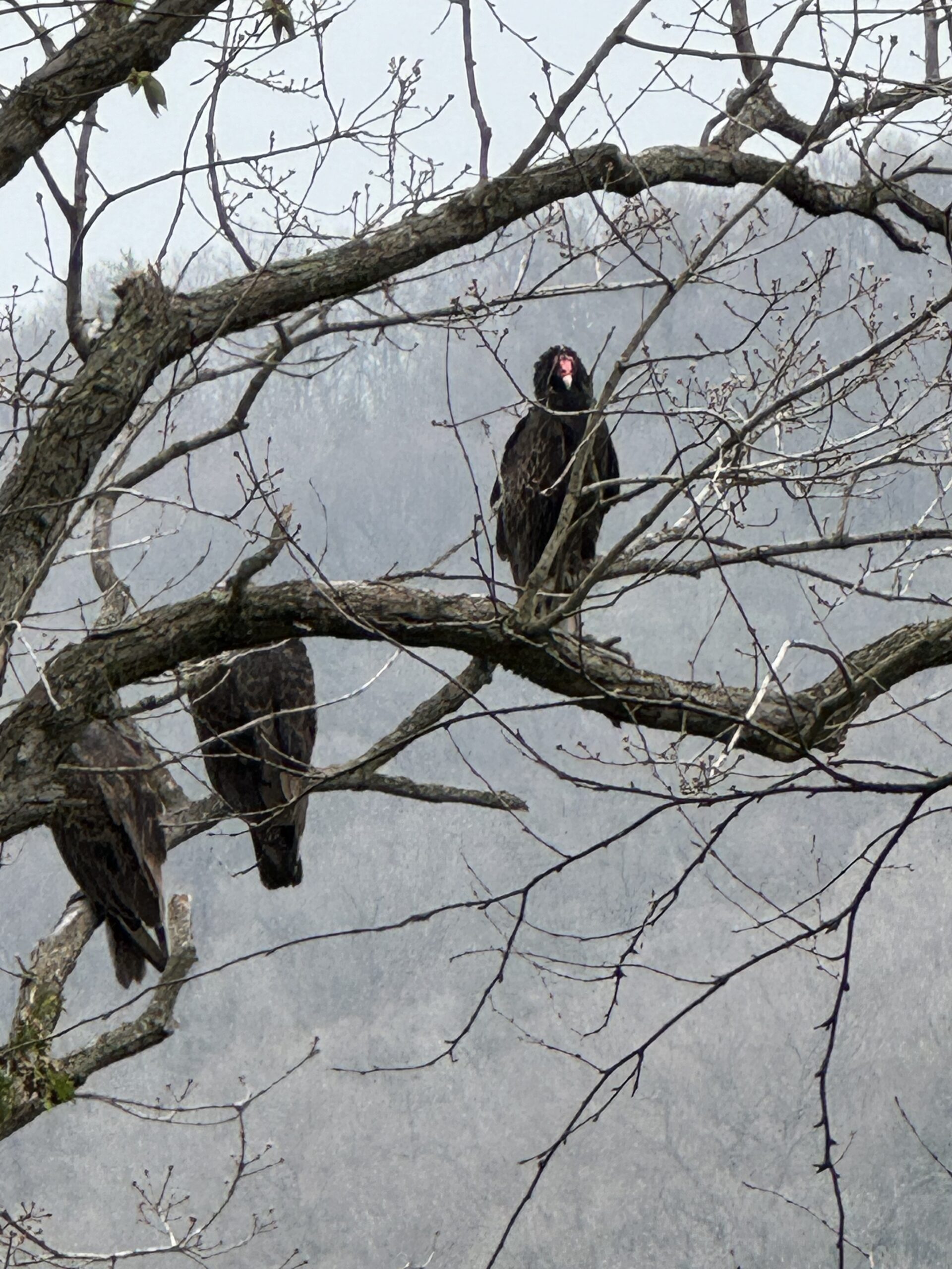
Crawford Lake Loop
https://hikesstaging.brucetrail.org/event/crawford-lake-loop-3/Sorry, the registration cut-off time for this hike has been reached.Not a member? Click here to join today!Hosting Club: Iroquoia
Category: Good Companions
Location (Google Maps): Crawford Lake Conservation Area, 3115 Conservation Road, off of Guelph Line.Hike Leader(s): Anne Armstrong Click here to contact Hike Leader(s)
Pace: Leisurely – 3km/hr or less
Terrain: Moderate – Some hills and/or some poor footing
Distance: Approx. 7-8 km.Description
Hike the lovely trails of this area with a great views towards Rattlesnake Point. Meet in the lower parking lot at Crawford Lake Conservation Area at 9:15 for a 10:00 am. start. Bring water, a snack, insect repellent and sunscreen. Hiking poles might be useful. We may get lucky and see some Turkey Vultures. Reservation with Halton Parks is necessary.Contact the hike leader through this form if there are any questions.
Outdoor Meditation and Yoga Fundraiser 2024
https://hikesstaging.brucetrail.org/event/outdoor-meditation-and-yoga-fundraiser-2024/Sorry, the registration cut-off time for this hike has been reached.Not a member? Click here to join today!Hosting Club: Peninsula
Location (Google Maps): 388 Cape Chin Road North, Lion’s Head, Ontario
Hike Leader(s): Marg Glendon Click here to contact Hike Leader(s)
Pace: Leisurely
Description
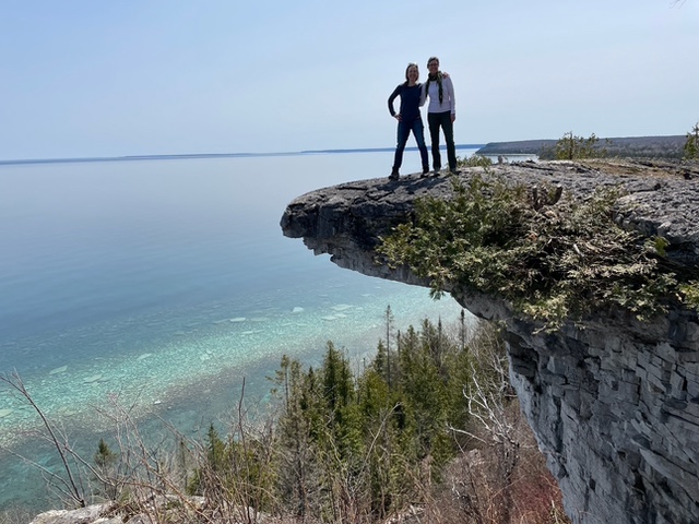
Join Nina and Barbara from Loving Yoga for the third annual fundraising event to help restore the natural beauty and habitat of BTC Nature Reserves on the Saugeen Bruce Peninsula. This year’s fundraising event will support the restoration at Vanishing Streams Nature Reserve. This is an outdoor yoga and meditation experience with one of the most magnificent views of Georgian Bay from the Bruce Trail. All levels, including beginners, welcome.Your teachers will guide you through mindful & gentle yoga and meditation practices above the stunning lookout point. Since it was so well received last year, Barbara will bring back the Yoga Tune Up therapy balls and you will have the opportunity to experience firsthand the benefits of self-massage through rolling.
Part of the experience will be guided in silence, heightening your awareness & senses and connecting to nature. We will wrap up the experience with some social time and a picnic under the trees overlooking Georgian Bay. There will be plenty of time for spectacular photographs and short, self-guided walks nearby.
Cost: Free will donation. Please consider donating generously for this worthwhile fundraiser. A tax deductible receipt is available upon request. Last year’s fundraising supported tree planting and meadow restoration at Maple Cross Nature Reserve at Cape Chin. This year, 100% of proceeds will be directed toward the PBTC Vanishing Streams restoration work. Payment received by cash or cheque at the event , or etransfer to Bruce Trail Conservancy upon registration. No refunds.
Parking: Please arrive at 388 Cape Chin Road North, Lion’s Head about 1/2 hour prior to starting time. This will give you time to drive up the winding driveway (3 1/2 km) to the yoga location. Please park directly behind the previous vehicle. If you need to leave before lunch, please let Marg know.
What to bring:
- Yoga mat or towel (large towel preferable on the grass)
- Tennis ball or yoga tune up ball
- Water bottle, bug spray, etc
- Picnic lunch (bring your own lunch)
Raindate: August 29th. Same time.
For more information about Nina and Barbara at Loving Yoga: lovingyoga.ca
- 16August 16, 2024

9:00 am Niagara on the Lake Tour & Some Yoga
https://hikesstaging.brucetrail.org/event/900-am-niagara-on-the-lake-tour-some-yoga-21/Sorry, the registration cut-off time for this hike has been reached.Not a member? Click here to join today!Hosting Club: Niagara
Location (Google Maps): Veteran’s Memorial Park, park just outside the park on King St.
Hike Leader(s): Robin Garrett Click here to contact Hike Leader(s)
Pace: Medium
Terrain: Easy
Distance: 6 kmDescription
Enjoy the benefits of pausing for a yoga practice as we tour through the trails, parkland and Historic Niagara-on-the-Lake. No mat required. Movement will focus on a flow of standing poses designed especially for hikers. Plan to stay for conversation and a warm cup of coffee or tea at Sweets & Swirls, Community Centre, Niagara Stone Road, NOTL. - 17August 17, 2024

Falls to Falls
https://hikesstaging.brucetrail.org/event/borer-falls-to-the-great-falls-at-smokey-hollow-thru-grindstone-creek/Sorry, the registration cut-off time for this hike has been reached.Not a member? Click here to join today!Hosting Club: Iroquoia, Toronto
Category: Car Hike
Location (Google Maps): Parking area beside Mill St at the Smokey Hollow Side Trail. GPS Coordinates N43.330803, W79.886980Hike Leader(s): Ross Estrella Click here to contact Hike Leader(s)
Pace: Moderate (3-4 km/hr)
Terrain: Hilly, Rocky, Variable
Distance: 12.5 kmsDescription
At a moderate to brisk pace we’ll hike from Borer’s Falls to the Great Falls at Smokey Hollow while enjoying the rhythmic and calming sound of Grindstone Creek rushing water. Please bring snack, lunch and sufficient water for hydration. Bring sun screen, sun head protection and bug spray in the event our friendly mosquitoes welcome us. Comfortable hiking shoe/boot and poles are strongly suggested. Please dress accordingly to weather forecast for the area. Please make sure your personal medication and health card is with you at all times. No drop out.Bethesda Trail Richmond Hill
https://hikesstaging.brucetrail.org/event/car-hike-bethesda-trail-richmond-hill-20/Sorry, the registration cut-off time for this hike has been reached.Not a member? Click here to join today!Hosting Club: Toronto
Category: Urban Walk
Location (Google Maps): Meet at Bethesda Trail Head Parking on Bethesda Sideroad off Bayview Avenue, across from Lake Wilcox. This parking lot is free.
From Finch subway station take blue bus to Richmond hill Centre and then Bus 91B to Bethesda Sideroad and then walk 600 meter to parking lot and meeting point, Please check the public transit one day before hike.Hike Leader(s): Mohammad Aghamiri Click here to contact Hike Leader(s)
Pace: Moderate (3-4 km/hr)
Terrain: Hilly, Variable
Distance: 14-15 kmDescription
Join us to explore Jefferson Forest and Bond lakePlease bring hiking poles, proper closing and shoes and lots of water,
Please carefully read safety procedures during the hike:
1-Hikers must stay between the leader and the sweep.
2-Hikers must advise the leader or the sweep if they wish to leave the group.
3- Hikers must follow the whistle instructions: 1 blast- stay where you are; 2 blasts come to the leader; 3 blasts – come to the leader quickly.
4-Hike leader may request volunteers to stop at trail intersections, they need to help hikers to the direction the group walk and wait till they see the sweep .
5-Hikers have to make sure they can see the persons behind and in front of
Car Hike: Hockley Valley Challenge #2 - CANCELLED
https://hikesstaging.brucetrail.org/event/hockley-valley-challenge-2/Sorry, the registration cut-off time for this hike has been reached.Not a member? Click here to join today!Hosting Club: Caledon Hills
Category: General
Location (Google Maps): Hockley Valley Nature Reserve, Map 18. To reach the meeting point, drive north on Hwy 10 from Orangeville and turn right onto Hockley Road. Continue approximately 5 km east until you see the parking area on your left, directly across the road from the Black Birch restaurant.Hike Leader(s): Dylan “Lana” Hubbard Click here to contact Hike Leader(s)
Pace: Brisk – 4 to 5 km/hour
Terrain: Strenuous – hilly with steep climbs and some poor footing
Distance: 18 kmDescription
THIS HIKE HAS BEEN CANCELLED DUE TO BAD WEATHER – PLEASE DO NOT REGISTER!!
Ready for a serious workout and some scenic sweat? Join us at Hockley Valley, one of the hilliest sections of the Bruce Trail and the crown jewel of the Caledon Hills BTC. This hike will be at a brisk pace, so please honestly assess your hiking abilities, this one is a killer. Come prepared with at least two liters of water, snacks, lunch, bug spray, sunscreen, electrolytes, and hiking poles if you use them. Wear appropriate clothing and footwear, and beware of the tick population this year – they’re having a boom! I highly recommend dressing like a fashionable mummy with a light long-sleeve shirt and pants.
This is also a loop hike – no shuttling required!
Please note that this is a 2SLGBTQIA+ friendly hike. Everyone is welcome. And after we’ve conquered the hills, feel free to join me at the Black Birch restaurant for some well-deserved refreshments!
Easy Does It Hike View Historic Site of Knifeworks. (now a skate park). We'll have an easy hike on Merrit Trail.
https://hikesstaging.brucetrail.org/event/easy-does-it-hike-view-historic-site-of-knifeworks-now-a-skate-park-well-have-an-easy-hike-on-merrit-trail/Sorry, the registration cut-off time for this hike has been reached.Not a member? Click here to join today!Hosting Club: Niagara
Category: Leisurely
Location (Google Maps): Google: Knifeworks historical site on Merrit Trail, Park Lot:166 Westchester Cr., St.Catharines L2P2T3Hike Leader(s): Diane Marlatt Click here to contact Hike Leader(s)
Pace: Leisurely
Terrain: Easy
Distance: 5kmDescription

Bus Hike: Niagara, beyond the Falls
https://hikesstaging.brucetrail.org/event/niagara-beyond-the-falls/Sorry, the registration cut-off time for this hike has been reached.Not a member? Click here to join today!Hosting Club: Toronto
Category: School Bus Hike
Location (Google Maps): Niagara ParksHike Leader(s): Marijo Roy; Janet McColeman Click here to contact Hike Leader(s)
Pace: Leisurely (2-3 km/hr)
Terrain: Flat, Variable
Distance: 10 kmDescription
- Please join us for a relaxing and picturesque hike along the Niagara River Recreation Trail. Along the way, we’ll explore the Botanical Gardens, which boasts 99 acres of meticulously maintained gardens, including a world-famous rose garden, the Niagara Glen Nature Centre, and the Whirlpool Area, among other places. As we navigate the trails, we will take in the Niagara River’s breathtaking views and its powerful rapids. There will be time for picture-taking and learning about Niagara’s history and ecology. We’ll follow the scenic Niagara River to Downtown Niagara, stopping for refreshments after the hike.
Trip Information:
Departure Time: 9:00 a.m.
Return to City Time: 6:00 p.m.
Departure Point: Kipling Station North Parking Lot https://maps.app.goo.gl/pudZxLwvbcjR9vLq8
9:15 Summer 2024 BLACK HISTORY SERIES - #4 of 5: The Early Niagara Community
https://hikesstaging.brucetrail.org/event/915-notl-black-history-series-4-of-4-the-early-niagara-community-2/Sorry, the registration cut-off time for this hike has been reached.Not a member? Click here to join today!Hosting Club: Niagara
Category: Urban
Location (Google Maps):Veteran’s Memorial Park. Park on King St. at Centre
Hike Leader(s): Karen Couch Click here to contact Hike Leader(s)
Pace: Medium
Terrain: Easy
Distance: 5-6 kmDescription
The Town of Niagara-on-the-Lake (NOTL) has a significant and nation-shifting Black history. Voices from the past will tell stories, enriching hikers’ understanding of how they shaped this town and nation.See link below for a brief overview of NOTL’s Black History.
https://artsandculture.google.com/story/niagara-on-the-lake-s-black-history-niagara-historical-society-museum/-QXR3nRTdnmqJw?hl=en
*Be prepared for the sun/heat as this hike is largely in the open (e.g., hydration, sunscreen, etc.).
**This hike counts as 1 of the 3 required hikes in the Summer 2024 series towards the Black History badge.
PLEASE NOTE: Hikes are offered by volunteers who have committed to their own learning to be able to offer informative and contemplative hike experiences. These hikes are open to all and offered in a spirit of mutual leaning and inclusion.