
Hike Schedule
Join us for a hike! Registration required.
All hikes available to BTC members. Some hikes are open to non-members.
See Refund Policy for Paid Hikes >
TIP: The calendar view displays up to 7 hikes on a day, but often there are more. Click “View more events” to see them all.
Categories
- 11June 11, 2024
NEW TIME 8:00 Long Hike Wiley Road Short Hills
https://hikesstaging.brucetrail.org/event/new-time-800-long-hike-wiley-road-short-hills-6/Sorry, the registration cut-off time for this hike has been reached.Not a member? Click here to join today!Hosting Club: Niagara
Location (Google Maps):
Short Hills Wiley Road Entrance
Hike Leader(s): Alan Laver Click here to contact Hike Leader(s)
Pace: Medium
Terrain: Moderate
Distance: 10kmDescription
Explore Short Hills and the majestic side trails of Scarlett Tanager, Hemlock. Swayze Falls and Terrace. Register for each hikeBring Poles bug spray water, snack, and dress for the weather
Spring Birds and Blooms #2
https://hikesstaging.brucetrail.org/event/spring-birds-and-blooms-2-2/Sorry, the registration cut-off time for this hike has been reached.Not a member? Click here to join today!Hosting Club: Peninsula
Category: Birding
Location (Google Maps): Meet at the parking lot at the intersection of Highway 6 and Dyers Bay Road at 8:30 am, and car pool to the Cottrill Lake ST parking area where we begin our hike.Hike Leader(s): Marg Glendon Click here to contact Hike Leader(s)
Pace: Leisurely
Terrain: Easy, Moderate
Distance: ~3 1/2kmDescription
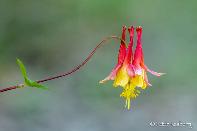
Open Registration “Spring Birds and Blooms – Join Bird Enthusiast – Peter Rasberry – for a Spring Birds and Blooms hike on the Cottrill Lake Side Trail. This should be peak time for both spring wildflowers and bird migration. The hike pace is slow and will be a “walk, stop and talk” type of hike. This provides an opportunity to identify and appreciate all that nature is offering us! The terrain is rocky but relatively flat on Cottrill Lake Side Trail. At the end of Cottrill Lake Side Trail, we will decide as a group, whether we return to our starting point by walking on Britain Lake Road, or hiking the more rugged terrain with lots of “ups and downs” on the Anne and Clayton Roberts Side Trail to the Main Trail. Both options complete the loop at the Cottrill Side Trail parking area. Distance for both options is about the same ~ 3 ½ km. Dress according to the weather. Bring snacks, water, cameras, binoculars, field guides, and insect repellent. Hike finish should be about 11:30 a.m. Bruce Trail Reference Guide Edition 31.Humber Valley - Glen Haffy Side Trail
https://hikesstaging.brucetrail.org/event/humber-valley-glen-haffy-side-trail-6/Sorry, the registration cut-off time for this hike has been reached.Not a member? Click here to join today!Hosting Club: Dufferin Hi-Land
Category: Tuesday Hike
Location (Google Maps): Caledon Hills, Map 18. Meet at 7th Line BTC parking lot about 1.5 km north of Hwy 9 (near Km 43.3) . Entrance to the lot is just off of Airport Rd on 7th Line, Mono.Hike Leader(s): Tony Evangelista; Les Babbage; Inge Eckerich; Julie Daley Click here to contact Hike Leader(s)
Pace: Leisurely
Terrain: Moderate
Distance: 7 or 3.6 kmDescription
We will hike the Main Trail south to the Glen Haffy Side Trail, then follow the side trail east as far as the Mono Adjala Townline and back. The shorter hike will turn back at the intersection of the two trails.9:15 Short Hike - Short Hills Park, Pelham Rd
https://hikesstaging.brucetrail.org/event/915-short-hike-short-hills-park-pelham-rd-6/Sorry, the registration cut-off time for this hike has been reached.Not a member? Click here to join today!Hosting Club: Niagara
Category: Hike
Location (Google Maps): Shorthills Provincial Park, Pelham Rd entranceHike Leader(s): Debbie Demizio Click here to contact Hike Leader(s)
Pace: Medium
Terrain: Moderate
Distance: ~ 6kmsDescription
Hike the main and side trails in Shorthills Provincial Park. Bring hiking boots, water, sunscreen and bug spray. Please help prevent the spread of invasive species by cleaning your boots following the hike. Please check yourself for ticks following the hike.Terra Cotta
https://hikesstaging.brucetrail.org/event/terra-cotta-12/Sorry, the registration cut-off time for this hike has been reached.Not a member? Click here to join today!Hosting Club: Caledon Hills
Category: Tuesday Hikers
Location (Google Maps): Meet at Winston Churchill Blvd., intersection with Caledon Trailway.
Driving direction: North on Highway 410, continue north on Highway 10, left on King Street, right on Winston Churchill Blvd; drive 1 kilometre to roadside parking on either side of the road.Hike Leader(s): Mohammad Shafiq Click here to contact Hike Leader(s)
Pace: Medium – 3 to 4 km/hour
Terrain: Moderate – some hills and/or some poor footing
Distance: 12 kmDescription
Will hike Terra Cotta Side Trail and main Bruce Trail. Bring water, snack, poles and bug spray.
Hike Leaders phone contact for the day of hike: 416-566-0503. - 12June 12, 2024
PBTC Tree Badge Pilot Hike #2
https://hikesstaging.brucetrail.org/event/pbtc-tree-badge-pilot-hike-2/Sorry, the registration cut-off time for this hike has been reached.Not a member? Click here to join today!Hosting Club: Peninsula
Location (Google Maps): Parking lot on Jackson’s Cove Rd at the top of the hill just to the west of the trail [44.939536, -81.133319]
Hike Leader(s): Barbara Reuber Click here to contact Hike Leader(s)
Pace: Leisurely
Terrain: ModerateDescription
Join us for the 2nd tree badge pilot hike to help us establish the requirements for the badge. The tree badge will be the next in a series of conservation badges that include the birder badges, fern badge and orchid badge. This hike will allow you to test the requirements for the badge. The badge requirements are at the end of this hike description. The badge requires the use of the iNaturalist app – if you aren’t already part of the iNaturalist Bruce Trail Conservancy Project, please get the app before the hike, see details here: https://development.brucetrail.org/what-we-do/#iNaturalistPBTC volunteer and hike leader Jeannine Krait will lead the hike and share her knowledge of trees on the Peninsula to support hikers as they try out the Tree Badge requirement.
We will meet at the Jackson’s Cove parking lot [44.939536, -81.133319] and hike the main trail to Jackson Cove Side Trail and back on the Jackson Cove Side Trail. If there is time and interest, we may extend the hike along the main trail. Our pace will be slow as we focus on tree identification. Bring a snack and water. Be prepared for variable weather and dress for the conditions on the day of the hike.
Draft Tree Badge Requirements:
There is no time limit for completing the badge requirements. All observations must be from the main trail or sides trails of the Peninsula section or on a PBTC-organized hike.
- Photograph, identify and document 25 different tree species along the Peninsula section of the Bruce Trail. Your list must include at least 1 tree in each of the following categories:
- Deciduous
- Coniferous
- Mast Tree– produces food for wildlife or human foragers through periodic booms in seed production. A key characteristic of mast trees is that their seed production becomes synchronized across entire populations of the same species, producing an over-abundance of food in some years (also known as bumper crops, which is a crop that has yielded a usually productive harvest), and greatly reduced production in other years. Many mast foods have great storage value, avoiding rot, or freezing on the trees to provide quality food even when everything is dormant. Mast foods also have a high nutrition content, such as fatty nuts, which helps mammals build up fat stores for winter. Periodic booms (typically once every 2-8 years) of mast production trigger a cascade of ecological effects that affects mammals, birds, insects & even diseases like Lyme. Some common types of mast trees include oak, spruce, walnut, butternut and beech. (Note: the tree does not need to be bearing fruit/nut/seed at the time it is ID’d, so long the species is considered a “mast” species)
- Wildlife Tree – standing dead or live tree (also known as snags, den trees or cavity trees) with characteristics that provide valuable habitat for wildlife. Wildlife trees may contain spike, fork or broken tops, cavities, loose bark, large platform limbs and brooms. In Ontario, at least 50 species of birds and mammals rely on snags. Many species of trees make for good snaps, but large conifers such as cedar, fir, larch, and pine, tend to rot more slowly than do deciduous trees such as alder, birch, and cherry. Large deciduous trees such as cottonwoods, big-leaf maples, and oaks can last many years as snags. While alive, large deciduous trees tend to develop cavities in their bulky live and dead branches and trunks.
- Invasive Species – could be an invasive tree species (i.e., Scots pine, Buckthorn, Norway Maple) or identification of invasive pathogen (i.e., Emerald Ash Borer, butternut canker, beech bark disease)
- Upload photos to iNaturalist.ca and add them to the Bruce Trail Project. New to iNaturalist? When loading pictures on iNaturalist, take clear pictures of and upload as many features of the tree as are available to help with ID – bark, leaves/needles, pinecones or seeds, overall structure of the tree, etc. Tag photos with “PBTC Tree Badge” for easy reference. Not registered for the Bruce Trail Project? Visit https://development.brucetrail.org/what-we-do/#iNaturalist for details.
- For one specimen tree in each of the five categories record the following:
- Deciduous
- Common name
- Leaf category: opposite, alternate, simple, compound, pinnate, palmate, lobed, toothed, margins
- Coniferous
- Common name
- Leaf category: Short needles in opposite pairs or whorls of 3, needles in bundles or 2, 3 or 5, needles in tufts of 10 or more on dwarf shoots or single on long shoots
- Mast Tree
- Name of fruit/ seed
- Wildlife Tree
- Wildlife habitat characteristic (spike, fork or broken top, cavity, loose bark, large platform limbs or brooms) and name species that may use habitat
- Invasive Species
- Common name of tree or pathogen
- Once you have accumulated 25 species, and your entries have been verified on iNaturalist, and you have recorded the characteristics of five specimen trees, you may obtain your badge. Instructions for obtaining the badge will be available on the PBTC website at https://www.pbtc.ca/badges after the badge is launched.
Fairmount Loop
https://hikesstaging.brucetrail.org/event/fairmount-loop-3/Sorry, the registration cut-off time for this hike has been reached.Not a member? Click here to join today!Hosting Club: Sydenham
Category: General Hike
Location (Google Maps): Meet at roadside parking on Sideroad 22B, just east of Grey Road 7. We will meet by the Blue sign for the Fairmount Loop. Map number 27.Hike Leader(s): Fran Turner Click here to contact Hike Leader(s)
Pace: Brisk: 4 to 5 km/h
Terrain: Strenuous: Hilly with steep climbs and some poor footing.
Distance: 12 kmDescription
This is a challenging but very rewarding hike. We start by descending to the floor of the Beaver Valley, enjoying forests and streams along the way. Then comes the steep climb back up, where we are rewarded with spectacular views to the east across the valley and to Blue Mountain. We’ll stop for lunch at the gazebo beside Webwood Falls. The last leg of the hike is the very pretty Fairmount trail which offers sweeping panoramic views of the Beaver Valley. Please bring a lunch and lots of water.Balsam Wetlands to Glen Huron - Medium Pace
https://hikesstaging.brucetrail.org/event/balsam-wetlands-to-glen-huron-2/Sorry, the registration cut-off time for this hike has been reached.Not a member? Click here to join today!Hosting Club: Blue Mountains
Category: Register in person the morning of hike.
Location (Google Maps): Hike meets in the parking lot behind Tim Hortons on First St. in Collingwood.Hike Leader(s): David Little Click here to contact Hike Leader(s)
Pace: Medium – 3 to 4 km/hr
Terrain: Moderate – Some hills and/or some poor footing
Distance: 12 kmDescription
Description: This is a car shuttle hike. We will drive to and leave the cars on Station Street in Glen Huron and drive to km 37.4 (BTC parking lot off Cty.Rd. 91) to begin the hike. The trail winds its way through privately owned forest and farmland eventually coming to a viewing platform south of Cty. Rd. 124. The hike continues down into the valley and at km 30.6 we meet up with the Mad River Side Trail. Following the side trail parallel to the Mad River we continue on to the cars. Bring a snack or lunch and water.Balsam Wetlands to Glen Huron - Leisurely Pace
https://hikesstaging.brucetrail.org/event/balsam-wetlands-to-glen-huron-3/Sorry, the registration cut-off time for this hike has been reached.Not a member? Click here to join today!Hosting Club: Blue Mountains
Category: Organized Hike
Location (Google Maps): Hike meets in the parking lot behind Tim Hortons on First St. in Collingwood.Hike Leader(s): Terry Kimmberly Click here to contact Hike Leader(s)
Pace: Leisurely – 3 km/hr. or less
Terrain: Moderate – Some hills and/or some poor footing
Distance: 6.5 kmDescription
Leisurely Option: This is a car shuttle hike. A leisurely version will be offered from Franks Kiln parking (BTC parking lot off Cty. Rd. 91) to 10th line.9:00 Queenston Heights loop
https://hikesstaging.brucetrail.org/event/900-queenston-heights-loop/Sorry, the registration cut-off time for this hike has been reached.Not a member? Click here to join today!Hosting Club: Niagara
Category: Loop
Location (Google Maps): Meet at Locust grove parking lot and hike the Bruce trail and side trails around Queenston Heights.
Bring snacks, water and bug spray.Hike Leader(s): Heather Howkins Click here to contact Hike Leader(s)
Pace: Medium
Terrain: Moderate
Distance: 8kDescription
Loop hike around Queenston Heights on the main trail and side trails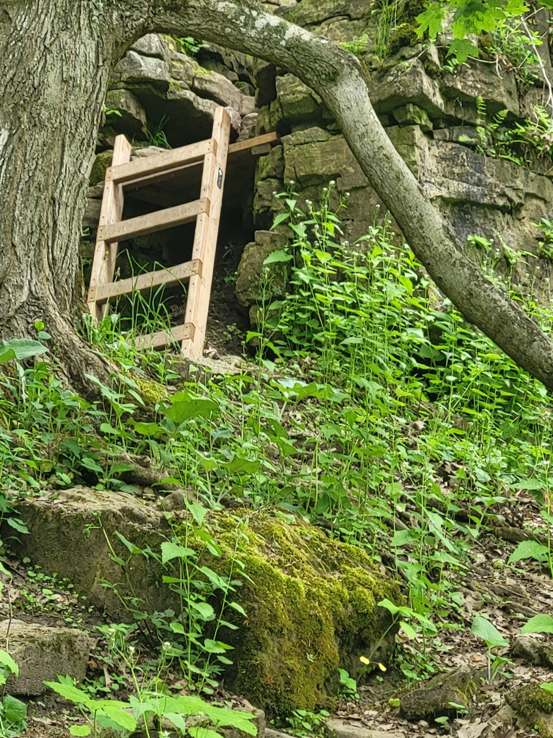
Mt Nemo Walkers Line
https://hikesstaging.brucetrail.org/event/mt-nemo-walkers-line/Sorry, the registration cut-off time for this hike has been reached.Not a member? Click here to join today!Hosting Club: Iroquoia
Category: Good Companions
Location (Google Maps): Mt Nemo Conservation Area
Walkers LineHike Leader(s): Jill Parratt Click here to contact Hike Leader(s)
Pace: Medium – 3 to 4 km/hr
Terrain: Moderate – Some hills and/or some poor footing
Distance: 7-8 kmDescription
Meet at 9:15 for a 9:30 start.
Take Bruce Trail to Escarpment ladder. Very rocky and steep just before ladder.
Hike Bruce Trail and Mt Nemo trails.
Either register at Conservation Halton or pay for parking at parking lot.
Poles are recommended
Jill Parratt
WEDNESDAY WALKERS - Duncan Crevice and Pinnacle Rock
https://hikesstaging.brucetrail.org/event/wednesday-walkers-duncan-crevice-and-pinnacle-rock-2/Sorry, the registration cut-off time for this hike has been reached.Not a member? Click here to join today!Hosting Club: Beaver Valley
Location (Google Maps): Meet in the small parking lot of Duncan Crevice Caves Provincial Nature Reserve on the 9th Sideroad near Duncan. km 33.3, map 25, Edition 31
Hike Leader(s): Margaret Yaraskavitch Click here to contact the hike leader.
Pace: Medium
Terrain: Moderate
Length of Hike: 4.4 kmDescription
This hike takes us along a pleasant flat forest pathway to the impressive Duncan Crevices. There’s a walk along a field and then it’s on to the massive Pinnacle Rock. We then return to our original parking lot. Please bring water.COVID-19 Precautions Before, During and After your Hike
- Each hiker joining a Bruce Trail Club organized hike must perform a self-screening check before hiking.
Find Ontario’s self-assessment tool here: https://covid-19.ontario.ca/self-assessment/ - If you are experiencing COVID-19 symptoms, stay home.
Other Guidelines
- Arrive 15 minutes before the start of the hike.
- Wear sturdy footwear and appropriate attire for the weather and the terrain.
Hiking poles are a good idea in any season, especially if the terrain is rocky or slippery. In winter, snowshoes or icers/crampons are needed when conditions dictate.
Wearing appropriate clothing and footwear prevents injuries and shows consideration for a safe and positive group hiking experience. - Always carry I.D. and your health card.
- Bring sufficient water and snacks (or lunch if indicated). A minimum of 1L of water is recommended on all hikes, and 3L is recommended for long, challenging hikes in the heat of the summer.
- Bring sunscreen and insect repellent (for spring and summer hikes).
- Bring your own first aid kit.
- Please leave dogs at home.
- 13June 13, 2024
NEW TIME 8:00 am Long Hike Jordan to Moyer / Louth
https://hikesstaging.brucetrail.org/event/new-time-800-am-long-hike-jordan-to-moyer-louth-5/Sorry, the registration cut-off time for this hike has been reached.Not a member? Click here to join today!Hosting Club: Niagara
Location (Google Maps):
Jordan Hollow Park 3039 King St Jordan
Hike Leader(s): Alan Laver Click here to contact Hike Leader(s)
Pace: Medium
Terrain: Moderate
Distance: 10kDescription
From Jordan Hollow Hike the main trail to Upper and Lower Balls Falls, Moyer Road or Louth and Return. You must register for each hike. Bring Poles, sunscreen, bug spray , snack and a drink and dress for the weather
Beaver Valley End-to-End Hike 8 of 9
https://hikesstaging.brucetrail.org/event/beaver-valley-end-to-end-hike-8-of-9/Sorry, the registration cut-off time for this hike has been reached.Not a member? Click here to join today!Hosting Club: Caledon Hills
Category: End-to-End
Location (Google Maps): Meet at 6th Line parking north of Grey Rd. 119, km 13.7, Map 24 (Ed. 31). Shuttle to start at parking on 10th Line.Hike Leader(s): Nancy Mooney Click here to contact Hike Leader(s)
Pace: Medium – 3 to 4 km/hour
Terrain: Moderate – some hills and/or some poor footing, Strenuous – hilly with steep climbs and some poor footing
Distance: 27.9 – 13.7, + 0.1 from parking = 14.3 km totalDescription
This is the eighth hike in the series. We will encounter Metcalfe Rock, Kolapore Uplands, and the Old Mail Road.9:15 Short hike - Jordan Hollow
https://hikesstaging.brucetrail.org/event/915-short-hike-jordan-hollow-114/Sorry, the registration cut-off time for this hike has been reached.Not a member? Click here to join today!Hosting Club: Niagara
Location (Google Maps): Jordan Hollow Park, Jordan Station
Hike Leader(s): Bill Russell Click here to contact Hike Leader(s)
Pace: Medium
Terrain: Strenuous
Distance: 6 kmsDescription
Hike the main and side trails around Jordan and Balls Falls. Bring hiking boots, water, sunscreen and bug spray.
Bluebirds and Meadowlarks
https://hikesstaging.brucetrail.org/event/bluebirds-and-meadowlarks/Sorry, the registration cut-off time for this hike has been reached.Not a member? Click here to join today!Hosting Club: Caledon Hills
Category: Nature Walks
Location (Google Maps): Meet at Bruce Trail Parking lot on 5 Sideroad Mono, east of Airport Road, at km 45.4 on the north side of the road where the trail crosses.Hike Leader(s): Gary Hall Click here to contact Hike Leader(s)
Pace: Leisurely – 3 km/hour or less
Terrain: Moderate – some hills and/or some poor footing
Distance: 3 kmDescription
This will be a car hike. From our meeting place, we’ll make a short car pool to the Bruce Trail Parking lot on the 7th Line Mono (corner of 7th Line and Airport Road) . We’ll begin by exploring the Humber Heights property and listen and watch for Bluebirds, Meadowlarks, Indigo Buntings, Field Sparrows as well as other grassland species. We’ll then retrace our steps on Humber Heights and follow the main trail through Twin Waters (a new BTC property), Mathilde’s Way and The Gosling Forest and Nature Reserve and finish at the car park on 5 Sideroad. With the exception of a 600 metre walk along the 7th Line, the hike will be entirely on BTC properties – four in all. Bring binoculars, camera, and cell phone. The Merlin App will help identify bird songs.
Urban Walk: Toronto Islands Evening Walk
https://hikesstaging.brucetrail.org/event/urban-walk-toronto-islands-evening-walk-7/Sorry, the registration cut-off time for this hike has been reached.Not a member? Click here to join today!Hosting Club: Toronto
Location (Google Maps): Jack Layton Ferry Terminal, near the gates to Wards Island Ferry. Arrive 20 minutes prior to departure to check in with hike leader.
From Union Station take the LRT and get off at the stop Ferry Docks.Walk up to the Ferry Docks on Queens Quay West, street level. at the foot of Bay Street.
Hike Leader(s): Miriam Stevens Click here to contact Hike Leader(s)
Pace: Leisurely
Terrain: Flat
Distance: 6-9 kmDescription
After a day’s work come and “cool off” on the Toronto Islands free of fumes and traffic. Enjoy the view of the city skyline and Toronto’s beautiful island parkland.
Pack a dinner for a sit down picnic. Food is not available for purchase on the Islands early in the season. Also bring a warm jacket and flashlight.
Return fare ticket for the ferry approx $10.00 less for seniors.
Hikes will take place rain or shine.
Toronto Island evening hikes will take place every THURSDAY in MAY and JUNE 2024.
Same time and same meeting place. No preregistration is required – just show up at the ferry docks at 5:40 PM and sign with the hike leader.** As of the publication of the hike entry the start date of the Spring schedule is not available – current departure time to Wards Island is 6:00 PM, check back closer to the date to confirm the time **
- 14June 14, 2024

Car Hike: 21th Annual Excellent Orchid Adventure – Chi-Cheemaun Weekend (2 overnights)
https://hikesstaging.brucetrail.org/event/car-hike-21th-annual-excellent-orchid-adventure-chi-cheemaun-weekend-3-overnights/Sorry, the registration cut-off time for this hike has been reached.Not a member? Click here to join today!This is a Multi-Day Hike
You are signing up for the following dates:
2024-06-14, 2024-06-15, 2024-06-16Hosting Club: Toronto, Peninsula
Category: Car Hike
Location (Google Maps): Princess Hotel
34 Bay St, Tobermory, ON N0H 2R0Hike Leader(s): Jeanette Vincent. Brenda Menezes. David Royle. Click here to contact Hike Leader(s)
Pace: Leisurely
Terrain: Hilly, Rocky, Variable
Distance: 10 – 12 KmDescription
We continue Greg Vincent’s legacy of weekends away. Please join Jeanette Vincent, Brenda and David Royle as we explore the Tip o’ the Bruce, Tobermory in search of orchids and other flowers. Our search will extend to Flowerpot Island (cost approx. $60.00 for the glass bottom ferry and Parks Canada fee). The wildflowers in the Tobermory area at this time of year are wonderful and our slow paced walks will focus on these flowers and the area’s great views. We stay and have our meals at a comfortable hotel overlooking Little Tub Harbour. Approximately 10km/day.This outing is restricted to those staying with us at the Princess Hotel in Tobermory for the weekend – the hotel fills quickly. You will need a car to access this outing. Please contact the Princess Hotel for a reservation.1-519-592-8282 or info@tobermoryprincesshotel.com and mention Vincent/Royle Excellent Orchid weekend.
Before registering at the hotel please contact Jeanette: vincentjeanette1604@gmail.com | 519-588-5916 For prices and more details.

Car Hike: Beaver Valley E2E Fundraiser Badge in 8 hikes.
https://hikesstaging.brucetrail.org/event/beaver-valley-e2e-fundraiser/Sorry, the registration cut-off time for this hike has been reached.Not a member? Click here to join today!Hike open to BTC Members only.
This is a Multi-Day Hike
You are signing up for the following dates and times:
2024-06-14 at 08:30
2024-06-15 at 08:30
2024-06-16 at 08:30
2024-06-17 at 08:30
2024-06-21 at 08:30
2024-06-22 at 08:30
2024-06-23 at 08:30
2024-06-24 at 08:30Hosting Club: Toronto, Beaver Valley
Category: Car Hike
Location (Google Maps): Hike 1- Maple Lane, km 67.3 Blue Mountain on map 24. It is also km 0.0 of the BV. Coordinates N 44504973,W 80.331780Hike Leader(s): Smadar Junkin Click here to contact Hike Leader(s)
Pace: Brisk
Terrain: Hilly, Variable
Distance: 13.7 kmDescription
This is a fundraiser hike to keep the pledge of “ ribbon of wilderness for everyone forever “. The funds will be collected by the Toronto Bruce Trail Club and will be transferred to the Beaver Valley Club to help continuing the gear maintenance work that the team of volunteers doing.this hike will earn you the special stained glass badge of the BV.
you will be permitted to miss two of the organized hikes and make them up on your own to get the badge.
hike2- meet at km 27.9 parking- a 100 meters south of the main trail across the 10th line coordinates N 44.416209,W 80.443557 we will shuttle to 6th line. Map 25hike 3- meet at at the same place as hike 2 and shuttle to km 43.5 map 25
hike 4- meet at km 43.6 side road 7B coordinates N 44.395310,W 80.518495 we will shuttle to km 56.1 north street. Map 26
hike 5- meet at km 71.7 Johnston side road parking. Coordinates N 44.315674,W 80.549984 we will shuttle to NorthStreet.
hike 6- we will meet at the same place as hike 5 and shuttle to km 86.9 side road 13A map27hike 7- we will meet at km 86.9 side road 13A coordinates N 44.420867,W 80.562233 we will shuttle to km 99.9. Map 27
hike 8 badge day we will meet at Blantyre km 117,3 and shuttle to km 99.9. Please note that at this time the parking in Blantyre is closed. The resident across the street kindly offered us parking in an area in his property. At this time I’m not sure if the the parking will be open. More information to come at the later date.
after each hike I will be hiking a geology hike to to learn about the geology of the beaver valley and to earn the badge. If you wish to join me, let me know and I’ll send you information closer to the time of the hikes. These will not be official Bruce Trail hikes. If you are interested it might be a good idea to get Beth Gilhespy’s book “Walking Through Time” from. The conservancy office.
please bring two litres of water to each hike, bug prevalent and sun screen.
Niagara-on-the-Lake Tour
https://hikesstaging.brucetrail.org/event/niagara-on-the-lake-tour-54/Sorry, the registration cut-off time for this hike has been reached.Not a member? Click here to join today!Hosting Club: Niagara
Category: Urban
Location (Google Maps): Meet on King St near Centre St, at the entrance to Veteran’s Memorial Park, Niagara-on-the-LakeHike Leader(s): Margaret Northfield Click here to contact Hike Leader(s)
Pace: Medium
Terrain: Easy
Distance: 6-7kmDescription
Each Friday we will explore different neighbourhoods, trails and parkland throughout Historic Niagara-on-the-Lake.Moderate pace with some weeks entirely on sidewalks and roads while others may include a mix of trails and paved pathways. Great way to build up endurance for longer more strenuous hikes.
Prepare for cooler windy conditions on open parkland and along Lake Ontario and Niagara River trails.
Plan to stay for conversation and a warm cup of coffee or tea at Sweets & Swirls, Community Centre, Niagara Stone Road, NOTL
Margaret Northfield & Robin Garrett