
Hike Schedule
Join us for a hike! Registration required.
All hikes available to BTC members. Some hikes are open to non-members.
See Refund Policy for Paid Hikes >
TIP: The calendar view displays up to 7 hikes on a day, but often there are more. Click “View more events” to see them all.
Categories
- 11May 11, 2024
Dufferin Hi-Land Two-Day End-to-End
https://hikesstaging.brucetrail.org/event/dufferin-hi-land-two-day-end-to-end-2/Sorry, the registration cut-off time for this hike has been reached.Not a member? Click here to join today!This is a Multi-Day Hike
You are signing up for the following dates and times:
2024-05-11 at 07:00
2024-05-12 at 07:00Hosting Club: Dufferin Hi-Land
Category: Special Events
Location (Google Maps): 586387 10th Sideroad, Mulmur. GPS Coordinates: N 44 13849 W 080 13649. This is the first farm 200m west of Center Rd on 10th (also called 17 when west of Center rd) There is a church on the corner. Please arrive by 7:45 latest to allow time for check in. Buses depart at 8:00 am. BTC Map 20 just west of km 30.4 (Whitfield).
Directions to Parking Location:
If coming by Hwy 10 from Orangeville:
– follow 10 north to Primrose
– proceed straight through the intersection onto Dufferin County Road 19, also called Prince of Wales Road
– follow this road for 6 km to first stop sign
– turn right, proceed approx 1 km
– the church is highly visible on the left side, parking is 200m west of the church.Hike Leader(s): Stuart Law Click here to contact Hike Leader(s)
Pace: Brisk
Terrain: Dependent on Conditions, Slippery and Steep Sections, Slippery Sections Likely, Strenuous
Distance: 55km (29km & 26km)Description
Join us for two days of hiking the rolling hills of Dufferin County. Enjoy the spring flowers while earning your Red Trillium Badge. Hike distances are approximately 29km on Day 1 and 26km on Day 2. There will be checkpoints along the hike with volunteers providing assistance, refreshments and snacks. Registration is $65 for members and $75 for non-members, which includes shuttle bus service, checkpoint snacks and refreshments, Red Trillium Badge (must complete full hike to earn badge), and post-hike refreshments. Space is limited so register early! No dogs. No children under twelve. No refunds. Further details to be provided to participants upon registration.Peninsula in 6 Challenger Series A Hike #5 Dyers Bay to Halfway Dump
https://hikesstaging.brucetrail.org/event/peninsula-in-6-challenger-series-a-hike-5-dyers-bay-to-halfway-dump/Sorry, the registration cut-off time for this hike has been reached.Not a member? Click here to join today!Hike open to BTC Members only.
Hosting Club: Peninsula
Location (Google Maps): Halfway Dump Side Trail via Emmett Lake Road
Fee by Park
Capacity: 50
Coordinates: 45.227342, -81.480393Hike Leader(s): Margaret O’Dell Click here to contact Hike Leader(s)
Pace: Fast
Terrain: Difficult
Distance: 27.4 KmDescription
Hike #5 of 6 Dyers Bay to Halfway Log DumpPeninsula in 6 Challenger Series
Complete 162.4 km section from Wiarton to Tobermory in 6 hikes.- You must sign up for EACH hike individually. The series is spread-out over 2 weeks, and 3 weekends. You are not automatically accepted into either series as a whole.
- This hike series is intended for experienced distance hikers only. Hikers must demonstrate recent experience completing hikes exceeding 25 km over difficult terrain and at a brisk pace;
- If a hiker is unable to keep pace with the group, or finds the distance too challenging, their future hike registrations may be canceled by the hike leader.
- Be very aware of your ability to join this series.
- Hikes will average 4.5 km per hour including breaks, moving pace is 5 km per hour;
- Expect to be on-trail for 7 – 9 hours;
- Meeting time is scheduled for 7:00am; arrive no later than 15 minutes prior to the meeting time;
- Hikers must carry sufficient hydration, accessible snacks, lunch, first-aid kit, rain gear, extra socks, and possibly protective boot covers (i.e. bags);
- Hikers will be expected to participate in shuttling hikers to the start and to drive shuttlers back to their car. Responsibility will be shared equally;
- Any applicable parking fees will be shared within the group.
DOUBLE Surprise Hike EARLY START
https://hikesstaging.brucetrail.org/event/double-surprise-hike-early-start/Sorry, the registration cut-off time for this hike has been reached.Not a member? Click here to join today!Hosting Club: Blue Mountains
Category: Register on-line or sign-in morning of hike
Location (Google Maps): Hike meets in the parking lot behind Tim Hortons on First St. in Collingwood.Hike Leader(s): Hart Fischer Click here to contact Hike Leader(s)
Pace: Brisk – 4 to 5 km/hr
Terrain: Strenuous – Hilly with steep climbs and some poor footing
Distance: LongDescription
This will be a surprise. Guaranteed to be super challenging and
strenuous. Come prepared for a workout. You should be a hiker experienced in longer
distance hikes as well as managing various terrains. Bring lots of water, snacks and
lunch and maybe even dinner.Trillium hike Bethesda Trail Richmond Hill
https://hikesstaging.brucetrail.org/event/car-hike-bethesda-trail-richmond-hill-19/Sorry, the registration cut-off time for this hike has been reached.Not a member? Click here to join today!Hosting Club: Toronto
Location (Google Maps): Meet at Bethesda Trail Head Parking on Bethesda Sideroad off Bayview Avenue, across from Lake Wilcox. This parking lot is free.
Hike Leader(s): Mohammad Aghamiri Click here to contact Hike Leader(s)
Pace: Moderate
Terrain: Hilly, Variable
Distance: 14-17 kmDescription
Join us to explore Jefferson Forest and Bond lake and thousands of trillium flowersPlease bring hiking poles, proper closing and shoes and lots of water,
Please carefully read safety procedures during the hike:
1-Hikers must stay between the leader and the sweep.
2-Hikers must advise the leader or the sweep if they wish to leave the group.
3- Hikers must follow the whistle instructions: 1 blast- stay where you are; 2 blasts come to the leader; 3 blasts – come to the leader quickly.
4-Hike leader may request volunteers to stop at trail intersections, they need to help hikers to the direction the group walk and wait till they see the sweep .
5-Hikers have to make sure they can see the persons behind and in front of

Prediction Hike Challenge
https://hikesstaging.brucetrail.org/event/prediction-hike-challenge/Sorry, the registration cut-off time for this hike has been reached.Not a member? Click here to join today!Hosting Club: Caledon Hills
Category: Prediction Hike Fundraiser
Location (Google Maps): Akela and Scouters Heather and Ross Hamlin Nature Reserve at Riverside WoodsMeet at the BTC Parking Lot, 713377 1st Line EHS, Mono, 43.959916, -80.070494
Directions: From ON-9, head north onto 2nd Line EHS for 3 km. Turn left/west onto Side Road 5 for 1.5 km. Turn right onto 1st Line EHS for approximately 1 km. Continue straight into the parking lot.
From ON-10, head east on Hockley Road/Dufferin County Road 7 for 1 km. Continue straight onto Side Road 5 for 1.5 km. Turn left onto 1st Line EHS for approximately 1 km. Continue straight into the parking lot.
[/if 111]
Event Coordinator(s): Sandy Green & Sally Cohen Click here to contact Event Coordinator(s)
Terrain: Moderate – some hills and/or some poor footing
Distance: 4.5 kilometres or 15.0 kilometresDescription
Plan to attend our fourth and final organized Prediction Hike Challenge. Choose one of two predetermined hikes – 4.5 km or 15.0 km. Provide a personal to-the-second prediction of how long it will take you to complete the distance on event day. Registration fees are $30.00 for adults and $10.00 for children and students.Light refreshments and beverages will be served at mid location checkpoints and as part of a celebration at the end. Take lots of pictures, but NO peeking at time, pace, or distance technology during the hike. Trail Marshalls will be situated along the trail to help with directions.
Everyone will receive a spectacular collectible badge. The hikers in each distance category with the closest prediction to their actual time will be awarded a fabulous prize. If you wish to reserve a particular limited edition badge, register early. In addition to the actual three badges, there is a “blooper/printing oops” badge.
Proceeds from the event will go towards trail development projects.
For further details visit https://caledonbrucetrail.ca/hiking/hikes/prediction-hike-challenge-2024/.
Introductory Hike: Scotsdale Farm
https://hikesstaging.brucetrail.org/event/hiker-initiation-program-h-i-p-bus-hike-scotsdale-farm-introductory-hike/Sorry, the registration cut-off time for this hike has been reached.Not a member? Click here to join today!Trip Information
Departure Time: 08:30
Return to City Time: 16:30
Departure Point: York Mills Bus PickupOptional Items
Hosting Club: Toronto
Category: Bus Hike
Location (Google Maps):Scotsdale Heritage Farm
The Bus will depart from the north side of York Mills Road just east of Yonge Street in front of the York Mills Centre opposite the Shell gas station. Look for the yellow school bus.
Several other groups depart from this location so verify that it is the Bruce Trail Bus before boarding.Hike Leader(s): Tom Swales, David Royle Click here to contact Hike Leader(s)
Pace: Moderate
Terrain: Variable
Distance: 7 – 10 kmDescription
Join us for an introductory hike suitable for beginners at scenic Scottsdale Farm near Georgetown. We will hike on the Bruce Trail and side trails in the area for a distance of 7-10 km. Bruce Trail Reference Guide Map # 13We will be on the trail for around 4 hours, so bring lunch, snack and at least 1.5 L of water. We’ll hike a circular route on trails which include the main Bruce Trail and side trails. Expect variable terrain with a few hills, rocky spots. Hiking Boots are strongly recommended. Bring gear appropriate for the weather conditions of the day. Toronto Bruce Trail Club hikes go rain or shine.
Please note that masks are recommended while on the bus and there is no eating on the bus.
This introductory hike compliments the 2024 Hiker Initiation Program webinar hosted by Toronto Bruce Trail Club (TBTC). The information webinar will be held Monday May 6th at 6:30 PM where TBTC hike leaders will speak on reasons to hike, the Bruce Trail, our hiking activity program, biodiversity, and how to enjoy the trail responsibly. If you are new to hiking and/or the Bruce Trail consider registering for this presentation.
You can register for the webinar at:
https://us02web.zoom.us/webinar/register/WN_h9HhmurgRriVX4TFlBM6Xg#/registration
Members are encouraged to bring a friend that have expressed interest in hiking but haven’t had the chance to hike with the club.
We’ll have a refreshment stop in Georgetown with a choice of pubs or cafes before heading back to the city. We expect to arrive back at York Mills Subway by 4:30 depending on the traffic.

Queenston to Horiticultural Grounds
https://hikesstaging.brucetrail.org/event/queenston-to-horiticultural-grounds/Sorry, the registration cut-off time for this hike has been reached.Not a member? Click here to join today!Hosting Club: Niagara
Category: Loop
Location (Google Maps): Meet near the cairn in Queenston Heights Park, Niagara River ParkwayHike Leader(s): Margaret Northfield Click here to contact Hike Leader(s)
Pace: Medium
Terrain: Easy
Distance: 8kmDescription
Hike to Niagara Glen and back through the Niagara Parks Botanical Gardens.Paid parking at Queenston Heights check out the annual parking pass
$45 for 2 cars.
Iroquoia Bruce Trail Club AGM Hike
https://hikesstaging.brucetrail.org/event/iroquoia-bruce-trail-club-agm-hike/Sorry, the registration cut-off time for this hike has been reached.Not a member? Click here to join today!Hike open to BTC Members only.
Hosting Club: Iroquoia
Category: Special Event
Location (Google Maps): St. James United Church 306 Parkside Dr Waterdown (Hamilton)Hike Leader(s): Ruth Moffatt Click here to contact Hike Leader(s)
Pace: Medium – 3 to 4 km/hr
Terrain: Easy – Mostly flat and usually good footing, Moderate – Some hills and/or some poor footing, Strenuous – Hilly with steep climbs and some poor footing, Dependent on Conditions
Distance: Less than 10kmDescription
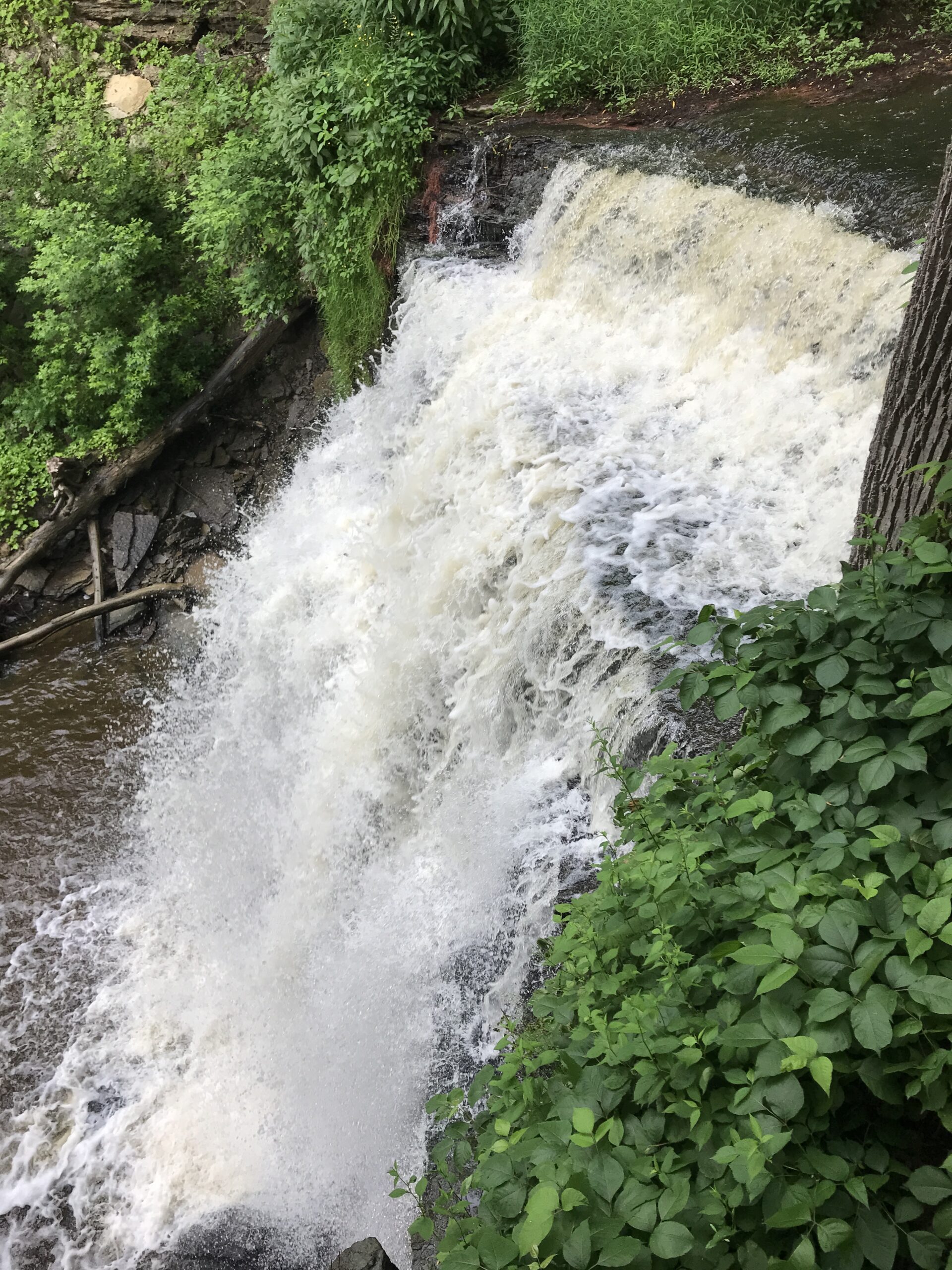
Please join us for a pre-AGM hike to and from the location of the Iroquoia Bruce Trail Club AGM. The hike will proceed over to Great Falls along Mill St, main trail to the Eric Best ST, back on the main trail to Norman Pearson ST, back through Grindstone Creek along the main trail and then to Rockcliffe ST, backout to Dundas St E and return to the parking lot just in time for the AGM to begin. Please bring enough water and snacks for your hike. Trails may be muddy, so gaiters would be useful.
Urban Walk; Don Valley to The Distillery District
https://hikesstaging.brucetrail.org/event/urban-walk-don-valley-to-the-distillery-district-2/Sorry, the registration cut-off time for this hike has been reached.Not a member? Click here to join today!Hosting Club: Toronto
Category: Urban Walk
Location (Google Maps):Toronto
Hike Leader(s): Brian Rideout Click here to contact Hike Leader(s)
Pace: Moderate
Terrain: Flat
Distance: 27.5 kmDescription
This hike follows the Don River south from Steeles Ave East at Leslie St through Toronto to the Distillery District, through a series of ravines and several parks. We will detour to street level when we cross the 401 (trail closed due to construction) and again south of Pottery Rd where we take the Bayview Ave Extension (trail closed due to construction).Please bring a lunch and at least two liters of water. Be prepared for cool / wet weather.
Here is an online map of our route: Don Valley to The Distillery