
Hike Schedule
Join us for a hike! Registration required.
All hikes available to BTC members. Some hikes are open to non-members.
See Refund Policy for Paid Hikes >
TIP: The calendar view displays up to 7 hikes on a day, but often there are more. Click “View more events” to see them all.
Categories
- 25April 25, 2024
Peninsula in 6 Challenger Series B Hike #3 Richardson Side Trail to Rush Cove
https://hikesstaging.brucetrail.org/event/peninsula-in-6-challenger-series-b-hike-3-richardson-side-trail-to-rush-cove/Sorry, the registration cut-off time for this hike has been reached.Not a member? Click here to join today!Hike open to BTC Members only.
Hosting Club: Peninsula
Location (Google Maps):
Rush Cove Parking Lot
Capacity: 10
Coordinates: 44.958806, -81.143985Hike Leader(s): Margaret O’Dell Click here to contact Hike Leader(s)
Pace: Fast
Terrain: Difficult
Distance: 29.7 KmDescription
Hike #3 of 6 Richardson Side Trail To Rush CovePeninsula in 6 Challenger Series
Complete 162.4 km section from Wiarton to Tobermory in 6 hikes.- You must sign up for EACH hike individually. The series is spread-out over 2 weeks, and 3 weekends. You are not automatically accepted into either series as a whole.
- This hike series is intended for experienced distance hikers only. Hikers must demonstrate recent experience completing hikes exceeding 25 km over difficult terrain and at a brisk pace;
- If a hiker is unable to keep pace with the group, or finds the distance too challenging, their future hike registrations may be canceled by the hike leader.
- Be very aware of your ability to join this series.
- Hikes will average 4.5 km per hour including breaks, moving pace is 5 km per hour;
- Expect to be on-trail for 7 – 9 hours;
- Meeting time is scheduled for 7:00am; arrive no later than 15 minutes prior to the meeting time;
- Hikers must carry sufficient hydration, accessible snacks, lunch, first-aid kit, rain gear, extra socks, and possibly protective boot covers (i.e. bags);
- Hikers will be expected to participate in shuttling hikers to the start and to drive shuttlers back to their car. Responsibility will be shared equally;
- Any applicable parking fees will be shared within the group.
Car Hike: Sydenham E2E 5/8
https://hikesstaging.brucetrail.org/event/car-hike-sydenham-e2e-5-8/Sorry, the registration cut-off time for this hike has been reached.Not a member? Click here to join today!Hike open to BTC Members only.
Hosting Club: Toronto, Sydenham
Category: Car Hike
Location (Google Maps):Km 86.3 GPS coordinates N 44.556781, W 80.925586 Centennial Tower, west side of highway 6&10, top of the hill.
map 31.
Hike Leader(s): Smadar Junkin Click here to contact Hike Leader(s)
Pace: Brisk
Terrain: Challenging, Variable
Distance: 21.33 kmDescription
The 5th hike of the Sydenham E2E, we will carpool to Range road. Please note that Range Road is not a designated Bruce Trail parking but we can park there. We will hike hike back. May need icers. Bring 2litres of water. We will follow all Covid 19 instructions. Please arrive at 8:15 so the shuttle can go at 8:30. Everyone is expected to shuttle during the 8 days hike. Expected pace is 4- 4.5 km per hour.9:00 am Long Hike Jordan to Moyer / Louth
https://hikesstaging.brucetrail.org/event/900-am-long-hike-jordan-to-moyer-louth-67/Sorry, the registration cut-off time for this hike has been reached.Not a member? Click here to join today!Hosting Club: Niagara
Location (Google Maps):
Jordan Hollow Park 3039 King St Jordan
Pace: Medium
Terrain: Moderate
: 10kDescription
From Jordan Hollow Hike the main trail to Upper and Lower Balls Falls, Moyer Road or Louth and Return. You must register for each hike. Bring Poles, sunscreen, bug spray , snack and a drink and dress for the weather
Beaver Valley End-to-End Hike 2 of 9
https://hikesstaging.brucetrail.org/event/beaver-valley-end-to-end-hike-2-of-9/Sorry, the registration cut-off time for this hike has been reached.Not a member? Click here to join today!Hosting Club: Caledon Hills
Category: End-to-End
Location (Google Maps): Meet at roadside parking on the south side of Sideroad 19, km 92.3, Map 27 (Ed. 31). Shuttle to start at Grey Rd. 40.Hike Leader(s): Nancy Mooney Click here to contact Hike Leader(s)
Pace: Medium – 3 to 4 km/hour
Terrain: Moderate – some hills and/or some poor footing
Distance: km 105.7 – 92.3 = 13.4 km totalDescription
This is the second hike of the series and includes Webwood Falls, Siegerman reroute, beaver pond and bird sanctuary.9:15 Short Hike, Jordan Hollow
https://hikesstaging.brucetrail.org/event/915-short-hike-jordan-hollow-107/Sorry, the registration cut-off time for this hike has been reached.Not a member? Click here to join today!Hosting Club: Niagara
Category: Hike
Location (Google Maps): Jordan Hollow Park, Jordan StationHike Leader(s): Bill Russell Click here to contact Hike Leader(s)
Pace: Medium
Terrain: Moderate
Distance: ~ 6kmsDescription
Hike the main and side trails around Jordan and Ball’s Falls. Bring hiking boots, water, sunscreen and bug spray.River and Ruin and loop
https://hikesstaging.brucetrail.org/event/river-and-ruin-and-loop-3/Sorry, the registration cut-off time for this hike has been reached.Not a member? Click here to join today!Hosting Club: Iroquoia
Category: Thursday Group
Location (Google Maps): Kilbride Park. Please park behind public schoolHike Leader(s): Jill Parratt Click here to contact Hike Leader(s)
Pace: Medium – 3 to 4 km/hr
Terrain: Moderate – Some hills and/or some poor footing
Distance: 7.5Description
Meet at 9:15 for a 9:30am start.We will hike Kilbride side trail, part of River & Ruin and the loop.
Some good hills so poles are recommended.
Jill Parratt
Island Lake, Orangeville
https://hikesstaging.brucetrail.org/event/island-lake-orangeville/Sorry, the registration cut-off time for this hike has been reached.Not a member? Click here to join today!Hosting Club: Caledon Hills
Category: General
Location (Google Maps): Meet at Vicki Barron Lakeside Trail Parking.
After driving through Orangeville traffic lights on Highway 10, turn right on Hockley Rd., keep straight on SIderoad 5, turn right on Hurontario Street to the car parking.Hike Leader(s): Mohammad Shafiq Click here to contact Hike Leader(s)
Pace: Medium – 3 to 4 km/hour
Terrain: Easy – mostly flat and usually good footing
Distance: 10-11 kmDescription
Will hike around Island Lake, may take few diversions into the side trails for a total of 11-12 km, completing a loop around the lake. Will be watching for birds, other wild life in the lake and enjoy the spring season.
There may be an optional refreshment stop after the hike.Ross McLean Loop
https://hikesstaging.brucetrail.org/event/ross-mclean-loop-10/Sorry, the registration cut-off time for this hike has been reached.Not a member? Click here to join today!Hosting Club: Sydenham
Category: General Hike
Location (Google Maps): West End of Dawson Rd., West of County Rd. 1., north of OS. East of km 129.6 (new book)Hike Leader(s): Franziska Edney Click here to contact Hike Leader(s)
Pace: Medium: 3 to 4 km/h
Terrain: Strenuous: Hilly with steep climbs and some poor footing., There are crevices or holes which may be hidden by layers of snow. Hike with extreme caution., There might be muddy sections.
Distance: 7.6 kmsDescription
We will hike up the Dawson Road Side trail to the white-blazed trail, then north-west to the blue-blazed Ross McLean Side trail. We’ll follow the side trail to the main trail at the end of Lundy Rd. There is a crevice which we need to cross, and you will be able to admire a great specimen of walking fern. From there we will finish the loop and hike back to our cars. Map 34, Poles are advised. Please bring water and a snack if you wish. - 26April 26, 2024

Car Hike: CHBTC 60th Anniversary E2E Badge Combo 1 of 5
https://hikesstaging.brucetrail.org/event/chbtc-60th-anniversary-e2e-badge-combo-1-of-5/Sorry, the registration cut-off time for this hike has been reached.Not a member? Click here to join today!Hike open to BTC Members only.
Hosting Club: Toronto, Caledon Hills
Category: Car Hike
Location (Google Maps): Hike #1 – meet southwest of km 48.4 (Toronto section due to lack of parking at the very south end of Caledon) at Boston Mills Rd. just west of the Mississauga Rd. intersection. (Note: driveway is private property). GPS N43.750866, W79.951452)Hike Leader(s): Jacquie Van Dyke
Pace: Moderate
Terrain: Variable
Distance: 18km – there will be about 6 km of road walking today.Description
Come to one, a few, or all of these hikes to celebrate Caledon’s 60th anniversary! In completing all 5 of these hikes, you’ll qualify for BOTH of Caledon’s NEW badges. On this first of five hikes, we’ll meet at the north end of the Toronto section (due to no parking at the very south end of Caledon) and shuttle to our starting point. We’ll hike through the Forks of the Credit Provincial Park, the Badlands (which may be muddy) and finish with an easy walk back to the vehicles. Although the hike is approximately 18km, there will be about 6km of road walking. If the Spirit Tree Cidery is open, you may wish stop by after the hike.We’ll stop for a short snack break and also a lunch break, so please bring enough food to last the hike, 2L of water, bug repellent, and proper hiking attire. Hiking boots/shoes are mandatory. It may be rainy so ensure you have rain gear with you.
Car Hike: Sydenham E2E 6/8
https://hikesstaging.brucetrail.org/event/car-hike-sydenham-e2e-6-8/Sorry, the registration cut-off time for this hike has been reached.Not a member? Click here to join today!Hike open to BTC Members only.
Hosting Club: Toronto, Sydenham
Category: Car Hike
Location (Google Maps): Range Road, km 108. Please note that this location is not a designated Bruce Trail parking but we can park there.map 33. Coordinates N 44.599838,W 80.956024Hike Leader(s): Smadar Junkin Click here to contact Hike Leader(s)
Pace: Brisk
Terrain: Challenging, Variable
Distance: 21.30Description
The 6th hike of the Sydenham E2E, we will carpool to km 129.6, Dawson Rd Side Trail. and hike back. We will walk the short S T at the end of the hike.May need icers, bring 2 litres of water. We will follow all Covid 19 instructions. Please arrive at 8:15 so the shuttle can leave at 8:30. Everyone is expected to participate in the shuttle over the 8 days hike duration. Expected pace is 4- 4.5 km per hour.
9:00 Mennonite History Hike
https://hikesstaging.brucetrail.org/event/900-mennonite-history-hike/Sorry, the registration cut-off time for this hike has been reached.Not a member? Click here to join today!Hosting Club: Niagara
Category: Urban
Location (Google Maps): Meet in the parking lot behind Meridian Credit Union Arena, 1567 Four Mile Creek Rd, VirgilHike Leader(s): Margaret Northfield Click here to contact Hike Leader(s)
Pace: Medium
Terrain: Easy
Distance: 6kmDescription
Seeking religious freedom, Mennonites from Russia/Ukraine immigrated to Canada from 1923-1930. In 1934, Peter Wall, a Mennonite entrepreneur, purchased several acres of land in the Virgil area. Learn about the Mennonite history in Virgil.Stay for conversation and coffee at Sweets & Swirls, Community Centre, Niagara Stone Rd, Niagara-on-the-Lake
- 27April 27, 2024
1:15pm pre AGM Niagara-on-the-Lake Hike
https://hikesstaging.brucetrail.org/event/115pm-pre-agm-niagara-on-the-lake-hike/Sorry, the registration cut-off time for this hike has been reached.Not a member? Click here to join today!Hosting Club: Niagara
Category: Urban
Location (Google Maps): Street parking in front of the Veterans Memorial Park on King St.Hike Leader(s): Suzanne Gourluck Click here to contact Hike Leader(s)
Pace: Leisurely
Terrain: Easy
Distance: 6 kmDescription
This is a short hike around Niagara-on-the-Lake mostly along paved paths and local trails. Stay afterwards to enjoy the Chilli Cookoff and AGM at 3pm. Dress for the weather and please advise me beforehand of any medical or health concerns.Peninsula in 6 Challenger Series A Hike #3 Richardson Side Trail to Rush Cove
https://hikesstaging.brucetrail.org/event/peninsula-in-6-challenger-series-a-hike-3-richardson-side-trail-to-rush-cove/Sorry, the registration cut-off time for this hike has been reached.Not a member? Click here to join today!Hike open to BTC Members only.
Hosting Club: Peninsula
Location (Google Maps): Rush Cove Parking Lot
Capacity: 10
Coordinates: 44.958806, -81.143985Hike Leader(s): Margaret O’Dell Click here to contact Hike Leader(s)
Pace: Fast
Terrain: Difficult
Distance: 29.7 KmDescription
Hike #3 of 6 Richardson Side Trail To Rush CovePeninsula in 6 Challenger Series
Complete 162.4 km section from Wiarton to Tobermory in 6 hikes.- You must sign up for EACH hike individually. The series is spread-out over 2 weeks, and 3 weekends. You are not automatically accepted into either series as a whole.
- This hike series is intended for experienced distance hikers only. Hikers must demonstrate recent experience completing hikes exceeding 25 km over difficult terrain and at a brisk pace;
- If a hiker is unable to keep pace with the group, or finds the distance too challenging, their future hike registrations may be canceled by the hike leader.
- Be very aware of your ability to join this series.
- Hikes will average 4.5 km per hour including breaks, moving pace is 5 km per hour;
- Expect to be on-trail for 7 – 9 hours;
- Meeting time is scheduled for 7:00am; arrive no later than 15 minutes prior to the meeting time;
- Hikers must carry sufficient hydration, accessible snacks, lunch, first-aid kit, rain gear, extra socks, and possibly protective boot covers (i.e. bags);
- Hikers will be expected to participate in shuttling hikers to the start and to drive shuttlers back to their car. Responsibility will be shared equally;
- Any applicable parking fees will be shared within the group.
Car Hike: Ganaraska Pine Ridge 0-21Km
https://hikesstaging.brucetrail.org/event/car-hije-ganaraska-pine-ridge-0-21km/Sorry, the registration cut-off time for this hike has been reached.Not a member? Click here to join today!Hosting Club: Toronto
Category: Car Hike
Location (Google Maps): Pine Ridge Ganaraska trailHike Leader(s): Lindita Kalo Click here to contact Hike Leader(s)
Pace: Moderate
Terrain: Variable
Distance: 21Description
Pine Ridge is a section of Ganaraska Trail. This is a long distance hike, we going to hike within 4-5km per hour on the flat section and 3-4km per hour on variable terrain. We meet at 44°03’50.6″N 78°23’10.3″W drive to 43°56’56.0″N 78°17’38.9″W Hiking South to North. An e-mail will be send to register hikers with my phone for easy contact.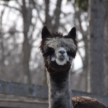
Bus Hike: Presqu'ile Provincial Park Alpaca Hike!
https://hikesstaging.brucetrail.org/event/bus-hike-presquiile-provincial-park-alpaca-hike/Sorry, the registration cut-off time for this hike has been reached.Not a member? Click here to join today!Trip Information
Departure Time: 08:00
Return to City Time: 18:30
Departure Point: York Mills Bus PickupOptional Items
Hosting Club: Toronto
Category: Bus Hike
Location (Google Maps): Presqu’ile Provincial ParkHike Leader(s): Lisa Ruth Lifshitz, Nijole Mockevicius Click here to contact Hike Leader(s)
Pace: Moderate
Terrain: Flat
Distance: 8-9 kmDescription
Come join us for a wonderful and relaxing outing to Presqu’ile Provincial Park, located in Brighton, Ontario. We will hike the best trail of the Park, visiting paths along the shorelines, woodlands and meadows. We will also stop at the second oldest operating lighthouse in Ontario. We will eat lunch in park and then take the marsh boardwalk trail accessing the largest protected marsh on the north shore of Lake Ontario. Early afternoon we will leave the Park to go visit Old Mill Alpacas, a nearby Alpca farm where you will have the opportunity to take turns walking Alpacas, spend time with them to feed them apples, learn about their habits and watch the “running of the Alpacas” as they go for dinner. We have negotiated a special rate for this experience ($30, tax included) which must be paid to Lisa in advance to join the bus. Please e-transfer $30 to lisa.ruth@rogers.com per person attending promptly after you register for this hike on the site. If time permits, we will also stop at the Big Apple before we head back to Toronto. Total hiking around 8-9km but it will be an amazing day.Reminder to our non-members: You are most welcome to join this hike but you must remember to sign up with the Bruce Trail using this signup process in addition to e-transferring payment for the Alpaca tour as you have to be formally registered (and pay the Bruce Trail bus fees) in advance to get on the bus.
Car Hike: Bethesda Trail Richmond Hill
https://hikesstaging.brucetrail.org/event/car-hike-bethesda-trail-richmond-hill-17/Sorry, the registration cut-off time for this hike has been reached.Not a member? Click here to join today!Hosting Club: Toronto
Category: Car Hike
Location (Google Maps): Meet at Bethesda Trail Head Parking on Bethesda Sideroad off Bayview Avenue, across from Lake Wilcox. This parking lot is free.Hike Leader(s): Mohammad Aghamiri Click here to contact Hike Leader(s)
Pace: Moderate
Terrain: Hilly, Variable
Distance: 14-17 kmDescription
Join us to explore Jefferson Forest and Bond lake and thousands of trillium flowersPlease bring hiking poles, proper closing and shoes and lots of water,
Please carefully read safety procedures during the hike:
1-Hikers must stay between the leader and the sweep.
2-Hikers must advise the leader or the sweep if they wish to leave the group.
3- Hikers must follow the whistle instructions: 1 blast- stay where you are; 2 blasts come to the leader; 3 blasts – come to the leader quickly.
4-Hike leader may request volunteers to stop at trail intersections, they need to help hikers to the direction the group walk and wait till they see the sweep .
5-Hikers have to make sure they can see the persons behind and in front of
Car Hike: Sydenham E2E 7/8
https://hikesstaging.brucetrail.org/event/car-hike-sydenham-e2e-7-8/Sorry, the registration cut-off time for this hike has been reached.Not a member? Click here to join today!Hike open to BTC Members only.
Hosting Club: Toronto
Category: Car Hike
Location (Google Maps):Km 129.6, Dawson Road Side Trail. Coordinates N 44.704859,W 80.974322 map 34.
Hike Leader(s): Smadar Junkin Click here to contact Hike Leader(s)
Pace: Brisk
Terrain: Challenging, Variable
Distance: 18.77 kmDescription
The 7th hike of the Sydenham E2E, we will carpool to km 148.0and walk back. Icers May be needed. Bring 2 litres of water. We will follow all Covid 19 instructions. Please arrive at 8:15 so the shuttle can leave by 8:30. Everyone is expected to participate in the shuttle over the 8 days hike duration. Expected pace is 4- 4.5 k per hour.
Creemore - Mingay Loop
https://hikesstaging.brucetrail.org/event/creemore-mingay-loop/Sorry, the registration cut-off time for this hike has been reached.Not a member? Click here to join today!Hosting Club: Blue Mountains
Category: Register in person the morning of hike.
Location (Google Maps): Hike meets in the parking lot behind Tim Hortons on First St. in Collingwood.Hike Leader(s): Michael Treuman Click here to contact Hike Leader(s)
Pace: Leisurely – 3 km/hr. or less
Terrain: Easy – Mostly flat and usually good footing
Distance: 5 kmDescription
This 204 acre property features majestic, mature sugar maple trees and a
meandering cold water stream. This lush Niagara Escarpment forest is home to a
variety of rare and at risk species. The sounds of hairy and pileated woodpeckers echo
through the trees. We will creatively combine Mingay, Maple Leaf and Trout trails to
complete a loop-de-loop. Bring a snack and water.Car Hike: Spring Flowers Hike, Hockley Valley
https://hikesstaging.brucetrail.org/event/car-hike-spring-flowers-hike-hockley-valley/Sorry, the registration cut-off time for this hike has been reached.Not a member? Click here to join today!Hosting Club: Toronto, Caledon Hills
Category: Car Hike
Location (Google Maps): Hockley Valley Nature Preserve, Map 18Hike Leader(s): Al Brown Click here to contact Hike Leader(s)
Pace: Moderate
Terrain: Challenging
Distance: 14 kmDescription
We will hike 14 km through the Nature Preserve, one of the most challenging (hilliest) parts of the Bruce Trail. A great aerobic outing plus we should see lots of spring flowers along the way. After the hike I invite those interested to stop at the Hockley Valley Resort for refreshments.To get to the meeting point drive north of Hwy 10 from Orangeville to Hockley Road. Turn right and go about 5 km east to the parking area on your left. It is across the road from the Black Birch restaurant.

Urban Walk: Graffiti Art, Culture & Nature in Toronto
https://hikesstaging.brucetrail.org/event/urban-walk-graffiti-art-culture-nature-in-toronto-2/Sorry, the registration cut-off time for this hike has been reached.Not a member? Click here to join today!Hosting Club: Toronto
Category: Urban Walk
Location (Google Maps): Meet at the South-West Corner of Queen & OssingtonHike Leader(s): Sajedeh Zahraei Click here to contact Hike Leader(s)
Pace: Leisurely
Terrain: FlatDescription
This hike is part of a series of urban hikes exploring graffiti art, culture, and social history in Toronto’s streets, laneways, underpasses, and parks across the city. These hikes provide opportunities for reflection on our own identity, personal history, examining our connection to each other and to the land, fostering a sense of community and belonging. In this hike we will explore Parkdale – Queen West neighbourhoods.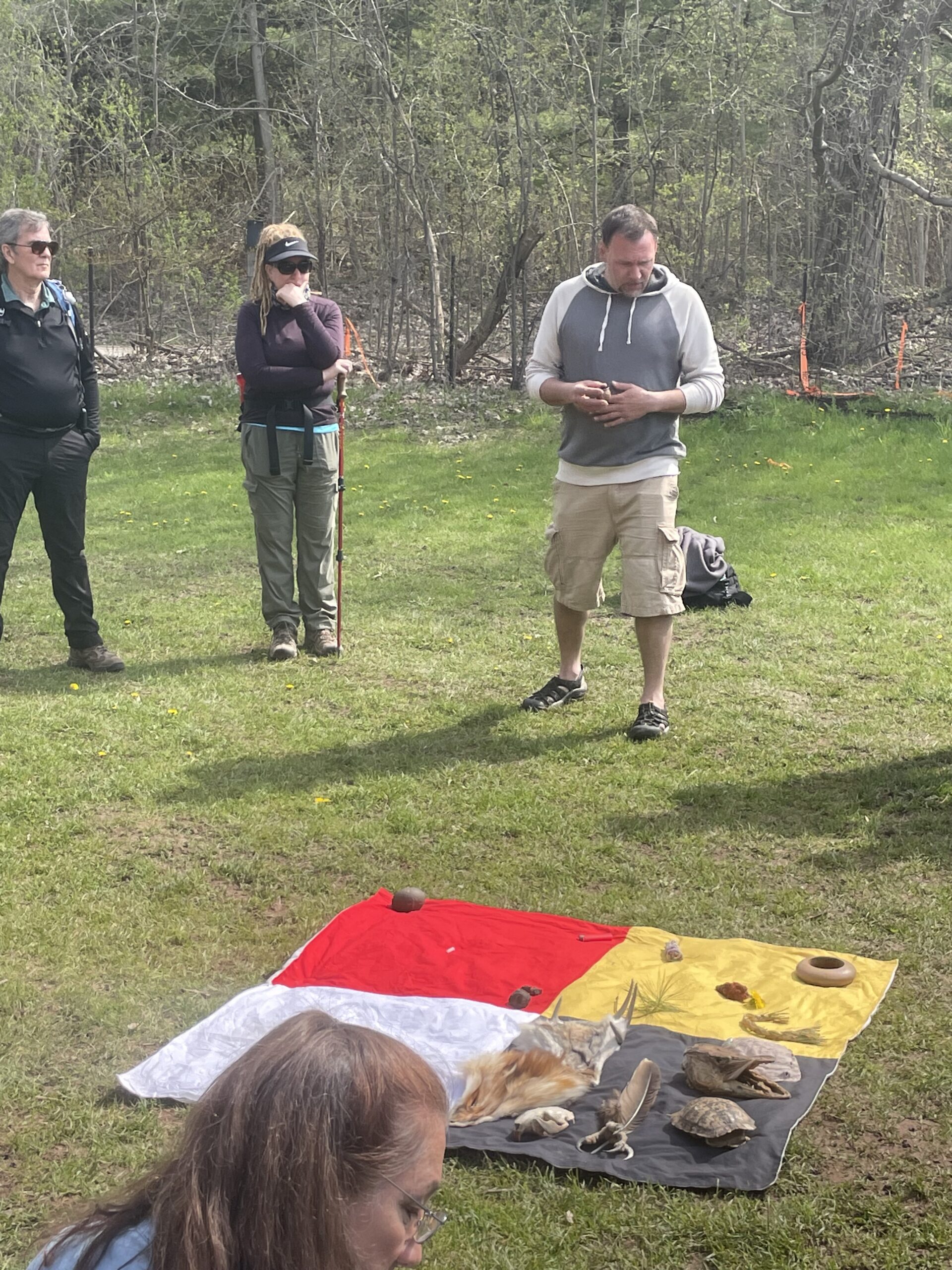
Car Hike: Spring Indigenous Teachings Hike with Alan Colley - CANCELLED
https://hikesstaging.brucetrail.org/event/car-hike-spring-indigenous-teachings-hike-with-alan-colley/Sorry, the registration cut-off time for this hike has been reached.Not a member? Click here to join today!Hosting Club: Toronto
Category: Cancelled
Location (Google Maps): Toronto section Map 12 edition 31, Sideroad 17 parking area, east off Halton RD 25 north of 401 at Milton. there is room for 5-10 cars so park respectfullyHike Leader(s): Lynn McFerran Click here to contact Hike Leader(s)
Pace: Leisurely
Terrain: Variable
Distance: 5-8 kmDescription
Please note this hike has been cancelled due to WET WEATHER AND TRAIL CONDITIONS and will be rescheduled for a date arranged with the hike leaders and Alan ColleyThis spring hike will be co led with Alan Colley the founder and nature guide of Toronto Aboriginal Eco Tours.
HIs mission is to develop relationships with the land for generations to come. He did a hike last spring and is coming back to share his learnings and knowledge this spring. Hopefully the end of April will bring spring ephemerals for us to view. Be sure to download I naturalist app for this hike. This is a learning hike so ata very leisurely pace, with stops along the trail about what you see hear and smell.
This area can be a bit wet if we have a rainy spring dress accordingly and bring bug spray, yes even in April. Pack a lunch or snacks.
Pre AGM Niagara-on-the-Lake Tour
https://hikesstaging.brucetrail.org/event/pre-agm-niagara-on-the-lake-tour/Sorry, the registration cut-off time for this hike has been reached.Not a member? Click here to join today!Hosting Club: Niagara
Category: Urban
Location (Google Maps): Meet on King St near Centre St, Niagara-on-the-LakeHike Leader(s): Margaret Northfield Click here to contact Hike Leader(s)
Pace: Medium
Terrain: Easy
Distance: 8-9kmDescription
This urban hike will take us around beautiful Niagara-on-the-Lake. Mostly paved pathways with some trail walking.Join us for the Annual General Meeting after the hike. Make sure you take in the Chili Cookoff as well.
CANCELLED Spring Ephemeral Series: Fossil Glen
https://hikesstaging.brucetrail.org/event/spring-ephemeral-series-fossil-glen/Sorry, the registration cut-off time for this hike has been reached.Not a member? Click here to join today!Hosting Club: Sydenham
Category: Botany Hike
Location (Google Maps): Due to limited parking at the hike location, participants are encouraged to meet at the Owen Sound Galaxy Cinema parking lot for 1pm, and carpool from there. Meet at the tall “Galaxy Centre” sign next to the traffic lights.Hike Leader(s): Jeannine Kralt Click here to contact Hike Leader(s)
Pace: Leisurely: 3 km/h or less
Terrain: Moderate: Some hills and/or poor footing
Distance: 3kmDescription
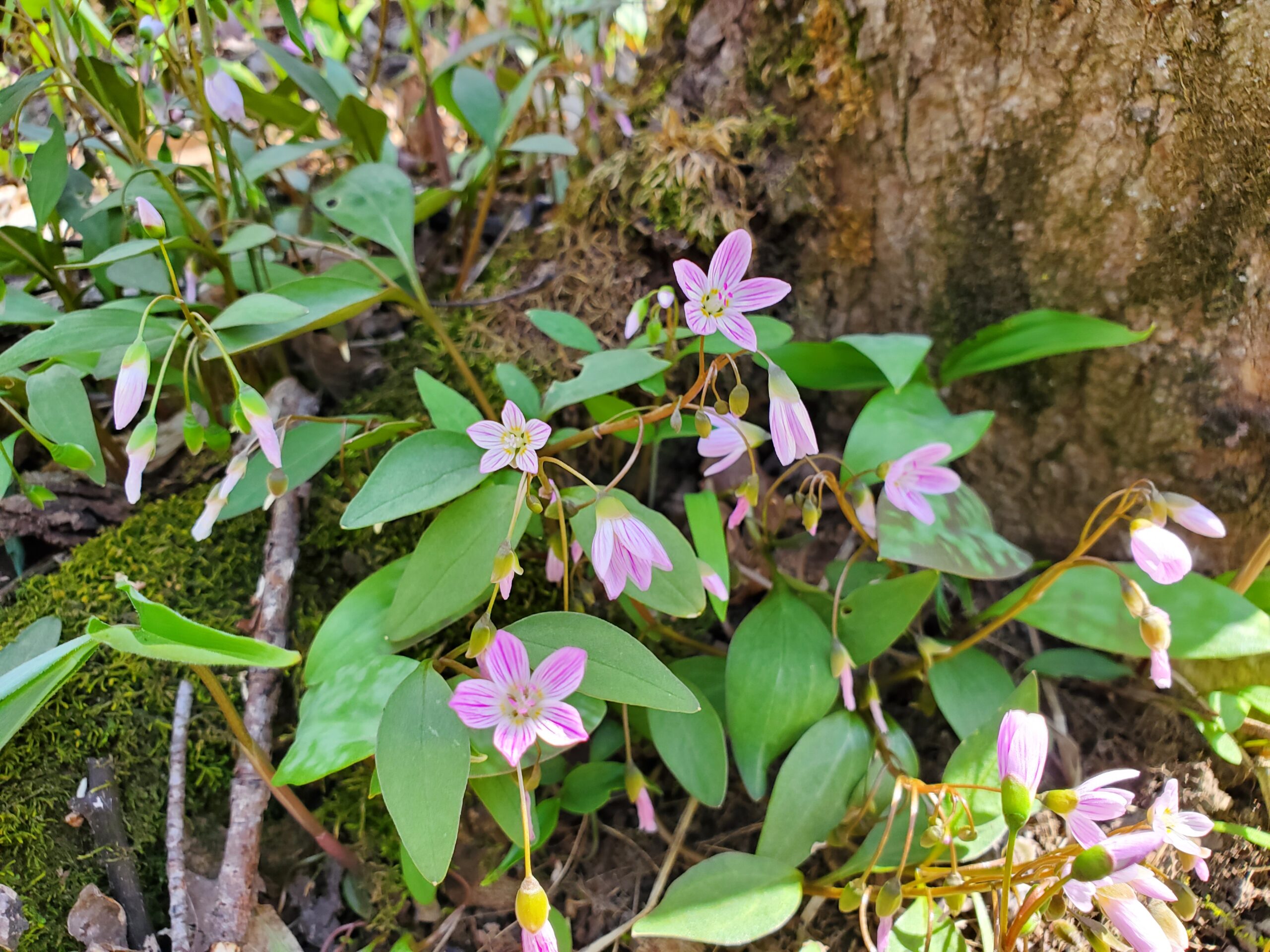
The third and final hike in our series of spring ephemeral hikes – this area has a wide variety of spring ephemerals, including both native Dicentra species, Spring Beauties, Trout Lilies, and Wild Ginger, amongst others. We’ll see what we can find. We’ll be completing a loop including the Frank Holley Side Trail. Portions of this trail are rocky, with some up and downhill sections – good footwear is a must.This leisurely hike will be a classic Discovery Hike, with a focus on spring wildflowers – participants are encouraged to ask questions, and we’ll briefly stop to look at things we find. This section also has interesting fossils, which can briefly be discussed if participants are interested. Photographers welcome. There is a chance that this hike might be moved slightly, given the warmer end to winter this year (it’s been hard to predict timing). Participants will be contacted in advance if that is to be the case.
This hike also appears in Ron Savage’s book Exploring Sydenham – sufficient time will be available to locate the code.
Carpooling encouraged – get in touch with the hike leader if you are in need of a ride. Please plan to arrive 15 minutes in advance of the start time, by 1pm if meeting at the carpool location. An email confirming conditions will be sent out in advance of the hike. Please contact Jeannine via the hike leader contact form should there be any questions or concerns.
NBTC Annual General Meeting
https://hikesstaging.brucetrail.org/event/nbtc-annual-general-meeting-3/Sorry, the registration cut-off time for this hike has been reached.Not a member? Click here to join today!Hike open to BTC Members only.
Hosting Club: Niagara
Category: Register
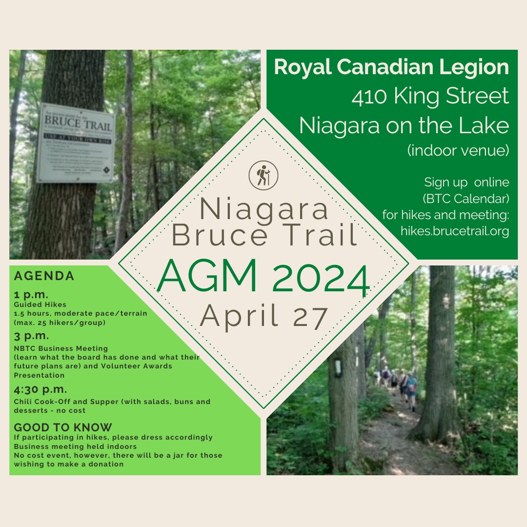
Location (Google Maps): Niagara on the Lake Royal Canadian Legion, 410 King Street, Niagara on the LakeDescription
Come out to meet the Niagara Bruce Trail Club Board as well as other members!Learn what the board has done and what their future plans are. Make your voice heard.
Volunteer Appreciation Awards Presentation.
Stay for the chili cook-off! If you are able, please bring a dessert to share with others. T-shirts, neck scarves and bumper stickers available to purchase. Cash or transfers accepted.
Please note that the meeting will take place on the second floor of the legion. There is no elevator or chair lift. Also, the legion does not allow hats to be worn within their premises.
Registration Required.
Urban Walk: Theatre Hike - Humber River/Swansea
https://hikesstaging.brucetrail.org/event/urban-walk-theatre-hike-humber-river-swansea-3/Sorry, the registration cut-off time for this hike has been reached.Not a member? Click here to join today!Hosting Club: Toronto
Category: Urban Walk
Location (Google Maps):Meet at 3 PM at the bus Route #79 stop at south east corner of Scarlett Road and Eglinton West.
Hike Leader(s): Miriam Stevens Click here to contact Hike Leader(s)
Pace: Leisurely
Terrain: Variable
Distance: 9-10 kmDescription
Join us for a leisurely hike (3 km/hour) on the Humber River trail and through Swansea. There are 3 steep stair cases on the route through Swansea. Suitable for beginners and families. We will follow the Humber River Trail to Old Mill and then hike parts of Swansea to Runnymede & Bloor. Optional dropout at Old Mill Subway Station. After the hike you may choose to join us for dinner at 6:00 PM at either at Ali Baba Mediterranean Cuisine or at a nearby pub as you prefer.
We will attend the play at 8:00 PM at the Village Players, 2190E Bloor Street West to see the play “The Book Of Will” by Lauren Gunderson .Call the theatre directly at 416 767 7702 to reserve your ticket ($29.00 adults and seniors) and mention that you are with the Bruce Trail Conservancy, Toronto Club.
Anyone may choose to come for the hike only, join us for the theatre performance, or join us for all three: Hike, dinner and play.
Parking on side streets off of Bloor street west. A paid parking lot is available behind the theatre building (and adjacent to the subway station) at 2190 Bloor Street West - 28April 28, 2024
Peninsula in 6 Challenger Series A Hike #4 Richardson Side Trail to Dyers Bay
https://hikesstaging.brucetrail.org/event/peninsula-in-6-challenger-series-a-hike-4-richardson-side-trail-to-dyers-bay/Sorry, the registration cut-off time for this hike has been reached.Not a member? Click here to join today!Hike open to BTC Members only.
Hosting Club: Peninsula
Location (Google Maps): Dyers Bay Community Parking
Capacity: 50
Coordinates: 45.162328, -81.340377Hike Leader(s): Margaret O’Dell Click here to contact Hike Leader(s)
Pace: Fast
Terrain: Difficult
Distance: 26 KmDescription
Hike #4 of 6 Richardson Side Trail to Dyers BayPeninsula in 6 Challenger Series
Complete 162.4 km section from Wiarton to Tobermory in 6 hikes.- You must sign up for EACH hike individually. The series is spread-out over 2 weeks, and 3 weekends. You are not automatically accepted into either series as a whole.
- This hike series is intended for experienced distance hikers only. Hikers must demonstrate recent experience completing hikes exceeding 25 km over difficult terrain and at a brisk pace;
- If a hiker is unable to keep pace with the group, or finds the distance too challenging, their future hike registrations may be canceled by the hike leader.
- Be very aware of your ability to join this series.
- Hikes will average 4.5 km per hour including breaks, moving pace is 5 km per hour;
- Expect to be on-trail for 7 – 9 hours;
- Meeting time is scheduled for 7:00am; arrive no later than 15 minutes prior to the meeting time;
- Hikers must carry sufficient hydration, accessible snacks, lunch, first-aid kit, rain gear, extra socks, and possibly protective boot covers (i.e. bags);
- Hikers will be expected to participate in shuttling hikers to the start and to drive shuttlers back to their car. Responsibility will be shared equally;
- Any applicable parking fees will be shared within the group.
Car Hike: Sydenham E2E 8/8
https://hikesstaging.brucetrail.org/event/car-hike-sydenham-e2e-8-8/Sorry, the registration cut-off time for this hike has been reached.Not a member? Click here to join today!Hike open to BTC Members only.
Hosting Club: Toronto
Category: Car Hike
Location (Google Maps):Km 171.6 BlueWater park, Wiarton. Coordinates N 44.742514,W 81.135140 map 35.
Hike Leader(s): Smadar Junkin Click here to contact Hike Leader(s)
Pace: Brisk
Terrain: Challenging, Variable
Distance: 23.43 kmDescription
8th hike of 8, badge day. We will carpool to km 148.0 and hike back. Icers May be needed. Bring 2litres of water. We will follow all Covid 19 instructions. Congratulations for finishing the Sydenham, the longest section of the Bruce Trail. Please arrive at 8:15 so the shuttle can leave by 8:30. Everyone is expected to participate in the shuttle during the 8 days hike duration. Expected pace is 4- 4.5 km per hour.l
Just For Fun Hikers at Whitetail Refuge Nature Reserve
https://hikesstaging.brucetrail.org/event/just-for-fun-hikers-at-whitetail-refuge-nature-reserve/Sorry, the registration cut-off time for this hike has been reached.Not a member? Click here to join today!Hosting Club: Caledon Hills
Category: General
Location (Google Maps): Meet at the Mono Community Centre, 200 m south of Mono Centre (County Road 8). 44.026195, -80.071516Directions: From ON-10 head east onto Dufferin Rd. 8/Mono Centre Rd. for 6.0 km. The Community Centre is on the right.
Hike Leader(s): Sandy Green Click here to contact Hike Leader(s)
Pace: Medium – 3 to 4 km/hour
Terrain: Moderate – some hills and/or some poor footing
Distance: 10 kilometresDescription
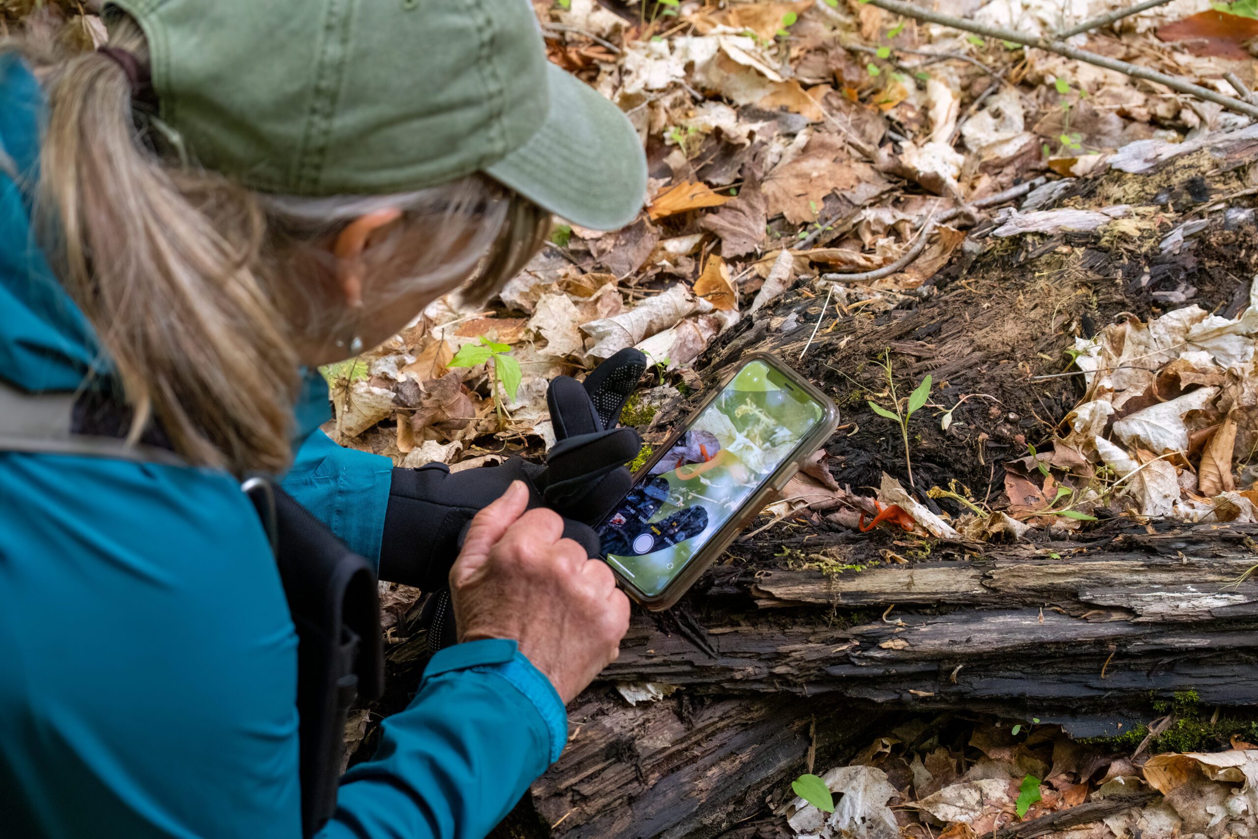
Join with other friends of the Caledon Hills Club to explore the emergence of spring on our Whitetail Refuge Nature Reserve. Bring your choice of hydration and snacks. Sturdy footwear is highly recommended. This hike can be used towards earning the 60 for the 60th commemorative badge.Niagara Gorge, American side
https://hikesstaging.brucetrail.org/event/niagara-gorge-american-side-2/Sorry, the registration cut-off time for this hike has been reached.Not a member? Click here to join today!Hosting Club: Niagara
Category: Loop
Location (Google Maps): Whirlpool State Park, Niagara Scenic Pkwy, Niagara Falls, NY 14303, United StatesHike Leader(s): Marion Hanover Click here to contact Hike Leader(s)
Pace: Medium
Terrain: Easy
Distance: 8 kmDescription
Let’s explore the Niagara gorge from the American side. Proper documentation needed to cross into the United States. I will arrange a car pool from St Catharines Glendale Carpool lot at 9:00am if there is an interested.
Toronto Urban Badge Hike - 4 of 7
https://hikesstaging.brucetrail.org/event/toronto-urban-badge-hike-4-of-7-3/Sorry, the registration cut-off time for this hike has been reached.Not a member? Click here to join today!Hosting Club: Toronto
Category: Urban Walk
Location (Google Maps):Toronto, Ontario, Canada
Hike Leader(s): Brian Rideout Click here to contact Hike Leader(s)
Pace: Moderate
Terrain: Flat
Distance: 11.4 kmDescription
Please join me at the north west corner of Finch and Weston by 10 AM. We will hike east along the Finch Hydro Corridor Trail to Bathurst St (N of Finch) (km 30.2 to km 41.6). Here is an online map with km markings of our route for all 7 hikes for the Toronto Urban Badge.Please make sure you bring at least 2 liters of water, a lunch, bug spray and sunscreen.
Crawford Lake Wildflowers
https://hikesstaging.brucetrail.org/event/crawford-lake-wildflowers/Sorry, the registration cut-off time for this hike has been reached.Not a member? Click here to join today!Hosting Club: Iroquoia
Category: General Hike
Location (Google Maps): Crawford Lake Conservation Area, 3115 Conservation Rd. East side of Guelph Line.Hike Leader(s): Anne Armstrong Click here to contact Hike Leader(s)
Pace: Leisurely – 3km/hr or less
Terrain: Moderate – Some hills and/or some poor footing
Distance: Approx. 7 – 8 km.Description
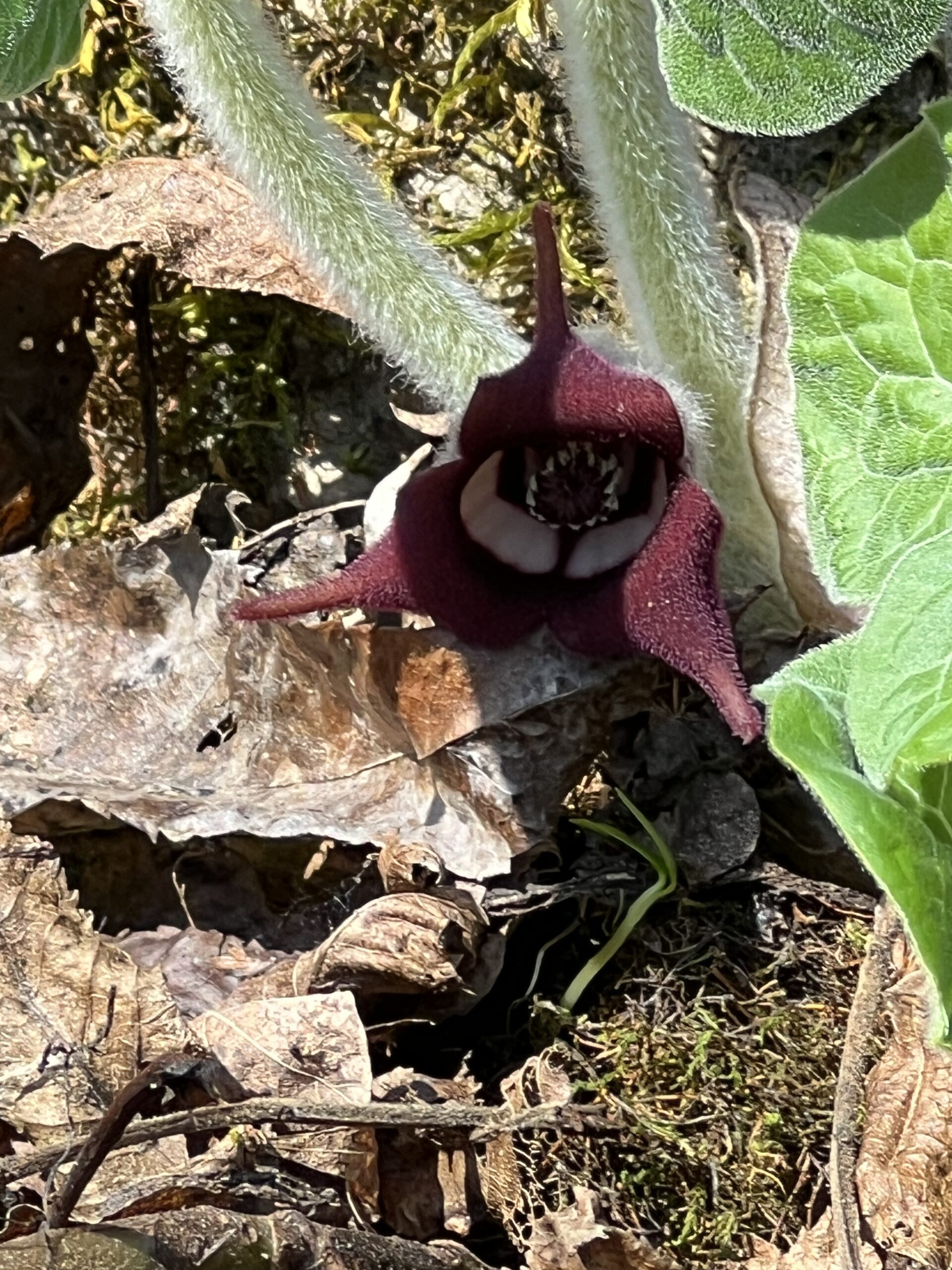
Crawford Lake is always a good area to spot Spring Wildflowers. We will complete a loop hike in our search. The section north of the lookout is quite rocky (that’s where they love to grow). Bring water, a snack and sunscreen. Poles would be useful on the rocky sections. I will contact you a couple of days ahead of the hike with more detailed contact information.
Leader: Anne Armstrong
Car Hike: Hike #4 to earn the Dufferin Hi-Land Youth and/or Side Trails Badge!
https://hikesstaging.brucetrail.org/event/car-hike-hike-4-to-earn-the-dufferin-hi-land-youth-and-or-side-trails-badge/Sorry, the registration cut-off time for this hike has been reached.Not a member? Click here to join today!Hosting Club: Toronto, Dufferin Hi-Land
Category: Car Hike
Location (Google Maps): We will meet at roadside parking on 2nd Line EHS north of 20 Sideroad (Map 19 of the Bruce Trail Reference Guide, Edition 31).Hike Leader(s): Monica Pasquali Click here to contact Hike Leader(s)
Pace: Leisurely
Terrain: Variable
Distance: 8.6 kmDescription
Calling all families with children who love hiking and earning badges!!!This is the fourth in a series of ten hikes that will be offered throughout 2024 on a roughly monthly basis so that children who are 15 years of age and younger can earn the Dufferin Hi-Land Adventurer Youth Badge and their parents/guardians can earn the Dufferin Hi-Land Side Trails Badge at the same time!!! Details regarding the requirements for each badge can be found here: https://dufferinbrucetrailclub.org/dufferin-bruce-trail-club-badges/ Each of the ten hikes will be a loop hike so no car shuttles will be needed, and each hike will cover a distance of approximately 6-9 km hiked at a leisurely pace (2-3 km/h) so children and adults alike can participate.
This fourth hike will be a spring hike to explore some side trails within Mono Cliffs Provincial Park, specifically McCarston’s Lake Side Trail, the Lookout Side Trail, the Walter Tovell Side Trail, and the Carriage Side Trail. Please dress appropriately for a spring hike by dressing in layers (wear an inner layer that wicks sweat away from your skin, a middle layer that keeps you warm, and an outer layer that protects you from wind and rain), wearing a sunhat, and wearing comfortable footwear that has good traction. Hiking poles or walking sticks are an asset since they will help keep you balanced if the ground is muddy/slippery. As well, make sure you bring enough water and food for a 3-4 hour hike since we’ll be covering a total distance of approximately 8.6 km.
Hopefully you’ll be able to join me on Sunday, April 28th! Until then, happy hiking, everyone!
Hiking 101April 28, May 5, May 26, 2024
https://hikesstaging.brucetrail.org/event/hiking-101april-28-may-5-may-26-2024/Sorry, the registration cut-off time for this hike has been reached.Not a member? Click here to join today!This is a Multi-Day Hike
You are signing up for the following dates and times:
2024-04-28 at 13:00
2024-05-05 at
2024-05-26 atHosting Club: Niagara
Category: Register
Location (Google Maps): April 28: Kinsmen Park, Frost Rd, Beamsville
May 5: Louth Conservation Area
May 26: Queenston HeightsHike Leader(s): Lauren Doig Click here to contact Hike Leader(s)
Pace: Leisurely
Terrain: Moderate
Distance: 5-6 kmDescription
Hiking 101 is an introductory course for novice hikers, members and non-members alike. If you want some guidance on where to begin, what to wear, and what to take along, this is the course for you. The course is 3 Sunday afternoon sessions with a combination of workshop/Q& A followed by short hikes along the trail. Dress in weather appropriate clothing and wear good walking shoes.Time: 1 pm – 3pm
Meeting locations: Sunday, April 28- Kinsmen Park, Kinsmen Rd & Frost Rd., Beamsville N 43.146108 W 79.475609
Sunday, May 5 – Louth Conservation Area, parking lot off of Staff Avenue, Louth, 500 m north of Pelham Rd (Regional Road 69) N 43.121706 W 79.351235
Sunday May 26 – Queenston Height Park, near the Bruce Trail Cairn N 43.157826 W 79.052045
Registration is Members $30, Non-Members $40. Upon completing the three sessions, you will receive a FREE tube scarf ($15 value)
Memorial Forest Loop
https://hikesstaging.brucetrail.org/event/memorial-forest-loop-10/Sorry, the registration cut-off time for this hike has been reached.Not a member? Click here to join today!Hosting Club: Sydenham
Category: General Hike
Location (Google Maps): Owen Sound – Memorial Forest west end of Young’s Drive – just east of km 105.8 on B.T.Hike Leader(s): Danuta Valleau Click here to contact Hike Leader(s)
Pace: Leisurely: 3 km/h or less
Terrain: Moderate: Some hills and/or poor footing
Distance: 3 kmDescription
We will leave the parking area at 1:15 pm and follow the side trail along base of escarpment to Jones Falls, where we ascend through a crevice to the main trail and return along the top of the escarpment with lookout points.Walking poles are recommended although not essential.