
Hike Schedule
Join us for a hike! Registration required.
All hikes available to BTC members. Some hikes are open to non-members.
See Refund Policy for Paid Hikes >
TIP: The calendar view displays up to 7 hikes on a day, but often there are more. Click “View more events” to see them all.
Categories
- 01November 1, 2024
Car Hike: Caledon E2E in 5 sections - 3 of 5
https://hikesstaging.brucetrail.org/event/car-hike-caledon-e2e-in-5-sections-3-of-5/Sorry, the registration cut-off time for this hike has been reached.Not a member? Click here to join today!Hosting Club: Iroquoia, Caledon Hills
Category: General Hike
Location (Google Maps): Meet at km 45.5 at Mono 5 Sideroad on the north side where the trail crosses, and we carpool to km 31.7Hike Leader(s): Susan Glofcheskie Click here to contact Hike Leader(s)
Pace: Medium – 3 to 4 km/hr
Terrain: Moderate – Some hills and/or some poor footing
Distance: 14 kmDescription
Join us for this Caledon E2E in 5 sections. Sign up for all 5 sections (to be entitled to the badge) or only the ones you are available for.Please bring 2 litres of water, a snack, bug spray, sunscreen, a personal first-aid kit and appropriate clothing. Hiking boots/shoes are mandatory and poles are suggested.
Please arrive by 8 am, so we can leave at 8:15 am to shuttle to our starting point.
Click on the Google link for directions to the meeting place.
9:00 Niagara On The Lake Tour
https://hikesstaging.brucetrail.org/event/900-niagara-on-the-lake-tour/Sorry, the registration cut-off time for this hike has been reached.Not a member? Click here to join today!Hosting Club: Niagara
Category: Urban
Location (Google Maps): Veterans Memorial Park, park just outside the park on King StreetHike Leader(s): Suzanne Gourluck Click here to contact Hike Leader(s)
Pace: Medium
Terrain: Easy
Distance: 6-7 kmsDescription
Each Friday we will explore different neighbourhoods, trails and parkland throughout Historic Niagara-on-the-Lake.Moderate pace with some weeks entirely on sidewalks and roads while others may include a mix of trails and paved pathways. Great way to build up endurance for longer more strenuous hikes.
Prepare for cooler windy conditions on open parkland and along Lake Ontario and Niagara River trails.
Plan to stay for conversation and a warm cup of coffee or tea at Sweets & Swirls, Community Centre, Niagara Stone Road, NOTL
Grey Road 40 to Blantyre
https://hikesstaging.brucetrail.org/event/grey-road-40-to-blantyre/Sorry, the registration cut-off time for this hike has been reached.Not a member? Click here to join today!Hosting Club: Beaver Valley
Location (Google Maps): Meet in the parking area provided by a landowner on the west side of Grey Road 12 across from the trail entrance which is at km 117.3, Map 28, Edition 31.
Hike Leader(s): Glenda Collings Click here to contact the hike leader.
Pace: Medium
Terrain: Moderate, Some rocky footing
Length of Hike: 11.6 kmDescription
We’ll be hiking through lovely hardwood forest, along fields, beside crevices and across creeks. Bring water and snacks and dress for the weather. The good news is – no steep hills! You can contact me using the Contact Hike Leader option in the hike posting if you have any questions.COVID-19 Precautions Before, During and After your Hike
- Each hiker joining a Bruce Trail Club organized hike must perform a self-screening check before hiking.
Find Ontario’s self-assessment tool here: https://covid-19.ontario.ca/self-assessment/ - If you are experiencing COVID-19 symptoms, stay home.
Other Guidelines
- Arrive 15 minutes before the start of the hike.
- Wear sturdy footwear and appropriate attire for the weather and the terrain.
Hiking poles are a good idea in any season, especially if the terrain is rocky or slippery. In winter, snowshoes or icers/crampons are needed when conditions dictate.
Wearing appropriate clothing and footwear prevents injuries and shows consideration for a safe and positive group hiking experience. - Always carry I.D. and your health card.
- Bring sufficient water and snacks (or lunch if indicated). A minimum of 1L of water is recommended on all hikes, and 3L is recommended for long, challenging hikes in the heat of the summer.
- Bring sunscreen and insect repellent (for spring and summer hikes).
- Bring your own first aid kit.
- Please leave dogs at home.
- Each hiker joining a Bruce Trail Club organized hike must perform a self-screening check before hiking.
- 02November 2, 2024
School Bus Hike: Dufferin Section E2E #1 of 4
https://hikesstaging.brucetrail.org/event/school-bus-hike-dufferin-section-e2e-1-of-4/Sorry, the registration cut-off time for this hike has been reached.Not a member? Click here to join today!Trip Information
Departure Time: 08:30
Return to City Time: 18:00
Departure Point: York Mills Bus PickupOptional Items
Hosting Club: Toronto
Category: Bus Hike
Location (Google Maps): Dufferin Hi-Land/Caledon Section Boundary to km 14.1Hike Leader(s): Tom Swales, Celia Ho Click here to contact Hike Leader(s)
Pace: Moderate (3-4 km/hr)
Terrain: Hilly, Level 2 (Intermediate – some hills and uneven surfaces, rocks and roots underfoot), Rocky, Variable
Distance: 14.1 kmDescription
Join us on the first four Saturdays of November on a series of bus hikes to complete the Dufferin Hi-Land section. Hikers who complete all four hikes may apply for the Dufferin Hi-Land Club’s pink rose E2E badge ($10.00 Members, $15.00 Non-Members) or their stained glass fundraiser Yellow Ladies Slipper badge ($30.00 – Members Only). The first hike in the series will take us from the Caledon/Dufferin Hi-Land section boundary and northwards 14.1 km through Mono Cliffs Provincial Park. Anyone is welcome to join one or more of the hikes even if not working on one of the E2E badges. For drivers who wish to meet us at the trailhead, four spots will be reserved – cost $10 includes return shuttle to meeting location – please email the hike leaders for details on how to register as Car Hike – priority for the four spots will be given to hikers intending to join all 4 hikes.Car Hike: Wilder Forest Uxbridge
https://hikesstaging.brucetrail.org/event/car-hike-wilder-forest-uxbridge-9/Sorry, the registration cut-off time for this hike has been reached.Not a member? Click here to join today!Hosting Club: Toronto
Location (Google Maps): 2499 Brock Road, Uxbridge, ON there is a free parking when you enter the road off brock road beside Horse training facility
Hike Leader(s): Mohammad Aghamiri Click here to contact Hike Leader(s)
Pace: Moderate (3-4 km/hr)
Terrain: Hilly, Variable
Distance: 14-15 kmDescription
We will explore Wilder forest and the beautiful scenery of Uxbridge forests.
9:00 Witch of Cave Spring Hike
https://hikesstaging.brucetrail.org/event/900-witch-of-cave-spring-hike-3/Sorry, the registration cut-off time for this hike has been reached.Not a member? Click here to join today!Hosting Club: Niagara
Location (Google Maps):
Parking lot Quarry Road Beamsville
Hike Leader(s): Angela Lytle Click here to contact Hike Leader(s)
Pace: Medium
Terrain: Moderate
Distance: 5 kmDescription
Enjoy a beautiful hike through the autumn woods and learn about local historical and mystical lore while searching for the Witch of Cave Spring.Complete this guided hike and count it towards the Screaming Tunnel Badge, more info on the badge requirements is here: https://niagarabrucetrail.club/badges/
Wearing a witch hat, while not required, is highly recommended!
Details:
This hike loops from Quarry Rd in Beamsville (limited parking, carpool if possible) along the Bruce Trail to Cave Spring Conservation area and back.
Note: The path to Cave Spring is quite rocky and has some hills. We recommend using hiking poles and wearing good hiking shoes is a must. Carry water and dress for changeable weather.
We will stop along the way at sites of interest and loop back to the car park on Quarry Rd. The loop is around 5 km. Please arrive by 8:50 to check in with the hike leader for departure at 9.
Balsam Wetlands to Glen Huron
https://hikesstaging.brucetrail.org/event/balsam-wetlands-to-glen-huron-4/Sorry, the registration cut-off time for this hike has been reached.Not a member? Click here to join today!Hosting Club: Blue Mountains
Category: Organized Hike
Location (Google Maps): Tim Hortons, First Street Collingwood, ONHike Leader(s): David Little Click here to contact Hike Leader(s)
Pace: Medium – 3 to 4 km/hr
Terrain: Moderate – Some hills and/or some poor footing
Distance: 12 kmDescription
This is a car shuttle hike. We will drive to and leave the cars on Station Street in Glen Huron and drive to km 37.4 (BTC parking lot off Cty.Rd. 91) to begin the hike. The trail winds its way through privately owned forest and farmland eventually coming to a viewing platform south of Cty. Rd. 124. The hike continues down into the valley and at km 30.6 we meet up with the Mad River Side Trail. Following the side trail parallel to the Mad River we continue on to the cars. Bring a snack or lunch and water.
9:00am Niagara Shores Park Beachcoming Hike
https://hikesstaging.brucetrail.org/event/900am-niagara-shores-park-beachcoming-hike-2/Sorry, the registration cut-off time for this hike has been reached.Not a member? Click here to join today!Hike open to BTC Members only.
Hosting Club: Niagara
Category: Loop
Location (Google Maps):Corner of Niven Road and Lakeshore Road in Niagara-on-the-Lake. Park along Old Lakeshore Road.
Hike Leader(s): Suzanne Gourluck Click here to contact Hike Leader(s)
Pace: Leisurely
Terrain: Moderate
Distance: 5-6kmDescription
Explore a lakeshore park, shoreline and cliff top trail in Niagara-on-the-Lake. This beachcombing hike involves uneven ground, clambouring over fallen trees, a pebbly beach, sandy, wet and exposed areas. Hat, sunscreen and poles are highly recommended. Please note: This is not a maintained trail and some areas may have overhanging grass and shrubs.
Saturday Shorts: Terra Cotta
https://hikesstaging.brucetrail.org/event/saturday-shorts-terra-cotta/Sorry, the registration cut-off time for this hike has been reached.Not a member? Click here to join today!Hike open to BTC Members only.
Hosting Club: Caledon Hills
Category: General
Location (Google Maps): Meet at 9:30 am at the roadside parking on Winston Churchill Blvd., where the Terra Cotta Side Trail (Caledon Trailway) crosses the road. This is south of the entrance to Terra Cotta Conservation Area.Hike Leader(s): Elizabeth Ganong Click here to contact Hike Leader(s)
Pace: Medium – 3 to 4 km/hour
Terrain: Easy – mostly flat and usually good footing, Moderate – some hills and/or some poor footing
Distance: Approximately 5 kmDescription
Looking to get out on a Saturday but not give up your whole day? Saturday Shorts, a hiking series, will get you out in a small group on a short hike. This Saturday’s hike is at Terra Cotta. We’ll hike the Terra Cotta Side Trail and a conservation trail to make a lollipop route that will be shorter than 5 km. Bring water and a snack, if desired. There will be a short break. No dogs please. - 03November 3, 2024

Caledon Hills Vintage Badge & 60 For the 60th End-to-End Series
https://hikesstaging.brucetrail.org/event/caledon-hills-vintage-badge-60-for-the-60th-end-to-end-series/Sorry, the registration cut-off time for this hike has been reached.Not a member? Click here to join today!This is a Multi-Day Hike
You are signing up for the following dates:
2024-11-03, 2024-11-17, 2024-11-24, 2024-12-08Hosting Club: Caledon Hills
Category: End-to-End
Location (Google Maps): Meet at km 15.9, designated roadside parking along the southwest shoulder of Willoughby Road near Escarpment Sideroad intersection, 43.831244, -79.980588.
Directions: From ON-10 turn west onto Escarpment Side Rd. Proceed for 1.5 km to roadside parking.Hike Leader(s): Sandy Green, Lana Hubbard, and Lily Li Click here to contact Hike Leader(s)
Pace: Medium – 3 to 4 km/hour
Terrain: Strenuous – hilly with steep climbs and some poor footing
Distance: 16 kilometresDescription
Here is an end of the year opportunity to complete the Caledon Hills section in 4 hikes for the vintage E2E and the 60 for the 60th badges. Hike distances range from 16 km – 20 km. Bring snacks and beverages. Sturdy footwear is required. Badges will be available for purchase.
Peninsula Blue Series: Sinkhole Side Trail
https://hikesstaging.brucetrail.org/event/peninsula-blue-series-sinkhole-side-trail/Sorry, the registration cut-off time for this hike has been reached.Not a member? Click here to join today!Hosting Club: Peninsula
Category: Peninsula Blue Series
Location (Google Maps):Little Cove parking
Hike Leader(s): Saabir Sohrab Click here to contact Hike Leader(s)
Pace: Medium
Terrain: Difficult
Distance: ~13kmDescription
This is an in and out hike. We will meet at the Little Cove parking and hike south on the main trail to Driftwood Cove. Along the way, we will explore the Sink hole side trail and also enjoy gorgeous views of the Georgian bay.Our lunch stop will be at the Driftwood Cove beach before hiking back to the Little Cove parking.
Bring water, snacks, and lunch, and most importantly, dress for the weather.
Scotsdale Farm
https://hikesstaging.brucetrail.org/event/scotsdale-farm-trafalgar-day-hike/Sorry, the registration cut-off time for this hike has been reached.Not a member? Click here to join today!Hosting Club: Dufferin Hi-Land
Category: General Hike
Location (Google Maps): First parking lot in a grass field on the right as you enter from Trafalgar Road just north of Silver Creek. The address for Scotsdale Farm is 13807 Trafalgar Road, Georgetown. About .5 km northeast of km 29.7, BTC Map 13.Hike Leader(s): Stuart Law Click here to contact Hike Leader(s)
Pace: Medium
Terrain: Dependent on Conditions, Moderate, Slippery Sections Likely
Distance: 17 kmsDescription
Join us on a 17 km loop hike of the many Side Trails of Scotsdale Farm. There will be the traces of a railway from Toronto to Guelph hidden in the bush. There will be a pit, a reservoir, a quarry, three streams, and perhaps a salamander or two. The area is carpeted with leaves and some Fall colours remain too. Please bring a warm drink, water, a snack, a smile and an appreciation of nature. Boardwalks and bridges will be slippery. Extra caution required. Hiking boots mandatory. Please dress in layers for the weather. Please don’t forget to change your clocks to “Fall Back”.
Silver Creek and Walking Fern
https://hikesstaging.brucetrail.org/event/silver-creek-and-walking-fern-2/Sorry, the registration cut-off time for this hike has been reached.Not a member? Click here to join today!Hosting Club: Iroquoia
Category: General Hike
Location (Google Maps): Meet roadside on Fallbrook Trail at 9:15 amHike Leader(s): Karen Bergmann Click here to contact Hike Leader(s)
Pace: Medium – 3 to 4 km/hr
Terrain: Moderate – Some hills and/or some poor footing
Distance: 9 kmsDescription
Meeting roadside on Fallbrook Trail at Silver Creek Conservation Area, we will hike the Irwin Quarry Side Trail to the main trail and to Tenth Line. We will then hike in and back on the Walking Fern Side Trail. A challenging trail for footwork but is well worth it. Then it’s back up the main trail to the Roberts Side Trail to the cars. This hike has some crazy rocky spots and a few hilly bits. Come with water and a snack. Hike is dependent on weather conditions.Car Hike: Scotsdale Farm
https://hikesstaging.brucetrail.org/event/car-hike-scotsdale-farm-9/Sorry, the registration cut-off time for this hike has been reached.Not a member? Click here to join today!Hosting Club: Toronto
Category: Car Hike
Location (Google Maps): Scotsdale Farm, Map 13Hike Leader(s): Al Brown Click here to contact Hike Leader(s)
Pace: Moderate (3-4 km/hr)
Terrain: Level 2 (Intermediate – some hills and uneven surfaces, rocks and roots underfoot), Variable
Distance: 10 kmDescription
We will complete a loop hike on the main and side trails across variable terrain that includes farmlands and forest. Trail conditions will reflect the season and weather conditions and could be a bit muddy. This hike is an easy level 2.After the hike those interested will meet for refreshments in Georgetown at the Sheppard’s Crook.
To get to the meeting point from Mississauga, go west on the 401 to Trafalgar Road. North on Trafalgar past Georgetown. Turn left onto Hwy 7 and continue north about 4 km to Silver Creek. Turn right at the stoplight and continue north on Trafalgar about 2 km to the entrance of Scotsdale Farm. The parking area is about half a km from the entrance.
- 04November 4, 2024
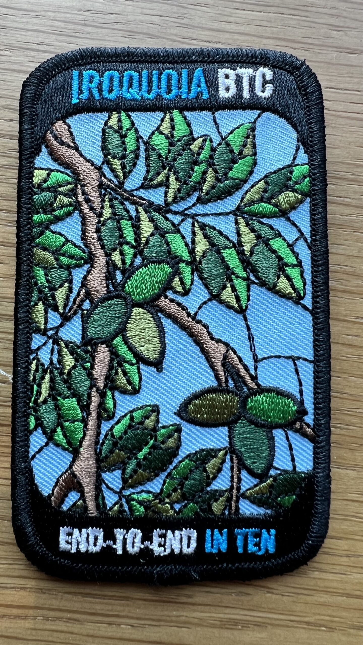
Stained Glass Butternut Badge End to End in 8 Fundraiser
https://hikesstaging.brucetrail.org/event/stained-glass-butternut-badge-end-to-end-in-8-fundraiser/Sorry, the registration cut-off time for this hike has been reached.Not a member? Click here to join today!This is a Multi-Day Hike
You are signing up for the following dates and times:
2024-11-04 at 08:00
2024-11-05 at
2024-11-06 at
2024-11-12 at
2024-11-13 at
2024-11-18 at
2024-11-19 at
2024-11-20 atHosting Club: Iroquoia
Category: Stained Glass Badge End to End Fundraiser Hike
Location (Google Maps): We are hiking Southbound from Hilton Falls to Grimsby.Hike Leader(s): Ruth Moffatt Click here to contact Hike Leader(s)
Pace: Medium – 3 to 4 km/hr
Terrain: Dependent on Conditions, Moderate – Some hills and/or some poor footing, Strenuous – Hilly with steep climbs and some poor footing
Distance: 122/8 hikes – Daily distance will depend on available parkingDescription
Please Note: Refunds are not allowed for this hike. Proceeds will go to supporting the Iroquoia Bruce Trail Club in maintaining the trail infrastructure and in turn supports the mission of the Bruce Trail Conservancy, which is: “Preserving a ribbon of wilderness, for everyone, forever.”Terrain: Dependent on Conditions, Moderate – Some hills and/or some poor footing, Slippery and Steep Sections, Slippery Sections Likely, Strenuous – Hilly with steep climbs and some poor footing. This section has it all and conditions are sometimes due to weather.
Distance: The Iroquoia section of trail is 122km which will be split into 8 hikes. Each hike’s distance will be dependent on available parking. The first day’s distance is about 19.5km. A schedule with all distances will be provided to all participants prior to the start.
Please arrive at the meeting spot at least 15min prior to 8am on each day.Description
This is a special series of 8 hikes to complete the entire Iroquoia section of the Bruce Trail over 2-3 days each week, during the week, over 3 weeks. There is an accomplishment badge, included in the registration fee – which was designed by Joe Borges and features the butternut tree. Please note, normally this badge is offered in 10 hikes, where you can miss up to 3 and make those hikes up on your own. For this series, we are combining two of those hikes with the distance, so you can only miss one of the hikes and make it up on your own.
For this E2E in 8, we will be following the main trail southbound starting in Milton and finishing in Grimsby where the celebration often concludes with a special treat. Please note, you are signing up for the entire series of eight hikes as a Group Hike. The Iroquoia series is geared to experienced hikers with the expectation of a 3 -4km/hr pace maintained over the entire daily distance. Please contact the Hike Leader if you only need a portion of this section.
Hikers will be expected to wear proper hiking footwear and layered clothing. Sufficient snacks, water, hiking poles, and wet weather gear (if necessary) are recommended. Please always include a First Aid Kit in your backpack.
A maximum of 1 of the 8 hikes can be self-completed as a result of scheduling challenges, but it is intended that this badge be earned while hiking as part of a group led by the hike leader. Car shuttles are shared amongst the hikers.
Points of interest, plant id, photo ops, guidance, hike organization and choice of the butternut badge or the new red fox badge, are all included in the fee.
If anyone has any questions, please direct them through the contact on this page.
Please note there are no refunds!

Iroquoia E2E Series 1 of 8
https://hikesstaging.brucetrail.org/event/iroquoia-e2e-series-1-of-8/Sorry, the registration cut-off time for this hike has been reached.Not a member? Click here to join today!Hike open to BTC Members only.
Hosting Club: Iroquoia
Location (Google Maps): Meeting Place: Roadside Parking MacDui Drive, we will car shuffle to the start of the hike.
Hike Leader(s): Pati Greenwood, Jeff Dowsett Click here to contact Hike Leader(s)
Pace: Medium – 3 to 4 km/hr
Terrain: Moderate – Some hills and/or some poor footing
Distance: 15.8Description
Join us for this series of 8 hikes to complete the Iroquoia Section of the Bruce Trail. Register for all 8 hikes (to be entitled to the badge) or only the ones you are available for. Car shuffle and other hike details will be emailed to registered hikers a few days prior to the hike. Bring plenty of water and a snack. Wear appropriate clothing for conditions. Hiking boots are mandatory and hiking poles are suggested. Please arrive at the meeting place by 8:15 am as we will leave promptly at 8:30 am to shuffle to our starting point.Bayview Escarpment Nature Reserve Side Trails & Coffin Ridge Boutique Winery
https://hikesstaging.brucetrail.org/event/bayview-escarpment-nature-reserve-coffin-ridge-boutique-winery/Sorry, the registration cut-off time for this hike has been reached.Not a member? Click here to join today!Hosting Club: Sydenham
Category: Hike & Picnic
Location (Google Maps): HD for those coming from Owen Sound OR Bayview Escarpment Nature Reserve(Km 52.7, Map 30, Ed 31) to drive directly to the hike.Hike Leader(s): Sheri Hatcher Click here to contact Hike Leader(s)
Pace: Medium: 3 to 4 km/h
Terrain: Moderate: Some hills and/or poor footing
Distance: Approx 12 kmDescription
For those wanting to carpool, we will meet at 8:30 a.m in the north-east corner of the parking lot at Home Depot on Highway 26 on the east side of Owen Sound. We will shuttle to km 52.7 (Map 30; Edition 31) were we will begin our hike at 9:00.We will hike the main trail clockwise and explore the 3 side trails within the Nature Reserve (Bayview Escarpment, Kaboom and River Kwai). We will hike through mixed hardwood forest, deep crevices and high cliffs. Following the hike there will be an optional opportunity to visit Coffin Ridge Boutique Winery were we can enjoy a snack while appreciating the views overlooking the vineyard and Georgian Bay.
Men's Hike; Black Creek Provincial Park
https://hikesstaging.brucetrail.org/event/mens-hike-black-creek-provincial-park/Sorry, the registration cut-off time for this hike has been reached.Not a member? Click here to join today!Hosting Club: Peninsula
Location (Google Maps): Black Creek Provincial Park, Lion’s Head
Hike Leader(s): Owen Glendon Click here to contact Hike Leader(s)
Pace: Leisurely
Terrain: Easy
Distance: ~3-3 1/2 kmDescription
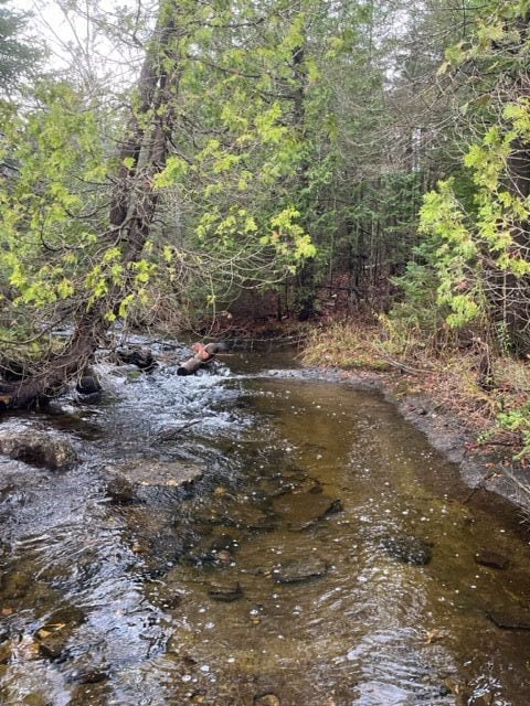
Meet at the Lion’s Head Legion located on Hwy 6 (6 Hellyer’s Rd) by 1030 am. Join us for coffee anytime between 9:00 a.m.and 10:30 a.m. We will take the 10 minute drive from here to the Park on the Lake Huron shore for an easy in/out hike. The hike will include a short sandy beach section, trail through mixed forest and some rocky beach.Dress warmly as we will be next to open water. Bring water and snacks as the hike will run until about 12:30. Hiking footwear is suggested.