
Hike Schedule
Join us for a hike! Registration required:
All hikes available to BTC members. Some hikes are open to non-members.
TIP: The calendar view displays up to 7 hikes on a day, but often there are more. Click “More events” to see them all.
Categories
- 12October 12, 2024

Fall Colours Two-day End-to-End
https://hikesstaging.brucetrail.org/event/fall-colours-two-day-end-to-end/Sorry, the registration cut-off time for this hike has been reached.Not a member? Click here to join today!This is a Multi-Day Hike
You are signing up for the following dates:
2024-10-12, 2024-10-13Hosting Club: Caledon Hills
Category: End-to-End
Location (Google Maps): On Saturday and Sunday, meet at Coolihans Side Road at km 35.0, east of where the Trail crosses the road, 43.937967, – 79.934650.From Airport Rd., head east on Coolihans Side Road for 850 metres. Park well off the road on the north side.
Hike Leader(s): Sandy Green Click here to contact Hike Leader(s)
Pace: Brisk – 4 to 5 km/hour
Terrain: Strenuous – hilly with steep climbs and some poor footing
Distance: 37.4 kilometresDescription
Challenge yourself to complete our 72.4 section of Trail over two days during the peak display of fall colours. Daily bus shuttles and a finisher’s commemorative badge are included in the registration fee. Refreshments and beverages will be served at checkpoints every 7 – 11 kilometres. Participants are expected to hike at a minimum pace of approximately 4 km/hr.Description: The bus leaves at 7:30 am sharp each day. Please plan to arrive at least 20 – 30 minutes before the departure time.
On Saturday and Sunday, meet at Coolihans Side Road at km 35.0, east of where the Trail crosses the road, 43.937967, – 79.934650.
From Airport Rd, head east on Coolihans Side Road for 850 metres. Park well off the road on the north side.
On Saturday, the bus will drop participants off at the northern end of the Caledon Hills section, at County Rd. 8. Hikers will then head south back to Coolihans Side Road.
Checkpoints are located 11.3 km, 18.2 km, 29.1 km (Cut-off Time: 4:00 pm), and 37.4 km into the hike.
On Sunday, the bus will drop the group off on Creditview Road at km 0.0. Hikers will then hike north, back to Coolihans Side Road.
Checkpoints are located 9.5 km, 20.8 km, 27.8 km (Cut-off Time: 4:00 pm), and 35.0 km into the hike.
For further details visit caledonbrucetrail.ca.

Fall Colours Three-Day (Early Start) End-to-End
https://hikesstaging.brucetrail.org/event/fall-colours-three-day-early-start-end-to-end/Sorry, the registration cut-off time for this hike has been reached.Not a member? Click here to join today!This is a Multi-Day Hike
You are signing up for the following dates and times:
2024-10-12 at 07:45
2024-10-13 at 07:45
2024-10-14 at 07:45Hosting Club: Caledon Hills
Category: End-to-End
Location (Google Maps): On Saturday, meet at the Fung Loy Kok Taoist Tai Chi-International Centre
248305 Side Road 5, Mono, ON L9W 6C3. Google Maps GPS Coordinates: 43.975421, -79.989252.From Airport Road, turn east onto Side Road 5. Drive 270 metres to the entrance of the International Centre on the left. Enter the driveway and head straight for approximately 50 metres. Parking is in a field on the right. The buildings and facilities of the International Centre are off limits to participants during this Bruce Trail event.
Hike Leader(s): Sandy Green Click here to contact Hike Leader(s)
Pace: Brisk – 4 to 5 km/hour
Terrain: Strenuous – hilly with steep climbs and some poor footing
Distance: 27 kilometresDescription
Experience the spectacular fall colours while completing our 72.4 kilometre section of Trail over the Thanksgiving long weekend. Bus shuttles for the three days and a beautiful finisher’s commemorative badge are included in the registration fee. Refreshments and beverages will be served at checkpoints every 7-11 kilometres. Participants are expected to hike at a minimum pace of 4 km/hr.Note: As in past years, registration for the extreme 2-day event did not reach capacity. Participants of this early start 3-day E2E option fill the bus. The bus picks up the 2-day participants and then makes a second stop to pick up the 3-day early hikers. Both 3-day E2E events are exactly the same except for different start times.
Description:
The bus leaves at 7:45 a.m. sharp on Saturday and Sunday. On Monday, the bus and trail angels will transport hikers at 8:30. Please plan to arrive at least 20 – 30 minutes before the departure time.
On Saturday, meet at the Fung Loy Kok Taoist Tai Chi-International Centre
248305 Side Road 5, Mono, ON L9W 6C3. Google Maps GPS Coordinates: 43.975421, -79.989252.
From Airport Road, turn east onto Side Road 5. Drive 270 metres to the entrance of the International Centre on the left. Enter the driveway and head straight for approximately 50 metres. Parking is in a field on the right. The buildings and facilities of the International Centre are off limits to participants during this Bruce Trail event.
The bus will take participants to the northern end of the Caledon Hills section, at County Rd 8. The group will then hike south, back to the International Centre.
Checkpoints are located 11.3 km, 18.2 km (Cut-off Time: 2:00 pm), and 26.9 km into the hike.
On Sunday, meet at km 20.8, the north/east corner of Escarpment Side Road and Heart Lake Road. Park on the north side of Escarpment Side Road, well off of the road, 43.859911, -79.947606.
The bus will take hikers to km 0.0 on Creditview Road. Participants will then hike back to the meeting place on Escarpment Side Road.
Checkpoints are located 9.5 km (Cut-off Time: 11:45) and 20.8 km into the hike.
On Monday, meet at the Fung Loy Kok Taoist Tai Chi-International Centre.
The bus will take participants to Escarpment Side Road and Heart Lake Road. Everyone will then hike back to the International Centre.
Checkpoints are located 10.7 km, 18.4 km (Cut-off Time: 2:00 pm), and 25.1 km into the hike.
Please note that on Saturday and Monday, the final checkpoint (the end of the hike) is slightly off the Bruce Trail. There will be signs in place to direct hikers. Also note that the meeting place on Sunday is different than the other two days.
School Bus Hike: Niagara Glen and Niagara-on-the-Lake
https://hikesstaging.brucetrail.org/event/school-bus-hike-niagara-glen-and-niagara-on-the-lake/Sorry, the registration cut-off time for this hike has been reached.Not a member? Click here to join today!Trip Information
Departure Time: 08:30
Return to City Time: 18:00
Departure Point: Kipling Departure PointOptional Items
Hosting Club: Toronto
Category: Bus Hike
Location (Google Maps): Niagara Falls, Niagara-on-the-LakeHike Leader(s): Celia Ho; Tom Swales; Leila Damband Click here to contact Hike Leader(s)
Pace: Leisurely (2-3 km/hr), Mixed (See Hike Description), Moderate (3-4 km/hr)
Terrain: Other (Refer to Description), Variable
Distance: 8-9 kmDescription
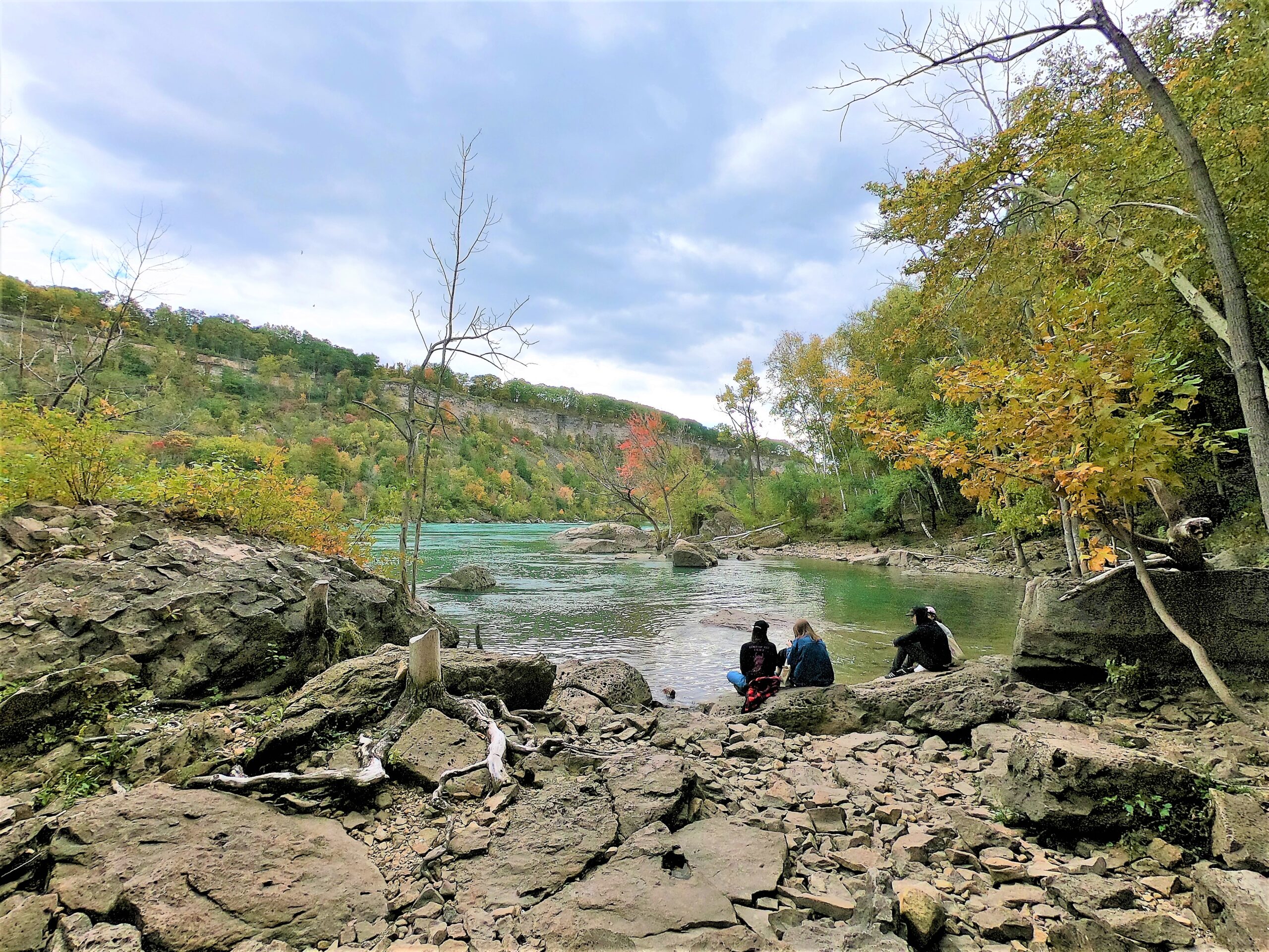
Join us to visit Niagara Glen (https://www.niagaraparks.com/visit/attractions/niagara-glen) and Niagara-on-the-Lake (https://www.niagaraonthelake.com/).There will be 4-5 km of trails at Niagara Glen (excluding the rocky Whirlpool Trail). The terrain is Moderate (Difficulty Level 2) trails suitable for most hikers with basic trail experience and with infrequent obstacles and gently rolling areas with some short, steep sections. There are steep staircases going down into the gorge and coming back up.
After Niagara Glen the bus will take us to Niagara-on-the-Lake where we will do a 4 km loop on the Heritage Trail with paved and unpaved trails between Fort George, Butler’s Barracks, and Paradise Grove. The trails link Fort George National Historic Site and Butler’s Barracks National Historic Site. The terrain is Easy with hard-packed surface, no obstacles, minimal stairs and little or no change in elevation. Please refer to the route map: https://onthegomap.com/s/gi8t3622
After the hike free time will be given to explore the streets of the Historic Old Town of Niagara-on-the-Lake and stop for refreshments.
Pro-rated parking fee of $1.35 for bus parking at Niagara On The Lake will be added to the bus fare when registering.
Car Hike: Glasgow Village Whitchurch-Stouffville 156
https://hikesstaging.brucetrail.org/event/car-hike-glasgow-village-whitchurch-stouffville-9/Sorry, the registration cut-off time for this hike has been reached.Not a member? Click here to join today!Hosting Club: Toronto
Category: Car Hike
Location (Google Maps): Glasgow Trail, Concession Road 2 Park in parking lot at the trail head.From Highway 404 turn right to Stouffville Rd, till to the end of road and turn left on York Durham line in About 1km turn right to Webb Rd. and turn right to Concession Road 2 ,you will see parking lot in 500 meters
Hike Leader(s): Mohammad Aghamiri Click here to contact Hike Leader(s)
Pace: Moderate (3-4 km/hr)
Terrain: Hilly, Level 2 (Intermediate – some hills and uneven surfaces, rocks and roots underfoot), Variable
Distance: 14-15KMDescription
Lets explore Goodwood conservation area and visit Secord forest and pondApproximately 5-hour hike, bring lots of water

Fall Colours Three-day End-to-End
https://hikesstaging.brucetrail.org/event/fall-colours-three-day-end-to-end/Sorry, the registration cut-off time for this hike has been reached.Not a member? Click here to join today!This is a Multi-Day Hike
You are signing up for the following dates:
2024-10-12, 2024-10-13, 2024-10-14Hosting Club: Caledon Hills
Category: End-to-End
Location (Google Maps): On Saturday, meet at the Fung Loy Kok Taoist Tai Chi-International Centre
248305 Side Road 5, Mono, ON L9W 6C3, 43.975421, -79.989252.From Airport Road, turn east onto Side Road 5. Drive 270 metres to the entrance of the International Centre on the left. Enter the driveway and head straight for approximately 50 metres. Parking is in a field on the right. The buildings and facilities of the International Centre are off-limits to participants during this Bruce Trail event.
Hike Leader(s): Sandy Green Click here to contact Hike Leader(s)
Pace: Brisk – 4 to 5 km/hour
Terrain: Strenuous – hilly with steep climbs and some poor footing
Distance: 27.0 kilometresDescription
Experience the spectacular fall colours while completing our 72.4 kilometre section of Trail over the Thanksgiving long weekend. Bus shuttles for the three days and a beautiful finisher’s commemorative badge are included in the registration fee. Refreshments and beverages will be served at checkpoints every 7 – 11 kilometres. Participants are expected to hike at a minimum pace of 4 km/hr.Description:
The bus leaves at 8:30 a.m. sharp, each day. Please plan to arrive at least 20 – 30 minutes before the departure time.
On Saturday, meet at the Fung Loy Kok Taoist Tai Chi-International Centre, 248305 Side Road 5, Mono, ON L9W 6C3, 43.975421, -79.989252.
From Airport Road, turn east onto Side Road 5. Drive 270 metres to the entrance of the International Centre on the left. Enter the driveway and head straight for approximately 50 metres. Parking is in a field on the right.
The bus will take participants to the northern end of the Caledon Hills section, at County Rd. 8. The group will then hike south, back to the International Centre.
Checkpoints are located 11.3 km, 18.2 km (Cut-off Time: 2:00 pm), and 26.9 km into the hike.
On Sunday, meet at km 20.8, the north/east corner of Escarpment Side Road and Heart Lake Road. Park on the north side of Escarpment Side Road, well off of the road, 43.859911, -79.947606.
The bus will take hikers to km 0.0 on Creditview Road. Participants will then hike back to the meeting place on Escarpment Side Road.
Checkpoints are located 9.5 km (Cut-off Time: 11:45) and 20.8 km into the hike.
On Monday, meet at the Fung Loy Kok Taoist Tai Chi-International Centre.
The bus will take participants to Escarpment Side Road and Heart Lake Road. Everyone will then hike back to the International Centre.
Checkpoints are located 10.7 km, 18.4 km (Cut-off Time: 2:00 pm), and 25.1 km into the hike.
For further details visit caledonbrucetrail.ca.

Fireman's Park Tour
https://hikesstaging.brucetrail.org/event/firemans-park-tour/Sorry, the registration cut-off time for this hike has been reached.Not a member? Click here to join today!Hosting Club: Niagara
Category: Loop
Location (Google Maps): Meet in the upper parking lot of Fireman’s Park, Dorchester & Mountain Rds, Niagara FallsHike Leader(s): Margaret Northfield Click here to contact Hike Leader(s)
Pace: Medium
Terrain: Moderate
Distance: 9-10kmDescription
We will be hiking a mixture of the Bruce Trail as well as paved and dirt trails in and around Fireman’s Park. Poles recommended. Bring water and a snack.
9:00 Remembering the Six Nations' Role in the Battle of Queenston Heights, 13 OCT 1812
https://hikesstaging.brucetrail.org/event/900-remembering-the-six-nations-role-in-the-battle-of-queenston-heights-13-oct-1812-2/Sorry, the registration cut-off time for this hike has been reached.Not a member? Click here to join today!Hosting Club: Niagara
Category: Loop
Location (Google Maps):Queenston Heights Park, near Bruce Trail Southern Terminus Cairn, km 0.0. Enter from Niagara Pkwy. A parking fee is charged.
Hike Leader(s): Karen Couch Click here to contact Hike Leader(s)
Pace: Medium
Terrain: Moderate
Distance: 10 kmsDescription
This hike will recognize the contribution of the Six Nations during the Battle of Queenston Heights, Oct 13, 1812. We will stop at several points of interest for information to be shared. The hike will follow several side trails and paths through and around Queenston. A final stop at the Landscape of Nations Memorial will be included.The climbs up and down the escarpment can be slippery and offer poor footing, and may be strenuous, particularly if there has been rain. Hiking poles are recommended.
Right click on/Open the link below to view a short video on the subject.
https://www.historicacanada.ca/productions/minutes/queenston-heights
Please Note: Hikes are offered by volunteers who have committed to their own learning, to be able to offer informative and contemplative hike experiences. These hikes are open to all and offered in a spirit of mutual learning and inclusion.
Geology Hike
https://hikesstaging.brucetrail.org/event/geology-hike/Sorry, the registration cut-off time for this hike has been reached.Not a member? Click here to join today!Hosting Club: Blue Mountains
Category: Organized Hike
Location (Google Maps):Hike Leader(s): Annette Sandberg Click here to contact Hike Leader(s)
Pace: Leisurely – 3 km/hr. or less
Terrain: Moderate – Some hills and/or some poor footing
Distance: 7.5Description
Griersville to Webwood Falls: Erratic boulders at Stop 4 (Page 109) Glacial erratics are rocks picked up by glaciers and transported great distances to be left behind as the glacier melts. These erratic boulders are 1 billion years older than the local sedimentary bedrock, and originally came from the Canadian Shield.
Hike Ontario - Certified Hike Leader Course - October 12 - 9-5pm - Please read all the details before signing up for this course.
https://hikesstaging.brucetrail.org/event/hike-ontario-certified-hike-leader-course-please-read-all-the-details-before-signing-up-for-this-course/Sorry, the registration cut-off time for this hike has been reached.Not a member? Click here to join today!Hosting Club: Iroquoia
Category: Special Event
Location (Google Maps): Bruce Trail Conservancy Board Room – 55 Head St, DundasHike Leader(s): Ruth Moffatt Click here to contact Hike Leader(s)
Distance: N/A
Description
This is a one day course to certify volunteers as Certified Hike Leaders for leading hikes on the Iroquoia Bruce Trail. A student manual will be sent electronically ahead of time, to all qualified applicants. You will be required to participate in an all day course delivered in person. There will be about an hour outside. Typically you will have already participated in many group hikes on the Bruce Trail and are ready to lead your own hikes. The fee of $85 is payable on registration but is refundable on completion of leading at least 4 hikes by the end of 2025.This course is intended for individuals who wish to volunteer their time leading hikes and will include a manual, a badge and guidance on how to complete a hike for the BTC hike schedule.
If you have any questions, please reach out through this form .
Urban Walk: Toronto Islands
https://hikesstaging.brucetrail.org/event/urban-walk-toronto-islands-4/Sorry, the registration cut-off time for this hike has been reached.Not a member? Click here to join today!Hosting Club: Toronto
Category: Urban Walk
Location (Google Maps): Toronto IslandHike Leader(s): Michael Humpage, Janet McColeman Click here to contact Hike Leader(s)
Pace: Moderate (3-4 km/hr)
Terrain: Flat, Level 1 (Easy – mostly on flat, well maintained trails with hard-packed surface)
Distance: 13.5 KMDescription
The island can be very beautiful and peaceful in the early fall. We will meet at 9:15 AM at the Toronto Islands Ferry Dock at the bottom of Bay Street to take the 9:30 AM Ward’s Island ferry (as per Island Fall Schedule). Tickets can be bought online or at the ticket booth. Ferry adult return cost is $9.11. The hike will do a loop around the islands, along the boardwalk, past the lighthouse to Hanlan’s Point and returning on the other side of Ward’s island. Expected return on the Ward’s Island ferry departing at 2:15 PM. Dropout anytime by returning to Ward’s island ferry dock or there are also ferries leaving from Hanlan’s Point or Centre Island on a limited schedule. Hiking shoes or good walking shoes needed. Bring water (2 litres recommended), lunch, sunscreen and insect repellant. Difficulty Level: 1/2 (Easy to/Moderate)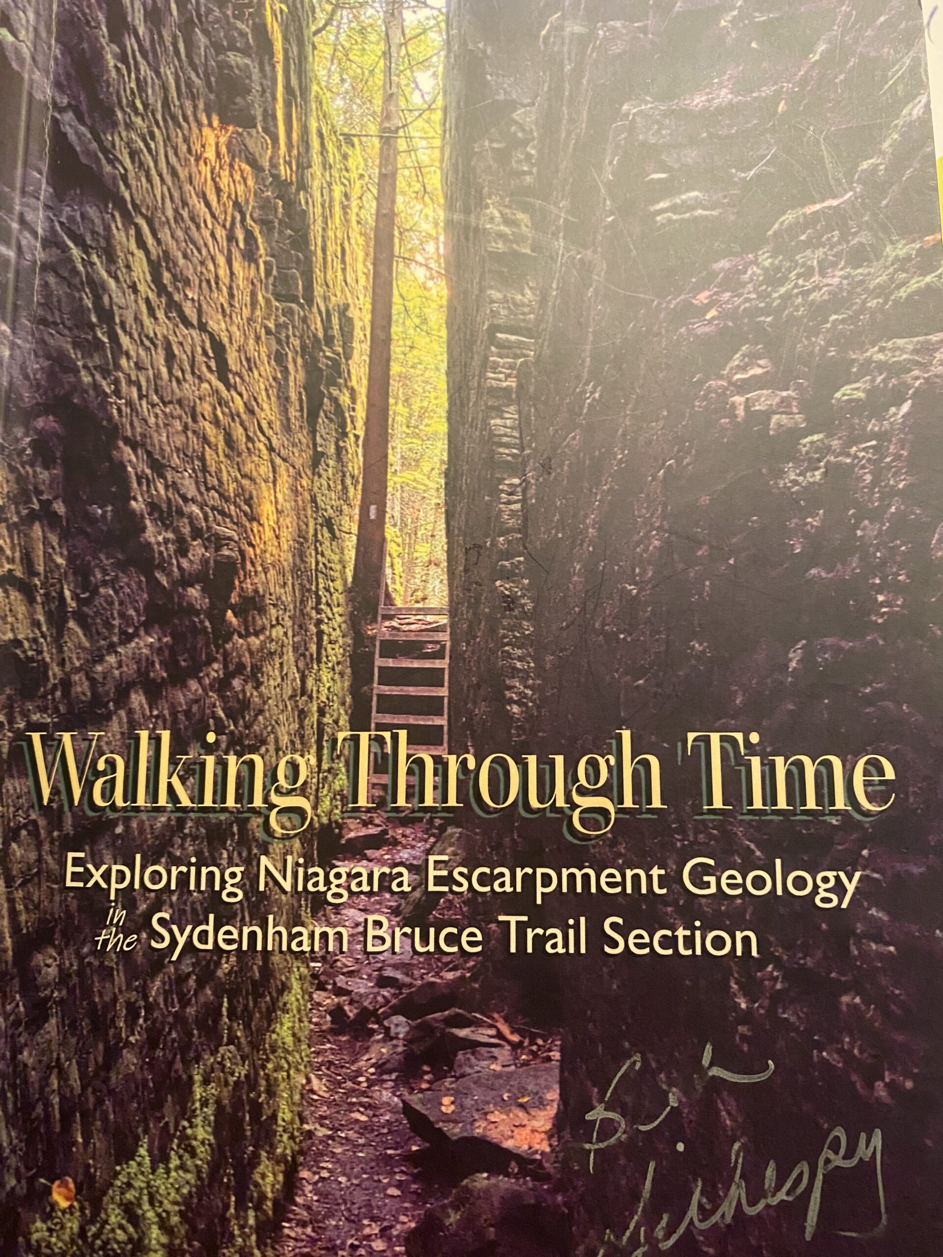
Geology Hike # 3 Silent Valley to Woodford
https://hikesstaging.brucetrail.org/event/geology-hike-3-silent-valley-to-woodford/Sorry, the registration cut-off time for this hike has been reached.Not a member? Click here to join today!Hike open to BTC Members only.
Hosting Club: Sydenham
Category: Geology Hike
Location (Google Maps): Woodford Community Hall, 107 Woodford Crescent, Owen Sound, N4K 5W4. Please park behind the hall. We will carpool to trailhead from here. Car shuttle.Hike Leader(s): Carol Graham-Mullin Click here to contact Hike Leader(s)
Pace: Leisurely: 3 km/h or less
Terrain: Easy: Mostly flat and good footing., Moderate: Some hills and/or poor footing, Strenuous: Hilly with steep climbs and some poor footing.
Distance: 6.4 kmDescription
This is Geology Hike # 3, from Silent Valley to Woodford, following Beth Gilhespy’s “Walking Through Time” book re: geology of the Sydenham Bruce Trail section. We will immerse ourselves in the beauty of the crevices, wetlands, fossils and views and discover some local settler history. Please bring water and snacks. Proper footwear and hiking poles are recommended. A very special guest may join us ! Copies of Beth’s book will be available for purchase. Special member’s price of $37.00 , cash, cheque or etransfer. If using cash, please bring correct change.