
Hike Schedule
Join us for a hike! Registration required:
All hikes available to BTC members. Some hikes are open to non-members.
TIP: The calendar view displays up to 7 hikes on a day, but often there are more. Click “More events” to see them all.
Categories
- 14January 14, 2024

Caledon End to End in 4 Days - January 14, 17, 21, 24 (Save January 25 in case of inclement weather)
https://hikesstaging.brucetrail.org/event/caledon-end-to-end-in-4-days/Sorry, the registration cut-off time for this hike has been reached.Not a member? Click here to join today!Hike open to BTC Members only.
This is a Multi-Day Hike
You are signing up for the following dates:
2024-01-14, 2024-01-17, 2024-01-21, 2024-01-24Hosting Club: Iroquoia, Caledon Hills
Category: Special Event
Location (Google Maps): Caledon End to End in 4 Hikes – If one day has to be cancelled for inclement weather, the snow date will be January 25Hike Leader(s): Ruth Moffatt Click here to contact Hike Leader(s)
Pace: Brisk – 4 to 5 km/hr, Medium – 3 to 4 km/hr
Terrain: Dependent on Conditions, Moderate – Some hills and/or some poor footing, Strenuous – Hilly with steep climbs and some poor footing
Distance: The distance will be approximately 20km per dayDescription
Are you ready for some winter hiking? This group hike will be held over 4 days (2 Sundays and 2 Wednesdays) and will qualify you for the new Caledon 60th Anniversary badge as well as their new ETE badge and the Frosty Five Winter Badge. That’s three badges for one end to end. Caledon club is very generous to hikers! 😊
$10 for each badge for members.Conditions may be difficult due to snow fall and/or icy conditions. You will need to bring icers for every outing and possibly snow shoes. Please ensure you are physically able to hike in possibly severe conditions and deep snow. Please be prepared to share in cutting trail, if needed.
Please dress in layers according to the weather forecast. Bring enough food and water for a long day of hiking. This is a car shuttle hike – please be prepared to share in the shuttling either to the hike start or driving the drivers back at the end of day.
Please arrive at the meeting spot at least 15 minutes ahead of time.
Snow/inclement weather date will be January 25 or you can make any missed days when it is convenient for you.
A schedule will be sent to all registered participants about a week prior to our start date.
Urban Walk; Wincott Wetland and Humber Creek to Scarlett Woods Golf Course via Humber River East Side
https://hikesstaging.brucetrail.org/event/urban-walk-wincott-wetland-and-humber-creek-to-eglington-flats-via-humber-river-east-side/Sorry, the registration cut-off time for this hike has been reached.Not a member? Click here to join today!Hosting Club: Toronto
Category: Urban Walk
Location (Google Maps): 125 metres west of Dixon Road & Islington Avenue intersection, south side at entrance to Wincott Park. If arriving early, meet me at the Tim Hortons inside the No Frills Plaza SE corner at 10 am to use the washrooms and to stay warm. We will leave the Tim Hortons at 10:20 to walk to Winicott Park entrance. If driving to the hike, park on Northcrest Road, assessable via Fenley Dr and Poynter Dr from Islington Ave. Follow the path around the pond to the entrance of the park at Dixon Road to meet the group. Transit users can come either via Islintgton Bus 37 from Islington Subway running every 11 minutes or via Lawrence West Bus 52 to Pearson Airport running every 12 minutes.Hike Leader(s): Andrew Proczek Click here to contact Hike Leader(s)
Pace: Moderate
Terrain: Flat, Variable
Distance: 11.5 kmDescription
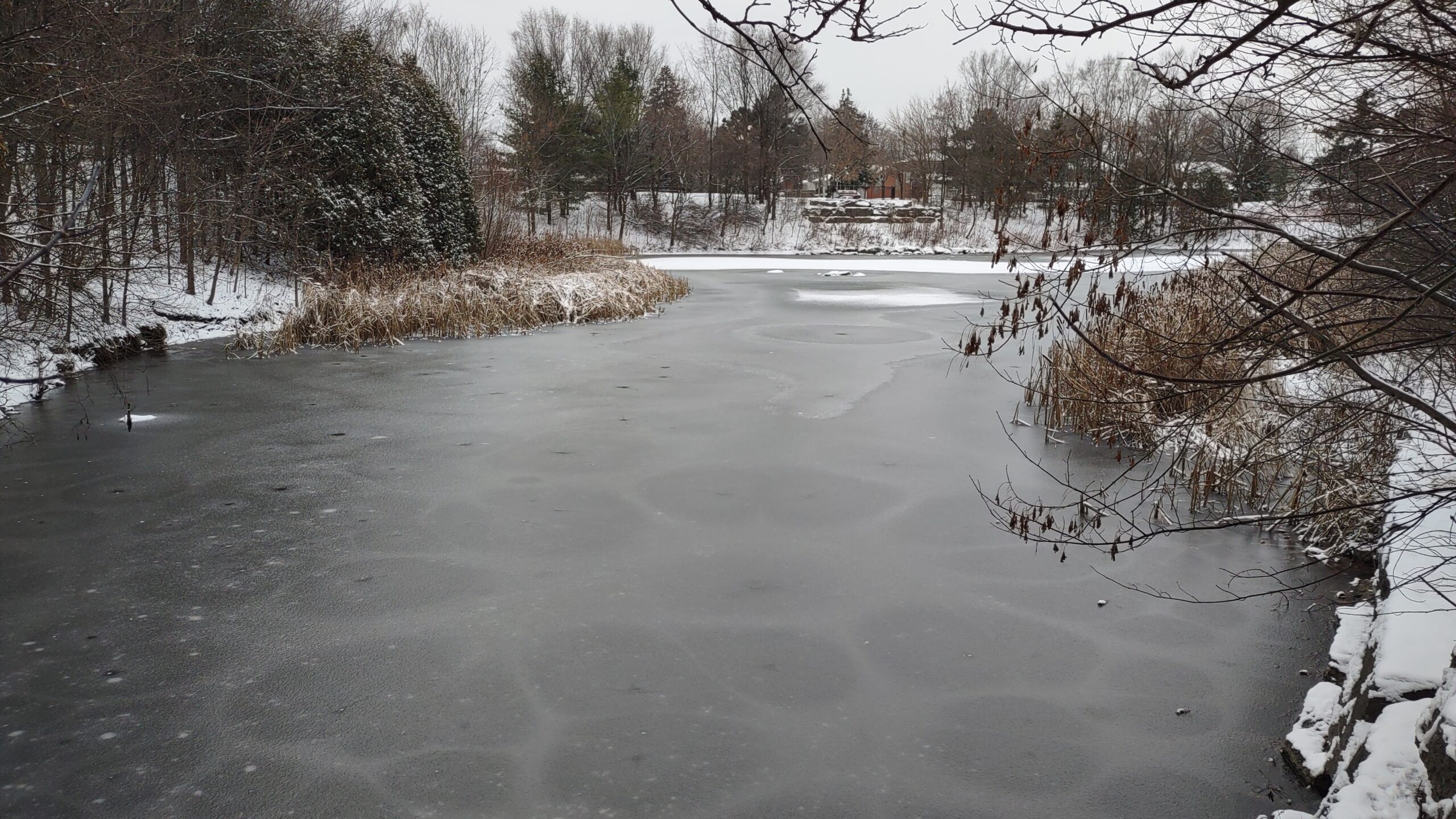
Come join me for an original TBTC hike between two wetlands as we hike along Humber Creek, from Etobicoke eastward to the Humber River and Emmett Falls. To begin we’ll hike around Wincott Wetland and visit Briarcrest Manor which bore witness to the fall of the Avro Arrow during the Diefenbaker Era, a mystery speculated on to this day. From Emmett Falls we will hike north through Raymore Park, then across the Humber and South along Weston and Denison Roads and through Denison Park, St. John’s Cemetery on the Humber and along the trail to Scarlett Woods Golf Course. Jane St and Eglington Avenue, at roughly the 11.5 km mark, will be the official end of the hike. A 1.3 km loop extension into Eglington Flats and around Topham Pond will be offered on a repeat hike and on a warmer day.
Public Washrooms and warm-up facilities available at Valleyfield Rink (The West Way) at 3 km; and at the end of the hike at Scarlett Woods Golf Course Club House at 11 + km.
Dropouts available at various points during the hike with easy access to the TTC.
The route: https://onthegomap.com/s/brlhsnsh
Sunday Social Hike - Snowshoe in the Derby Forest
https://hikesstaging.brucetrail.org/event/sunday-social-hike-snowshoe-in-the-derby-forest/Sorry, the registration cut-off time for this hike has been reached.Not a member? Click here to join today!Hosting Club: Sydenham
Category: Snowshoe Hike
Location (Google Maps):Parking at the north end of Georgian Bluffs Concession 3 Derby, north of km 98.7 (Map 32)
Hike Leader(s): Bill Snel Click here to contact Hike Leader(s)
Pace: Leisurely: 3 km/h or less
Terrain: Easy: Mostly flat and good footing.
Distance: 5 kmDescription
We will snowshoe one of the 3 trails that vary between 2 and 5 km depending on conditions. For more information contact Bill Snel at w.snel2@gmail.com or call landline (519) 470-0584. If unable to register phone the hike leader. For those with the Exploring Sydenham book, this is loop 26 but does not have any secrets. - 15January 15, 2024
Car Hike: Iroquoia Winter E2E 3/6
https://hikesstaging.brucetrail.org/event/iroquoia-winter-e2e-3-6/Sorry, the registration cut-off time for this hike has been reached.Not a member? Click here to join today!Hike open to BTC Members only.
Hosting Club: Toronto
Category: Car Hike
Location (Google Maps): Km 38.6, Chedoke Civic Golf Club. N 43.246205,W 79.906935Hike Leader(s): Smadar Junkin Click here to contact Hike Leader(s)
Pace: Brisk
Terrain: Challenging, Variable
Distance: 20 kmDescription
Third hike in the winter E2E series. We will car shuttle to km 58.8, Sydenham Lookout and hike back. Please bring icers, snowshoes and 2 litres of water. Hike date may changed due to bad winter conditions. Come 15 minutes early. Hikers are expected to move at a pace of 4.5 km per hour. Covid 19 regulations are expected to be followed.CANCELLED Great Esker & Duff Pit Side Trails in Silver Creek
https://hikesstaging.brucetrail.org/event/great-esker-duff-pit-side-trails-in-silver-creek/Sorry, the registration cut-off time for this hike has been reached.Not a member? Click here to join today!Hike open to BTC Members only.
Hosting Club: Iroquoia
Category: General Hike
Location (Google Maps):Meet where the Bruce Trail Eighth Line Side Trail meets the Eighth Line North of Georgetown
Hike Leader(s): Victoria Best Click here to contact Hike Leader(s)
Pace: Medium – 3 to 4 km/hr
Terrain: Dependent on Conditions, Moderate – Some hills and/or some poor footing, Slippery Sections Likely, Strenuous – Hilly with steep climbs and some poor footing
Distance: 12 kmDescription
Hike the Great Esker and Duff Pit Side Trails.
The hike distance will be reduced if hiking conditions are poor. Dress appropriately for the weather and for slippery trail conditions and rocks. Bring food and water, hiking boots, icers, and no dogs please.
Directions to Meeting Place: From where Trafalgar Road merges with Hwy 7 in Georgetown, drive north 3.4 km and then turn right onto 22 Side Rd and then left on Eighth Line. Continue along Eighth Line until you see the blue blazes for the Eighth Line Side Trail. Note: you can not access the meeting place driving south on Eighth Line from the 27 Side Rd because it is closed in the winter.
Please arrive at 9:45 for hike start time of 10:00 AM. Register using the hiking schedule. Cancellations the morning of the hike please call 905-257-6815.
Silent Moon Night Hike
https://hikesstaging.brucetrail.org/event/silent-moon-night-hike/Sorry, the registration cut-off time for this hike has been reached.Not a member? Click here to join today!Hosting Club: Niagara
Category: Night
Location (Google Maps):Louth Conservation Area
Hike Leader(s): Alan Laver Click here to contact Hike Leader(s)
Pace: Fast, Medium
Terrain: Moderate
Distance: 8 kmDescription
Take in the Magical sights and sounds of Louth Conservation Area. Bring night light and dress for the weather . 5 night hikes to earn your badge
Numbers are limited due to Parking
- 16January 16, 2024
Urban Walk: Valley View Park Thornhill
https://hikesstaging.brucetrail.org/event/urban-walk-valley-view-park-thornhill-4/Sorry, the registration cut-off time for this hike has been reached.Not a member? Click here to join today!Hosting Club: Toronto
Location (Google Maps): Parking lot at the corner of Bayview Ave, and Sycamore Dr. South of Highway 7
Hike Leader(s): Mohammad Aghamiri Click here to contact Hike Leader(s)
Pace: Moderate
Terrain: Variable
Distance: 7-8 KMDescription
We will explore Valleyview and Huntington park and walk along German Mill Creek,It is winter time and trail is hilly bring proper clothing, hiking boots, and ice cleats.
9:00 Long Hike Wiley Road Short Hills
https://hikesstaging.brucetrail.org/event/900-long-hike-wiley-road-short-hills-21/Sorry, the registration cut-off time for this hike has been reached.Not a member? Click here to join today!Hosting Club: Niagara
Location (Google Maps):
Short Hills Wiley Road Entrance
Pace: Medium
Terrain: Moderate
: 10kmDescription
Explore Short Hills and the majestic side trails of Scarlett Tanager, Hemlock. Swayze Falls and Terrace. Register for each hike
Bring Poles water, snack, Icers and dress for the weather
9:15 Short hike, Pelham Road, Short Hills
https://hikesstaging.brucetrail.org/event/915-short-hike-pelham-road-short-hills-72/Sorry, the registration cut-off time for this hike has been reached.Not a member? Click here to join today!Hosting Club: Niagara
Location (Google Maps): Pelham Road entrance, Short Hills Provincial Park
Hike Leader(s): janet davey Click here to contact Hike Leader(s)
Pace: Medium
Terrain: Moderate
Distance: 6 kmsDescription
Hike the main and side trails of Short Hills Provincial Park. Bring hiking boots, icers and water.Forest Bathing Hike at Scotsdale Farm and Learn About the Indigenous Village 1550 - 1580
https://hikesstaging.brucetrail.org/event/forest-bathing-hike-at-scotsdale-farm-and-learn-about-the-indigenous-village-1550-1580/Sorry, the registration cut-off time for this hike has been reached.Not a member? Click here to join today!Hosting Club: Caledon Hills
Category: Nature Walks
Location (Google Maps): The hike departs from the parking lot at Scotsdale Farm (north of km 29.8, BTC Ref Guide Map 13). Enter Scotsdale Farm from Trafalgar Rd., 1.7 km northwest of Highway 7.Hike Leader(s): Janice McClelland Click here to contact Hike Leader(s)
Pace: Medium – 3 to 4 km/hour
Terrain: Moderate – some hills and/or some poor footing
Distance: 8 kmDescription
This Forest Bathing walk begins on the Bennet Heritage Trail at Scotsdale Farm. We cross the Snows Creek pond and subsequently Owl Creek, close to the site of an Indigenous (Attiwonderonk) village from 1550 – 1580. Hike leader will briefly present further info learned about the village. Our trail then follows Owl Creek. Lunch break at a scenic spot along the Creek. We peacefully return via the Bennet Heritage Trail, the Maureen Smith Side Trail and the forested main Bruce Trail. Please bring water and a lunch. (Icers may be helpful depending on ice/snow conditions.)Riverside Woods Nature Trail
https://hikesstaging.brucetrail.org/event/riverside-woods-nature-trail/Sorry, the registration cut-off time for this hike has been reached.Not a member? Click here to join today!Hosting Club: Dufferin Hi-Land
Category: Tuesday Hike
Location (Google Maps): Caledon Hills Section, Map 18 (Edition 31)
Parking at the end1st Line EHS, off 5th sideroadHike Leader(s): Julie Daley, Les Babbage, Inge Eckerich, Tony Evangelista Click here to contact Hike Leader(s)
Pace: Medium
Terrain: Dependent on Conditions, Moderate, Slippery and Steep Sections
Distance: 4.5 km; Short Hike: 2.2 kmDescription
This is a beautiful new trail in the Caledon Hills Section consisting of 3 side trails, Goodyear Sidetrail, Uplands Sidetrail and Rushing River Sidetrail. Approximately 4.5 km. Please bring your icers, poles, snowshoes (weather depending) and a snack.

Niagara ETE in Seven - New Stained Glass badge
https://hikesstaging.brucetrail.org/event/niagara-ete-in-seven-new-stained-glass-badge/Sorry, the registration cut-off time for this hike has been reached.Not a member? Click here to join today!This is a Multi-Day Hike
You are signing up for the following dates and times:
2024-01-16 at 13:00
2024-01-22 at 13:00
2024-01-23 at
2024-03-04 at 13:00
2024-03-05 at 13:00
2024-03-11 at 13:00
2024-03-12 at 13:00Hosting Club: Niagara
Category: Event Hikes
Location (Google Maps): Jan 16: Meet at Woodend Conservation Area, Taylor Road, Niagara-on-the-Lake, 43.1432995, -79.1672588, Carpool to the BTC Southern Terminus 14184 Niagara River Pkwy, Niagara-on-the-Lake, 43.1602848, -79.052315.
January 22 Meet at Decew House, Decew Rd Thorold. 43.1078074, -79.2498458. Carpool to Woodend Conservation Area, Taylor Road, Niagara-on-the-Lake, 43.1432995, -79.1672588.
January 23: Meet at Roland Rd parking lot east of Effingham St 43.090278, -79.305073. Carpool to Decew House, Decew Rd Thorold. 43.1078074, -79.2498458
March 4: Meet at 3640 Glen Rd Jordan 43.139030, -79.373893. Carpool to Roland Rd parking lot east of Effingham St 43.090278, -79.305073.
March 5: Meet at 3774 Quarry Rd Beamsville, 43.142799, -79.458922. Carpool to 3640 Glen Rd Jordan 43.139030, -79.373893.
March 11: Meet at Ridge Road East & Thirty Road, Grimsby, ON 43.165938, -79.5151243. Carpool to 3774 Quarry Rd Beamsville, 43.142799, -79.458922
March 12: Meet at Grimsby Lions Club Pool 1 Elm St 43.193201, -79.565301. Carpool to Ridge Road East & Thirty Road, Grimsby, ON 43.165938, -79.5151243Hike Leader(s): Alan Laver Click here to contact Hike Leader(s)
Pace: Medium
Terrain: Moderate
Distance: 8 – 15k per dayDescription
THIS HIKE SERIES WILL BE LED BY JACQUI VAN DYKE: vdyke0946@gmail.com (647) 231-0946Meet time is 12:45 for 13:00 start. . This is a special series of 7 hikes to complete the Niagara section of the Bruce Trail. There will be a new accomplishment badge, included in the registration fee featuring the White-tailed deer – which has been designed by Joe Borges and will be made available on our last day. The White-tailed deer is common throughout Niagara. For this E2E in 7, we will be following the main trail east to west eventually finishing in Grimsby. Please note that you are signing up for the entire series of 7 hikes as a Group Hike. The section is approximately 85km so daily distances will be based on available parking. No dropout points have been established and therefore hikers who must drop out, will be responsible for their own transportation back to their vehicle. We will hike at a steady pace but there will be plenty of time to take pictures and to enjoy the flora and fauna of this beautiful but challenging section.
Again, this particular set of 7 hikes is intended to be Moderate.
Hikers will be expected to be wearing proper hiking boots and layered clothing with the expectation of hot and humid weather. Sufficient food and 2 litres of water for a full day of hiking is required as well as hiking poles (if you use them). Check the daily forcast and prepare for wet weather, as well. Bug spray is strongly suggested. Clothing adjustments, bio-breaks are as needed. Please let the sweep person know and they will wait for you. A morning break around 10am and a 10-15 minute on-trail lunch break will be scheduled. Car Shuttles and Missing Hikes
A maximum of 2 (of the 7) hikes can be self-completed as a result of scheduling challenges, but it is intended that this badge be earned while hiking as part of a group led by a certified hike leader.
Some parking locations require paid parking, and hikes that enter Niagara Parks. The fee for this E2E-in-7 does not include any parking/entry fees for hikers. These costs, where applicable, will be shared amongst all participants unless you have a parking or park pass. - 17January 17, 2024

Mount Nemo in the Winter
https://hikesstaging.brucetrail.org/event/mount-nemo-in-the-winter/Sorry, the registration cut-off time for this hike has been reached.Not a member? Click here to join today!Hosting Club: Iroquoia
Category: Good Companions
Location (Google Maps): Meet at the main Mount Nemo parking lot off from Guelph Line for a 1:30pm departure. We will hike the local trails for about 2 hours. Online Registration with Conservation Halton is required and fees required. Did you know that Bruce Trail members can get a discounted park pass? Dress for the weather, bring icers, water and optional snack. We may go somewhere for a coffee or hot chocolate after for those who wish to join in.Hike Leader(s): Paul Toffoletti Click here to contact Hike Leader(s)
Pace: Medium – 3 to 4 km/hr
Terrain: Dependent on Conditions, Moderate – Some hills and/or some poor footing
Distance: 7kmDescription

Niagara Winter End to End #3 Glen Road to Roland Road
https://hikesstaging.brucetrail.org/event/niagara-winter-end-to-end-3-glen-road-to-roland-road-2/Sorry, the registration cut-off time for this hike has been reached.Not a member? Click here to join today!Hosting Club: Niagara
Category: Car Pool
Location (Google Maps): Short Hills Parking Lot at Roland Road. Car Pool to Glen RoadHike Leader(s): Sam Rutherford Click here to contact Hike Leader(s)
Pace: Medium
Terrain: Moderate
Distance: 13 kmsDescription
We will be car pooling, Bring Icers and poles. No dogs. To earn your Niagara Winter End to End badge, it must be completed between December 21, 2022 to March 21, 2023.
Because of the potential for bad winter trail conditions we have broken this e2e into 6 hikes rather than 5Eleventh Line Loop
https://hikesstaging.brucetrail.org/event/eleventh-line-loop/Sorry, the registration cut-off time for this hike has been reached.Not a member? Click here to join today!Hosting Club: Blue Mountains
Category: Register in person the morning of hike.
Location (Google Maps): Hike meets in the parking lot behind Tim Hortons on First St. in Collingwood.Hike Leader(s): David Little Click here to contact Hike Leader(s)
Pace: Medium – 3 to 4 km/hr
Terrain: Easy – Mostly flat and usually good footing
Distance: 6 kmDescription
We will drive to a suitable start point for a hike through the many loop trails off the Eleventh Line, just west of Collingwood. The trails are mostly in the trees and well sheltered. The hike will be approximately two hours. Bring a snack and water.9:15 Hike from Rotary Park to Morningstar Mill
https://hikesstaging.brucetrail.org/event/915-hike-from-rotary-park-to-morningstar-mill/Sorry, the registration cut-off time for this hike has been reached.Not a member? Click here to join today!Hosting Club: Niagara
Category: In and Out
Location (Google Maps):Meet at the parking lot of Rotary Park, 376 Regional Road 69, St. Catharines L2S0A2
Hike Leader(s): Sheila Massey Click here to contact Hike Leader(s)
Pace: Medium
Terrain: Moderate
Distance: 12 kmDescription
Hiking the trails of Rotary Par kuntil we reach Morningstar Mill. We then hike back the same trails to Rotary Park. The trails may be muddy; hiking poles are advisable.Winter Wednesday Walkers - Kolapore West
https://hikesstaging.brucetrail.org/event/winter-wednesday-walkers-kolapore-west/Sorry, the registration cut-off time for this hike has been reached.Not a member? Click here to join today!Hosting Club: Beaver Valley
Location (Google Maps): Meet in the Kolapore parking lot on Grey Road 2, about 650 m south of where the trail crosses at km 23.8, Map 25, Edition 31
Hike Leader(s): Glenda Collings Click here to contact the hike leader.
Pace: Medium
Terrain: Moderate
Length of Hike: Approx. 6km returnDescription
This will be an in and out hike from the Kolapore parking lot. We pass along a field, through cedar and beautiful hardwood forest, encountering signs of old stone borders. On winter hikes we may encounter bare ground, light snow, deep snow, or ice. Please bring snowshoes and icers to our Winter Wednesday Walkers outings. Wear appropriate clothing for the weather plus water and a snack.COVID-19 Precautions Before, During and After your Hike
- Each hiker joining a Bruce Trail Club organized hike must perform a self-screening check before hiking.
Find Ontario’s self-assessment tool here: https://covid-19.ontario.ca/self-assessment/ - If you are experiencing COVID-19 symptoms, stay home.
Other Guidelines
- Arrive 15 minutes before the start of the hike.
- Wear sturdy footwear and appropriate attire for the weather and the terrain.
Hiking poles are a good idea in any season, especially if the terrain is rocky or slippery. In winter, snowshoes or icers/crampons are needed when conditions dictate.
Wearing appropriate clothing and footwear prevents injuries and shows consideration for a safe and positive group hiking experience. - Always carry I.D. and your health card.
- Bring sufficient water and snacks (or lunch if indicated). A minimum of 1L of water is recommended on all hikes, and 3L is recommended for long, challenging hikes in the heat of the summer.
- Bring sunscreen and insect repellent (for spring and summer hikes).
- Bring your own first aid kit.
- Please leave dogs at home.
- Each hiker joining a Bruce Trail Club organized hike must perform a self-screening check before hiking.