
Hike Schedule
Join us for a hike! Registration required.
All hikes available to BTC members. Some hikes are open to non-members.
See Refund Policy for Paid Hikes >
TIP: The calendar view displays up to 7 hikes on a day, but often there are more. Click “View more events” to see them all.
Categories
- 06September 6, 2023
Good Companions - Dundas Driving Park to Tews Falls and Return
https://hikesstaging.brucetrail.org/event/good-companions-dundas-driving-park-to-tews-falls-and-return-2/Sorry, the registration cut-off time for this hike has been reached.Not a member? Click here to join today!Hike open to BTC Members only.
Hosting Club: Iroquoia
Category: Good Companions
Location (Google Maps):Dundas Driving Park – Main parking area – See map below
Hike Leader(s): Ted Bossence Click here to contact Hike Leader(s)
Pace: Medium – 3 to 4 km/hr
Terrain: Strenuous – Hilly with steep climbs and some poor footing
Distance: 7.5 kmDescription
We will walk, following city streets, to the Tews Falls Side trail. We will ascend the escarpment and onwards to view Tews Falls. We will then return with a stop at the Dundas Peak Viewpoint and retrace our steps back to the Dundas Driving Park. Bring water, sunscreen, bug repellant and a snack. Hiking poles recommended. Please arrive at the car park by 8:50 am in order to be walking by 9:00 am (note the earlier start time). If you must cancel after 3:00 pm on Tuesday Sept 5, please inform me by text at 905 334-8752 or email at tedbossence@sympatico.ca . I will inform you if the hike is cancelled due to rain. Please check your email the evening before the hike.Glen Huron - Keyhole - the Bluffs
https://hikesstaging.brucetrail.org/event/glen-huron-keyhole-the-bluffs/Sorry, the registration cut-off time for this hike has been reached.Not a member? Click here to join today!Hosting Club: Blue Mountains
Category: Register in person the morning of hike.
Location (Google Maps): Hike meets in the parking lot behind Tim Hortons on First St. in Collingwood.Hike Leader(s): David Little Click here to contact Hike Leader(s)
Pace: Medium – 3 to 4 km/hr
Terrain: Moderate – Some hills and/or some poor footing
Distance: 10kmDescription
We will park in Glen Huron near Station St and begin hiking west on the Ganaraska Trail to meet up with the white blazed trail at km 26.0. From here we head south heading towards the Nottawasaga Bluffs Conservation Area. After exploring the Keyhole Side Trail, we will loop around and back to the cars via the white blazed trail and the Betty Carter Side Trail. Bring a snack or lunch and water. Parking: Concession 8 South and Station St.
WEDNESDAY WALKERS - McCluskey's Rock
https://hikesstaging.brucetrail.org/event/wednesday-walkers-mccluskeys-rock/Sorry, the registration cut-off time for this hike has been reached.Not a member? Click here to join today!Hosting Club: Beaver Valley
Location (Google Maps): Park on the shoulder of Sideroad 7B, at the bend in the road near the Old Baldy parking lot, km 43.5, Map 25, Edition 30
Hike Leader(s): Margaret Yaraskavitch Click here to contact the hike leader.
Pace: Medium
Terrain: Moderate
Length of Hike: 5 kmDescription
This hike is primarily a there-and-back hike. We will be starting near the iconic Old Baldy. The Trail takes us along the edge of the Escarpment with a number of views across the Valley. We will walk on the main Trail as far as McCluskey’s Rock. After experiencing being “between a rock and a hard place”, we will return on the main Trail and then take the Ken Young side Trail back.5:30 pm Niagara Glen (Gorge)
https://hikesstaging.brucetrail.org/event/530-pm-niagara-glen-gorge/Sorry, the registration cut-off time for this hike has been reached.Not a member? Click here to join today!Hosting Club: Niagara
Category: Loop
Location (Google Maps): Niagara Glen / GorgeHike Leader(s): Heather Howkins Click here to contact Hike Leader(s)
Pace: Medium
Terrain: Moderate
Distance: 5 – 6kDescription
Evening hike in Niagara Gorge. We will meet by the metal stairs into the gorge and follow the trail down to the river and return up the metal stairs.Please bring poles, water and bug spray.
This is a paid parking lot – the Niagara parks parking pass is valid at this location.
Evening Hike in Owen Sound followed by an opportunity for Refreshments
https://hikesstaging.brucetrail.org/event/evening-hike-in-owen-sound-followed-by-an-opportunity-for-refreshments/Sorry, the registration cut-off time for this hike has been reached.Not a member? Click here to join today!Hosting Club: Sydenham
Category: An evening walk.
Location (Google Maps): Meet in the municipal parking lot by the river on the west side of 1st Ave. E between 7th St. E and 8th St. E in Owen Sound.Hike Leader(s): Harriet Nixon Click here to contact Hike Leader(s)
Pace: Brisk: 4 to 5 km/h
Terrain: Moderate: Some hills and/or poor footing
Distance: Approx 5 kmDescription
Join us for an evening hike exploring Owen Sound trails and neighbourhoods followed by an opportunity for refreshments. No need to show up 15 minutes early. The hike will start at 7:00 pm. For further information contact Hike Leader Hrriet Nixon at harrietnixon@bmts.com or Cell 519-373-6598. - 07September 7, 2023
8:00 am Long Hike Jordan to Moyer / Louth
https://hikesstaging.brucetrail.org/event/800-am-long-hike-jordan-to-moyer-louth-57/Sorry, the registration cut-off time for this hike has been reached.Not a member? Click here to join today!Hosting Club: Niagara
Location (Google Maps):
Jordan Hollow Park 3039 King St Jordan
Pace: Medium
Terrain: Moderate
: 10kDescription
From Jordan Hollow Hike the main trail to Upper and Lower Balls Falls, Moyer Road or Louth and Return. You must register for each hike. Bring Poles, sunscreen, bug spray , snack and a drink and dress for the weather
Centennial Tower to Inglis Falls Loop
https://hikesstaging.brucetrail.org/event/centennial-tower-to-inglis-falls-loop/Sorry, the registration cut-off time for this hike has been reached.Not a member? Click here to join today!Hosting Club: Sydenham
Category: General Hike
Location (Google Maps): Parking area on the west side of 9th Avenue East/Hwy 6&10 at the top of the hill, just south of Superior StreetHike Leader(s): Maureen McFarland Click here to contact Hike Leader(s)
Pace: Medium: 3 to 4 km/h
Terrain: Strenuous: Hilly with steep climbs and some poor footing.
Distance: Approx 11 kmsDescription
We will do a large loop of Harrison Park, hiking south then west on the main trail to where it meets the Creamery Hill Sude Trail. From the Creamery Side Trail, we return via the Harrison Park Side Trail to the main trail then follow it north to Centennial Tower. This is a challenging hike on very rocky terrain for experienced hikers. Hiking boots are a must, hiking poles may be helpful. Bring enough water and a snack. The hike will take at least three hours. If you are unable to register, please call or text the hike leader at 647-918-4180.9:15 Short Hike, Jordan Hollow
https://hikesstaging.brucetrail.org/event/915-short-hike-jordan-hollow-73/Sorry, the registration cut-off time for this hike has been reached.Not a member? Click here to join today!Hosting Club: Niagara
Category: Loop
Location (Google Maps): Jordan Hollow Park, Jordan StationHike Leader(s): Bill Russell Click here to contact Hike Leader(s)
Pace: Medium
Terrain: Strenuous
Distance: ~ 6 kmsDescription
Hike the main and side trails around Jordan and Balls Falls. Bring hiking boots, water, sunscreen and bug spray.Iroquoia End-To-End Hike 1 of 10
https://hikesstaging.brucetrail.org/event/iroquoia-end-to-end-hike-1-of-10/Sorry, the registration cut-off time for this hike has been reached.Not a member? Click here to join today!Hosting Club: Caledon Hills
Category: End-to-End
Location (Google Maps): *** We will meet for this first hike in Campbellville at the car pool lot south of the 401 off Reid’s Sideroad and shuttle to a paid parking area in Hilton Falls Conservation Area. An email will be sent out regarding parking arrangements a week prior to the hike date.Hike Leader(s): Nancy Mooney Click here to contact Hike Leader(s)
Pace: Medium – 3 to 4 km/hour
Terrain: Moderate – some hills and/or some poor footing, Strenuous – hilly with steep climbs and some poor footing
Distance: From 121.8 – 108.8 plus walk from Hilton Falls parking and to Crawford Lake Conservation parking – 14.5 km. Map 11Description
This is the first hike in a series of ten. You will need to register for each hike you wish to do. We will hike from the north end of the Iroquoia Section through Kelso Conservation Area enjoying great views, around Rattlesnake Point and through the Nassagaweya Canyon to Crawford Lake Conservation Area.RattlesnakePoint Loop
https://hikesstaging.brucetrail.org/event/rattlesnakepoint-loop/Sorry, the registration cut-off time for this hike has been reached.Not a member? Click here to join today!Hosting Club: Iroquoia
Category: Thursday Group
Location (Google Maps): Rattlesnake Point Conservation Area, Appleby LineHike Leader(s): Anne Armstrong Click here to contact Hike Leader(s)
Pace: Leisurely – 3km/hr or less
Terrain: Moderate – Some hills and/or some poor footing
Distance: Approx. 8 – 9 km.Description
Join us to hike the trails of Rattlesnake Point. Our trails follow the escarpment heights and the canyon between Crawford Lake and Rattlesnake Point Conservation Areas. There is one long descent into the canyon and another more gentle ascent back to the top. Meet in the LOWER parking lot of the conservation area at 9:45 am. for a 10:00 am. start. Bring water, sunscreen, insect repellent and poles if using. A registration is required to enter the conservation area.
Leader: Anne Armstrong 905 617 3937 hikingrandma@gmail.comFriendship Trail (City View Park to Grindstone Creek Loop)
https://hikesstaging.brucetrail.org/event/friendship-trail-city-view-park-to-grindstone-creek-loop-4/Sorry, the registration cut-off time for this hike has been reached.Not a member? Click here to join today!Hosting Club: Iroquoia
Category: Thursday Group
Location (Google Maps):Meet at City View Park parking lot (South Entrance), Burlington. Located just south of Hwy #5 off of Kerns Rd.
Hike Leader(s): Karen Capindale-Smith Click here to contact Hike Leader(s)
Pace: Medium – 3 to 4 km/hr
Terrain: Strenuous – Hilly with steep climbs and some poor footing
Distance: 10km +Description
This 10.5 km hike will follow the main BT along the edge of the escarpment for great views of the Skyway bridge , Lake Ontario and surrounding area. We will continue to the outskirts of Waterdown and down into/out of the Grindstone Creek via the McNally and Waterdown Rd Side trails and main BT. Please dress in layers and bring water, a snack and lunch. Hike leader: Karen Capindale-Smith, kjcapindale@gmail.com. Please use cell (905-749-0914) for hike morning cancellations.Expect baked goods 🙂
- 08September 8, 2023
9:00 Niagara-on-the-Lake Tour
https://hikesstaging.brucetrail.org/event/900-niagara-on-the-lake-tour-11/Sorry, the registration cut-off time for this hike has been reached.Not a member? Click here to join today!Hosting Club: Niagara
Category: Urban
Location (Google Maps): Park on King St just outside of Veteran’s Memorial ParkHike Leader(s): Margaret Northfield Click here to contact Hike Leader(s)
Pace: Medium
Terrain: Easy
Distance: 6-7kmDescription
These weekly hikes will take various routes around beautiful Niagara-on-the-Lake. We may take in history or just enjoy the ambiance of the area. Urban hikes are mostly paved with some trail walking.
Plan to stay for conversation and a warm cup of coffee or tea at Sweets & Swirls, Community Centre, Niagara Stone Road, NOTL
CANCELLED - Fern hike
https://hikesstaging.brucetrail.org/event/fern-hike/Sorry, the registration cut-off time for this hike has been reached.Not a member? Click here to join today!Hosting Club: Sydenham
Category: Botany Hike
Location (Google Maps): Meet in the parking lot behind the Grey-Sauble Conservation Authority head office.
237897 Inglis Falls Road, Owen SoundHike Leader(s): Barbara Palmer Click here to contact Hike Leader(s)
Pace: Leisurely: 3 km/h or less
Terrain: Moderate: Some hills and/or poor footing, There might be muddy sections.
Distance: 5 kmDescription
The leader has had to cancel due to a foot injury. - 09September 9, 2023

TBTC Biennial1 Day End-to-End
https://hikesstaging.brucetrail.org/event/tbtc-biennial1-day-end-to-end/Sorry, the registration cut-off time for this hike has been reached.Not a member? Click here to join today!Hosting Club: Toronto
Category: Annual TBTC E2E
Location (Google Maps): Hilton Falls CA north to Cheltenham BadlandsHike Leader(s): Jacquie Van Dyke Click here to contact Hike Leader(s)
Pace: Brisk, Fast
Terrain: Variable
Distance: 50 kmDescription
Come test your grit on our 1 day E2E which will be held on Saturday Sept. 9, 2023. Cost for members is $40 which includes bus transportation from the meeting point to the hike starting point, online registrations fees, parking in Hilton Falls CA, water and snacks, and the official one day E2E badge. If any spots are still available on June 15 at 8:00 pm, registration will then open for non-members at a cost of $45. Details will be emailed to participants in early August. This long hike is not suitable for beginning hikers. Hikers are expected to maintain an average pace of 4km per hr. Hikers must reach each checkpoint by a prescribed time in order to continue and ensure everyone is off the trail before dark. You will hike on your own without a hike leader. Space is limited, hikes go rain or shine, and no dogs are permitted on this event. For questions, please contact Jacquie Van Dyke at vdyke0946@gmail.com Masks will be worn on the buses.
TBTC Annual 2 Day End-to-End
https://hikesstaging.brucetrail.org/event/tbtc-annual-2-day-end-to-end/Sorry, the registration cut-off time for this hike has been reached.Not a member? Click here to join today!This is a Multi-Day Hike
You are signing up for the following dates:
2023-09-09, 2023-09-10Hosting Club: Toronto
Category: Annual TBTC E2E
Location (Google Maps): LimehouseHike Leader(s): Jacquie Van Dyke Click here to contact Hike Leader(s)
Pace: Brisk
Terrain: Variable
Distance: Saturday’s hike is approximately 28km. Sunday’s hike is approximately 22km.Description
Plan to hike the Toronto section in late summer over two days.On Saturday, the bus will take participants to the north end of the Toronto section. Hikers will then hike south to Limehouse – a distance of approximately of 28kms.
On Sunday, the bus will take participants south to Campbellville Rd and Appleby Line where hikers will hike north to Limehouse – a distance of approximately 22kms.
There will be checkpoints along the way where light snacks and water will be available. Those who complete the distances on both days will be receive the special Club E2E badge.
Registration cost for members is $50. Refunds will not be issued. Attendance is limited to 92 (two buses). If any spots are still available at 8:00 pm on June 15, registration will also be opened for non-members at a cost of $60 each. The fee covers: bus transportation each morning from the hike end location to the hike start, a badge, parking permits, 1 or 2 checkpoints each day. Masks will be worn on the buses. You will hike on your own without a hike leader. Complete details will be provided in early August. For questions, contact Jacquie Van Dyke at vdyke0946@gmail.com

Blue Mountains End to End Part I of VI
https://hikesstaging.brucetrail.org/event/blue-mountains-end-to-end-part-i/Sorry, the registration cut-off time for this hike has been reached.Not a member? Click here to join today!Trip Information
Departure Time: 08:00
Return to City Time: 19:00
Departure Point: York Mills Bus PickupOptional Items
Hosting Club: Toronto
Category: Bus Hike
Location (Google Maps): Maps 24 and 23 of the Bruce Trail Reference and Guide. Km 67.3 to km 55.7Hike Leader(s): George Lennon and Michael Humpage Click here to contact Hike Leader(s)
Pace: Moderate
Terrain: Variable
Distance: 13.5kmDescription
Bus departs 10 York Mills Rd at 8:00 AM and Major Mackenzie Dr and HWY 400 Park and Ride at 8:20 AM. If you wish to be picked up at the Major Mackenzie Dr and HWY 400 Park and Ride, type ‘yes’ in the additional information field. Please arrive 15 minutes before departure. The bus waits for no one.We begin our hike at km 67.3 on the boundary between the Blue Mountains and Beaver Valley Sections. Our route south will take us from the Swiss Meadows subdivision. We will have spectacular views of Georgian Bay and Collingwood below us as we pass along and just below the brow of the Escarpment. The trail makes its way through the Blue Mountain and the Scenic Caves Ski Areas before descending to our final destination at km 55.7 just outside the Petun Conservation Area. We will have a chance to refresh ourselves in Collingwood before returning to Toronto.
Car Hike: Wilder Forest
https://hikesstaging.brucetrail.org/event/car-hike-wilder-forest/Sorry, the registration cut-off time for this hike has been reached.Not a member? Click here to join today!Hosting Club: Toronto
Category: Car Hike
Location (Google Maps): 2499 Brock Road, Uxbridge, ON there is a free parking when you enter the road off brock road beside Horse training facilityHike Leader(s): Mohammad Aghamiri & Amir Alemohammad Click here to contact Hike Leader(s)
Pace: Moderate
Terrain: Variable
Distance: 14-15KMDescription
We will explore Wilder forest and the beautiful scenry of Uxbridge forest.Niagara E2E #2: Woodend to DeCew Falls
https://hikesstaging.brucetrail.org/event/niagara-e2e-2-woodend-to-decew-falls/Sorry, the registration cut-off time for this hike has been reached.Not a member? Click here to join today!Hike open to BTC Members only.
Hosting Club: Dufferin Hi-Land
Category: General Hike
Location (Google Maps): Morningstar Mill parking lot off DeCew Road. 2714 DeCew Road, St. Catharines, L2R 6P7. Just to the east of km 34.2 BTC Map 3.Hike Leader(s): Stuart Law Click here to contact Hike Leader(s)
Pace: Medium
Terrain: Dependent on Conditions, Moderate, Slippery Sections Likely
Distance: 18.2 kmsDescription
Join us on this shuttle hike from Woodend to DeCew Falls taking in the main trail and the Morningstar Side Trail. Expect a lot of mud given the wet summer we have had. Please bring an extra set of footwear and a garbage bag for your shoes for the ride at the end of the hike. Please also bring 3L of water, a snack, a lunch, bug spray and sunscreen.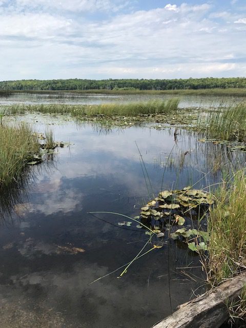
Hike and Sketch/Paint at Otter Lake - Fundraiser
https://hikesstaging.brucetrail.org/event/hike-and-sketch-paint-at-otter-lake-fundraiser/Sorry, the registration cut-off time for this hike has been reached.Not a member? Click here to join today!Hosting Club: Peninsula
Location (Google Maps): Otter Lake Side Trail (Bruce Trail Reference Guide – Map 39). Meet first at 388 Cape Chin Road North, Lion’s Head. This is the driveway to Maple Cross Nature Reserve. We will park a few vehicles in the driveway and carpool from this location to roadside parking at Otter Lake (about 1/4 mile away).
Hike Leader(s): Marg Glendon Click here to contact Hike Leader(s)
Pace: Leisurely
Terrain: Easy
Distance: ~1-3 kmDescription
Join well-known, local artists and PBTC members -Suzanne Dyke and Julie Heinrichs – for a plein air hike at Otter Lake Side Trail on Saturday, September 9th, 2023. Suzanne and Julie love the Bruce Trail and have kindly offered their time and support for this lovely experience, as a fundraiser for the Peninsula Bruce Trail Club.This peaceful location is ideal for a plein art visit. Walking will be on reasonably flat terrain on a short section of the Otter Lake Side Trail. The gentle wetland and meadow habitat attracts many species of wildflowers and birds, including the threatened Meadowlark and Bob-o-link.
Participants are asked to bring their own sketching or painting materials. A small cushion or a folding stool to sit on is required. No drawing or painting experience is required, just a willingness to put pencil/pen or brush to paper.
This is mostly non-instructional but if you wish, they will provide drawing starters and will support any and all drawing efforts. This event is designed to encourage the development of great observation skills and to enjoy time out in nature.
Bring water, snacks, lunch, sunscreen, insect repellent. Wear a hat, long pants. There are no facilities at this location. The nearest porta-pottie is located at the Borchardt Road parking lot (about a 10 minute drive from Otter Lake).
You won’t want to miss this exceptional opportunity to join Suzanne,Julie, and others who enjoy the plein art experience! Limited registration. Please register early to avoid disappointment. All proceeds will be donated to the Bruce Trail Conservancy (BTC) and used to support BTC work on the Saugeen (Bruce) Peninsula. No children or pets, please.
Learn about Suzanne and her artwork here: https://suzanne-dyke.wixsite.com/portfolio. Learn about Julie here: https://julieheinrichs.com/artist-bio/
Rain date is Sunday, September 10.
10:00am Invasive Honeysuckle Removal - Work Party - 2023
https://hikesstaging.brucetrail.org/event/1000-invasive-honeysuckle-removal-work-party-2023/Sorry, the registration cut-off time for this hike has been reached.Not a member? Click here to join today!Hosting Club: Niagara
Location (Google Maps): Parking is available in the triangle at the intersection of Thirty Road & Ridge Road.
Hike Leader(s): Alicia Aitchison Click here to contact Hike Leader(s)
Pace: Leisurely
Distance: ~2km
Description
This event is to work on removing invasive honeysuckle from the BTC Thirty Mile Creek Nature Reserve off Thirty Road in Grimsby.We will meet for 10 am at the designated parking area at the intersection of Thirty Road & Ridge Road East and walk in together.
Invasive honeysuckle removal methods depend on size – small being pulled by hand and hung on tree branches by the roots to dry out, medium sized pulled through the use of extractigators (special shovel like tools that help pry out the small shrubs) & large having to be cut with chain saws. BTC Ecologists will join us as well as certified club chain sawyers. We hope to have many volunteers on site and we will tackle this area in one day/one work party per year.
Join us at ten am and stay as long as you can – it’s an easy walk out for those that just want to work for an hour or two. If you plan on staying longer pack a lunch & don’t forget lots of water, long pants, long sleeves, work gloves & sturdy footwear.Volunteers make a difference – come out and join us for a fun work day.
contact Alicia Aitchison – aliciaaitchison1@gmail.com with any questions.
Please register so we know how many people to expect & we can keep everybody informed if anything changes.
10:00 Harold Black Park
https://hikesstaging.brucetrail.org/event/1000-harold-black-park/Sorry, the registration cut-off time for this hike has been reached.Not a member? Click here to join today!Hosting Club: Niagara
Category: Hike
Location (Google Maps): Harold Black Park, FonthillHike Leader(s): Sylvia Wheeler Click here to contact Hike Leader(s)
Pace: Medium
Terrain: Easy
Distance: 8 kmDescription
CANCELLED: Hockley Valley, Map 18
https://hikesstaging.brucetrail.org/event/car-hike-hockley-valley-map-18/Sorry, the registration cut-off time for this hike has been reached.Not a member? Click here to join today!Hosting Club: Toronto
Category: Cancelled
Location (Google Maps): Meet at the BTC parking lot 200 meters east of the Nature Reserve across the road from the Black Birch restaurant. Map 18.Hike Leader(s): Al Brown Click here to contact Hike Leader(s)
Pace: Moderate
Terrain: Challenging, Hilly
Distance: 14 kmDescription
We will complete a 14 km route through the Nature Reserve along the min and side trails. The is one of the hilliest sections of the Bruce Trail.After the hike I invite hikers to join me at the Hockley Valley Resort for refreshments.
To get to the meeting place drive north on Hwy 1o past Orangeville to Hockley Road. Turn right (east) and go about 5 km. The parking area is on your left.
Urban Walk: Theatre Hike, High Park to Village Playhouse
https://hikesstaging.brucetrail.org/event/urban-walk-theatre-hike-high-park-to-village-playhouse/Sorry, the registration cut-off time for this hike has been reached.Not a member? Click here to join today!Hosting Club: Toronto
Category: Urban Walk
Location (Google Maps): Depart at 3 PM from the meeting point at the west side Exit of High Park subway station (Quebec Avenue). Parking available close to the theatre behind 2190 Bloor street west (east of Runnymede Rd).Hike Leader(s): Miriam Stevens and Tom Swales Click here to contact Hike Leader(s)
Pace: Leisurely
Terrain: Flat, Variable
Distance: 7-9 kmDescription
Join us for a Level 1 Urban Walk at a leisurely-moderate pace of 3 km/hour to enjoy the High Park area with the options to join us for dinner and a play. We will walk into High Park and along Colborne Lodge street southbound towards the Grenadier Pond and around it towards Ellis street and up Ellis Park road to the Village Playhouse (2190 Bloor Street West) to see the Oscar Wilde play “The Importance of being Earnest”. Those who would like to walk a little further may join Tom for an extended route.duration 3 hours, pace 3 kms/hr.Terrain: mostly flat, 1 steep sidewalk, dropouts.Suitable for beginners and familiesCall the theatre directly 416 767 7702 to reserve your ticket($29.00 adults and seniors). Mention that you are with the Bruce Trail Conservancy, Toronto ClubDinner at Ali Baba 6 PM or a nearby Pub – your choice.You may choose to hike only, enjoy the theatre performance or to join us for all three: Hike, dinner and theatre.