
Hike Schedule
Join us for a hike! Registration required.
All hikes available to BTC members. Some hikes are open to non-members.
See Refund Policy for Paid Hikes >
TIP: The calendar view displays up to 7 hikes on a day, but often there are more. Click “View more events” to see them all.
Categories
- 13September 13, 2023
Car Hike: Sydenham End to End 1 of 8
https://hikesstaging.brucetrail.org/event/car-hike-sydenham-end-to-end-1-of-8/Sorry, the registration cut-off time for this hike has been reached.Not a member? Click here to join today!Hike open to BTC Members only.
Hosting Club: Toronto
Category: Car Hike
Location (Google Maps): North of km 22.8 on the shoulder of the 6th Concession S. GPS co-ordinates N44.507399, W80.810098Hike Leader(s): Jacqueline Van Dyke Click here to contact Hike Leader(s)
Pace: Brisk
Terrain: Hilly, Variable
Distance: 23 kmDescription
This is the first of an eight part series to complete a Sydenham End to End. On this hike, we will pass through the Walters Falls and Rocklyn Creek Management Areas before finishing at the entrance to the Massie Hills Management Area.Please ensure you arrive prior to 8:15 to be ready for a 8:30 departure. This is a car shuttle hike so be prepared to participate in the shuttle, either as the driver or a passenger. We will begin at km 0.0, and finishing at our vehicles. All Covid protocols will be followed.
Please check the weather the morning of or the night before and dress accordingly. Bring enough water, snacks, and lunch to last you the entire day.
Trout Hollow Trail, Meaford, ON
https://hikesstaging.brucetrail.org/event/trout-hollow-trail-meaford-on/Sorry, the registration cut-off time for this hike has been reached.Not a member? Click here to join today!Hosting Club: Blue Mountains
Category: Register in person the morning of hike.
Location (Google Maps): Hike meets in the parking lot behind Tim Hortons on First St. in Collingwood.Hike Leader(s): Dick Edwards Click here to contact Hike Leader(s)
Pace: Medium – 3 to 4 km/hr
Terrain: Moderate – Some hills and/or some poor footing
Distance: 12kmDescription
We will drive to Beautiful Joe Park in Meaford to hike the pretty Trout Hollow Trail. It follows the east bank of the Bighead River upstream for 5 kms to a sideroad and then we return along the west bank. We will hike through woodlands, past historical sites including Trout Hollow where John Muir laid low during the U.S. Civil War, and view wildlife along the river. Bring lunch and water.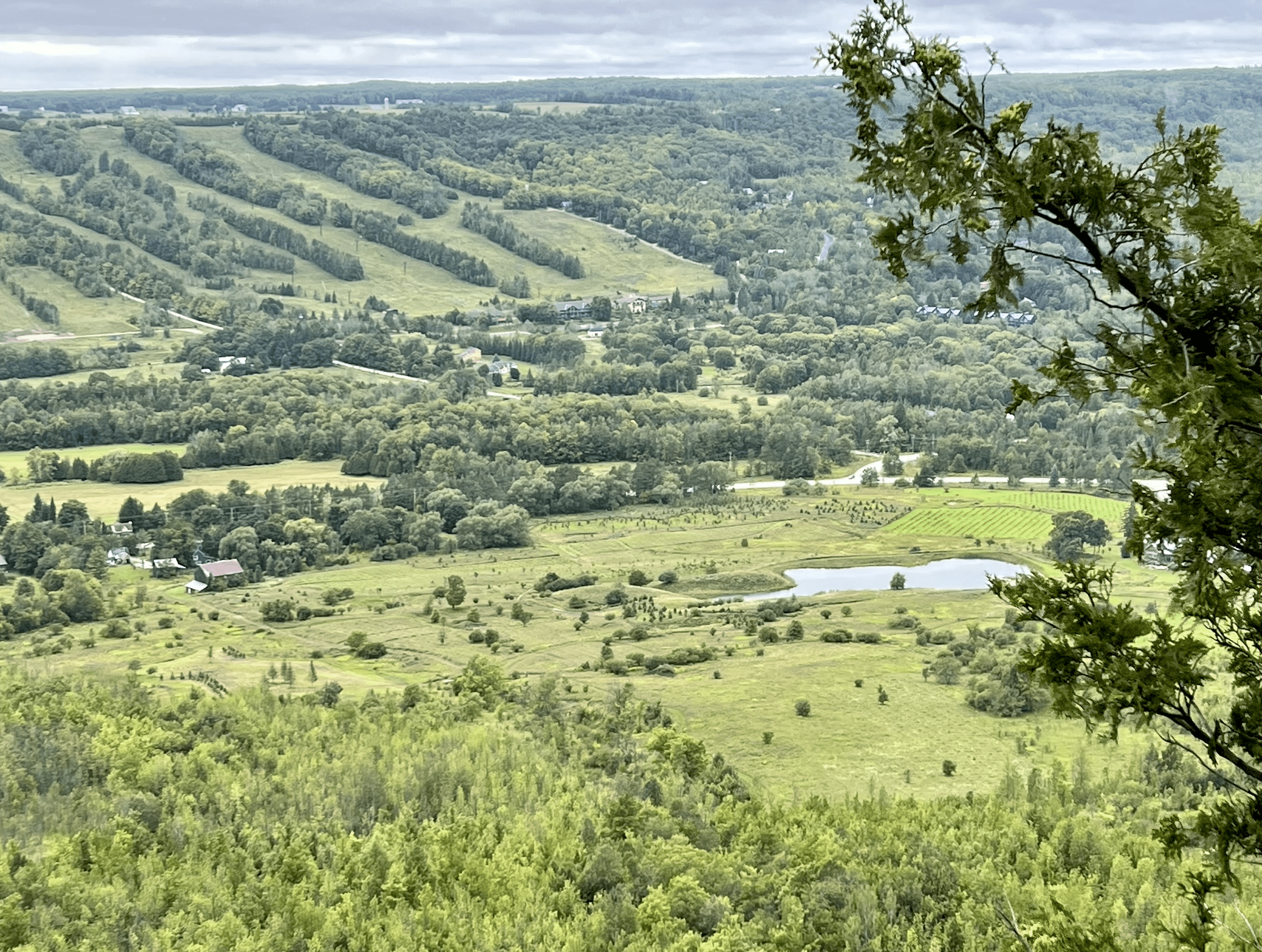
WEDNESDAY WALKERS - Old Baldy
https://hikesstaging.brucetrail.org/event/wednesday-walkers-old-baldy/Sorry, the registration cut-off time for this hike has been reached.Not a member? Click here to join today!Hosting Club: Beaver Valley
Location (Google Maps): Our hike will begin from the parking lot of Old Baldy. km 43.9, Map 26, Edition 30. Any hike participants who do not have a parking pass for Grey Sauble CA can park on the shoulder of Sideroad 7B by the bend in the road and then be shuttled to the parking lot.
Hike Leader(s): Margaret Yaraskavitch Click here to contact the hike leader.
Pace: Medium
Terrain: Moderate
Length of Hike: 5 kmDescription
Our hike takes us atop Old Baldy, the iconic outcrop. The Trail is well-used, the pathway often being “roots and rocks”. There will be a number of lookout spots to view into and across the Beaver Valley. We will hike along the main Trail and then turn back when we reach the road allowance part of the Trail. On the way back we will walk on the Mac Kirk Side Trail, under a canopy of deciduous trees. - 14September 14, 2023
8:00 am Long Hike Jordan to Moyer / Louth
https://hikesstaging.brucetrail.org/event/800-am-long-hike-jordan-to-moyer-louth-58/Sorry, the registration cut-off time for this hike has been reached.Not a member? Click here to join today!Hosting Club: Niagara
Location (Google Maps):
Jordan Hollow Park 3039 King St Jordan
Pace: Medium
Terrain: Moderate
: 10kDescription
From Jordan Hollow Hike the main trail to Upper and Lower Balls Falls, Moyer Road or Louth and Return. You must register for each hike. Bring Poles, sunscreen, bug spray , snack and a drink and dress for the weather
Car Hike: Sydenham End to End 2 of 8
https://hikesstaging.brucetrail.org/event/car-hike-sydenham-end-to-end-2-of-8/Sorry, the registration cut-off time for this hike has been reached.Not a member? Click here to join today!Hike open to BTC Members only.
Hosting Club: Toronto
Category: Car Hike
Location (Google Maps): We’ll meet again at km 22.8 GPS N44.507399, W80.810098 on the shoulder of the 6th Concession S.Hike Leader(s): Jacqueline Van Dyke Click here to contact Hike Leader(s)
Pace: Brisk
Terrain: Hilly, Variable
Distance: 22kmDescription
This is the second hike in a eight part series of a Sydenham End to End. On this hike, we’ll need to do some road walking but also passing through the Bognor Marsh Management Area (hopefully it will be dry).Please arrive prior to 8:15 to be ready for an 8:30 departure. This is a car shuttle hike so be prepared to participate in the shuttle, either as the driver or a passenger. All participants will be expected to take a turn as a driver in this series. We will shuttle to km 44.2 on St. Vincent-Sydenham Townline and hike back to our vehicles.
Please check the weather the morning of, or the night before, and dress accordingly. Bring enough water, snacks, and lunch to last the entire day.
9:15 Short Hike, Jordan Hollow
https://hikesstaging.brucetrail.org/event/915-short-hike-jordan-hollow-74/Sorry, the registration cut-off time for this hike has been reached.Not a member? Click here to join today!Hosting Club: Niagara
Category: Loop
Location (Google Maps): Jordan Hollow Park, Jordan StationHike Leader(s): Bill Russell Click here to contact Hike Leader(s)
Pace: Medium
Terrain: Strenuous
Distance: 6kDescription
Hike the main and side trails around Jordan and Balls Falls. Bring hiking boots, water, sunscreen and bug spray.Iroquoia End-to-End Hike 2 of 10
https://hikesstaging.brucetrail.org/event/iroquoia-end-to-end-hike-2-of-10/Sorry, the registration cut-off time for this hike has been reached.Not a member? Click here to join today!Hosting Club: Caledon Hills
Category: End-to-End
Location (Google Maps): Meet at the parking area behind Kilbride School at the north end of Panton St., km 100.0. Shuttle to start of hike at Crawford Lake Conservation Area. Parking fee arrangements will be made before hike date.Hike Leader(s): Nancy Mooney Click here to contact Hike Leader(s)
Pace: Medium – 3 to 4 km/hour
Terrain: Moderate – some hills and/or some poor footing, Strenuous – hilly with steep climbs and some poor footing
Distance: From 108.8 – 98.8 (Carriage Trail Rd.) plus walking from and to parking areas. Approx. 12 km. Maps 11, 10Description
This is the second hike of ten. We will hike through Crawford Lake Conservation Area, past the Calcium Pits and through Yaremko Ridley Park to Derry Rd. - 15September 15, 2023
9:00 am Niagara on the Lake Tour & Some Yoga
https://hikesstaging.brucetrail.org/event/900-am-niagara-on-the-lake-tour-some-yoga-15/Sorry, the registration cut-off time for this hike has been reached.Not a member? Click here to join today!Hosting Club: Niagara
Category: Urban
Location (Google Maps):Veteran’s Memorial Park, park just outside the park on King St.
Hike Leader(s): Robin Garrett Click here to contact Hike Leader(s)
Pace: Medium
Terrain: Easy
Distance: 6 kmDescription
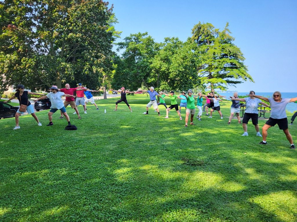
Enjoy the benefits of pausing for a yoga practice as we tour through the trails, parkland and Historic Niagara-on-the-Lake. No mat required. Movement will focus on a flow of standing poses designed especially for hikers. Plan to stay for conversation and a warm cup of coffee or tea at Sweets & Swirls, Community Centre, Niagara Stone Road, NOTL.
Urban Walk: Clarkson to Port Credit Evening Hike
https://hikesstaging.brucetrail.org/event/urban-walk-clarkson-to-port-credit-evening-hike/Sorry, the registration cut-off time for this hike has been reached.Not a member? Click here to join today!Hosting Club: Toronto
Category: Urban Walk
Location (Google Maps): Clarkson GO StationHike Leader(s): Ginny Giraudi Click here to contact Hike Leader(s)
Pace: Moderate
Terrain: Flat
Distance: 12 kmDescription
We will meet inside the Clarkson GO Station near the bathrooms at 6:30 pm and walk along the lake to Port Credit (see route here.) Head lamps or flashlights are required as the sun will set at 7:40 pm. The after hike stop is the Archtop Coffee Bar and Market in Port Credit. Hikers can take the 23 Lakeshore Eastbound Miway bus back to the Clarkson GO (Presto is accepted) or they can use the nearby Port Credit GO Station to return home. - 16September 16, 2023

Iroquoia End-to-End - 4 days
https://hikesstaging.brucetrail.org/event/iroquoia-end-to-end-4-days/Sorry, the registration cut-off time for this hike has been reached.Not a member? Click here to join today!This is a Multi-Day Hike
You are signing up for the following dates and times:
2023-09-16 at 07:00
2023-09-17 at 07:00
2023-09-23 at 07:00
2023-09-24 at 07:00Hosting Club: Iroquoia
Category: Special Event
Location (Google Maps): Two different bus loading locations (one for each wknd) will be provided to registered hikers only. Unregistered hikers who show up will not be permitted to board the buses.Hike Leader(s): Parvinder Sachdeva Click here to contact Hike Leader(s)
Pace: Brisk – 4 to 5 km/hr, Fast – 5+ km/hr
Terrain: Moderate – Some hills and/or some poor footing, Slippery Sections Likely, Strenuous – Hilly with steep climbs and some poor footing
Distance: 122km (30-35 each day)Description
Please join us for the Iroquoia Bruce Trail Club annual self-led End-to-End. You can enjoy and complete the 122 km distance over four days (approximately 30-35km each day). Please be honest about your physical abilities. These 4 days are not recommended for new hikers or anyone who hasn’t completed these sort of distances recently.
The registration fee is non-refundable and non-transferable.The hikes will traverse the varied terrain from Grimbsy in the south, to the 401 in Milton. Checkpoint stations will be approximately every 10 km offering snacks, water refill, and assistance.
The hike is $95 for members and $110 for non-members and includes bus transportation from the meeting point to the hike starting point, refreshments, parking, permit costs, and the official E2E badge.
Registration opens at 3 pm on Tuesday, July 4, 2023 for Bruce Trail Conservancy members. If any spots are still available at 3 pm on Thursday, July 13, 2023, registration will also be opened for non-members.
Details will be emailed to participants once registration is received. As mentioned, these are longer hikes and are not suitable for beginning hikers. For both events, hikers are expected to maintain an average pace of 4 km/hr (or more). Hikers will be required to reach each checkpoint on each day by a prescribed time in order to continue, and ensure everyone is off the trail before dark. Please be aware that volunteers are running this event and will be waiting.
Space is limited, hikes go rain or shine, and no dogs are permitted on this event. For questions, please contact Parvinder Sachdeva at pavvysingh@gmail.com
Car Hike: Rouge National Park Toronto
https://hikesstaging.brucetrail.org/event/car-hike-rouge-national-park-toronto-6/Sorry, the registration cut-off time for this hike has been reached.Not a member? Click here to join today!Hosting Club: Toronto
Location (Google Maps): Please park at parking lot in Zoo Road beside the trail head
Hike Leader(s): Mohammad Aghamiri, Amir Alemohammad Click here to contact Hike Leader(s)
Pace: Moderate
Terrain: Variable
Distance: 14-15 KMDescription
Will explore Toronto part of Rouge park along Rouge river and Little Rouge Creek,Some safety procedures during the hike:
1-Hikers must stay between the leader and the sweep.
2-Hikers must advise the leader or the sweep if they wish to leave the group.
3- Hikers must follow the whistle instructions: 1 blast- stay where you are; 2 blasts come to the leader; 3 blasts – come to the leader quickly.
4-Hike leader may request volunteers to stop at trail intersections, they need to help hikers to the direction the group walk and wait till they see the sweep .
5-Hikers have to make sure they can see the persons behind and in front of them.
8:30 Welland Canals Hike #1 New Badge!!!!
https://hikesstaging.brucetrail.org/event/830-welland-canals-hike-1-new-badge/Sorry, the registration cut-off time for this hike has been reached.Not a member? Click here to join today!Hosting Club: Niagara
Category: Loop
Location (Google Maps): Parking lot at Allanburg Bridge, Lundy’s Lane, Allanburg, ONHike Leader(s): Lauren Doig Click here to contact Hike Leader(s)
Pace: Brisk
Terrain: Easy
Distance: 18.9 kmDescription
Be one of the first to earn NBTC’s new Welland Canals Badge! This is the first of 4 hikes needed to earn the new badge. It is a long hike, but fairly flat and mostly on pavement. You will get a flavour of all 4 Welland Canals during the hike. Please refer to the Badge section of the NBTC website for information about all 4 hikes and the required pictures.Pacific Slope Friendship Trail - Top Down and Back Up!
https://hikesstaging.brucetrail.org/event/pacific-slope-friendship-trail-top-down-and-back-up/Sorry, the registration cut-off time for this hike has been reached.Not a member? Click here to join today!Hosting Club: Blue Mountains
Category: Experienced hikers ONLY/STRENUOUS
Location (Google Maps): Hike meets in the parking lot behind Tim Hortons on First St. in Collingwood.Hike Leader(s): Hart Fischer Click here to contact Hike Leader(s)
Pace: Brisk – 4 to 5 km/hr, Medium – 3 to 4 km/hr
Terrain: Strenuous – Hilly with steep climbs and some poor footing
Distance: 14kmDescription
We will start the Pacific Slope Trail (Sendero Pacífico) Friendship Trail at the Johnston’s Sideroad parking area at km74.3. We will head south through a high meadow that has magnificent views west across the Cuckoo Valley (you might even see the Penn stocks) and the high edges of the Escarpment. Continuing to km 73.6 we will take the Stew Hilts Side Trail to see the splendiferous waterfall! Check out the exposed Queenston Shale formation, red- gray, and gray-green shales. We are never too far from the sound of falling water as we make steep descents and ascents all the way to km 68.3 (East Back Line). We will then turn around and make our way back UP to the cars! Keep in mind that this hike is challenging and strenuous as the descents are at the beginning of the hike and the steep and continuous ascents are at the end. Bring a snack or lunch and water.
Bus Hike: Toronto Section E2E 2 of 4 - Speyside/Limehouse
https://hikesstaging.brucetrail.org/event/bus-hike-toronto-section-e2e-2-of-4-speyside-limehouse/Sorry, the registration cut-off time for this hike has been reached.Not a member? Click here to join today!Trip Information
Departure Time: 08:30
Return to City Time: 17:30
Departure Point: Kipling Departure PointOptional Items
Hosting Club: Toronto
Category: Bus Hike
Location (Google Maps): Toronto Section – Speyside/LimehouseHike Leader(s): Tom Swales & George Lennon Click here to contact Hike Leader(s)
Pace: Moderate
Terrain: Rocky, Variable
Distance: 14 kmDescription
Join us to hike the Toronto section of the Bruce Trail in a series of four moderate pace/moderate distance Level 2 hikes (14-16 km a day). Those who complete all 4 hikes will qualify for the Toronto club’s diamond E2E badge. The badge fee ($5 members/$15 non-members) will be collected on Hike #3.Members may alternatively choose to use the hikes to earn the new stained glass Limehouse stone bridge fundraiser badge. Available to members only the badge fee is $30 and proceeds go to protecting and preserving the Bruce Trail. Please contact the Hike Leader if you are interested in earning the fundraiser badge for further instructions. This badge can be earned only on one of the series of special group hikes led by a BTC Hike Leader and not individually.
Hikers who complete all 4 hikes will qualify for either the diamond badge or stained glass fundraiser badge, as they have chosen.
Any relatively fit hikers are welcome to join regardless of working towards one of E2E badges.
The second segment in the series will take us from Pear Tree Park and Speyside, through the BTC protected areas of Speyside Woods and Speyside Sanctuary Nature Reserve to Limehouse Conservation Area including the ladders through the famous “Hole In The Wall” and by the Lime Kilns. Of course, there is also the old stone bridge as featured on the fundraiser badge. We finish this segment passing through two more two more BTC protected areas, Springle and Maple Ridge Nature Reserve. There will be an optional dropout at 10.2 km. This section has some fairly rocky terrain so sturdy hiking boots are recommended.
There will be a refreshment/social stop in Georgetown after the hike before returning to the Kipling Station departure point by 5:30 pm
Car Hike: Ambling along and Apple-picking
https://hikesstaging.brucetrail.org/event/car-hike-ambling-along-and-apple-picking/Sorry, the registration cut-off time for this hike has been reached.Not a member? Click here to join today!Hosting Club: Toronto
Category: Car Hike
Location (Google Maps): We will meet at roadside parking southeast of km 44.5 on Heritage Road – coordinates are 43.734086, -79.944062. (Map 14 of the Bruce Trail Reference Guide, Edition 30)Hike Leader(s): Monica Pasquali Click here to contact Hike Leader(s)
Pace: Leisurely
Terrain: Variable
Distance: 4.7 kmDescription
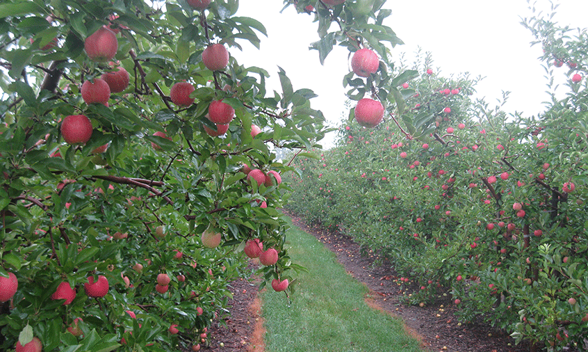
Enjoy two awesome activities in one day: ambling along the Bruce Trail in Terra Cotta followed by a visit to Downey’s Farm to go apple picking! First we’ll do a loop hike of the main Bruce trail and Rockside Side Trail, enjoying the varied scenery of forest and country road as we hike the area (while keeping an eye out for the pink bench!). After returning to our cars, those who would like to join me in extending their day of fun will make the 15-minute drive to reach Downey’s Farm where we will pick apples and enjoy a sandwich or meat pie from the bakery lunch counter. Afterwards, any children in our group can play in the “Downey’s Farmyard Play Area” if they wish to do so.Children under 13 years of age are encouraged to join their parents/guardians on this hike so they can fulfill the requirements for the Toronto Bruce Trail Club’s Youth Badge (https://torontobrucetrailclub.org/the-trail/badges) – all family members who are planning on joining us should register for the hike, including children. You should bring enough water and food for a 2-hour hike, comfortable hiking shoes, sun and bug protection, appropriate clothing for the weather, and money if you intend to join us at Downey’s Farm after the hike.
There is no admission charge to enter Downey’s Farm to pick apples, but they do require a minimum pick of $8.50 a person which applies to all individuals who enter the farm. Bags are purchased at the farm entrance as follows: a 10 lb bag of apples costs $26 (max 3 people per bag) and a 20 lb bag of apples costs $42 (max 5 people per bag). More information about apple picking at Downey’s Farm can be found here: https://downeysupickfarm.ca/apples/
Similarly, there is no admission charge to enter Downey’s Farm store, but if you decide to enjoy lunch from the bakery lunch counter then that will incur an additional fee, too. No outside food is permitted on farm grounds.
Please note that there is an admission fee to visit “Downey’s Farmyard Play Area”: $16 + HST for people aged 2 years and older, and free for children aged 23 months and younger. Tickets for “Downey’s Farmyard Play Area” must be purchased online here: https://downeysfarm.com/downeys-farm-market-activities.htm#openModal.

Sherman Falls Loop
https://hikesstaging.brucetrail.org/event/sherman-falls-loop/Sorry, the registration cut-off time for this hike has been reached.Not a member? Click here to join today!Hosting Club: Iroquoia
Category: General Hike
Location (Google Maps): Dundas Valley Conservation Area, 650 Governor’s Rd., Dundas, NotHike Leader(s): Anne Armstrong Click here to contact Hike Leader(s)
Pace: Leisurely – 3km/hr or less
Terrain: Moderate – Some hills and/or some poor footing
Distance: Approx. 10 km.Description
Please join in for a pleasant hike in the Dundas Valley CA. We will complete a loop using a combination of CA trails and Bruce Trail. Our loop takes us past a number of waterfalls including Sherman Falls. Park in the last parking lot and make your way to our meeting point at the trail centre. Meet at 9:45 am for a 10:00 am. start. Bring water, a snack, insect repellent and sunscreen. Parking fee in effect or a Conservation Area pass.Join in a pleasant hike in the Dundas Valley CA. We will hike a loop using a combination of Bruce Trail and Conservation Area trails. Our loop will take us past a number of waterfalls including Sherman Falls. Expect some hills. Bring water, a snack, insect repellent and sunscreen. Parking fee in effect or a Conservation Area pass.
Leader: Anne Armstrong 905 617 3937 hikingrandma@gmail.comEco Hike Series - Identifying Birds, Plants, Trees
https://hikesstaging.brucetrail.org/event/eco-hike-series-identifying-birds-plants-trees-2/Sorry, the registration cut-off time for this hike has been reached.Not a member? Click here to join today!Hosting Club: Dufferin Hi-Land
Category: General Hike
Location (Google Maps): Split Rock Narrows Parking Lot on 2nd Line EHS, Mono Cliffs Park, Mono, OntarioHike Leader(s): Margery Cruise Click here to contact Hike Leader(s)
Pace: Leisurely
Terrain: Easy
Distance: 5 kmDescription
We will hike along the side trails identifying trees, as well as any birds or plants of interest. Optional to use apps on your phone.https://dufferinbrucetrailclub.org/whats-your-reason-to-hike-at-splitrock-narrows/
Also, there is a treasure hunt for children. To download the map ahead of time:
https://dufferinbrucetrailclub.org/childrens-treasure-hike/

Hiking Tips and Basic Survival Skills Workshop, and Urban Hike in High Park
https://hikesstaging.brucetrail.org/event/hiking-tips-and-basic-survival-skills-workshop-and-urban-hike-in-high-park/Sorry, the registration cut-off time for this hike has been reached.Not a member? Click here to join today!Hosting Club: Toronto
Category: Urban Walk
Location (Google Maps): High Park (High Park North Gates, Main Entrance on Bloor Street West)Hike Leader(s): Marie-Josée Roy Click here to contact Hike Leader(s)
Pace: Leisurely
Terrain: VariableDescription
Let’s get started on the right (hiking) foot! Please join us for a workshop on hiking tips and basic survival skills. Topics covered: proper gear/clothing/footwear, essentials to carry in your backpack, priority survival skills (water, fire, shelter), First Aid, communication, navigation, and more. Please note that this is a hands-on workshop. Children 9 and over are welcome. The workshop will be followed by a 1-hour hike in beautiful High Park.BMBTC Music Hike @ Nottawasaga Lookout
https://hikesstaging.brucetrail.org/event/bmbtc-music-hike-nottawasaga-lookout/Sorry, the registration cut-off time for this hike has been reached.Not a member? Click here to join today!Hosting Club: Blue Mountains
Category: Organized Hike
Location (Google Maps): From the village of Duntroon, head west along County Road 91 for 5.3Km to Osprey-Clearview Townline. Turn right and head north on Osprey-Clearview Townline for 2.7Km to the Nottawasaga Lookout PNR trailhead. Park along the roadside of Osprey-Clearview Townline. Km 42.5 on the Bruce Trail Guide Edition 30”Hike Leader(s): Jim Lewis Click here to contact Hike Leader(s)
Pace: Leisurely – 3 km/hr. or less
Terrain: Easy – Mostly flat and usually good footing
Distance: 5kmDescription
Hike through the Nottawasaga Lookout Nature Reserve and through the woods at your own pace, listening to a variety of musicians along the way. You will be looping around on top of the Escarpment before heading back to the cars. Set your own pace and take in all the beauty of nature combined with the music at this special event for the Bruce Trail.This event is a fundraiser promoting awareness of the Bruce Trail. Bring your donations for the Bruce Trail as well as a snack and water. For more info or answers to questions contact: Secretary@bmbtc.org
Rainbow Hike - Burnt Loop Side Trail
https://hikesstaging.brucetrail.org/event/rainbow-hike-burnt-loop-side-trail/Sorry, the registration cut-off time for this hike has been reached.Not a member? Click here to join today!Hosting Club: Peninsula
Location (Google Maps): 120 Chi sin tib dek Rd, Tobermory, ON N0H 2R0 Meet at the building entrance of the Bruce Peninsula National Park Visitor’s Centre. (Bruce Trail Reference Guide 30th Edition – Map 42)
Hike Leader(s): Marg Glendon Click here to contact Hike Leader(s)
Pace: Leisurely, Medium
Terrain: Easy, Moderate
Distance: ~2 KM with an optional 3 1/2 KM for interested hikersDescription
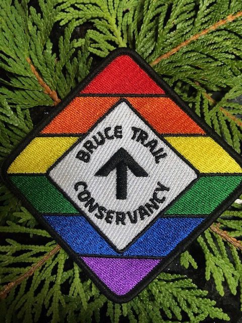
All PBTC hikes welcome 2S-LGBTQQIAP+ participants and community allies. This hike is planned by Grey Bruce Pride and PBTC.Join us for a hike on the Burnt Loop Side Trail at Bruce Peninsula National Park in Tobermory. This hike is on flat terrain and is an accessible trail to the first lookout. A PBTC hike leader and a Grey Bruce Pride member will guide everyone to the first lookout. Those interested in returning to explore the Visitor’s Centre may retrace their steps. If any group participants are interested in a moderate hike of the rest of the Burnt Loop Side Trail, a PBTC hike leader will guide the remaining participants along this pretty hiking trail. The trail here is unpredictable with uneven terrain over rocky and rooty sections. The waterview lookouts highlight Flowerpot Island, Middle Island and Bears Rump Island. This moderately paced hike (~3 ½ km) will allow us to meet the rest of the group at the Visitor’s Centre within 1 ½ – 2 hours. You will have time to take photos and enjoy the views at the three lookouts along the way. There are picnic tables at the Park and in the village of Tobermory, if you wish to picnic before returning home. All hike participants receive a BTC Pride Badge!
Parking: Parking is available at the Visitors Centre. Arrive early to purchase your Bruce Peninsula National Park admission fee and parking pass at the Visitor’s Centre. If you have a National Parks Discovery Pass already, your admission and parking is included in this pass.
What to bring: Wear a hat and long sleeved/legged pants. Bring a light back pack with snacks and water. Hiking poles are not essential, but would be helpful.