
Hike Schedule
Join us for a hike! Registration required.
All hikes available to BTC members. Some hikes are open to non-members.
See Refund Policy for Paid Hikes >
TIP: The calendar view displays up to 7 hikes on a day, but often there are more. Click “View more events” to see them all.
Categories
- 31May 31, 2023
Hart's DOUBLE Surprise Hike!
https://hikesstaging.brucetrail.org/event/harts-double-surprise-hike-2/Sorry, the registration cut-off time for this hike has been reached.Not a member? Click here to join today!Hosting Club: Blue Mountains
Category: Experienced hikers ONLY/STRENUOUS
Location (Google Maps): Hike meets in the parking lot behind Tim Hortons on First St. in Collingwood.Hike Leader(s): Hart Fischer Click here to contact Hike Leader(s)
Pace: Brisk – 4 to 5 km/hr
Terrain: Strenuous – Hilly with steep climbs and some poor footing
Distance: looooongDescription
This will be a surprise! Guaranteed to be super challenging and strenuous! Come prepared for a workout. You should be a hiker experienced in longer distance hikes as well as managing various terrains. Bring lots of water, snacks and lunch and maybe even dinner!!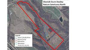
Hendrie Valley and Sheelah Dunn Dooley
https://hikesstaging.brucetrail.org/event/hendrie-valley-and-sheelah-dunn-dooley/Sorry, the registration cut-off time for this hike has been reached.Not a member? Click here to join today!Hosting Club: Iroquoia
Category: Good Companions
Location (Google Maps): Park on the Spring Garden Road lay by’s across from the Royal Botanical Gardens main building or use your RBG pass to park in the parking lot.Hike Leader(s): Paul Toffoletti Click here to contact Hike Leader(s)
Pace: Medium – 3 to 4 km/hr
Terrain: Moderate – Some hills and/or some poor footing
Distance: 8kmDescription
The hike will start at the RBG, go through the Woodland Cemetery and down into Hendrie Valley. We will then take a small side trail and visit the recently acquired Sheelah Dunn Dooley Nature Reserve that the Hamilton Naturalist Club now owns. Find out what the eco-goats were about. Return via Cherry Hill gate. There will be a little bit of road walking. Overall, a pleasant hike on established trails except Sheelah Dunn Dooley could be muddy depending on the weather the days before. At the end, there will be an optional apres hike at the Rose Garden Cafe near by. Call my cell 289-230-2038 or email paulbrucetrail@gmail.com if you have to cancell that morning or need help finding the meeting place. We will be out in the open at times, so bring a hat and water.
Metcalfe Rock - Chuck Grant ST Loop
https://hikesstaging.brucetrail.org/event/metcalfe-rock-chuck-grant-st-loop/Sorry, the registration cut-off time for this hike has been reached.Not a member? Click here to join today!Hosting Club: Beaver Valley
Location (Google Maps): Meet in the Metcalfe Rock parking lot on the 10th line. Km 27.9 (Guidebook Edition 30)
Hike Leader(s): Margaret Yaraskavitch Click here to contact the hike leader.
Pace: Medium
Terrain: Moderate, Some rocky footing, Some steep sections
Length of Hike: 9 kmDescription
Enjoy a varied route. Along a field, crossing creeks, deciduous forest. There will be several great viewpoints and there will be an optional short trip through the impressive Metcalfe Rock Side Trail.
The Amazing Diversity of Insects
https://hikesstaging.brucetrail.org/event/the-amazing-diversity-of-insects/Sorry, the registration cut-off time for this hike has been reached.Not a member? Click here to join today!Hosting Club: Caledon Hills
Category: Nature Walks
Location (Google Maps): Whitetail Refuge Nature Reserve. Meet at the Mono Centre Community Centre, 754483 Mono Centre Road.Hike Leader(s): Gary Hall Click here to contact Hike Leader(s)
Pace: Leisurely – 3 km/hour or less
Terrain: Moderate – some hills and/or some poor footing
Distance: 3 – 4 kmDescription
Discover the amazing diversity of insects on the Bruce Trail with entomologist Jim Chaput and learn about these sentinels of our fragile environment. Learn what you can do to help these amazing species. - 01June 1, 2023
8:00 am Long Hike Jordan to Moyer / Louth NEW TIME
https://hikesstaging.brucetrail.org/event/800-am-long-hike-jordan-to-moyer-louth-new-time-5/Sorry, the registration cut-off time for this hike has been reached.Not a member? Click here to join today!Hosting Club: Niagara
Location (Google Maps):
Jordan Hollow Park 3039 King St Jordan
Pace: Medium
Terrain: Moderate
: 10kDescription
From Jordan Hollow Hike the main trail to Upper and Lower Balls Falls, Moyer Road or Louth and Return. You must register for each hike. Bring Poles, sunscreen, bug spray , snack and a drink ices and dress for the weather
9:15 Short Hike - Jordan Hollow
https://hikesstaging.brucetrail.org/event/915-short-hike-jordan-hollow-59/Sorry, the registration cut-off time for this hike has been reached.Not a member? Click here to join today!Hosting Club: Niagara
Category: In and Out
Location (Google Maps): Jordan Hollow Park, Jordan StationHike Leader(s): Bill Russell Click here to contact Hike Leader(s)
Pace: Medium
Terrain: Moderate
Distance: 6 kmsDescription
Hike the main trail and side trails around Jordan and Balls Falls. Bring hiking boots, water, sunscreen and bug spray.Sydenham E2E Hike 7 of 14
https://hikesstaging.brucetrail.org/event/sydenham-e2e-hike-7-of-14/Sorry, the registration cut-off time for this hike has been reached.Not a member? Click here to join today!Hosting Club: Caledon Hills
Category: End-to-End
Location (Google Maps): Meet at Grey Sauble Conservation Headquarters west of km 92.9. Enter from Inglis Falls Road. Shuttle to start at Grey-Bruce Tourist Information parking lot. (km 104.4)Hike Leader(s): Nancy Mooney Click here to contact Hike Leader(s)
Pace: Medium – 3 to 4 km/hour
Terrain: Moderate – some hills and/or some poor footing
Distance: From km 104.4 to 92.9 plus a bit of side trails, total distance 12 km.Description
This hike skirts the western edge of Owen Sound, south to Inglis Falls and the Sydenham River and offers great views from the brow of the escarpment.
Toronto, Toronto Islands
https://hikesstaging.brucetrail.org/event/toronto-toronto-islands-17/Sorry, the registration cut-off time for this hike has been reached.Not a member? Click here to join today!Hosting Club: Toronto
Location (Google Maps): Meet inside the Jack Layton Ferry Terminal, foot of Bay Street, beyond the cashiers selling the ferry tickets, in the open area with the benches and Muskoka chairs. From Union Station take the LRT one stop to “Ferry Docks” or take bus number #19 or #72 on Bay Street southbound to the Queens Quay. Walk across Queen Quay south through the park to the ferry terminal.
Hike Leader(s): Miriam Stevens, Tom Swales Click here to contact Hike Leader(s)
Pace: Leisurely
Terrain: Flat
Distance: 8-12 kmDescription
After a day’s work, come and “cool off” on the Toronto Islands free of fumes and traffic to enjoy the view of the city skyline and Toronto’s own beautiful island parkland oasis away from the city. Pack a dinner for a sit-down picnic. Note that food is not available for purchase on the islands early in the season. Bring a warm jacket and flashlight. Return ticket for the ferry is approximately $8.70, $5.60 for seniors. The hike will take place rain or shine. Toronto Island Evening Hikes will take place every Thursday in May and June, same time and meeting place. The route and time we return to the city may vary depending if the ferries are running on the Spring or Summer (starts in May) schedule. Contact Hike Leaders via the Contact form for further information or to confirm the current ferry schedule that will be in place the week of the hike. Registration is not required for this hike – just meet the Hike Leader at the above location. - 02June 2, 2023

9:00 am Niagara on the Lake Tour & Some Yoga
https://hikesstaging.brucetrail.org/event/900-am-niagara-on-the-lake-tour-some-yoga-7/Sorry, the registration cut-off time for this hike has been reached.Not a member? Click here to join today!Hosting Club: Niagara
Category: Urban
Location (Google Maps):Veteran’s Memorial Park, park just outside the park on King St.
Hike Leader(s): Robin Garrett Click here to contact Hike Leader(s)
Pace: Medium
Terrain: Easy
Distance: 6 kmDescription
Enjoy the benefits of pausing for a yoga practice as we tour through the trails, parkland and Historic Niagara-on-the-Lake. No mat required. Movement will focus on a flow of standing poses designed especially for hikers. Plan to stay for conversation and a warm cup of coffee or tea at Sweets & Swirls, Community Centre, Niagara Stone Road, NOTL.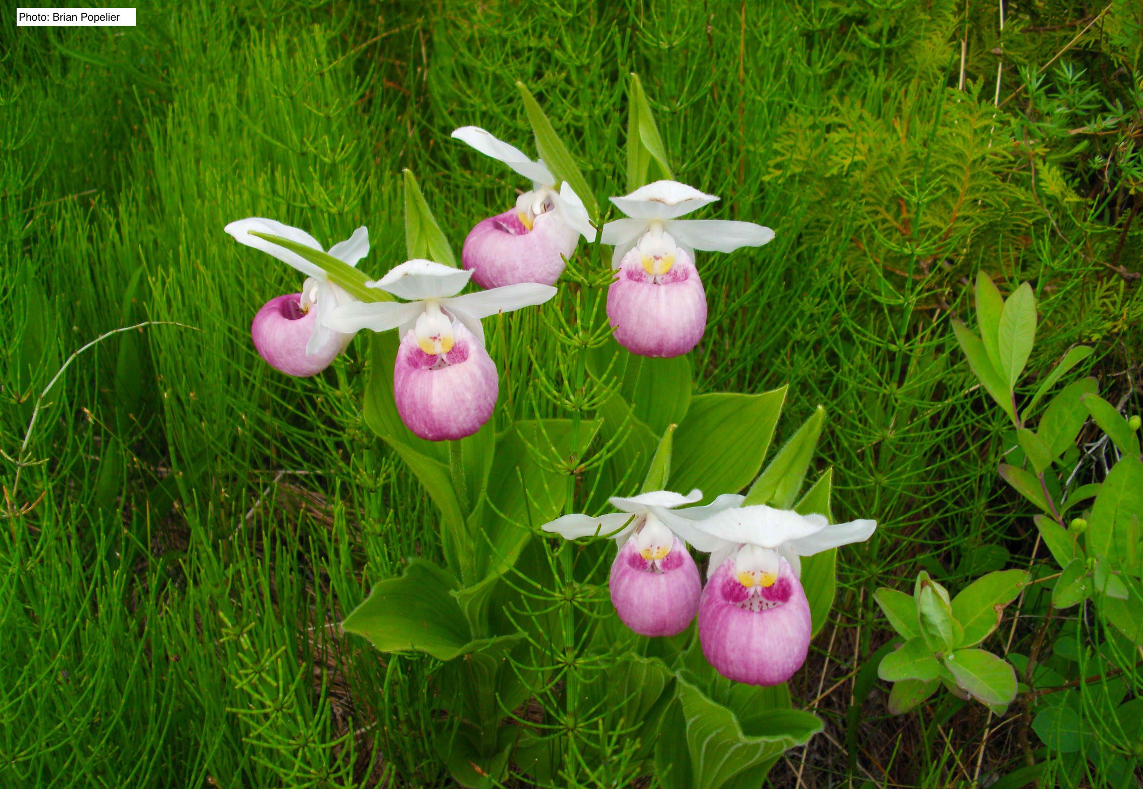
Spring Orchid Adventure
https://hikesstaging.brucetrail.org/event/spring-orchid-adventure/Sorry, the registration cut-off time for this hike has been reached.Not a member? Click here to join today!Hosting Club: Peninsula
Location (Google Maps): Bruce Peninsula National Park Visitor Centre at 120 Chi sin tib dek Rd, Tobermory, ON N0H 2R0. Meet at Front Entrance of the Visitor’s Centre
Hike Leader(s): Marg Glendon Click here to contact Hike Leader(s)
Pace: Leisurely
Terrain: Easy
Distance: ~5 KMDescription
Join Tony Edwards, a local orchid expert and much loved nature guide on our quest to find some of the first orchids of the season along with an array of other beautiful wildflowers that are unique to the area. Meet at the Bruce Peninsula National Park Visitor Centre located at 120 Chi sin tib dek Rd, Tobermory, ON N0H 2R0. This hike will be a car-hike with short distance walking at each stop. Car pooling will be coordinated at the meet up location, to three different locations on the northern Saugeen (Bruce) Peninsula. Total duration of the hike is about 4 hours. Learn about what defines an orchid, as well as environmental ethics, conservation considerations and the interconnectedness of the natural world. Although this hike will not include Bruce Trail locations, it will help you to learn more about orchids found on the Saugeen (Bruce) Peninsula and how to identify them. For those who would like to stay a little longer, upon returning to the Bruce Peninsula National Park Visitor’s Centre at the end of our hike, you are welcome to join us for a half hour hike extension along the Bruce Trail to the Burnt Loop Side Trail Lookout in the hopes of spotting another elusive orchid species here.Please wear sun protective clothing, sturdy walking shoes, and a hat. Bring camera, binoculars, lunch/snack , water bottles, insect repellent and sunscreen. Masks are strongly recommended for carpooling.
Bruce Peninsula National Park Admission Fee and Parking Fees are required. If you do not have a Park Discovery Pass, purchase your day pass and parking pass at the Bruce Peninsula National Park Visitor’s Centre prior to 10 a.m.
Rain Date: June 10, 2023
- 03June 3, 2023

Falling Water Trail Badge Event - (go to hike description for new information about this badge)
https://hikesstaging.brucetrail.org/event/falling-water-trail-badge-event-participants-hike-independently-no-hike-leader-2/Sorry, the registration cut-off time for this hike has been reached.Not a member? Click here to join today!Hosting Club: Beaver Valley
Location (Google Maps): Meet in the south end of the Beaver Valley Ski Club lower parking lot off Grey Road 30.
Hike Leader(s): Glenda Collings Click here to contact the hike leader.
Pace: Medium
Terrain: Moderate, Some rocky footing, Some steep sections, Strenuous
Length of Hike: Approx. 30 km Please note that the hike length may change slightly as there are some reroutes currently being constructed.Description
New info about this badge. If you are registering and already have this badge, you may want to know that we are introducing a separate independent Falling Water one day badge later this year and you may want to wait and do the hike that way. The current event badge will only be earned by participating in the yearly event.Come and test your mettle! This loop hike traverses the beautiful, rugged upper Beaver Valley. It’s a challenging hike during which you’ll experience all that spring has to offer, including cascading creeks and waterfalls. Registrants should have experience hiking long distances over strenuous terrain. The $35.00 registration fee covers the cost of the online registration fee, check point refreshments and the badge. Further details will be emailed to participants once registration is received.
Bus Hike: Warsaw Caves Conservation Area
https://hikesstaging.brucetrail.org/event/bus-hike-warsaw-caves-conservation-area/Sorry, the registration cut-off time for this hike has been reached.Not a member? Click here to join today!Trip Information
Departure Time: 08:00
Return to City Time: 18:00
Departure Point: York Mills Bus PickupOptional Items
Hosting Club: Toronto
Category: Bus Hike
Location (Google Maps): Warsaw Caves Conservation AreaHike Leader(s): Martina Furrer, Nijole Mockevicius, Tim Wainwright Click here to contact Hike Leader(s)
Pace: Moderate
Terrain: Variable
Distance: 15Description
Join us for a fun day exploring Warsaw Caves Conservation Area. We will hike about 15 km (dropout after 9 km) at a 3.5 to 4 km/hr pace through forests, across open limestone plains, past potholes and kettles, and stop to enjoy the lookout over the Indian River valley. After the hike you will have about an hour to go spelunking (caving) and discover the park’s seven caves, or relax on the beach. If it’s hot bring a swimsuit and cool off in the Indian River.Pack lunch, snacks, enough water for the day (at least two litres), sunhat, sunscreen, bug repellent, bug mesh, and rain protection. If you plan to go spelunking, bring a headlight.
There will be no washroom/refreshment stop on the way up or down.
Bus will depart from 10 York Mills Rd at 8 AM. We hope to be back in the city around 6 PM.
Car Hike: Hockley Crest to Hockley Valley 5th Line
https://hikesstaging.brucetrail.org/event/car-hike-hockley-crest-to-hockley-valley-5th-line/Sorry, the registration cut-off time for this hike has been reached.Not a member? Click here to join today!Hosting Club: Toronto
Category: Car Hike
Location (Google Maps): Hwy 400 north to Hwy 9. From Hwy 9, drive 3.5 km north on Airport Rd, then 0.6 km east on 5th Sideroad to the parking area on the north.Hike Leader(s): Amir Alemohammad, Mohammad Aghamiri Click here to contact Hike Leader(s)
Pace: Moderate
Terrain: Hilly, Variable
Distance: 14-16 KmDescription
Meet at the Bruce Trail parking lot in 5th Sideroad. We will hike the Hockley Crest Trail to the Airport Road, cross the road and to the Hockley Vallety 5th Line road and back (loop hike). This is a challenging hike with constant up and down steep hills – scenery are beautiful in the forest and high grounds. Bring at least two lit of water, sun screen and bug spray. Boots mandatory, poles recommended. We will have a snack/lunch break for 20 minutes.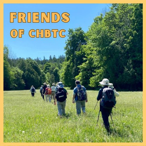
Friends of CHBTC Just For Fun Hike
https://hikesstaging.brucetrail.org/event/friends-of-chbtc-just-for-fun-hike/Sorry, the registration cut-off time for this hike has been reached.Not a member? Click here to join today!Hosting Club: Caledon Hills
Category: General
Location (Google Maps): Meet at the Bruce Trail Parking Lot on Mono 5 Sideroad on the north side of the road where the Trail crosses. Google GPS Coordinates: 43.974055, -79.984988Directions: From Airport Road turn east onto 5 Sideroad and drive for 600 metres. The parking lot is on the left hand side.
Hike Leader(s): Sandy Green Click here to contact Hike Leader(s)
Pace: Medium – 3 to 4 km/hour
Terrain: Moderate – some hills and/or some poor footing
Distance: 10.0 kilometreDescription
Join with other friends of the Caledon Hills Club to hike parts of the Main Trail, Hockleycrest Side Trail, Darcy’s Side Trail, and the Tall Timbers Bruce Trail Conservancy protected natural area. Bring your choice of hydration and snacks. Sturdy footwear is highly recommended. Note: This hike can be counted towards your Caledon Hills Sideways Badge.
#3/5 Loop of Toronto Hike for Urban Hiking Badge - 15km
https://hikesstaging.brucetrail.org/event/3-5-loop-of-toronto-hike-for-urban-hiking-badge-15km/Sorry, the registration cut-off time for this hike has been reached.Not a member? Click here to join today!Hosting Club: Toronto
Category: Urban Walk
Location (Google Maps): Southwest corner of Finch Ave & Weston RdHike Leader(s): Alina Lin
Pace: Moderate
Terrain: Flat
Distance: 15kmDescription
Embark on a captivating journey through Toronto’s remarkable urban trail systems. From the scenic Don River in the east to the captivating Waterfront in the south, the tranquil Humber River in the west, and the enchanting Finch Corridor in the north, this diverse collection of trails offers an unforgettable opportunity to explore the city’s longest trails on foot.By interconnecting these four trail systems, which weave through more than ten parks and trails, we are creating an awe-inspiring loop spanning approximately 74 kilometers: https://onthegomap.com/s/c2c1hf3n . As a testament to your accomplishment, completing the entire loop will earn you the Toronto Urban Hiking Badge—the first ever urban hiking badge launched by the Toronto Bruce Trail Club.
Distance: 15km. Start from Finch & Weston and end at Finch Subway Station.
Pace: 4kph
Trail condition: mostly flat and paved.
Bring water and snacks. Dress and prepare for the weather.
Dropouts are available anytime.

9:00 Twelve Mile Creek Loop
https://hikesstaging.brucetrail.org/event/900-twelve-mile-creek-loop/Sorry, the registration cut-off time for this hike has been reached.Not a member? Click here to join today!Hosting Club: Niagara
Category: Loop
Location (Google Maps): Welland Vale Rd. (Pump Station) & Sawmill Rd., St. CatharinesHike Leader(s): Karen Couch Click here to contact Hike Leader(s)
Pace: Medium
Terrain: Easy
Distance: 10 kmsDescription
Hike along the banks of 12 Mile Creek through St. Catharines.The BMBTC Cake Walk: Group 1 -The Longer Hike
https://hikesstaging.brucetrail.org/event/the-bmbtc-cake-walk-group-1-the-longer-hike/Sorry, the registration cut-off time for this hike has been reached.Not a member? Click here to join today!Hosting Club: Blue Mountains
Category: Register on-line or sign-in morning of hike
Location (Google Maps): Hike meets in the parking lot behind Tim Hortons on First St. in Collingwood.Hike Leader(s): Hart Fischer Click here to contact Hike Leader(s)
Pace: Medium – 3 to 4 km/hr
Terrain: Moderate – Some hills and/or some poor footing
Distance: 11.3kmDescription
Reconnect with Club members and join us on our Picnic Party hikes to celebrate the coming of SUMMER. Both hikes will meet for lunch and cake at km 14.5 to celebrate good times on the trail and kick off the summer/fall schedule!
We will park on 6/7 Sideroad at km 10.6 and hike to the picnic table at km 16.0 and return. We follow the Transcarioca Friendship Trail for part of this hike along the Bruce Trail. We will meet up with Group #2 at km 16.0 at the picnic table to share some delicious cake. Bring lunch and water. We provide the cake!Urban Walk: Toronto Islands
https://hikesstaging.brucetrail.org/event/urban-walk-toronto-islands-3/Sorry, the registration cut-off time for this hike has been reached.Not a member? Click here to join today!Hosting Club: Toronto
Category: Urban Walk
Location (Google Maps): Toronto IslandsHike Leader(s): Michael Humpage; George Lennon Click here to contact Hike Leader(s)
Pace: Leisurely
Terrain: Flat
Distance: 13.5 KMDescription
Come enjoy the islands in early June. We will meet at 9:15 AM at the Toronto Island Ferry dock at the bottom of Bay Street to take the 9:30 AM Ward’s Island ferry. Tickets can be bought online or at the ticket booth. Ferry adult return cost is $9.11. The hike will do a loop around the islands, along the boardwalk , past the lighthouse to Hanlan’s Point and returning on the other side of Ward’s island. Expected return on the Ward’s Island ferry departing at 2:15 PM. Dropout anytime. All 3 island ferries are running on the Spring schedule. Hiking shoes/boots or good walking shoes needed. Bring water, lunch, sunscreen and insect repellant.The BMBTC Cake Walk: Group 2 - The Shorter Hike
https://hikesstaging.brucetrail.org/event/the-bmbtc-cake-walk-group-2-the-shorter-hike/Sorry, the registration cut-off time for this hike has been reached.Not a member? Click here to join today!Hosting Club: Blue Mountains
Category: Register on-line or sign-in morning of hike
Location (Google Maps): Hike meets in the parking lot behind Tim Hortons on First St. in Collingwood.Hike Leader(s): Flo Kusiak Click here to contact Hike Leader(s)
Pace: Leisurely – 3 km/hr. or less
Terrain: Easy – Mostly flat and usually good footing
Distance: 4kmDescription
Reconnect with Club members and join us on our Picnic Party hikes to celebrate the coming of SUMMER. Both hikes will meet for lunch and cake at km 14.5 to celebrate good times on the trail and kick off the summer/fall schedule!
We will drive to km 14.1 on 9/10 Sideroad and park the cars to begin the hike. We will hike north to km 16 and will meet up with Hike #1 group at the picnic table. After lunch we will retrace our steps back to the cars. Bring lunch and water. We provide the cake!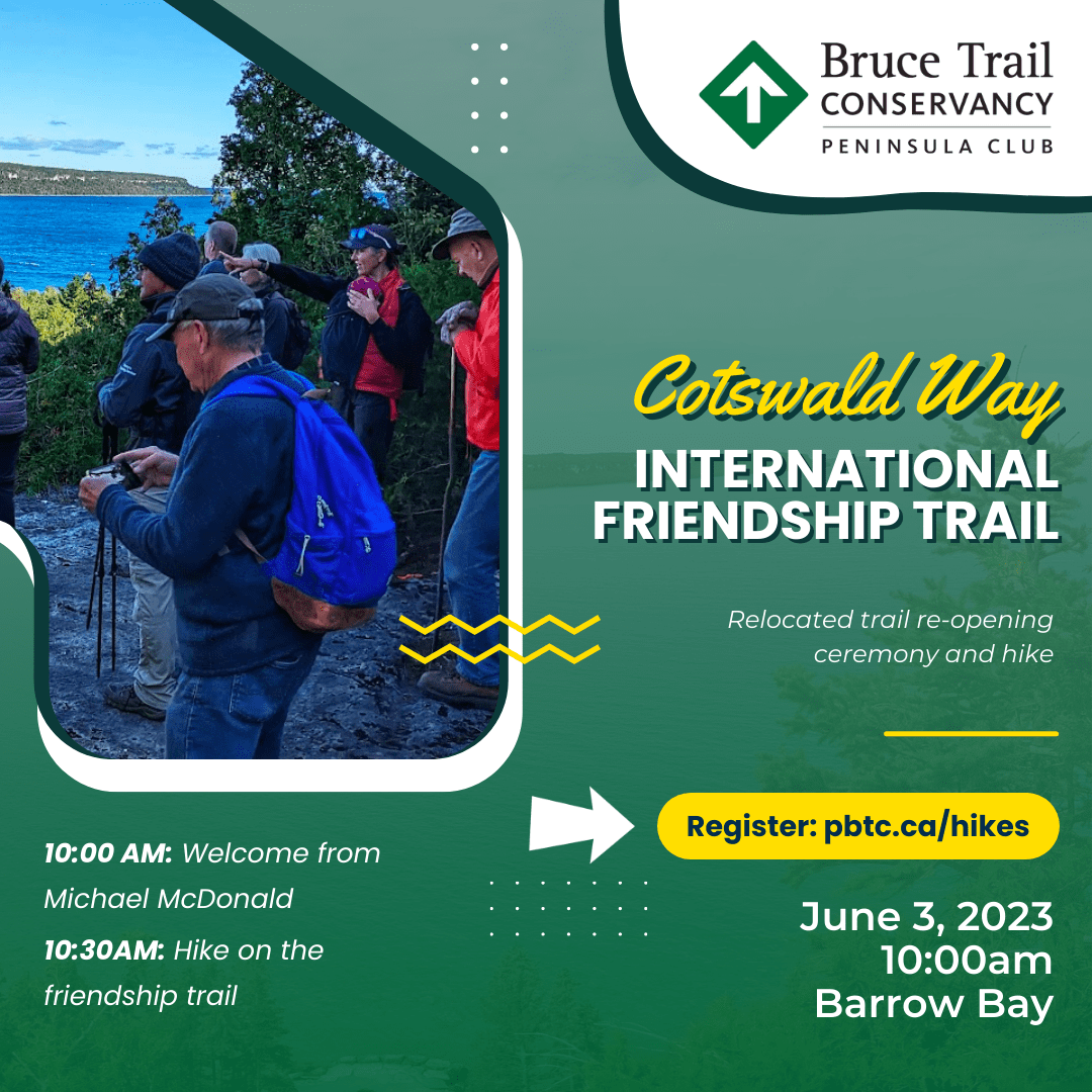
Friendship Trail Opening
https://hikesstaging.brucetrail.org/event/friendship-trail-opening/Sorry, the registration cut-off time for this hike has been reached.Not a member? Click here to join today!Hike open to BTC Members only.
Hosting Club: Peninsula
Location (Google Maps): Meet up at the new Barrow Bay Parking Lot off of CR 9 about 1 km south of old Barrow Bay Parking. Barrow Bay South Parking Lot is located at (44.950638, -81.222274),
Hike Leader(s): Tamara Wilson Click here to contact Hike Leader(s)
Pace: Leisurely
Terrain: Moderate
Distance: 6kmDescription
Michael McDonald, CEO of the Bruce Trail Conservancy will lead us on a hike of the Peninsula Section’s new Friendship Trail! The World Trails Network is excited to announce the reopening of the recently relocated International Friendship Trail between the Bruce Trail Conservancy and The Cotswolds Way. This Friendship Trail represents both organizations’ commitment to international collaboration and raising awareness for our world’s trails.The Cotswolds Way is a 102-mile National Trail in the west of England, stretching between the beautiful market town of Chipping Campden in the north and the World Heritage Site of Bath in the south. A six-mile (around 10 km) section of trail dedicated as a Friendship Trail with the Bruce Trail can be found in the Haresfield area near Pitchcombe. This beautiful walk takes trail users along peaceful woodland tracks and out onto windswept hillsides with breath-taking views. Learn more about the twinned section at https://www.nationaltrail.co.uk/app/uploads/walk_14_bruce_trail_circular_final.pdf
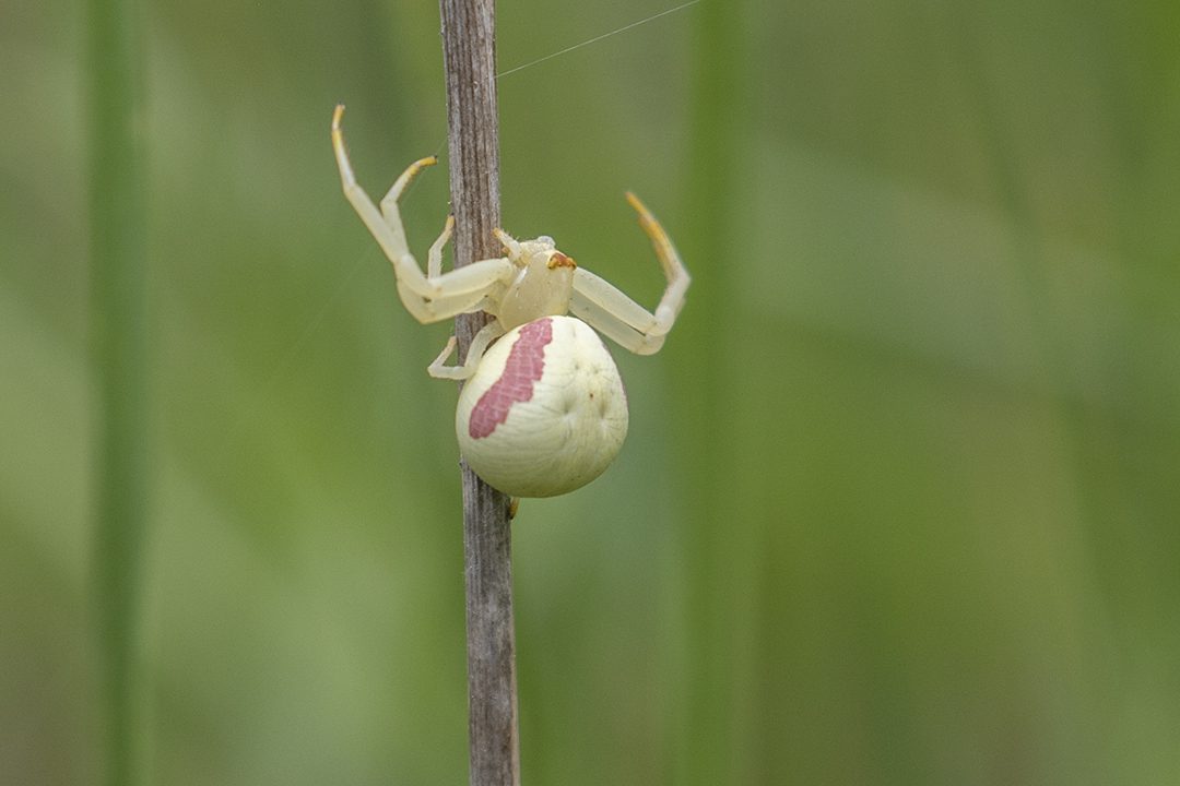
The Amazing Diversity of Insects
https://hikesstaging.brucetrail.org/event/the-amazing-diversity-of-insects-2/Sorry, the registration cut-off time for this hike has been reached.Not a member? Click here to join today!Hosting Club: Caledon Hills
Category: Nature Walks
Location (Google Maps): Mono Centre Community Centre, 754483 Mono Centre Road.Hike Leader(s): Gary Hall Click here to contact Hike Leader(s)
Pace: Leisurely – 3 km/hour or less
Terrain: Moderate – some hills and/or some poor footing
Distance: 3 – 4 kmDescription
Discover the amazing diversity of insects on the Bruce Trail with entomologist Jim Chaput and learn about these sentinels of our fragile environment. Learn what you can do to help these amazing speciesSilent Valley 10th Birthday Celebration Picnic & Hikes
https://hikesstaging.brucetrail.org/event/silent-valley-10th-birthday-celebration-picnic-hikes/Sorry, the registration cut-off time for this hike has been reached.Not a member? Click here to join today!Hosting Club: Sydenham
Category: Hike & Picnic
Location (Google Maps): Roadside parking at the north end of 2nd Concession S, north of County Road 18 at the start of the Silent Valley Side Trail (Map 30)Hike Leader(s): Maureen McFarland Click here to contact Hike Leader(s)
Pace: Leisurely: 3 km/h or less, Medium: 3 to 4 km/h
Terrain: Moderate: Some hills and/or poor footing, Strenuous: Hilly with steep climbs and some poor footing.Description
On June 3, 2013, Bruce Trail acquired the Silent Valley Nature Reserve. Ten years later, we will celebrate the occasion with a picnic and hikes at this beautiful property. Come for lunch at 12 pm. We’ll provide the birthday cake. After lunch, there will be two hikes, an easier shorter one (3-4 kms) and a longer, more challenging one (6-7 kms). Please bring a picnic lunch, lawn chair, water bottle and plate and cutlery for the cake. (Thank you. We hate to use disposables!)
8:30 pm Sunset & Moonrise Night Hike in Niagara-on-the-Lake
https://hikesstaging.brucetrail.org/event/830-pm-sunset-moonrise-night-hike-in-niagara-on-the-lake-3/Sorry, the registration cut-off time for this hike has been reached.Not a member? Click here to join today!Hosting Club: Niagara
Category: Night
Location (Google Maps): Veteran’s Memorial Park, park just outside the park on King St.Hike Leader(s): Robin Garrett Click here to contact Hike Leader(s)
Pace: Medium
Terrain: Easy
Distance: 6-7 kmDescription
Sunset & Moonrise Night Hike – Take in the magic of the setting sun and rising moon over Lake Ontario and the Niagara River. This hike includes a stop to connect with your senses – sights, sounds, smells and the rhythm of your breath. Counts towards your night hike badge (5 night hikes).