
Hike Schedule
Join us for a hike! Registration required.
All hikes available to BTC members. Some hikes are open to non-members.
See Refund Policy for Paid Hikes >
TIP: The calendar view displays up to 7 hikes on a day, but often there are more. Click “View more events” to see them all.
Categories
- 14May 14, 2023
Car hike: Limehouse
https://hikesstaging.brucetrail.org/event/car-hike-limehouse/Sorry, the registration cut-off time for this hike has been reached.Not a member? Click here to join today!Hosting Club: Toronto
Category: Car Hike
Location (Google Maps): We will meet each other at the roadside parking on 17 Sideroad, which is 730 meters northeast of Halton Rd 25.Hike Leader(s): Mehrnoush Ahmadi Click here to contact Hike Leader(s)
Pace: Brisk, Moderate
Terrain: Flat, Rocky, Variable
Distance: 19kmDescription
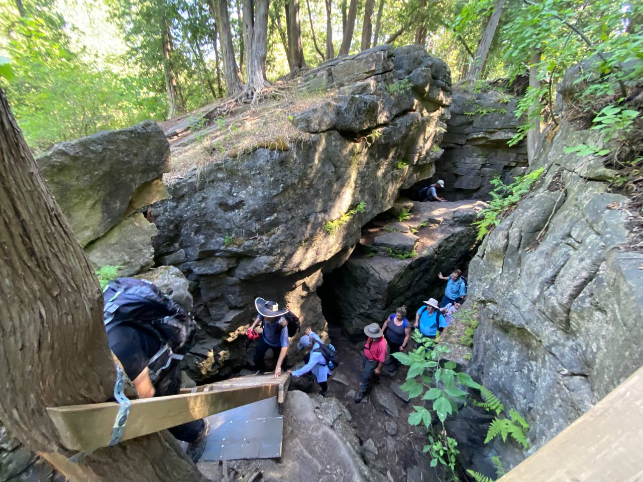
Join us for an unforgettable hiking experience in the Limehouse Conservation Area, one of the best hiking trails near Toronto. Our hike will take us to the Limehouse Cliffs and the Hole in the Wall, two unique geological features that are popular attractions for hikers and nature lovers on the Bruce Trail.Hikers should exercise caution when visiting the Limehouse Cliffs and the Hole in the Wall. It is important to follow the marked trails and stay on designated paths to avoid damaging the fragile ecosystem.
To ensure a comfortable hike, hiking boots are required, and we also recommend dressing appropriately for weather conditions and bringing insect repellent spray and sun protection cream. It’s important to carry a minimum of 2 litres of water and lunch to keep your energy levels up.
We will take short breaks for water along the way, and also take a 30-minute lunch break to enjoy the scenery and recharge.
Everybody is welcome! See you there!
9:00 Birding Hike at Woodend Conservation Area
https://hikesstaging.brucetrail.org/event/900-birding-hike-at-woodend-conservation-area/Sorry, the registration cut-off time for this hike has been reached.Not a member? Click here to join today!Hosting Club: Niagara
Category: Loop
Location (Google Maps): Woodend Conservation Area – Taylor Road Parking LotHike Leader(s): Alicia Aitchison Click here to contact Hike Leader(s)
Pace: Leisurely
Terrain: Moderate
Distance: ~4kmDescription
Join us for a leisurely bird watching hike through the Carolinian forest along the Niagara Escarpment at Woodend Conservation Area and around the Niagara College Ponds. This area is a very popular birding spot & we will be joined by Colleen Reilly, leader of the Pipits birding club and member of the Board of the Ontario Field Ornithologists as well Mara McAffie, BTC Ecologist & fellow birder. Colleen & Mara will lead us on this leisurely hike & share their knowledge & passion for birding
Urban Walk: Ramsden Park to Broadview Subway Stn. via Riverdale reroute
https://hikesstaging.brucetrail.org/event/urban-walk-ramsden-park-to-kew-gardens-via-riverdale-farm/Sorry, the registration cut-off time for this hike has been reached.Not a member? Click here to join today!Hosting Club: Toronto
Category: Urban Walk
Location (Google Maps): Public Washrooms, Artificial Ice Rink, Ramsden Park, 300 meters west of Rosedale Subway Station. From the subway cross to the west side. Follow Ramsden Park Road to the end and continue straight taking the left branch path until you reach the washrooms on the right. We will meet here outside the washrooms.Hike Leader(s): Andrew Proczek; Thomas Swales Click here to contact Hike Leader(s)
Pace: Leisurely, Moderate
Terrain: Flat, Variable
Distance: 12.5 kmDescription
Rosedale Valley Road is a pleasant walk and no one released the hounds. Wayne Crockett, July 25, 2020. Please join me for the third of three interconnected hikes inspired by Wayne who would start and finish many of his urban walks at Castle Frank Station. Starting in Ramsden Park we will be following what used to be Castle Frank Brook in the 1800s. The first two hikes featured Mount Pleasant and Prospect Cemeteries and this one will include two more, St. James and the Necropolis, two cemeteries in proximity to each other. In between the two we will visit the Victorian neighborhood of Don Vale in Old Cabbagetown which has the largest concentration of surviving Victorian Homes in all of North America. After stopping for our lunch break at Riverdale farm we will continue along the Lower Don River Trail and reroute as previously advertised from Lake Shore Blvd. E. to Queen St. E. and Broadview Ave and then north through the Riverdale neighborhood to Riverdale Park East, finishing at Broadview Subway Station. Among the historic homes, buildings and churches we will visit will be The “Group of Seven” Studio Building, Wellesley Cottages, and the Toronto Necropolis Chapel.Apart from the one climb up from the Rosedale Ravine to St. James Cemetery, the hike is mostly flat. Please pack 2 litres of water, a lunch or snacks, a hat and sun screen.
Public Washrooms at km 0, km 5.5 & 6.8, Riverdale Farm.
The route: https://onthegomap.com/s/g880u45q
Palisades and Inglis Falls Geology Hike with Beth Gilhespy
https://hikesstaging.brucetrail.org/event/palisades-and-inglis-falls-geology-hike-with-beth-gilhespy/Sorry, the registration cut-off time for this hike has been reached.Not a member? Click here to join today!Hosting Club: Sydenham
Category: Geology Hike
Location (Google Maps): Parking lot at Harrison Park, in front of the Harrison Park Inn & Restaurant, north of km 96.7 (Map 32)Hike Leader(s): Beth Gilhespy Click here to contact Hike Leader(s)
Pace: Leisurely: 3 km/h or less
Terrain: Moderate: Some hills and/or poor footing, Strenuous: Hilly with steep climbs and some poor footing.
Distance: 8 kmDescription
Beth Gilhespy, a conservationist, amateur geologist and former Bruce Trail Conservancy CEO, will introduce us to the geology of our area. This will be a slow, exploratory hike of 4 to 5 hours in length. Beth will explain the geological history of the Palisades and Inglis Falls. This hike is longer than the Saturday hike and while there will be frequent stops to explore the geology, it is more suited to hikers with some experience. Non members are welcome. Preregistration is required.
Crawford Lake Wildflowers CANCELLED
https://hikesstaging.brucetrail.org/event/spring-ephemerals-2/Sorry, the registration cut-off time for this hike has been reached.Not a member? Click here to join today!Hosting Club: Iroquoia
Category: General Hike
Location (Google Maps): Crawford Lake Conservation Rd. Conservation Rd., north of Derry Rd., east sideHike Leader(s): Anne Armstrong Click here to contact Hike Leader(s)
Pace: Leisurely – 3km/hr or less
Terrain: Moderate – Some hills and/or some poor footing
Distance: Approx.8 km.Description
Please join me for a hike in this lovely Conservation Area with its many trails and escarpment views. We will be on the lookout for early Spring Ephemerals (aka wildflowers). Of course they love to grow in amongst the rocks so expect some rocky sections. Poles would be useful. Bring a snack, water, sunscreen and insect repellent and your camera. Meet in the lower parking lot. You must make a reservation for entry into the Conservation Area, done through Halton Conservation Area Parks. Please note that if cancelling the morning of the hike, text the leader or email. Even though it is Mothers’ Day you can still get home for the celebrations after the hike!
Leader: Anne Armstrong 905617 3937 hikingrandma@gmail.com