
Hike Schedule
Join us for a hike! Registration required.
All hikes available to BTC members. Some hikes are open to non-members.
See Refund Policy for Paid Hikes >
TIP: The calendar view displays up to 7 hikes on a day, but often there are more. Click “View more events” to see them all.
Categories
- 13May 13, 2023

Sydenham official end to end
https://hikesstaging.brucetrail.org/event/sydenham-official-end-to-end/Sorry, the registration cut-off time for this hike has been reached.Not a member? Click here to join today!Hike open to BTC Members only.
This is a Multi-Day Hike
You are signing up for the following dates:
2023-05-13, 2023-05-14, 2023-06-03, 2023-06-04, 2023-09-16, 2023-09-17, 2023-09-30, 2023-10-01Hosting Club: Sydenham
Category: General Hike
Location (Google Maps): Owen Sound area – details to be provided by email after registrationHike Leader(s): Bill Snel Click here to contact Hike Leader(s)
Pace: Medium: 3 to 4 km/h
Terrain: Moderate: Some hills and/or poor footing, There might be muddy sections., There might be sections with water on the trail.
Distance: The 8 hikes vary from 19.0 to 24.1 kmsDescription
The official Sydenham end-to-end consists of 8 hikes on 4 week-ends. Registration will be on the Bruce Trail on-line hike schedule (hikes.brucetrail.org) under Saturday 13 May 2023. COVID protocols will be followed. You must bring a mask and wear it on the bus. Attendance is restricted to 48 (one bus). At 8 pm on Wednesday 01 March 2023 registration opens for Bruce Trail members only at $120 each. NO REFUNDS. If any spots are still available at 8 pm on Wednesday 15 March 2023 registration will also be opened for non-members at a cost of $160 each. The fee covers: bus transportation each morning from the hike end location to the hike start, a badge, 1 or 2 checkpoints each day with water and snacks. You will hike on your own without a hike leader. Complete details will be provided once you are registered. For questions contact Bill Snel at sydenhame2e@gmail.com.Bus Hike: Awenda Provincial Park
https://hikesstaging.brucetrail.org/event/bus-hike-awenda-provincial-park/Sorry, the registration cut-off time for this hike has been reached.Not a member? Click here to join today!Trip Information
Departure Time: 08:00
Return to City Time: 18:15
Departure Point: York Mills Bus PickupOptional Items
Hosting Club: Toronto
Category: Bus Hike
Location (Google Maps): Awenda Provincial ParkHike Leader(s): Martina Furrer, Nijole Mockevicius, Ross Estrella, Lisa Lifshitz Click here to contact Hike Leader(s)
Pace: Moderate
Terrain: Hilly, Variable
Distance: 12 – 14Description
Join us for an awesome spring hike in Awenda Provincial Park. Enjoy amazing views of Georgian Bay and beautiful spring wildflowers. Mostly small rolling hills. One steep climb to come back up from the beach. Two groups.Bring lunch, water (1.5 to 2 litres), and sun, rain and bug protection.
Bus departs 10 York Mills Rd at 8 AM. We hope to be back in Toronto around 6 PM. Return time will depend on traffic and road conditions. In good conditions driving time is around 1.5 hours. No refreshment stop.

Two Day End to End
https://hikesstaging.brucetrail.org/event/two-day-end-to-end/Sorry, the registration cut-off time for this hike has been reached.Not a member? Click here to join today!This is a Multi-Day Hike
You are signing up for the following dates:
2023-05-13, 2023-05-14Hosting Club: Dufferin Hi-Land
Category: Special Events
Location (Google Maps): 586387 10th Sideroad
GPS Coordinates: N 44 13849 W 080 13649
This is the first farm 200m west of Center Rd on 10th (also called 17 when west of Center rd) There is a church on the corner. Please arrive by 7:45 latest to allow time for check in. Buses depart at 8:00 amMap Reference #20
Directions to Parking Location:
If coming by Hwy 10 from Orangeville
– follow 10 north to Primrose
– proceed straight through the intersection onto Dufferin County Road 19, also called Prince of Wales Road
– follow this road for 6 km to first stop sign
– the road sign says
– turn right, proceed approx 1 km
– the church is highly visible on the left side, parking is 200m west of the church.Hike Leader(s): Hyo-Eun Shin, Les Babbage, Susan Bate Click here to contact Hike Leader(s)
Pace: Brisk
Terrain: Dependent on Conditions, Moderate, Strenuous
Distance: 55km (29km & 26km)Description
Join us for two days of hiking the rolling hills of Dufferin County. Enjoy the spring flowers while earning your Red Trillium Badge. Hike distances are approximately 29km on Day 1 and 26km on Day 2. There will be checkpoints along the hike with volunteers providing assistance, refreshments and snacks. Registration is $55 for members and $65 for non-members, which includes shuttle bus service, checkpoint snacks and refreshments, Red Trillium Badge (must complete full hike to earn badge), and post-hike refreshments. Space is limited so register early!Car Hike: Bethesda Trail Richmond Hill
https://hikesstaging.brucetrail.org/event/car-hike-bethesda-trail-richmond-hill-9/Sorry, the registration cut-off time for this hike has been reached.Not a member? Click here to join today!Hosting Club: Toronto
Location (Google Maps): Meet at Bethesda Trail Head Parking on Bethesda Sideroad off Bayview Avenue, across from Lake Wilcox. This parking lot is free.
Hike Leader(s): Mohammad Aghamiri Click here to contact Hike Leader(s)
Pace: Moderate
Terrain: Variable
Distance: 14-17KMDescription
Join us to explore Jefferson Forest and Bond lake ,Right time to see thousands of Trillium wild flowers covering more than hundred acres of the forest,
we will repeat this hike possibly 2 more times to see these beautiful wild flowers growing.
Please bring hiking poles, proper closing and shoes and lots of water,
Please carefully read safety procedures during the hike:
1-Hikers must stay between the leader and the sweep.
2-Hikers must advise the leader or the sweep if they wish to leave the group.
3- Hikers must follow the whistle instructions: 1 blast- stay where you are; 2 blasts come to the leader; 3 blasts – come to the leader quickly.
4-Hike leader may request volunteers to stop at trail intersections, they need to help hikers to the direction the group walk and wait till they see the sweep .
5-Hikers have to make sure they can see the persons behind and in front of them.
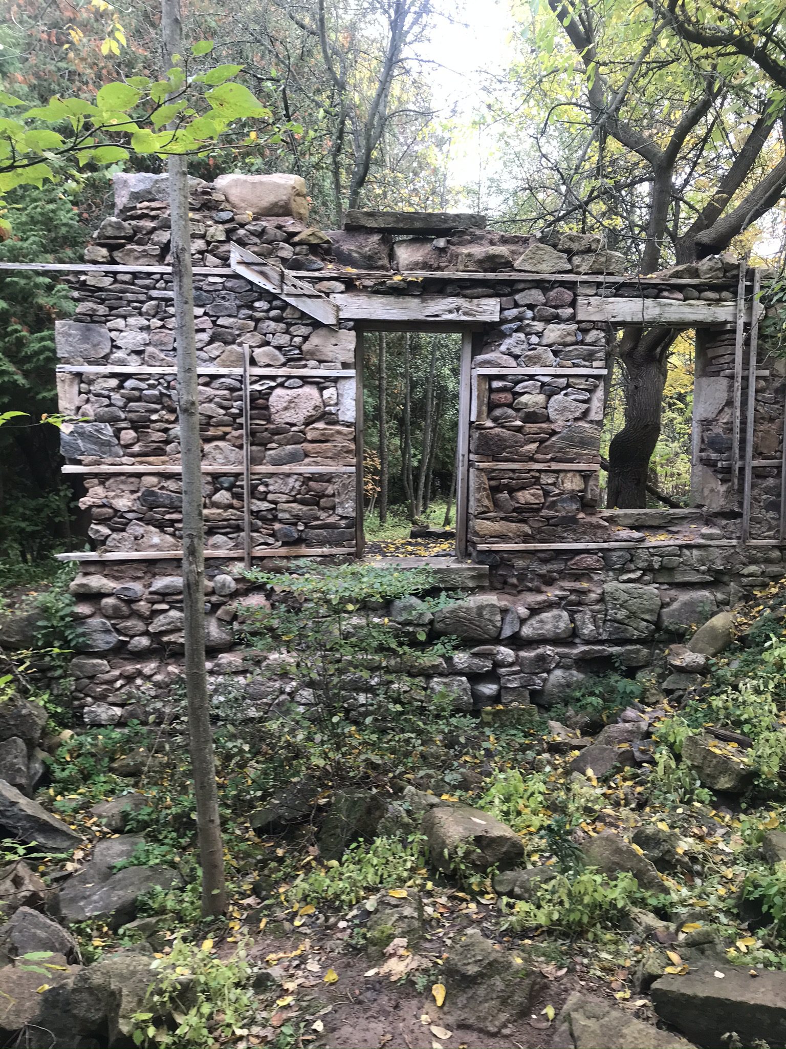
Iroquoia Bruce Trail Club AGM Pre-Hike River & Ruin
https://hikesstaging.brucetrail.org/event/iroquoia-bruce-trail-club-agm-pre-hike-river-ruin/Sorry, the registration cut-off time for this hike has been reached.Not a member? Click here to join today!Hike open to BTC Members only.
Hosting Club: Iroquoia
Category: Special Event
Location (Google Maps): Kilbride Public School, 6611Panton Street, Burlington, ON
River & Ruin side trailHike Leader(s): Dave Salt Click here to contact Hike Leader(s)
Pace: Medium – 3 to 4 km/hr
Terrain: Moderate – Some hills and/or some poor footing
Distance: 7.7Description
Please meet at the Kilbride public school. There is ample parking for us around the back of the school.We will walk along Panton Street, followed by the 8th sideroad where we will access the Bruce trail at Twiss road. Follow the BT south where we will branch off on the river & ruin side trail before rejoining the BT to a return at the school parking area.
We will be joined today by Martin Rumble who will provide some insight into conservation efforts.
Please arrive by 08:45 as we will be leaving promptly at 09:00
Please dress accordingly for the weather. Hiking shoes are required, water and snack.
Our hike distance today will be 7.7 km
Aprox 2.5 hrs
Caledon Hills E2E Hike #4 - Forks of the Credit
https://hikesstaging.brucetrail.org/event/caledon-hills-e2e-hike-4-forks-of-the-credit/Sorry, the registration cut-off time for this hike has been reached.Not a member? Click here to join today!Hike open to BTC Members only.
Hosting Club: Dufferin Hi-Land
Category: General Hike
Location (Google Maps): Western end of Boston Mills Road west of Mississauga Road near km 47.4 BTC Map 14.Hike Leader(s): Stuart Law Click here to contact Hike Leader(s)
Pace: Medium
Terrain: Dependent on Conditions, Moderate
Distance: 18.5 kmsDescription
Join us on our 4th in a series of five Humane Hiking hikes to complete the Caledon Hills section. Today we take in the Cheltenham Badlands and the Forks of the Credit. Some road walking required but lots of time in the woods too. Some hills for sure but nothing remotely like the Hockley Valley! Please bring 2.5L of water, bug spray, a garbage bag and extra pair of shoes for the shuttle, a snack, a lunch, an appreciation of nature and a smile.
Iroquoia Bruce Trail Club AGM Pre-Hike River & Ruin
https://hikesstaging.brucetrail.org/event/iroquoia-bruce-trail-club-agm-pre-hike-river-ruin-2/Sorry, the registration cut-off time for this hike has been reached.Not a member? Click here to join today!Hike open to BTC Members only.
Hosting Club: Iroquoia
Category: Special Event
Location (Google Maps): Kilbride Public School – 6611 Panton Street, Burlington, ON
River & Ruin Side TrailHike Leader(s): Anita Bergsma Click here to contact Hike Leader(s)
Pace: Leisurely – 3km/hr or less
Terrain: Moderate – Some hills and/or some poor footing
Distance: 5kmDescription
Join us on Saturday May 13th for a gentle hike on the River and Ruin side trail!Please meet at the Kilbride Public School. There is parking for everyone at the back of the school.
We will walk along Panton Street, followed by the 8th sideroad where we will access the Bruce trail at Twiss road. Follow the BT south where we will branch off on the River & Ruin Side Trail hiking to the bridge then turning around to return to the school parking area.
This hike is suitable for families with children, please note parents are responsible for their children for the duration of the hike.
Free Junior Hiker badges are available for the children participating in the hike.
Bring snacks, a warm beverage, and weather-appropriate clothing.
Your Hike Leaders are: Anita Bergsma, Karen Capindale-Smith, Robert House
This will be a 5 km hike at gentle pace for adults and children for approximately 1.5 hours. The terrain is moderate with some hills
See you on the trail.
Lime Kiln, Caves and Standing Rock
https://hikesstaging.brucetrail.org/event/lime-kiln-caves-and-standing-rock/Sorry, the registration cut-off time for this hike has been reached.Not a member? Click here to join today!Hosting Club: Blue Mountains
Category: Register on-line or sign-in morning of hike
Location (Google Maps): Hike meets in the parking lot behind Tim Hortons on First St. in Collingwood.Hike Leader(s): Allison Thomas Click here to contact Hike Leader(s)
Pace: Medium – 3 to 4 km/hr
Terrain: Moderate – Some hills and/or some poor footing
Distance: 10kmDescription
MUST HAVE LONG SPIKE CRAMPONS (ICERS)We start at the BTC parking lot off of Cty. Rd. 91. This in and out hike. Hikers will explore Frank’s Lime Kiln first. We will then follow the white blazed trail to km 41.3 and take the Singhampton Side Trail back to the white blazed trail. We then head to the Standing Rock Side Trail to explore. Bring crampons as you won’t get through without them. Once we make it to the top of the caves, we loop around, retracing some of our steps back to the cars. Bring water and a snack. Map 22 Edition 30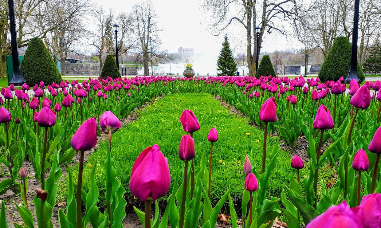
9:30 Enjoy the Flora around The Falls
https://hikesstaging.brucetrail.org/event/930-enjoy-the-flora-around-the-falls/Sorry, the registration cut-off time for this hike has been reached.Not a member? Click here to join today!Hosting Club: Niagara
Category: In and Out
Location (Google Maps): Dufferin Islands parking lot, off Burning Springs Hill, Niagara Falls. Note: a parking fee applies, as part of the Niagara Falls Parkway parking system.Hike Leader(s): Karen Couch Click here to contact Hike Leader(s)
Pace: Medium
Terrain: Easy
Distance: 6 kmsDescription
Experience the flora in the Dufferin Islands Nature Area, Oakes Garden Theatre and in between along the Niagara Parkway. With luck the tulips will be in full bloom.Nature Hike - observing spring growth
https://hikesstaging.brucetrail.org/event/nature-hike-observing-spring-growth/Sorry, the registration cut-off time for this hike has been reached.Not a member? Click here to join today!Hosting Club: Niagara
Category: Hike
Location (Google Maps): Woodend Conservation AreaHike Leader(s): Mary-Lyn Hopper Click here to contact Hike Leader(s)
Pace: Leisurely
Terrain: ModerateDescription
In this leisurely hike we will look for signs of spring and identify spring flowers.Fossil Glen Geology Hike with Beth Gilhespy
https://hikesstaging.brucetrail.org/event/fossil-glen-geology-hike-with-beth-gilhespy/Sorry, the registration cut-off time for this hike has been reached.Not a member? Click here to join today!Hosting Club: Sydenham
Category: Geology Hike
Location (Google Maps): The Owen Sound Galaxy Theatre parking lot. Meet at the tall “Galaxy Centre” sign next to the traffic lights.Hike Leader(s): Beth Gilhespy Click here to contact Hike Leader(s)
Pace: Leisurely: 3 km/h or less
Terrain: Easy: Mostly flat and good footing., Moderate: Some hills and/or poor footing
Distance: 2 kmDescription
Beth Gilhespy, a conservationist, amateur geologist and former Bruce Trail Conservancy CEO, will introduce us to the geology and fossils found in our area. This will be a slow, exploratory hike of 1 1/2 to 2 hours in length. Beth will explain the geological history of this area and help us to find and identify fossils. This hike is suitable for anyone who would like to learn more about geology and fossils, including families and children. Non members are welcome. Preregistration is required.If you do not wish to carpool from Owen Sound, please call or text Maureen McFarland at 647-918-4180 or email at maureen.mcfarland@gmail.com.