
Hike Schedule
Join us for a hike! Registration required.
All hikes available to BTC members. Some hikes are open to non-members.
See Refund Policy for Paid Hikes >
TIP: The calendar view displays up to 7 hikes on a day, but often there are more. Click “View more events” to see them all.
Categories
- 09April 9, 2023
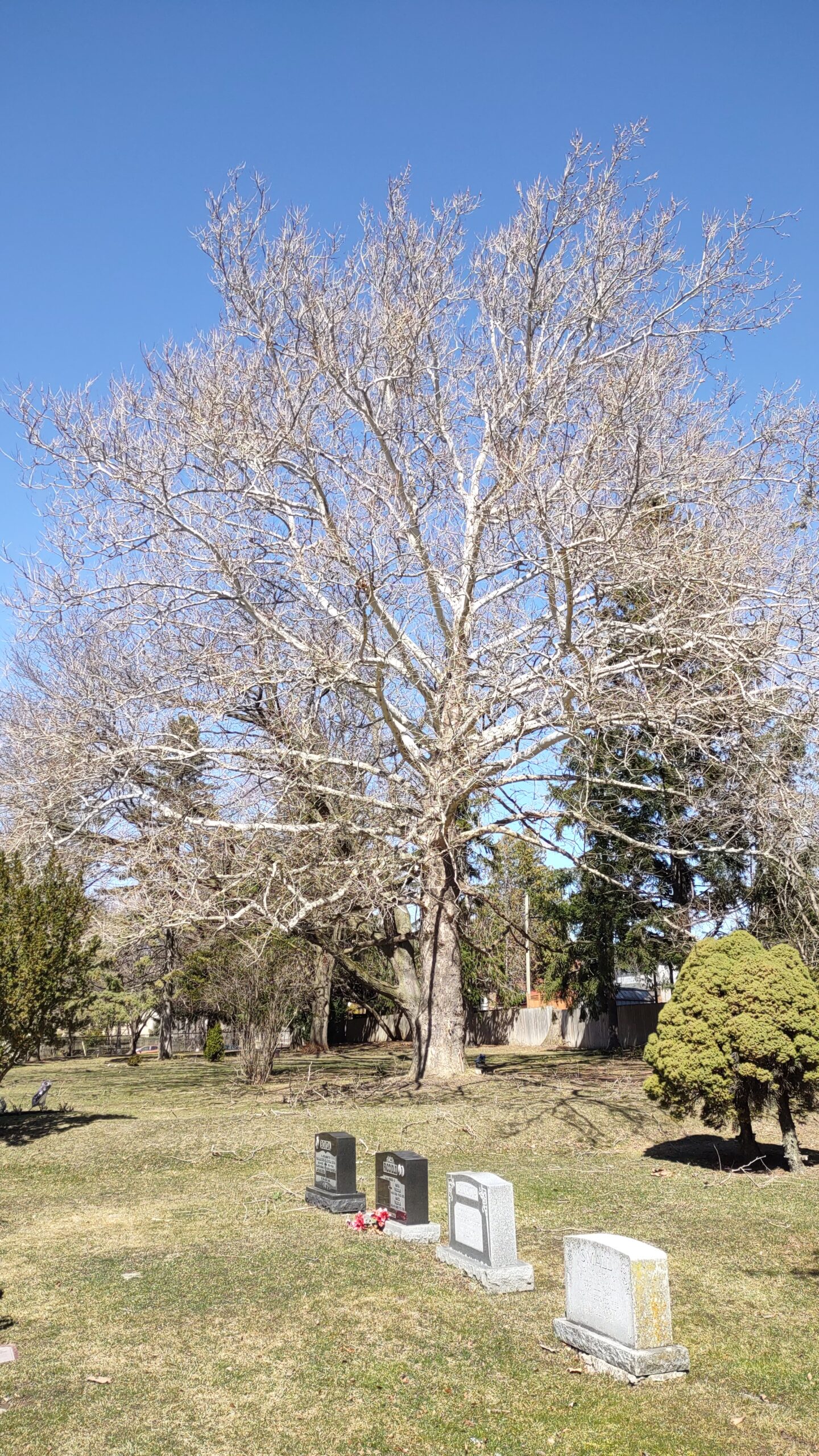
Urban Walk: First Signs of Spring Hike: Prospect Cemetery to Rosedale Subway Stn. via Cedervale Ravine
https://hikesstaging.brucetrail.org/event/urban-walk-first-signs-of-spring-hike-prospect-cemetery-to-rosedale-subway-stn-via-cedervale-ravine/Sorry, the registration cut-off time for this hike has been reached.Not a member? Click here to join today!Hosting Club: Toronto
Category: Urban Walk
Location (Google Maps): Meet on front of the Joseph J. Piccininni Community Centre, on the South side of St. Clair Ave. W., west of Landsdowne Ave.Hike Leader(s): Andrew Proczek; Mehrnoush Ahmadi Click here to contact Hike Leader(s)
Pace: Moderate
Terrain: Hilly, Variable
Distance: 12 kmDescription
Join me and apprentice hike leader, Mehrnoush Ahmadi, for the second of three connecting Toronto urban hikes, often hiked by Wayne Crockett. Part 1 took us from Castle Frank Subway Station to the end of the Kay Gardiner Beltline. In Part 2 we will hike the length of Prospect Cemetery from south to north, eventually linking up with the York Beltline which will take us in proximity to the end of Part 1. This section through the cemetery is challenging with its share of hills and ups and downs. The remainder of the hike will be relatively easier as we move our way east and then south and southeast through the Cedervale and Nordheimer Ravines. We will stop for Lunch at the Loblaws on St Clair before rejoining the ravine system and continuing southeast to Roycroft Park, emerging in the Republic of Rathnelly. Wayne jokingly commented on his FB page, “There was a revolution and no one called me?” From there we will link up with Ramsden Park to finish the hike at Rosedale Subway Station.
Public washrooms at the start of the hike at Joseph J. Piccininni Community Centre will be closed because of the holiday. Please try to find a washroom on route to the hike.
The route: https://onthegomap.com/s/cjlrn95r
Migration Monitor Hike
https://hikesstaging.brucetrail.org/event/migration-monitor-hike-5/Sorry, the registration cut-off time for this hike has been reached.Not a member? Click here to join today!Hosting Club: Peninsula
Location (Google Maps): Parking for all hikes start at km 109.7, 30th Ed Ref Manual. Park adjacent to Cape Chin Mail boxes on Cape Chin North Road
Hike1 (Mar 12, 26, Apr 9): Otter Lake/Cape Chin Loop – see details below
Hike 2 (Mar 19, Apr 2, Apr 16): Borchardt/Cotrill Lk Loop – see details belowHike Leader(s): Tamara Wilson Click here to contact Hike Leader(s)
Pace: Leisurely
Terrain: Difficult
Distance: Each hike ranges 10 to 12 kmDescription
Join us as we look for clues of spring’s arrival on Cape Chin North. We will alternate two routes on a weekly basis, watching for seasonal changes along the wetlands, small inland lakes, woodlands and escarpment shoreline. We will stop, look and listen for the arrival of plants and flowers, birds and other harbingers of spring. Hikes are weather dependent and will be cancelled for treacherous local driving conditions (mud), rain, snow or very strong winds. Always check the road and weather conditions for the entire length of your trip up as local weather can be quite different. Some hikes may recommend snow shoe hikes (I will let you know). Poles and crampons are recommended for navigating wet and slippery conditions typical of spring hikes. It is recommended to bring snacks and water for the hike. A dry set of socks and shoes is a good idea for the trip home. A sweep, topic experts – all are welcome!
Alternating hikes:
Hike1 (Mar 12, 26, Apr 9): From km 109.7 parking, Otter Lk ST (2.2 km), up Cape Chin N Rd (past Tagwerk) to Cape Chin Meadow ST (1km) to Cape Chin Driveway (2.5 km) to house, North along MT back to parked vehicles (3.6 km ) – Total 9.3 km approx
Hike 2: (Mar 19, Apr 2, Apr 16) – From km 109.7 parking, MT North through Cape Chin Woods to Borchardt Parking (2.3 km), Minhinnik ST (1.7km) to Lillie Parking Lot, Take Cotrill Lk ST (1.4km) to Anne and Clayton Robert’s St (turn right) back to Britain Lk Rd (1km). At this point we will either a) follow Britain Lk Rd and reverse the route that we took (Minhinnik to Borchardt back along Borchardt to parking) – approx 12km OR b) if conditions are good, we will follow the Main Trail back along the escarpment to Borchardt PL and hike back to the vehicles along Borchardt.
Sunday Social Hike - Snowshoe or hike in the Derby Forest
https://hikesstaging.brucetrail.org/event/snowshoe-or-hike-in-the-derby-forest/Sorry, the registration cut-off time for this hike has been reached.Not a member? Click here to join today!Hosting Club: Sydenham
Category: General Hike
Location (Google Maps):Parking at the north end of Georgian Bluffs Concession 3, north of km 98.7 (Map 32)
Hike Leader(s): Bill Snel Click here to contact Hike Leader(s)
Pace: Leisurely: 3 km/h or less
Terrain: Easy: Mostly flat and good footing.
Distance: 5 kmDescription
We will snowshoe or hike one of the 3 trails that vary between 2 and 5 km depending on conditions. For more information contact Bill Snel at w.snel2@gmail.com or call landline (519) 470-0584. - 10April 10, 2023
Toronto end to end, 2 of 3
https://hikesstaging.brucetrail.org/event/toronto-end-to-end-2-of-3/Sorry, the registration cut-off time for this hike has been reached.Not a member? Click here to join today!Hike open to BTC Members only.
Hosting Club: Niagara
Category: Car Pool
Location (Google Maps): Meet on Eight Line and 27 Sideroad (parking lot at km 33.4) Carpool to Third Line (km 16.3)Hike Leader(s): Vince Zvonar Click here to contact Hike Leader(s)
Pace: Brisk, Medium
Terrain: Moderate
Distance: 17.1Description
Car Hike: Dufferin End to End 2 of 3
https://hikesstaging.brucetrail.org/event/car-hike-dufferin-end-to-end-2-of-3/Sorry, the registration cut-off time for this hike has been reached.Not a member? Click here to join today!Hike open to BTC Members only.
Hosting Club: Toronto
Category: Car Hike
Location (Google Maps): *Please note the new meeting location* which is at km 34.9, on Centre Rd (Kilgorie), 30m south of River Rd (GPS N44.174783, W80.146573). If your GPS directs you to drive down Centre Rd, DO NOT! Access meeting point from Prince of Wales Rd/Dufferin County Rd 19, then River Rd, then finally just around the corner onto Centre Rd (intersection of River Rd. and Centre Rd).Hike Leader(s): Jacqueline Van Dyke Click here to contact Hike Leader(s)
Pace: Brisk
Terrain: Hilly, Variable
Distance: 18 kmDescription
This is the second of a three part End to End Dufferin series and on this hike, we’ll enjoy passing through hardwood forests, old orchards, along country roads, and past the concrete shell of the Dufferin Light and Power generating station. Near the end of our hike, we’ll pass by our vehicles and continue to km 37.7 before taking the Kilgorie Side Trail back to our cars.Please arrive prior to 8:15 to be ready for an 8:30 departure. This is a car shuttle hike so please be prepared to share equally in the shuttling.
Check the weather the night before/morning of, the hike and dress accordingly. Bring enough water, snacks, and lunch to last the entire hike. Please bring your icers as we may encounter ice and if not ice, icers can also be well used in mud.
Ross McLean loop (Bass Lake)
https://hikesstaging.brucetrail.org/event/ross-mclean-loop-bass-lake/Sorry, the registration cut-off time for this hike has been reached.Not a member? Click here to join today!Hosting Club: Sydenham
Category: General Hike
Location (Google Maps): Meet at 12:45 pm at Kemble Arena parking lot to carpool to trail head. Limited parking at trail head. 5 minute drive from Kemble.Hike Leader(s): Carol Mullin Click here to contact Hike Leader(s)
Pace: Medium: 3 to 4 km/h
Terrain: Moderate: Some hills and/or poor footing, There might be icy and slippery sections.
Distance: 3.9 km loopDescription
If there is snow we will avoid the upper creviced section. Snowshoes may or may not be needed. Ice grippers may be helpful for your boots. Picturesque view of Bass Lake and the wetlands. Approx. 1.5 to 2 hrs. If you are unable to register, please call or text the leader at 226-787-8804. - 11April 11, 2023
9:00 Long Hike Rockway
https://hikesstaging.brucetrail.org/event/900-long-hike-rockway-2/Sorry, the registration cut-off time for this hike has been reached.Not a member? Click here to join today!Hosting Club: Niagara
Location (Google Maps): Rockway Community Center
Pace: Medium
Terrain: Moderate
: 10kmDescription
Explore Rockway and Louth Conservation area Register for each hike
Bring Poles water, snack and Dress for the weather, Icers and layers/p>
9:15 Short hike - Rotary Park, St Catharines
https://hikesstaging.brucetrail.org/event/915-short-hike-rotary-park-st-catharines-6/Sorry, the registration cut-off time for this hike has been reached.Not a member? Click here to join today!Hosting Club: Niagara
Category: In and Out
Location (Google Maps): Rotary Park, St. CatharinesHike Leader(s): janet davey Click here to contact Hike Leader(s)
Pace: Medium
Terrain: Moderate
Distance: 6 kmsDescription
Hike the trails in Rotary Park. Bring hiking boots and water.Speyside, Map 12
https://hikesstaging.brucetrail.org/event/speyside-map-12-4/Sorry, the registration cut-off time for this hike has been reached.Not a member? Click here to join today!Hosting Club: Caledon Hills
Category: Tuesday Hikers
Location (Google Maps): Pear Tree parking lot, 15 Sideroad.
Driving directions: From Highway 401 going west, turn right (north) on Road 25, left on 15 Sideroad, drive about 300 m to Pear Tree parking lot on the left.Hike Leader(s): Mohammad Shafiq
Pace: Medium – 3 to 4 km/hour
Terrain: Moderate – some hills and/or some poor footing
Distance: 12 kmDescription
Will hike southwards from the parking lot, main Bruce Trail, Al Shaw Side Trail and parts of Hilton Falls Side Trail, there and back.
Dress according to weather, poles are strongly recommended,
Bring water and snack.
Hike leaders phone contact for hiking day: 416-566-0503
Beaver Valley E2E in 8 (NEW BADGE!!!) Led by Kristina Rettie (brisk 3.5-5km/hr)
https://hikesstaging.brucetrail.org/event/beaver-valley-e2e-in-8-tuesday-trekkers/Sorry, the registration cut-off time for this hike has been reached.Not a member? Click here to join today!Hike open to BTC Members only.
This is a Multi-Day Hike
You are signing up for the following dates:
2023-04-11, 2023-04-18, 2023-04-25, 2023-05-02, 2023-05-09, 2023-05-16, 2023-05-23, 2023-05-30Hosting Club: Beaver Valley
Location (Google Maps): First hike will meet at km13.7 of the Beaver Valley section on the West side 6th Line, North of Grey 119. Do not block driveways/laneways!
Map 24 E30Hike Leader(s): Kristina Rettie Click here to contact the hike leader.
Pace: Brisk
Terrain: Moderate, Some rocky footing, Some steep sections
Length of Hike: between 14k-18k per hike, brisk 4-5km/hrDescription
Welcome to Tuesday TrekkersThe goal of this hike is to earn the NEW BEAVER VALLEY ACCOMPLISHMENT BADGE!! WOOT WOOT!!!
The Tuesday Trekkers will achieve this new badge by hiking all 8 Tuesdays in this series. As life sometimes can be interrupted and you need to bail on a hike please don’t stress. You can make up two hikes on your own and still qualify for the badge on the final day. Please keep a log of the missed hikes and get them to me by the last day.
The fee goes towards supporting the Beaver Valley Bruce Trail Club, which in turn supports the mission of the Bruce Trail Conservancy, which is: “Preserving a ribbon of wilderness, for everyone, forever.”
For the time being, registration for the Beaver Valley E2E in 8 will be limited to members of the Bruce Trail Conservancy. Hikers can belong to any section.
Please note there are no refunds!
This particular set of 8 hikes is intended to be BRISK (4K-5K PER HOUR) Please be honest about your degree of physical fitness prior to registration.
All hikes in this series will include a car shuttle and everyone will take a turn as a shuttle driver. Trails will be wet at this time of year so please be prepared with extra socks and gaiters. Experience with hiking 16k/day at a brisk pace (4-5km/hr) is essential. Ideally we will hike from km0 to km119.9 over the series of 8 hikes but as conditions change and parking issues arise I will ask you to be flexible with the routes and trust our judgment. You will receive an e-mail outlining meeting location and start location for each hike as well as any other information needed closer to the start of the hike event.
We will have a clothing adjustment break, and 2 snack/lunch breaks of 10 min each. Please have your water accessible while hiking (water bladder recommended)
There will be plenty of opportunity for photos. I recommend having your camera/phone accessible to get all those great shots.
No dogs!
COVID-19 Precautions Before, During and After your Hike
- Each hiker joining a Bruce Trail Club organized hike must perform a self-screening check before hiking.
Find Ontario’s self-assessment tool here: https://covid-19.ontario.ca/self-assessment/ - If you are experiencing COVID-19 symptoms, stay home.
- Personal Protective Equipment:
- Hikers may choose to wear masks
Transportation
It is the Bruce Trail Conservancy’s current policy that car shuttles are allowed. It is at the discrepancy of individual hike leaders to make that decision.
Other Guidelines
- Arrive 15 minutes before the start of the hike.
- Wear sturdy footwear and appropriate attire for the weather and the terrain.
Hiking poles are a good idea in any season, especially if the terrain is rocky or slippery. In winter, snowshoes or icers/crampons are needed when conditions dictate.
Wearing appropriate clothing and footwear prevents injuries and shows consideration for a safe and positive group hiking experience. - Always carry I.D. and your health card.
- Bring sufficient water and snacks (or lunch if indicated). A minimum of 1L of water is recommended on all hikes, and 3L is recommended for long, challenging hikes in the heat of the summer.
- Bring sunscreen and insect repellent (for spring and summer hikes).
- Bring your own first aid kit.
- Please leave dogs at home.
Splitrock and Lookout Side Trails
https://hikesstaging.brucetrail.org/event/splitrock-and-lookout-side-trails-4/Sorry, the registration cut-off time for this hike has been reached.Not a member? Click here to join today!Hosting Club: Dufferin Hi-Land
Category: Tuesday Hike
Location (Google Maps):Dufferin Hi-Land Section, Map 19. Meet at BTC Splitrock parking lot on the East side of 2nd Line EHS, Mono, about 1.5 km north of 25 Sideroad.
Hike Leader(s): Inge Eckerich, Les Babbage, Julie Daley, Tony Evangelista Click here to contact Hike Leader(s)
Pace: Leisurely
Terrain: Slippery Sections Likely, Moderate
Distance: Longer Hike 7 km; Shorter hike: 2.5 kmDescription
We will hike the Split Rock, 2nd Line EHS, Walter Tovell and Lookout Side Trails. The hike will end at 25 Sideroad where we will car pool back to the Split Rock parking lot. The short hike will include the Split Rock and Ralph Tremills Side Trails. Bring water and snacks. - Each hiker joining a Bruce Trail Club organized hike must perform a self-screening check before hiking.
- 12April 12, 2023
Blue Mountains E2E Hike #3 in a series of 6 hikes
https://hikesstaging.brucetrail.org/event/blue-mountains-e2e-hike-3-in-a-series-of-6-hikes/Sorry, the registration cut-off time for this hike has been reached.Not a member? Click here to join today!Hosting Club: Blue Mountains
Category: Organized Hike
Location (Google Maps): Hike meets in the parking lot behind Tim Hortons on First St. in Collingwood.Hike Leader(s): Mary-Lynne Chenard Click here to contact Hike Leader(s)
Pace: Medium – 3 to 4 km/hr
Terrain: Moderate – Some hills and/or some poor footing
Distance: 12.3kmDescription
We will park the cars at km 34.2 on Conc, 10 South and car shuttle to km 21.9 where we will begin the hike. The trail winds through a mature hardwood bush and passes the Nottawasaga Lookout and Freedom Rock. The trail goes through a pine plantation and follows a series of downhill switchbacks to the river. We will work our way uphill on an angle, climbing gently up a series of natural steps and wooden stairs where there is a viewing platform. Bring a snack or lunch and water. Don’t forget to log your hike! Map 22 Edition 30Colpoy's Bay
https://hikesstaging.brucetrail.org/event/colpoys-bay/Sorry, the registration cut-off time for this hike has been reached.Not a member? Click here to join today!Hosting Club: Sydenham
Category: General Hike
Location (Google Maps): Meet at the Bluewater Park in Wiarton in the parking area opposite the arena, at km 0.0 (Peninsula section, Map 35).Hike Leader(s): Sheri Hatcher Click here to contact Hike Leader(s)
Pace: Brisk: 4 to 5 km/h
Terrain: Moderate: Some hills and/or poor footing
Distance: 14 kmsDescription
We will carpool from Bluewater Park in Wiarton to km 6.6 (map 35) were we will start our 14 km hike. We will hike the main trail heading north along Mallory Beach until we reach km 12.9. We will then head west until we hit the Colpoy’s Bluff Side trail were we will then head south to the Whicher Side Trail and then to the Main Trail until we reach our cars. We will make a stop for lunchHalton Agreement Forest Circuit
https://hikesstaging.brucetrail.org/event/halton-agreement-forest-circuit/Sorry, the registration cut-off time for this hike has been reached.Not a member? Click here to join today!Hosting Club: Iroquoia
Category: Good Companions
Location (Google Maps): Halton Agreement Forest- Corner of Nassagaweya Fourth Line and 10th SideroadHike Leader(s): Anne Armstrong Click here to contact Hike Leader(s)
Pace: Leisurely – 3km/hr or less
Terrain: Moderate – Some hills and/or some poor footing
Distance: Approx. 9 km.Description
This hike takes us on various trails in the Halton Agreement Forest to Hilton Falls and back. Expect some rocky sections and perhaps a glimpse of early Spring flowers. Meet at (9:45 am. for a 10:00 am. start at the corner of Nassagaweya Fourth Line and 10th Sideroad. (Make sure it is NASSAGAWEYA FOURTH LINE.) Bring water, a snack, icers and poles if using. Leader: Anne Armstrong 905 617 3937 hikingrandma@gmail.com