
Hike Schedule
Join us for a hike! Registration required.
All hikes available to BTC members. Some hikes are open to non-members.
See Refund Policy for Paid Hikes >
TIP: The calendar view displays up to 7 hikes on a day, but often there are more. Click “View more events” to see them all.
Categories
- 24December 24, 2023
Dundas Valley Loop
https://hikesstaging.brucetrail.org/event/dundas-valley-loop-3/Sorry, the registration cut-off time for this hike has been reached.Not a member? Click here to join today!Hosting Club: Dufferin Hi-Land
Category: General Hike
Location (Google Maps): Iroquoia Section, Map 8. Dundas Valley Conservation Area Parking Lot P3. Take DVCA Trail Centre Entrance off Governors Road, near km 51.8.Hike Leader(s): Stuart Law Click here to contact Hike Leader(s)
Pace: Medium
Terrain: Moderate, Slippery and Steep Sections, Slippery Sections Likely
Distance: 17 kmsDescription
Join us on a lovely loop hike in the Dundas Valley. We take in part of the Bruce Trail and several DVCA trails. Lots of waterfalls like Sherman, Canterbury, and Cascade. Please bring icers, water, a warm drink, snack for “elevensies”, lunch, hiking boots, poles and lots of smiles. Please dress in layers. Entrance fee to DVCA in effect at gate. Consider buying a Hamilton Conservation Area annual pass. It’s well worth it. Please arrive at 8:45 to be ready to hike at 9:00. - 25December 25, 2023
Christmas Day Hike - Bronte Creek Provincial Park
https://hikesstaging.brucetrail.org/event/christmas-day-hike-bronte-creek-provincial-park-2/Sorry, the registration cut-off time for this hike has been reached.Not a member? Click here to join today!Hosting Club: Dufferin Hi-Land
Category: General Hike
Location (Google Maps): Orchard Park parking lot off Blue Spruce Avenue (not Sutton Drive) in Burlington to the east of Alexander’s Public School. From the QEW westbound take the Burloak exit north on Burloak Drive. Blue Spruce Avenue is the right immediately after the bend in the road as Burloak Drive becomes Upper Middle Road.Hike Leader(s): Stuart Law Click here to contact Hike Leader(s)
Pace: Medium
Terrain: Dependent on Conditions, Easy, Slippery Sections Likely
Distance: 10 kmsDescription
Join us with special elves Anne and Phill Armstrong on an easy and fun in and out hike in Bronte Creek Provincial Park. We will take in woodland trails alongside and down to Bronte Creek then up to Spruce Lane Farm and the Trillium Trail. We will then head north on an old farm track between two fields to enjoy more woods on our way back to the cars. The park amenities will be closed. Please bring icers, a warm drink, some water and a light lunch. Poles recommended. Please arrive at 9:45 am to be ready to hike at 10.Santa's Elves Hike
https://hikesstaging.brucetrail.org/event/santas-elves-hike/Sorry, the registration cut-off time for this hike has been reached.Not a member? Click here to join today!Hosting Club: Iroquoia
Category: General Hike
Location (Google Maps): Orchard Park parking lot off Blue Spruce Ave (not Sutton Drive) in Burlington to the east of Alexander’s Public School. From QEW westbound and eastbound take exit north on Burloak Drive. Blue Spruce Avenues is the immediate right after the bend in the road as Burloak Drive becomes Upper Middle Rd.Hike Leader(s): Anne Armstrong Click here to contact Hike Leader(s)
Pace: Medium – 3 to 4 km/hr
Terrain: Dependent on Conditions, Easy – Mostly flat and usually good footing, Slippery Sections Likely
Distance: 10 kms.Description
After the work in Santa’s workshop some of the elves are ready for a fun day outside. Join Anne and Phill (and maybe some other elves) for an easy and fun in and out hike in Bronte Creek Provincial Park. We will take in the woodland trails alongside and down to Bronte Creek, then up to Spruce Lane Farm and the Trillium trail. We will then head north on an old farm track between two fields to enjoy more woods on our way back to our cars. (We many not see any reindeer, but there may be some local species around.) The park amenities will be closed. Please bring icers, a warm drink, some water and a light lunch. Poles recommended. Please arrive at 9:45 am. for a 10:00 am. start.
Leaders: Anne and Phill Armstrong 905 617 3937 hikingrandma@gmail.com
Christmas Day Hike
https://hikesstaging.brucetrail.org/event/christmas-day-hike-5/Sorry, the registration cut-off time for this hike has been reached.Not a member? Click here to join today!Hosting Club: Niagara
Category: Urban
Location (Google Maps): Meet at the Floral Showhouse, Niagara Parkway – just south of the FALLS. Paid parking.Hike Leader(s): Margaret Northfield Click here to contact Hike Leader(s)
Pace: Medium
Terrain: Easy
Distance: 6-7kmDescription
Celebrate the season with a hike around the Falls. Gives you energy to deal with the stresses and joys of the day. - 26December 26, 2023
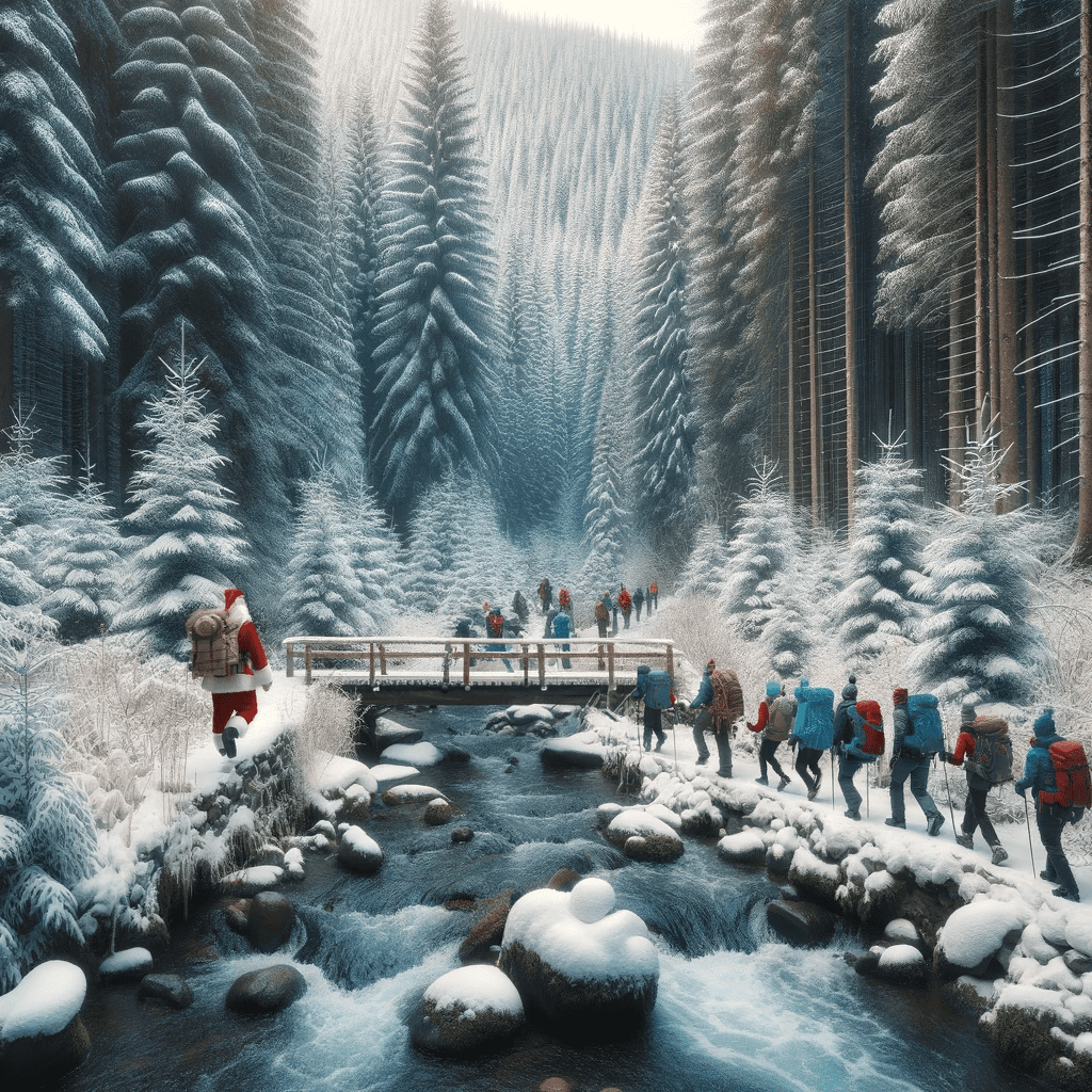
Jingle Trails: A hike for the Holiday Season
https://hikesstaging.brucetrail.org/event/jingle-trails-a-hike-for-the-holiday-season/Sorry, the registration cut-off time for this hike has been reached.Not a member? Click here to join today!Hosting Club: Peninsula
Location (Google Maps): Meet at Highway 6 and Dyers Bay Road parking area – 9am sharp – December 26
Hike Leader(s): Randy Vanderlaan Click here to contact Hike Leader(s)
Pace: Medium
Terrain: Moderate
Distance: 7kmDescription
Embrace the spirit of the holiday season with a rejuvenating hike in the Shouldice Lake area. Our festive hike offers the perfect opportunity to stay active during the holidays while exploring the southern area of the national park. Hike through scenic forest trails that lead to the Crane River.Trail conditions will guide our hike. Whether it be a brisk walk or a snowshoe experience, we’ll make the decision together, ensuring an enjoyable hike for all. Our flexible route will allow us to adapt to the day’s conditions, with the option to either retrace our steps for an ‘out and back’ hike or to complete a scenic 7km loop.
Connect with nature, enjoy the crisp winter air, and create memorable holiday moments. So, lace up your hiking boots, grab your snowshoes [if necessary], and join us for this holiday hike!
We will update you on our hiking plan as we get closer to the date.
9:00 Staff Avenue Louth
https://hikesstaging.brucetrail.org/event/900-staff-avenue-louth-4/Sorry, the registration cut-off time for this hike has been reached.Not a member? Click here to join today!Hosting Club: Niagara
Location (Google Maps):
Staff Avenue Parking Lot
Pace: Medium
Terrain: Moderate
: 10kmDescription
CHANGE OF VENUE DUE TO DEER HARVEST Explore Louth Conservation area
Bring Poles water, snack, Icers and dress for the weather
9:15 Short Hike, Pelham Road, Short Hills
https://hikesstaging.brucetrail.org/event/915-short-hike-pelham-road-short-hills-69/Sorry, the registration cut-off time for this hike has been reached.Not a member? Click here to join today!Hosting Club: Niagara
Category: Loop
Location (Google Maps): Short Hills Provincial Park, Pelham Road entranceHike Leader(s): janet davey Click here to contact Hike Leader(s)
Pace: Medium
Terrain: Moderate
Distance: 6 kmsDescription
Hike the main and side trails of Short Hills Provincial Park. Bring water and icers.City View Park, Burlington, Map 9.
https://hikesstaging.brucetrail.org/event/city-view-park-burlington-map-9/Sorry, the registration cut-off time for this hike has been reached.Not a member? Click here to join today!Hosting Club: Caledon Hills
Category: Tuesday Hikers
Location (Google Maps): City View Park, Burlington.
From Highway 403 going west, turn right on Brant Street, left on Dundas Street, left on Kerns Rd., take second turn left into City View Park to the parking lot.Hike Leader(s): Mohammad Shafiq Click here to contact Hike Leader(s)
Pace: Leisurely – 3 km/hour or less, Medium – 3 to 4 km/hour
Terrain: Moderate – some hills and/or some poor footing
Distance: 11 kmDescription
From City View Park will connect with main Bruce Trail and hike to Smokey Hollow waterfall, also hike Kings ST and Eric Best ST on the way. After snack break will trace back our steps and return to parking.
It’s an opportunity to start shedding some weight may have gained during holiday partying. For Boxing Day enthusiasts, there will be still time to spend.
Bring icers, gaiters, water and snack. Dress according to weather.
There is optional refreshment stop at Copper Kettle Cafe in Waterdown at Dundas St. and Main St. after the hike.
As of now the weather forecast looks good, but check your email about 7:30 am for a last minute change, especially during winter hikes.
Hike leader phone No. 416-566-0503.Urban Walk: Annual TBTC Boxing Day Hike
https://hikesstaging.brucetrail.org/event/urban-walk-annual-tbtc-boxing-day-hike-2/Sorry, the registration cut-off time for this hike has been reached.Not a member? Click here to join today!Hosting Club: Toronto
Category: Urban Walk
Location (Google Maps):Meet inside Jack Layton Ferry Terminal, foot of Bay Street. TTC – take any streetcar from Union Station one stop south the Ferry Docks stop and walk south.
Hike Leader(s): Tom Swales & David Royle Click here to contact Hike Leader(s)
Pace: Moderate
Terrain: Flat
Distance: 12Description
Avoid the Boxing Day shopping crowds and come hike with the TBTC instead. The Toronto Islands are very peaceful in the Winter Season. We will catch the 2:15 or 2:45 pm ferry to be back in the city by 3:00 pm. Bring a lunch, snacks, water, a hot beverage, and icers if the first snow has fallen. Dress in warm layers appropriate to the weather. Heated washrooms available. Dropout anytime by walking back to the Ward’s Island Ferry Dock. We will hike towards Hanlan’s Point and return to Ward’s Island (the only ferry destination served in the Winter) – approximately 5-6 km each way.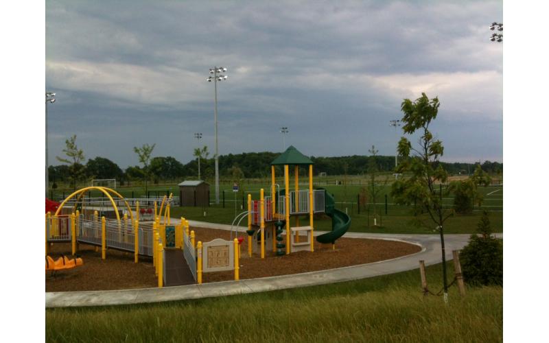
Car Hike: Short and Sweet Family Hike at City View Park
https://hikesstaging.brucetrail.org/event/car-hike-short-and-sweet-family-hike-at-city-view-park/Sorry, the registration cut-off time for this hike has been reached.Not a member? Click here to join today!Hosting Club: Toronto
Category: Car Hike
Location (Google Maps): We will meet at the south parking lot of City View Park in Burlington – coordinates are 43.351844, -79.862122. (Map 9 of the Bruce Trail Reference Guide, Edition 31).Hike Leader(s): Monica Pasquali Click here to contact Hike Leader(s)
Pace: Leisurely
Terrain: Variable
Distance: 3.5 kmDescription
Take a break from the hustle and bustle of the holidays by joining me for a short and sweet hike in the Iroquoia section of the Bruce Trail on Boxing Day! First we’ll do a short 3.5 km hike of the main Bruce Trail, City View Park Side Trail, and Ian Reid Side Trail. Upon returning to our cars we’ll enjoy some hot chocolate and cookies (provided by the hike leader). After the sweet pick-me-up, if weather permits then kids can play on the playground at City View Park (supervised by their parents/guardians) before heading home. What a great way to relax and enjoy the outdoors during this busy time of year!Children under 13 years of age are encouraged to join their parents/guardians on this hike so they can fulfill the requirements for the Iroquoia Bruce Trail Club’s Winter Junior Hiker Badge (https://www.iroquoia.on.ca/index.php/hiking/junior-hiker-program/) – all family members who are planning on joining us should register for the hike, including children.
You should bring enough water and food for a 1-hour hike, comfortable and warm footwear with good traction (which is especially important if it’s icy), appropriate clothing for the weather (dressing in layers is ideal so you can adjust what you wear based on local conditions), and a heat-safe cup if you’d like some hot chocolate after the hike.
Everyone is welcome – I hope to see you there!
- 27December 27, 2023
9:00 am Side Trail Challenge #7 - Rockway, Louth, Staff, Midway, Lower Falls
https://hikesstaging.brucetrail.org/event/900-am-side-trail-challenge-7-rockway-louth-staff-midway-lower-falls/Sorry, the registration cut-off time for this hike has been reached.Not a member? Click here to join today!Hosting Club: Niagara
Category: Loop
Location (Google Maps): Park at Rockway Conservation Area Parking LotHike Leader(s): Sam Rutherford Click here to contact Hike Leader(s)
Pace: Brisk
Terrain: Moderate
Distance: 11.5 kmsDescription
Take Rockway ST to the end.
Hike back to where it meets the Main Trail @ km 47.9
Take Main Trail until it meets Lower Falls Side trail. Take Lower Falls Side Trail until it meets main trail again then continue up Midway Side Trail until it meets the Main trail again. Take Main trail up the hill until it meets Staff Ave Side Trail. Take Staff Ave Side Trail out and back. Then take Louth Side trail until it meets Main Trail at km 51.2. Turn right and follow Main trail back to Rockway.Participate in all 9 scheduled hikes in the NBTC Side Trail Challenge or hike the side trails on your own. Submit your photos to collect the NBTC Side Trail badge.
http://niagarabrucetrail.club/wp/niagara-side-trails/
Mono Cliffs
https://hikesstaging.brucetrail.org/event/mono-cliffs/Sorry, the registration cut-off time for this hike has been reached.Not a member? Click here to join today!Hosting Club: Blue Mountains
Category: Register in person the morning of hike.
Location (Google Maps): Hike meets in the parking lot behind Tim Hortons on First St. in Collingwood.Pace: Medium – 3 to 4 km/hr
Terrain: Moderate – Some hills and/or some poor footing
Distance: 10 kmDescription
We will drive to Mono Centre (45 minutes from Collingwood south on Airport Rd.) and park in the village parking lot. We will enter the park and pick up the white blazed trail at km 1.2 of the Dufferin Hi-Land section. Climbing up the escarpment, we continue along the white blazed trail past McCarston’s Lake to km 5.1. From here, we proceed up the Lookout Side Trail where we will have our lunch while enjoying the amazing view. We then return down the Spillway Trail and along the valley bottom to exit the park, having completed our circuit. Bring a snack or lunch and water.CANCELLED - Discovery Hike - Cottonwood Loop
https://hikesstaging.brucetrail.org/event/discovery-hike-cottonwood-loop-2/Sorry, the registration cut-off time for this hike has been reached.Not a member? Click here to join today!Hosting Club: Sydenham
Category: General Hike
Location (Google Maps): Roadside parking on the east side of 11 Line, approximately 3 km north of Highway 26, at the entrance to the Cottonwood Side Trail, Map 30, Edition 31Carpool may be available upon request.
Hike Leader(s): Jeannine Kralt Click here to contact Hike Leader(s)
Pace: Leisurely: 3 km/h or less
Terrain: Easy: Mostly flat and good footing.
Distance: 2.1kmDescription
This hike will be a discovery hike along the Cottonwood Loop – we’ll take our time, and see what we can find. This trail is a stand-alone trail, separate from the rest of the Bruce Trail. We’ll hike through forests, past a particularly large cottonwood tree, and to a lookout along a ridge. This property is the original location of the Rows homestead – their farmhouse can be seen at Moreston Village at Grey Roots.The Cottonwood Loop is also featured in Ron Savage’s new book, Exploring Sydenham. There will be sufficient time to find the related code en route.
As we’ll be taking our time, this hike is suitable for families, new hikers, and anyone wanting a more leisurely hike. We’ll likely take an hour or two, depending on the group – dress in layers, bring a snack, and wear good footwear. Given that December can be variable, an email re: trail conditions to expect will be sent out prior to our hike together.
If you are unable to register, please contact the hike leader via the link above.
- 28December 28, 2023

Beaver Valley Winter End-to-End
https://hikesstaging.brucetrail.org/event/beaver-valley-winter-end-to-end/Sorry, the registration cut-off time for this hike has been reached.Not a member? Click here to join today!This is a Multi-Day Hike
You are signing up for the following dates:
2023-12-28, 2023-12-29, 2024-01-02, 2024-01-03, 2024-01-04, 2024-01-09, 2024-01-10, 2024-01-11Hosting Club: Caledon Hills
Category: End-to-End
Location (Google Maps): For Hike One meet at km 13.7, off-road parking on the west side of 6th Line, north of Grey Road 119, 44.484137, -80.386155.
The group will then shuttle to km 0.0, roadside parking along the north side of Maple Lane, 44.504972, -80.331780.
A detailed schedule for the full series, with dates and meeting locations, will be provided upon registration.Hike Leader(s): Sandy Green and Jacquie Van Dyke Click here to contact Hike Leader(s)
Pace: Medium – 3 to 4 km/hour
Terrain: Strenuous – hilly with steep climbs and some poor footing
Distance: 13.7 kilometresDescription
This Beaver Valley Winter End-to-End Series for the Club’s brand new badge will be completed in 8 hikes. The series will be a test of strength and character, as the group will face varied winter conditions in SNOWBELT COUNTRY. Hikes range in distance from 13 km to 20 km. Pack sufficient water and snacks to boost your energy. Wear appropriate attire for the weather conditions and come prepared with icers and snowshoes. Hikers will be contacted the night before, if a hike must be cancelled due to inclement weather. If you have further questions or concerns email Sandy at sgreenhikes@gmail.com.9:00 am Long Hike Jordan to Moyer / Louth
https://hikesstaging.brucetrail.org/event/900-am-long-hike-jordan-to-moyer-louth-50/Sorry, the registration cut-off time for this hike has been reached.Not a member? Click here to join today!Hosting Club: Niagara
Location (Google Maps):
Jordan Hollow Park 3039 King St Jordan
Pace: Medium
Terrain: Moderate
: 10kDescription
From Jordan Hollow Hike the main trail to Upper and Lower Balls Falls, Moyer Road or Louth and Return. You must register for each hike. Bring Poles, sunscreen, bug spray , snack and a drink and dress for the weather
9:15 Short Hike - Jordan Hollow
https://hikesstaging.brucetrail.org/event/915-short-hike-jordan-hollow-89/Sorry, the registration cut-off time for this hike has been reached.Not a member? Click here to join today!Hosting Club: Niagara
Location (Google Maps): Jordan Hollow Park, Jordan Station
Hike Leader(s): Bill Russell Click here to contact Hike Leader(s)
Pace: Medium
Terrain: Moderate
Distance: 6 kmsDescription
Hike the main and side trails around Jordan and Ball’s Falls. Bring water and hiking boots.
7:00 pm Moonlight Night Hike in Niagara-on-the-Lake
https://hikesstaging.brucetrail.org/event/700-pm-moonlight-night-hike-in-niagara-on-the-lake-4/Sorry, the registration cut-off time for this hike has been reached.Not a member? Click here to join today!Hosting Club: Niagara
Category: Night
Location (Google Maps): Veteran’s Memorial Park, park just outside the park on King St.Hike Leader(s): Robin Garrett Click here to contact Hike Leader(s)
Pace: Medium
Terrain: Easy
Distance: 6-7 kmDescription
Moonlight Night Hike – Take in the magic of the rising moon over Lake Ontario and the Niagara River. This hike includes a stop to connect with your senses – sights, sounds, smells and the rhythm of your breath. Counts towards your night hike badge (5 night hikes). - 29December 29, 2023

Niagara-on-the-Lake Tour
https://hikesstaging.brucetrail.org/event/niagara-on-the-lake-tour-45/Sorry, the registration cut-off time for this hike has been reached.Not a member? Click here to join today!Hosting Club: Niagara, Peninsula
Category: Urban
Location (Google Maps): Meet on King St near Centre St, at the entrance to Veteran’s Memorial Park, Niagara-on-the-LakeHike Leader(s): Margaret Northfield Click here to contact Hike Leader(s)
Pace: Medium
Terrain: Easy
Distance: 6-7kmDescription
Each Friday we will explore different neighbourhoods, trails and parkland throughout Historic Niagara-on-the-Lake.
Moderate pace with some weeks entirely on sidewalks and roads while others may include a mix of trails and paved pathways. Great way to build up endurance for longer more strenuous hikes.
Prepare for cooler windy conditions on open parkland and along Lake Ontario and Niagara River trails.
Plan to stay for conversation and a warm cup of coffee or tea at Sweets & Swirls, Community Centre, Niagara Stone Road, NOTL
- 30December 30, 2023
Car Hike: Rouge National Park Toronto 115
https://hikesstaging.brucetrail.org/event/car-hike-rouge-national-park-toronto-8/Sorry, the registration cut-off time for this hike has been reached.Not a member? Click here to join today!Hosting Club: Toronto
Location (Google Maps): Rouge Park, Zoo Road Parking Lot, off Meadowvale Road, north of Sheppard Ave
Hike Leader(s): Mohammad Aghamiri Click here to contact Hike Leader(s)
Pace: Moderate
Terrain: Hilly, Variable
Distance: 14-15 kmDescription
Will explore Toronto part of Rouge park along Rouge river and Little Rouge Creek,Some safety procedures during the hike:
1-Hikers must stay between the leader and the sweep.
2-Hikers must advise the leader or the sweep if they wish to leave the group.
3- Hikers must follow the whistle instructions: 1 blast- stay where you are; 2 blasts come to the leader; 3 blasts – come to the leader quickly.
4-Hike leader may request volunteers to stop at trail intersections, they need to help hikers to the direction the group walk and wait till they see the sweep .
5-Hikers have to make sure they can see the persons behind and in front of them.

Great Niagara Circle Route #4 Fort Erie to Miller
https://hikesstaging.brucetrail.org/event/great-niagara-circle-route-4-fort-erie-to-miller/Sorry, the registration cut-off time for this hike has been reached.Not a member? Click here to join today!Hosting Club: Niagara
Category: Car Pool
Location (Google Maps):Meet at Niagara Boulevard and Miller Road, Carpool to Court Wright St / Niagara Boulevard Fort Erie
Hike Leader(s): Alan Laver Click here to contact Hike Leader(s)
Pace: Brisk
Terrain: Easy
Distance: 17.5Description
The Greater Niagara Circle Route badge is awarded to walkers who independently complete the Circle Route Trail i.e. Lock 1 Port Weller, along the Welland Canal to Port Colborne , following the Friendship Trail to Fort Erie, following the Niagara Recreational Parkway Trail to Niagara-on-the-Lake and following the Waterfront Trail to Port Weller.
Feversham Gorge
https://hikesstaging.brucetrail.org/event/feversham-gorge-2/Sorry, the registration cut-off time for this hike has been reached.Not a member? Click here to join today!Hosting Club: Blue Mountains
Category: Register on-line or sign-in morning of hike
Location (Google Maps): Hike meets in the parking lot behind Tim Hortons on First St. in Collingwood.Hike Leader(s): Michael Treuman Click here to contact Hike Leader(s)
Pace: Leisurely – 3 km/hr. or less
Terrain: Easy – Mostly flat and usually good footing
Distance: approx 2 hrsDescription
We will drive to the Feversham Gorge parking lot south of the bridge on County Road 2. We will hike on the trail under the bridge and through the village of Feversham, cross the bridge then proceed on the Gorge trail. Great views of the Beaver River. The trail continues back to the top of the gorge, returning to the cars. The hike will include historical information. Bring a snack and water.
9:00 Queenston Hike
https://hikesstaging.brucetrail.org/event/900-queenston-hike-2/Sorry, the registration cut-off time for this hike has been reached.Not a member? Click here to join today!Hosting Club: Niagara
Category: Loop
Location (Google Maps):Queenston Heights Park, 14184 Niagara Pkwy, Niagara-on-the-Lake, ON L0S 1J0
Hike Leader(s): Dan Wilson Click here to contact Hike Leader(s)
Pace: Medium
Terrain: Moderate
Distance: 7kmDescription
Meet at the Southern Terminus cairn in the Queenston Heights parking lot. Please bring hiking poles and icers, in case it’s icy. If the parking lot is blocked off, we will meet at the parking area near the washrooms at Queenston Heights.